By Mark Hilton, August 26, 2017
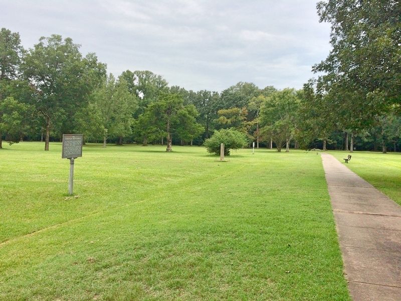
Stone from Ruins of Old Bank Marker in middle distance.
| Near Old Post Road, 0.7 miles south of State Route 169. |
| On Arkansas Route 153, on the right when traveling north. |
| On Broadway Avenue at Main Street, on the right when traveling east on Broadway Avenue. |
| On South Main Street south of Second Street, on the right when traveling south. |
| On Cedar Crest Drive at Cunningham Drive, on the right when traveling west on Cedar Crest Drive. |
| On Northeast A Street, on the right when traveling west. |
| On Central Avenue (State Highway 72) near Main Street, on the right when traveling west. |
| On Central Avenue (State Highway 72) near A Street, on the left when traveling west. |
| Near South Walton Boulevard (Business U.S. 71) 0.1 miles north of Southwest I Street, on the left when traveling north. |
| On West Central Avenue, on the left when traveling north. |
| On East Central Avenue, on the right when traveling east. |
| On Central Avenue (State Highway 72) at Main Street, on the right when traveling west on Central Avenue. |
| On Main Street near Central Avenue (Arkansas Highway 72), on the left when traveling north. |
| On North Main Street at East Central Avenue (State Highway 72), on the right when traveling north on North Main Street. |
| On Southeast 3rd Street at Southeast A Street, on the right when traveling east on Southeast 3rd Street. |
| On South Main Street north of Southeast 2nd Street, on the right when traveling north. |
| On 4th Avenue Southeast just south of Atlanta Street Southeast (State Highway 72), on the right when traveling south. |
| On Monroe Avenue east of Lincoln Street, on the left when traveling east. |
| On Jackson Street south of McClure Avenue (County Road 923), on the right when traveling south. |
| On McClure Avenue (County Road 923) at Jackson Street, on the right when traveling east on McClure Avenue. |
| On Jackson Street at Johnson Avenue, on the right when traveling north on Jackson Street. |
| On Jackson Place at McClure Avenue, on the left when traveling north on Jackson Place. |
| On Jackson Street south of McClure Avenue (County Road 923), on the left when traveling south. |
| On Jackson Street south of McClure Avenue (County Road 923), on the right when traveling south. |
| On South 1st Street south of West Walnut Street, on the right when traveling south. |
| On Walnut Street (State Highway 12) at 2nd Street (State Highway 12), on the right when traveling west on Walnut Street. |
| On South 1st Street south of West Walnut Street, on the right when traveling south. |
| On 2nd Street (State Highway 12) at Walnut Street (State Highway 12), on the right when traveling south on 2nd Street. |
| On Elm Street west of 1st Street, on the left when traveling west. |
| On North 3rd Street north of West Maple Street, on the right when traveling north. |
| On State Highway 12, 0.1 miles west of Van Winkle Place Road, on the left when traveling west. |
| On 2nd Street south of Walnut Street (Arkansas Highway 12), on the right when traveling south. |
| On War Eagle Road (County Route 98) at Bettis Hill Road (County Route 1059), on the left when traveling west on War Eagle Road. |
| On War Eagle Road, on the right when traveling east. |
| On North Willow Street north of West Stepenson Avenue, on the left when traveling north. |
| On West Ridge Avenue west of North Main Street (Business U.S. 65), on the left when traveling west. |
| On West Ridge Avenue at North Main Street (Business U.S. 65), on the left when traveling west on West Ridge Avenue. |
| On North Walnut Street at East Rush Avenue, on the right when traveling north on North Walnut Street. |
| On North Main Street (Business U.S. 65) at West Ridge Avenue, on the left when traveling north on North Main Street. |
| On North Willow Street south of West Rush Avenue, on the right when traveling south. |
| On West Rush Avenue west of North Main Street, on the right when traveling west. |
| On North Willow Street south of West Rush Avenue, on the right when traveling south. |
| On North Willow Street south of West Rush Avenue, on the right when traveling south. |
| On West Stephenson Avenue at South Willow Street, on the left when traveling west on West Stephenson Avenue. |
| On North Main Street (Business U.S. 65) at East Stephenson Avenue, on the right when traveling north on North Main Street. |
| On Spring Street west of Hillside Avenue, on the right when traveling west. |
| On Main Street (State Highway 23) north of Armstrong, on the right when traveling north. |
| On Main Street (State Highway 23) south of Benton Street, on the left when traveling north. |
| On Main Street (State Highway 23) at Spring Street, on the right when traveling east on Main Street. |
| On Spring Street, 0.2 miles north of Main Street (Arkansas Highway 23), on the left when traveling north. |
| On North Main Street (Arkansas Route 23) at Mill Hollow Road, on the right when traveling south on North Main Street. |
| On Spring Street at Pine Street, on the right when traveling north on Spring Street. |
| On Spring Street at Mountain Street / Owen Street, on the left when traveling north on Spring Street. |
| On Flint Street at Steele Street, on the left when traveling south on Flint Street. |
| On Spring Street at Pine Street, on the left when traveling east on Spring Street. |
| Near Pivot Rock Road north of West Van Buren (U.S. 62), on the left when traveling north. |
| On Main Street at Spring Street (State Highway 23), on the right when traveling north on Main Street. |
| On Hillside Avenue south of North Main Street (Arkansas Route 23), on the left when traveling south. |
| On Prospect Avenue, 0.1 miles north of Crescent Drive, on the right when traveling north. |
| On Spring Street north of Main Street (Arkansas Highway 23), on the left when traveling north. |
| On Hillside Avenue south of North Main Street (Arkansas Route 23), on the left when traveling south. |
| On Spring Street north of Main Street (Arkansas Highway 23), on the left when traveling north. |
| On Spring Street, on the left when traveling north. |
| On North Main Street (Arkansas Route 23) at Magnetic Drive, on the right when traveling south on North Main Street. |
| On Spring Street at Center Street, on the right when traveling north on Spring Street. |
| On Main Street (State Highway 23) 0.1 miles north of Magnetic Drive, on the left when traveling north. |
| On Grand Lake Loop (Arkansas Route 8) at Cariola Road when traveling south on Grand Lake Loop. |
| On East Lee Street, 0.5 miles south of South Main Street, on the right when traveling south. |
| Near State Highway 142, 0.9 miles east of Robert Mazzanti Road (Parish Road 505). |
| On Court Street south of Clay Street, on the right when traveling south. |
| On Valley Street (U.S. 67) 0.1 miles south of Malvern Road, on the left when traveling south. |
| On County Road 11E at County Road 25, on the right when traveling west on County Road 11E. |
| On Stouts Point, on the right when traveling east. |
| Near Petit Jean Mountain Road. |
| On West Matthews Avenue at Witt Street, on the right when traveling west on West Matthews Avenue. |
| On Main Street at Fayetteville Road, on the right when traveling west on Main Street. |
| On East Military Road at Cypress Drive, on the right when traveling east on East Military Road. |
| On Cypress Drive, on the right when traveling north. |
| On Military Road east of Cypress Drive, on the right when traveling east. |
| On Court Street north of East Military Road, on the left when traveling north. |
| On East Broadway Avenue (U.S. 70) near Arkansas Route 38, on the left when traveling east. |
| Near State Highway 184, 0.6 miles north of U.S. 64, on the left when traveling north. |
| Near State Highway 184, 0.6 miles north of U.S. 64, on the left when traveling north. |
| Near State Highway 184, 0.6 miles north of U.S. 64, on the left when traveling north. |
| On Front Street just north of Main Street, on the left when traveling north. |
| On West Main at Franklin, on the left when traveling east on West Main. |
| On South 2nd Street north of West Main Street, on the right when traveling north. |
| Near U.S. 63 at Main Street (State Route 9), on the right when traveling north. |
| Near U.S. 63 at Main Street (State Route 9), on the right when traveling north. |
| Near U.S. 63 at Main Street (State Route 9), on the right when traveling north. |
| On Central Avenue (Arkansas Route 7) at Fountain Street, on the right when traveling north on Central Avenue. |
| Near Central Avenue (Arkansas Route 7), on the right when traveling south. |
| On Central Avenue (State Highway 7), on the right when traveling south. |
| On Central Avenue (State Highway 7), on the right when traveling south. |
| On Central Avenue (State Highway 7) just south of Fountain Street, on the left when traveling north. |
| On Central Avenue (State Highway 7) 0 miles south of Fountain Street, on the left when traveling north. |
| On Reserve Street near Central Avenue. |
| On Central Avenue (Arkansas Route 7) south of Fountain Street, on the left when traveling south. |
| On Central Avenue (Arkansas Route 7) south of Bath, on the right when traveling south. |
224 entries matched your criteria. The first 100 are listed above.
Next 100 ⊳