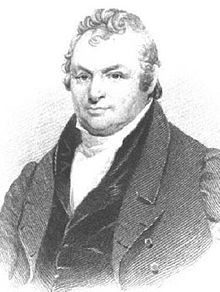
Senior Chief Engineer
of the New York Canals
His public history may be found
in the history of the General
and State Goverments;
His private [virtues?] in the memory
of his acquaintances
Born in Pennsylvania
July 22, 1763. . . . — — Map (db m181134) HM
Delphos
Delphos began and flourished as separate settlements: East Bredeick, West Bredeick, Howard, and Section
Ten (named after a section of the canal). In 1851, Father John Otto Bredeick, a Bavarian priest who had purchased and founded this . . . — — Map (db m159752) HM
This grain mill, which was located at the southwest corner of Second & Broadway Streets and considered one of the oldest landmarks in Spencerville, was constructed in 1843 and remained in existence until the early 1940's. The mill eliminated the . . . — — Map (db m196332) HM
From 1845 to about 1906 barges pulled by horses provided transportation from the Ohio River to Lake Erie through a system of locks which raised or lowered boats to the next level of the canal.
Locks often became sites of towns, beginning . . . — — Map (db m22933) HM
Miami & Erie Canal, Deep Cut
You are on that section of the Miami and Erie Canal where the greatest excavation was made – a section that has been known over the years as “Deep Cut.” The huge ditch, 6,600 feet long and 5 to . . . — — Map (db m22848) HM
Miami And Erie Canal Deep Cut
has been designated a
Registered National
Historic Landmark
Under the provisions of the
Historic Sites Act of August 21, 1975
this site possesses exceptional value
in commemorating or . . . — — Map (db m166567) HM
Spencerville was platted in 1844 under the name "Spencer". In 1854, the name was changed to "Acadia", and was incorporated as Spencerville in 1866. The town was located on the banks of the Miami & Erie Canal, and its development as a commercial . . . — — Map (db m196325) HM
Canal boats carried either freight or passengers. The typical canal boat was 14 1/2 feet wide by 85 feet long and carried up to 100 tons of cargo. Each boat typically had a captain, members of his family, animal drivers, steersmen and a bowman. The . . . — — Map (db m196328) HM
Canal specifications called for the canal to be 28' wide at the bottom and 40' wide at the top. The water level was 4' deep and the tow path was 10' wide. A team of mules, donkeys or horses pulled the boat along by means of a 90 foot tow rope. — — Map (db m196329) HM
During the canal years of the 1850's a rivalry grew between Bill Jones and Jack Billings for the love of Minnie Warren. This became hatred by Bill because Minnie chose Jack. On a fall night in 1854, returning from a party, Minnie and Jack were . . . — — Map (db m80159) HM
Represents the strong Christian faith of the community. In the eighth century Charlemagne and Benedictine missionaries brought this faith to the Saxon tribes in the Munster and Osnabruck area of Germany.
Oak Leaf and Acorn - The acorn is . . . — — Map (db m238608) HM
Completed in 1845, the canal gave quick and easy access to the Ohio River and Lake Erie. Boats were towed along the canal using donkeys or horses, traveling at 4 to 5 miles per hour. With ice in the winter, flooding, and the slowness of the boats, . . . — — Map (db m238593) HM
Constructed in 1864, this is the oldest cast iron "bowstring girder" bridge in Ohio. Originally part of a three-span structure over the Auglaize River in Wapakoneta, the bridge was moved to Moulton Angle Road north of New Knoxville in 1904. In 1984, . . . — — Map (db m22947) HM
The Miami Erie Canal, built 1825-1845, 244.5 miles long, was a transporter of passengers and freight between Lake Erie and the Ohio River. This section is Loramie Summit., a 21 mile plateau of water retained by Lock 1-N (this marker) and Lock 1-S at . . . — — Map (db m22946) HM
Locking Through
Lock One North is one of 105 locks used to raise and lower boats traveling between Lake Erie and the Ohio River. Large wooden gates were built at each end of the lock to hold water in the lock. A boat, pulled by a team of . . . — — Map (db m23062) HM
Lockkeeper's House
The Lockkeeper's House was the residence of the Lockkeeper and his family. The Lockkeeper was on duty 24 hours a day, seven days per week, and was responsible for operating the lock as needed to move boats through the . . . — — Map (db m22781) HM
The Miami and Erie Canal, connecting the Ohio River with
Lake Erie, was the primary mode of transportation for
cargo in the mid to late 1800s. This allowed towns like
New Bremen to quickly grow and prosper. Local farm
boys, leading the family . . . — — Map (db m167049) HM
The Miami & Erie Canal and New Bremen
Begun in 1833, the Miami Extension linked the Miami Canal in Dayton to the Wabash & Erie Canal at Junction. Engineering difficulties, epidemics and the Panic of 1837 delayed completion of the Extension . . . — — Map (db m20023) HM
These stones were originally used at Grand Lake St. Marys in the Bulkhead Lock constructed in 1852. Each stone was "neatly dressed with a bush hammer," meaning it was cut and finished with a hand chisel by masons at the construction site. . . . — — Map (db m236469) HM
The original "bump" bridge crossing the feeder was just a few feet above the water line of the canal. A canal boat actually bumped or pushed the bridge to turn the bridge decking to an open position. Then the bridge structure was a turntable on . . . — — Map (db m236459) HM
To the left is the "Short Level" of the Miami and Erie Canal. The canal extension from Dayton to Toledo was completed in 1837. Linking the Great Lakes to the Ohio River. Travel took only five days to Toledo and six days to Cincinnati. The canal . . . — — Map (db m29673) HM
Largest of 3 ponds created when the St. Mary's River was relocated here during construction of Miami-Erie Canal. The existing tow path is the west bank of the canal. Canal built Cincinnati to Toledo 1825 - 1845. — — Map (db m235858) HM
In the canal era Lock 14 was platted as a community that would include a mill, homes and a church.
The town got started, but when the mill went out of business, the town withered away to what you see today. Lock 14 North was originally timber. . . . — — Map (db m260848) HM
The Miami and Erie Canal opened the western Ohio wilderness between Cincinnati and Toledo in the mid-19th century. More than 4000 workers labored to build the canal, earning 30 cents a day, a jigger of whiskey, and room and board. When completed, . . . — — Map (db m235857) HM
Six Mile Creek Aqueduct. Canal aqueducts provide transportation of canal waters over natural waterways, allowing for reliable boat passage. The multi-arch masonry and formed concrete flume of the Six Mile Creek Aqueduct create a unique . . . — — Map (db m234184) HM
The Tumbles is a hydraulic control structure to maintain water levels used for water power, a water source, and for cooling.
At least eight different industries located along the raceway used the water to power manufacturing operations. — — Map (db m260851) HM
Port Middletown, located at Third St. (Central Ave.), was the main port along the Miami & Erie Canal. A scale was located there and tolls were collected.
[Photos] Left, a fire in 1881 at the Ben Smith Livery at Port Middletown has just been . . . — — Map (db m30418) HM
History
Connecting the Maumee, Miami and the Wabash Rivers for economical
transportation was advocated by George Washington as early as 1773. Captain
John Riley surveyed the route in 1820. After further surveys, the Ohio
legislature in . . . — — Map (db m173037) HM
This area is thought to be the burial place of more than 300 soldiers who once
camped at Fort Winchester, Camp No. 3, also known as Fort Starvation, during the
War of 1812. They were led by Brigadier General James Winchester.
Kentucky . . . — — Map (db m265379) HM
The Miami and Erie Canal
———— • ————
Over this site once flowed the Miami and
Erie Canal, linking the Ohio River with the
Maumee and Lake Erie. The canal was opened
in 1827 and was finally . . . — — Map (db m43960) HM
Canal Days in Lockland
The canal was a place for fun as well as commerce; for boys, a place to swim, boat, and fish; for the whole family, a place to skate when the canal became a frozen ribbon of ice; for lodge and church groups, a place for . . . — — Map (db m163571) HM
The Miami & Erie Canal stretched approximately 250 miles from Cincinnati to Toledo. Napoleon and other towns on the Maumee River's banks were on a slackwater section of the canal. Between 1825 and 1845, laborers constructed the canal using . . . — — Map (db m160264) HM
Riverfront Industries Powered by Canal Water. The completion of the Miami and Erie Canal passing through Napoleon in 1843 provided a way to receive manufactured goods, export farm products, and power local mills. The early industries of . . . — — Map (db m250930) HM
From Canal Feeder to Premier Recreation Destination
Step back in time to explore Indian Lake's fascinating history. Thousands of years ago, retreating glaciers shaped this landscape, leaving kettle lakes - small, water-filled depressions . . . — — Map (db m306936) HM
Indian Lake Dam was built 1851-1860 to create a feeder lake, known as the Lewistown Reservoir, for the Miami and Erie Canal. The dam included a 700-foot long concrete ogee weir spillway that discharged water from the lake into the Great Miami . . . — — Map (db m226465) HM
Lewistown Reserve. The United States negotiated the Treaty of Fort Meigs with several Native American nations in 1817. It opened northwest Ohio to American settlers and established reservations for the remaining Indigenous residents. The . . . — — Map (db m299333) HM
As a result of the success of the Erie Canal in New York, the Ohio General Assembly decided to build two canals to promote business and travel between the Ohio River and Lake Erie. The Miami & Erie Canal, built in three stages, united Cincinnati . . . — — Map (db m104126) HM
The Wabash & Erie Canal opened between Toledo and Lafayette, Indiana, May 8, 1843. The Miami Extension Canal was completed to Junction, Ohio, on July 4, 1845, linking the Wabash & Erie Canal with Cincinnati and resulting in changing the canal’s . . . — — Map (db m19574) HM
Railroads signaled changing times for the canals, making them obsolete before they were even finished.
Only five years after the first spadesful of dirt on the Miami and Erie Canal had been dug, trains were already rolling into Ohio.
In . . . — — Map (db m268491) HM
The town of Providence was born, thrived and died with the Miami & Erie Canal. It was platted in 1835 by French trader Peter Manor, swept by fire in 1846, ravaged by cholera in 1854, and finally unincorporated in 1928. Today, only the Irish . . . — — Map (db m275294) HM
Legend has it that construction wasn't
easy. All towns wanted the canal because it
brought them prosperity. The townsfolk
living across the river in Gilead (Grand
Rapids) were so angry that their town was
not on the canal route that they . . . — — Map (db m173227) HM
A former hotel at this site was once a popular stopover for travelers in the 1850s on the Miami and Erie Canal. Folklore tells us this old hotel had questionable roots at best. Reportedly once a house of ill repute, the hotel had many functions . . . — — Map (db m173219) HM
The Towpath Trail, where mules once towed flat bottom
boats on the Miami & Erie Canal, connects three Metroparks
along the scenic Maumee River. Farnsworth overlooks three
islands in the river and the picturesque ruins of an Interurban
Bridge. . . . — — Map (db m173225) HM
Providence Dam: A roller dam across the Maumee
River is a scenic spot to fish or just relax. The dam
was built to divert water into the canal.
Providence Dam Area
Providence Dam Shelter (preservable)
Rangers & . . . — — Map (db m195581) HM
Providence Dam: A roller dam across the Maumee
River is a scenic spot to fish or just relax. The dam
was built to divert water into the canal.
Providence Dam Area
Providence Dam Shelter (reservable)
Rangers & . . . — — Map (db m195584) HM
The ghost town of Providence was once a booming
city with warehouses, shops, and the canal.
Colorful characters such as these would have been
seen throughout canal towns and villages. Thanks to illustrator Bill Kuhlman we have a peek at . . . — — Map (db m173218) HM
Life was not easy for the 50,000 people
who called Ohio home at the beginning
of the canal era.
It was difficult to send goods, travel
and receive mail. Governor Ethan Allan
Brown authorized canal construction to
help ease the . . . — — Map (db m173220) HM
It may surprise you that nature relies on
floods. Floods and adjacent lands called
floodplains allow rivers to purge excess
sand, silt, and pollution. Plants and shrubs
along the edge trap floodwater debris. The
earth itself filters . . . — — Map (db m173226) HM
Named for the Miami and Erie Canal's
'side cut' to Maumee City this canal land,
later abandoned, became the first Metropark.
Opened during the Great Depression, Side Cut
Metropark's landscape is dotted with remnants
of work done by 500 men . . . — — Map (db m173279) HM
Before super highways, Ohio had the Miami
and Erie Canal. Running from Toledo to
Cincinnati, it included 106 locks which
allowed canal boats to move through many
elevation changes. The first six of these
locks were built for the bustling . . . — — Map (db m173280) HM
The Side Cut section of the Miami and Erie Canal was completed in 1842 to provide a water connection from the canal down to the river at Maumee. It was two miles long with six limestone locks.
Canal locks acted like elevators to raise and . . . — — Map (db m173273) HM
Construction of roads and other
landscape changes have meant the
disappearance of much of the canal
system. Remnants such as locks can be
seen throughout our Metropark system.
Map caption: Maumee Side Cut of the Miami & Erie Canal as it . . . — — Map (db m173281) HM
Canal Terminus. The original northernmost lock in a canal system which linked Lake Erie with the Ohio River was located near the foot of LaSalle Street. Indiana’s Wabash & Erie Canal (1843 – 1874) joined Ohio’s Miami & Erie Canal (1845 – 1913) . . . — — Map (db m256324) HM
The Toledo Zoo
Now ranked among the country's finest, the zoo began in 1900 with one large woodchuck in a box at Walbridge Park. After the organization of the Toledo Zoological Society, 1905-10, the zoo began its steady growth, particularly . . . — — Map (db m41959) HM
[Marker Front]:
The first canal boat arrived in Toledo from Indiana in 1843 via the Wabash & Erie Canal. The Miami & Erie Canal from Cincinnati was completed in 1845. It joined the W&E Canal near Defiance and they shared the same course . . . — — Map (db m19474) HM
East Side of Marker:
"John Pray - Founder of Waterville, Ohio"
Born in Rhode Island, John Pray (1783-1872) moved to the Maumee River Valley from New York shortly after serving in the War of 1812 and completing a . . . — — Map (db m30795) HM
Providence Metropark
Providence Dam: A roller dam across the Maumee
River is a scenic spot to fish or just relax. The dam
was built to divert water into the canal.
Providence Dam Area
Dam Shelter,
Overlook,
Rangers & Maintenance . . . — — Map (db m217131) HM
Whats with the name? This lake has been known under different names. When it was first constructed
as the Grand Reservoir for the Miami-Erie Canal. Location of that during construction to the local residents may
called it something else not as . . . — — Map (db m166626) HM
Grand Lake St. Marys was constructed between 1837 and 1845
as a feeder reservoir for the Miami and Erie Canal. The
reservoir provided a constant source of water for the
canal through a feeder canal located at the eastern
embankment of the lake. . . . — — Map (db m83247) HM
Eldean Bridge is the only covered bridge left of about 30
that once crossed Miami County streams. The bridge, built in
1860, is one of Ohio's oldest. With a deck length of 222 feet,
it is also the state's second longest covered . . . — — Map (db m166799) HM
Completed in 1837, the limestone lock nine served as a catalyst for the growth of Piqua. The lock helped connect the village to Cincinnati (1837) and Toledo (1845) by way of the Miami and Erie Canal. German immigrants traveled up the canal from . . . — — Map (db m275715) HM
Governor Clinton of New York broke ground
for the canal on July 21, 1825 just below
Middletown.
Built
in sections,
the
canal
was opened from the Ohio River to Lake
Erie in l845.
It
was
248.8 miles long.
rose to
a summit at Loramie of . . . — — Map (db m278618) HM
[Side A:]
This section of the Miami and Erie Canal, constructed from 1833-1837, was vital to this region's commerce and development. It allowed for farmers and businesses to get their goods to larger markets at a lower cost and faster . . . — — Map (db m18385) HM
Canals were an integral part of the early settlement of the Ohio frontier. The Miami Erie Canal, part of by which you now stand, was built in the 1830s and connected Cincinnati with Toledo - A distance of 250 miles. The canal era (1825-1850) brought . . . — — Map (db m259919) HM
In front of you is a “footprint” of Lock 12 using a portion of the lock stones from the original Lock 12. It’s constructed in accordance with the original dimensions of Lock 12. The historic display is placed on land owned by the City of Troy. This . . . — — Map (db m104415) HM
At the rear of this building was the Canal Basin where packet boats landed and embarked passengers, and boats could be turned around. General Wm. Henry Harrison -- later President -- arrived here July 4, 1837, on the first canal boat from . . . — — Map (db m199344) HM
It all began with the Great Miami River, as the early pioneers sought ways to get their goods to market in New York. The landscape made this an impossible route to drive cattle so the pioneers built flatboats and rafts to float their wheat, corn, . . . — — Map (db m259875) HM
Construction of the Miami Extension of the Miami and Erie Canal, which included Troy, began around 1834. Lock 12 was built in 1836. General William Henry Harrison and other dignitaries officially opened the Troy section on July 4, 1837. The canal . . . — — Map (db m122871) HM
The Twin Arch stone culvert was constructed in 1837 as part of the “extension” of the original Miami and Erie Canal which ran from Dayton to Piqua. The purpose of the Twin Arch was to carry stream water from the Howell Ditch under the . . . — — Map (db m122981) HM
The canal was used not only for boat traffic. In 1899,
a couple of elephants bathed in the canal during a
street carnival in downtown Dayton.
This building served as the office for the toll collector and the superintendent
of the Southern . . . — — Map (db m173746) HM
Standard pay for workers building the canal was
"thirty cents a day and a jigger of whiskey."
A day's work stretched from sunrise to sunset.
In 1829, the Miami Canal opened between Dayton and Cincinnati.
The canal was later extended north . . . — — Map (db m173744) HM
The Josiah Gebhart Flour Mill was constructed at the intersection of Third and Canal streets in 1839 by Horace Pease, one year after the construction of Cooper Hydraulic from which it drew power. The mill was later purchased by the Gebhart family . . . — — Map (db m246767) HM
The George Roberts Central Machine Works building was located on Second Street west of the Miami Erie Canal Basin. The company, which was founded in 1867, manufactured pumping machinery until the early decades of the twentieth century. After the . . . — — Map (db m246833) HM
The Swaynie House inn was located on the south side of First Street, east of the Miami Erie Canal. Built in 1839, the hotel was a center of the social scene near the canal, famous for its ballroom gatherings. The Swaynie House was popular among . . . — — Map (db m246834) HM
Before the construction of the Miami Erie Canal, Main Street was Dayton's commercial center. The opening of the canal shifted commercial activity to the canal basin, with businesses, mills and hotels opening on the canal banks. The canal provided . . . — — Map (db m246784) HM
The filling of the canal began in 1928. Existing, unfilled segments of the canal had taken on the appearance of open sewers as they waited to be built upon. Associated construction included the elevated railroad, for which canal buildings such as . . . — — Map (db m246771) HM
The origins of Cooper Park can be traced to 1808, when the Ohio legislature empowered Daniel C. Cooper to amend the original plat of Dayton, setting aside Lots 94-100 and 141-143 west of Mill Street (Patterson Boulevard) for public use. The . . . — — Map (db m246841) HM
A view of Dayton looking south from across the Great Miami River. The Miami Erie Canal (A), the old Millrace (B), the Commons (Cooper Park, C), are visible southeast of the Main Street covered bridge (D). This panorama provides a snapshot of Dayton . . . — — Map (db m246832) HM
Dayton's Miami Erie Canal Basin was a hub for social life. Well-furnished packet boats were used for short excursions. Sunday picnics on the canal were common, particularly during summer. School children found the shallow waters of the canal . . . — — Map (db m246780) HM
In its heyday during the nineteenth century, the Miami Erie Canal had driven the growth of Dayton from a modest trade-post to a mid-sized industrial city. Now, in the 1920s, the city could barely wait for the parkway to be constructed over the . . . — — Map (db m246787) HM
Thomas Jefferson had envisioned, in 1787, an Ohio canal system that was part of a network of waterways linking the Ohio territory to the Atlantic Ocean. The vision was realized after Ohio Governor Ethan Allen Brown (1818-1822), a proponent of the . . . — — Map (db m246777) HM
During the late 1890s, Dayton became a hub for interurban railways such as those offered by the Dayton-Xenia Traction Company, the Dayton, Miamisburg Traction Company and the Ohio Electric Railway. The Ohio Electric Railway provided passengers . . . — — Map (db m246772) HM
Collectors stationed at several points along the Miami Erie Canal collected tolls and water rent to pay for the maintenance of the canal. Perishable goods garnered a higher toll than bulk freight like lumber. Until 1840, toll revenues steadily . . . — — Map (db m246792) HM
The Miami Canal was constructed along the east boundary of Daniel Cooper's plat, with its basin on Mill Street (Patterson Boulevard). The location was practical because a nearby millrace built earlier by Daniel Cooper could be used as a feeder to . . . — — Map (db m246781) HM
During the nineteenth century and up to the mid-twentieth century, the blocks south of Cooper Park and the Miami Erie Canal basin developed into Dayton's industrial district. The mills and factories on the canal path were an extension of the . . . — — Map (db m246766) HM
This plan for the Miami Canal Parkway (Patterson Boulevard) was laid out during the late 1920s by the City Plan Board. The lower corridor plan shows the segment of the Miami Erie Canal from Keowee Street to the northeast to Apple Street to the . . . — — Map (db m246786) HM
In 1888, Dayton's Free Public Library found a permanent home to house its collection in an imposing Romanesque building designed by the Dayton architectural firm of Peters and Burns. The new library building was constructed in the "Commons," . . . — — Map (db m246842) HM
Dayton had been subjected to floods many times during the nineteenth century, but none as devastating as the Great Flood of 1913. Heavy snow followed by rains in March of that year caused the flood that led to the loss of over 300 lives and . . . — — Map (db m279758) HM
The Miami Erie Canal was significant in promoting trade and commerce for Dayton by providing an effective way to ship goods. Yet, by the time it was completed in 1845, it was already facing competition from a faster and more efficient means of . . . — — Map (db m246769) HM
In 1925, the Miami Erie Canal was officially abandoned for transportation purposes. Portions of the canal remained in use until 1940 for hydraulic power generation. Plans to fill much of the canal to make way for the Miami Canal Parkway came soon . . . — — Map (db m246790) HM
From the mid-nineteenth to the early twentieth century, Dayton's industrial district thrived along the Miami Erie Canal between First and Sixth streets. Early buildings included mills and warehouses along the path of the canal and its branches. . . . — — Map (db m246812) HM
With the establishment of Cooper Hydraulics in 1838 near Fifth and Wyandot streets, the canal became a resource for commercial hydraulic power. In addition to existing mills near the rivers, new mills and factories opened further south between . . . — — Map (db m246779) HM
Tolls collected from boats on the Miami Erie Canal declined steadily after the construction of the railroad. By the 1870s, the Dayton-Cincinnati segment of the Miami Erie Canal was the only section that remained profitable. The profits came from . . . — — Map (db m246768) HM
122 entries matched your criteria. The first 100 are listed above. The final 22 ⊳