4206 entries match your criteria. Entries 201 through 300 are listed.⊲ Previous 100 — Next 100 ⊳
Anthropology & Archaeology Topic
By Barry Swackhamer, April 26, 2018
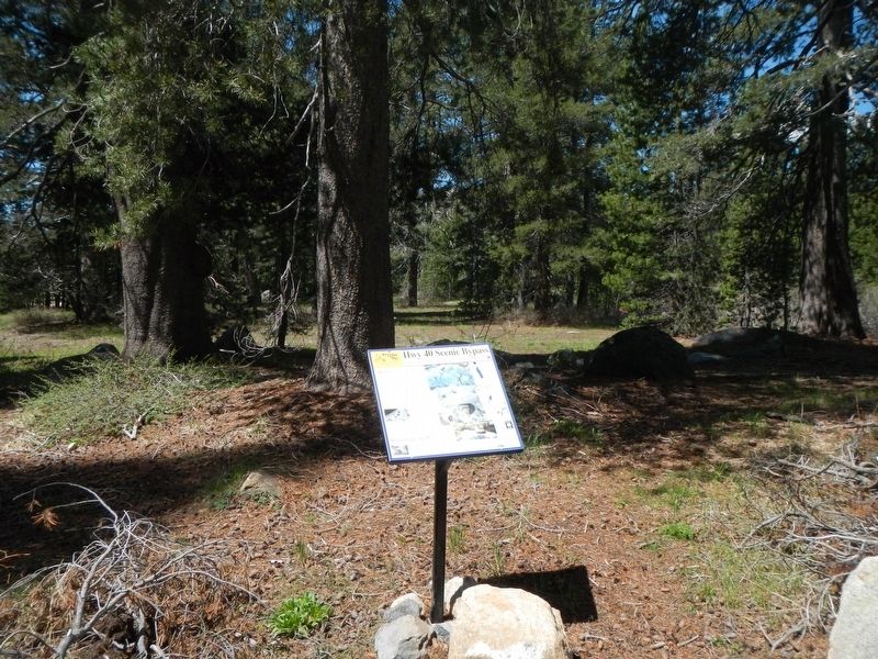
Summit Valley Native American Mortars Marker
201 ► California, Nevada County, Soda Springs — Summit Valley Native American Mortars — Hwy 40 Scenic Bypass —  |
| On Lake Van Norden Road near Soda Springs Road, on the right when traveling east. | |||
| 202 ► California, Orange County, Laguna Hills — Costeau Pit — |
| Near Costeau Street, on the left. | |||
| 203 ► California, Orange County, Lake Forest — Native Ways — The Acjachemen and Tongva weave local resources into their culture. — Heritage Hill Historical Park — |
| Near Serrano Road at Winding Way, on the right when traveling west. | |||
| 204 ► California, Orange County, Mission Viejo — Land of the Acjachemen — The Original People of Orange County — Welcome — |
| On Cielo Cresta near Cielo Azul, on the right when traveling west. | |||
| 205 ► California, Orange County, Rancho Mission Viejo — Topanga Formation — |
| On Ribera just west of Ascenso Avenue, on the right when traveling east. | |||
| 206 ► California, Riverside County, Blythe — 101 — Giant Desert Figures — Blythe Intaglios — |
| On State Highway 95 at milepost 15.3, 16 miles north of Blythe, on the right when traveling north. | |||
| 207 ► California, Riverside County, Hemet — 557 — Hemet Maze Stone — |
| Near California Avenue 2.5 miles north of Devonshire Avenue. | |||
| 208 ► California, Riverside County, Hemet — 104 — Pochea Indian Village Site — |
| On Ramona Bowl Road, on the right when traveling east. | |||
| 209 ► California, Riverside County, Idyllwild — Idyllwild Campground Pictograph — |
| On Riverside County Playground Rd 0.8 miles west of Highway 243, on the left when traveling west. | |||
| 210 ► California, Sacramento County, Walnut Grove, Locke — 打更 The Bok Bok Man 更夫 — |
| On Main Street south of Locke Road, on the right when traveling north. | |||
| 211 ► California, San Bernardino County, Barstow — Fort Irwin — |
| On Fort Irwin Road 27 miles north of Interstate 15, in the median. | |||
| 212 ► California, San Bernardino County, Goffs — 61 — Pah-Ute Creek — Fort Pah-Ute — Mojave Road — |
| On Lanfair Road at Goffs Road, on the right when traveling south on Lanfair Road. | |||
| 213 ► California, San Bernardino County, Joshua Tree — Are YOU a Packrat? — |
| Near Indian Cove Nature. | |||
| 214 ► California, San Bernardino County, Joshua Tree — Tortoise Troubles — |
| Near Indian Cove Nature. | |||
| 215 ► California, San Bernardino County, Kelso — 16 — Jack and Ida Mitchell — |
| On Essex Road at Black Canyon Road, on the right when traveling north on Essex Road. | |||
| 216 ► California, San Bernardino County, Lucerne Valley — 737 — Chimney Rock — |
| On Old Woman Springs Road (California Route 18) at Rabbit Springs Road, on the right when traveling west on Old Woman Springs Road. | |||
| 217 ► California, San Bernardino County, Twentynine Palms — Cottontails and Jackrabbits — |
| Near Indian Cove Nature Trail west of Indian Cove Road West, on the right when traveling north. | |||
| 218 ► California, San Bernardino County, Twentynine Palms — Desert Bighorn Sheep — |
| Near Indian Cove Nature Trail west of Indian Cove Road West, on the right when traveling north. | |||
| 219 ► California, San Bernardino County, Twentynine Palms — Desert Willow — |
| On Indian Cove Nature Trail west of Indian Cove Road West, on the right when traveling north. | |||
| 220 ► California, San Bernardino County, Twentynine Palms — Pencil Cholla-Opuntia ramosissima — |
| On Indian Cove Nature Trail west of Indian Cove Road West, on the right when traveling north. | |||
| 221 ► California, San Diego County, Anza-Borrego Desert State Park — Morteros Memories — |
| On Pictographs Trailhead road just west of Little Blair Valley Road. | |||
| 222 ► California, San Diego County, Anza-Borrego Desert State Park — Pictographs — What Do They Mean? — |
| On Pictographs Trailhead road 1.4 miles east of Little Blair Valley Road. | |||
| 223 ► California, San Diego County, Camp Pendleton — Panhe: Place by the Water — |
| Near Panhe Nature Trail 0.1 miles north of Cristianitos Road, on the right when traveling north. | |||
| 224 ► California, San Francisco City and County, San Francisco, Lincoln Park — Exploring Lands End — Golden Gate National Recreation Area — |
| Near Lands End Trail near Merrie Way. | |||
| 225 ► California, San Francisco City and County, San Francisco, Main Post — Outpost of an Empire — Golden Gate National Recreation Area — Presidio of San Francisco — |
| On Graham Street south of Sheridan Avenue, on the right when traveling south. | |||
| 226 ► California, San Francisco City and County, San Francisco, Northern Waterfront — The History of Sourdough Bread — |
| Near The Embarcadero at Beach Street, on the right when traveling north. | |||
| 227 ► California, San Francisco City and County, San Francisco, Presidio of San Francisco — Adobe House Site — Sitio de la casa de adobe — Presidio of San Francisco — |
| Near MacArthur Avenue. | |||
| 228 ► California, San Francisco City and County, San Francisco, Presidio of San Francisco — Daily Life in the Early 19th Century / La vida cotidiana en el siglo XIX — Presidio of San Francisco — |
| Near MacArthur Avenue. | |||
| 229 ► California, San Luis Obispo County, Carrizo Plain National Monument — Painted Rock — |
| Near Soda Lake Road. | |||
| 230 ► California, San Mateo County, Pacifica — The Enduring Aramai — Golden Gate National Recreation Area — |
| Near Mori Point Road 0.1 miles west of Cabrillo Highway (State Highway 1). | |||
| 231 ► California, San Mateo County, Redwood City — Native Americans — Stanford | Redwood City — |
| On Broadway near Warrington Avenue, on the left when traveling west. | |||
| 232 ► California, San Mateo County, Redwood City — Pleistocene Period — 2.6 Million - 11,700 Years Ago — Stanford | Redwood City — |
| On Broadway near Warrington Avenue, on the left when traveling west. | |||
| 233 ► California, Santa Barbara County, Goleta — Mini-Mammoths — The Island Effect — |
| On El Camino Real, on the right when traveling east. | |||
| 234 ► California, Santa Barbara County, Santa Barbara — 306 — Burton Mound — |
| On West Mason Street, on the right when traveling north. | |||
| 235 ► California, Santa Barbara County, Santa Barbara — 306 — Burton’s Mound — Syuxtun Village — |
| On Chapala Street north of Cabrillo Boulevard, on the right when traveling north. | |||
| 236 ► California, Santa Clara County, Gilroy — A journey of a Lifetime — |
| Near Watsonville Road. | |||
| 237 ► California, Santa Clara County, Gilroy — Arrival of the Spanish — La llegada de los españoles — |
| Near Watsonville Road. | |||
| 238 ► California, Santa Clara County, Gilroy — Food Processing — Cocina — |
| Near Watsonville Road north of Burchell Road, on the left when traveling north. | |||
| 239 ► California, Santa Clara County, Gilroy — Ohlone Buildings — Los edificios de los ohlones — |
| Near Watsonville Road north of Burchell Road, on the left when traveling north. | |||
| 240 ► California, Santa Clara County, Gilroy — Rock Art — Arte lítico — |
| Near Watsonville Road (County Road G8), on the right when traveling south. | |||
| 241 ► California, Santa Clara County, Gilroy — Uvas Creek — El arroyo de las Uvas — |
| Near Watsonville Road (County Road G8) at Burchell Road, on the right when traveling south. | |||
| 242 ► California, Santa Clara County, Los Gatos, Almaden — Early People of Mount Umunhum — |
| Near Mount Umunhum Road near Mount Umunhum-Loma Prieta Road. | |||
| 243 ► California, Santa Clara County, Morgan Hill — Circle of Circles — 4000 BC — |
| Near Monterey Highway near Wright Avenue. | |||
| 244 ► California, Santa Clara County, Stanford — Ancient Ohlone Villages — |
| On Searsville Road west of Fremont Road, on the left when traveling west. | |||
| 245 ► California, Santa Clara County, Stanford — Papua New Guinea Sculpture Garden — |
| On Lomita Drive at Santa Teresa Street, on the right when traveling south on Lomita Drive. | |||
| 246 ► California, Siskiyou County, Tule Lake — Petroglyph Point — |
| Near County Road 126. | |||
| 247 ► California, Tehama County, Butte Meadows — Welcome to the Ishi Wilderness — |
| On Lassen Trail (Forest Road 27N08) near Route 32, on the right when traveling south. | |||
| 248 ► California, Tulare County, Kaweah — 389 — Kaweah Post Office — |
| On North Fork Drive 2.7 miles north of Sierra Drive ( Route 198), on the left when traveling north. | |||
| 249 ► California, Ventura County, Piru — 624 — Portolá Expedition — |
| On Orchard Street south of North Main Street, on the right when traveling north. | |||
| 250 ► California, Ventura County, Thousand Oaks — 5 — Lang Ranch — Oakbrook Regional Park Archeological Area — |
| Near Lang Ranch Parkway 0.5 miles east of Westlake Boulevard, on the right when traveling east. | |||
| 251 ► California, Ventura County, Ventura — The Flood of 1997 — A Destructive Force — |
| Near Cavern Point Trail. | |||
| 252 ► Colorado, Alamosa County, Mosca — Evidence of a Changing World — |
| On Lane 6N 1.2 miles west of State Highway 150, on the left when traveling west. | |||
| 253 ► Colorado, Archuleta County, Chimney Rock National Monument — Chimney Rock Artifacts — |
| Near Chimney Rock Road. | |||
| 254 ► Colorado, Archuleta County, Chimney Rock National Monument — Pit House Site — |
| Near Chimney Rock Road. | |||
| 255 ► Colorado, Archuleta County, Chimney Rock National Monument — The Great Kiva — |
| Near Chimney Rock Road. | |||
| 256 ► Colorado, Archuleta County, Pagosa Springs — Chimney Rock — |
| On U.S. 160 at milepost 136.9, just west of Hersch Avenue, on the right when traveling west. | |||
| 257 ► Colorado, Archuleta County, Pagosa Springs — Welcome to Chimney Rock National Monument — An Ancestral Puebloan Cultural Landmark — |
| On Chimney Rock Road (Forest Road 617) east of State Highway 151, on the right when traveling west. | |||
| 258 ► Colorado, Bent County, Hasty — Santa Fe Trail — Travelers through Time — |
| Near County Highway HH near County Highway 24. | |||
| 259 ► Colorado, Boulder County, Eldorado Springs — Welcome to the Crags Hotel — 1908 - 1912 — |
| Near Rattlesnake Gulch Trail. | |||
| 260 ► Colorado, Conejos County, Lasauses — Why a Natural Area? — |
| On State Highway 142 at milepost 14.2, 14.2 miles east of U.S. 285, on the right when traveling east. | |||
| 261 ► Colorado, Delta County, Delta — The Tipi and the Wickiup — Traditional Native American Shelter — |
| Near Gunnison River Drive (North Palmer Street) 0.3 miles west of U.S. 50. | |||
| 262 ► Colorado, Dolores County, Dove Creek — Community and Conflict — |
| On U.S. 491 at Guyrene Street, on the right when traveling west on U.S. 491. | |||
| 263 ► Colorado, Dolores County, Dove Creek — Dove Creek Country — |
| On U.S. 491 at Guyrene Street, on the right when traveling west on U.S. 491. | |||
| 264 ► Colorado, Fremont County, Cañon City — Garden Park — Type Locality of Dinosaurs — |
| On Garden Park Road (County Road 9) 2.6 miles north of Red Canyon Road, on the left when traveling north. | |||
| 265 ► Colorado, Grand County, Fraser — Indian and Eagle — |
| Near Zerex Street (U.S. 40) at Clayton Avenue, on the right when traveling north. | |||
| 266 ► Colorado, Grand County, Granby — Ancient Peoples Lived Near Windy Gap — |
| On U.S. 40 at State Highway 125, on the right when traveling east on U.S. 40. | |||
| 267 ► Colorado, Gunnison County, Gunnison — Puzzle from the Past — Is it writing, artwork, ancient graffiti? — Curecanti National Recreation Area — |
| Near Elk Creek 0.3 miles south of U.S. 50, on the right when traveling south. | |||
| 268 ► Colorado, Hinsdale County, Lake City — Early Holocene Encampment — Silver Thread Colorado Scenic and Historic Byway — |
| On Silver Thread Scenic Byway (State Highway 149 at milepost 76.8), 4 miles north of 8th Street, on the right when traveling north. | |||
| 269 ► Colorado, Larimer County, Kinikinik — An Ancient Connection — |
| Near Poudre Canyon Road (State Highway 14 at milepost 83) at Forest Road 297.1, on the right when traveling east. | |||
| 270 ► Colorado, Las Animas County, Kim — Dinosaur Shoulder Blade From An Apatosaurus — |
| Near Forest Road 2185 east of Rourke Road (County Highway 25). | |||
| 271 ► Colorado, Las Animas County, Ludlow — History Revealed — |
| On County Highway 44 at County Highway 61.5, on the right when traveling west on County Highway 44. | |||
| 272 ► Colorado, Las Animas County, Ludlow — Rediscovering Ludlow — Archaeologists uncovered the original tent colony — |
| On County Highway 44 at County Highway 61.5, on the right when traveling west on County Highway 44. | |||
| 273 ► Colorado, Las Animas County, Ludlow — The Story — |
| On County Highway 44 at County Highway 61.5, on the right when traveling west on County Highway 44. | |||
| 274 ► Colorado, Montezuma County, Cortez — Canyons of the Ancients National Monument — |
| On Mildred Road north of Main Street (U.S. 160), on the left when traveling north. | |||
| 275 ► Colorado, Montezuma County, Cortez — The Native Americans — 12,000 Years of History — |
| On Mildred Road north of Main Street (U.S. 160), on the left when traveling north. | |||
| 276 ► Colorado, Montezuma County, Cortez — Yucca House National Monument — |
| On County Route 20.5. | |||
| 277 ► Colorado, Montezuma County, Dolores — A Path Well Traveled — |
| Near State Highway 184 at milepost 7, on the right when traveling west. | |||
| 278 ► Colorado, Montezuma County, Dolores — Big Sagebrush — |
| Near State Highway 184 at milepost 7, on the right when traveling west. | |||
| 279 ► Colorado, Montezuma County, Dolores — Dominguez Pueblo — |
| Near State Highway 184 at milepost 7, on the right when traveling west. | |||
| 280 ► Colorado, Montezuma County, Dolores — Escalante Pueblo — |
| Near State Highway 184 at milepost 7, on the right when traveling west. | |||
| 281 ► Colorado, Montezuma County, Dolores — Gambel Oak — |
| Near State Highway 184 at milepost 7, on the right when traveling west. | |||
| 282 ► Colorado, Montezuma County, Dolores — Great Sage Plain, Colorado and Utah — |
| Near State Highway 184 at milepost 7, on the right when traveling west. | |||
| 283 ► Colorado, Montezuma County, Dolores — Indian Ricegrass — |
| Near State Highway 184 at milepost 7, on the right when traveling west. | |||
| 284 ► Colorado, Montezuma County, Dolores — Juniper — |
| Near State Highway 184 at milepost 7, on the right when traveling west. | |||
| 285 ► Colorado, Montezuma County, Dolores — Mountain Mahogany — |
| Near State Highway 184 at milepost 7, on the right when traveling west. | |||
| 286 ► Colorado, Montezuma County, Dolores — Piñon — |
| Near State Highway 184 at milepost 7, on the right when traveling west. | |||
| 287 ► Colorado, Montezuma County, Dolores — Prickly Pear Cactus — |
| Near Highway 184 at milepost 7, on the right when traveling west. | |||
| 288 ► Colorado, Montezuma County, Dolores — Rabbitbrush — |
| Near State Highway 184 at milepost 7, on the right when traveling west. | |||
| 289 ► Colorado, Montezuma County, Dolores — Respite Along the Dolores — Dominguez y Escalante Expedition • 1776-1976 — |
| On Railroad Avenue (State Highway 145) at 5th Street, on the left when traveling east on Railroad Avenue. | |||
| 290 ► Colorado, Montezuma County, Dolores — Skunkbush Sumac — |
| Near State Highway 184 at milepost 7 north of Lebanon Road, on the right when traveling west. | |||
| 291 ► Colorado, Montezuma County, Dolores — Spanish Explorers — |
| Near State Highway 184 at milepost 7, on the right when traveling west. | |||
| 292 ► Colorado, Montezuma County, Dolores — The Anasazi — Dominguez y Escalante Expedition • 1776-1976 — |
| On Railroad Avenue (State Highway 145) at 5th Street, on the left when traveling east on Railroad Avenue. | |||
| 293 ► Colorado, Montezuma County, Dolores — The Landscape — |
| Near State Highway 184 at milepost 7, on the right when traveling west. | |||
| 294 ► Colorado, Montezuma County, Dolores — The Making of a Mountain — Two World Views of the Same Horizon — |
| Near State Highway 184 at milepost 7, on the right when traveling west. | |||
| 295 ► Colorado, Montezuma County, Dolores — The People — |
| Near State Highway 184 at milepost 7, on the right when traveling west. | |||
| 296 ► Colorado, Montezuma County, Dolores — Wildlife or Relatives? — |
| Near State Highway 184 at milepost 7, on the right when traveling west. | |||
| 297 ► Colorado, Montezuma County, Dolores — Yucca — |
| Near State Highway 184 at milepost 7, on the right when traveling west. | |||
| 298 ► Colorado, Montezuma County, Mesa Verde — Canyon Barriers — Mesa Verde National Park — |
| On Mesa Top Loop. | |||
| 299 ► Colorado, Montezuma County, Mesa Verde — Oak Tree House — Mesa Verde National Park — |
| On Mesa Top Loop. | |||
| 300 ► Colorado, Montezuma County, Mesa Verde — Pithouse Life — Mesa Verde National Park — |
| On Mesa Top Loop. | |||
4206 entries matched your criteria. Entries 201 through 300 are listed above. ⊲ Previous 100 — Next 100 ⊳