From this point the Canadian explorers and early fur-traders caught their first glimpse of Lake Nipissing as they paddled westward on their journey from Montreal by way of the Ottawa, Mattawa and French Rivers to the Great Lakes. Champlain viewed . . . — — Map (db m199966) HM
The vast body of water before you is a shining Northern gem. Known as Lake Nipissing, the name being derived from an Aboriginal term meaning "little water", it is one of the ten largest lakes in Ontario at roughly 65 km by 25 km. When . . . — — Map (db m215993) HM
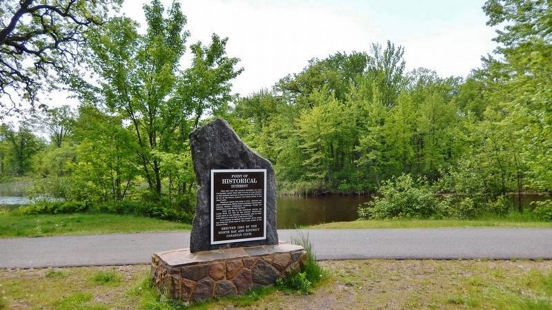
North Bay citizens have long enjoyed a refreshing tankard and for a short time in the early 20th Century, residents were served by their own brewery. The New Ontario Brewing Company Ltd. was the area's first commercial brewery, producing . . . — — Map (db m215898) HM
“Midnight Herring”
(Rum-Running 1920-1933)
In 1919 the commercial fishermen of Lake Erie were experiencing one of their industry's cyclical downturns. On Jan. 1, 1920 the Volstead Act introduced prohibition across the United States and created . . . — — Map (db m236371) HM
This monument is dedicated to those commercial fishermen who have lost their lives on the lake. It will serve as a lasting memorial celebrating the heritage of our fishing ports and the unique and hazardous way of life of our fishermen. — — Map (db m236364) HM
Although vessels had come to the mouth of the Lynn River since the 1790s, there was no proper harbour here until the 1840s. At that time the mouth of the river was dredged and the first piers and lighthouse were built, This project was initiated . . . — — Map (db m236376) HM
The story of this 3-cylinder Kahlenberg engine intertwines three communities:
Port Dover, Ontario; Cellardyke, Scotland; Two Rivers, Wisconsin.
From 1912 to 1931, Scottish communities experienced an exodus of commercial fisherman, migrating . . . — — Map (db m236565) HM
With Peggy Scruton's aid, I located a working three cylinder Kahlenberg engine in Albion, Maine, U.S.A
When I explained to the owner, William Alexander, a Kahlenberg descendant, that I wished to display it as representing the transition to . . . — — Map (db m236566) HM
The first Port Dover lighthouse was a 7.3 metre (24 foot) high wooden structure built on the west pier at the mouth of the Lynn River in 1845 as a small harbour light for the active shipbuilding, square timber trade, inshore fishery and, later, . . . — — Map (db m236339) HM
For much of the twentieth century, Port Dover was the heart of Canada's freshwater fishing industry. The industry had already begun to grow by 1911 when William "Cap" Kolbe came from Eric, Pennsylvania to establish the town's first large scale . . . — — Map (db m236363) HM
The original name of the hotel was the Royal Exchange. The back section of the hotel dates back to 1812 and the front was built between 1835 and 1840. During the Wm. Lyon Mackenzie Rebellion of 1837, the hotel served as the headquarters for . . . — — Map (db m217671) HM
During the War of 1812, Long Point Bay
provided a safe harbour for the vessels
of the British Provincial Marine, and
later the Royal Navy. Port Ryerse,
Turkey Point (Fort Norfolk) and the site
of present-day Port Dover were all
transfer . . . — — Map (db m236332) HM
During the 19th century, literally thousands of wooden schooners and steam-powered vessels plied the waters of Lake Erie. Dozens of these vessels were built within Long Point Bay and many were sailed by crews drawn from local ports. In the days . . . — — Map (db m234241) HM
Long Point Bay
Looking across Long Point Bay
1) Long Point Lighthouse at the tip of the peninsula. First built in 1830, rebuilt in 1843 and 1916.
2) Bluff Point. Home of the Bluff Shooting and Fishing Club, established in 1919. . . . — — Map (db m234275) HM
Port Rowan
Lake Erie Inner and Outer Long Point Bay
Commercial Fishermen and Punters
Our Oldest Heritage
In the early seventeen hundreds, this area was well noted for its abundance of waterfowl and fish. Punting and commercial . . . — — Map (db m234200) HM
English:
The Rideau Canal, a great military engineering achievement of the 19th century, opened central Canada to settlement and trade. The canal construction also brought thousands of people to the area, helping to shape the community of . . . — — Map (db m83421) HM
English: “Plenty of spirits, and provisions of all sorts, with beds, blankets, mits, caps, shoes, etc. shall always be at hand, in the Government store, to answer whatever demands may come for such articles by the people on the work, . . . — — Map (db m83363) HM
English:
Built between 1826 and 1832, the Rideau Canal is the best preserved, fully operational example of North America’s great canal building era. Lieutenant-Colonel John By’s innovative deign was based on a “slackwater” system that . . . — — Map (db m83361) HM
English: The Rideau Waterway stretches 202 kilometres through a chain of lakes, rivers and canals, linking Canada’s capital, Ottawa, to the historic city of Kingston on Lake Ontario. To follow the Rideau Waterway is not only a trip through . . . — — Map (db m83362) HM
English: Canada’s Capital is young — but the land is old, and the people have lived here for a long, long time. After the glaciers melted and the waters of the Champlain Sea retreated from this valley (10,000 to 13,000 years . . . — — Map (db m150699) HM
The Rideau Canal is a 202 kilometre waterway made navigable by a system of more than 50 dams, 47 locks and 19 kilometres of actual canal ruts. Built between 1826 and 1832 as British military defence strategy, the Canal served as a . . . — — Map (db m112342) HM
You are standing in Dickinson Square, named after Moss Kent Dickinson, the founder of the Village of Manotick. Dickinson and his partners were established forwarders of goods and people along the Rideau River. Recognizing the potential . . . — — Map (db m112355) HM
In wartime, merchant mariners have collectively faced constant danger and heavy losses to carry vital supplies and personnel across the oceans.
These plants depict the many crossings of our mariners, with yellow symbolizing the hope of our . . . — — Map (db m110332) WM
On the high seas, our sailors defend our sovereignty, protect sea lanes and support our troops, ever ready to heed the call of far flung allies.
Ship bells and white foam of ocean wavers are illustrated here.
En haute mer, nos marins défendent . . . — — Map (db m110346) WM
An outstanding example of mill architecture in Ontario, this grist-mill was constructed by Thomas Langrell, an Ottawa contractor, for Moss K. Dickinson (1822-97) and Joseph M. Currier (1820-84), the owners of a nearby sawmill. The Long Island Mill . . . — — Map (db m110294) HM
After the War of 1812 between Britain and the United States, many citizens of Upper and Lower Canada feared Americans had unfinished business with Canada. As a result, the Rideau Canal was constructed as part of a military system to . . . — — Map (db m110301) HM
Since the Rideau Canal opened in 1832, water management has been essential to its successful operation. Initially, water concerns focused on maintaining navigation and protecting engineering structures, with the excess water supplied to . . . — — Map (db m112353) HM
English: Standing here in 1860, you would have heard the sound of hammers and the creak of winches from across the river as construction began on Canada's Parliament Buildings. As recently as 1857, Canadians had been embroiled . . . — — Map (db m150700) HM
English: Imagine the “voyageurs” — the fur traders — who, in centuries past, camped on these wild shores. The Ottawa River is part of a 5,000-kilometre system of waterways that, for thousands of years, carried Aboriginal traders . . . — — Map (db m150701) HM
To commemorate Lieutenant-Colonel John By, R.E., builder of the Rideau Canal (1826-1832) and founder of Bytown (Later renamed Ottawa), the federal capital of the Dominion of Canada.
Erected by the Historic Landmarks Association of Canada
May 1915 . . . — — Map (db m205831) HM
During the construction of the Rideau Canal between 1826 and 1832, this structure was built as the headquarters for the Royal Engineers and Ordnance Department The three-story structure, built by the contractor Robert Drummond was completed in . . . — — Map (db m241868) HM
WHEN Lieutenant-Colonel John By arrived from England
to oversee the
construction of the Rideau Canal, he
selected this picturesque location for his
family residence. Nestled high on a cliff,
the attractive stone house overlooked the
Ottawa . . . — — Map (db m207149) HM
English: Forestry has sustained Canada — one of the world's largest exporters of forest products — for almost two centuries. Canada’s Capital has its own rich forestry heritage. Imagine the place where you are standing as it was a . . . — — Map (db m150698) HM
[English] Opened in 1904, with a lift of 19.8 metres, this is the highest hydraulic lift lock in the world and the first of two built in North America, both on the Trent-Severn Waterway. It operates on a balance principle. A . . . — — Map (db m247847) HM
The Father of New France, Samuel de Champlain, made the first of two voyages into what is now Ontario in 1613. He travelled up the Ottawa River seeking the northern sea (Hudson Bay) which one of his five companions, Nicolas de Vignau, claimed to . . . — — Map (db m105539) HM
For over two centuries the Ottawa River was part of the main canoe route to the West. Some of the river's most spectacular and dangerous rapids were located immediately downriver from here: the Rapide de la Veillée, the Trou and the Rapide des Deux . . . — — Map (db m105622) HM
The first steamboat on the Upper Ottawa River was the 25 horse-power "Lady Colborne" built in 1833 for service between Aylmer and Chats Falls. Gradually other sections of the river where opened to steam navigation and in 1854 the "Pontiac" was . . . — — Map (db m105618) HM
The first of the “Imperial Tower” lighthouses to be completed and the first official lighthouse on Lake Huron's Georgian Bay. Constructed in 1857, it was one of 6 similar lighthouses commissioned by the province of Canada West. These lights were . . . — — Map (db m196039) HM
[English] First installed as only a “temporary” boat transfer system at Big Chute, this veteran marine railway has been upgraded over the years to meet the changing demands of Waterway boat traffic.
The marine railway before you is still . . . — — Map (db m196010) HM
[English]
Numerous surveys dating back to the 1790s led to the selection of Port Severn as the western outlet for the Trent Canal. In 1913, York Construction company won a contract to build a main regulating dam, small water control dams . . . — — Map (db m196033) HM
[English]
Water Control Dams
A complex system of dams was needed to manage water levels for navigation on the lower Severn River. In many cases older timber structures built by loggers were replaced with concrete.
Port Severn – The . . . — — Map (db m196025) HM
The Cornwall Canal was one of eight canals that connected western Canada with the ocean by way of the Great Lakes and the St. Lawrence River. Constructed in 1834–1842 to overcome the rapids of the Long Sault, it was enlarged several times . . . — — Map (db m103668) HM
The Cornwall Canal remained in use for over 100 years. It consisted of a series of locks which carried boats 18.5 kilometers around the rapids. It was upgraded in 1881 with a new entrance and later a drydock facility. Power drawn from the . . . — — Map (db m202613) HM
In June 1784 disbanded Loyalist soldiers and their families settled at new Johnstown, the site of present-day Cornwall. Initially called Pointe Maligne, the area had been visited by native traders and French missionaries and explorers during the . . . — — Map (db m103632) HM
On July 1, 1958, Lake St. Lawrence was created. Under it's majestic waters, now lie the six "Lost Villages" of Mille Roche, Moulinette, Dickinson's Landing, Wales, Farran's Point and Aultsville. This large body of water embodies . . . — — Map (db m205335) HM
To the south-east, at approximately one-half kilometre, lies Mille Roches, once a village of 900 residents. Between 1890 and 1910, much quarrying took place near the village. The stone was used for the rebuilding of the Cornwall Canal and Lock . . . — — Map (db m205345) HM
To the south at approximately one-half kilometre, lies Moulinette, once a village of 300 residence. Adam Dixson, of Moulinette's prominent family, built the first dam across to Sheek Island and part of the Cornwall Canal, near the village. Christ . . . — — Map (db m205346) HM
Between this cemetery and the wooded island to the south, once lay the village of Wales. First a land grant to Dr. J Stuart, U.E.L., it became the local commercial centre, after 1856, when the railroad arrived. It was named Wales after . . . — — Map (db m205341) HM
The canals at Farran's Point, Rapide Plat and Galops were known collectively as the Williamsburg Canals. All three were built in the period 1844-56 on the north side of the St. Lawrence to form part of the Great Lakes navigation system. Farran's . . . — — Map (db m86848) HM
Construction of the St Lawrence Seaway required the flooding of 20,000 acres along the Canadian shoreline between Iroquois and Cornwall. Some of these lands had been settled by loyalists in the 1780s. Between 1955 and 1957, 6,500 residents were . . . — — Map (db m203013) HM
This chain of rivers, lakes and portages linking the St. Lawrence system with the waterways of the prairies had been known to the Indians for centuries when Jacques de Noyon first travelled it in 1688. After 1800, when the boundary settlement had . . . — — Map (db m106543) HM
This portage around Kakabeka Falls formed a link in the historic Kaministiquia canoe route connecting Lake Superior with Lake of the Woods and the West. First recorded in 1688 by the French explorer Jacques de Noyon, it was later abandoned in . . . — — Map (db m106547) HM
[English] A solitary path The Nipigon River is the traditional gateway from Lake Superior to the fur rich Arctic watershed. By 1885, the area was dramatically altered when the Canadian Pacific Railway finished the "Nipigon gap" . . . — — Map (db m244764) HM
Look around. What appears to be a natural stream is actually the result of careful planning and bio-engineering. Clearwater Creek was home to a spawning run of Lake Superior coaster brook trout and flowed into the Nipigon River just north of . . . — — Map (db m244597) HM
Nipigon Historical Museum Nipigon’s first museum was built in 1904 as an engineering office building for the Canadian Northern Railroad. Dr. Herman Bryan, the first doctor in town, arrived in 1905 to look after the railway workers and took up . . . — — Map (db m244600) HM
Men, machines, water and wood came together in 1900 but it was 1938 before any company was able to drive the entire length of the Nipigon River. From 14,000 cords then to as much as 400,000 cords later, pulp wood has journeyed downstream to the . . . — — Map (db m222198) HM
History: In 1915 Dr. Cook caught the world record brook trout, 14 lbs. 8 oz. (6.58 Kg) in the Nipigon River. Today, anglers still travel to Nipigon from around the world to fish for trophy brook trout. Brook trout from 5 lbs. to 8 lbs. are . . . — — Map (db m244594) HM
This turbine runner was from generating unit #2 at Cameron Falls Generating Station. The generating unit #2 was placed in service on December 20th 1920, and remains in service today. In 1988, the turbine runner was replaced with a new stainless . . . — — Map (db m244571) HM
In the early days lakes and rivers took the place of roads. The dotted green line shows part of the first Highway across Canada. This was a very renowned canoe route used by the Indians, celebrated explorers, traders, and missionaries. It was first . . . — — Map (db m237391) HM
This community, originally known as Isbester's Landing, was named in 1885 after Collingwood G. Schreiber. Born at Bradwell Lodge, near Colchester, England, Schreiber emigrated to Canada West in 1852. His training in England as a civil engineer . . . — — Map (db m107382) HM
Origin Stories The rock, the water, the oral traditions of the First Nations: Each tells its own tale about the origins of this shoreline site, but all speak of a place that is ancient. Geologists talk in terms of glaciers. The first . . . — — Map (db m227996) HM
Thunder Bay’s Stone Frigate Her Majesty's Canadian Ship Griffon was launched modestly, in a leased garage a few blocks from this waterfront with its White Ensign flying from a tree trunk felled in the bush. But from the start, . . . — — Map (db m227989) HM
A small fort was established near here in 1717 by a French officer, Zacharie Robutel de la Nouë. First of a projected series of bases en route to the "Western Sea", it replaced a structure built in 1679 by Daniel Greysolon, Sieur Dulhut, on another . . . — — Map (db m106760) HM
In aboriginal times the Kaministikwia river was an important link between the Great Lakes and the northwest, and from the late 17th century French posts here at its mouth served as bases for the penetration of the interior. Between 1804 and 1821 . . . — — Map (db m106755) HM
Cathedrals, Pyramids and Hospitals Canada's famous photographer Yousuf Karsh called them cathedrals. Europe's most influential architects compared them to the pyramids. At one time, there were 29 grain elevators on this waterfront. . . . — — Map (db m227991) HM
Paddling to the Depot Bark peeled from a birch tree felled in spring. Cedar branches, tamarack roots, spruce pitch, and charcoal. From those materials, the first mariners of Lake Superior — the ancestors of the present-day First . . . — — Map (db m227995) HM
[English] On Thunder Bay just north of Fort William, engineer Simon Dawson established the eastern terminus of the Canadian government's proposed land and water route connecting Lake Superior and the Red River, for . . . — — Map (db m199597) HM
For many decades, lake commerce was the life's blood of the community and the focus of much business activity. Port Arthur and Fort William, which joined in 1970 to become Thunder Bay, once fought over who had the better harbour. But things changed . . . — — Map (db m243799) HM
The First Highway to the West Continents and oceans, geography and history, the Great Lakes and the inland waterways: they all meet here, on this waterfront, at the mouth of a river called the Kaministiquia. The name has been . . . — — Map (db m227997) HM
North of this watershed all flowing water eventually reaches Hudson Bay, while south of it all watercourses form part of the Great Lakes drainage system. The height of land follows an erratic course of some 1,400 miles across Ontario, ranging from . . . — — Map (db m106542) HM
The height of land known as the Artic Watershed crosses Highway 11 at this point.North of here, water drains into Hudson Bay; rivers, lakes and streams to the south flow into the Great Lakes. As the northern wilderness came under development, the . . . — — Map (db m195924) HM
[English] The height of land known as the Artic Watershed crosses Highway 11 at this point. North of here, water drains into Hudson Bay; rivers, lakes and streams to the south flow into the Great Lakes. As the northern wilderness . . . — — Map (db m217881) HM
This lighthouse, one of the earliest on the Great Lakes, was completed in 1808 as an hexagonal tower 52 feet high, topped by a wooden cage with a fixed whale-oil lantern. In 1832 it was raised to 82 feet and later equipped with a revolving light. . . . — — Map (db m40779) HM
The adjacent plaque was the first created by the Toronto Historical Board, and was installed in 1969 on an earlier building on this site. It marks the first place in Toronto where citizens were recruited and trained by the Royal Canadian Naval . . . — — Map (db m217587) HM
On June 21, 1832, the first cases of cholera, a highly contagious and deadly disease, appeared in the Town of York. Much feared, cholera first appeared in India in the 1770s, spreading along trade routes to Asia and Europe, and arriving in London, . . . — — Map (db m217097) HM
Grand River
The Grand River, flowing 290 kilometres from the Dundalk Highlands to Lake Erie, is aptly named, for its valley is the largest in Southern Ontario. A mosaic of Aboriginal
and European cultures combined to shape the . . . — — Map (db m231798) HM
Welcome to the Village of Erin. As you can observe from the maps, the village is nestled in the valley of the West Credit River. Beginning in the 1820s, European settlers began to harness the power of the river to drive early mills. Erin prospered . . . — — Map (db m243400) HM
277 entries matched your criteria. Entries 201 through 277 are listed above. ⊲ Previous 100