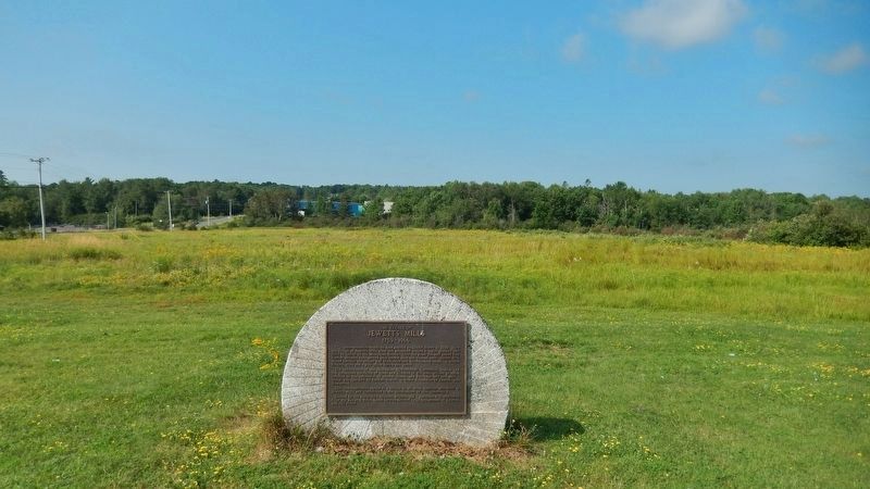
On Route 105 0.5 kilometers north of Route 615, on the left when traveling north.
This commemorative stands on land granted to Daniel Jewett in 1799. Here the village of Jewett’s Mills grew and prospered around a water-powered mill built by Daniel on the Mactaquac Stream. Over the years the mill sawed long lumber, shingles, . . . — — Map (db m137469) HM
On Rue Main (New Brunswick Route 134) north of Queen Street, on the right when traveling north.
This Monument is dedicated by the Village of Rexton in grateful commemoration of 74 years (1925-1999) of continuous medical service provided to the people of Kent County by two physicians and surgeons; Dr. William Francis Kenney and his son, Dr. . . . — — Map (db m150498) HM
On Rue Main (New Brunswick Route 134) at Church Street, on the right when traveling north on Rue Main.
English: Edward Hannay, regarded as one of the shrewdest horse traders who ever lived, would never pass by a pedestrian. He would say: "He knows something that we don't know, so pick him up." Ned, as he was widely and more . . . — — Map (db m150505) HM
Near North Street 0.3 kilometers east of Rue Main ( Route 134), on the right when traveling east.
Connue à l'origine comme « the Yard », la communauté fut fondée en 1825 alors que John Jardine, un constructeur de navire reconnu et respecté, y construisit la première demeure. L'imposante maison se tient encore fièrement debout, rendant hommage au . . . — — Map (db m150502) HM
On Rue Main (New Brunswick Route 134) just north of Bonner Law Avenue ( Route 116), on the left when traveling north.
MacNarin Family History (left panel) In 1817, a Canadian ship, The Dykes, set sail from Scotland for Canada with Capt. Simon Graham in command: On board were lads and lassies from the Scottish towns of Dumfriesshire, Gallowayshire . . . — — Map (db m150643) HM
On Rue Main (New Brunswick Route 134) just north of Cail Court, on the right when traveling north.
English: Originally built as the manse for St. Andrew's Church, the imposing house was constructed in 1880 on a half-acre of land donated by William and Margaret Bowser. Church Trustees' minutes of July 6, 1881 record that the . . . — — Map (db m150506) HM
On Queen Street just north of Rue Main ( Route 134), on the right when traveling north.
English: Built in 1884 on land given by the Brait family, its construction was under the direction of the community's first Anglican families, the Forsters and the Palmers. The church was consecrated on September 3rd of that year by . . . — — Map (db m150499) HM
On Rue Main (New Brunswick Route 134) north of River Street, on the right when traveling north.
English:The BridgesIn the beginning it was the river and the abundance of natural resources in the area that brought the settlers here; but, years later, it would be the building of the bridge across the Richibucto that would . . . — — Map (db m150500) HM
Near North Street 0.3 kilometers east of Rue Main ( Route 134), on the right when traveling east.
Originally known as "The Yard", the community was established in 1825 when the widely known and well respected shipbuilder John Jardine built the first home here. The stately house still stands as a memorial to the founder of the village. The . . . — — Map (db m150503) HM
Near Rue Main (New Brunswick Route 134) north of Queen Street, on the right when traveling north.
English: Shawn Michael Graham was born on February 22, 1968 in Rexton, New Brunswick. He is the eldest child of Alan Graham and Sharon Crothers, and his step-mother Connie Tramley. His family also includes wife Roxanne Reeves, PhD, . . . — — Map (db m150497) HM
Near North Street 0.3 kilometers east of Rue Main ( Route 134), on the right when traveling east.
English:The MastsIn partnership with the Richibucto River Historical Society, the Kingston Maritime Association was organized in 2003 for the purpose of establishing a means of recognizing and preserving the shipbuilding history . . . — — Map (db m150501) HM
On Rue Main (New Brunswick Route 134) just north of Cail Court, on the right when traveling north.
English: The village of Rexton was founded in 1825 and officially incorporated, as a village, in 1966. Rexton's population had reached 908 according to the 1996 census. Rexton is located in Southeastern New Brunswick, near the mouth . . . — — Map (db m150507) HM
Near North Street 0.3 kilometers east of Rue Main ( Route 134), on the right when traveling east.
English:Wooden Ships and Iron Men During the nineteenth century, New Brunswick's booming shipbuilding industry brought great prosperity to the Richibucto River. More than seventy ships of 500 tons and over were built and . . . — — Map (db m150504) HM
On King Street east of York Street, on the left when traveling east.
Best known as the Fred B. Edgecombe Dry Goods Store, Albion House was built after a major fire in 1871. The building was leased to Colwell and Jennings Ltd. Home Furnishings in 1920. In 1950 it became the J.D. Creaghan Co. Department Store. Rebuilt . . . — — Map (db m150291) HM
Near Union Street (New Brunswick Route 105) at Station Road, on the right when traveling south.
English:
Lumber and railway baron and generous benefactor, Gibson was a pivotal figure in the economy of the Maritimes at a time of transformation and integration within the national economy. A leading entrepreneur in mid-to-late . . . — — Map (db m139997) HM
Near Queen Street (New Brunswick Route 102) west of Sainte Anne's Point Drive, on the right when traveling west.
English: Fredericton's Changing of the Guard ceremony commemorates the birth of the Canadian Army in Officers' Square in 1883. Following the formation of the Dominion of Canada in 1867 and the departure of British Forces, the . . . — — Map (db m152399) HM
Near Queen Street (New Brunswick Route 102) west of Sainte Anne's Point Drive, on the right when traveling west.
English: Canada's professional army was born on this site, here in Fredericton in 1883, with the formation of the Infantry School Corps. Sixteen years prior, in 1867, the Dominion of Canada was formed when the colonies of British . . . — — Map (db m152396) HM
Near St. John Street south of Queen Street ( Route 102), on the left when traveling south.
English:
Born in Fredericton, Fisher practised law before entering politics. Excepting the period 1850-1854 he represented York as a member of the Legislature continuously from 1837 until his retirement in 1868. Entering the . . . — — Map (db m139900) HM
Near Queen Street (New Brunswick Route 102) west of Sainte Anne's Point Drive, on the right when traveling west.
English: Local Man Saves 200 Soldiers in the War of 1812 Courage and heroism are epitomized by Fredericton's Charles Rainsford, who led a risky mission to secure rations for a storm-stayed military regiment during an epic . . . — — Map (db m152398) HM
On Church Street north of Brunswick Street ( Route 102), on the right when traveling north.
English:
Christ Church Cathedral, begun in 1845, is one of the best and earliest examples of the Gothic Revival in Canada. Its stone walls, crossing tower and picturesque massing, echoing the internal parts of the church, were . . . — — Map (db m139987) HM
Near Queen Street (New Brunswick Route 102) west of Sainte Anne's Point Drive, on the right when traveling west.
English: During the War of 1812, as the colonies of British North America stood together to fend off attacks from the relatively new United States of America, close to 600 men undertook an epic trek. New Brunswick's 104th Regiment . . . — — Map (db m152395) HM
Near St. John Street south of Queen Street ( Route 102), on the left when traveling south.
English:
The Legislature of New Brunswick, recognizing the growing importance of health as a matter of public concern, established, in 1918, a department of government with specific and exclusive responsibilities in that field. . . . — — Map (db m139899) HM
On York Street just north of Queen Street ( Route 102), on the left when traveling north.
English:
Built in 1875-1876 to the design of architects McKean and Fairweather, this is the oldest municipal hall in Atlantic Canada still used for civic administration. Its imposing exterior and the many functions it has . . . — — Map (db m139800) HM
On Rue Carleton Street north of Queen Street ( Route 102), on the left when traveling north.
English:
This building is one of four remaining structures of the British establishment which housed the garrison at Fredericton from 1784 until the withdrawal of Imperial troops in 1869. Occupying the area between York and Regent . . . — — Map (db m139996) HM
Near Queen Street (New Brunswick Route 102) west of Sainte Anne's Point Drive, on the right when traveling west.
English: The wife of the last British Officer stationed in New Brunswick, Mrs. Juliana Horatia Ewing wrote and published an impressive 32 children's books and numerous articles during her brief life, dying at age 44. Fredericton was . . . — — Map (db m152397) HM
Near Queen Street (New Brunswick Route 102) just east of St. John Street, on the left when traveling west.
English:
The Legislative Assembly Building, built in the Second Empire style with Corinthian features in 1882, together with the Old Education Building (1816, second story 1869) and the Departmental Building (1888), form the seat . . . — — Map (db m139856) HM
Near St. John Street south of Queen Street ( Route 102), on the left when traveling south.
English:
Born in Sunbury County, educated at King’s College, and called to the bar in 1832, Wilmot entered politics as a reformer and represented York County in the Legislature (1835-51). A member of the Executive Council . . . — — Map (db m139897) HM
Near Queen Street (New Brunswick Route 102) just west of Sainte Anne's Point Drive, on the right when traveling west.
English: In the winter of 1813, New Brunswick’s 104th Regiment of Foot marched over 1,100 km from Fredericton to Kingston, in present-day Ontario, to support the British effort during the War of 1812. This expedition is regarded as . . . — — Map (db m152393) HM WM
Near St. John Street south of Queen Street ( Route 102), on the left when traveling south.
English:
Born in England, Douglas was Lieutenant-Governor and Commander in Chief of New Brunswick (1823-1831). He encouraged agriculture and fostered pioneer work in steam navigation and lighthouse construction. In 1828 he founded . . . — — Map (db m139898) HM
On George Street just east of York Street, on the left when traveling west.
English:
Built in 1886, St. Paul's is a fine example of High Victorian Gothic Revival architecture, fashionable in Canada during the second half of the 19th century. The style is marked by a bold and vigorous approach to design, . . . — — Map (db m139980) HM
On Woodstock Road (Route 102) 0.5 kilometers east of Springhill Road, on the left when traveling east.
Welcome to St Peter's Anglican Church and cemetery! The church building to your left was first opened for worship late in 1837 - Queen Victoria had just come to the throne the previous June! The nation of Canada had not yet been conceived, the . . . — — Map (db m138995) HM
On Queen Street (New Brunswick Route 102) just west of Rue Carleton Street, on the right when traveling west.
English:
Six companies of this Fredericton-based regiment made a 700-mile, 52-day march to Quebec and Kingston between February and April 1813. The feat was accomplished in the face of hunger, cold and heavy snows, with remarkably . . . — — Map (db m139995) HM
Near Queen Street (New Brunswick Route 102) just west of Sainte Anne's Point Drive, on the right when traveling west.
Member of Her Majesty’s Privy Council and Chancellor of the University of New Brunswick was born on May 25th 1879 the son of the Reverend William and Jane Aitken of the Manse, Newcastle, new Brunswick. Throughout a career remarkable for its many . . . — — Map (db m152392) HM
On Queen Street (New Brunswick Route 102) 0.1 kilometers west of St. John Street, on the right when traveling west.
English:
Opened about 1858, this building is the earliest surviving New Brunswick court house constructed of brick. It represents the beginning of the trend toward the widespread use of brick and stone in public buildings in the . . . — — Map (db m139799) HM
On Brunswick Street west of St John St, on the right when traveling east.
York County Gaol
Completed in 1842, the York County Gaol served as a jail until 1996. Constructed by builder Andrew Blair of granite quarried near Hampstead,
this Georgian style, functional building with its restrained . . . — — Map (db m306566) HM
Hartland Covered Bridge
This structure, 390.75 metres long, is by far the longest
covered bridge extant in the world. Covered bridges date
from the first decade of the 19th century when North American
builders began using . . . — — Map (db m284474) HM
On Main Street (Route 105) at Maple Street, on the right when traveling south on Main Street.
(English:) Historic salmon harvesting area of First Nations People and Loyalists. In the first half of the 20th century, the pool became internationally renowned as a sport fisherman's paradise.
(Français:) Zone . . . — — Map (db m138996) HM
Near Main Street (Route 105) north of Hartland Hill Bridge Road, on the right when traveling south.
Named on June 24, 1604 – the feast day of St. John the Baptist – during the expedition of Sieur de Monts and Samuel de Champlain the river originates in northern Maine and flows 673 kilometers emptying into the Bay of Fundy at Saint . . . — — Map (db m138997) HM
Near Main Street (Route 105) south of Mill Street, on the right when traveling south.
• Settled 1802 by William Orser United Empire Loyalist near where the Becaguimac Stream flows into the St. John River
• Originally known as Mouth of the Becaguimac
• Becaguimac — Abekaquimek — Maliseet for salmon bed
• Incorporated October 2, . . . — — Map (db m138999) HM
This collection of historic buildings creates a community representing an evolution of rural New Brunswick society from the Loyalists to the late Victorians.
Cette collection de bâtiments
historiques forme une . . . — — Map (db m230388) HM
On Main Street (New Brunswick Route 121) east of Peter Street, on the left when traveling east.
This property, as with so many in the area, once belonged to the estate of George Leonard who arrived in New Brunswick as a Loyalist with the spring fleet of 1783.
Although Mr. Leonard had been raised in Plymouth, Massachusetts and owned a home . . . — — Map (db m137651) HM
On Queen Street at Main Street ( Route 121), on the left when traveling south on Queen Street.
On this site in 1930, K. C. Irving built one of the first Irving service stations. We are proud to donate this land to assist in the development of Peace Park, built for the enjoyment of the citizens of Sussex and their visitors.
Thank you for . . . — — Map (db m106903) HM
On Broad Street just east of Queen Street, on the left when traveling east.
1914 ~ 1918
[Honored Dead]
John Andrews • John Bloomfield • Allen Bremner
Leonard Bunnell • George Bunnell • Harry Carr
George Calhoun • Frederick W. Crawford • George Chapman
Guy Chapman • Thomas DeCoursey • John Dawson
Charles . . . — — Map (db m106908) WM
On Chapel Street east of Queen Street, on the right when traveling east.
English:This plaque commemorates the bicentenary of the 3rd Field Artillery Regiment (The Loyal Company), Royal Canadian Artillery, formed in Saint John, New Brunswick, on May 4, 1793 as “The Loyal Company of Artillery”
During . . . — — Map (db m139194) HM WM
On Main Street (Route 103) north of Maple Street, on the left when traveling north.
(English:) Captured World War I German 77mm field gun manufactured by Krupp Armaments in Germany and introduced in 1896. Model: C96n/A Calibre: 77mm Maximum Range: 9186 yards (5 Miles) Weight: 1930 lbs. (8 75kg) Rate of Fire: 10 . . . — — Map (db m138994) HM WM
On Main Street at King Street, on the right when traveling north on Main Street.
F. L. Atherton, Harness Maker, operated on the
town square for many years. “Fred,” the plaster
model horse, stood silently outside the shop
displaying the wares. In 1951 "Fred” was sold to
a museum in Maine. . . . — — Map (db m138908) HM
On Chapel Street west of Orange Street, on the right when traveling west.
English:
Believed to have been built in the 1860’s for the Hon. Charles Connell, this Gothic Revival house was leased to Charles Bailey, a shoemaker and carpenter from the 1870’s through to his death in 1902. Bailey may have been . . . — — Map (db m140137) HM
On Main Street (Route 103) north of Maple Street, on the left when traveling north.
(English:)
The Court House was built in two phases twenty years apart. The left half, completed in 1889, was designed by architect J. G. Fletcher, to house the Records Office. The upper half, with the cornerstone laid on July 31, . . . — — Map (db m137483) HM
On Maple Street west of Main Street (Route 103), on the right when traveling west.
(English:) The jail was built in 1901, with H. H. Mott as architect and R. Maxwell of Saint John as contractor. It was in use until 1993. Three hangings took place in the yard of this jail: George Gee in 1904, Thomas Cammack in . . . — — Map (db m138900) HM
On Main Street (Route 103) north of Queen Street, on the right when traveling north.
(English:) Originally built as the Gibson House in 1873 by Alex Gibson and his son, John, it stood on Connell St. Following the 1881 fire that wiped out most of the buildings on Main St., the Gibsons built a new hotel at the . . . — — Map (db m138895) HM
On Connell Street (New Brunswick Route 550), on the left when traveling south.
Lumber merchant and politician, Charles Connell had this house
constructed circa 1840. Its pedimented front and freestanding columns
make it a fine example of the Greek Revival style. Such houses inspired
by classical temples are rare . . . — — Map (db m139149) HM
On Chapel Street west of Green Street, on the left when traveling west.
English:
This Classic Revival, 2 1/2 story house was built in 1896 for bank manager Mr. George White (1861-1922), and sold to Dr. J.F. Leigh Brown in 1920. Dr. Brown had just returned to Woodstock after being the Chief Medical . . . — — Map (db m139199) HM
On Main Street (Route 103) north of Victoria Street, on the right when traveling north.
(English:) The Prescott House was built circa 1840 by Robert Neilson. Dr. Alfred Prescott purchased the building in 1909 for use as a private hospital and it remained in use until closing in 1927. It served as apartments and . . . — — Map (db m138899) HM
On Main Street (Route 103) at Grover Street (Elm Street), on the left when traveling north on Main Street.
English:
In 1905 Woodstock physician and surgeon Dr. William D. Rankin, who had been instrumental in establishing the first Carleton County Hospital three years previously, purchased this house from John Fisher, one of the owners . . . — — Map (db m139198) HM
On Chapel Street at Orange Street, on the right when traveling west on Chapel Street.
English: Built c1905 for R. Norman Loane, this four square Edwardian house was designed by the same architect who built St. James United Church. Two provincial premiers have lived in this house: J. K. Flemming (premier from 1911 to . . . — — Map (db m139195) HM
On Connell Street (New Brunswick Route 550) at Queen Street, on the left when traveling south on Connell Street.
Built circa 1868 this house is considered to be the best example of High Victorian architecture in Woodstock. The house was built on land that was originally part of the grounds of the Honourable Charles Connell House. It is possible that . . . — — Map (db m139106) HM
On Connell Street (New Brunswick Route 550) at Green Street, on the left when traveling south on Connell Street.
This Edwardian house, the home of Murray Hay,
was built in 1904. It has a decorative verandah
and a stained glass window in the dormer, facing
the scenic Meduxnekeag river. Mr. Hay was a well known businessman for many years. . . . — — Map (db m139183) HM
On Connell Street (New Brunswick Route 550), on the left when traveling south.
Built in 1839 for Hon. Charles Connell.
It represents the peak of classicism
in Woodstock architecture. It is Greek Revival,
its essence being the Greek Temple look.
Wood is used here to imitate stone.
Purchased by the Carleton County . . . — — Map (db m139176) HM
On Chappel Street east of Green Street, on the left when traveling west.
(English:) This house was built in 1856-1857 for Edwin Fisher, one of the owners of the Small and Fisher foundry. It is considered to belong to the "picturesque cottage style", a variation on gothic. The house is known as the "Judge . . . — — Map (db m138993) HM
L. P. Fisher (1821-1905) was the first mayor of
Woodstock, from 1856-1880. He was a lawyer and he
advocated free public education and technical training.
Due to his advocacy he left a free public hospital (his
private residence), a . . . — — Map (db m138868) HM
On Chapel Street east of Cedar Street, on the right when traveling west.
(English:) Constructed in 1913 in accordance with the wishes of the Lewis Peter Fisher estate, the L.P. Fisher Vocational School was erected to provide vocational training for the county's youth. It was deeded to the County and . . . — — Map (db m138990) HM
On Chapel Street west of Orange Street, on the left when traveling west.
English:
This dwelling is a reminder of an era when small towns produced more of their own food. Built by local carpenter James McLean for his family in 1890, the lot included a barn where they kept the cows which supported a . . . — — Map (db m139577) HM
On Chapel Street west of Orange Street, on the right when traveling west.
English: Built for the Hon. Charles Connell about 1855, this is probably the oldest surviving brick house in Woodstock. The mansard roof, which gives the house a Second Empire appearance, was added in 1880.
The house may have . . . — — Map (db m139193) HM
On King Street east of Main Street (Route 103), on the left when traveling east.
(English:) With "thirty new fish-barrels of my stock in trade", is how William T. Baird described his 1839 start in the drugstore business. Bought in Saint John, his stock traveled up the St. John River - from Fredericton to . . . — — Map (db m138898) HM
On Chapel Street east of Green Street, on the right when traveling west.
(English:) Built in 1908 to the Romanesque revival design of architect H.H. Mott and replacing an earlier wooden church on the same site, Saint James's red brick and sandstone exterior make it unique among Woodstock's churches. . . . — — Map (db m138992) HM
On Main Street (Route 103) at Church Street, on the right when traveling north on Main Street.
(English:) Completed in 1884, St. Luke's Anglican Church is the third Anglican Church to be erected on this site, its uncompleted predecessor having been destroyed by the Woodstock Fire of 1881. The first church erected on this site . . . — — Map (db m138897) HM
On Chapel Street west of Green Street, on the left when traveling west.
English:
Built in 1889-1890 in the Classic Revival style for Mr. James Wolverton (1856-1917) and his wife Eva (Hovey) this was originally operated as a boarding house. At the time it was said to have one of the finest bathrooms in . . . — — Map (db m139197) HM
On Chapel Street west of Orange Street, on the left when traveling west.
English: The Women's Institute is a Canadian innovation, founded at the close of the 19th century as a discussion and action group for rural women. New Brunswick's WI was organized in 1911, at about the same time as Woodstock . . . — — Map (db m139196) HM
On Main Street (Route 103) north of Church Street, on the right when traveling north.
(English:) The early 1800s were a time of religious ferment in New Brunswick, and there are records of Baptist meeting houses in Woodstock as early as 1813. A Free Christian Baptist Church was organized here in 1834.
This Gothic . . . — — Map (db m138896) HM
In honour of
the men and women
of Canada who served
on land, sea, and air
overseas and at home
during World War II
1939-1945
Dedicated 8 May 2005
60th anniversary
V-E Day
Lest We Forget — — Map (db m138866) WM