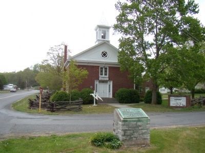
May 8, 1862, one mile southeast, Jackson and Edward Johnson, C.S.A. defeated Milroy and Schenck, U.S.A. This church served both Blue and Gray as a hospital. — — Map (db m62929) HM
Beyond the ridge you are facing is Sitlington’s Hill. On the afternoon of May 8, 1862, Gen. Edward “Allegheny” Johnson directed two brigades of Confederate infantry to take position on the hill facing the Federals across Bull Pasture Creek in . . . — — Map (db m155083) HM
You are standing at the center of the McDowell battlefield. Throughout the afternoon of May 8, 1862, hundreds or Union soldiers advanced doggedly uphill toward your position, loading and firing as they came. On either side of you, Confederate . . . — — Map (db m165773) HM
Elements of three Union armies moved through the Shenandoah Valley in the spring of 1862, while a fourth army marched up the Virginia Peninsula toward Richmond. Together, these two wings comprised a pincer movement against the Confederate . . . — — Map (db m172827) HM
Gen. Thomas J. "Stonewall" Jackson's unsuccessful attack on Union forces at Kernstown on March 23, 1862, alarmed Federal officials, who assigned additional troops to the Shenandoah Valley to guard against a Confederate assault on . . . — — Map (db m172829) HM
(preface)
Gen. Thomas J. "Stonewall" Jackon's unsuccessful attack on Union forces at Kernstown on March 23, 1862, alarmed Federal officials, who assigned additional troops to the Shenandoah Valley to guard against a Confederate assault on . . . — — Map (db m194722) HM
Gen. Thomas J. "Stonewall" Jackson's unsuccessful attack on Union forces at Kernstown on March 23, 1862, alarmed Federal officials, who assigned additional troops to the Shenandoah Valley to guard against a Confederate assault on . . . — — Map (db m235831) HM
The Battle of McDowell was the second engagement of Confederate Gen. "Stonewall" Jackson's Shenandoah Valley Campaign. After being defeated by Union forces at Kernstown, just south of Winchester, on March 23, 1862, Jackson withdrew south in the . . . — — Map (db m239604) HM
The Battle of McDowell
You're standing at the base of Sitlington's Hill, the key position during the Battle of McDowell.
When Union forces under Gen. Robert H. Milroy advanced into this area and occupied the village of McDowell in . . . — — Map (db m311039) HM
Stonewall Jackson, to prevent a junction of Fremont and Banks, took position on the hills just to the south and beat off the attacks of Fremont’s advance under Milroy, May 8, 1862. Milroy retreated that night. — — Map (db m4232) HM
Federals in action 4000 — killed and wounded 256
Confederates in action 2500 — killed and wounded 498
Confederate Officers Killed
Captains Lieutenants
Samuel Dawson John K. Goldwire
William . . . — — Map (db m256786) HM
Beyond the Ridge you are facing is Sitlington's Hill. On the afternoon of May 8, 1862, Confederate Gen. Edward "Allegheny" Johnson directed two brigades of Confederate infantry to take position on the hill facing the Federals across Bullpasture . . . — — Map (db m239058) HM
This stately brick house was built about 1855 for Felix Hull (ca. 1823-1861) in the Greek Revival style popular in the late antebellum period. During the Civil War, his widow, Eliza Mathews Hull, was living here on 7-8 May 1862 when the house was . . . — — Map (db m155460) HM
Fort George was built in the spring of 1757 by Captain William Preston, acting on orders of Major Andrew Lewis. Local residents assisted in construction of the 80-foot-square log fort located on the land of Wallace Estill. It was never attacked . . . — — Map (db m30465) HM
During the Civil War, Virginia's roads were of vital importance to both Union and Confederate armies for the transport of soldiers, artillery, supply wagons, and livestock herds to feed the troops. The roads ranged from narrow dirt paths to wide, . . . — — Map (db m172828) HM
During the Civil War, Virginia's roads were of vital importance to both Union and Confederate armies for the transport of soldiers, artillery, supply wagons, and livestock herds to feed the troops. The roads ranged from narrow dirt paths to wide, . . . — — Map (db m235814) HM
Neighbor fought neighbor on this ground during the Battle of McDowell. During the fighting, the 3rd Virginia Infantry (Union) moved to your left along the Staunton-Parkersburg Turnpike in an attempt to get around the Confederate right flank. . . . — — Map (db m235849) HM
This congregation, first known as Central Union Church, was organized in 1822. The present brick sanctuary, an interpretation of the Greek Revival style, replaced an earlier structure ca. 1856. The entrance on the building's south side was likely . . . — — Map (db m235759) HM
At 5:30 pm during the Battle of McDowell, the second line of Confederate infantry moved through this area as they climbed to the top of Sitlington's Hill to reinforce the defenders who had been battered by the initial assaults.
The Federals had . . . — — Map (db m239156) HM
In 1996, Congress designated eight counties as the Shenandoah Valley Battlefields National Historic District, with a mission to preserve and interpret the region's Civil War battlefields and related historic sites. The effort is led by the . . . — — Map (db m307940) HM
Sitlington's Hill was heavily wooded with thick underbrush and several rocky slopes, made for hard fighting. Both armies used ravines that traversed around and through the hill during the battle. The top of the ridge has a knoll to the left and a . . . — — Map (db m239207) HM
During the Battle of McDowell, the Confederate 12th Georgia Infantry held this ridge, overlooking the Village of McDowell. The Georgians began the battle on a knoll - a "large hilly old field" - in advance of the main Confederate line before . . . — — Map (db m239270) HM
Major General Edward Johnson commanded the Confederates on the crest overlooking the town of McDowell. Johnson spread his line along the hilltop, anchoring his right flank on the knoll to your right. Stonewall Jackson remained in the valley below, . . . — — Map (db m16685) HM
The Confederate 12th Georgia Infantry Regiment held this exposed crest overlooking McDowell. Milroy’s Union troops assaulted this hilltop from two directions – on the left and the right. The Confederates held their ground against repeated attacks . . . — — Map (db m16689) HM
In the spring of 1862 Confederate fortunes seemed to have gone from bad to worse. Union forces had won several key battles in the West, while the U.S. Navy was establishing its coastal blockade and Major General George B. McClellan’s Army of the . . . — — Map (db m165817) HM
You are standing on one of the pivotal battlefields of the Shenandoah Valley campaign. Here, on May 8, 1862, Confederate Gen. Thomas J. "Stonewall" Jackson and his 6,000 men defeated Union Gens. Robert C. Schenck's and Robert H. Milroy's . . . — — Map (db m172816) HM
“… [The 31st Virginia] came close to the 3rd and saluted them, and called them by name, and proceeded with the slaughter.” Andrew Price, 3rd Virginia Most of Stonewall Jackson’s Confederates climbed Sitlington’s Hill through a ravine off to . . . — — Map (db m194639) HM
"Many of the boys had their guns shot to pieces... They would pick up another gun and go to work as usual." - Pvt. Ephraim Hutchison, 82nd Ohio Infantry, USA
You are standing along the Confederate defensive line during the Battle . . . — — Map (db m239254) HM
Union troops camped in the fields south of here between April 17, 1862, and the Battle of McDowell on May 8, 1862. They deployed artillery, including "two twelve pounders [that] were planted on the plateau in the rear of [the church] so as to . . . — — Map (db m235785) HM
You are looking toward the Confederate right flank. At the beginning of the battle, this flank extended toward the Staunton-Parkersburg Turnpike at the bottom of the hill to your right. The main Union attack came against this part of the . . . — — Map (db m239197) HM
During the Battle of McDowell on May 8, 1862, this height known as Cemetery Hill was crowded with Federal cannon, each served by a crew of 14 men or more. Union Capt. Henry Hyman, Battery I, 1st Ohio Light Artillery, positioned his guns here with . . . — — Map (db m254965) HM
As they advanced to combat, both armies used ravines to make their way to the top of Sitlington's Hill. Most Confederate troops used a ravine just off to your left, which provided a direct route to the top of the height.
During the battle, . . . — — Map (db m239178) HM
When he arrived in McDowell on May 8, 1862, Confederate Gen. Thomas J. "Stonewall" Jackson rode to the top of Sitlington's Hill. There he studied the terrain and Union positions in the village below with Confederate Gen. Edward "Allegheny" . . . — — Map (db m239089) HM
Union troops camped in the fields south of here between April 17, 1862, and the Battle of McDowell on May 8. They deployed artillery, including “two twelve pounders [that] were planted on the plateau in the rear of [the church] so as to cover the . . . — — Map (db m254981) HM
Entering this house, the Mansion House (The George Washing Hull House), on May 9, 1862, the day after the Battle of McDowell, a VMI Cadet witnessed a horrifying scene. "The parlor had been used as a hospital; there was a dead man laid on top of . . . — — Map (db m302500) HM
This property
Highland Inn
has been placed on the
National Register
of Historic Places
by the United States
Department of the Interior — — Map (db m172831) HM
Monterey, the seat of Highland County government, also served as the headquarters for Confederate and Union forces at different times during the Civil War. Confederate Gen. Henry R. Jackson, who led a brigade under Gen. Robert E. Lee during the . . . — — Map (db m172834) HM
Monterey, the seat of Highland County government, also served as the headquarters for Confederate and Union forces at different times during the Civil War. Confederate Gen. Henry R. Jackson, who led a brigade under Gen. Robert E. Lee during the . . . — — Map (db m257005) HM
In 1850, Adam H. Fleisher purchased one third of town Lot 4 from James Bell. The original house, built in 1850, was a log and frame structure consisting of four rooms and a central staircase.
At some point, the roof was raised, and the . . . — — Map (db m307945) HM
The
Charles Pinckney Jones
Law Office
has been placed in the
National Register
of Historic Places
by the United States
Department of the Interior
2013 — — Map (db m172835) HM
George M. Jordan and Philip E. Witts established The Recorder in Monterey in Oct. 1877 during a period of rapid growth for local journalism in the post-Civil War years. By horse and wagon they hauled a Washington printing press, the most . . . — — Map (db m307943) HM
Monterey was headquarters for Confederates during much of the 1861 Mountain Campaign and headquarters for Federals prior to the fighting at McDowell. In the winter of 1861-1862, skirmishing occurred across the county as the frontier between the . . . — — Map (db m155465) HM
Virginia. Highland County. Area 422 Square Miles. Formed in 1847 from Pendleton and Bath, and given its name because of its mountains. The battle of McDowell, 1862, was fought in this county.
West Virginia. West . . . — — Map (db m34538) HM
My Dear Penelope
Wee are now tolerable well fortified; got 12 pieces of cannon and places all fixed for the men to shoot from; that is, fortifications for cannon with openings to shoot through so the men can man the cannon and not . . . — — Map (db m86203) HM
You are standing in the middle of what was once Fort Edward Johnson. Confederate soldiers built this fort in 1862 under the command of Brigadier general Edward Johnson, a career officer from Virginia.
Look to your right, and then left across . . . — — Map (db m272339) HM
You are standing in the middle of what was once Fort Edward Johnson. Confederate soldiers under the command of Gen. Edward "Allegheny" Johnson built this fort—"cutting timber, ditching, fortifying"—in early April 1862 to defend the Shenandoah . . . — — Map (db m307917) HM
On April 19, 1862, General Johnson, with General Lee’s approval, moved our regiment from Allegheny Mountain to Shenandoah Mountain. To protect ourselves from Yankee bullets, we dug about a mile of trench in this rocky ground. We then opened our . . . — — Map (db m16775) HM
My name is Shepherd Green Pryor, but my friends and family call me “Shep.” I was elected First Lieutenant of the Muckalee Guards, Company A, 12th Regiment, Georgia Volunteer Infantry. We’ve just survived a cold Virginia winter on the top of . . . — — Map (db m16773) HM
61 rods west stood original
round log church upon 3½
acre plot, deeded Dec.18, 1769,
by John Michael Propst and his
wife, Catherine, “for the congregation of the South Fork of the
Potowmack for five shillings
current money of Virginia.” — — Map (db m123901) HM
The stone cemetery takes its name from Daniel Stone, an early owner,while the
oldest tombstone carries the date 1793. The principal use began in the 1860s at the time of the civil war and the creation of the State of West Virginia by president . . . — — Map (db m123913) HM
Here mountain waters divide into many rivers. Greenbrier, Gauley and Elk start south and west to the Kanawha; the Jackson east to the James; north goes the South Branch to the Potomac, and the Cheat and Tygard to the Monongahela. — — Map (db m124091) HM
Pocahontas County. Formed from Bath, Pendleton
and Randolph in 1821. Named
for Pocahontas, Indian princess, friend of the Jamestown
settlers. Site of Droop Mountain battle, November 6, 1863.
The famous Cranberry Glades
are in this . . . — — Map (db m124088) HM
1977 Baseball State Champions
James Arbogast •
David Bennett •
Floyd Bennett •
Richard Bennett •
Steve Bland •
Bob Bogan •
Jerry Bowers •
Mark Colaw •
Chris Harper •
Rocky Hedrick •
Tim Kisamore •
Don Lantz •
John . . . — — Map (db m234896) HM
Spruce Knob (9 miles W.), 4,860 feet and the highest point in West Virginia, lies slightly above the crest ridge of Spruce Mountain. The crest lies above 4,500 feet for more than 10 miles and is strewn with fragments of Pottsville Sandstone of the . . . — — Map (db m304589) HM
Dedicated to the memory of the men from Pendleton County, Confederate and Union, who served in the War Between the States
1861 - 1865 — — Map (db m165763) WM
Near this site, in May 1862, following the battle of Mcdowell, General "Stonewall" Jackson received orders to return to the Shenandoah Valley while attending church service with the army. — — Map (db m34530) HM
A key component of gun powder, the saltpeter mined near Franklin was of great importance to the South during the Civil War. On August 19, 1863, during his raid of Pendleton and surrounding counties, Union Gen. William W. Averell destroyed the . . . — — Map (db m155458) HM
The carbonaceous shale exposed in the quarry is the Marcellus brown and black shale of the driller. it yields large amounts of natural gas in southern West Virginia. — — Map (db m34502) HM
Settled, 1769. Named for its founder, Francis Evick. John Van Meter first reached the South Branch, 1725. Roger Dyer and others came in 1745. Site of Federal camp of Gen. John C. Fremont, 1862, on way to attack "Stonewall" Jackson. — — Map (db m34500) HM
Following the Battle of McDowell on May 8th 1862, Confederate General "Stonewall" Jackson pursued retreating Union forces under the command of Generals Schenck and Milroy to Franklin. As was his custom, Jackson called for a day of prayer and . . . — — Map (db m180860) HM
Gen. Thomas J. "Stonewall" Jackson's unsuccessful attack on Union forces at Kernstown on March 23, 1862, alarmed Federal officials, who assigned additional troops to the Shenandoah Valley to guard against a Confederate assault on . . . — — Map (db m155456) HM
On May 6, 1862, Union Gen. Union Gen. Robert C. Schenck made his headquarters here at the McCoy House—invited by homeowner William McCoy—when he and his brigade arrived in Franklin.
the next day, Schenck and his men hurried . . . — — Map (db m307983) HM
At this site on May 10th, 1862, following the battle of Mcdowell, union soldiers murdered Rev. Ambrose Meadows. A mill and the Meadows home were burned, his wife and three children left homeless. — — Map (db m155457) HM
At this site on May 10th, 1862, Rev. Ambrose Meadows was murdered by Union Troops. Samuel Johnson, a union who was present, wrote the following: "Col. Zigler of my regiment ordered Capt. McCall with Company B out to investigate the the . . . — — Map (db m187217) HM
"By fairy hands their knell is rung by forms unseen their dirge is sung" Dedicated to these heroes of Pendleton County who made the supreme sacrifice in the World War 1914 - 1918 Killed in action
John Dayton Dove - Riverton
Raymond L. Harman . . . — — Map (db m34501) HM
At this gap defeated Union forces slowed the pursuit of "Stonewall" Jackson following the battle of McDowell in May 1862.
The site was used by Confederate forces to make gunpowder from saltpeter secured in nearby cave. — — Map (db m34531) HM
The Trout Rock Fort was one in the chain of forts that the Virginia House of Burgesses in March 1756 directed Washington to erect for the defense of settlers in the South Branch Valley. It also marks the end of Gen. Stonewall Jackson's pursuit of . . . — — Map (db m34533) HM
Greek Revival home built in 1848 for William McCoy, who was a deputy sheriff, justice of the peace, and delegate to the VA Assembly from 1835 to 1839. During the Civil War, Union troops ran a telegraph line from Moorefield to Franklin and housed . . . — — Map (db m234985) HM
West Virginia. (Pendleton County). "The Mountain State" - western part of the Commonwealth of Virginia until June 20, 1863. Settled by the Germans and Scotch-Irish. It became a line of defense between the English and French . . . — — Map (db m34536) HM
Fort Seybert, strong frontier post with blockhouse, cabins, and stockade, surrendered to the Indians after three-day siege in 1758. Twenty of the prisoners were massacred and the others were carried into captivity. (Site 2 Mi. North) — — Map (db m34461) HM
Pendleton County. Formed in 1788 from Augusta, Hardy, and Rockingham. It was named for Edmund Pendleton, Virginia jurist and statesman. This county has a range of altitude of over 3500 feet. here is the Smoke Hole with its wonderful scenery. . . . — — Map (db m301653) HM
At this site, Confederate infantry along with two units of cavalry engaged Union forces numbering close forty. In the skirmish that resulted, Union troops rallied: forcing the Confederates from the field. Two local, Perry Bland and Thomas Powers . . . — — Map (db m92895) HM
In Germany Valley is the site of Hinkle's Fort built in 1761–1762. It was the only defense of the South Branch after Fort Upper Tract and Fort Seybert were destroyed by Shawnee Indians under Killbuck, April 27–28, 1758. — — Map (db m23303) HM
Nearby is grave of John Dolly (Dahle, 1749-1847), a Hessian mercenary in the Revolutionary War and an early settler in Germany Valley. Naming of Dolly Sods attributed to his surname and large tracks of grass sod lands found here. — — Map (db m164077) HM
On the evening of January 13, 1865, Union Maj. Elias S. Troxel, 22nd Pennsylvania Cavalry, was leading a two-hundred-man scouting expedition south from New Creek in present-day Mineral County. After passing through Petersburg, he joined Capt. . . . — — Map (db m45040) HM
The massive sandstone across the road is the Oriskany of the driller and geologist. The "Oriskany Sand", an important gas sand, has produced in excess of a trillion cubic feet of gas in West Virginia. — — Map (db m80414) HM
At this site on March 2nd, 1862, Union forces numbering forty were attacked by local Confederate infantry and two units of cavalry. In the skirmish that resulted, Union troops rallied forcing the Confederates from the field. Two local men, Perry . . . — — Map (db m49696) HM
The massive vertical sandstone forming Judy Rocks is the Tuscarora of the driller and geologist. The "Tuscarora (Clinton) Sand" yields some gas although it is largely untested in West Virginia. — — Map (db m80415) HM
On this site on 2 June 1788 in a building owned by Seriah Stratton and formerly the property Col. Benjamin Wilson. Pendleton County was organized by justices commissioned by Virginia Governor Edmund Randolph from portions of Augusta, Rockingham . . . — — Map (db m125118) HM
In honor of the 10th Mountain Division and the soldiers they trained here on Seneca Rocks.
In 1943-44 these men climbed here to prepare themselves for the difficulties of mountain warfare before facing action during World War II. — — Map (db m23273) HM WM
The American frontier was one of the world's most effective architectural mixing pots. This typical Appalachian home started as a German Blockbau style log house. Hewn (squared) logs with V-notched corner joints, spaced apart with stone and . . . — — Map (db m167995) HM
The garden before you reflects some of the crops grown by our ancestors, the hardy pioneers who settled these valleys a few centuries ago.
Do you see any familiar plants that are still grown in our gardens today? Which crops do you find . . . — — Map (db m124112) HM
Prior to the Civil War, a Lutheran
log church built on the North Fork
housed a growing congregation. The
building, renamed Camp Luther, was
used by soldiers from both sides
during the war. On March 1, 1862, a Union force under Col. . . . — — Map (db m164089) HM
Near Champe Rocks is the home and grave of Sergeant John Champe who was sent by General Washington and Major Lee to kidnap Benedict Arnold, the traitor, from within the British lines. The daring plot almost succeeded. — — Map (db m9264) HM
The first recorded ascent of Seneca Rocks was in 1939. Since then, climbers have explored a maze of more than four-hundred routes across its face. Some routes lead to the summit; others meet dead-ends. Climbers from around the world come to test . . . — — Map (db m23257) HM
Seneca Rocks, an outstanding natural formation of Tuscarora Sandstone of the Silurian Age, rises over 900 feet above the North Fork of the South Branch. This almost perpendicular rock mass overlooks junction of Seneca Trail and Shawnee Trail, or . . . — — Map (db m45033) HM
Originally constructed around 1830 by Jacob Sites, this homestead started as a single room log cabin. William Sites, one of his two sons, expanded it into a two story frame structure in the late 1850's using locally available materials and skilled . . . — — Map (db m23232) HM
The vertical resistant sandstone forming Seneca Rocks is the Tucarora of the driller and geologist. The “Tuscarora Sand” yields some gas altough it is largely untested in West Virginia — — Map (db m254552) HM
“The Wilfong Church.” Four acres of land for church and
cemetery were purchased for one
shilling on October 1, 1794 from
German immigrant couple, Michael
and Sophia Wilfong. Historically and
locally known as “The . . . — — Map (db m123921) HM
Named for William Eagle, a Revolutionary War soldier who lived nearby. Enlisting at age fifteen, 12-24-1776, he served in the 3rd, 4th, 8th, and 12th Va. Rgts., Continental Line, at Valley Forge and Yorktown. Died, 1848, and is buried here. — — Map (db m85457) HM
Site of Fort Upper Tract, one of the forts erected under Washington's orders to guard the settlements. In 1758, Indians captured and burned it. Captain James Dunlap and 21 others were killed. No one escaped. — — Map (db m50401) HM
Oldest log church building in Pendleton Co. Built in 1848 of hewn white pine logs cut nearby. Served as Methodist Episcopal Church until 1910 when abandoned. Used as community center since rededication in 1936. — — Map (db m50400) HM
The Smoke Hole, a rugged canyon of 1421 feet elevation, made by the South Branch of he Potomac River, extends eighteen miles to the junction with the North Fork. In Coeymans Limestone of Devonian Age, the river has carved out various formations and . . . — — Map (db m94117) HM
527 entries matched your criteria. Entries 101 through 200 are listed above. ⊲ Previous 100 — Next 100 ⊳