2017 entries match your criteria. Entries 401 through 500 are listed.⊲ Previous 100 — Next 100 ⊳
Georgia Historical Society Historical Markers
The Georgia Historical Society has administered GA's historical marker program since 1998, erecting hundreds of new markers. GA's historical marker program was begun by the GA Historical Commission in 1953 and continued by the GA Department of Natural Resources. Their markers are now maintained by the Society. With over 3,000 markers, it is 2nd to Texas in state markers.
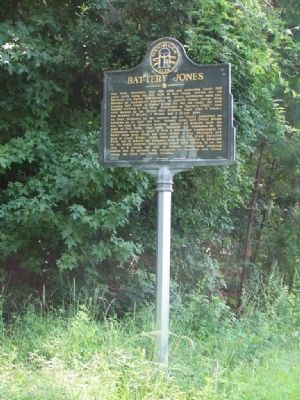
On Ogeechee Road (U.S. 17) at Silk Hope Road when traveling north on Ogeechee Road.
Dec. 1864. Beginning near this point and extending about 500 yards north along the left bank of Salt Creek, astride the old Savannah and Darien (Ogeechee) road, strong earthworks were constructed by Confederate engineers to prevent enemy forces . . . — — Map (db m10353) HM
On Dancy Avenue 0.1 miles east of Rockwell Avenue, on the right when traveling east.
In May, 1864, the USS "Water Witch" (80 officers and men and 4 guns), Lt. Comdr. Austin Pendergrast, USN, was on patrol duty in Ossabaw Sound. On the 31st, Flag Officer Wm. W. Hunter, CSN, assigned Lt. Thos. P. Pelot, CSN, to command a boat . . . — — Map (db m5945) HM
On Drayton Street at East Bolton Street, on the right when traveling north on Drayton Street.
A pioneer in women’s education, Nina Anderson Pape completed her studies at Columbia University. She founded the Froebel Circle, which educated the poor children of Savannah’s Yamacraw Village; and Tybee Island’s Fresh Air Home for disadvantaged . . . — — Map (db m8659) HM
On Augusta Avenue at Dunn Street, on the right when traveling east on Augusta Avenue.
One of the largest sales of enslaved persons in U.S. history took place on March 2-3, 1859, at the Ten Broeck Race Course ¼ mile southwest of here. To satisfy his creditors, Pierce M. Butler sold 436 men, women, and children from his Butler Island . . . — — Map (db m15838) HM
In 1841, under the inspiration of Sister Catherine McAuley of Dublin, Ireland, a group of Sisters of Mercy came to the United States to establish infirmaries and schools to minister to the poor and sick immigrants. In 1845, the Sisters of Mercy came . . . — — Map (db m34948) HM
On this spot, according to long and persistent tradition, occurred one of Sergeant William Jasper's most famous exploits during the American Revolution. Here, in 1779, at the spring then located along the road to Augusta. Sergeant Jasper and . . . — — Map (db m9300) HM
From 1878 to 1889, Robert Sengstacke Abbott lived in the parsonage of Pilgrim Congregational Church, once located on this site. His stepfather John H. H. Sengstacke, minister of the church, published the Woodville Times. Abbott learned the . . . — — Map (db m15782) HM
On West Bryan Street, on the right when traveling west.
Andrew Bryan was born at Goose Creek, S.C. about 1716. He came to Savannah as a slave and here he was baptized by the Negro missionary, the Reverend George Leile, in 1781. Leile evacuated with the British in 1782 at the close of the American . . . — — Map (db m15624) HM
On Louisville Road west of Martin Luther King Jr Boulevard, on the left when traveling west.
Over this ground, hallowed by the valor and the sacrifice of the soldiery of America and of France, was fought October 9, 1779, one of the bloodiest battles of the Revolution when Savannah, which the British had possessed for several months, was . . . — — Map (db m243780) HM
On 500 Block West Bay Street, on the left when traveling west.
One of two native Georgians who served as generals in the U.S. Army during the Civil War, John C. Frémont was born nearby on January 21, 1813. As an army officer, his 1840s explorations of the American West gained him fame as the . . . — — Map (db m62765) HM
On West Bryan Street west of Ann Street, on the left when traveling west.
First Bryan dates its founding to the constitution of the Ethiopian Church of Jesus Christ under Rev. Andrew Bryan in January 1788, making it one of the nation's oldest African-American Baptist churches. Known later as First Colored Church, First . . . — — Map (db m200204) HM
Near this spot two notable heroes of the American Revolution were mortally wounded in the ill-fated assault by the American and French forces upon the British lines here on October 9, 1779.
Brig. Gen. Casimir Pulaski, the famous Polish patriot, . . . — — Map (db m6698) HM
On Martin Luther King Jr. Blvd. (West Broad Street) near West Congress Street, on the left when traveling north.
Designed by noted English architect William Jay,
this house was built for William Scarbrough,
president of the Savannah Steamship Company.
Completed in 1819, it is an excellent example of
the neoclassical style. Scarbrough hosted
President . . . — — Map (db m35303) HM
On McWhorter Drive at Ocean Science Circle, in the median on McWhorter Drive.
This location first appears (1734) in Georgia's history as a Savannah outpost. An original settler was Thomas Mouse who is remembered for his description of early hardships here. An evangelical visitor in 1736 was John Wesley. By 1740 the settlement . . . — — Map (db m9400) HM
Designed and built in 1848 by renowned architect John S. Norris to mark the entrance to the South Channel of the Savannah River, the Cockspur Island Lighthouse was destroyed by a hurricane in 1854. A larger replacement was built on the same . . . — — Map (db m47201) HM
On Islands Expressway (U.S. 80) at Catalina Drive, on the right when traveling west on Islands Expressway.
Between February 21 and April 9, 1862, Federal troops under Gen. Quincy A. Gillmore erected 36 guns in 11 batteries, extending eastwardly on Tybee Island from Lazeretto Creek opposite Fort Pulaski. Two of the Federal batteries consisted of rifled . . . — — Map (db m7545) HM
On Islands Expressway (U.S. 80), on the left when traveling east.
Named for General Casimir Pulaski, the Polish hero who was mortally wounded at the siege of Savannah, 1779, Fort Pulaski was built in accordance with plans by General Simon Bernard, formerly chief engineer under Napoleon. Begun in 1829 and . . . — — Map (db m5037) HM
On Meddin Drive 0.1 miles north of Veterans Drive, on the right when traveling north.
The Legislature of Georgia in 1786 passed a law providing for a fort on Cockspur or Tybee Island to be named in honor of General James Screven, Revolutionary War hero. It was never built by the state. In 1808 the Federal government obtained . . . — — Map (db m210473) HM
Near Islands Expressway (U.S. 80), on the left when traveling east.
On April 13, 1862, following the Union capture of Ft. Pulaski during the Civil War, Maj. Gen. David Hunter issued General Orders No. 7 freeing those enslaved at the fort and on Cockspur Island. Hunter, an abolitionist advocating the enlistment of . . . — — Map (db m280516) HM
On February 6, 1736, John Wesley, the founder of Methodism, landed at Peeper (now Cockspur) Island near here and there preached to his fellow voyagers his first sermon on American soil. A monument has been erected on Cockspur Island to commemorate . . . — — Map (db m5072) HM
On US 80 at Olde Tybee Rd., on the right when traveling east on US 80.
After the repeal of the anti-slavery provision in the Charter of the Colony of Georgia on 1749, an act permitting the importation of slaves ordered the erection of a Lazaretto (Quarantine Station) on Tybee Island. Not until 1767 were 104 acres . . . — — Map (db m12953) HM
For 44 years, Florence Martus (1868-1943) lived on nearby Elba Island with her brother, the lighthouse keeper, and no ship arrived for Savannah or departed from 1887 to 1931 without her waving a handkerchief by day or a lantern by night. Throughout . . . — — Map (db m5049) HM
On Meddin Drive, on the right when traveling north.
Tybee Island was named by the Indians who came from the interior to hunt and fish. Settled since the beginning of the colony of Georgia, it was the scene in 1775 of the first capture by the first Provincial vessel commissioned by any Congress in . . . — — Map (db m44320) HM
On Meddin Drive, on the left when traveling north.
A lighthouse on Tybee was one of the first public structures in Georgia. Completed in 1736 by William Blithman of cedar piles and brickwork, its 90 foot height made it the loftiest in America. Destroyed
in a storm, it was replaced by another . . . — — Map (db m7423) HM
On Martha Berry Highway (U.S. 27) at River Bend Road, on the right when traveling south on Martha Berry Highway. Reported missing.
In February, 1836, after rumors of unrest among the Creek Indians and a report of 500 having crossed the Chattahoochee River at Bryants Ferry, 22 members of the Georgia Militia under Col. John H. Watson were sent out from Columbus to investigate the . . . — — Map (db m55463) HM
On Broad Street (Georgia Route 520) 0 miles east of Lafayette Road, on the left when traveling east.
Chattahoochee County, created by Act of February 13, 1854, was cut off from Muscogee and Marion Counties. It was named for the Chattahoochee River. Its courthouse, constructed in 1854, was built of select heart lumber from the Long Leaf Pine by . . . — — Map (db m38841) HM
On Broad Street (Georgia Route 520) 0 miles east of Lafayette Road, on the left when traveling east.
Kashita, “the Peace Town of the Lower Creeks,” one of two great Muskogee towns in the Creek Confederation of Indians, stood on the site of the Generals’ Headquarters at Fort Benning. Kashita, mentioned in the narrative of DeSoto’s . . . — — Map (db m38838) HM
On Vibbert Avenue 0.1 miles west of Lumpkin Road, on the right when traveling east.
“Riverside” was built in 1909 by Arthur Bussey, a prominent Columbus, Georgia businessman, and served as a summer home for the Bussey family. The spacious
dwelling was surrounded by one of the last self-supporting plantations in this area. When in . . . — — Map (db m57605) HM
Hugh Montgomery, born in S.C. Jan. 8, 1769, is buried here. He was employed in 1786 to survey the line between Franklin Co. and the Cherokee Nation. He represented Jackson Co. in the Ga. Legislature in 1807-11 and in the State Senate 1812-18 and . . . — — Map (db m51687) HM
On N Commerce Street (U.S. 27) at W Washington Street, on the right when traveling west on N Commerce Street.
Chattooga County was created by Act of Dec. 28, 1838 from Floyd and Walker Counties. It was named for the river which flows through the county, called Chattooga by the Cherokee Indians. Sequoyah (George Guess or Gist), inventor of the Cherokee . . . — — Map (db m16374) HM
On Fourth Street, on the left when traveling west on Fourth Street.
Three Walker County businessmen, Andrew P. Allgood, Spencer S. Marsh and Col. W.K. Briers, officially organized the Trion factory Oct. 12, 1845. It has had few shut-downs since its first production in 1847. In 1858 an epidemic, in 1864 Sherman's . . . — — Map (db m11460) HM
On Gilmer Ferry Road (Georgia Route 372) at Valley Street, on the left when traveling west on Gilmer Ferry Road. Reported permanently removed.
Two and one-half miles to the east, near the confluence of Long-Swamp Creek and the Etowah River, is the traditional site of Taliwa, scene of the fiercest and most decisive battle in the long war of the 1740's and 50's between the Cherokee and . . . — — Map (db m315008) HM
On West Main Street (Georgia Route 205) at South Church Street, on the left when traveling east on West Main Street.
Created December 3, 1832, from Cherokee Indian Lands, and named in memory of the Cherokees. Early settlers tried to start silk production, but were not successful, and today there remains no trace of this except Canton, hopefully named for the . . . — — Map (db m21824) HM
On North Street 0.1 miles west of North Church Street, on the right when traveling west.
Cherokee County, located along Georgia’s gold belt, figured prominently in the gold rush of the 1830’s and 40’s. Several mines operated along a five mile area near the Etowah River in the northeastern part of the county, including the . . . — — Map (db m225896) HM
On Marietta Highway (State Highway 5), on the right when traveling south.
The Crescent Farm Rock Barn was constructed in 1906 by Augustus (Gus) Lee Coggins. One of a rare number of rock barns constructed in Georgia, the Rock Barn, together with the nearby Georgian Revival style main house, constitutes the core of the . . . — — Map (db m11491) HM
On Cumming Highway (Georgia Route 20) at Dobson Circle, on the right when traveling east on Cumming Highway. Reported missing.
One-half mile north is the site of Fort Buffington, built in the 1830’s by local militia. It was one of about 25 stockades in the Cherokee Indian Nation used by Federal and State troops during the Cherokee Removal in 1838. In May and June, 1838, . . . — — Map (db m51190) HM
On East Marietta Street 0 miles north of Elizabeth Street, on the right when traveling north.
Born April 15, 1821 in Pickens District, South Carolina, he grew up in Union County, Georgia. He taught to pay for his education and while teaching in Canton he read law at night, being admitted to the bar in August, 1845. He graduated from the . . . — — Map (db m21891) HM
On Washington Street S (Route 39) 0 miles north of Hartford Road ( Route 37), on the right when traveling north.
This County created by Act of the Legislature Feb. 16, 1854, is named for Henry Clay, famous statesman who died in 1852. Near Fort Gaines, the County Site, stood the actual Fort built in 1816 for defense in the Creek Indian Wars and named for Gen. . . . — — Map (db m47761) HM
Near Extension of Bluff Street 0.1 miles south of Carroll Street.
One of several forts on Georgia’s western frontier for the protection of white settlers, Fort Gaines was established in 1816 by order of Gen. Edmund P. Gaines, commander of a large district, who used this as his headquarters. Containing two . . . — — Map (db m48308) HM
On Washington Street (Georgia Route 39) 0 miles south of Carroll Street, on the right when traveling south.
Organized in 1836 under the command of Col. J. E. Brown, for 74 years the Fort Gaines Guards was one of the best and, later, the oldest military organization in western Georgia. Kept intact between wars, the Guards fought in the Indian and Mexican . . . — — Map (db m47097) HM
On Washington Street South (Georgia Route 39) 0 miles north of Hartford Road ( Route 37), on the right when traveling north.
The son of James Gaines, Revolutionary soldier and relative of five Presidents, General Gaines (1777–1849) was born in Virginia. From 1801 to 1804 he built the military highway from Nashville, Tenn., to Natchez, Miss. He made the arrest of . . . — — Map (db m47515) HM
On North Washington Street (Georgia Route 39) 0 miles north of Carroll Street, on the right when traveling north.
DILL HOUSE ~ John Dill (1788-1856) of S.C., military aide to Gen. Gaines, commander of Fort Gaines, and leading pioneer citizen, is said to have built this, “the finest home on the frontier,” with money his wife had saved while a captive . . . — — Map (db m47203) HM
On Bluff Street south of Commerce Street, on the right when traveling south. Reported missing.
CONFEDERATE FORT - To protect Fort Gaines from Federal gunboats, Confederate Army engineers in 1863 laid out a fort here, commanding a full view of the river for two miles below. A large magazine of lumber and sand was built about 60 feet from the . . . — — Map (db m253987) HM
On Days Cross Road (County Route 2411) at Cottonhill Road, on the right when traveling east on Days Cross Road.
Here stood the Cotton Hill Male and Female Seminary incorporated by an Act of the Legislature March 6, 1856, but in existence before that time. Professor Norman Flavius Cooledge, uncle of President Calvin Coolidge, who had come to Georgia for the . . . — — Map (db m47103) HM
On Hartford Road (Georgia Route 37) at Washington Street ( Route 39), on the right when traveling east on Hartford Road.
Known by the Indians as A-Con-Hollo-Way Tal-lo fa (Highland Town), Fort Gaines, established as a frontier fort in 1816 by Gen. Edmund P. Gaines, was chartered as a town in 1830 and named for Gen Gaines. A shipping point for cotton planters for many . . . — — Map (db m47100) HM
On Jefferson Street 0 miles west of Jackson Street, on the right when traveling west. Reported missing.
In 1857, the Legislature authorized a lottery to complete this college, chartered in 1838 as Fort Gaines Female Institute. It was finished in 1859. Sereno Taylor was the first principal, followed by John W. Grant. The large college building was used . . . — — Map (db m164124) HM
On Clark Howell Highway at Blalock Industrial Boulevard (State Highway 331), on the right when traveling north on Clark Howell Highway. Reported missing.
Res. of Wm. Thames (1796-1892) pioneer citizen of Clayton, formerly Henry, County; veteran of the War of 1812; owner of a saw & grist mill on Flint River; pastor of Tanner’s Church.
Aug. 31, 1864. Troops of the Federal 23rd & 4th A. C., . . . — — Map (db m36727) HM
On Georgia Route 85 0 miles north of West Lee's Mill Road, on the right when traveling south.
The Federals, having lifted siege operations N. & W. of Atlanta Aug. 25, moved on the A. & W.P. R.R. below East Point & by the 29th began its destruction. In an effort to protect the M. & W. (Central of Ga.) R.R., Hardee’s A.C. [CS] hastily built & . . . — — Map (db m42137) HM
On West Fayetteville Road (Georgia Route 314) at East Fayetteville Road, on the right when traveling south on West Fayetteville Road.
Aug. 29, 1864. The 10th Mich. reg't, in advance of Davis’ 14th A. C. [US], en route from Red Oak to Jonesboro, encountered Armstrong’s & Martin’s cav. [CS] posted at the church, where a spirited delaying action forced the 10th to withdraw.
Aug. . . . — — Map (db m18904) HM
On West Fayetteville Road (Georgia Route 314) at East Fayetteville Road, on the right when traveling south on West Fayetteville Road.
This pioneer sanctuary stood some 200 ft. W., atop the hill. Long since vanished, its site is indicated by the HUTCHESON CEMETERY. It was cited as a landmark on maps of military operations by Federal armies moving E. toward the Macon . . . — — Map (db m18889) HM
On Stagecoach Road at Panola Road, on the right when traveling south on Stagecoach Road.
This road is one of the oldest in North Georgia. In the Indian days it connected Hightower Trail to the Etowah Mounds and Cherokee country with trails to Coweta Falls (Columbus), the Chief McIntosh home on the Chattahoochee River and the Creek . . . — — Map (db m36758) HM
On Flankers Road at Hood Avenue, on the right when traveling east on Flankers Road.
Commemorating action of General Iverson’s cavalrymen of Wheeler’s Corps in this vicinity who attempted to protect the railhead of Macon & Western Railroad for retreating Confederate troops after the fall of Atlanta. — — Map (db m59220) HM
On Club Drive at Hood Avenue, on the left when traveling east on Club Drive.
Named in honor of Lieut. General William Joseph Hardee (USMA 1838), CSA. A Corps commander during the Atlanta Campaign, he fought a delaying action on Depot site during the retreat. Later, he commanded the Department of South Carolina, Georgia and . . . — — Map (db m59279) HM
On Hood Avenue at North 36th Street, on the right when traveling east on Hood Avenue.
Named in honor of General John Bell Hood (USMA 1853), who was a Lieut. General in command of the 2nd Corps, Army of Tennessee, CSA, during Atlanta Campaign in 1864. He succeeded General Joseph E. Johnston as commanding general of Confederate forces . . . — — Map (db m59328) HM
On Hood Avenue at Wheeler Drive, on the right when traveling west on Hood Avenue.
Named in honor of General John Bell Hood (USMA 1853), who was a Lieut. General in command of the 2nd Corps, Army of Tennessee, CSA, during Atlanta Campaign in 1864. He succeeded General Joseph E. Johnston as commanding general of Confederate forces . . . — — Map (db m59381) HM
On Hood Avenue at North 36th Street, on the right when traveling west on Hood Avenue.
Named in honor of Brig. General Alfred Iverson, Jr., CSA. He became a first lieutenant, First U. S. Cavalry, 1856. In 1861 he resigned commission in U. S. Army and joined the Confederacy as a Colonel. Promoted to Brig. General in November 1862. He . . . — — Map (db m59295) HM
On Hood Avenue at Moreland Avenue (U.S. 23), on the right when traveling east on Hood Avenue.
Named in honor of Brig. General William McIntosh, U.S. Army. Chief of the Coweta Tribe of the Creek Nation, he negotiated a treaty ceding this territory to the United States, which included the land on which the Depot now stands. The son of a . . . — — Map (db m59345) HM
On Wheeler Drive at Hood Avenue, on the right when traveling south on Wheeler Drive.
Named in honor of Maj. General Joseph Wheeler (USMA 1859), commander of the 2nd Cavalry Corps, Army of Tennessee, CSA.
A renowned raider, he guarded the flanks of the Confederate Army, with headquarters near present Depot site, covering the . . . — — Map (db m170084) HM
On Tara Boulevard (U.S. 41) at McDonough Road, on the right when traveling north on Tara Boulevard.
On the night of Nov. 15, 1864, the 3rd Cavalry Division of General Sherman’s army [US], which had left Atlanta early that morning on its destructive March to the Sea, camped on the west bank of Flint River near Jonesboro (6 miles N). This division, . . . — — Map (db m42325) HM
On Fayetteville Road (Georgia Route 54) at North Avenue ( Route 138), on the right when traveling south on Fayetteville Road.
Gen. Hood's move to checkmate the Federal foray at Jonesboro on the one remaining railroad entering Atlanta, resulted in two major engagements August 31 & September 1, 1864. Aug. 31. A concerted attack on the Fed. 15th A. C. between the town & . . . — — Map (db m18288) HM
On North Avenue (Georgia Route 138) at Hynds Springs Road, on the right when traveling west on North Avenue.
Aug. 31, 1864. This immediate area was occupied by the Army of the Tenn. [US], commanded by Gen. O. O. Howard. These troops, Logan’s 15th, Ransom’s 16th & Blair’s 17th corps, marched to this position from Fairburn the previous day; the 15th & . . . — — Map (db m18824) HM
On Jonesboro Road (Georgia Route 54) at Adamson Drive, on the right when traveling south on Jonesboro Road.
Sept. 1, 1864. The area bounded by the McPeak house (N), the Warren house (S), the R. R. (E), & U.S. 41 (W), was the scene of the final pitched battle of the Atlanta Campaign (begun May 7, '64). Hardee’s A. C. [CS], posted in a salient angle at . . . — — Map (db m18185) HM
On Tara Boulevard (U.S. 19/41) at Veterans Parkway, on the right when traveling south on Tara Boulevard.
One of few natural landmarks of the battle fought here Aug. 31, 1864, is the deep gully S. of marker -- the bed of a small stream flowing W. to Flint River. N. of, & parallel to it, was the refused line of Harrow’s div. of the 15th, prolonged by . . . — — Map (db m41702) HM
On North McDonough Street at King Street, on the right when traveling north on North McDonough Street.
Clayton County was created by Act of Nov. 30, 1858 from Fayette and Henry Counties. It was named for Augustine Smith Clayton, born at Fredericksburg, Va., Nov. 27, 1783, who moved to Georgia before 1800. A graduate of the U. of Ga., he was a lawyer, . . . — — Map (db m18956) HM
On Fayetteville Road (Georgia Route 54) at West Mill Road, on the right when traveling south on Fayetteville Road.
Aug. 31, 1864. The three divs. of Hardee’s A. C. [CS] Lowrey’s, Brown’s & Maney’s (under Gen. Cleburne), moved W. from Jonesboro to attack the flank of the intrenched Federal 15th A. C. 400 yds. N. This called for a wheel to the right (or N.) & . . . — — Map (db m18294) HM
On Jonesboro Road (Georgia Route 54) at Battlecreek Road, on the right when traveling north on Jonesboro Road. Reported missing.
Aug. 31, 1864. Lee’s troops [CS] were withdrawn from Atlanta’s defense lines evening of the 30th when Hood learned that Federal forces, after wrecking the West Point R.R. to the S.W., were threatening the Macon R.R. at Jonesboro.
Lee’s . . . — — Map (db m50862) HM
On North Main Street (Georgia Route 54) 0 miles north of West Mimosa Drive, on the right when traveling north.
Sept. 1, 1864. The withdrawal of S. D. Lee’s A. C. toward Atlanta left Hardee facing the same Federal forces of the preceding day. To meet an attack on his rt., he shifted Cleburne’s & Carter’s divs. [CS] to an extended line forming a salient angle . . . — — Map (db m36755) HM
On Tara Boulevard (U.S. 41) at Battle Creek Parkway, on the right when traveling north on Tara Boulevard.
Aug. 31, 1864. The night march of Hardee’s A. C. (followed by Anderson’s div. of S. D. Lee’s) [CS] from East Point & Rough and Ready to Jonesboro, was not without incident. About 3 A. M. the head of Brown’s column encountered Federal pickets at . . . — — Map (db m18175) HM
On North Main Street (Georgia Route 54) at Stockbridge Road ( Route 138), on the right when traveling north on North Main Street.
Aug. 31, 1864. When Gen. Hood in Atlanta heard that Federal forces had seized the railroad at Rough and Ready & suspecting an attack from that quarter, he ordered Gen. S. D. Lee’s A. C. [CS] to move back toward Atlanta to support Stewart’s A. C. . . . — — Map (db m18809) HM
On Jonesboro Road (Georgia Route 54) 0.2 miles south of Battle Creek Road, on the right when traveling south. Reported missing.
Cited in Official Records of military operations at Jonesboro, 1864; not the one standing in 1958, but one at rear on the old road of which the driveway is a remaining portion. Aug. 31, 1864, Hardee’s A. C. & Anderson’s div. of S. D. Lee’s, marched . . . — — Map (db m59426) HM
On Tara Boulevard (U.S. 41) at North Avenue ( Route 138), on the right when traveling north on Tara Boulevard.
On Nov. 15, 1864, after destroying Atlanta and cutting his communications with the North, Maj. Gen. W. T. Sherman, USA, began his destructive campaign for Savannah -- the March to the Sea. He divided his army [US] into two wings. The Left Wing . . . — — Map (db m36812) HM
On Jonesboro Road (Route 54) at West Mimosa Drive, on the left when traveling north on Jonesboro Road.
During the War Between the States, on this property to the north and west of this house was fought a major part of the Battle of Jonesboro, August 31st and September 1st, 1864. The battle was a struggle to capture the railroad to cut off supplies to . . . — — Map (db m12357) HM
On Johnson Street at North McDonough Street, on the left when traveling east on Johnson Street.
In this vicinity were fought the engagements that ended the Atlanta Campaign of 1864. Confederate forces under Gen. Hardee, endeavoring to defend the remaining R.R. to Atlanta, against outnumbering Federal troops, Aug. 31 & Sept. 1 were forced to . . . — — Map (db m12330) HM
On Morrow Road 0 miles west of Jonesboro Road ( Route 54), on the right when traveling west.
Morrow Station was established as a depot on the Macon & Western R. R. when it was put into operation in 1846. A post office was opened here in 1871, and the City of Morrow was incorporated in 1943.
The birthplace and childhood home of Capt. . . . — — Map (db m37016) HM
Near Jonesboro Road (Georgia Route 54) at Interstate 75, on the right when traveling south. Reported missing.
On Nov. 15, 1864, after destroying Atlanta and cutting his communications with the North, Maj. Gen. W. T. Sherman, USA, began his destructive campaign for Savannah -- the March to the Sea. He divided his army [US] into two wings. The Left Wing . . . — — Map (db m125750) HM
On Old Dixie Highway (U.S. 41 at milepost 16), 0.1 miles north of Conley Road, on the left when traveling south. Reported missing.
August 30, 1864. On receipt of Hardee’s report from Rough and Ready of Federal threats to the M. & W. R. R., at Jonesboro, Hood directed Hardee & S. D. Lee [CS] to come to headquarters. The locomotive N. C. MONROE was sent for them at sunset: Hardee . . . — — Map (db m284682) HM
On Old Dixie Highway (U.S. 41 at milepost 16), 0.1 miles north of Conley Road, on the left when traveling south. Reported missing.
A way station on a stage line from Macon to upper Georgia in the 1840's; Post Office, Apr. 5, 1847 - June 24, 1869. Also, a cotton shipping point - the tavern an eating house for passengers -- after the Macon & Western (Central of Georgia) R.R. was . . . — — Map (db m284683) HM
On Old Dixie Highway (U.S. 41 at milepost 16), 0.1 miles north of Conley Road, on the left when traveling south. Reported missing.
Here stood the Rough and Ready Tavern or Old Bagley House which was at different times a residence, tavern, general store, arsenal & probably headquarters of Gen. Hardee Aug. 30, 1864. To this place, mentioned in “Gone With The Wind,” the people of . . . — — Map (db m284681) HM
On Old Dixie Highway (U.S. 41 at milepost 16), 0.1 miles north of Conley Road, on the left when traveling south. Reported missing.
After the occupation of Atlanta by Federal forces, Sept. 2, 1864, the remaining civilians were required to register for transportation to points north or south as desired. Those electing to go south were carried, with household goods, in army . . . — — Map (db m284684) HM
On Macon Highway (U.S. 23) at Fielder Road, on the right when traveling south on Macon Highway.
Sept. 1, 1864. Gen. S. D. Lee’s A. C., withdrawn from Jonesboro after the battle Aug. 31, camped in this vicinity enroute northward via the McDonough Rd., to aid Stewart’s A. C. [CS] in Atlanta if attacked by Federals at East Point. Learning of . . . — — Map (db m36744) HM
On Flat Shoals Road at Riverdale Road ( Route 139), on the right when traveling east on Flat Shoals Road.
Aug. 30, 1864. Davis’ 14th A. C. [US], having moved from Red Oak to Shoal Creek Ch., was divided into 2 columns when marching therefrom to the Fayetteville Rd. (Highway 139). Morgan’s & Carlin’s divs. went S. E. by a winding road to the Evans farm . . . — — Map (db m59433) HM
On Georgia Route 85 at Route 138, on the right when traveling south on Georgia Route 85.
The John Renfroe house, which stood near this crossroads, marked the right flank of Federal troops moving eastward toward the Macon R. R. (Central of Georgia) in August 1864.
It was the converging point of the 15th, 16th, & 17th corps of the . . . — — Map (db m42136) HM
On Church Street (Georgia Route 139) 0.1 miles north of King Road, on the right when traveling north.
Because of its location at the center of Federal forces moving toward the Macon R. R. & Jonesboro, in Aug. 1864, the Drew Couch house, a log structure which stood at this site, was designated headquarters by the high command. Here, Generals Sherman . . . — — Map (db m18255) HM
On Riverdale Road (Georgia Route 139) just north of Flat Shoals Road, on the right when traveling north.
Near here stood the antebellum, one-story farm house of Marcus Long, a Confederate soldier who fell on a Virginia battlefield. The house, cited several times in Official Records, was a prominent landmark in movements of the Federal 4th and 23rd . . . — — Map (db m18826) HM
On Flat Shoals Road at Riverdale Road ( Route 139), on the right when traveling east on Flat Shoals Road.
Some 400 ft. S. on this ridge stood the antebellum farm house of John A. Mann (1828-1904).
It is cited in reports & dispatches of the movement of the 4th A. C. [US] from Red Oak to the Macon R. R. at Rough & Ready. Aug. 30, 1864, the 4th A. C., . . . — — Map (db m59445) HM
On Flat Shoals Road at Riverdale Road ( Route 139), on the right when traveling east on Flat Shoals Road. Reported missing.
Having cut the A. & W.P. R. R. at Red Oak, Federal forces were shifted toward the Macon R. R. to complete the isolation of Atlanta, making it untenable by the Confederate defenders.
Aug. 30, 1864. Stanley’s 4th A. C. [US], moving S. from Red . . . — — Map (db m59455) HM
On U.S. 441 at Route 94, on the left when traveling south on U.S. 441.
Okefenokee, “Land of the Trembling Earth”, was named by its early inhabitants, the Seminole Indians. Acquired by the Federal Government in 1937 for a national wildlife refuge, its more than 600 square miles make it the largest preserved . . . — — Map (db m14657) HM
On West Dame Avenue (U.S. 84) near Smith Street, on the right when traveling south.
Clinch County was created by an Act of the Legislature approved Feb. 14, 1850 out of lands formerly in Lowndes and Ware Counties and was named for General Duncan L. Clinch, a hero of the War of 1812 and the Indian wars. At the first election held . . . — — Map (db m23848) HM
On Georgia Route 37 at North Cemetery Road, on the right when traveling east on Georgia Route 37.
About 1 mile south of here, the first Court and Election in Clinch County were held in 1850, in the home of Jonathan Knight. Pursuant to the Act creating
Clinch, Commissioners appointed met in the Knight house to perfect the organization of the . . . — — Map (db m14649) HM
On Guest Mill Pond Road (Private) 0.1 miles west of Pearson Highway (Route 441), on the left when traveling west.
Site of ante-bellum trading post. Dam constructed in 1840 by Duncan Giddens; acquired by Miles J. Guest.1858, and enlarged by him. Water power used for grist mill and gin. Election precinct.1850-1920; Justice of Peace Court held here for area now . . . — — Map (db m102638) HM
On Arabia Church Road 0.1 miles north of Route 122, on the right when traveling north.
Bethany Primitive Baptist Church was initiated as an arm of Union Church in 1841, and was formally constituted in May, 1847.
In the cemetery adjoining the church, on the high bluff of Arabia Bay, are buried many of the pioneers of this section, . . . — — Map (db m14648) HM
On County Line Road NW at Due West Road NW, on the right when traveling north on County Line Road NW.
June 2, 1864. The rt. of Johnston’s Dallas - New Hope line -- a short distance E. of road, was held by Bate’s Div. of Hardee’s Corps [CS] after being pressed back by Fed. 23d A. C. June 3. Walker’s Div. of Hardee, prolonged Bate’s line N. E., . . . — — Map (db m17015) HM
On Due West Road NW at County Line Road NW, on the right when traveling west on Due West Road NW.
June 2-4, 1864. Hood’s A.C. was posted 1 mi. W. & Hardee’s A. C. was aligned along Dallas - Acworth rd., N. 1.5 mi to Burnt Hickory rd. - Confederate center & rt. These corps withdrew, along with rest of Johnston’s forces [CS], when the Federal 23d . . . — — Map (db m17016) HM
On Burnt Hickory Road NW at County Line Road NW, on the right when traveling west on Burnt Hickory Road NW.
On June 2, 1864 pressure on right of Johnston’s line [CS] by 23rd A. C. [US] forced the rt. of Hardee’s Corps [CS] E. of the Dallas - Acworth road, enabling Schofield [US] to gain a position near the Foster House. Failing to get promised support . . . — — Map (db m17003) HM
On County Line Road 0.1 miles east of Old Stilesboro, on the right when traveling west.
June 4, 1864. Ireland’s (3d) Brigade, Geary’s (2d) Div., 20th A.C., [US] seized, repaired & held Mason’s Bridge, which had been wrecked by Confederate forces retreating eastward.
June 6. The Army of the Cumberland, [US] commanded by Maj. Gen. . . . — — Map (db m60588) HM
On County Line Road 0 miles south of Kings Tree Pass, on the left when traveling south.
Extreme left of Federal line on the Dallas - New Hope front where Johnston’s & Sherman’s forces had been in daily conflict since May 25, 1864. June 3. Hovey’s (1st) Div., 23d A. C. [US] drove Armstrong’s cavalry [CS] from the road, thereby . . . — — Map (db m30259) HM
On Dallas-Acworth Highway NW (Georgia Route 92) at North Shores Drive NW, on the right when traveling south on Dallas-Acworth Highway NW. Reported missing.
Hardee’s Corps [CS] marched by this road to points S. of New Hope Ch., from Stegall's Station (Emerson) May 23, 24, 1864. Hood’s Corps [CS] followed Hardee’s, May 24, 25, from Etowah River (at R. R. Bridge), reaching New Hope Ch. in time to check . . . — — Map (db m206288) HM
On Cherokee Street at Main Street, on the right when traveling east on Cherokee Street.
In 1838 - 41, a construction camp of laborers, grading & building the State R.R., was located at the spring approximately 250 yds. W. of here, where temporary structures (shanties) housed the workmen.
Track level here, being some 345 ft. above . . . — — Map (db m30043) HM
On Cobb Parkway NW (U.S. 41) 0 miles north of Dobbs Drive, on the right when traveling south.
To the east were the parade grounds and tents of Camp McDonald, established by Governor Joseph E. Brown, June 1861, to train citizens for the defense of the Confederacy. Here Phillips Legion, and other Georgia units trained, then rendered valiant . . . — — Map (db m23099) HM
On Kennesaw Due West Road NW 0.2 miles east of Due West Road NW, on the right when traveling west.
Site of Gilgal Primitive Baptist Church, a log structure and prominent landmark during military operations, June 5-17, 1864, in which church was destroyed. Cleburne’s Div., Confederate, was posted at the ch., the left of Johnston’s line [CS] after . . . — — Map (db m17680) HM
2017 entries matched your criteria. Entries 401 through 500 are listed above. ⊲ Previous 100 — Next 100 ⊳