On Kings Road at Hancock Street (Georgia Route 22/24), on the right when traveling north on Kings Road.
The first settlement in this section was made up of four frame houses, a dozen or more cabins and a fort. It was called Federal town. Many of the soldiers died so a new fort was built several miles up the river and named Fort Fidius. It was located . . . — — Map (db m36323) HM
Near Rock Hill Road east of Vinson Highway (County Route 112) when traveling south.
Where treaty of limits took place between the United States and Creek Nation of Indians June 16, 1802, ratified Jan. 11, 1803
This treaty was signed by James Wilkinson, Benjamin Hawkins, Andrew Pickens, Commissioners on the part of the United . . . — — Map (db m239149) HM
On South Clark Street (U.S. 441) 0 miles north of West Greene Street, on the right when traveling north.
Completed in 1838, The Executive Mansion was the fifth and last residence occupied by Georgia governors when Milledgeville was the capital of Georgia. The Palladian-inspired structure is considered one of the most perfect examples of Georgian . . . — — Map (db m36124) HM
On Allen Memorial Drive at Ivey Drive, on the right when traveling west on Allen Memorial Drive.
This is the site of the antebellum college established in the community of Midway by the Hopewell Presbytery in 1833. Its first president, Carlisle P. Beman, was succeded by Samuel K. Talmage. In 1861, students and faculty entered Confederate . . . — — Map (db m10803) HM
On South Jefferson Street at East Hancock Street (Georgia Route 22/24), in the median on South Jefferson Street.
A reproduction of Georgia’s State Capitol 1807-1867 stands on the original site. Wings to the main building were added in 1828 and 1837. Here the Secession Convention met Jan. 16, 1861 and after three days of bitter debate passed the secession act. . . . — — Map (db m36405) HM
On Broad Street west of Swint Avenue Southeast, on the left when traveling west.
Under the care of Superintendent Dr. Theophilus Orgain Powell from 1879 to 1907, the institution adjusted to more accurate and innovative methods of diagnosis. In recognition of his long, devoted service to the institution, the Board chose the most . . . — — Map (db m197779) HM
On East Greene Street at North Jefferson Street, on the right when traveling east on East Greene Street. Reported missing.
The 3rd Wisconsin and the 107th New York Regiments, having been detailed for provost duty, encamped on this square, November 22-25, 1864. The State Arsenal on the north side of the square was burned. The magazine, which stood on the opposite side, . . . — — Map (db m208063) HM
To The Memory of
Rear Adm. John W. Wilcox, Jr.
Born Midway Ga. Mar 22, 1882
Commander of Battle Ships
Atlantic Fleet U.S. Navy
Lost at sea from his flagship
the U.S.S. Washington
on Mar 27, 1942
off Sabel Island, N. Atlantic . . . — — Map (db m52109) HM
On West Greene Street at South Jackson Street, on the left when traveling east on West Greene Street.
On the morning of Nov. 23, 1864, the main body of the 20th Corps of the Union Army, commanded by Gen. A. S. Williams, reached Milledgeville from Eatonton. The Corps marched down Jackson Street to this point where companies were formed into line. . . . — — Map (db m35712) HM
On North Jefferson Street at East Hancock Street (Georgia Route 22/24), on the right when traveling south on North Jefferson Street.
The first Catholic mass was celebrated at Milledgeville in April, 1845, at the Hugh Treanor apartment in the Newell Hotel. Bishop Ignatius Reynolds of the diocese of Charleston, accompanied by Father J. F. O’Neill, visited here in 1847. In 1850 this . . . — — Map (db m36357) HM
On South Wayne Street at West Washington Street, on the right when traveling north on South Wayne Street.
This Church was organized in 1841 through the efforts of Bishop Stephen Elliott. The church building was completed in 1843 and consecrated Dec. 10. The vestibule, annex and Gothic roof were added later. The handmade chancel furniture was given by . . . — — Map (db m36104) HM
On North Clark Street (Business U.S. 441) 0 miles West Hancock Street (Georgia Route 49), on the right when traveling north.
Largely through the efforts of William Y. Atkinson the Georgia Normal and Industrial College was founded in 1889 with J. Harris Chappell as the first president. It became a degree-granting institution in 1917 and included a liberal arts program. The . . . — — Map (db m36361) HM
On East Greene Street at South Jefferson Street, on the right when traveling east on East Greene Street.
This 20-acre square as the center of Georgia's state government and location of its capitol building from 1807 until 1868. The "State House," imposing Gothic edifice that dominates the square contained the offices of the governor and the chambers of . . . — — Map (db m103227) HM
On South Wayne Street at East Greene Street, on the right when traveling north on South Wayne Street.
On this tract of twenty acres was built the Statehouse, the original wing of which was completed in 1811. Later additions were made until 1835 when it was finished in its present form. Near the Statehouse stood the Arsenal and the Magazine, brick . . . — — Map (db m36404) HM
Near West Hancock Street at North Wilkinson Street.
In grateful commemoration
of the contribution to agriculture by
Drs. Henry Dawson
and
Edwin Whitaker Allen, Brothers,
of Baldwin County, Georgia, in the discovery,
improvement and dissemination, 1920-1940, . . . — — Map (db m103162) HM
On North Wilkinson Street at West Hancock Street (Georgia Route 49), on the right when traveling south on North Wilkinson Street.
When Federal troops entered Milledgeville in November, 1864, Georgia Secretary of State Nathan C. Barnett hid the Great Seal under a house and the legislative minutes in a pig pen 30 yards east of this point. Later they were returned to the . . . — — Map (db m36358) HM
On Swint Avenue Southeast, 0.1 miles north of Broad Street, on the right when traveling north.
Dr. Thomas F. Green was appointed superintendent of the Georgia Lunatic Asylum in 1845. He worked for 33 years before collapsing while caring for a patient and died two days later on Feb. 13, 1879.
Under Thomas F. Green, the patient population . . . — — Map (db m197778) HM
On Clark Street (Georgia Route 243) 0 miles south of West Montgomery Street (U.S. 441), on the right when traveling south. Reported missing.
On Nov. 15, 1864, after destroying Atlanta and cutting his communications with the North, Maj. Gen. W.T. Sherman, USA, began his destructive campaign for Savannah -- the March to the Sea. He divided his army [US] into two wings. The Right Wing (15th . . . — — Map (db m208062) HM
This marks the original site
of the Methodist Church erected
about the year 1805.
Bishop Asbury and Bishop
McKendree in 1815 held here
a conference which James O.
Andrew attended.
Bishop Capers, Dr. Lovick Pierce,
and many other . . . — — Map (db m42773) HM
On South Wayne Street at East Greene Street, on the right when traveling north on South Wayne Street.
On this corner stood the Milledgeville Hotel built in 1858 while Milledgeville served as Georgia's capital. In 1903 Emily Norvell Hardy took over management of the hotel. She moved into the hotel with her two youngest children, including . . . — — Map (db m15373) HM
On South Clarke Street (Business U.S. 441) south of East Hancock Street, on the left when traveling south.
Construction of this Executive Mansion was authorized in 1835 and completed in 1839. The governor's earlier residence, Government House, just to the south on the corner of Clarke and Greene Streets, had fallen into disrepair. The Mansion is . . . — — Map (db m103230) HM
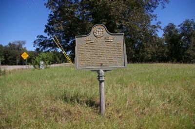
On Kings Road at Hancock Street (Georgia Route 22/24), on the right when traveling north on Kings Road.
Five miles south of this point is the Rock Landing at the head of navigation on the Oconee River and at the junction of the old Indian trading paths leading westward. In 1789 Pres. Washington sent Gen. Benjamin Lincoln here to treat with Chief . . . — — Map (db m36326) HM
These Confederate soldiers, all serving in the Georgia Militia, died at Brown Hospital in Milledgeville and were buried at this location. Their names soon became lost, and they were considered Unknown Soldiers until 2003 when their identities were . . . — — Map (db m91851) HM
On Swint Avenue Southeast north of Broad Street, on the right when traveling north.
The Walker Building was originally called the Male Convalescent Building. It was built in 1884 and opened for use in 1886. The Walker Building served as an admission ward for white males. This building was faithfully used to treat patients until . . . — — Map (db m197776) HM
On West Greene Street at South Liberty Street, on the right when traveling west on West Greene Street.
At this site lived Tomlinson Fort (1787-1859). A leader of the Union Party, he studied medicine and wrote a widely used book on medical practice. A captain in the War of 1812, he served in the Georgia legislature and the U.S. Congress, and on the . . . — — Map (db m36134) HM
On East Greene Street at South Jefferson Street, on the left when traveling east on East Greene Street.
In the street near this site in June 1807, occurred the horse-whipping of Superior Court Judge Charles Tait by his political enemy John Clark, later Governor of Georgia. Clark was fined $2,000 for the assault. The incident illustrates Georgia . . . — — Map (db m36362) HM
On Gordon Highway (Georgia Route 243) at Colony Farm Road, on the right when traveling south on Gordon Highway.
This house, now the Du Bignon home, was once the home of John Clark, Governor of Georgia. At the age of 16, John Clark fought with his father, General Elijah Clark, distinguished Revolutionary soldier, at the decisive Battle of Kettle Creek. . . . — — Map (db m13138) HM
On Irwinton Road (Ga 29) (U.S. 441) at Georgia Route 243, on the right when traveling north on Irwinton Road (Ga 29).
Gen. Sherman’s Cavalry Corps, commanded by Gen. Judson Kilpatrick, consisted of 5,000 men, 8,000 animals, and 300 wagons. It rode from Gordon to Milledgeville on Nov. 24 to join the left wing of the Union Army. On the 25th, Gen. Kilpatrick moved . . . — — Map (db m42314) HM
On Old U.S. 441 at Line Church Road, on the right when traveling south on U.S. 441.
The Line Baptist Church was constituted Sept. 13, 1802, by Rev. Moses Sanders, Thomas Maxwell and Daniel White.
This church was just over the line between Georgia and Cherokee lands. Meetings couldn’t be held at night, because all white people . . . — — Map (db m40651) HM
On Homer Road (U.S. 441) 0 miles north of Womack Drive, on the right when traveling north.
This line, sometimes called “The Four Mile Purchase Line” was the boundary between Georgia and the Cherokee Nation from 1804 to 1818. It was established when Georgia bought a four mile strip from the Indians so as to take in Wofford’s . . . — — Map (db m40642) HM
On Homer Road (U.S. 441) 0.1 miles north of Womack Drive, on the right when traveling north.
This battle was fought Oct. 12, 1864 between Confederate troops and Union cavalry in the nearby mountain pass.
A Confederate victory saved Habersham county from pillaging by Union troops and camp followers and also saved grain fields for . . . — — Map (db m40640) HM
On Georgia Route 105, 0.3 miles east of Andrews Road, on the right when traveling east.
Leatherwood Baptist Church was established in 1801 at Eastanollee in Franklin County. Many members moved near here, organized this church and named it Leatherwood. Members remaining in Eastanollee reorganized and named their church Eastanollee. Land . . . — — Map (db m40703) HM
On Georgia Route 105 at Carnes Circle, on the right when traveling east on State Route 105.
This marker is a memorial to the Middle River Volunteers, March 4, 1862, who drilled on this road for service before entering Civil War.
Donated by descendants of these soldiers.
Dedicated 1980
Company Roster
Orig Capt Wm P Brown + . . . — — Map (db m41943) HM
On Main Street (Georgia Route 51) at Yonah Homer Road, on the left when traveling east on Main Street.
Banks County was created by Act of Dec. 11, 1858 from Franklin and Habersham Counties. It was named for Dr. Richard Banks (1784-1850), whose reputation as physician and surgeon extended over north Ga. and S.C. Especially noted for treating Indians . . . — — Map (db m40684) HM
On U.S. 441 at Old U.S. 441, on the right when traveling south on U.S. 441.
The boundary between the State of Georgia and the Cherokee Nation established by the Treaty of Augusta, May 31, 1783, ran along here. The line ran “from the top of Currahee mountain to the head, or source, of the most southern branch of the . . . — — Map (db m40659) HM
On Georgia Route 51, 0.1 miles west of Damascus Road (Old Georgia Route 184), on the right when traveling east.
In 1780 a group of people, Garrisons and Wilmonts, met on the top of the hill behind the church, built a platform between two trees, and held a religious meeting. This small gathering, and the statement that it was pleasant to worship on the . . . — — Map (db m16995) HM
On Georgia Route 51, 0.1 miles west of Martin Bridge Road (Georgia Route 63), on the right when traveling west.
Nails Creek Baptist Church, the first Baptist Church in Banks County, was established February 11, 1787. It was the Mother Church of Middle River, Grove Level and Indian Creek. Many descendants of its charter members are active in the work of the . . . — — Map (db m14473) HM
On Hurricane Shoals Park Road, 0.1 miles south of Wheeler Cemetery Road, on the right when traveling south.
On this site in 1882, the original Hurricane Shoals Covered Bridge was completed, spanning some 127 feet at the cost of a mere $1,433. Vandals burned the old bridge in 1972, spoiling a community landmark and transportation corridor that had been in . . . — — Map (db m109855) HM
On 6th Avenue at 7th Street, on the right when traveling east on 6th Avenue.
Perry-Rainey Institute founded 1892 by Mulberry Baptist Assn. at Appalachee Baptist Church, Auburn.
Predecessors of Perry-Rainey Institute - Harmony Grove Academy, Mulberry High School and Perry-Rainey College.
Named for Reverend Hiram . . . — — Map (db m14883) HM
Near Christmas Avenue (Georgia Route 11) at Manger Avenue, on the right when traveling south.
Oldest Methodist Church in Barrow County, organized in the 1780’s. Services first held two miles N.E. in log house. In 1790 a church was built nearby. The present site was originally a camp ground with an arbor, tents & cottages for camp meetings. . . . — — Map (db m46843) HM
On Old Thompson Mill Road, 0.1 miles south of Farm Market Road, on the right when traveling south.
Clayborn Dalton built an arbor for public Worship across Mulberry River in Jackson County in the early 1800’s. It was called “Dalton’s Stand”. In 1813 the church was moved on this side of Mulberry River near the Maynard Cemetery. Rev. . . . — — Map (db m16125) HM
On Atlanta Highway Southeast, 0.3 miles east of Jefferson Street, on the right when traveling east.
First Georgia Chapter Future Farmers of America was located at Statham Consolidated High School, Statham, Georgia.
Organized October 1928 and chartered by State Association January 16, 1929.
Officers were:
William R Bowdoin, President . . . — — Map (db m180659) HM
Near Broad Street at Elizabeth Street, on the right when traveling west.
First Georgia Chapter Future Farmers of America was located at Statham Consolidated High School, Statham, Georgia.
Organized October 1928 and chartered by State Association January 16, 1929.
Officers were:
William R. Bowdoin, President . . . — — Map (db m181830) HM
On Broad Street, 0 miles east of Elizabeth Street, on the left when traveling east.
Educator; 52 years service in education. Born Feb. 12, 1900 Ila, Ga., Graduate of University of Georgia. Taught: Maysville, Cornelia, Buford 1920-1933. Principal - Coach Statham School 1933 - 1957. Supt. Barrow County Schools 1957 - 1965. Professor . . . — — Map (db m17364) HM
On Broad Street at Wise Court, on the right when traveling east on Broad Street.
Built circa 1850. Owned by M. John C. Statham. He provided homes for widows of Civil War Veterans; donated land for right-of-way of railroad; streets for town, and a lot for a Methodist Church -- now the city cemetery. Statham, incorporated Dec. 20, . . . — — Map (db m17348) HM
On Georgia Route 82 at milepost 4,, 0.1 miles east of Steed Road, on the right when traveling east.
Served 3 years in Revolutionary War from Dinwiddie Co., Va. in Buford’s Detachment.
Lost an arm at Waxhaws, May 29, 1780.
Remembered as successful business man, educator and civic worker, but most outstanding as devout Methodist minister. . . . — — Map (db m19763) HM
On North Broad Street (Georgia Route 11) at West Athens Street (Georgia Route 211), on the right when traveling south on North Broad Street.
Barrow County was created by Act of July 7, 1914 from Gwinnett, Jackson and Walton Counties. It was named for David Crenshaw Barrow, Chancellor of the University of Georgia for many years. Born in Oglethorpe County, October 18, 1852, he died in . . . — — Map (db m19070) HM
On Thompson Mill Road (Georgia Route 211) 0.1 miles north of Will Maynard Road, on the right when traveling north.
On July 31, 1864, at the Battle of Sunshine Church (19 miles NE of Macon), Maj. Gen. Geo. Stoneman [US] surrendered with 600 men to Brig. Gen. Alfred Iverson, Jr., [CS], after covering the escape of Adams’ and Capron’s brigades of his cavalry . . . — — Map (db m23454) HM
On Porter Street, 0 miles west of North Broad Street (Georgia Route 53), on the right when traveling east.
This steam locomotive was presented to the City of Winder and Barrow County in 1959 by the Seaboard Air Line Railroad Company. It was placed here as a permanent exhibit in memory of the important service engines of this type rendered to the country. . . . — — Map (db m14528) HM
On Fort Yargo Road, 1 mile south of Loganville Highway (Georgia Highway 81), on the right when traveling south.
In Memory of Charles O. Maddox 1887 – 1973 Banker, Farmer, Conservationist Purchased and held for 18 years 1800 acres of land In 1954 he transferred the land to the State of Georgia at no personal gain His vision was then fulfilled . . . — — Map (db m187403) HM
On West Athens Street (Georgia Route 211) 0 miles east of Church Street, on the left when traveling east.
In 1836 Byrd Betts, Pioneer Steward of the Concord Methodist Church, later to become the First Methodist Church of Winder, gave 10 acres land for the church and cemetery. Those known buried here.
On Fort Yargo Road, 0.2 miles east of South Broad Street (State Highway 81), on the left when traveling south.
Between the Oconee & Ocmulgee In the late 1700s, the (Muscogee) Creek village of Snoden, present-day Winder, was located within the unbroken forests of Georgia's wilderness. Numerous waterways crisscrossed the landscape supplying . . . — — Map (db m187100) HM
On Broad Street, 0.4 miles south of South Broad Street (Georgia Route 81), on the left when traveling south.
This remarkably preserved log blockhouse was built in 1793, according to historians. There are several references to Fort Yargo as existing prior to 1800. Its location is given as three miles southwest of “Jug Tavern,” original name for Winder. . . . — — Map (db m22396) HM
Near Fort Yargo Road east of South Broad Street (Georgia Highway 81), on the left when traveling south.
At one time, settlers used beehive ovens to bake all kinds of foods. Taking its name from its shape, the beehive oven can be found in all parts of the world even today. They are simple to build from clay and straw so there is little or no cost — . . . — — Map (db m187401) HM
Near Fort Yargo Road east of South Broad Street (Georgia Highway 81), on the left when traveling south.
Imagine this log building being occupied by 30 to 50 people while under attack by Indians. That was its purpose when it was built in 1792. Settlers in the area took refuge in the fort during times of threat or attack. When it was not being used for . . . — — Map (db m187377) HM
Near Fort Yargo Road east of South Broad Street (Georgia Highway 81), on the left when traveling south.
Small forts sprang up across Georgia's Indian lands during and after the Revolutionary War. The Creek, Cherokee, and other native peoples were drawn into the conflict by the British and fought skirmishes against the settlers who were establishing . . . — — Map (db m187300) HM
Near Fort Yargo Road east of South Broad Street (Georgia Highway 81), on the left when traveling south.
Settlers established farms as they arrived in new areas. They cleared forest and brush and built fences to corral their livestock, to mark their boundaries, and to keep out predators. The type of fence they built depended on available materials and . . . — — Map (db m187366) HM
Near Fort Yargo Road east of South Broad Street (Georgia Highway 81), on the left when traveling south.
Fort Yargo benefits from a group of volunteer living historians who assist in maintaining the original 1790s blockhouse structure, as well as providing demonstrations of the lifeways and skills of the late 18th and very early 19th centuries. The . . . — — Map (db m187354) HM
Near Fort Yargo Road east of South Broad Street (Georgia Highway 81), on the left when traveling south.
Fort Yargo resembles many log cabins built across the southern highlands, especially those of Appalachia. It is one and one-half stories, with front and back doors opposite to each other for air flow during the warmer months. It has a shake roof . . . — — Map (db m187400) HM
Near Fort Yargo Road east of South Broad Street (Georgia Highway 81), on the left when traveling south.
Fort Yargo's smokehouse is a reconstruction and is in use most winters. Smokehouses served to cure meat or fish with smoke and salt. Before the invention of refrigeration, fresh meat would not last very long unless it was "smoked" or frozen. In the . . . — — Map (db m187402) HM
On King Street at Wood Street, on the right when traveling north on King Street.
Glenwood Elementary and High School was established in 1951 as one of Georgia’s first public consolidated schools for African Americans. Part of a statewide equalization effort to improve school buildings and preserve segregation, Glenwood became . . . — — Map (db m56487) HM
Near Park Avenue at East Athens Street, on the right when traveling south.
Hal Jackson was a native of Winder, Georgia born on October 1, 1910 to J. Roy and Emma Jackson. Other than the time he served in the Army Air Force during World War II, Winder was his home. He married Katherine Adair on December 25, 1943, and they . . . — — Map (db m187287) HM
On West Athens Street (Georgia Route 211) at North Broad Street (Georgia Route 11), on the right when traveling east on West Athens Street.
This obelisk marked the intersection of the boundaries of Jackson, Walton, and Gwinnett Counties from which Barrow County was formed in 1914. The obelisk location was the center of the intersection of Broad and Athens Streets. This obelisk . . . — — Map (db m187291) HM
On Fort Yargo Road, 1 mile south of Loganville Highway (Georgia Highway 81), on the right when traveling south.
Built under the Watershed Protection and Flood Prevention Act 83rd Congress — 1954 by Barrow County, Georgia Oconee River Soil and Water Conservation District City Government of Winder Department of State Parks of Georgia with assistance . . . — — Map (db m173170) HM
On Gainesville Highway (Georgia Route 53) at Rockwell Church Road, on the right when traveling north on Gainesville Highway.
Organized 1839 — second oldest Universalist Church in Georgia. Located here near original site of Rockwell School, oldest school in this section, and Rockwell Masonic Lodge. Confederate Soldiers enlisted and drilled here 1861-1865. Church . . . — — Map (db m19548) HM
On Atlanta Highway SE (U.S. 29) 0 miles east of Russell Cemetery Road, on the right when traveling east.
The Russell House was built in 1912 by Richard Brevard Russell, Sr., B. 1861 - D. 1938, and his wife, Ina Dillard, B. 1868 - D. 1953, who were married June 24, 1891. Fifteen children were born of this marriage. Judge Russell was elected Chief . . . — — Map (db m17288) HM
On North Broad Street (Georgia Route 11) at Laura Street, on the right when traveling south on North Broad Street.
Closing in on Atlanta in July, 1864, Maj. Gen. W.T. Sherman found it "too strong to assault and too extensive to invest." To force its evacuation, he sent Maj. Gen. Geo. Stoneman's cavalry [US] to cut the Macon railway by which its defenders were . . . — — Map (db m17307) HM
On West Athens Street (Georgia Route 211) at Church Street, on the left when traveling east on West Athens Street.
For years inestimable the CREEK INDIAN VILLAGE of SNODON stood here. In 1793 ALONZO DRAPER, HOMER JACKSON and HERMAN SCUPEEN and their families became the first white people to establish homes in SNODON. This same year SNODON became JUG TAVERN. In . . . — — Map (db m17349) HM
On Cottage Lane east of Fort Yargo Road, in the median.
Completed in 1971, Will-A-Way Recreational Area was the nation's first comprehensive outdoor recreational facility designed for people with disabilities. Beginning in 1966, the Georgia Department of State Parks met with multiple agencies to develop . . . — — Map (db m229236) HM
On Main Street North at Cherry Street, on the left when traveling north on Main Street North.
Adairsville had its beginning in Oothcaloga Valley, two miles north of the present site. It was named for Cherokee Indian Chief John Adair, the son of a Scottish trader and a Cherokee Princess.
Adairsville moved in 1848 to Adair Station . . . — — Map (db m227027) HM
On Barnsley Gardens Road, 0.1 miles east of Rock Fence Road, on the right when traveling east.
A unique, ante-bellum plantation, established by Godfrey Barnsley in the 1850’s.
Maj. Gen. J. B. McPherson’s H’dq’rs. [US], May 18, 1864.
K. Garrard’s cav. [US], via Hermitage, arrived at noon. A detachment (Minty’s brigade) sent S. . . . — — Map (db m40812) HM
On Poplar Springs Road at South Cass Street, on the right when traveling east on Poplar Springs Road.
May 18, 1864, The 4th, 14th & 20th Corps (Army of the Cumberland) [US] together with the 15th &16th corps (Army of the Tennessee) [US] reached Adairsville from Resaca, at noon. Sherman convinced that all of Johnston's forces had gone to Kingston & . . . — — Map (db m13235) HM
On Adairsville Highway (Georgia Route 140) at Poplar Springs Road, on the right when traveling east on Adairsville Highway.
About 2 miles N. is the plantation home of Augustus Crawford Trimble, pioneer settler, member of the Home Guard, and businessman of Adairsville. A son, serving in the 1st Georgia Cavalry under Gen. Joe Wheeler, engaged the enemy on the plantation. . . . — — Map (db m12419) HM
On Public Square at Wood Street, on the right when traveling south on Public Square.
[Top] City mayor-council many years. Founded city public
schools. Founded city water works. Co-founder & V.P.,
Georgia Brick Company. President, Bank of Adairsville.
Owner-editor Adairsville Banner. Owner, Bowdoin Drug . . . — — Map (db m228042) HM
On Poplar Springs Road at South Cass Street, on the right when traveling east on Poplar Springs Road.
May 18, 1864. The three corps of the Confederate Army, on reaching Adairsville from Resaca, moved by two roads to Cassville. Hood's & Polk's corps marched S. on old U.S.41 Highway: Hardee's corps took direct road to Kingston W. & parallel to the . . . — — Map (db m13233) HM
A Revolutionary soldier volunteer under Capt.
Marks of Charlottesville, Va. Part of the time he belonged to the regiment that was detailed as a body guard to General LaFayette. He was in all the principle battles fought in New Jersey, Penn. and . . . — — Map (db m87052) HM WM
On Hall Station Road at Rock Fence Road, on the right when traveling south on Hall Station Road.
May 18th, 1864. Logan’s 15th A.C. of the Army of the Tennessee [US] left Adairsville in afternoon, following the 4th & 14th A.C. [US] as far as this point, where it turned S.W. to Barnsley Gardens, where it joined K. Garrard’s Cavalry [US]. . . . — — Map (db m40466) HM
On Poplar Springs Road at South Cass Street, on the right when traveling east on Poplar Springs Road.
Five miles NE on State Highway 140 - a notable plantation and manufacturing center of the 1860's. The Federal 23rd Corps, left wing of Sherman's forces [US] marching southward from Resaca, having crossed at Field's Mill, Coosawattee River, enroute . . . — — Map (db m13231) HM
On Joe Frank Harris Parkway (U.S. 41 at milepost 0), 0 miles south of Miller Ferry Road, on the right when traveling south.
May 17, 1864, Johnston’s forces (CSA) retreated S. From Resaca and paused here on an E. - W. line, the intention being to make a stand against the Federals in close pursuit. Finding the position untenable due to width of Oothcaloga Valley, Johnston . . . — — Map (db m87049) HM
On Public Square south of Wood Street, on the right when traveling south.
April 12, 1862: James J. Andrews led Union spies in an espionage scheme to destroy the Western & Atlantic Railroad and thus disrupt a vital supply line for the Confederacy. Andrews' Raiders stole a train, The General, 50 miles south of . . . — — Map (db m87053) HM
Near Old Alltatoona Road SE, 0.4 miles north of Allatoona Landing Road SE, on the right when traveling north.
On this site stood a wood frame "dog-trot" style house that served as the regimental headquarters for the 4th Minnesota Regiment, the permanent Federal garrison at Allatoona under the command of Lieutenant Colonel John E. Tourtellotte.
Here . . . — — Map (db m87376) HM
Near Old Allatoona Road SE, 0.4 miles Allatoona Landing Road SE, on the right when traveling north.
On the morning of October 5, 1864, following a two hour bombardment from Major John D. Myrick's Confederate artillery on Moore's Hill located 1,200 yards to the south, Confederate Major General Samuel G. French sent his adjutant, Major David W. . . . — — Map (db m193681) HM
On Old Allatoona Road, 0.2 miles north of Allatoona Landing Road, on the left when traveling east.
Allatoona was in pioneer days a travel hub, because ridges from east and south met here where it was fairly easy to cross the Allatoona Mountain range by winding over a low ridge, or pass.
The Sandtown or Tennessee Road from the south, and the . . . — — Map (db m13843) HM
On Old Allatoona Road SE, 2.9 miles east of Interstate 75.
The Western & Atlantic Railroad, running from
Chattanooga to Atlanta, “winds Southeasterly among
the hills, and...penetrates a minor ridge and emerges
from a cut” recalled a Federal officer. The ruggedness of
Allatoona Pass . . . — — Map (db m142914) HM
Near Old Alltatoona Road SE, 0.4 miles north of Allatoona Landing Road SE, on the right when traveling north.
By 11:00 a.m., after overrunning Rowett's Redoubt, the Confederate attack swept up this hill from the west and the north, forcing the Federals to retreat inside the Star Fort. As the last of the fleeing Federals entered the fort, a three-inch . . . — — Map (db m87383) HM
On Old Allatoona Road, 0.2 miles north of Allatoona Landing Road, on the left when traveling east.
After artillery firing and repeated assaults by French's troops, [CS] the Federals made a final stand in the star fort W. of rock cut. Failing to dislodge
the defenders, French retreated to New Hope Church in Paulding County. French's division . . . — — Map (db m13936) HM
Near Old Alltatoona Road SE, 0.4 miles north of Allatoona Landing Road SE when traveling north.
"A shout of triumph rolled over those fields … Men grasped hands and shouted … and embraced each other. The wounded joined in the delirium of rejoicing. The dying looked to the Flag, still proudly floating above these hills…" History of . . . — — Map (db m87386) HM
Near Old Alltatoona Road SE, 0.4 miles north of Allatoona Landing Road SE, on the right when traveling north.
During the night of October 4, Federal troops anxiously awaited in their defenses for the attack they knew would come.
Harvey M. Trimble at the 93rd Illinois Regiment recalled:
"That night the command slept under arms. All knew that . . . — — Map (db m87379) HM
Near Old Alltatoona Road SE, 0.4 miles north of Allatoona Landing Road SE, on the right when traveling north.
Local families once recalled that a few days after the battle, a wooden box addressed "Allatoona, Georgia" arrived at the station with no information as to its origin. Six local women found a deceased Confederate soldier in the box and buried . . . — — Map (db m87382) HM
Near Old Allatoona Road, 0.2 miles north of Allatoona Landing Road.
They Died so that our Nation Might Live 39th Iowa Volunteer Infantry Brigadier General John Corse of Iowa commanded victorious Federal forces at Allatoona Pass October 5, 1864 Reverse: 39th Iowa Volunteer Infantry Fallen soldiers at . . . — — Map (db m240086) HM WM
Near Old Alltatoona Road SE, 0.4 miles north of Allatoona Landing Road SE, on the right when traveling north.
The Federal defenses at Allatoona included a military service road that crossed the Tennessee Wagon Road at this point. The military road connected the fortified positions at the Eastern Redoubt on the right side with positions closer to the . . . — — Map (db m87373) HM
Near Old Allatoona Road SE, 2.9 miles east of Interstate 75.
The Federal defense at Allatoona included a military
service road that crossed the Tennessee Wagon
Road-noted by a star on the map. The Military Service
Road connected the fortified positions of the Eastern
Redoubt to the headquarters of the 4th . . . — — Map (db m142956) HM
7016 entries matched your criteria. Entries 201 through 300 are listed above. ⊲ Previous 100 — Next 100 ⊳