Explorer, interpreter, fur trader and diplomat, French-born Perrot played an important role in the establishment and protection of New France's western frontier during the last four decades of the 17th century. In 1671 he was with Saint-Lusson at . . . — — Map (db m105957) HM
The nearby Michipicoten River formed an important link in the canoe route from Lake Superior to James Bay via the Michipicoten, Missinaibi and Moose Rivers. The route was probably explored at an early date by the French Fur traders who maintained a . . . — — Map (db m199496) HM
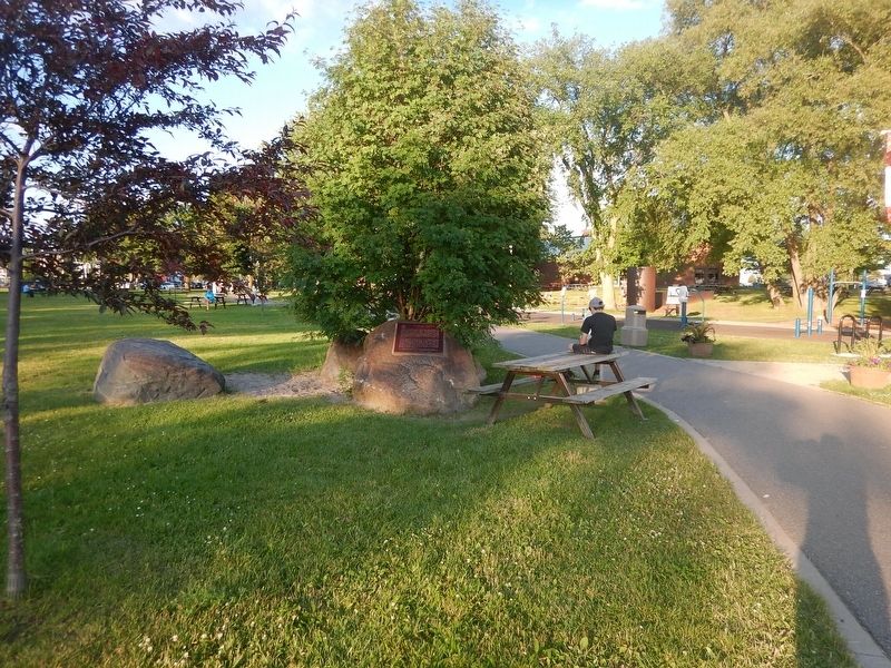
Michipicoten can be found on some of the earliest European maps created by early explorers of North America. One of the first official cartographers to put Michipicoten on the map was the English surveyor Philip Turnor. Born in the English . . . — — Map (db m218634) HM
This National Monument erected by the Brant Memorial Association, Incorporated 41 Vic. Cap. 62 S.O. to Thayendanegea. Capt. Joseph Brant born 1742 died 1807 interred at Mohawk Church and to The Six Nations Indians for their . . . — — Map (db m215797) HM
East of the Forks, the Thames River becomes shallower and not navigable for larger ships. With the American forces close behind, the British vessels were threatened with capture. One cargo ship, probably the Miamis, had already been set on fire . . . — — Map (db m71398) HM
On this site a blockhouse was constructed in 1794 by order of Lieutenant-Governor John Graves Simcoe. He planned to establish here a small naval arsenal which would form a link in the defences of Upper Canada's western frontier and also draw the . . . — — Map (db m71313) HM
On October 2, 1813, Tecumseh moved his warriors up-river to the Forks where he had been led to believe that fortifications would be prepared for a full-scale confrontation with harrison's army. When Tecumseh arrived, he was enraged to find no . . . — — Map (db m71335) HM
Robert McAfee, a member of Colonel Johnson's Kentucky Mounted Regiment, described the skirmish in his journal. He wrote:
Oct 4: …a woman … informed us that about six miles above the River forked, that there was a large bridge across the mouth . . . — — Map (db m71378) HM
From 1783 until the 1860s, abolitionists in British North America took part in the fight to end slavery both at home and in the United States. Thanks to the determination of colonial officials, anti-slavery organizations, and the thousands of . . . — — Map (db m71391) HM
The Forks of the Thames are formed by the joining of the Thames River and McGregor Creek creating a peninsula that is present day Tecumseh Park in Chatham, Ontario. The strategic importance of the site was recognized by Lieutenant Governor John . . . — — Map (db m71331) HM
On November 7, 1763 a fleet of small boats carrying nearly 700 officers and men of the 60th and 80th Regiments under Major John Wilkins was forced ashore by a violent storm abut three miles east of this point. The expedition had set out from Niagara . . . — — Map (db m108505) HM
As Lieutenant Colonel James Johnson's horsemen were charging the British front line, his brother, Colonel Richard Johnson led an attack against the First Nations warriors in Backmetack Marsh. The mounted infantry charged the Native left flank led by . . . — — Map (db m233828) HM
Makataimeshekiakiak, Black Hawk, 1767-1838: A Sauk war leader and experienced warrior, Blackhawk was a veteran of the Battles of Fort Meigs and Fort Stephenson. Although he left the war for a period of time, he rejoined the British, and scholars . . . — — Map (db m71418) HM
Shabbona 1775-1859: A Potawatomi chief, grand nephew of Pontiac, and veteran of Tippecanoe, Shabbona was an accomplished warrior and strong supporter of Tecumseh. He persuaded many natives to join the confederacy.
Sou-veh-hoo-wah, Split Log, . . . — — Map (db m71419) HM
John Adair 1757-1840: Pioneer, soldier, and statesman, Adair was a veteran of the American Revolution, was 8th governor of Kentucky, and represented that state in both the U.S. House of Representatives and the Senate. He fought at the Battle of the . . . — — Map (db m72381) HM
James Johnson 1774-1826: The brother of Richard Johnson, James was elected as a Kentucky State senator in 1808. He served as a lieutenant colonel in Johnson's Mounted Infantry and led the charge on the British lines at the Battle of the Thames along . . . — — Map (db m72385) HM
Isaac Shelby 1750-1826: Shelby was the 1st and 5th governor of Kentucky and a veteran of the American Revolution. As governor and at 63years of age, Shelby personally led the Kentucky Militia at the Battle of the Thames.
Tarhe 1742-1816: A . . . — — Map (db m72388) HM
By the early morning of October 5, 1813, the American Army had forded the Thames River and was advancing quickly. The British rearguard was able to destroy Cornwall's mill, west of Sherman's farm (present-day Thamesville, Ontario) but not the mill . . . — — Map (db m71413) HM
Born in a Shawnee village in what is now Ohio, Tecumseh became in the 1770s co-leader with his brother, the Prophet, of a movement to restore and preserve traditional Indian values. He believed a union of all the western tribes to drive back white . . . — — Map (db m71410) HM
Many of the men of the 41st Regiment had been stationed in Canada for 13 years. By October 5, 1813, they had not been paid for 6 to 9 months; they lacked tents and blankets; their uniforms were in rags; they were plagued by a variety of diseases; . . . — — Map (db m72393) HM
Robert McAfee, a soldier in Colonel Johnson's Mounted Regiment, kept a journal of his experiences, and wrote on October 7, 1813:
Spent the day in collecting in plunder ... Colonel Owings Regiment of Regulars came up and took charge of the . . . — — Map (db m72414) HM
At some point during the attack on Backmetack Marsh, Tecumseh was fatally shot. As word spread of their leader's death, one American account tells of the warriors giving, "the loudest yells I ever heard from human beings and that ended the fight." . . . — — Map (db m72405) HM
[English] A Hudson's Bay Company post named after a son of George III, Frederick House was established in 1785 to prevent Canadian fur traders in the Abitibi region from intercepting the passage of furs to Moose Fort (Moose Factory) . . . — — Map (db m217973) HM
Originally known as Darlington Mills, Bowmanville was founded in 1794 when an American family of Loyalists settled near the site of Vanstone's Mill. The first businesses were established in the river valley south of the mill but are now gone. . . . — — Map (db m245101) HM
In 1728 a mission to the Huron Indians was established near Fort Pontchartrain (Detroit) by Father Armand de la Richardie, S.J. The mission was moved to Bois Blane Island and the adjacent mainland in 1742. In 1747 it was destroyed by disaffected . . . — — Map (db m37386) HM
Shortly after the founding of Detroit in 1701 a village of Ottawa Indians was established on the south shore of the river in this vicinity and its inhabitants lived on friendly terms with the French garrison and settlers. However after the British . . . — — Map (db m36944) HM
This limestone double house was erected in the Georgian style by architect William Coverdale in 1842-43 for Noble Palmer, founder of the Kingston Spectator newspaper. It is notable for its windows and ashlar string courses.
Half of the building . . . — — Map (db m144999) HM
Following the American Revolution Sir Frederick Haldimand,
Governor-in-Chief of Canada, granted to the Six Nations of
the Iroquois a tract of land extending for six miles on both sides of the Grand River from its source to Lake Erie. This grant . . . — — Map (db m234947) HM
The area that is present day Oakville was first settled by Europeans in 1806, after the land was purchased from the Mississauga tribe and Trafalgar Township was surveyed.
Twenty-one years later, in 1827, William Chisholm bought 960 acres at . . . — — Map (db m238670) HM
Under the Royal Proclamation of 1763, European settlement could not proceed without a formal treaty with the aboriginal proprietors of the land. In 1806 the Mississauga signed the treaty surrendering all the lands from Etobicoke River to Burlington . . . — — Map (db m241812) HM
From these heights, Lieutenant-Colonel John Harvey set out with about 700 men on the night of June 5, 1813, to launch a surprise attack on an invading United States force of some 3,000 men camped at Stoney Creek. His rout of the troops commanded by . . . — — Map (db m56743) HM
In Lasting Memory
of the
United Empire
Loyalists
Who preferred to remain loyal British
subjects and came to canada
in large numbers immediately
following the American Revolution
of 1776 and the . . . — — Map (db m66131) HM
Born at Queenston, George Hamilton was the son of a prosperous merchant, the Hon. Robert Hamilton. He followed his father's career as a merchant in the Niagara District until the War of 1812, in which he served as a Captain of Light Dragoons. . . . — — Map (db m218241) HM
William Terryberry
(1779-1847)
Since 1812, the name William Tenybeny has been associated with this section of Mohawk Road West. Having immigrated to the province of Upper Canada from the state of New Jersey, Terryberry purchased land along . . . — — Map (db m232325) HM
In 1794, with Europe caught in the turmoil of the
French Revolution and talk of war with the United
States widespread, Lieutenant Governor John Graves
Simcoe found the frontiers of Upper Canada seriously
isolated and threatened by the young . . . — — Map (db m234207) HM
[North Side]
This monument is dedicated to the lasting memory of
The United Empire Loyalists
who, after the Declaration of Independence, came into British North America from the seceded American colonies and who, with faith and fortitude, . . . — — Map (db m229935) HM
This plaque commemorates the historic homesite of
Richard Beasley
United Empire Loyalist Merchant Soldier Politician
Member of the Legislative Assembly of Upper Canada 1791
Appointed Justice of the Peace 1795, Magistrate 1796 . . . — — Map (db m231253) HM
This was early frontier Kenora/Keewatin, and was named by the Ojibway people for the many muskrats inhabiting these waters. Venturing into this area were a number of fur traders employed by the Northwest Company and the Hudson’s Bay Company. They . . . — — Map (db m244996) HM
The full name given in the charter is: “The Governor and Company of Adventurers of England, Trading into Hudson Bay”. The charter, granted by King Charles on May 2nd, 1670, gave the company “The Whole Trade of All Those Seas, Streights, and Bays, . . . — — Map (db m244997) HM
Patriot, colonizer and priest, he was born in the Highlands of Scotland. In 1804 he came to Canada as chaplain of the disbanded Glengarry Fencibles and later became Auxiliary Bishop of Quebec. As the first Bishop of the Roman Catholic diocese of . . . — — Map (db m141400) HM
One of the most influential and controversial figures in Canadian history, Frontenac was born at St-Germain-en-Laye, France. As a member of the noblesse d'epee he was able in 1672 to secure the appointment as Governor-General of New France. Devoted . . . — — Map (db m39978) HM
This Anglican Church burial ground is one of the oldest consecrated cemeteries in Ontario.
Loyalists, who wanted to continue living under British rule, came to Kingston after the American Revolution. A Loyalist soldier, Corporal Forbes of the . . . — — Map (db m141394) HM
Commemorating the services of the first permanent Militia Garrison of Kingston, assembled by Lieutenant-Colonel R.H. Bonnycastle to defend this city during the Upper Canadian Rebellion. The mobilization saved Kingston from invasion since the regular . . . — — Map (db m141444) HM
Born about 1736, Molly Brant (Degonwadonti) was a member of a prominent Mohawk family. About 1759 she became the wife of Sir William Johnson, Superintendent of Indian Affairs in the Province of New York and a powerful figure in that colony. . . . — — Map (db m141525) HM
English:
Early in his celebrated career the explorer La Salle played a principal role in the expansion of the French fur trade into the Lake Ontario region. In 1673 he arranged a meeting between Governor-General Frontenac, who . . . — — Map (db m141300) HM
Formerly St. George’s Burial Ground, this cemetery is the oldest in the Kingston district. Among the distinguished persons buried here are Molly Brant, Reverend John Stuart, Lieutenant Hugh Earl (Provincial Marine), Colonel Sir Richard Bonnycastle, . . . — — Map (db m141397) HM
The largest Loyalist Corps in the Northern Department during the American Revolution, the King's Royal Regiment of New York was raised on June 19, 1776 under the command of Sir John Johnson. Originally composed of one battalion with ten companies, . . . — — Map (db m39977) HM
Stood on this site from 1848 to 1875. With Shoal Tower opposite it defended Kingston Harbour and the Rideau Canal. From 1875 this was a public park. In 1885 the Kingston and Pembroke railway station was built. — — Map (db m39979) HM
Born in Pennsylvania, Stuart was ordained in 1770 and sent to Fort Hunter, N.Y., as missionary to the Mohawks. An ardent Loyalist, he came to Canada in 1781 where he was appointed chaplain to the 2nd Battalion King’s Royal Regiment of New York. In . . . — — Map (db m144202) HM
Born in Connecticut, Stone forfeited his home and property there when he fled to New York to serve with the Loyalist militia during the American Revolution. He came to Canada in 1786, settled with his family in New Johnstown (now Cornwall) and was . . . — — Map (db m90006) HM
Last stand of France in Canada. Fort De Levis, on Isle Royale, (Chimney Island), was built by Captain Francois Pouchot in the spring and early summer of 1760. Its garrison surrendered after a gallant defense, on 25th August, 1760, to the British . . . — — Map (db m178522) HM WM
Development of this community began after the construction of the province's first successful iron smelter and a sawmill in 1801. On the west bank of the river a grist-mill was built in 1827 and a village plot laid out by Charles and Jonas Jones of . . . — — Map (db m244317) HM
This was the site of the first iron smelter in Canada west of Quebec. Furnace Falls took its name from the blast furnace. The iron works were built in remote wilderness conditions in 1801 by Wallis Sunderlin an ironmaster from Vermont. By 1803, . . . — — Map (db m244348) HM
Following the War of 1812 expeditions traversed the wilderness between Lakes Simcoe and Muskoka and the Ottawa River, seeking a route across Upper Canada less open to attack than by the St. Lawrence and Lake Ontario. In 1819 Lieut. J.P. Catty, R.E., . . . — — Map (db m144822) HM
Originally conceived in 1818 by its promoter, William Hamilton Merritt, to divert trade from the Erie Canal and New York and built under private auspices, the canal was opened to traffic in 1829. After additional work in 1833, the canal with its 40 . . . — — Map (db m75850) HM
[Text on the West Side]:
Battle of Chippawa
5 July 1814
In memory of all those who fought on this ground, many of whom are buried nearby,
and to commemorate the peace that has prevailed between Canada and the . . . — — Map (db m49393) HM
On these fields and the surrounding woods 4,000 American, British, Canadian and Native forces fought the first major battle of the Niagara campaign of 1814. When the last shots died away on Samuel Street's farm, more than 800 lay dead and wounded. . . . — — Map (db m49398) HM
At dawn 5 July 1814, parties of Canadian-Militia and British allied Native Warriors scouted the American camp. They began sniping from the bushes on the north side of Street's Creek and this continued throughout the morning. Around noon, General . . . — — Map (db m49399) HM
Major General Phineas Riall, the British commander, had repaired the bridge over the Chippawa and ordered his own Regular light infantry, the local Canadians of the 2nd Lincoln Militia and a force of Native Warriors, to clear out the now scattered . . . — — Map (db m49400) HM
British General Riall was convinced that the greater part of Brown's army was still surrounding Fort Erie. He did not know the Fort had surrendered and he was facing the entire U.S. division. Still, the number of men deployed on both sides was . . . — — Map (db m49402) HM
As the battle raged, more American artillery deployed to the middle of the plain between the 11th U.S. and the lone 25th U.S. company, less than 100 meters (109 yards) from the British line. General Brown then led Ripley's brigade across Street's . . . — — Map (db m49403) HM
The Aftermath. In the days following the battle, General Brown's victorious troops advanced another 25 kilometers (18 miles) north to Fort George before retiring back to Niagara Falls when more British troops arrived in the area. They met the . . . — — Map (db m49404) HM
The fortifications which stood on this site were built in 1791 to protect the southern terminus of the Niagara portage road, and serve as a forwarding depot for government supplies. Known also as Fort Welland, the main structure consisted of a log . . . — — Map (db m49164) HM
The British used Navy Island from 1761 to 1764 as a shipyard in which to build the first British decked vessels to sail the upper lakes. These were essential in maintaining the supply lines westward during Pontiac's uprising, 1763-4. Thereafter the . . . — — Map (db m49052) HM
On the night of 12 August 1814, as a prelude to a British attack on Fort Erie, an expedition was mounted against three armed American schooners anchored off the fort. Captain Alexander Dobbs, R.N., embarked with 70 seamen and marines in six batteaux . . . — — Map (db m48913) HM
The border between Canada and the United States of America has witnessed many migrations of people. At two times, however, the migration was primarily from south to north. That was in the troubled days just prior to the American Revolutionary War . . . — — Map (db m75851) HM
Three fortifications occupied this site. The first (1764-1779) and second (c. 1783-1803), located at lower levels, were abandoned when ice and water inundated the works. The third Fort Erie, built between 1805 and 1808, was repaired in January 1814 . . . — — Map (db m48912) HM
A Loyalist from the Mohawk Valley, New York, Nelles came
to Canada during the American Revolution and from 1780 to
1784 served in the Indian Department. Following hostilities he settled near the Grand River but by 1792 had moved to this area. . . . — — Map (db m233660) HM
First Town Meeting
-1790-
Near this site on April 5. 1790, was held the
earliest known session of a municipal government
in what is now Ontario. This ‘town meeting' of
Township No. 6, later named Grimsby, dealt with
such matters as the . . . — — Map (db m233729) HM
On this land donated by Robert Nelles, United Empire
Loyalist, the pioneers of this community built a log church in 1794. It was replaced by a frame structure which was completed by 1804. The present stone church was erected 1819-25 and . . . — — Map (db m233732) HM
“If the captain wants me, he may come himself and if he does I will shoot him.”
With these words, Charles Green refused induction into the N. Jersey rebel militia. Imprisoned, he escaped and joined the “King’s Rangers” a . . . — — Map (db m75879) HM
Here rests, in the hope of a joyful resurrection, the mortal remains of Edgeworth Ussher, Esq., whose devotion to his sovereign and exertions in the cause of his country at a critical period of the history of Canada, marked him out as an object for . . . — — Map (db m75852) HM WM
Early on the morning of July 26th, 1814, Lieutenant-General Sir Gordon Drummond awaited another attack on the Lundy's Lane hill near Niagara Falls. Throughout the previous night, this hill had been taken and retaken in the bloodiest, most hard . . . — — Map (db m49693) HM
[Front Side of the Monument]:
To perpetuate
the name and fame of
Laura Secord
who walked alone nearly 20
miles by a circuitous difficult
and perilous route, through woods
and swamps and over miry . . . — — Map (db m49694) HM
[Front Side of Monument]:
Erected by the
Canadian Parliament
in honour of the victory
gained by the
British & Canadian Forces
on this field on the
25th day of July, 1814
and in grateful remembrance . . . — — Map (db m49790) WM
The Tower
By 1813, the British were planning to build "a tower in small redoubt to command the entrance of the River...at Mississauga Point." Begun in the Spring of 1814, this tower rests on the remains of the first Capital of . . . — — Map (db m52200) HM
A Strategic Location
You are standing at Mississauga Point where the Niagara River flows into Lake Ontario. Long ago the lakes and rivers were military supply and transportation routes and forts were built to protect them. . . . — — Map (db m52610) HM
On the 8th of July, 1813, an outpost of the invading force, encamped near Fort George, was defeated by a band of Six Nations and Western Indians led by Chiefs John Norton and Blackbird and interpreters Michel Brisebois, Louis Langlade and Barnet . . . — — Map (db m48747) HM
Brown's Inn was located here. Both the Canadian York Militia and the American Army bivouacked near here on separate occasions during the War of 1812. Adam Brown later added a store to his inn, and built a wharf on the river shore below, where . . . — — Map (db m49166) HM
In 1777 John Butler of New York raised a force of Rangers who, with their Iroquois allies, raided the frontiers of New York, Pennsylvania and New Jersey throughout the American Revolutionary War. From their base at Fort Niagara they successfully . . . — — Map (db m75857) HM
In the early morning of December 19th, 1813, a force under Colonel John Murray, consisting of detachments of the 100th and 41st Regiments. Royal Scots, Royal Artillery and Canadian Militia embarked in bateaux at the foot of this ravine. Crossing . . . — — Map (db m49158) HM
Constructed by order of Lieutenant-Governor Simcoe 1796-99, Fort George served as the headquarters for Major-General Brock in 1812. In May, 1813, it was bombarded and captured by the Americans who constructed fortifications of their own on the site. . . . — — Map (db m48743) HM
This tower and earthwork are all that survive of the barracks, guardroom, and cells of Fort Mississauga. Built between 1814 and 1816 to replace Fort George as the counterpoise to the American Fort Niagara immediately opposite, it was garrisoned . . . — — Map (db m48745) HM
• Mississauga Point was the location of a Neutral First Nation fishing settlement by the 15th century.
• The area was under the control of the Seneca Nation during the late 17th century, and it became home to the Mississauga Nation by the . . . — — Map (db m52236) HM
Explore a part of our heritage - visit a fort almost 200 years old and discover part of the Lake Ontario shoreline.
Explorez un volet de notre patrimoine - visitez un fort qui a presque 200 ans d'histoire et decouvrez une partie du rivage du . . . — — Map (db m48632) HM
Here at Niagara on September 17, 1792
he presided over the first
representative assembly
of this province.
His genius foresaw the greatness of
this country and he threw himself
into its building with ardour and
enthusiasm. . . . — — Map (db m49475) HM
Simcoe was born in Northamptonshire and educated at Oxford. He joined the British army in 1771, and from 1777-81 commanded the Queen's Rangers, a Loyalist corps in America. After the Loyalist influx had led to the creation of a separate province of . . . — — Map (db m75860) HM
The facilities of this strategic location have served British and later Canadian troops stationed at Niagara from 1765 to the 1920's. — — Map (db m49477) HM
The first organization devoted to the improvement of agriculture in Ontario was founded at Niagara. Its original name, the Agricultural Society of Upper Canada, reflected Lieutenant-Governor John Graves Simcoe’s hope that it would become a . . . — — Map (db m139985) HM
Formed by local businessmen in 1831, the Niagara Harbour and Dock Company created a shipping basin here on the Niagara River by hiring hundreds of labourers to excavate a riverside marsh. By the late 1830s the company employed close to 400 workers . . . — — Map (db m54049) HM
To obtain land on which to settle Loyalists and dispossessed members of the Six Nations of the Iroquois, Guy Johnson in May 1781 and John Butler in May 1784 negotiated treaties with representatives of the Mississauga and Chippewa of this region. The . . . — — Map (db m75863) HM
Brock's Monument and
Queenston Heights:
This striking commemoration and final resting place of Major General Brock marks the site of the Battle of Queenston Heights. Visitors can climb the 235 stairs to take in spectacular views, or . . . — — Map (db m54037) HM
The first lighthouse on the Great Lakes was built of stone at Point Mississauga in 1804 by John Symington, under orders from Lieutenant-Governor Peter Hunter. Demolished in 1814 to make room for this fort, its materials with debris from the ruined . . . — — Map (db m48746) HM
Field artillery was designed for mobility. Cannons mounted on carriages with large wheels could be moved quickly, even over rough terrain. This six pounder has a limber to carry ammunition and supplies and would be harnessed to a team of horses. . . . — — Map (db m54000) HM
On July 20, 1799, the first edition of the "Canada Constellation", Upper Canada's earliest independent newspaper, was published at Niagara by Gideon and Silvester Tiffany, two brothers who had come from the United States. Gideon had at first held . . . — — Map (db m75864) HM
One of the oldest brick houses in Ontario, this handsome Georgian structure was built about 1800. Originally a farm house, it was the home of Gilbert Field (1765-1815), a United Empire Loyalist who was in possesion of the land by 1790. During the . . . — — Map (db m56718) HM
Known at various times as Butlersburg, West Niagara and Newark, its first permanent settlers, including Butler’s Rangers and other Loyalists, arrived about 1780. The first five sessions of Upper Canada’s legislature met here under . . . — — Map (db m139988) HM
Everywhere
Artillery was vitally important to the defense of Upper Canada. Due to a shortage of heavy cannons available in the province, there were only five garrison guns mounted inside Fort George in May of 1813. . . . — — Map (db m53989) HM
130 entries matched your criteria. The first 100 are listed above. The final 30 ⊳