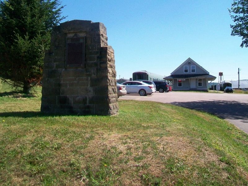
On Main Street (New Brunswick Route 114) just south of Legion Street, on the left when traveling south.
Near this town on 3rd September 1755, a detachment of Major Frye's troops, sent from Fort Cumberland to destroy Acadian settlements on the river and compel the people to surrender for deportation, was defeated by a French force under . . . — — Map (db m106630) HM
Imagine 100 billion tons of water moving in and out of a bay twice every 25 hours. Powered by the gravitational pull of the moon and the sun, Fundy's tides are among the highest in the world and vary daily with the changing positions of these . . . — — Map (db m106860)
Although the flowerpot rocks come in a variety of different shapes and sizes, they have all been formed over millions of years by the dynamic movements of the earth and erosion from glaciers, tides, snow, ice and winds.
The story of the rocks . . . — — Map (db m106812) HM
On Main Street (New Brunswick Route 114) at Hopewell Cross Road, on the left when traveling north on Main Street.
This 18th century anchor
retrieved from the
Petitcodiac River
at Hopewell Cape in 1981
by Jack Weldon
Donated to the
Albert County Historical Society
by
his wife Grace
and sons James, Thomas and Dale
This plaque was given as . . . — — Map (db m106638) HM
Designed by local architect Watson Reid, this magnificent Court House was built in 1904 partially on the same foundation as the original that was lost to fire earlier. The County Council reluctantly agreed to pay the whopping $4,495 price . . . — — Map (db m106750) HM
This small rectangle of land was part of a 738 acre tract originally granted to Robert Dickson Esq. and Jesse Converse on 8 May 1789. The original land grant encompassed all of present day Hopewell Cape. Later, after being acquired by the . . . — — Map (db m106770) HM
An original Shiretown building, the bottom floor of the Gaol was built with three cells and a gaol keeper's apartment. The second story was added around 1902 to provide better accommodations for the gaol keeper's family.
À l'origine un . . . — — Map (db m106769) HM
On Main Street (New Brunswick Route 114) at Old Great Road/Hopewell Cross Road, on the left when traveling north on Main Street.
An original Shiretown building where all real estate and some other legal transactions were recorded. The records also include County births, marriages and livestock identifiers.
À l'origine un édifice du chef-lieu du comté, les . . . — — Map (db m106646) HM
On Main Street (New Brunswick Route 114) at Old Great Road, on the right when traveling south on Main Street.
An original Shiretown building where County citizens made their remittances. The pressed tin interior is a Victorian era addition that contributes to the building's pleasant ambiance.
À l'origine un édifice du . . . — — Map (db m106705) HM
As Hopewell Cape grew as the centre of County activity, the need for a Community Hall became apparent. This hall was built around 1870 to satisfy that need. Extensive refurbishment has returned it to a fully functioning centre of . . . — — Map (db m106749) HM
On Main Street (New Brunswick Route 114) at Hopewell Cross Road, on the right when traveling south on Main Street.
Viscount of Mickelham, Calgary and Hopewell
[Burgundy marker on monument]
Rt. Hon. Richard Bedford Bennett
1870-1947
Born at Hopewell Hill, New Brunswick, Bennett moved to Calgary in 1897. A member of the legislature of the North . . . — — Map (db m106707) HM
On Main Street (New Brunswick Route 114) at Hopewell Cross Road, on the left when traveling north on Main Street.
Built in the early 1900's, this building was converted into the Silver Jubilee Lodge and Library for the Hopewell Cape Boys Club. It later served as a branch of the local regional library system. It has been restored to its 1935 . . . — — Map (db m106641) HM
Near Main Street (Provincial Road 114) east of Dobson Road, on the right when traveling east.
[English]
In October 1869, the Saxby Gale was a powerful storm in which the combined force of wind and high tides destroyed homes and killed people and cattle all along the Bay of Fundy. In that storm the bridge over Sawmill . . . — — Map (db m198784) HM
On King Street (New Brunswick Route 114) at Maple Street, on the right when traveling west on King Street.
A. R. McClelan was born in Riverside. At age twenty-three he entered politics and was elected to represent Albert County in the New Brunswick House of Assembly. He was a keen supporter of Confederation, and after Confederation in 1867 he became a . . . — — Map (db m106867) HM
On King Street (New Brunswick Route 114) at Maple Street, on the right when traveling west on King Street.
[front]
In grateful remembrance of
all those who served
in past conflicts
In memory of
those who gave all
Boer War 1899-1902 • W.W.I 1914-1918
W.W.II 1939-1945 • Korean 1950-1953
At the going down of the sun
and in the morning, . . . — — Map (db m106865) WM
On Main Street 0.2 kilometers south of Big Salmon River Road, on the right when traveling north.
English: From its origins in the late 18th century, the shipbuilding industry profoundly influenced New Brunswick history. Craftsmen in the colony built over 6,000 vessels during the 19th century, a third of the total tonnage produced in . . . — — Map (db m137643) HM
On Saint Martins Road (New Brunswick Route 111) just east of Base Road/Howell Road, on the right when traveling east.
”One of the Black Refugee Tract Areas” Grants of 55 acres of land was issued to the black settlers in Willow Grove in 1836. On September 7, 1836, the grants were finally issued and 74 black refugees received titles to lots in . . . — — Map (db m144129) HM
On Chipman Hill just south of Union Street, on the left when traveling north.
English:
Remarkable for the range of trompe l'œil effects and skillful execution, the wall and ceiling paintings inside this residence, part of a row of similar town houses, reflect the taste of the High Victorian era, . . . — — Map (db m140107) HM
On Market Square just east of Water Street, on the right when traveling east.
English:
In 1867, brothers George and William Barbour started a wholesale operation on South Market Wharf supplying fish, eggs, poultry and other local goods to vessels and area retailers. Although the building burned in the . . . — — Map (db m145582) HM
On Water Street just west of Prince William Street, on the left when traveling south.
English:
Look out to the head of the harbour, and you'll see Partridge Island, a major point of entry for European immigrants during the 19th and 20th centuries, almost 100 years before Ellis Island.
Many of our ancestors . . . — — Map (db m145397) HM
On Prince William Street at Saint James Street, on the left when traveling north on Prince William Street.
English:
Partridge Island has been home to natural and human communities for a long time.
It began about 300 million years ago when ash from an ancient volcano created the island. Sand and soil slowly built up, seeds took . . . — — Map (db m145599) HM
Near Chesley Drive (New Brunswick Route 100) at Bentley Street, on the right when traveling north.
English:
Some of the world's oldest fossils from a time long before dinosaurs have been found near here. Billion-year-old cyanobacteria lived underwater in Precambrian times and left circular shapes in the rock called . . . — — Map (db m147794) HM
Near Lancaster Avenue 0.2 kilometers east of Bridge Road ( Route 100), on the left when traveling east.
English:
In 1741 Benedict Arnold was born in Connecticut to a prosperous family. Twice before he was 18 young Arnold ran away to join British forces fighting the French and Indian wars.
When the American revolution began . . . — — Map (db m141993) HM
English What do you do for a 225th anniversary The answer in Canada’s first incorporated city was celebrate! Saint John 225: The Original City/La ville originale was a year-long celebration of the city’s heritage, creativity and . . . — — Map (db m77568) HM
Construction of this tower was begun by the British Army during the War of 1812 as one of the projected series of fortifications intended to block the western land approach to Saint John. Subsequent to its completion in 1815 the tower . . . — — Map (db m120628) HM
On Prince William Street at King Street, on the left when traveling south on Prince William Street.
This historic city block of attached late-Victorian buildings was designed and constructed immediately after the Great Fire of 1877 that swept away much of Saint John. Prominent architects from Canada and the United States vied for the honour of . . . — — Map (db m77457) HM
Near Lancaster Avenue 0.2 kilometers east of Bridge Road ( Route 100), on the left when traveling east.
English:
Charles Ingraham Gorman, born 1897 in Saint John, quickly grew into a boy with great energy. He thrived on competition. Once he had ice skates he dazzled family and friends with his speed on ice. At ten Charlie competed . . . — — Map (db m142002) HM
On Germain Street close to Duke Street, on the left when traveling south.
English
Constructed in 1879, on the site of the 1815 “Auld Kirk”, the present church is a faithful representation of the Gothic Revival style. One highlight of the interior is the Gothicized pulpit by local carver John Rogerson. . . . — — Map (db m77483) HM
On Water Street at Duke Street, on the right when traveling south on Water Street.
English:
From 1881 to 1960, a massive building with a central dome and two elaborate towers dominated the Saint John waterfront.
The Custom House was three storeys high on Prince William Street and five storeys on Water . . . — — Map (db m145399) HM
Near Lancaster Avenue 0.2 kilometers east of Bridge Road ( Route 100), on the left when traveling east.
English:
Born to a wealthy American family in 1736, Gabriel Ludlow grew up a supporter of the King. When the American Revolution came Ludlow raised a battalion for General DeLancey's Brigade. He was commissioned colonel of the . . . — — Map (db m141992) HM
On Union Street just west of Smythe Street when traveling west.
English:
Saint John Harbour has long been strategically important. There are many sites in and around the harbour relating to its defense — from Fort Saint Marie, now known as Fort LaTour, a fortified fur-trading settlement . . . — — Map (db m145591) HM
English The New Brunswick Electric Power Commission’s DOCK STREET PLANT, built on this site in 1889, was the longest continually operating electrical generation station in the world.
Built by the Saint John Railway Company, the 18,000 . . . — — Map (db m77558) HM
Near Union Street just west of Smythe Street, on the right when traveling west.
English:
Saint John Energy was established by the Saint John Common Council in 1922 to manage and operate the transmission and distribution of electrical power and energy in the City of Saint John. The Union Street substation . . . — — Map (db m145395) HM
On Peters Wharf at Water Street, on the right when traveling east on Peters Wharf.
English
The first vessel in the world propelled by a compound steam engine was the REINDEER launched for service on the Saint John, in 1845. Both the vessel and engine were designed by Benjamin Tibbets, a native of Queen’s County, New . . . — — Map (db m77428) HM
On Peters Wharf at Water Street, on the right when traveling east on Peters Wharf.
English
In 1854, Robert Foulis of St. John, N.B., first advocated the use of a steam horn or whistle to give warning to vessels in foggy weather. An apparatus devised by him was installed on Partridge Island in 1859. This was the first . . . — — Map (db m77430) HM
Near Chesley Drive (New Brunswick Route 100) at Bentley Street, on the right when traveling north.
English:
Fishing the Harbour
For at least 10,000 years the Saint John harbour and river estuary, with its rich range of maritime food resources, from shellfish to walrus, provided abundantly for the Wolastoqiyik (Maliseet) and . . . — — Map (db m147795) HM
Three markers are mounted on this monument Fort Howe
English Late in 1777 Major Gilfred Studholme hurriedly fortified this ridge overlooking the mouth of the Saint John River. Throughout the remainder of the American . . . — — Map (db m77537) HM
Near Fort Latour Drive at Navy Way when traveling east.
Fort La Tour was built on this site in 1631 by Charles de La Tour, a historical crossroads for First Nations peoples, French settlers and British traders. La Tour’s wife, Francoise-Marie Jacquelin defended the Fort against rival Charles de Menou . . . — — Map (db m138888) HM
Near Fort Latour Drive at Navy Way, on the right when traveling east.
English:
In 1631, Charles de Sainte-Étienne de La Tour built a fort here on ground traditionally used by First Nations people, for some 4000 years. The fort became one of the earliest centres of the French fur trade with the . . . — — Map (db m139998) HM
Français:
Fort La Tour
Les peoples des Premières nations ont utilisé cet endroit comme lieu de rassemblement et de cérémonie pendant plus de 4000 ans. En 1631, Charles de Sainte-Étienne de La Tour a établi un poste de . . . — — Map (db m152385) HM
Near Chesley Drive (New Brunswick Route 100) at Bentley Street, on the right when traveling north.
English:
Saint John was home to some of Canada's earliest fossil hunters. One great story from the 1880s tells how a young boy named Will Matthew found a gigantic trilobite — perhaps the largest ever found at that time about a . . . — — Map (db m147799) HM
On Sydney Street close to Kings Square North, on the left when traveling north.
English
The increase of population consequent upon the large influx of Loyalists in 1783 and 1784 convinced the British government of the desirability of creating the Province of New Brunswick. This was done on 16 August 1784. Brigadier . . . — — Map (db m77519) HM
Near Lancaster Avenue 0.2 kilometers east of Bridge Road ( Route 100), on the left when traveling east.
English:
In 1640 Françoise Marie Jacquelin from France stepped onto the shores of Acadia to marry Charles de Saint-Étienne, Sieur de La Tour, the 46 year-old Governor of Acadia. With her marriage the young bride joined the war for . . . — — Map (db m141988) HM
Near Lancaster Avenue 0.2 kilometers east of Bridge Road ( Route 100), on the left when traveling east.
English:
When George Bauld Oland was growing up in Dartmouth, N.S. he was surrounded by his brothers and sisters and many Oland cousins. Their homes were together by the Halifax harbour near the Oland family brewery. The popular . . . — — Map (db m141995) HM
On Canterbury Street just south of King Street, on the right when traveling south.
Here stood the house occupied by Gen. Benedict Arnold, famous Revolutionary War soldier, prominent merchant and trader 1787 to 1791. — — Map (db m147887) HM
On Kings Square South close to Sydney Street, on the right when traveling west.
English
Constructed in 1912-1913 to the designs of Philadelphia architect A.E. Westover, this structure was built by the Keith-Albee chain of New York City and its Canadian subsidiary, the Saint John Amusements Company. Dramatic, musical . . . — — Map (db m77506) HM
On Water Street 0.03 kilometers north of Prince William Street, on the left when traveling south.
This Celtic cross, erected in 1967 by descendants of the Irish settlers, is a half scale replica of a cross which stands on Partridge Island in Saint John Harbour.
A reproduction of the plaque on the original cross is shown below.
This . . . — — Map (db m78253) HM
Near Lancaster Avenue 0.2 kilometers east of Bridge Road ( Route 100), on the left when traveling east.
English:
At age 16 John Robertson left Scotland for Saint John to work as his uncle's clerk. From his arrival in 1817 Robertson's energy, vision and shrewd business sense were combined with significant social skills. People liked . . . — — Map (db m141994) HM
Near Lancaster Avenue 0.2 kilometers Bridge Road ( Route 100), on the left when traveling east.
English:
Kenneth Colin Irving, known to everyone as K.C., spent most of his life in New Brunswick. He was born (March 1899) in Buctouche, Kent County where his father owned various businesses. From his earliest years it was . . . — — Map (db m142000) HM
On Charlotte Street close to King Street, on the left when traveling south.
English
The Memorial Bandstand was designed and built in 1908 for the City Coronet Band by Neil Brodie, a local architect. One year later, it was donated to the City of Saint John in the name of Edward VII of England.
The bandstand is . . . — — Map (db m77531) HM
On Charlotte Street close to King Street, on the left when traveling south.
English
King’s Square, named for King George III of England, was granted to the City of Saint John by royal charter in 1785. During its early years, the grounds were the site of such public uses as oxen roasts, fireworks displays, militia . . . — — Map (db m77534) HM
Near Lancaster Avenue 0.2 kilometers Bridge Road ( Route 100), on the left when traveling east.
English:
Koluskap and Beaver
The following is a creation story kept by the storytellers of the Wolastoqiyik (Maliseet) about their ancestors in the communities of the Wolastoq (St. John River) where it meets the Bay of . . . — — Map (db m141909) HM
Near Lancaster Avenue 0.2 kilometers east of Bridge Road ( Route 100), on the left when traveling east.
English:
Land of the Dawn
The traditional territory of the Wolastoqiyik is called Wabanaki (Land of the Dawn). Wolastoqiyik, people of the beautiful river, have been here since the beginning. In the beginning the river . . . — — Map (db m141443) HM
On Union Street just west of Germain Street (Wellington Row), on the right when traveling east.
English:
This gracious building is a well-preserved example of the homes built by prosperous United Empire Loyalists and their descendants. Constructed before 1820 by the merchant David Merritt, this house was maintained with . . . — — Map (db m139999) HM
Near Fort Latour Drive at Navy Way when traveling east.
As the people of the Saint John River/Walastakok River, Maliseets are known to have lived on this river for nearly 12,000 years. When The Europeans first came here in 1604 we were living in a village on an island in this harbor. Maliseets referred . . . — — Map (db m138887) HM
Near Lancaster Avenue 0.2 kilometers east of Bridge Road (Route 100), on the left when traveling east.
English:
The site opposite, where Irving Pulp and Paper mill now stands, has been used for mill operations since the early 19th century. At that time the site was known as Union Point.
Mills at Union Point 1835 . . . — — Map (db m142003) HM
Near Chesley Drive (New Brunswick Route 100) at Bentley Street, on the right when traveling north.
English:
Through this viewing tube you can see a small patch of ground around one of the abutments of the Saint John Harbour Bridge. This is all that remains visible of a small island known as Navy Island. For centuries this . . . — — Map (db m147874) HM
On Canterbury Street close to Princess Street, on the left when traveling north.
Established on October 8, 1892 in connection with King’s College, Windsor, N.S., New Brunswick’s first School of Law was located in this building until 1953. The school is now the Faculty of Law of the University of New Brunswick. This plaque was . . . — — Map (db m77482) HM
On Sydney Street close to Kings Square South, on the right when traveling west.
English
The cry “Fire!” so terrified Canadians in the early 19th century that communities began to construct permanent fire stations. Erected in 1840, this elegant Neoclassical building is a pioneer example of a firehall designed . . . — — Map (db m77508) HM
Near Market Square (North Market Wharf) just west of St. Patrick Street, on the right when traveling west.
1867 The year has great significance — not only did it mark Canada's confederation, but it also marked the year that Susannah Oland introduced her family's October Brown Ale to the public.
1870 John Oland died unexpectedly, but . . . — — Map (db m145396) HM
Near Smythe Street at North Market Wharf, on the right when traveling south.
English:
Look toward the mouth of the harbour and you'll see Partridge Island, an official National and Provincial Historic Site. Only 600 metres (654 yards) long by 300 metres (327 yards) wide, the rocky island was home to . . . — — Map (db m145596) HM
On Prince William Street near King Street, on the left when traveling south.
This marker has plaques on both sides.English
Before the 1877 Fire
The year is 1865, and you are looking across Market Square at the “Imperial Building.” This was the site of the famous “Coffee House” and now the home of . . . — — Map (db m77480) HM
On Prince William Street at Princess Street, on the left when traveling north on Prince William Street.
English: This historic streetscape is distinguished by its rare concentration of homogeneous, primarily late 19th century architecture. Traditionally referred to as “Wall Street,” the area contains major public buildings, banks, . . . — — Map (db m137519) HM
Near Lancaster Avenue 0.2 kilometers east of Bridge Road ( Route 100), on the left when traveling east.
English:
Partnership at Portland Point
In August 1775 the 140 residents of Portland Point were attacked. A Machias war sloop burnt Fort Frederick, carried off its four soldiers and a ship full of supplies from the upriver . . . — — Map (db m141990) HM
Near Lancaster Avenue 0.2 kilometers east of Bridge Road ( Route 100), on the left when traveling east.
English:
In 1822 when Robert Foulis arrived in Saint John, New Brunswick he was 30 years old, a well-educated Scotsman from Glasgow, recognized as brilliant in sciences, and trained as an engineer. He spent the rest of his life in . . . — — Map (db m141998) HM
On Long Wharf 0.1 kilometers west of Smythe Street, on the left when traveling west.
English:
For more than two hundred years the City of Saint John and its sheltered, ice-free port, have been critical to the economic success of New Brunswick. Historically providing a port of entry for people and products, the . . . — — Map (db m145394) HM
On King Street just east of Prince William Street, on the right when traveling east.
English:This Clock commemorates the 225th Anniversary of the Incorporation of the City of Saint John on May 18th 1785 as Canada’s First Incorporated City.
It also recognizes May 18th, celebrated in Saint John as Loyalist Day, for . . . — — Map (db m147895) HM
On Charlotte Street at Market Street on Charlotte Street.
English
Built between 1874 ad 1876, the Saint John City market narrowly escaped the fire that swept through the town in 1877 and stands today as a rare and distinguished example of a 19th century market building. Designed in the Second . . . — — Map (db m77535) HM
On Sydney Street at King Street E, on the right when traveling north on Sydney Street.
Saint John County Court House
Facing King Square, the County Court House was built between 1827
and 1829 to house the Court of Quarter Sessions and the Supreme
Court. Probably designed by Scottish born architect John . . . — — Map (db m302730) HM
On Union Street 0.03 kilometers west of Smythe Street when traveling west.
English:
Saint John Harbour has been a strategic military site from the 1600’s through 1945. Each conflict led to the construction of defensive installations reflecting changing naval technologies.
Français: . . . — — Map (db m145597) HM
English
Saint John’s original burial ground was established on this site shortly after the landing of the United Empire Loyalists in 1783. After its closure as a cemetery in 1845, the site became a memorial garden with tree lined walkways . . . — — Map (db m77518) HM
Near Lancaster Avenue 0.2 kilometers east of Bridge Road ( Route 100), on the left when traveling east.
English:
On March 7th 1604, Samuel de Champlain, map-maker for Henry IV of France, sailed for L'Acadie with its newly appointed Lieutenant-General, Pierre du Gua de Monts. A second ship followed with Pont-Gravé who had explored . . . — — Map (db m141299) HM
On Market Square at Water Street, on the right when traveling east on Market Square.
English
Saint John has a strong Scottish presence. The breakup of the clan system in the late 18th century caused massive emigration from the Highlands. As a result, some 25 percent of the population has Scottish ancestry. Scottish . . . — — Map (db m77458) HM
On Prince William Street at Saint James Street, on the left when traveling north on Prince William Street.
English:
Where does a nickname come from?
No one can say why the Three Lamps light is better known as The Three Sisters. Nevertheless, local residents know the landmark by its nickname and have many stories to explain it. . . . — — Map (db m145600) HM
Near Lancaster Avenue 0.2 kilometers east of Bridge Road ( Route 100), on the left when traveling east.
English:
In 1762 three young ex-officers of provincial regiments (units of Americans within the British army) joined in a trading venture. The Boston friends - James Simonds, James White and William Hazen - were attracted to the . . . — — Map (db m141991) HM
Near Lancaster Avenue 0.2 kilometers east of Bridge Road ( Route 100), on the left when traveling east.
English:
Born in 1818 at Gagetown, NB, Leonard Tilley apprenticed at age 13 to a pharmacist in the north end of Saint John known as Portland. As a certified pharmacist 7 years later, Tilley and his cousin opened "Peters and Tilley . . . — — Map (db m141997) HM
On Carleton Street at Wellington Row, on the right when traveling west on Carleton Street.
English:
Constructed in 1824-1825, St. John’s is one of the earliest Gothic Revival churches in Canada. Its name, the Stone Church, reflects the high quality of its regularly coursed masonry. The skillful treatment of its Gothic . . . — — Map (db m140105) HM
On Prince William Street at Saint James Street, on the left when traveling north on Prince William Street.
1842 • A navigational signal lamp was erected on this site
1847 • A single gas lamp was erected by the Saint John Gas Co. and dedicated to the harbour pilots of Saint John
1848 • The Saint John Gas Co. commissioned Alexander . . . — — Map (db m145598) HM
On Market Square near Chipman Hill, on the left when traveling east.
English
A three-masted full-rigged ship with a modified clipper hull, the Marco Polo earned a reputation as the “fastest ship in the world” and drew international attention to New Brunswick shipyards. Built in 1851 by . . . — — Map (db m77456) HM
On King Street at Germain Street, on the right when traveling east on King Street.
There are two side to this markerEnglish
The Great Fire of 1877
One of the most destructive fires of modern times occurred at Saint John, N.B., on Wednesday, June 20th, 1877. It was more calamitous in its character than . . . — — Map (db m77570) HM
Near Market Square at Water Street, on the right when traveling east.
On 10 May 1783 the Spring Fleet, carrying over 2,000 Loyalists, arrived at the Saint John River mouth. The exiles, mostly civilians from the Middle Colonies, established themselves in the newly-surveyed townsites of Parr and Carleton. A . . . — — Map (db m77432) HM
On Water Street north of Prince William Street, on the left when traveling north.
English:
Imagine the harbour full of sails, wooden vessels of every shape and size navigating the tricky tidal currents to enter port.
Imagine the snap of the canvas and the shouts of sailors dropping the massive sheets to . . . — — Map (db m145400) HM
On Water Street north of Prince William Street, on the left when traveling south.
(English:)The Marco Polo and the Golden Age of Sail The Fastest Ship in the World Saint John, New Brunswick, Canada In the background you can see Saint John as it appeared in 1851, twenty-six years before the great fire of 1877 . . . — — Map (db m138894) HM
Near Lancaster Avenue 0.2 kilometers east of Bridge Road ( Route 100), on the left when traveling east.
English:
With the rebels controlling the New England timber trade in 1779, Hazen and White secured a contract to supply the Royal Navy with essential masts and spars. Their lumber camps fought battles with those of rival traders . . . — — Map (db m141989) HM
Near Navy Way 0.1 kilometers east of Chesley Drive ( Route 100), on the right when traveling east.
English:
The St. John River, with its long interior waterways, deep and sheltered harbour, and connection to the oceans of the world, is a natural highway for those travelling with the flow of the river. However, for those . . . — — Map (db m147796) HM
Near Fort Latour Drive 0.2 kilometers east of Chesley Drive ( Route 100), on the right when traveling east.
English:
This sculpture is based on the rich historical and archeological heritage of the area — where the St. John River meets the Bay of Fundy and where inhabitants have congregated over millennia. It comprises a . . . — — Map (db m147797) HM
Near Navy Way 0.1 kilometers east of Chesley Drive ( Route 100), on the right when traveling east.
English:
The tides in the Bay of Fundy are among the highest in the world, reaching 16 m (53 feet) at the head of the bay. Closer to the mouth, the tidal range is less. At Saint John it averages 7 m (23 feet), still enough to . . . — — Map (db m147800) HM
This plaque is in commemoration of the firm of Messrs. Troop and son, shipowners in the city of Saint John, New Brunswick, where the business of the firm was carried on during the years 1847-1912. Founded by Jacob V. Troop, the business was . . . — — Map (db m77459) HM
Near Lancaster Avenue 0.2 kilometers east of Bridge Road ( Route 100), on the left when traveling east.
English:
The American Civil War had a significant impact on young Thomas Stockwell Simms. A native of Maine, he tried to enlist in Lincoln's Republican army at age 16 when he was too young. At 18 he was accepted by the Seventh . . . — — Map (db m141996) HM
Near Chesley Drive (New Brunswick Route 100) at Douglas Avenue, on the right when traveling north.
English:
You can see and touch two ancient continents which actually meet beneath the Reversing Falls Bridge. According to geologists, this is possible because small continental slices drifted across the globe before they . . . — — Map (db m147798) HM
On Water Street just south of Princess Street, on the right when traveling south.
English:
West meets East… by Harbour Ferry
Long before a bridge spanned the harbour, passenger ferries linked the east and west sides of Saint John.
From 1841 to 1954, eight different ferries provided service between . . . — — Map (db m145398) HM
Near Lancaster Avenue 0.2 kilometers east of Bridge Road ( Route 100), on the left when traveling east.
English:
Born in Maine in 1810, young Kilby Reynolds soon proved he had remarkable mechanical skills. His inventive mind enjoyed developing improvements and trying new ideas.
In 1844 Reynolds purchased a large sawmill property . . . — — Map (db m142001) HM
Near Lancaster Avenue 0.2 kilometers east of Bridge Road ( Route 100), on the left when traveling east.
English:
Wolastoq Park The Name
Wolastoq means "the Beautiful River" in the language of the Maliseet people who lived beside it. Today, we know it as the beautiful St. John River. For many centuries before Europeans arrived . . . — — Map (db m141298) HM