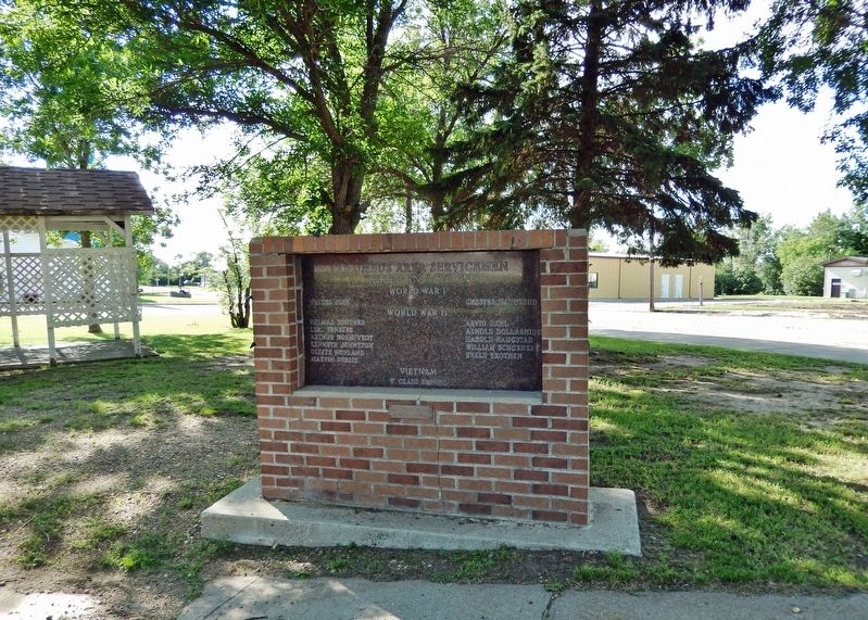
On Main Street just south of 2nd Avenue West, on the left when traveling north.
World War I Walter Frye • Chester Haugerud World War II Delmar Souther • Lyal Fenster • Arthur Horntvedt • Kenneth Johnston • Oliver Hovland • Marvin Sorlie • Arvid Dahl • Arnold Dollarhide • Harold Haugstad • William . . . — — Map (db m202896) WM
Near 5th Avenue Southwest at 6th Street West, on the right when traveling west.
Some gave their all, Some gave their life. Divide County History: The earliest inhabitants of what became Divide County included natives of the Assiniboine tribe, dating back to prehistoric time. They crossed the area as they . . . — — Map (db m202740) HM WM
On 94th Street Northwest, on the left when traveling east.
Writing Rock State Historic Site fuels the imagination. Carved into
two granite boulders at the site are figures that probably represent
a mythological thunderbird. These stone carvings are called
petroglyphs. Thunderbirds were sacred figures . . . — — Map (db m288745) HM
In 1989, inspection of the Lake Ilo dam found that critical maintenance was needed. A notch cut into the spillway lowered the water about 7 feet so the work could be completed. The exposed lake bed revealed remarkable discoveries and mysteries of . . . — — Map (db m153143) HM
On 5th Street SW 0.3 miles south of 4th Street SW, on the right when traveling south.
Chelsey and Polly Dinkins played a major role in the construction and operation of this dam and National Wildlife Refuge known as Lake Ilo.
Chelsey Dinkins was the foreman of the Works Progress Administrations (WPA) crew that built the dam in . . . — — Map (db m152944) HM
On Killdeer Mount Battlefield Road, on the right when traveling north.
On July 28, 1864, a U.S. military force, commanded by General Alfred Sully, attacked several groups of the Dakota, Nakota, and Lakota (Sioux) Nations camped at this location. Major Sioux leaders included Medicine Bear and Sitting Bull. Sully's . . . — — Map (db m285850) HM
On State Highway 22 at milepost 126 near County Road 14, on the left when traveling south.
More than a few ranchers have probably had to look for a lost cow in this country, but few people would
suppose that even the world's most famous badlands were a place where you could lose a bridge.
A new bridge was built just downstream from . . . — — Map (db m252889) HM
Near State Highway 22 at milepost 944 near !st Street Southwest, on the left when traveling south.
Three panels make up this marker
Rodeo!
Modern rodeo is big business, but at its heart rodeo is still a working class sport of small western towns, dusty pickup trucks and cowboys doing the things they love to do.
The . . . — — Map (db m252892) HM
The Fairview Bridge crossing the Yellowstone River in North Dakota is named after the Montana town of Fairview located five miles west. Although it is considered the only lift span bridge in North Dakota, it has a twin structure located nine miles . . . — — Map (db m162155) HM
For thirty-one years, automobile traffic crossed the Fairview railroad bridge. This was obviously a dangerous situation and accidents did occur, but none involving a train and surprisingly, no deaths were reported. Although a highway bridge has been . . . — — Map (db m162153) HM
The only railroad tunnel in North Dakota is located some 300 feet from the east end of the Fairview Lift Bridge. Locally known as the Cartwright Tunnel, it is named after the town of Cartwright, located about 1 1/ miles east of the tunnel. As . . . — — Map (db m162157) HM
By 1912 the Northern Pacific, Soo, and Milwaukee railroads were in competition. Louis W. Hill, president of the Great Northern, and his father, James J. Hill, knew that a successful farming population on railroad territory was essential to the . . . — — Map (db m162154) HM
On Scenic Drive, on the left when traveling north. Reported permanently removed.
Good grass and shelter attracted ranching interests to the badlands. Taking advantage of the void left by the killing of the bison, a Texas trail drive pushed 4,000 head of longhorn cattle into this region in the fall of 1884. Other trail drives . . . — — Map (db m282249) HM
On Scenic Drive west of CanAm Highway (U.S. 85), on the left when traveling west.
Work in Progress
Did you know Theodore Roosevelt National Park is fenced? You can see the fence from here. The park's small size, unnatural barrier, and the mixed uses of surrounding land require park managers to play an active role in . . . — — Map (db m282231) HM
Near 121st Avenue North West near State Highway 23, on the left when traveling north.
The Schafer Jail is of native granite stone and concrete construction. It was completed in 1910, and served McKenzie County for 31 years. It was from this jail that Charles Bannon, the confessed murderer of the six members of the Albert E. Haven . . . — — Map (db m162159) HM
On Scenic Drive, on the right when traveling north. Reported permanently removed.
The large spherical boulders in front of you are called concretions. They may have any shape, but most are round. Concretions are formed within rocks (shale, clay, sandstone, etc.) by the deposition of mineral around a core. More concretions will . . . — — Map (db m282173)
On Scenic Drive, on the right when traveling west.
A Wild River The undammed Little Missouri River floods often, eroding areas of floodplain and depositing new land. This new land next to the river offers plenty of water and sunlight. It is the only place cottonwood seedlings can survive. As . . . — — Map (db m282224)
On Theodore Roosevelt Expressway (U.S. 85), on the right when traveling north.
The colorful and fantastic shapes along these canyon walls are part of an ever-changing landscape. The horizontal layers of multi-colored sandstone, clay and shale are complimented by scattered beds of lignite coal and patches of pastel . . . — — Map (db m85880) HM
On Scenic Drive, on the right when traveling north.
The blue-black popcorn-like soil that caps the plateau 50 feet below this point is bentonitic clay. Bentonite clays flow when wet. This bluish-colored layer can be traced for miles up and down the river. — — Map (db m88636) HM
On Scenic Drive, on the left when traveling north. Reported permanently removed.
The drought and depression of the 1930’s hit the badlands region hard. Small landowners, no longer able to eke out a living, sold their lands to the government with the hope of finding a new start elsewhere. Throughout the country, men were out of . . . — — Map (db m282220) HM
On Scenic Drive, on the right when traveling west.
The large, round rocks littering the ground and protruding from the butte are bizarre. They don't seem to fit with the rest of the landscape. Where did they come from?
These "cannonballs" were not carried here by flowing water or glaciers. . . . — — Map (db m282168)
On Scenic Drive, on the right when traveling north. Reported permanently removed.
These small boulders are clues to a fascinating story. Geologists believe they were ripped from bedrock 400 miles north in Canada and carried to this point by a great glacier which covered nearly all North America north and east of here.
The . . . — — Map (db m282239)
Near 2nd Avenue Southwest at Main Street South (State Highway 23), on the left when traveling west.
Between 1874 and 1893, millions of head of cattle and horses went up the Great Western Trail from Texas through nine U.S. states into Canada. This famous trail lasted more years, carried more cattle, and was longer than any other cattle trail in . . . — — Map (db m202898) HM
Layers in Time From this vantage point the colorful layers of the badlands are very apparent. Individual layers can be traced for miles across the buttes in the distance. What caused the rocks to form this way? Many millions of years ago, a sea . . . — — Map (db m282247) HM
On Scenic Drive, on the right when traveling north. Reported permanently removed.
Abundant grass in North Dakota resulted in cattle being driven in the 1880’s along this trail to the Long X Ranch three miles north of this point. In North Dakota the trail passed through the place that is now the town of New England, then on . . . — — Map (db m282179) HM
On Scenic Drive, on the right when traveling north. Reported permanently removed.
Throughout history livestock growing has depended upon abundant grasslands. An unused sea of grass in this region attracted cattlemen who brought large herds here in the early 1880’s. Damage from overstocking and overgrazing brought a quick . . . — — Map (db m282237) HM
The badlands you see here were so named because they were badlands to travel over before modern roads were built. A part of the Northern Great Plains the area has been carved by rain, wind and running water of the Little Missouri River. These layers . . . — — Map (db m96782)
This river, the Little Missouri, flowed northward a
million years ago. Broad, gentle warping and uplift of this
region just before the Ice Age caused streams east of
here to erode more rapidly. Eventually one of these
streams cut into this . . . — — Map (db m304653) HM
In the spring of 1886 thieves stole Theodore Roosevelt’s boat from his Elkhorn Ranch, 25 miles south of here. Roosevelt pursued the thieves past this point and captured them at the mouth of Cherry Creek about 24 miles downstream. He then marched . . . — — Map (db m282223) HM
On Scenic Drive, on the right when traveling north. Reported permanently removed.
These tilted mounds were once part of the higher cliffs beyond. Stream cutting against their base over-steepened the cliffs. During wet periods, blocks of earth slid downhill, retaining their original layered sequence.
Can you match the . . . — — Map (db m282180)
On Scenic Drive, on the right when traveling west.
In the Spring of 1844, two brothers and their team of cowboys drove a herd of 4,000 longhorn cattle through the Little Missouri River Valley in front of you.
It had been a long, grueling journey from Texas. Rumors of abundant grass sent them east . . . — — Map (db m282176) HM
On Cedar Canyon Road, aka Scenic Drive near Theodore Roosevelt Expressway (U.S. 85), on the left when traveling west.
Before this land became a national park, this spot was recognized for its dramatic beauty. The area's future was uncertain-would it become a state park? A national park? A recreation area? No one knew yet, but they did known one thing: this view was . . . — — Map (db m162198) HM
On Scenic Drive west of CanAm Highway (U.S. 85), on the right when traveling west.
Welcome to Your National Park
Theodore Roosevelt National Park preserves three separate areas of the Little Missouri Badlands. The North and South Units support abundant wildlife and offer scenic drives, hiking trails, and camping. The . . . — — Map (db m282228) HM
On Scenic Drive, on the right when traveling west.
To your left and right are mounds of earth with diagonal stripes. How did these large blocks of land get turned on their sides?
Slump Block Formation
Long ago, the Little Missouri River was flowing along a steep cliff face where you are now. . . . — — Map (db m282174)
Near State Highway 1806 near Baywatch Lane, on the left when traveling north.
On "A delightfull morning." Lewis and Clark passed "immence quantities of game in every direction...consisting of herds of Buffaloe, Elk, and Antelopes with some deer and wolves." Lewis killed two buffalo, but the meat was "so . . . — — Map (db m282931) HM
On Theodore Roosevelt Expressway (U.S. 85), on the right when traveling north.
In memory of Walter H. Chaloner 1918 – 1933 Near this spot, this pioneer’s son failed in an attempt to jump a washout because of the tie-down on his horse. After five days of searching, he was found alive pinned under his horse. He did not . . . — — Map (db m85879) HM
Near Theodore Roosevelt Expressway (U.S. 85) near 46th Street North West, on the right when traveling north.
Good hunting and variable weather greeted the expedition. Hard frost and a cold, clear morning gave way to clouds and a rising wind by afternoon, Clark reported "an emence number of Elk & Buffalow, also Dear, Antelopes Geese Ducks & a few Swan." He . . . — — Map (db m282916) HM
Sunday, April 14, 1805
The expedition found reminders of the hard winter along those section of the Missouri. Clark killed a "meagre" buffalo bull, and near Indian Creek Lewis shot an elk "so poor that it was unfit for use. . . . — — Map (db m252883) HM
Established in 1914 on the east bank of the Missouri River, the village of Sanish was named after the Arikara world meaning real or friendly people. This area was also called "Old Crossing" by the early Indians because of the great buffalo herds . . . — — Map (db m252887) HM
This butte honors Crow Flies High, a Hidatsa Indian chief who was a leader on the Fort Berthold Indian Reservation. He lived at Like-A-Fishhook Village until a disagreement with another tribal chief led him and his followers to abandon the . . . — — Map (db m262757) HM
From 1947 to 1953, the Sanish Rodeo drew thousands of visitors to the small town of Sanish, ND. People traveled from all corners of the state to watch events, including Saddle Bronc Riding, Calf Roping, Bareback Riding, Bull Riding, Trick Riding, . . . — — Map (db m252871) HM
On State Highway 8 0.3 miles north of U.S. 2, on the right when traveling north.
This bronze statue is of a combat soldier on the Burma Trail, an almost forgotten part of WW II. It is to honor all Soldiers, Airmen, Marines, and Sailors. We thank them for their service and the contributions they and their families made to keep . . . — — Map (db m202893) WM
On C Street at A Street, on the right when traveling south on C Street.
Monday and Tuesday, April 15 and 16, 1805
The expedition paddled 41 miles upriver in these two days, finding better water, large and fertile plains, and "woody' bottomlands. At the Little Knife River, Clark saw an Assiniboine . . . — — Map (db m283106) HM
On 2nd Street Northeast just east of 1st Avenue Northeast, on the left when traveling west.
The Civilian Conservation Corps (CCC) Company 765 located in the city of Mohall, North Dakota. This plaque has been placed as a reminder to the future generation that invaluable service was rendered by many young men in preserving and maintaining . . . — — Map (db m231762) HM
Built in 1886 at Burlington
Relocated by the Rotary Club of Minot and Mr. Roy Huwe to serve as a historical museum July 27, 1953 The Ward County Historical Society — — Map (db m296609) HM
Near East Burdick Expressway (Business U.S. 2) at 13th Street Southeast, on the right when traveling west.
Fargo, North Dakota 1946-1971 U.S. Army Training Advisory Group, U.S. Army First Lieutenant Hagen, was the leader of a small reconnaissance team operating deep within enemy-held territory in the Republic of Vietnam. On August 7, 1971, the team came . . . — — Map (db m240695) HM
Near East Burdick Expressway (Business U.S. 2) at 13th Street Southeast, on the right when traveling west.
Bartlett, North Dakota 1873-1918 308th Infantry, 77th Division, U.S. Army When communication from the forward command post to the battalion leading the advance were interrupted by enemy infiltration, Lieutenant Colonel Smith led a party of 12 . . . — — Map (db m240646) HM
Near East Burdick Expressway (Business U.S. 2) at 13th Street Southeast, on the right when traveling west.
Neche, North Dakota 1922-1943 U.S. Marine Corps While his platoon was defending a vital roadblock on Bougainville Island on November 9, 1943, Private First Class Gurke, in company with another Marine, was delivering a fierce stream of fire against . . . — — Map (db m240691) HM
Near East Burdick Expressway (Business U.S. 2) at 13th Street Southeast, on the right when traveling west.
Minnewaukan, North Dakota 1895-1918 Company I, 138th Infantry, 35th Division, U.S. Army On September 29, 1918, Private Wold, with one other soldier, attacked and silenced enemy machine gun nests that blocked his company's advance near Cheppy, . . . — — Map (db m240674) HM
Near 34th Avenue Northeast 0.2 miles east of North Broadway (U.S. 83), on the right when traveling east.
This display is in recognition of the men and women who served in the 5th Fighter Interceptor Squadron during the early years of Minot Air Force Base 1960-1988. The three aircraft you see here were the types flown by the 5th Fighter Interceptor . . . — — Map (db m240700) HM
Near 34th Avenue Northeast 0.2 miles east of North Broadway (U.S. 83), on the right when traveling east.
In order to meet the need for close air support in South Vietnam, the USAF chose the A-7D Corsair II, derived from the US Navy's A-7, to fill that role. The Air Force required the Corsair II to be more powerful and thus was fitted with an Allison . . . — — Map (db m240699) HM
Near 34th Avenue Northeast 0.2 miles east of North Broadway (U.S. 83), on the right when traveling east.
On December 12, 1944, a B-17 Bomber on a training flight from the Army Air Base at Sioux City, Iowa, crashed while attempting an emergency landing at the Minot Airfield. Five of the crewmen perished in that tragic mishap. This memorial plaque is . . . — — Map (db m240917) HM
Near East Burdick Expressway (Business U.S. 2) at 13th Street Southeast, on the right when traveling west.
Forman, North Dakota 1884-1954 U.S. Navy An accidental explosion of ammunition occurred on the USS Pittsburgh on July 23, 1917. Commander (then Lieutenant) Bradley, who was about to enter the ammunition storage area, was blown back by the . . . — — Map (db m240630) HM
Near 34th Avenue Northeast 0.2 miles east of North Broadway (U.S. 83), on the right when traveling east.
The F-106 was the ultimate development of the USAF’s interceptor program of the early 1950s. The F-106 was envisaged as a specialized all-weather missile armed interceptor to shoot down bombers. The first prototype flew on 26 December 1956. The Air . . . — — Map (db m240697) HM
Near East Burdick Expressway (Business U.S. 2) at 13th Street Southeast, on the right when traveling west.
Fargo, North Dakota 1875-1966 Company B, 1st North Dakota Volunteer Infantry, U.S. Army On May 13, 1899, at San Miguel de Mayumo, Philippine Islands, an entrenched enemy force of 300 men opened fire upon Corporal Anders and 11 other scouts. The . . . — — Map (db m240442) HM
Near 34th Avenue Northeast 0.2 miles east of North Broadway (U.S. 83), on the right when traveling east.
The C-47 Skytrain (Dakota) was developed from the DC-3 civilian airliner for military use. The C-47 has a reinforced fuselage, stronger cabin floors for hauling heavy loads, large doors in the rear fuselage for loading cargo and dropping . . . — — Map (db m240918) HM
On East Burdick Expressway (Business U.S. 2) at 9th Street Southeast, on the right when traveling west on East Burdick Expressway.
This twelve block area in an oxbow of the Souris (Mouse) River was subdivided and platted into the city of Minot by K. E. and Belle Leighton in August of 1906. The neighborhood's proximity to the downtown business district made it appealing to . . . — — Map (db m241096) HM
Near East Burdick Expressway (Business U.S. 2) at 13th Street Southeast, on the right when traveling west.
Streeter, North Dakota 1915-1983 Company E, 338th Infantry, 85th Infantry Division, U.S. Army A small patrol led by First Lieutenant Bloch near Firenzuola, Italy, on September 22, 1944, located a group of machine gun nests holding up the advance in . . . — — Map (db m240690) HM
Near East Burdick Expressway (Business U.S. 2) at 13th Street Southeast, on the right when traveling west.
On this date, the Souris River reached a record flow rate of 27,400 cubic feet per second, resulting in water levels 11.9 feet above flood stage. — — Map (db m304087) HM
Near East Burdick Expressway (Business U.S. 2) at 13th Street Southeast, on the right when traveling west.
North Dakota 1875-1950 Blacksmith, U.S. Navy On May 11, 1898, while serving on the USS Marblehead, Carter was a member of a party sent to sever the communications cables from the Spanish fortifications at Cienfuegos, Cuba. Carter set an . . . — — Map (db m240427) HM
Near 4th Avenue Northwest 0.2 miles east of 16th Street Northwest, on the right when traveling east.
This monument is a tribute to the people of Minot who endured the worst flood of the Mouse River in the city's recorded history. On this historic day, sirens sounded the signal to more than 11,000 residents to flee their homes from the path of . . . — — Map (db m241098) HM
Near 34th Avenue Northeast 0.2 miles east of North Broadway (U.S. 83), on the right when traveling east.
The two-place T-33 jet was designed for advanced pilot training. It was developed from the single seat F-80 fighter by lengthening the fuselage to accommodate the second cockpit. The T-33 made its first flight in 1948. Production continued until . . . — — Map (db m240696) HM
Near East Burdick Expressway (Business U.S. 2) at 13th Street Southeast, on the right when traveling west.
Medal of Honor Citation Lt. Col. Roosevelt distinguished himself by acts of bravery on July 1, 1898 near Santiago de Cuba, Republic of Cuba, while leading a charge, accompanied by only four or five men up San Juan Hill. This action encouraged . . . — — Map (db m231684) HM
Near East Burdick Expressway (Business U.S. 2) at 13th Street Southeast, on the right when traveling west.
Wahpeton, North Dakota 1917-1982 Company G, 2nd Battalion, 19th Infantry Regiment, 24th Infantry Division, U.S. Army On October 20, 1951, Master Sergeant Keeble, who was leading a support platoon in the attack on Hill 765, observed that attacking . . . — — Map (db m240693) HM
Near 34th Avenue Northeast 0.2 miles east of North Broadway (U.S. 83), on the right when traveling east.
The F-15 “Eagle” is an American twin-engine, all-weather tactical fighter designed to gain and maintain air superiority in aerial combat. It is among the most successful modern fighters, with over 100 aerial combat victories. The Eagle first flew . . . — — Map (db m240698) HM
Near East Burdick Expressway (Business U.S. 2) at 13th Street Southeast, on the right when traveling west.
This memorial is dedicated with great pride to the courageous North Dakotans who received this nation's highest award for valor, the MEDAL OF HONOR. North Dakota veterans have an outstanding record in the services because of their devotion to duty, . . . — — Map (db m231686) HM WM
Near East Burdick Expressway (Business U.S. 2) at 13th Street Southeast, on the right when traveling west.
Valley City, North Dakota 1872-1943 Company G, 1st North Dakota Volunteer Infantry, U.S. Army On May 16, 1899, near San Isidro, Philippine Islands, Private Davis and 21 other scouts encountered an enemy force of approximately 600 men entrenched on . . . — — Map (db m240547) HM
Near East Burdick Expressway (Business U.S. 2) at 13th Street Southeast, on the right when traveling west.
Langdon, North Dakota 1867-1936 Company H, 1st North Dakota Volunteer Infantry, U.S. Army On May 16, 1899, near San Isidro, Philippine Islands, Private Ross and 21 other scouts encountered an enemy force of approximately 600 men entrenched on the . . . — — Map (db m240628) HM
Near East Burdick Expressway (Business U.S. 2) at 13th Street Southeast, on the right when traveling west.
Devils Lake, North Dakota 1872-1945 Company D, 1st North Dakota Volunteer Infantry, U.S. Army On May 13, 1899, at San Miguel de Mayumo, Philippine Islands, an entrenched enemy force of 300 men opened fire upon Private Jensen and 11 other scouts. . . . — — Map (db m240509) HM
Near East Burdick Expressway (Business U.S. 2) at 13th Street Southeast, on the right when traveling west.
Fargo, North Dakota 1877-1954 Company B, 1st North Dakota Volunteer Infantry, U.S. Army On May 16, 1899, near San Isidro, Philippine Islands, Private Kinne and 21 other scouts encountered an enemy force of approximately 600 men entrenched on the . . . — — Map (db m240601) HM
Near East Burdick Expressway (Business U.S. 2) at 13th Street Southeast, on the right when traveling west.
Wahpeton, North Dakota 1873-1910 Company I, 1st North Dakota Volunteer Infantry, U.S. Army On May 16, 1899, near San Isidro, Philippine Islands, Private Boehler and 21 other scouts encountered an enemy force of approximately 600 men entrenched on . . . — — Map (db m240528) HM
Near East Burdick Expressway (Business U.S. 2) at 13th Street Southeast, on the right when traveling west.
Mandan, North Dakota 1867-1951 Company A, 1st North Dakota Volunteer Infantry, U.S. Army On May 16, 1899, near San Isidro, Philippine Islands, Private Longfellow and 21 other scouts encountered an enemy force of approximately 600 men entrenched on . . . — — Map (db m240625) HM
Near East Burdick Expressway (Business U.S. 2) at 13th Street Southeast, on the right when traveling west.
Grafton, North Dakota 1872-1915 Company C, 1st North Dakota Volunteer Infantry, U.S. Army On April 12, 1899, three of the five members of Private Sletteland's squad were killed and another severely wounded in an ambush by Philippine rebel forces . . . — — Map (db m240439) HM
Near East Burdick Expressway (Business U.S. 2) at 13th Street Southeast, on the right when traveling west.
Jamestown, North Dakota 1866-1929 Company H, 1st North Dakota Volunteer Infantry, U.S. Army On May 13, 1899, at San Miguel de Mayumo, Philippine Islands, an entrenched enemy force of 300 men opened fire upon Private Downs and 11 other scouts. The . . . — — Map (db m240446) HM
Near East Burdick Expressway (Business U.S. 2) at 13th Street Southeast, on the right when traveling west.
Jamestown, North Dakota 1950~ Troop D, 2nd Squadron, 17th Cavalry, 101st Airborne Division, U.S. Army On March 23, 1971, Specialist Fourth Class Fitzmaurice and three fellow soldiers were occupying a bunker at Khe Sanh, Republic of Vietnam, when a . . . — — Map (db m240694) HM
Near East Burdick Expressway (Business U.S. 2) at 13th Street Southeast, on the right when traveling west.
Sentinel Butte, North Dakota 1918-1944 Company I, 120th Infantry, 30th Infantry Division, U.S. Army While advancing through the town of Bardenberg, Germany, on October 12, 1944, Staff Sergeant Pendleton's company was pinned down by machine gun fire . . . — — Map (db m240692) HM
Near 34th Avenue Northeast 0.2 miles east of North Broadway (U.S. 83), on the right when traveling east.
This 1/8th scale model of The B52 Stratofortress Bomber is presented as a token of the greater Minot region’s support and sincere appreciation of The United States Air Force. We are specifically thankful for the men, women and their . . . — — Map (db m240862) WM
Near East Burdick Expressway. Reported permanently removed.
County courthouses in the United States were built to house county administrators and to provide
jailing services for convicted criminals in that county. Courthouses have been built in many
shapes and sizes. Some were made entirely of stone and . . . — — Map (db m296610) HM
Near 119th Road Northwest near 121st Street Northwest.
The journals of Lewis and Clark are filled with vivid descriptions of the wildlife encountered on their journey west. On April 17th, 1805, near Lewis and Clark State Park, William Clark wrote that he saw "great numbs (numbers) of Buffalow feeding in . . . — — Map (db m252570) HM
Near 119th Road Northwest near 121st Street Northwest.
The seemingly endless sea of prairie that Lewis and Clark's Corp of Discovery encountered during their trek west along the Missouri River was a constant source of fascination. As the party neared what is today Lewis and Clark Park, Captain William . . . — — Map (db m252431) HM
Near 119th Road Northwest near 121st Street Northwest.
As the Corps of Discovery neared what is today Lewis and Clark State Park during their return trip, on August 8th, 1806, Captain Meriwether Lewis wrote "the men with me have not had leasure since we left the West side of the Rocky mountains to dress . . . — — Map (db m252571) HM
Near 119th Road Northwest near 121 Street North West.
On August 11th 1806, Captain Meriwether Lewis and Pierre Cruzatte, a fiddler blind in one eye and with poor sight in the other, went to shore to hunt for elk. Then, as Lewis wrote in his journal, "a ball struck my left thye about an inch below my . . . — — Map (db m252428) HM
Near 119th Road Northwest near 121st Street Northwest.
On "A delightfull morning," Lewis and Clark passed "immence quantities of game in every direction...consisting of herds of Buffaloe, Elk, and Antelopes with some deer and wolves." Lewis killed two buffalo, but the meat was "so . . . — — Map (db m252572) HM
Near 39th Lane Northwest near 153rd Avenue Northwest.
beaver is in every bend -- William Clark
Before the European colonization of North America, the use of animals for food and clothing seemed to have been in balance with the wildlife population. Once native people . . . — — Map (db m143013) HM
Near Mondak Backroad 1 near 143rd Avenue Northwest (State Route 1804).
The was the most elaborate structure on the upper Missouri River during the peak of the fur trade. Guided by elegant and detailed drawings of the artist Rudolph Frederich Kurz, an 1866 photograph of the house by William Illingworth, and . . . — — Map (db m143218) HM
Irrigation possibilities in the area were recognized as early as 1902. On November 18th, 1904 the Buford-Trenton Project was authorized by the Secretary of the Interior. Reclamation Service (now the Federal Bureau of Reclamation) specifications . . . — — Map (db m143023) HM
Near 39th Lane Northwest near 153rd Avenue Northwest.
Of the 161 burials in the Fort Buford cemetery, only a handful were directly related to combat. Soldiers as well as military dependents, civilians, Indian scouts employed by the army, and Indians visiting or living near the fort were buried here. . . . — — Map (db m143203) HM
Near Mondak Backroad 1 near 143rd Avenue Northwest (State Route 1804).
Directly in front of you is the site of the Dwelling Range. It was used to house a variety of people – clerks, interpreters, hunters, and employees as well as their Indian wives and children.
The original structure was destroyed by fire in . . . — — Map (db m143217) HM
Near 39th Lane Northwest near 153rd Avenue Northwest.
This building was constructed in 1871 as the post commanding officers' quarters. It served in that capacity until 1889, when a new commanding officers' quarters was built near the north side of the post. The single most important event that . . . — — Map (db m143159) HM
Fort Buford a United States Military Post named in honor of General John Buford of Gettysburg fame was established on this location in the fall of 1866. Preceding it on this site were two trading posts. Fort William erected in 1833 and Fort Mortimer . . . — — Map (db m96746) HM
On 39th Lane Northwest near 153rd Avenue Northwest, on the left when traveling west.
Fort Buford was named for Major General John Buford, a Union commander at the Battle of Gettysburg. The establishment of Fort Buford in 1866 safeguarded the territory surrounding the confluence of the Missouri and Yellowstone Rivers and served as a . . . — — Map (db m143064) HM
Near Mondak Backroad 1 near 143rd Avenue Northwest (State Route 1804).
Visitors entering the Fort from the river side had to pass through outer and inner gates separated by an enclosed area with access to the Indian Trade Room. When the outer gate was closed, trading could be carried on through a wicket (or window) . . . — — Map (db m143221) HM
Near 39th Lane Northwest near 153rd Avenue Northwest.
Fort Williams (1833-1834)
Fort Williams was constructed in late 1833 by the firm of Sublette & Campbell and named for one of its founders. William Sublette and Robert Campbell were St. Louis businessmen involved in the Rocky Mountain fur . . . — — Map (db m143022) HM
On Mondak Backroad 1 near 143rd Avenue Northwest (State Route 1804), on the left when traveling east.
River banks here are underlayed with a stable base of gravel. This was important to the American Fur Company when it selected this site to build Fort Union because its presence stabilized the riverbank from erosion and kept down mud.
Gravel is . . . — — Map (db m143236) HM
Near 39th Lane Northwest near 153rd Avenue Northwest.
The guardhouse (directly in front of you) and the officer of the guard building (the building to your right) were the heart of the fort's readiness and security functions. The officer of the guard supervised the men on guard duty who manned the . . . — — Map (db m143163) HM
Near 39th Lane Northwest near 153rd Avenue Northwest.
Fort Buford had no hospital during the first year of its existence. In the fall of 1867, quarters originally constructed to house the interpreter and mechanic were pressed into service as a hospital. The following summer, the hospital was moved into . . . — — Map (db m143202) HM
Near 39th Lane Northwest near 153rd Avenue Northwest.
The building you are now facing a reconstruction of a mid-1870s infantry barracks. It has been reconstructed where an original barracks once stood.
In 1867, adobe barracks were constructed to house Fort Buford's enlisted men. Adobe, a useful . . . — — Map (db m143160) HM
127 entries matched your criteria. The first 100 are listed above. The final 27 ⊳