127 entries match your criteria. The first 100 are listed. ⊳
Historical Markers and War Memorials
in the Bakken Oil Patch Region
By Cosmos Mariner, July 23, 2022
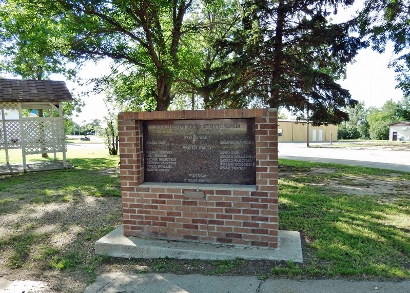
Columbus Area Servicemen Killed in Action Marker
1 ► North Dakota, Burke County, Columbus — Columbus Area Servicemen Killed in Action —  |
| On Main Street just south of 2nd Avenue West, on the left when traveling north. | |||
| 2 ► North Dakota, Divide County, Crosby — Crosby Freedom Rock Veterans Memorial — Honoring Divide County Veterans — Ray "Bubba" Sorensen II — |
| Near 5th Avenue Southwest at 6th Street West, on the right when traveling west. | |||
| 3 ► North Dakota, Divide County, Grenora, Writing Rock Township — Writing Rock State Historic Site — State Historical Society of North Dakota — |
| On 94th Street Northwest, on the left when traveling east. | |||
| 4 ► North Dakota, Dunn County, Dunn Center — A Mystery Exposed — |
| Near Fourth Street Southwest east of Olson Lane. | |||
| 5 ► North Dakota, Dunn County, Dunn Center — Chelsey and Polly Dinkins Memorial Dam — Refuge Manager and Wife — 1936-1983 — |
| On 5th Street SW 0.3 miles south of 4th Street SW, on the right when traveling south. | |||
| 6 ► North Dakota, Dunn County, Killdeer — Killdeer Mountain — Tachawakute (The Place Where They Kill Deer)* — |
| On Killdeer Mount Battlefield Road, on the right when traveling north. | |||
| 7 ► North Dakota, Dunn County, Killdeer — Lost Bridge of the Badlands — Killdeer Mountain Four Bears Scenic Byway — |
| On State Highway 22 at milepost 126 near County Road 14, on the left when traveling south. | |||
| 8 ► North Dakota, Dunn County, Killdeer — Mountain of the Medicine Hole — |
| Near State Highway 22 at milepost 944 near !st Street Southwest, on the left when traveling south. | |||
| 9 ► North Dakota, McKenzie County, Cartwright — Fairview Lift Bridge — |
| On Black Top Road near State Highway 200. | |||
| 10 ► North Dakota, McKenzie County, Cartwright — Hjalmer Nelson Memorial Bridge — 1955 - 1997 — |
| Near Black Top Road near Highway 200. | |||
| 11 ► North Dakota, McKenzie County, Cartwright — The Cartwright Tunnel — |
| Near Black Top Road near State Highway 200. | |||
| 12 ► North Dakota, McKenzie County, Cartwright — The Montana Eastern Railway Company — 1912 - 1935 — Great Northern's Second Main — |
| Near Black Top Road near State Highway 200. | |||
| 13 ► North Dakota, McKenzie County, Grassy Butte — Grassy Butte Post Office Museum — |
| On Museum Drive at Main Streett, on the right when traveling north on Museum Drive. | |||
| 14 ► North Dakota, McKenzie County, Grassy Butte — Longhorns |
| On Scenic Drive, on the left when traveling north. Reported permanently removed. | |||
| 15 ► North Dakota, McKenzie County, Grassy Butte — Work in Progress / Better Together — Theodore Roosevelt National Park — National Park Service, U.S. Department of the Interior — |
| On Scenic Drive west of CanAm Highway (U.S. 85), on the left when traveling west. | |||
| 16 ► North Dakota, McKenzie County, Schafer — The Schafer Jail — |
| Near 121st Avenue North West near State Highway 23, on the left when traveling north. | |||
| 17 ► North Dakota, McKenzie County, Schafer — The Schafer Jail — |
| Near 121st Avenue North West near State Highway 23, on the left when traveling south. | |||
| 18 ► North Dakota, McKenzie County, Watford City — “Cannon Ball” Concretions |
| On Scenic Drive, on the right when traveling north. Reported permanently removed. | |||
| 19 ► North Dakota, McKenzie County, Watford City — A Wild River / Growing Old / Cotton — |
| On Scenic Drive, on the right when traveling west. | |||
| 20 ► North Dakota, McKenzie County, Watford City — Badlands Panorama — |
| On Theodore Roosevelt Expressway (U.S. 85), on the right when traveling north. | |||
| 21 ► North Dakota, McKenzie County, Watford City — Bentonitic Clay — |
| On Scenic Drive, on the right when traveling north. | |||
| 22 ► North Dakota, McKenzie County, Watford City — Building From Hard Times |
| On Scenic Drive, on the left when traveling north. Reported permanently removed. | |||
| 23 ► North Dakota, McKenzie County, Watford City — Cannonball Mystery — |
| On Scenic Drive, on the right when traveling west. | |||
| 24 ► North Dakota, McKenzie County, Watford City — Edge of a Glacier |
| On Scenic Drive, on the right when traveling north. Reported permanently removed. | |||
| 25 ► North Dakota, McKenzie County, Watford City — Great Western Trail — |
| Near 2nd Avenue Southwest at Main Street South (State Highway 23), on the left when traveling west. | |||
| 26 ► North Dakota, McKenzie County, Watford City — Layers in Time / Portraits in Stone — |
| On Scenic Drive, on the left when traveling west. | |||
| 27 ► North Dakota, McKenzie County, Watford City — Long X Cattle Trail |
| On Scenic Drive, on the right when traveling north. Reported permanently removed. | |||
| 28 ► North Dakota, McKenzie County, Watford City — Man and Grass |
| On Scenic Drive, on the right when traveling north. Reported permanently removed. | |||
| 29 ► North Dakota, McKenzie County, Watford City — North Dakota Badlands — |
| On Scenic Drive. | |||
| 30 ► North Dakota, McKenzie County, Watford City — Ox Bow Bend Overlook — |
| Near Scenic Drive. | |||
| 31 ► North Dakota, McKenzie County, Watford City — Roosevelt and the Boat Thieves |
| On Scenic Drive. Reported permanently removed. | |||
| 32 ► North Dakota, McKenzie County, Watford City — Slump Formation |
| On Scenic Drive, on the right when traveling north. Reported permanently removed. | |||
| 33 ► North Dakota, McKenzie County, Watford City — The Long X Trail: A Dusty Trail to Greener Pastures — |
| On Scenic Drive, on the right when traveling west. | |||
| 34 ► North Dakota, McKenzie County, Watford City — The View that Launched a Park — Rebuilding a Nation - Building a Park — |
| On Cedar Canyon Road, aka Scenic Drive near Theodore Roosevelt Expressway (U.S. 85), on the left when traveling west. | |||
| 35 ► North Dakota, McKenzie County, Watford City — Theodore Roosevelt National Park — In Honor of our Convervation President — National Park Service, U.S. Department of the Interior — |
| On Scenic Drive west of CanAm Highway (U.S. 85), on the right when traveling west. | |||
| 36 ► North Dakota, McKenzie County, Watford City — Tilted — Slump Block Formation — |
| On Scenic Drive, on the right when traveling west. | |||
| 37 ► North Dakota, McKenzie County, Watford City — Tobacco Garden Bay — Wednesday, April 17, 1805 — |
| Near State Highway 1806 near Baywatch Lane, on the left when traveling north. | |||
| 38 ► North Dakota, McKenzie County, Watford City — Walter H. Chaloner — |
| On Theodore Roosevelt Expressway (U.S. 85), on the right when traveling north. | |||
| 39 ► North Dakota, McKenzie County, Williston — Lewis & Clark Wildlife Management Area — Sunday, April 21, 1805 — |
| Near Theodore Roosevelt Expressway (U.S. 85) near 46th Street North West, on the right when traveling north. | |||
| 40 ► North Dakota, Mountrail County, New Town — Crow Flies High — Mountrail County — |
| Near State Highway 23 near 2nd Street Northwest. | |||
| 41 ► North Dakota, Mountrail County, New Town — Old Sanish Townsite — |
| Near State Highway 23 near 2nd Street Northwest. | |||
| 42 ► North Dakota, Mountrail County, New Town — Pe-Ri-Tska-Wa-Ku-Re — (Crow Flies High) — |
| Near State Highway 23 near 2nd Street Northwest. | |||
| 43 ► North Dakota, Mountrail County, New Town — The Best of the West — The Sanish Rodeo — |
| Near State Highway 23 near 2nd Street Northwest. | |||
| 44 ► North Dakota, Mountrail County, Stanley — War Mules — |
| On State Highway 8 0.3 miles north of U.S. 2, on the right when traveling north. | |||
| 45 ► North Dakota, Mountrail County, White Earth Bay — White Earth Bay — Lewis and Clark in North Dakota — |
| On C Street at A Street, on the right when traveling south on C Street. | |||
| 46 ► North Dakota, Renville County, Mohall — Tribute to the Civilian Conservation Corps Project — |
| On 2nd Street Northeast just east of 1st Avenue Northeast, on the left when traveling west. | |||
| 47 ► North Dakota, Ward County, Burlington — First Courthouse — Imperial Ward County — |
| On US 2. | |||
| 48 ► North Dakota, Ward County, Minot — ☆ First Lieutenant Loren D. Hagen — |
| Near East Burdick Expressway (Business U.S. 2) at 13th Street Southeast, on the right when traveling west. | |||
| 49 ► North Dakota, Ward County, Minot — ☆ Lieutenant Colonel Fred E. Smith — |
| Near East Burdick Expressway (Business U.S. 2) at 13th Street Southeast, on the right when traveling west. | |||
| 50 ► North Dakota, Ward County, Minot — ☆ Private First Class Henry Gurke — |
| Near East Burdick Expressway (Business U.S. 2) at 13th Street Southeast, on the right when traveling west. | |||
| 51 ► North Dakota, Ward County, Minot — ☆ Private Nels Wold — |
| Near East Burdick Expressway (Business U.S. 2) at 13th Street Southeast, on the right when traveling west. | |||
| 52 ► North Dakota, Ward County, Minot — 5th Fighter Interceptor Squadron — The "Spittin Kittens" — |
| Near 34th Avenue Northeast 0.2 miles east of North Broadway (U.S. 83), on the right when traveling east. | |||
| 53 ► North Dakota, Ward County, Minot — A-7D Corsair II — |
| Near 34th Avenue Northeast 0.2 miles east of North Broadway (U.S. 83), on the right when traveling east. | |||
| 54 ► North Dakota, Ward County, Minot — B-17 Bomber Crash Memorial — |
| Near 34th Avenue Northeast 0.2 miles east of North Broadway (U.S. 83), on the right when traveling east. | |||
| 55 ► North Dakota, Ward County, Minot — Commander Willis Winter Bradley, Jr. — |
| Near East Burdick Expressway (Business U.S. 2) at 13th Street Southeast, on the right when traveling west. | |||
| 56 ► North Dakota, Ward County, Minot — Convair F-106 "Delta Dart" — |
| Near 34th Avenue Northeast 0.2 miles east of North Broadway (U.S. 83), on the right when traveling east. | |||
| 57 ► North Dakota, Ward County, Minot — Corporal Frank L. Anders — |
| Near East Burdick Expressway (Business U.S. 2) at 13th Street Southeast, on the right when traveling west. | |||
| 58 ► North Dakota, Ward County, Minot — Douglas C-47 Skytrain — |
| Near 34th Avenue Northeast 0.2 miles east of North Broadway (U.S. 83), on the right when traveling east. | |||
| 59 ► North Dakota, Ward County, Minot — Eastwood Park — |
| On East Burdick Expressway (Business U.S. 2) at 9th Street Southeast, on the right when traveling west on East Burdick Expressway. | |||
| 60 ► North Dakota, Ward County, Minot — First Lieutenant Orville Emil Bloch — |
| Near East Burdick Expressway (Business U.S. 2) at 13th Street Southeast, on the right when traveling west. | |||
| 61 ► North Dakota, Ward County, Minot — High Water Mark — June 25, 2011 — |
| Near East Burdick Expressway (Business U.S. 2) at 13th Street Southeast, on the right when traveling west. | |||
| 62 ► North Dakota, Ward County, Minot — Joseph E. Carter — |
| Near East Burdick Expressway (Business U.S. 2) at 13th Street Southeast, on the right when traveling west. | |||
| 63 ► North Dakota, Ward County, Minot — June 22, 2011 — |
| Near 4th Avenue Northwest 0.2 miles east of 16th Street Northwest, on the right when traveling east. | |||
| 64 ► North Dakota, Ward County, Minot — Lockheed T-33 "Shooting Star" — |
| Near 34th Avenue Northeast 0.2 miles east of North Broadway (U.S. 83), on the right when traveling east. | |||
| 65 ► North Dakota, Ward County, Minot — Lt. Colonel Theodore Roosevelt — 1st United States Volunteer Cavalry, U.S. Army — |
| Near East Burdick Expressway (Business U.S. 2) at 13th Street Southeast, on the right when traveling west. | |||
| 66 ► North Dakota, Ward County, Minot — Master Sergeant Woodrow Wilson Keeble — |
| Near East Burdick Expressway (Business U.S. 2) at 13th Street Southeast, on the right when traveling west. | |||
| 67 ► North Dakota, Ward County, Minot — McDonnell Douglas F-15 "Eagle" — |
| Near 34th Avenue Northeast 0.2 miles east of North Broadway (U.S. 83), on the right when traveling east. | |||
| 68 ► North Dakota, Ward County, Minot — North Dakota Medal of Honor Memorial — Dedication Day July 4, 2007 — |
| Near East Burdick Expressway (Business U.S. 2) at 13th Street Southeast, on the right when traveling west. | |||
| 69 ► North Dakota, Ward County, Minot — Private Charles P. Davis — |
| Near East Burdick Expressway (Business U.S. 2) at 13th Street Southeast, on the right when traveling west. | |||
| 70 ► North Dakota, Ward County, Minot — Private Frank F. Ross — |
| Near East Burdick Expressway (Business U.S. 2) at 13th Street Southeast, on the right when traveling west. | |||
| 71 ► North Dakota, Ward County, Minot — Private Gotfred Jensen — |
| Near East Burdick Expressway (Business U.S. 2) at 13th Street Southeast, on the right when traveling west. | |||
| 72 ► North Dakota, Ward County, Minot — Private John B. Kinne — |
| Near East Burdick Expressway (Business U.S. 2) at 13th Street Southeast, on the right when traveling west. | |||
| 73 ► North Dakota, Ward County, Minot — Private Otto Boehler — |
| Near East Burdick Expressway (Business U.S. 2) at 13th Street Southeast, on the right when traveling west. | |||
| 74 ► North Dakota, Ward County, Minot — Private Richard M. Longfellow — |
| Near East Burdick Expressway (Business U.S. 2) at 13th Street Southeast, on the right when traveling west. | |||
| 75 ► North Dakota, Ward County, Minot — Private Thomas Sletteland — |
| Near East Burdick Expressway (Business U.S. 2) at 13th Street Southeast, on the right when traveling west. | |||
| 76 ► North Dakota, Ward County, Minot — Private Willis H. Downs — |
| Near East Burdick Expressway (Business U.S. 2) at 13th Street Southeast, on the right when traveling west. | |||
| 77 ► North Dakota, Ward County, Minot — Specialist Fourth Class Michael John Fitzmaurice — |
| Near East Burdick Expressway (Business U.S. 2) at 13th Street Southeast, on the right when traveling west. | |||
| 78 ► North Dakota, Ward County, Minot — Staff Sergeant Jack J. Pendleton — |
| Near East Burdick Expressway (Business U.S. 2) at 13th Street Southeast, on the right when traveling west. | |||
| 79 ► North Dakota, Ward County, Minot — Thanks to the United States Air Force — |
| Near 34th Avenue Northeast 0.2 miles east of North Broadway (U.S. 83), on the right when traveling east. | |||
| 80 ► North Dakota, Ward County, Minot — The Courthouse |
| Near East Burdick Expressway. Reported permanently removed. | |||
| 81 ► North Dakota, Williams County, Epping — "Great Numbers" — |
| Near 119th Road Northwest near 121st Street Northwest. | |||
| 82 ► North Dakota, Williams County, Epping — "Handsome High Planes" — Lewis and Clark State Park — |
| Near 119th Road Northwest near 121st Street Northwest. | |||
| 83 ► North Dakota, Williams County, Epping — "Keeping up with Necessities" — |
| Near 119th Road Northwest near 121st Street Northwest. | |||
| 84 ► North Dakota, Williams County, Epping — "Lewis Mistaken For an Elk" — Lewis and Clark State Park — |
| Near 119th Road Northwest near 121 Street North West. | |||
| 85 ► North Dakota, Williams County, Epping — Lewis and Clark State Park — Wednesday, April 17, 1805 — |
| Near 119th Road Northwest near 121st Street Northwest. | |||
| 86 ► North Dakota, Williams County, Tioga — Betaini Norwegian Lutheran Church — |
| On 105th Avenue Northwest (County Highway 21) just south of 59th Street Northwest, on the left when traveling south. | |||
| 87 ► North Dakota, Williams County, Williston — A Beaver Boom — Missouri-Yellowstone Confluence Interpretive Center — |
| Near 39th Lane Northwest near 153rd Avenue Northwest. | |||
| 88 ► North Dakota, Williams County, Williston — Bourgeois House — |
| Near Mondak Backroad 1 near 143rd Avenue Northwest (State Route 1804). | |||
| 89 ► North Dakota, Williams County, Williston — Buford-Trenton Project — The Power of the Missouri — A U.S. Reclamation Service project contracted 1905-1908 — |
| Near 39 near 153rd Avenue Northwest. | |||
| 90 ► North Dakota, Williams County, Williston — Cemetery — |
| Near 39th Lane Northwest near 153rd Avenue Northwest. | |||
| 91 ► North Dakota, Williams County, Williston — Dwelling Range — |
| Near Mondak Backroad 1 near 143rd Avenue Northwest (State Route 1804). | |||
| 92 ► North Dakota, Williams County, Williston — Field Officers' Quarters — Fort Buford State Historic Site — |
| Near 39th Lane Northwest near 153rd Avenue Northwest. | |||
| 93 ► North Dakota, Williams County, Williston — Fort Buford Historic Site — |
| On 39th Lane NW. | |||
| 94 ► North Dakota, Williams County, Williston — Fort Buford State Historic Site — |
| On 39th Lane Northwest near 153rd Avenue Northwest, on the left when traveling west. | |||
| 95 ► North Dakota, Williams County, Williston — Front Gate — |
| Near Mondak Backroad 1 near 143rd Avenue Northwest (State Route 1804). | |||
| 96 ► North Dakota, Williams County, Williston — Fur Trade Forts — Protecting the Fur Trade — |
| Near 39th Lane Northwest near 153rd Avenue Northwest. | |||
| 97 ► North Dakota, Williams County, Williston — Gravel Pits — |
| On Mondak Backroad 1 near 143rd Avenue Northwest (State Route 1804), on the left when traveling east. | |||
| 98 ► North Dakota, williams County, Williston — Guardhouse and Officer of the Guard Building — Fort Buford State Historic Site — |
| Near 39th Lane Northwest near 153rd Avenue Northwest. | |||
| 99 ► North Dakota, Williams County, Williston — Hospital — |
| Near 39th Lane Northwest near 153rd Avenue Northwest. | |||
| 100 ► North Dakota, Williams County, Williston — Infantry Barracks — Fort Buford State Historic Site — |
| Near 39th Lane Northwest near 153rd Avenue Northwest. | |||
127 entries matched your criteria. The first 100 are listed above. The final 27 ⊳