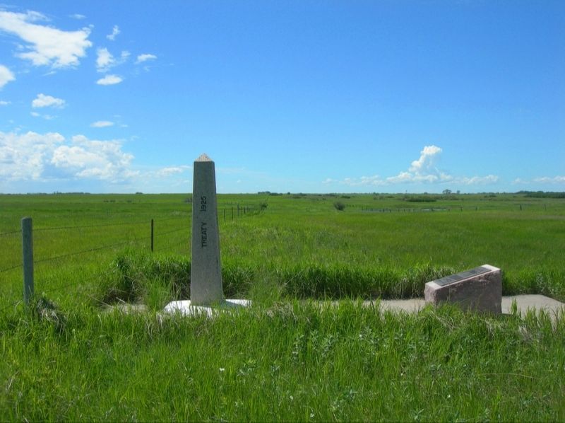
By Jimmy Emerson, 2013
Manitoba Saskatchewan Border on International Boundary Marker
| On unnamed dirt road, on the right when traveling south. |
| On Township Road 13, on the right when traveling east. |
| On Township Road 13, on the right when traveling east. |
| Near Chimney Coulee Road. |
| On Washington Avenue just east of First Street, on the right when traveling east. |
| On Central Avenue at 20th Street West, on the right when traveling north on Central Avenue. |
| On Old Saskatchewan Highway 4 (Provincial Highway 658) 1.1 kilometers west of Provincial Highway 4, on the left when traveling west. |
| Near Central Avenue just north of Campbell Innes Way, on the right when traveling north. |
| Near 3 Avenue West 0.5 kilometers south of Old Saskatchewan Highway 4 (Provincial Highway 658), on the left when traveling south. |
| On 3 Avenue West 0.4 kilometers south of Old Saskatchewan Highway 4 (Provincial Highway 658), on the left when traveling south. |
| On 3 Avenue West 0.4 kilometers south of Old Saskatchewan Highway 4 (Provincial Highway 658), on the right when traveling south. |
| Near 3 Avenue West 0.5 kilometers south of Old Saskatchewan Highway 4 (Provincial Highway 658), on the left when traveling south. |
| On Old Saskatchewan Highway 4 (Provincial Highway 658) 1.1 kilometers west of Provincial Highway 4, on the left when traveling west. |
| On 2 Avenue West just south of 25 Street, on the right when traveling south. |
| On Old Saskatchewan Highway 4 (Provincial Highway 658) 1.1 kilometers west of Provincial Highway 4, on the right when traveling west. |
| Near 3 Avenue West 0.5 kilometers south of Old Saskatchewan Highway 4 (Provincial Highway 658), on the left when traveling south. |
| On 3 Avenue West 0.4 kilometers south of Old Saskatchewan Highway 4 (Provincial Highway 658), on the right when traveling south. |
| Near 3 Avenue West 0.5 kilometers south of Old Saskatchewan Highway 4 (Provincial Highway 658), on the left when traveling south. |
| On 2 Street South (Old Provincial Highway 658) at Provincial Highway 4, on the left when traveling east on 2 Street South. |
| Near 3 Avenue West 0.5 kilometers south of Old Saskatchewan Highway 4 (Provincial Highway 658), on the left when traveling south. |
| On 2 Street South (Old Provincial Highway 658) at Provincial Highway 4, on the left when traveling east on 2 Street South. |
| On Ontario Street just north of 1 Avenue East, on the right when traveling north. |
| On King Street just south of 8 Avenue East, on the right when traveling north. |
| On 6 Avenue East just west of Dominion Street, on the right when traveling west. |
| On King Street just south of 8 Avenue East, on the right when traveling north. |
| On CanAm Highway (Provincial Highway 6) 9 kilometers north of Provincial Highway 39, on the left when traveling north. |
| On 1 Avenue South, on the left when traveling south. |
| On Main Street just north of Railway Avenue, on the left when traveling north. |
| On Miller Street at Portland St, on the right when traveling east on Miller Street. |
| On SK Highway 9 (Saskatchewan Route 9), on the right when traveling south. |
| On Norway Road (Provincial Highway 9) north of Provincial Highway 5, on the right when traveling north. |
| On 4th Street at 2nd Avenue, on the right when traveling north on 4th Street. |
| On Idylwyld Drive North (Highway 1) just south of 25 Street West, on the right when traveling south. |
| On 11th Street East east of Broadway Avenue, on the right when traveling east. |
| Near 20th Street West at Avenue D South, on the right when traveling west. |
| On 21st Street East just east of 3rd Avenue South, on the right when traveling east. |
| On Wanuskewin Heritage Park Access Road 0.8 kilometers south of Penner Road (Township Road 380). |
| Near Administration Place north of Campus Drive. |
| Near Administration Place north of Campus Drive. |
| Near Administration Place north of Campus Drive. |
| Near Administration Place north of Campus Drive. |
| On Third Street at 1st Avenue, on the right when traveling east on Third Street. |
| On Appleton Avenue just north of Young Street, on the right when traveling north. |
| Near Anderson Street (Provincial Highway 783/212) 0.5 kilometers west of Louis Riel Trail (Provincial Highway 11), on the right when traveling west. |
| On Louis Riel Trail (Provincial Highway 11) at East Street (Route 739), on the right when traveling east on Louis Riel Trail. |
| On 2nd Avenue just south of 3rd Street, on the right when traveling south. |
| On 6th Avenue at Front Street, on the right when traveling north on 6th Avenue. |
| On Railway Avenue just west of Main Street, on the left when traveling west. |
| On 4 Street (Provincial Highway 18/47) at Souris Avenue (Provincial Highway 18/47), on the right when traveling east on 4 Street. |
| On 4 Street (Provincial Highway 18/47) just east of 11 Avenue, on the right when traveling east. |
| On no nearby street, on the right when traveling north. |
| On Saskota Flyway, on the left when traveling south. |
| On Saskota Flyway, on the left when traveling south. |
| On Proton Avenue (Provincial Highway 37) just south of Main Street (Provincial Highway 37), on the left when traveling south. |
| On Saskatchewan 21 (Saskatchewan Route 21), on the left when traveling north. |
| On Saskatchewan Route 21, on the left when traveling north. |
| On Main Street (Saskatchewan Route 20) at 6th Avenue, on the right when traveling north on Main Street. |
| On 3rd Avenue just east of 5th Street, on the right when traveling east. |
| On Main Street (Saskatchewan Route 20) at 6th Avenue, on the right when traveling north on Main Street. |
| On Main Street (Saskatchewan Route 20) at 6th Avenue, on the right when traveling north on Main Street. |
| On North Railway Avenue at Main Street, on the left when traveling west on North Railway Avenue. |
| On Provincial Highway 56 3 kilometers north of Trans-Canada Highway (National Highway 1), on the left when traveling north. |
| On Center Street (National Highway 2) at Empire Road and Dominion Road (National Highway 2), in the median on Center Street. |
| Near County Route 699 11.7 kilometers west of Route 26, on the right when traveling west. |
| On Broadway Street at Saskatchewan Avenue, on the right when traveling west on Broadway Street. |
| On James Street (Provincial Highway 641) just north of Fifth Avenue, on the left when traveling north. |
| On Saskatchewan Route 271 west of Highway 615, on the right when traveling west. |
| On Saskatchewan Route 271 6.9 kilometers east of Highway 615, on the right when traveling west. |
| On Jasper Street just south of 1st Avenue, on the right when traveling south. |
| On Maple Street just north of 1 Avenue, on the right when traveling north. |
| Near Front Avenue just north of 4th Street, on the left when traveling north. |
| On Provincial Highway 4 8.6 kilometers north of Provincial Highway 26, on the left when traveling north. |
| On 2 Avenue just north of 2 Street East, on the right when traveling north. |
| On Wright Street at Railway Avenue, on the left when traveling west on Wright Street. |
| On Langdon Crescent at Cordova Street, on the right when traveling north on Langdon Crescent. |
| On Fairford Street West just west of 1st Avenue NW, on the right when traveling west. |
| On Main Street North (Saskatchewan Route 2) at Fairford Street West, on the right when traveling south on Main Street North. |
| On Fairford Street West just west of 1st Avenue NW, on the right when traveling west. |
| On Manitoba Street West (Saskatchewan Route 363) at Main Street North ( Route 2), on the right when traveling east on Manitoba Street West. |
| On High Street West just west of Main Street North (Provincial Highway 2), on the right when traveling west. |
| On Ominica Street West near 1st Avenue NW, on the right when traveling west. |
| On Ominica Street West near 1st Avenue NW, on the right when traveling west. |
| Near Langdon Crescent at Cordova Street when traveling east. |
| Near Langdon Crescent at Athabasca Street East, on the right when traveling north. |
| On Broadway Avenue just west of Carlton Street, on the right when traveling east. |
| On McKenzie Street just south of Prairie Avenue, on the right when traveling south. |
| On 100 Street (Saskatchewan Route 4) just north of 13 Avenue, on the right when traveling south. |
| On Railway Avenue East at Route 4, on the right when traveling south on Railway Avenue East. |
| On Range Road 3034 north of Highway 18, on the left when traveling north. |
| On Yellowhead Highway, on the left when traveling south. |
| On Darlington Street East, on the right when traveling west. |
| On Railway Avenue (Provincial Highway 3/4) just north of Main Street, on the right when traveling north. |
| Near 1 Street East 0.2 kilometers north of Railway Avenue (Provincial Highway 674), on the right when traveling north. |
| On North Front Street at Brunswick Street, on the right when traveling east on North Front Street. |
| On Local Road 614 south of Second Avenue, on the right when traveling south. |
| On Pacific Avenue at Gordon Street, on the left when traveling west on Pacific Avenue. |
| On Trans-Canada Highway (Provincial Highway 1) 4.6 kilometers east of Provincial Road 614, on the right when traveling east. |
| On Trans-Canada Highway (Provincial Highway 1) 4.6 kilometers east of Provincial Road 614, on the right when traveling east. |
195 entries matched your criteria. The first 100 are listed above.
The final 95 ⊳
