
427 entries match your criteria. Entries 301 through 400 are listed.⊲ Previous 100 — The final 27 ⊳
Covered Bridges Historical Markers
Wooden bridges were covered to protect the bridge flooring from the elements. It was more economical to re-roof a bridge than to replace the flooring. Concrete and Steel spans replaced covered bridges when they became cheaper to build.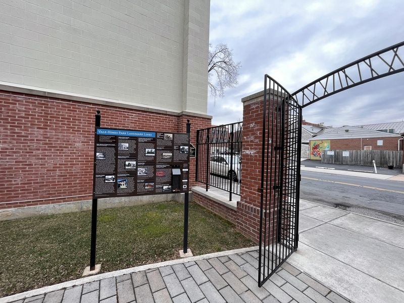
By Devry Becker Jones (CC0), February 25, 2023
Vale-Himes Park Landmark Lines Marker
301 ► Pennsylvania, Cumberland County, Carlisle — Vale-Himes Park Landmark Lines — A community park endowed in 2017 in memory of the Vale-Himes families. — Built by contributions of CCHS Members and Supporters —  |
| On North Pitt Street north of West High Street (U.S. 11), on the right when traveling north. | |||
| 302 ► Pennsylvania, Dauphin County, Duncannon, Clarks Ferry — The 7 Clarks Ferry Bridges — |
| On U.S. 22 south of Newport Road (Pennsylvania Route 849), on the right when traveling south. | |||
| 303 ► Pennsylvania, Dauphin County, Duncannon, Reed Township — Clark's Ferry Bridge Company — |
| On William Penn Highway (U.S. 22/322) at County Road 849, on the right when traveling south on William Penn Highway. | |||
| 304 ► Pennsylvania, Dauphin County, Harrisburg, Downtown Harrisburg — Camel Back Bridge — |
| On N. Front Street at Market Street on N. Front Street. | |||
| 305 ► Pennsylvania, Dauphin County, Harrisburg, Downtown Harrisburg — Camelback and Market Street Bridges — |
| On Market Street at Front Street on Market Street. | |||
| 306 ► Pennsylvania, Dauphin County, Harrisburg, Susquehanna Township — Roads — |
| Near Fort Hunter Road 0.1 miles east of North Front Street, on the right when traveling east. | |||
| 307 ► Pennsylvania, Dauphin County, Harrisburg, Susquehanna Township — The Everhart Covered Bridge — |
| On Fort Hunter Road 0.1 miles east of North Front Street, on the right when traveling east. | |||
| 308 ► Pennsylvania, Dauphin County, Loyalton, Washington Township — Henninger Farm Covered Bridge — |
| On Henninger Road 0.1 miles north of Matter Road, on the right when traveling south. | |||
| 309 ► Pennsylvania, Delaware County, Newtown Square, Newtown Township — Bartram Bridge — c. 1860 — The last remaining covered bridge in Delaware County, PA — |
| On Goshen Road at Boot Road, on the left when traveling west on Goshen Road. | |||
| 310 ► Pennsylvania, Greene County, Waynesburg, Greene Township — 224 — White Covered Bridge — |
| On Roberts Run Road (County Route 604) 0.2 miles south of Garards Fort Road (Pennsylvania Route 2011), on the left when traveling south. | |||
| 311 ► Pennsylvania, Juniata County, Port Royal, Beale Township — Academia / Pomeroy Covered Bridge — |
| On Covered Bridge Road at Mill Street on Covered Bridge Road. | |||
| 312 ► Pennsylvania, Lancaster County, Atglen — Mercer’s Mill Covered Bridge (1880) — East Octoraro #2 — |
| On Bailey Crossroads Road, on the left when traveling east. | |||
| 313 ► Pennsylvania, Lancaster County, Bird in Hand, Upper Leacock Township — Hunsecker Covered Bridge — |
| On Hunsecker Rd 0.5 miles west of Mondale Rd, on the right when traveling east. | |||
| 314 ► Pennsylvania, Lancaster County, Columbia — Columbia Bank & Bridge Company — |
| On Locust Street 0.1 miles east of North Front Street (Route 441), on the right when traveling west. | |||
| 315 ► Pennsylvania, Lancaster County, Columbia, West Hempfield Township — Forry's Mill Bridge (1869) — |
| On Bridge Valley Road 0.1 miles west of Miller Drive, on the right when traveling west. | |||
| 316 ► Pennsylvania, Lancaster County, Ephrata, West Earl Township — Zook's Mill Bridge — The Covered Bridges of Lancaster County, PA — |
| On Log Cabin Road just east of Rose Hill Road, on the right when traveling east. | |||
| 317 ► Pennsylvania, Lancaster County, Kirkwood — White Rock Forge Bridge (1884) — West Octoraro #2 — |
| On White Rock Road 0.1 miles east of King Pen Road, on the right when traveling west. | |||
| 318 ► Pennsylvania, Lancaster County, Lancaster, East Lampeter Township — The Willows Covered Bridge — Built c. 1855 — |
| Near Lincoln Highway (U.S. 30), on the right when traveling west. | |||
| 319 ► Pennsylvania, Lancaster County, Lancaster, West Lampeter Township — Kurtz's Mill Covered Bridge — |
| On Kiwanis Drive, on the right when traveling west. | |||
| 320 ► Pennsylvania, Lancaster County, Lancaster, West Lampeter Township — Neff's Mill Bridge (1875) — Pequea #7 — |
| On Penn Grant Road 0.1 miles east of Bridge Road, on the left when traveling east. | |||
| 321 ► Pennsylvania, Lancaster County, Lititz, Ephrata Township — Erb's Covered Bridge — Hammer Creek #1 — |
| On Erbs Bridge Road 0.2 miles north of Millway Road, on the right when traveling south. | |||
| 322 ► Pennsylvania, Lancaster County, Lititz, Ephrata Township — Keller's Mill Bridge — The Covered Bridges of Lancaster County, PA — |
| On Middle Creek Road 0.5 miles north of Rothsville Road, on the right when traveling north. | |||
| 323 ► Pennsylvania, Lancaster County, Lititz, Manheim Township — Pinetown Bridge — The Covered Bridges of Lancaster County, PA — |
| On Bridge Road just east of Pinetown Road, on the right when traveling west. | |||
| 324 ► Pennsylvania, Lancaster County, Manheim, Rapho Township — Kauffman's Distillery Bridge — Big Chiques #1 — |
| On West Sun Hill Road 0.1 miles south of Mount Joy Road (Pennsylvania Route 772), on the right when traveling south. | |||
| 325 ► Pennsylvania, Lancaster County, Manheim, Rapho Township — Shenk's Mill Bridge (1855) — |
| On Shenck Rd at Erisman Rd, on the left when traveling north on Shenck Rd. | |||
| 326 ► Pennsylvania, Lancaster County, Mount Joy, West Hempfield Township — Siegrist's Mill Bridge — The Covered Bridges of Lancaster County, PA — |
| On Siegrist Road 0.3 miles west of Farmdale Road, on the right when traveling north. | |||
| 327 ► Pennsylvania, Lancaster County, Neffsville, East Hempfield Township — Landis Mill Covered Bridge (1873) — Little Conestoga #1 — |
| On Shreiner Station Road, on the left when traveling east. | |||
| 328 ► Pennsylvania, Lancaster County, Paradise, Paradise Township — Leaman Place Bridge (1893) — Pequea #4 — |
| On North Belmont Road 0.1 miles north of Queen Road, on the right when traveling north. | |||
| 329 ► Pennsylvania, Lancaster County, Penn Township — Shearer's Covered Bridge — |
| On East Adele Avenue near Dead End when traveling east. | |||
| 330 ► Pennsylvania, Lancaster County, Pequea — Baumgardner's Mill Covered Bridge (1860) — Pequea #10 — |
| On Byerland Church Road near 88 Covered Bridge Road (Byerland Church Road), on the left when traveling south. | |||
| 331 ► Pennsylvania, Lancaster County, Pequea — Colemanville Covered Bridge — Pequea #12 — |
| On Fox Hollow Road 0.3 miles south of Pequea Boulevard (Pennsylvania Route 324), on the right when traveling south. | |||
| 332 ► Pennsylvania, Lancaster County, Pequea — York Furnace Bridge — |
| On Bridge Valley Rd 0.1 miles north of Lake Aldred Terrace, on the left when traveling south. | |||
| 333 ► Pennsylvania, Lancaster County, Quarryville — Jackson's Mill Bridge (1878) — West Octoraro #1 — |
| On Mount Pleasant Road at Hollow Road, on the right when traveling north on Mount Pleasant Road. | |||
| 334 ► Pennsylvania, Lancaster County, Stevens, East Cocalico Township — Bucher's Mill Covered Bridge (1881) — Cocalico #2 — |
| On Cocalico Creek Road (Local Road T746) just west of Cocalico Creek Road (Local Road T746). | |||
| 335 ► Pennsylvania, Lancaster County, Willow Street — Lime Valley Bridge (1871) — |
| On Brenneman Road 0.1 miles south of Lime Valley Road, on the right when traveling north. | |||
| 336 ► Pennsylvania, Lawrence County, McConnell's Mill — Covered Bridge — |
| On N. County Trail at McConnell's Mill Road, on the right when traveling south on N. County Trail. | |||
| 337 ► Pennsylvania, Mercer County, Greenville, Pymatuning Township — Kidd's Mill Covered Bridge — |
| On Reynolds Industrial Park Road (Pennsylvania Route SR 4012) at West Kidd's Mill Road, on the right when traveling east on Reynolds Industrial Park Road. | |||
| 338 ► Pennsylvania, Northampton County, Easton — Northampton Street Bridge — |
| Near Northampton Street east of Larry Holmes Drive ( Route 611), on the right when traveling east. | |||
| 339 ► Pennsylvania, Perry County, Duncannon — 6 — Clark's Ferry Bridge — Perry County Bicentennial — 1820 - 2020 — |
| On Cumberland Street at Water Street, on the left when traveling east on Cumberland Street. | |||
| 340 ► Pennsylvania, Perry County, Elliottsburg, Spring Township — Perry County Covered Bridges — Perry County Bicentennial — 1820 - 2020 — |
| Near Shermans Valley Road (Pennsylvania Route 274) 0.4 miles east of Veterans Way ( Route 74), on the right when traveling west. | |||
| 341 ► Pennsylvania, Perry County, Liverpool, Liverpool Township — Red Bridge — |
| On Red Bridge Road west of Sheaffer Road, on the right when traveling east. | |||
| 342 ► Pennsylvania, Philadelphia County, Philadelphia, Fairmount Park — Columbia Bridge — |
| On Schuylkill River Trail 0.4 miles north of Fountain Green Drive, on the right when traveling north. | |||
| 343 ► Pennsylvania, Philadelphia County, Philadelphia, Fitler Square — You Are Here, In the Year… — Schuylkill Banks |
| On Market Street (Pennsylvania Route 3) 0.1 miles east of Schuylkill Avenue, on the right when traveling east. Reported missing. | |||
| 344 ► Pennsylvania, Philadelphia County, Philadelphia, Roxborough — Park Directory — Wissahickon Valley Park — |
| On Wissahickon Bike Trail at Ridge Avenue (County Road 3009), on the left when traveling north on Wissahickon Bike Trail. | |||
| 345 ► Pennsylvania, Philadelphia County, Philadelphia, Wissahickon Valley Park — Park Directory — Wissahickon Valley Park — |
| On Forbidden Drive just south of Valley Green Road, on the left when traveling north. | |||
| 346 ► Pennsylvania, Philadelphia County, Philadelphia, Wissahickon Valley Park — Wissahickon Valley Park — Park Directory — |
| On Forbidden Drive north of Lincoln Drive, on the right when traveling north. | |||
| 347 ► Pennsylvania, Snyder County, Beaver Springs, Spring Township — Gross Bridge — (later known as Klinepeter Bridge) — |
| On Railroad Avenue just west of Center Avenue, on the left when traveling west. | |||
| 348 ► Pennsylvania, Somerset County, Fairhope — Somerset County Bridge No. 26 — |
| On Packsaddle Road (Local Route 407) 0.1 miles west of Pine Valley Road, on the right when traveling west. | |||
| 349 ► Pennsylvania, Somerset County, Lincoln Township — Walter's Mill Covered Bridge — |
| Near Somerset Pike. | |||
| 350 ► Pennsylvania, Somerset County, New Baltimore, Allegheny Township — Somerset County Bridge No. 5 • New Baltimore Covered Bridge — |
| On Town Hill Road at Water Street, on the left when traveling north on Town Hill Road. | |||
| 351 ► Pennsylvania, Somerset County, New Centerville, Middlecreek Township — History of the Barronvale Covered Bridge — |
| On Ream Road (Pennsylvania Route 3035) at Covered Bridge Road ( Route 3014), on the left when traveling east on Ream Road. | |||
| 352 ► Pennsylvania, Somerset County, New Centerville, Middlecreek Township — History of the Kings Covered Bridge — |
| On Scullton Road (Pennsylvania Route 653) 0.1 miles east of Ream Road ( Route 3035), on the right when traveling east. | |||
| 353 ► Pennsylvania, Somerset County, Shanksville, Stonycreek Township — Somerset County Bridge No. 65 — |
| On Covered Bridge Road (Local Route 565) 0.4 miles west of Lambertsville Road ( Route 1007), on the right when traveling west. | |||
| 354 ► Pennsylvania, Sullivan County, Forksville — 400 Acres: the Start of Forksville — |
| On Pennsylvania Route 87/154 at Route 87, on the right when traveling east on Pennsylvania Route 87/154. | |||
| 355 ► Pennsylvania, Sullivan County, Forksville — Forksville Covered Bridge — |
| On Bridge Street at Route 154, on the right when traveling west on Bridge Street. | |||
| 356 ► Pennsylvania, Union County, Mifflinburg — Hassenplug Bridge — Circa 1825 — |
| On 4th Street at Buffalo Creek, on the right when traveling north on 4th Street. | |||
| 357 ► Pennsylvania, Washington County, Avella — Pine Bank Covered Bridge — |
| Near Village Road 0.2 miles north of Meadowcroft Road, on the left when traveling north. | |||
| 358 ► Pennsylvania, Washington County, Burgettstown, Hanover Township — McClurg Covered Bridge - 1880 — |
| Near Municipal Drive south of Steubenville Pike, on the left when traveling south. | |||
| 359 ► Pennsylvania, York County, Wrightsville — Burning the Wrightsville Bridge — River Towns - Civil War Trails |
| On Walnut Street at North Front Street, on the right when traveling west on Walnut Street. Reported permanently removed. | |||
| 360 ► Pennsylvania, York County, Wrightsville — Necessary Destruction — Burning the Wrightsville Bridge — |
| On Walnut Street 0.1 miles east of North Front Street, on the left when traveling east. | |||
| 361 ► Pennsylvania, York County, York, Lower Windsor Township — Crossing the River — The Key to the West — |
| On Samuel Lewis State Park west of Mount Pisgah Road, on the left when traveling west. | |||
| 362 ► South Carolina, Greenville County, Landrum — 23-25 — Campbell’s Covered Bridge — |
| On Campbell Covered Bridge Road. | |||
| 363 ► South Carolina, Greenville County, Landrum — Campbell's Covered Bridge — |
| Near Campbell Covered Bridge Road. | |||
| 364 ► South Carolina, Greenville County, Landrum — Campbell's Covered Bridge — A Tribute to Stella (1921-2004) — |
| Near County Road 114. | |||
| 365 ► South Carolina, Richland County, Columbia, Riverbanks Zoo and Garden — A Bridge to the Past — |
| Near Wildlife Parkway. | |||
| 366 ► South Carolina, Richland County, Columbia, Saluda Riverwalk — Old Saluda River Bridge — |
| Near Candi Lane west of Greystone Boulevard, on the left when traveling west. | |||
| 367 ► South Carolina, Spartanburg County, Gowensville — Cherokee Foothills — National Scenic Byway — |
| On Cherokee Foothills Scenic Highway (State Highway 11) at New Cut Road, on the right when traveling east on Cherokee Foothills Scenic Highway. | |||
| 368 ► South Dakota, Fall River County, Edgemont — Edgemont Covered Bridge — |
| On 2nd Avenue (South Dakota Route 471) north of G Street, on the right when traveling north. | |||
| 369 ► Tennessee, Carter County, Elizabethton — 1A 62 — Covered Bridge — |
| On South Riverside Drive at 3rd Street, on the right when traveling north on South Riverside Drive. | |||
| 370 ► Tennessee, Carter County, Elizabethton — 22 — The Covered Bridge — Elizabethton Walking Tour — |
| On South Riverside Drive at Hattie Avenue, on the right when traveling north on South Riverside Drive. | |||
| 371 ► Tennessee, Carter County, Hampton — ET&WNC Railroad Covered Bridge |
| Near U.S. 19E 0.1 miles south of Spring Street, on the right when traveling south. Reported missing. | |||
| 372 ► Tennessee, Greene County, Midway — Bible Covered Bridge — |
| On Warrensburg Road at Bible Branch Road, on the right when traveling west on Warrensburg Road. | |||
| 373 ► Tennessee, Sevier County, Pittman Center — Emerts Cove Covered Bridge — |
| On Hills Creek Road at Price Cove Road, on the right when traveling west on Hills Creek Road. | |||
| 374 ► Tennessee, Sevier County, Sevierville — Harrisburg Covered Bridge — |
| On Old Covered Bridge Road at Harrisburg Road, on the right when traveling west on Old Covered Bridge Road. | |||
| 375 ► Tennessee, Sevier County, Sevierville — Harrisburg Covered Bridge — |
| On Harrisburg Road at Old Covered Bridge Road, in the median on Harrisburg Road. | |||
| 376 ► Tennessee, Sevier County, Sevierville — 1C 55 — Harrisburg Covered Bridge — |
| On Old Covered Bridge Road at Harrisburg Road on Old Covered Bridge Road. | |||
| 377 ► Tennessee, Williamson County, Franklin — Ash Grove — |
| On Old Natchez Trace just south of Sneed Road West, on the left when traveling south. | |||
| 378 ► Vermont, Bennington County, Bennington, North Bennington — Henry Covered Bridge — across the Walloomsac River — |
| On Murphy Road near Ore Bed Road, on the left when traveling north. | |||
| 379 ► Vermont, Bennington County, Bennington, North Bennington — Paper Mill History / Covered Bridges Span Rivers And Time — |
| On Murphy Road 0.1 miles south of N Bennington Road (Vermont Route 67A), on the left when traveling north. | |||
| 380 ► Vermont, Bennington County, Sunderland, Arlington — Chiselville — |
| On Sunderland Hill Road, on the right when traveling north. | |||
| 381 ► Vermont, Caledonia County, Danville — Greenbank's Hollow — A Forgotten Village — |
| On Greenbanks Hollow Road at Brook Road, on the right when traveling south on Greenbanks Hollow Road. | |||
| 382 ► Vermont, Chittenden County, Charlotte — Holmes Creek Bridge — |
| On Lake Road 0.2 miles north of Holmes Road, on the right when traveling north. | |||
| 383 ► Vermont, Chittenden County, Charlotte — Quinlan Bridge — |
| On Monkton Road at Spear Street, on the right when traveling south on Monkton Road. | |||
| 384 ► Vermont, Chittenden County, Shelburne — Covered Bridge — 1845 • Cambridge, Vermont • Moved to Museum: 1950-1951 — |
| Near Shelburne Road. | |||
| 385 ► Vermont, Franklin County, Montgomery — Hectorville Covered Bridge — |
| On Gibou Road 0.1 miles west of South Main Street (Vermont Route 118), on the left when traveling west. | |||
| 386 ► Vermont, Franklin County, Montgomery, East Berkshire — Fuller Covered Bridge — |
| On Fuller Bridge Road at Black Falls Road, on the right when traveling north on Fuller Bridge Road. | |||
| 387 ► Vermont, Franklin County, Montgomery, Enosburg Falls — Longley Covered Bridge — |
| On Rt 118 at Route 118, on the left when traveling north on Rt 118. | |||
| 388 ► Vermont, Franklin County, Montgomery, Montgomery Center — Comstock Covered Bridge — |
| On Comstock Bridge Road, on the left when traveling west. | |||
| 389 ► Vermont, Lamoille County, Cambridge, Jeffersonville — Cambridge Junction Bridge — |
| On Cambridge Junction Road 0.1 miles north of Grand Army of the Republic Highway (State Route 15), on the left when traveling north. | |||
| 390 ► Vermont, Lamoille County, Hardwick — Fisher Bridge — Wolcott, Vermont — |
| On Vermont Route 15, on the right when traveling east. | |||
| 391 ► Vermont, Lamoille County, Stowe — Gold Brook Covered Bridge — |
| On Covered Bridge Road north of Stowe Hollow Road, on the left when traveling north. | |||
| 392 ► Vermont, Rutland County, Clarendon, North Clarendon — Kingsley Grist Mill — |
| On Gorge Road at East Street on Gorge Road. | |||
| 393 ► Vermont, Rutland County, Pittsford — Hammond Covered Bridge — |
| On Kendall Hill Road 0.7 miles west of Franklin Street (U.S. 7), on the right when traveling west. | |||
| 394 ► Vermont, Rutland County, Shrewsbury, Cuttingsville — Brown Bridge — |
| On Upper Cold River Road 0.1 miles east of Cold River Road, on the left when traveling east. | |||
| 395 ► Vermont, Windsor County, Springfield — Eureka Schoolhouse & Baltimore Covered Bridge — |
| On Vermont Route 11 just east of Perley Gordon Road, on the left when traveling east. | |||
| 396 ► Vermont, Windsor County, Woodstock, Taftsville — Taftsville Covered Bridge — |
| On Covered Bridge Road at Happy Valley Road on Covered Bridge Road. | |||
| 397 ► Virginia, Patrick County, Woolwine — Jacks Creek Covered Bridge — |
| Near Jacks Creek Road (State Road 615) 0.1 miles west of Woolwine Highway (State Road 8), on the right when traveling west. | |||
| 398 ► Virginia, Patrick County, Woolwine — Jack's Creek Covered Bridge — |
| On Jacks Creek Road, on the right when traveling west. | |||
| 399 ► Virginia, Patrick County, Woolwine — Our Historic Covered Bridges — |
| On Jacks Creek Road, on the right when traveling west. | |||
| 400 ► Virginia, Rockingham County, Port Republic — North River Bridge — Covered bridge instrumental in Valley Campaign |
| Near The Point Street at Main Street, on the right when traveling north. Reported permanently removed. | |||
427 entries matched your criteria. Entries 301 through 400 are listed above. ⊲ Previous 100 — The final 27 ⊳