The U.S. Naval Ammunition Depot, known locally as "the NAD," was the largest of the navy's World War II inland munitions depots, occupying almost 49,000 acres of Adams and Clay County farmland. Construction began in July 1942; loading, assembly, and . . . — — Map (db m78005) HM
A marker, 200 feet to the south, recalls the death of White Buffalo Girl of the Ponca tribe. The death of this child, daughter of Black Elk and Moon Hawk, symbolizes the tragic 1877 removal of the Ponca from their homeland on the Niobrara River to . . . — — Map (db m182053) HM
With the establishment of the Neligh Mill and the platting of the town of Neligh, a crossing of the Elkhorn River here aided farm-to-market commerce. This bridge, built in 1910, replaced an earlier span at this location. It is a pin-connected Pratt . . . — — Map (db m158998) HM
The Neligh Mills, built from locally fired brick in 1873 by John D. Neligh, was the first business and industry in the then newly platted town. Later owners and operators of the mill included William C. Galloway, Stephen F. Gilman and J. W. Spirk. . . . — — Map (db m159000) HM
The Prairie States Forestry Project was initiated by President Franklin D. Roosevelt in 1935 to combat the severe wind-caused soil erosion of the Dust Bowl days. From 1935 through 1942, the U.S. Forest Service, working with the Works Progress . . . — — Map (db m9633) HM
The invention of mechanical balers in the mid-1800s led to the use of bales of hay or straw as building blocks. Pioneer builders developed structural bale walls using cuttings of either native prairie flora — baled-hay — or of agricultural waste, . . . — — Map (db m223422) HM
Logan Fontenelle, an interpreter and Omaha chief, was born at Bellevue in May, 1825. His father was Lucien Fontenelle, a noted fur trader both on the lower Missouri River and near Fort Laramie, Wyoming. His mother was a daughter of Big Elk, noted . . . — — Map (db m179377) HM
For more than ten thousand years the Beaver Valley and surrounding prairie, with their abundant water and wildlife, nurtured Native Americans. The Pawnee Indians, whose permanent earthlodge villages were a few miles to the south, claimed this area . . . — — Map (db m181373) HM
In the spring of 1942 the U.S. Army selected a site one mile south of here for an airfield. The dry climate and open landscape afforded ideal flying conditions. Ample water, cheap land, and Alliance’s new power plant, new hospital, and railroad . . . — — Map (db m178807) HM
By the mid-1880s the Sandhills had become an important cattle-raising region. The extension of the Burlington and Missouri Railroad westward through the Sandhills in 1877-1888 made ranching more profitable by making more accessible eastern markets. . . . — — Map (db m178801) HM
A flat-topped hill to the southeast was named Box Butte by early cowboys and travelers. This area is part of the Box Butte Tableland, semi-arid short grass country that stretches far to the west.
Box Butte has given its name to the creek that flows . . . — — Map (db m89342) HM
On this day the Lewis and Clark Expedition to the Pacific Ocean camped on the bank of the Missouri River at the base of a river landmark near here, now called The Tower. Clark wrote, “Capt Lewis & my Self walked up to the top which forms a Cone and . . . — — Map (db m181800) HM
On August 3, 1944, a C-47 transport carrying twenty-eight men of the U.S. Army Air Forces crashed in a ravine six miles southwest of Naper during a severe storm. There were no survivors. It was the largest single military air disaster in Nebraska . . . — — Map (db m70623) HM
Ainsworth Army Air Field, completed on November 30, 1942, was a satellite of Rapid City Army Air Field and under command of the Second Air Force. The field was one of eleven Army Air Force training bases built in Nebraska during World War II. The . . . — — Map (db m77760) HM
Lakeland High School was constructed 20 miles south of this site by ranchers from several rural school districts during the summer of 1934. School began that September with 11 students. Constructed of prairie sod, with a sod roof supported by pole . . . — — Map (db m9623) HM
Like many Nebraska communities, Long Pine's history is tied to railroad development. When the Fremont, Elkhorn, and Missouri Valley line arrived in 1881, Long Pine became a bustling railroad town. The Chicago & North Western Railroad (CNW) built a . . . — — Map (db m182061) HM
Through this valley passed the Oregon Trail, highway for early explorers, fur traders, California-bound gold seekers, freighters, and brave pioneers seeking new homes in the West. Traffic was especially heavy from 1843 to 1866. At times as many as . . . — — Map (db m45521) HM
Gibbon, on the old Mormon Trail, was the site of a unique experiment in homestead colonization. Originally conceived as a financial venture by Colonel John Thorp of Ohio, the Soldier's Free Homestead Colony was responsible for bringing the first . . . — — Map (db m79880) HM
Gibbon, near here, was the site of a unique experiment in homestead colonization. The Soldiers' Free Homestead Temperance Colony was responsible for bringing the earliest settlers, mostly Union veterans, to this locality. Traveling via the Union . . . — — Map (db m79716) HM
James E. Boyd settled near here in 1858 and by 1860 operated a trail ranche supplying travelers on the Platte Valley Overland Route (Mormon Trail). The ranche included 2200 acres of corn and barley. Nebraska Centre Post Office was here until it was . . . — — Map (db m45425) HM
The Lincoln Highway Association was founded in 1913 to promote a transcontinental automobile route from new York City to San Francisco. Dedicated on October 31, 1913, the route was marked by the letter “L” within red, white, and blue . . . — — Map (db m45520) HM
In 1847 Brigham Young led the first migration over the Mormon Trail along the north bank of the Platte River, and in 1866 the Union Pacific Railroad pushed its main line westward to this valley, bringing pioneer settlers. However, it was not until . . . — — Map (db m45427) HM
In the late 1880's, Kearney business leaders envisioned the city as a major manufacturing center. The Kearney Cotton Mill was among the many enterprises launched as part of this venture, which included paper, woolen, and oatmeal mills; plow and . . . — — Map (db m101852) HM
West-bound travelers will leave the prairie regions of eastern Nebraska and
enter the Great Plains the next within fifty miles. This semi-arid region stretching from Canada to Mexico and westward toward the Rockies was long known
as the Great . . . — — Map (db m228360) HM
The trail which followed the south side of the Platte River was the main route to Oregon and California. Fur traders going to the Rocky Mountains took the first wagons over the trail in 1830. Oregon-bound missionaries followed in the mid-1830s, and . . . — — Map (db m53268) HM
In 1888, H. D. Watson established the historic Watson Ranch, at one time containing 8,000 acres, reaching from the fertile Platte Valley on the south to the rolling hills on the north and from downtown Kearney to a point five miles west.
. . . — — Map (db m101853) HM
In 1903 the legislature appropriated $50,000 to establish a state normal school in central or western Nebraska. After 111 ballots, the State Board of Education chose Kearney as the site. The city donated twenty acres on the west edge of town for a . . . — — Map (db m45500) HM
From 1934 to 1939, Companies 2741 and 2732 of the Civilian Conservation Corps occupied a camp near this site. Barracks housed about 200 men, ages 18 to 25, who built soil conservation dams and planted shelterbelts on nearby farms. The camp moved to . . . — — Map (db m181771) HM
On the South Loup River southwest of here was the site of the U.S. Army’s Post South Loup Fork. This small outpost of Fort Kearney was established in May 1865 by Company “E”, Seventh Iowa Cavalry, under the command of Capt. James B. David and . . . — — Map (db m181699) HM
In April 1860 Joseph E. Johnson, a Mormon, established a road ranche at Wood River Center, today’s Shelton, and began publishing The Huntsman’s Echo, the first newspaper in Nebraska west of Omaha. He had earlier edited papers in Council Bluffs, . . . — — Map (db m45423) HM
Moses Shinn and his son Dick began operating Shinn's Ferry across the Platte in 1859. The original site was near Savannah, the first Butler County seat, and a short distance from the present Schuyler bridge. Just above this location the Platte was . . . — — Map (db m39143) HM
"Love is more like a light that you carry .... that is what love is to a woman - a lantern in her hand," says Abbie Deal the courageous heroine in Bess Streeter Aldrich's novel about the pioneers who with dreams and hard work forged this great . . . — — Map (db m82510) HM
When the outbreak of war between the states became imminent in the spring of 1861, the citizens of Plattsmouth were quick to respond to the impending crisis. Without waiting for President Lincoln's call for volunteers, Dr. Robert R. Livingston . . . — — Map (db m78024) HM
This building was constructed by community effort in 1871 of native limestone as the Congregational Church and served in that capacity until a new brick church was constructed 1887-1890. The nearby stone parsonage, first occupied in 1867, was sold . . . — — Map (db m82521) HM
During their exploration of the Missouri and Columbia Rivers, Lewis and Clark held councils with Ponca, Omaha, and Sioux Indians inhabiting this region. The council with the Sioux occurred August 28-31, 1804 at Calumet Bluff now the southern . . . — — Map (db m101395) HM
This scenic overlook provides a clear view of the valley of the Missouri River,
the longest waterway in North America. To the west is the Gavins Point Dam and
the Lewis and Clark Recreation Area. The dam was built to harness the fury of
the . . . — — Map (db m101391) HM
Much of the early history of Cedar County involves the Indian inhabitants, the Ponca, Omaha, and Sioux. Several prehistoric and historic Indian villages were located in the region. In 1804, Lewis and Clark ascended the Missouri River near here . . . — — Map (db m181311) HM
This marker, dedicated on the 100th anniversary of Hartington High School, June 25, 1988, is in honor of two graduates who became governors of Nebraska. Dwight Burney, born in 1892, graduated from Hartington High School in 1910. Burney attended . . . — — Map (db m181317) HM
Champion, on the Frenchman River (Creek), is the site of probably the oldest functioning water-powered mill in Nebraska. Preliminary construction on the mill was begun in the fall of 1886. The work was completed and the mill placed in operation by . . . — — Map (db m79376) HM
The first ranch in this area was set up on the Niobrara River about five miles south of here in 1877. E. S. Newman established his ranch to sell cattle to the government for delivery to the Indians at the Pine Ridge Agency to the north.
The . . . — — Map (db m9622) HM
This natural valley extending east and west across the Sandhills became known as Survey Valley after the Burlington and Missouri River Railroad surveyed a prospective line from O’Neill to Alliance in 1887. No rails were ever laid. On January 19, . . . — — Map (db m178711) HM
This arched cantilever truss bridge, connected in the center with a single pin, is the only one of its kind in the United States. It was built in 1932 by the Department of Public Works and named by the local citizenry in honor of Governor Charles . . . — — Map (db m70625) HM
When a Sioux Indian reservation was established north of here in Dakota Territory in 1878, early settlers in the region grew fearful of attack. They requested military protection, and in 1880 Fort Niobrara was built a few miles east of present-day . . . — — Map (db m77753) HM
At 10:45 a.m. on February 5, 1944, 1st Lt. John B. Beatty of Sandusky, OH, and 2d Lt. Earnest W. Fanslau of Mantua, NJ took to the air from the Ainsworth Army Air Field in two P-47 "Thunderbolt" fighter planes for an instrument training flight. Lt. . . . — — Map (db m77754) HM
On August 9, 1949, the first successful oil well in western Nebraska came in for 225 barrels of oil per day at a total depth of 4,429 feet. Marathon Oil Co. completed the discovery well, Mary Egging No.1, located four miles east and two miles . . . — — Map (db m223425) HM
On June 1, 1926, George A. Coulter completed one of the first four irrigation wells in Cheyenne County, among the earliest in western Nebraska, on his farm just south of here. He and his son, James, dug the first twenty-two feet by hand. Charles . . . — — Map (db m231142) HM
Potter began as a small Union Pacific Railroad settlement and depot midway between Kimball and Sidney. The station house was built by Union Pacific in 1870 and, as the only building in the settlement, also served as the post office and school. Its . . . — — Map (db m231144) HM
Cheyenne County was organized in 1870 from lands ceded by the Cheyenne, Arapaho, and Dakota Sioux Indians. In the panhandle of Nebraska, it is part of the Cheyenne tableland portion of the Great Plains. Some fifteen miles west of Sidney lies the . . . — — Map (db m231054) HM
Sidney Barracks, when established in 1867, was a temporary camp with one permanent structure, a blockhouse located to the north. In 1869 the Fort was relocated at this site and in 1870 the name was officially changed to Fort Sidney. The primary . . . — — Map (db m76864) HM
A distinct group of prehistoric hunter-gatherers known to archeologists as the Oxbow Complex once occupied the northern High Plains from western Nebraska to southern Canada. About 2500 B.C. a band of Oxbow people interred two of their own near . . . — — Map (db m231081) HM
In 1867 an Army tent camp was established near here to provide protection for Union Pacific Railroad construction crews. Three years later it became Fort Sidney, the nucleus for the town of Sidney, county seat of Cheyenne County. The rush to the . . . — — Map (db m231061) HM
Gold was discovered in the Black Hills in August, 1874. By the spring of 1876, the Army had stopped enforcing a treaty which reserved the hills for the Sioux Indians. Miners soon began to pour into the gold regions. From 1875 to 1881, the . . . — — Map (db m231079) HM
Sioux Army Depot was established on 23 March 1942 as Sioux Ordnance Depot. It was the only U.S. Army Ammunition Depot in Nebraska during World War II, the Korean War, and the Vietnam War. The depot was initially under the command of the U.S. Army . . . — — Map (db m76863) HM
The first permanent settler in the town of Sutton was Luther French, who arrived in 1870. He and his seven children lived near here in a dugout on the bank of School Creek. This dugout had a tunnel to the creek bank and the inside entrance could be . . . — — Map (db m78007) HM
On March 27, 1879, George G. Meade Post 19, Grand Army of the Republic, Department of Nebraska, was founded in Sutton by twenty former Union soldiers. The G.A.R. was a national fraternal organization created to provide for the welfare of Union . . . — — Map (db m78006) HM WM
By the early 1600s, the ancestors of the Pawnee Nation began consolidating into a few large communities. Each was home to hundreds, if not thousands, of people. Some of these were built along nearby Shell Creek. These Shell Creek cities may have . . . — — Map (db m179394) HM
John Gneisenau Neihardt (1881-1973), teacher, philosopher, and Nebraska Poet Laureate, moved to Bancroft in 1900. Here he first became acquainted with Indians, married, and began his major work, A Cycle of the West, a five-part epic poem . . . — — Map (db m161558) HM
The building was erected on this site in
the 1890s for August Hartman and used as a
residence by various owners until 1964. Poet
John G. Neihardt rented the building from
1911 through 1920 for a study. Here he wrote
his lyrics, prose, and part . . . — — Map (db m161556) HM
Anselmo began as a railroad town along the Burlington and Missouri River Railroad. The Burlington needed a stop for water, coal, and switching facilities. It built a depot, and the town itself was platted in November 1886. A Lincoln Land Company . . . — — Map (db m223426) HM
A discarded Indian bow suggested the name for a town. Wilson Hewitt, an early homesteader, had applied for the location of a post office on his place. Approving the location, the government rejected Hewitt's first three suggested names as being too . . . — — Map (db m77816) HM
Broken Bow was platted 1882 by Jesse Gandy. He donated lots to people who would build a house or establish a business. He did this to influence voters to make the new town the Custer County seat, which they did in an election that fall. The . . . — — Map (db m180947) HM
The National Grange of the Patrons of Husbandry was organized in Washington, D.C. in 1867. During the 1870's, it was the major voice of the American farmer and its social, educational, and fraternal activities brightened farm life. "Granger Laws", . . . — — Map (db m77761) HM
Custer County, named in memory of General George Armstrong Custer, was organized July 27, 1877. Frontiersmen and pioneer ranchers had been living in the area since 1872. Earlier, soldiers from Fort McPherson and settlers from the Platte River . . . — — Map (db m179199) HM
The first Etna post office (1885-1895) was located three miles to the northwest. A new post office operated 1.5 miles east until 1921. In 1907 Etna saw the opening of a school, store, and telephone exchange. The store was enlarged by Andrew . . . — — Map (db m181798) HM
Westerville, nestled in picturesque Clear Creek Valley, was the first town in Custer County. It was named for James H. Westervelt on whose land the townsite was platted August 11, 1880. The town became an important early trade center after pioneer . . . — — Map (db m77819) HM
Here stands the first Lutheran church building constructed in Nebraska. It has occupied this site since 1860. The congregation was first served by Reverend Henry W. Kuhns, a missionary sent by the Allegheny Synod to Nebraska Territory. Kuhns . . . — — Map (db m206698) HM
An important Omaha Indian village called Tonwantonga (Large Village) by the Omaha stood on Omaha Creek in this area. Ruled by the great chief Blackbird, an estimated 1,100 people lived in this earthlodge town about 1795 and it played an important . . . — — Map (db m206966) HM
When the Lewis and Clark Expedition to the Pacific Ocean went through this area their mood was undoubtedly gloomy. On the previous day they had buried their comrade, Sergeant Charles Floyd, who died of a ruptured appendix. Although he was the . . . — — Map (db m206919) HM
About 1½ miles north of this spot is the abandoned site of "Old St. John's," one of the first towns established in Dakota County. The townsite was settled on June 2, 1856, by the Father Trecy Colony — sixty people, with eighteen ox-drawn covered . . . — — Map (db m158996) HM
From about 1846 until 1872, an Indian "trading house" occupied a site near here. Built by James Bordeaux, the trading station was once attacked and set afire by hostile Crow warriors. Fortunately, some friendly Sioux Indians came to the rescue and . . . — — Map (db m4529) HM
Chadron was selected as the site of the fourth Nebraska State Normal School on January 8, 1910, and located on the grounds of the former Chadron Congregational Academy. Classes began in the summer of 1911, concluding with the dedication of the . . . — — Map (db m234618) HM
America’s longest horse race began here June 13, 1893. The 1,000 mile race ended June 27 in Chicago at Buffalo Bill’s Wild West Show. The race apparently was the idea of Chadron jokester John G. Maher. Seven of nine riders finished, some traveling . . . — — Map (db m51693) HM
Shortly after the townsite of Chadron was selected on August 1, 1885, the Reverend Harmon Bross, a Congregational missionary, conducted the first worship service in the fledgling community. For a time services were held in the open air or in tents. . . . — — Map (db m234613) HM
From about 1837 until 1850, more than a quarter million buffalo robes bought from Indians and 27 tons of fur company trade goods were hauled over the 300 mile long Fort Pierre-Fort Laramie Trail that followed the White River through this area. First . . . — — Map (db m4530) HM
During the 1887 expansion of Fort Robinson six adobe barracks were built on the south side of the parade ground. Later two frame barracks were added. Each building had a dormitory area 170 by 30 feet, a kitchen wing 70 by 30 feet, and housed a . . . — — Map (db m223428) HM
These duplex officers' quarters, of adobe brick construction, were completed in 1887 when Fort Robinson became a cavalry regimental headquarters. This structure has been restored by by the Nebraska State Historical Society, and furnishings . . . — — Map (db m223431) HM
Black soldiers of the Ninth and Tenth Cavalry regiments (called "buffalo soldiers" by the Plains Indians) garrisoned Fort Robinson for eighteen years and played an important role in northwestern Nebraska's history. Organized in 1866, the regiments . . . — — Map (db m174269) HM
Crawford sprang up as a tent city on land owned by homesteader/newspaper correspondent William E. Annin in 1886 when the Fremont, Elkhorn and Missouri Valley Railroad pushed through the Nebraska Panhandle. To Incorporate the town, editor William . . . — — Map (db m44254) HM
Crawford’s first High School building was erected with locally fired brick in 1890 at an approximate cost of $25,000. This bell was installed in the belfry the following year. During the structure’s demolition in 1956, citizens stealthily . . . — — Map (db m235898) HM
After escaping from Fort Robinson on January 9, 1879, the Cheyennes climbed the buttes to the south and fled through this area, pursued by Third Cavalrymen. Soldiers and Cheyennes fought sharp engagements west of here on January 11 and 13. The . . . — — Map (db m235873) HM
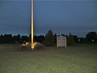
This flagstaff, 105 feet high, is constructed of metal pipe with a ladder and crow's nest for buglers. It was originally on the other side of the 1905 headquarters near the highway, having replaced an earlier flagstaff blown
down by an 1889 . . . — — Map (db m223432) HM
In March, 1874, the U.S. Government authorized the establishment of a military camp at the Red Cloud Indian Agency on the White River. Home of some 13,000 Indians, many of whom were hostile, the Agency was one of the most troublesome spots on the . . . — — Map (db m173982) HM
On January 20, 1885. Congress granted the
Fremont, Elkhorn and Missouri Valley Railroad
a right-of-way through the Fort Robinson Military
Reservation. Later this line was acquired by the
Chicago and North Western. With direct rail access
in . . . — — Map (db m223433) HM
This camp, constructed to house three thousand men, received the first German prisoners of war in June 1943. Most of the soldiers were members of the Afrika Korps. The prisoners were allowed to work on farms and ranches in the area and
received a . . . — — Map (db m223434) WM
In September 1942 the Fort Robinson War Dog Training Center was established. Barracks, classrooms, administrative offices, and other support buildings were located west and north of here. To the east and north was a sprawling kennel area housing . . . — — Map (db m223435) HM
Consisting of four double sets and one single
occupancy dwelling for the post commander,
these were the last officers' homes constructed
at Fort Robinson. They represent the culmination
of Victorian military architecture, with fancy
fireplaces . . . — — Map (db m223437) HM
The Post Headquarters was constructed in 1905. The Post Commander's office was located here, along with other administrative offices, post office, and the Fort's telephone exchange. An ornate auditorium on the second floor was often used for parties . . . — — Map (db m223439) HM
The stone monument at this location is one of Nebraska's original bench marks.
Surveyors use bench marks to determine elevations. This one was placed by the U.S. Coast & Geodetic Survey in 1902. It was part of a larger project in which a . . . — — Map (db m223449) HM
The Chief of Fort Robinson Scouts, Baptiste “Little Bat” Garnier was shot by James Haguewood, bartender, in this building known as Dietrich’s Saloon, December 16, 1900. “Little Bat” died near the center of the street intersection about 3 a.m. and . . . — — Map (db m235888) HM
Just before 10 P. M. on January 9, 1879,
the 130 Cheyennes held in the cavalry barracks
made their desperate bid for freedom. After
disabling the soldier guards, they fled across
this ground to the White River beyond. Under
heavy fire from . . . — — Map (db m223442) HM WM
Perhaps no spot in Nebraska is so surrounded by historical and geographical landmarks as this one. Numerous landmarks of the period of the Indian Wars are visible from here. The site of a legendary battle between the Sioux and Crow Indians, Crow . . . — — Map (db m135118) HM
In September 1875 a lone cottonwood provided a landmark where the Allison Commission met with thousands of Lakota Sioux in a futile effort to buy the Black Hills. Based on the recollections of elderly Lakotas, Captain Christopher Robinson Chapter, . . . — — Map (db m235900) HM
Here in Dawson county, much of the early history is concerned with the pioneer trails to the west. The Mormon Trail to Utah and the first transcontinental railroad passed through here on the north side of the Platte River; the Oregon Trail and the . . . — — Map (db m68060) HM
Here in Dawson County, much of the early history is concerned with the pioneer trails to the west. The Mormon Trail to Utah and the first transcontinental railroad passed through here on the north side of the Platte River; the Oregon Trail and the . . . — — Map (db m228354) HM
The 100th longitudinal line west of Greenwich was the major goal set by Congress in building the first transcontinental railroad.
Construction of the Union Pacific track reached the Meridian on October 5, 1866.
To celebrate this record-breaking . . . — — Map (db m123869) HM
One of the many Swedish settlements in Nebraska during the late nineteenth century was north of Gothenburg in northwestern Dawson County. An enduring symbol of this settlement is Swedish Crosses Cemetery, where three children of Mr. and Mrs. Berg . . . — — Map (db m62797) HM
Railroads played an important role in the settlement of the Great Plains. Their construction was particularly damaging to the Indian way of life, since railroads helped the military to patrol rapidly along their lines, and villages and farming . . . — — Map (db m101854) HM
The history of Big Springs, northeast of here, has been closely associated with the Union Pacific Railroad since 1867, when a station was established at that point. A nearby spring, from which the station derived its name, provided an . . . — — Map (db m68069) HM
Julesburg, Colorado, visible to the southwest, was
established as a road ranche, trading post, and stage
station in 1859. Located near the junction of several
overland routes, Old Julesburg became an important
transportation and military . . . — — Map (db m228355) HM
The Phelps Hotel was built in 1885 by the Edwin A. Phelps family, who were among the first settlers in the Big Springs area. Also known as the “House of Three Chimneys,” the hotel was the most important nineteenth-century landmark in . . . — — Map (db m51249) HM
374 entries matched your criteria. The first 100 are listed above. Next 100 ⊳