475 entries match your criteria. The first 100 are listed. ⊳
Canada, Historic Sites and Monuments Board Historical Markers
Mandated to advise the Government of Canada, through the Minister of the Environment, on the commemoration of nationally significant aspects of Canada's history, the Board authorizes Parks Canada to install plaques inscribed with a bilingual text describing the historic significance of the subject. They are sometimes also written in a third language, particularly when the commemorated subject is linked to the history of Aboriginal peoples or ethnocultural communities.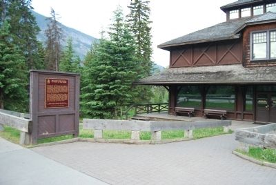
By Dawn Bowen, July 2, 2008
Wideview of Banff Park Museum Marker
| 1 ► Alberta, Banff National Park, Banff — Banff Park Museum — |
| On Banff Avenue, on the right when traveling south. | |||
| 2 ► Alberta, Banff National Park, Banff — Banff Springs Hotel — L'Hôtel Banff Springs — |
| On Spray Avenue, 0.3 kilometers south of Rundle Avenue, on the right. | |||
| 3 ► Alberta, Banff National Park, Banff — John Murray Gibbon — 1875-1952 — |
| Near Saint Julien Way. | |||
| 4 ► Alberta, Banff National Park, Banff — Sulphur Mountain Cosmic Ray Station — La Station d'étude des Rayons Cosmiques du Mont Sulphur — |
| 5 ► Alberta, Banff National Park, Banff — The Cave and Basin — |
| Near Cave Avenue, 1.4 kilometers west of Banff Avenue. | |||
| 6 ► Alberta, Calgary Metropolitan Region, Calgary — Mewata Armoury / Le manege militaire Mewata — |
| On 11 Street Southwest at 8 Avenue Southwest, on the right when traveling south on 11 Street Southwest. | |||
| 7 ► Alberta, Calgary Metropolitan Region, Calgary, Beltline — Rt. Hon. Richard Bedford Bennett — 1870-1947 — |
| On 13 Avenue Southwest just west of 2 Street Southwest, on the right when traveling west. | |||
| 8 ► Alberta, Calgary Metropolitan Region, Calgary, Downtown Commercial — Calgary City Hall / Hôtel de ville de Calgary — |
| On Macleod Trail Southeast just south of 7 Avenue Southeast, on the right when traveling north. | |||
| 9 ► Alberta, Calgary Metropolitan Region, Calgary, Downtown Commercial — Stephen Avenue / L'avenue Stephen — |
| On 8 Avenue Southwest (Stephen Avenue) west of Centre Street South, on the right when traveling west. | |||
| 10 ► Alberta, Calgary Metropolitan Region, Calgary, Downtown Commercial — The Palace Theatre / Le Théâtre Palace — |
| On 8 Avenue Southwest west of 1st Street Southwest, on the left when traveling west. | |||
| 11 ► Alberta, Cypress County, Medicine Hat — St. Patrick's Roman Catholic Church / L'Église Catholique St. Patrick — |
| On 2 Street Northeast just west of 2 Avenue Northeast, on the right when traveling west. | |||
| 12 ► Alberta, Edmonton Metropolitan Region, Edmonton — Creation of the Province of Alberta / Création de la province d'Alberta — |
| On Legislature Building Road Northwest just west of 107 Street Northwest, on the right when traveling west. | |||
| 13 ► Alberta, Edmonton Metropolitan Region, Edmonton, North Central Edmonton — John Rowand — 1787-1854 — |
| Near Fortway Drive Northwest just east of Legislature Building Road Northwest, on the left when traveling east. | |||
| 14 ► Alberta, Foothills County, Turner Valley — Turner Valley Gas Plant — |
| On Main Street (Provincial Highway 22) at Valley Trail (Provincial Highway 546), on the right when traveling north on Main Street. | |||
| 15 ► Alberta, Foothills County, Turner Valley — Turner Valley Oilfield — |
| On Main Street Northwest (Provincial Highway 22) at Valley Trail (Route 546), on the right when traveling north on Main Street Northwest. | |||
| 16 ► Alberta, Jasper — Henry House — |
| On Yellowhead Highway (Provincial Highway 16) 1 kilometer north of Hazel Avenue (Provincial Highway 93A), on the right when traveling north. | |||
| 17 ► Alberta, Jasper — Jasper Information Centre/Le centre d'information de Jasper — |
| On Connaught Drive (Provincial Highway 16A) just north of Miette Avenue, on the right when traveling south. | |||
| 18 ► Alberta, Jasper — The Overlanders of 1862 / Les Argonautes de 1862 — |
| On Yellowhead Highway (Provincial Highway 16) 4.2 kilometers north of Maligne Lake Road, on the right when traveling north. | |||
| 19 ► Alberta, Jasper National Park, Devona — Jasper House — |
| On Yellowhead Highway (Provincial Highway 16) 8 kilometers south of Miette Road (Range Road 275A), on the right when traveling south. | |||
| 20 ► Alberta, Jasper National Park, Jasper — Arthur Oliver Wheeler — (1860-1945) — |
| Near Icefields Parkway (Provincial Highway 93) 50 kilometers north of David Thompson Highway (Provincial Highway 11). | |||
| 21 ► Alberta, Jasper National Park, Jasper — David Thompson — 1770-1857 — |
| On Icefields Parkway (Provincial Highway 93) 24 kilometers south of Yellowhead Highway (Provincial Highway 16), on the right when traveling south. | |||
| 22 ► Alberta, Leduc County, Devon — Leduc-Woodbend Oil Field — Le Site Pétrolifière Leduc-Woodbend — |
| Near Provincial Highway 60. | |||
| 23 ► Alberta, Lethbridge County, Lethbridge — The Construction of the Lethbridge Viaduct / La construction du Viaduc de Lethbridge — |
| On the Crowsnest Highway off-ramp to 1st Avenue South, 0.9 kilometers from Crowsnest Highway (Provincial Highway 3), on the right. | |||
| 24 ► Alberta, Lethbridge County, Lethbridge, South Lethbridge — First Air Crossing of the Canadian Rockies / Première traversée des Rocheuses en avion — |
| Near 3 Avenue South at 6 Street South, on the right when traveling west. | |||
| 25 ► Alberta, Lethbridge County, Lethbridge, South Lethbridge — First Coal Mine in Alberta / La première houillère de L'Alberta — |
| Near 3 Avenue South at 6 Street South, on the right when traveling west. | |||
| 26 ► Alberta, Newell County, Brooks — The Brooks Aqueduct/L’aqueduc de Brooks — |
| Near Range Road 142, 0.4 kilometers south of Township Road 183A Road, on the right when traveling south. | |||
| 27 ► Alberta, Southern Alberta, Drumheller — Atlas No. 3 Coal Mine/La mine de charbon Atlas numéro trois — |
| Near Century Drive West, 0.2 kilometers west of Provincial Highway 10, on the left when traveling west. | |||
| 28 ► Alberta, Wetaskiwin County, Wetaskiwin — Wetaskiwin Court House/La Palais de Justice de Wetaskiwin — |
| On 50th Avenue at 47th Street, on the right when traveling east on 50th Avenue. | |||
| 29 ► Alberta, Willow Creek District, Fort Macleod — Territorial Court House/L’ancien palais de justice — |
| On Crowsnest Highway (Provincial Highway 3) 0.1 kilometers east of 2 Avenue, on the right when traveling east. | |||
| 30 ► Alberta, Wood Buffalo, Fort McMurray — Methye Portage — |
| On Morimoto Drive at Hardin Street, on the right when traveling south on Morimoto Drive. | |||
| 31 ► British Columbia, Alberni-Clayoquot, Port Alberni — Forest Industry in British Columbia — L’Industrie Forestiere en Colombie-Britannique — |
| Near Alberni Harbour Quay. | |||
| 32 ► British Columbia, Capital, Brentwood Bay — The Butchart Gardens / Les Jardins Butchart — |
| 33 ► British Columbia, Capital, Central Saanich — Black Pioneers in British Columbia — Les Pionniers Noirs de la Colombie-Britannique — |
| 34 ► British Columbia, Capital, Colwood — Fisgard Lighthouse — Le Phare Fisgard — |
| 35 ► British Columbia, Capital, Colwood — Hatley Park — |
| Near College Drive. | |||
| 36 ► British Columbia, Capital, Colwood — Victoria-Esquimalt Fortifications — Les Fortifications de Victoria-Esquimalt — |
| Near Fort Rodd Hill Road. | |||
| 37 ► British Columbia, Capital, Esquimalt, Victoria West — Esquimalt Naval Sites — Les Sites Navals d'Esquimalt — |
| Near Belim Street. | |||
| 38 ► British Columbia, Capital, Esquimalt, Victoria West — The Canadian Women's Army Corps (CWAC) — Le Corps Féminin de l'Armée Canadienne (CFAC) — |
| Near Belim Street. | |||
| 39 ► British Columbia, Capital, Oak Bay — Chinese Cemetery — Le Cimetière Chinois — |
| On Crescent Road at Penzance Road, on the left when traveling south on Crescent Road. | |||
| 40 ► British Columbia, Capital, Victoria — European exploration in the Strait of Juan de Fuca — Les Européens explorent le Détroit de Juan de Fuca — |
| Near Denison Road, 0.6 kilometers south of Beach Drive. | |||
| 41 ► British Columbia, Capital, Victoria, Downtown — Amor De Cosmos, 1825-1897 — |
| On Wharf Street. | |||
| 42 ► British Columbia, Capital, Victoria, Downtown — Congregation Emanu-El — |
| On Blanshard Street at Pandora Avenue, on the right when traveling north on Blanshard Street. | |||
| 43 ► British Columbia, Capital, Victoria, Downtown — Empress Hotel — L’Hotel Empress — |
| On Government Street. | |||
| 44 ► British Columbia, Capital, Victoria, Downtown — Former Victoria Law Courts — L’Ancien Palais de Justice de Victoria — |
| Near Langley Street. | |||
| 45 ► British Columbia, Capital, Victoria, Downtown — Fort Victoria — |
| On Wharf Street at Fort Street, on the left when traveling north on Wharf Street. | |||
| 46 ► British Columbia, Capital, Victoria, Downtown — Fort Victoria — |
| On Government Street at Broughton Street on Government Street. | |||
| 47 ► British Columbia, Capital, Victoria, Downtown — Old Victoria Custom House — Ancien Édifice de la Douane de Victoria — |
| On Wharf Street at Broughton Street on Wharf Street. | |||
| 48 ► British Columbia, Capital, Victoria, Downtown — Sir Matthew Baillie Begbie — 1819 – 1894 — |
| Near Langley Street. | |||
| 49 ► British Columbia, Capital, Victoria, Downtown — St. Andrew's Roman Catholic Cathedral — La Cathédrale Catholique St. Andrew — |
| On Blanshard Street, on the right when traveling south. | |||
| 50 ► British Columbia, Capital, Victoria, Downtown — The Church of Our Lord — |
| On Blanshard Street at Humboldt Street, on the right when traveling south on Blanshard Street. | |||
| 51 ► British Columbia, Capital, Victoria, Downtown — Victoria City Hall — Hôtel de Ville de Victoria — |
| Near Douglas Street / Trans-Canada Highway (National Highway 1), on the right when traveling south. | |||
| 52 ► British Columbia, Capital, Victoria, Downtown — Victoria’s Chinatown — Le Quartier Chinois de Victoria — 域 多 利 唐 人 街 — |
| On Fisgard Street at Fan Tan Alley on Fisgard Street. | |||
| 53 ► British Columbia, Capital, Victoria, Fairfield — Modeste Demers — 1809-1871 — |
| Near Academy Close. | |||
| 54 ► British Columbia, Capital, Victoria, Fairfield — Royal Theatre — Le Théâtre Royal — |
| On Broughton Street at Blanshard Street, on the right when traveling east on Broughton Street. | |||
| 55 ► British Columbia, Capital, Victoria, Fairfield — St. Ann's Academy — l'Académie St. Ann — |
| Near Humboldt Street. | |||
| 56 ► British Columbia, Capital, Victoria, James Bay — Creation of the Province of British Columbia — Création de la Province de Columbie-Britannique — |
| On Menzies Street. | |||
| 57 ► British Columbia, Capital, Victoria, James Bay — Emily Carr — 1871-1945 — |
| On Government Street at Simcoe Street on Government Street. | |||
| 58 ► British Columbia, Capital, Victoria, James Bay — Sir James Douglas — 1803-1877 — |
| On Douglas Street at Belleville Street on Douglas Street. | |||
| 59 ► British Columbia, Capital, Victoria, Rockland — Craigdarroch — |
| 60 ► British Columbia, Capital, Victoria, Rockland — Estate of the Lieutenant Governor of British Columbia — Le Domaine du Lieutenant-Gouverneur de la Colombie-Britannique — |
| Near Rockland Avenue. | |||
| 61 ► British Columbia, Capital, Victoria, Rockland — Robert Dunsmuir — (1825-1889) — |
| Near Joan Crescent. | |||
| 62 ► British Columbia, Capital, Victoria, Rockland — Sir Anthony Musgrave — 1828-1888 — |
| Near Rockland Avenue. | |||
| 63 ► British Columbia, Capital, Victoria, Victoria West — Esquimalt and Nanaimo Railway Roundhouse — La Rotonde de l'Esquimalt and Nanaimo Railway — |
| Near Sitkum Road. | |||
| 64 ► British Columbia, Central Kootenay, Castlegar — Doukhobor Suspension Bridge — Le pont suspendu Doukhobor — Bиcячий мocт дyxoБoрцeв — |
| On Brilliant Road, 0.5 kilometers east of Gorkoff Road, on the right when traveling east. | |||
| 65 ► British Columbia, Columbia-Shuswap, Craigellachie — Eagle Pass — |
| Near Trans-Canada Highway (Provincial Highway 1) 0.8 kilometers north of Lybarger Road, on the right when traveling north. | |||
| 66 ► British Columbia, East Kootenay, Vermilion Crossing — Sir George Simpson — 1792-1860 — |
| On Kootenay Highway (Provincial Highway 93) 0.7 kilometers south of Simpson River Trailhead, on the right when traveling north. | |||
| 67 ► British Columbia, Fraser-Fort George, Lucerne — The Yellowhead Pass / Le col Tête-Jaune — |
| On Yellowhead Highway (Provincial Highway 16) 24.8 kilometers west of Icefields Parkway (Provincial Highway 93), on the right when traveling west. | |||
| 68 ► British Columbia, Metro Vancouver, Vancouver, Central Vancouver — Vogue Theatre / Le Théâtre Vogue — |
| On Granville Street, on the right when traveling north. | |||
| 69 ► British Columbia, Metro Vancouver, West Vancouver — Point Atkinson Lighthouse / Le phare de Point Atkinson — |
| Near Beacon Lane, 1.1 kilometers south of Marine Drive when traveling south. | |||
| 70 ► Manitoba, Brandon — Sir Clifford Sifton — 1861-1929 — |
| On 9th Street just north of Victoria Avenue (Provincial Highway 1A), on the left when traveling north. | |||
| 71 ► Manitoba, Gimli — New Iceland — |
| On Second Avenue south of Lady of the Lake Drive, on the left when traveling south. | |||
| 72 ► Manitoba, North Cypress – Langford Municipality, Camp Hughes — Camp Hughes / Le Camp Hughes — |
| Near Camp Hughes Road (Road 91 W) 1.6 kilometers south of Provincial Road 351. | |||
| 73 ► Manitoba, North Cypress – Langford Municipality, Carberry — Ernest Thompson Seton — (1860-1946) — |
| On Main Street just north of Third Avenue, on the right when traveling north. | |||
| 74 ► Manitoba, Sagkeeng First Nation Reservation, Fort Alexander — Fort Maurepas — Fort Alexander — |
| On Southshore Road (Provincial Highway 11), on the left when traveling south. | |||
| 75 ► Manitoba, Saint Andrews — St. Andrew’s Rectory — |
| On River Road (Provincial Highway 238) at St. Andrew's Road (Provincial Highway 410), on the left when traveling north on River Road. | |||
| 76 ► Manitoba, Saint Andrews — St. Andrews Anglican Church — |
| On River Road (Provincial Highway 238) at St. Andrews Road (Provincial Highway 410), on the left when traveling north on River Road. | |||
| 77 ► Manitoba, Saint Andrews — Twin Oaks — |
| On River Road (Provincial Highway 238), on the right when traveling north. | |||
| 78 ► Manitoba, Shellmouth-Boulton Municipality, Inglis — Inglis Grain Elevators — |
| On Railway Avenue, on the left when traveling south. | |||
| 79 ► Manitoba, St. Andrews Municipality, Gimli — St. Andrews Caméré Curtain Dam — |
| On River Road (Provincial Highway 238), on the right when traveling north. | |||
| 80 ► Manitoba, St. François Xavier Municipality, Saint Eustache — Dominion Lands Survey System — |
| On Transcanada Highway (National Route 1) 2.4 kilometers east of Manitoba Highway 26, on the right when traveling west. | |||
| 81 ► Manitoba, Stuartburn Municipality, Gardenton — St. Michael’s Ukrainian Orthodox Church — |
| Near Manitoba Route 209 near Manitoba Highway 209. | |||
| 82 ► Manitoba, Winnipeg, Broadway - Assiniboine — Fort Garry — Fort Edmonton Trail — La Piste de Fort Garry à Fort Edmonton — |
| Near Main Street (Trans-Canada Highway) (Provincial Highway 1) just south of Broadway, on the right when traveling south. | |||
| 83 ► Manitoba, Winnipeg, Broadway - Assiniboine — Pierre Gaultier de La Vérendrye — 1685-1749 — |
| Near Assiniboine Avenue just west of Main Street (Trans-Canada Highway) (Provincial Highway 1), on the left when traveling west. | |||
| 84 ► Manitoba, Winnipeg, Broadway - Assiniboine — The Fort Garry Hotel / L'hôtel Fort Garry — |
| Near Broadway (Trans-Canada Highway) (Provincial Highway 1) just east of Garry Street, on the right when traveling east. | |||
| 85 ► Manitoba, Winnipeg, Broadway - Assiniboine — Upper Fort Garry Gateway / Porte d'entrée d'Upper Fort Garry — |
| Near Main Street (Trans-Canada Highway) (Provincial Highway 1) just south of Broadway, on the right when traveling south. | |||
| 86 ► Manitoba, Winnipeg, Central St. Boniface — Le Couvent des Soeurs Grises / Grey Nuns' Convent — |
| Near Tache Avenue just north of Rue Despins, on the right when traveling north. | |||
| 87 ► Manitoba, Winnipeg, Civic Centre — Abraham Albert Heaps — (1885-1954) — |
| On King Street (Manitoba Route 42) just north of William Avenue, on the right when traveling north. | |||
| 88 ► Manitoba, Winnipeg, Colony — George Bryce — 1844-1931 — |
| On Balmoral Street just north of Portage Avenue, on the left when traveling north. | |||
| 89 ► Manitoba, Winnipeg, Colony — Thomas Douglas — 5th Earl of Selkirk / 5e comte de Selkirk — 1771-1820 — |
| On Memorial Boulevard (Provincial Highway 62) just south of Portage Avenue (Provincial Highway 85), on the right when traveling south. | |||
| 90 ► Manitoba, Winnipeg, Downtown — Ella Cora Hind — (1861-1942) — |
| On Carlton Street (Manitoba Route 57) just south of Ellice Avenue, on the right when traveling south. | |||
| 91 ► Manitoba, Winnipeg, Downtown — The Royal Winnipeg Ballet / Le Royal Winnipeg Ballet — |
| On Graham Avenue just east of Edmonton Street, on the right when traveling east. | |||
| 92 ► Manitoba, Winnipeg, Exchange District — Early Skyscrapers in Winnipeg / Les gratte-ciel de Winnipeg — |
| On Main Street (Manitoba Route 52) just south of Bannatyne Avenue, on the right when traveling south. | |||
| 93 ► Manitoba, Winnipeg, Exchange District — The Confederation Building / L'édifice de la Confédération — |
| On Main Street (Manitoba Route 52) just south of Market Avenue, on the right when traveling north. | |||
| 94 ► Manitoba, Winnipeg, Exchange District — The Exchange District / L'Arrondissement de la Bourse — |
| On King Street (Manitoba Route 42) just south of William Avenue, on the right when traveling north. | |||
| 95 ► Manitoba, Winnipeg, Exchange District — The Royal Manitoba Theatre Centre — |
| On Market Avenue at Lily Street, on the right when traveling east on Market Avenue. | |||
| 96 ► Manitoba, Winnipeg, Exchange District — Union Bank Building / L’édifice de la Union Bank — |
| On Main Street (Manitoba Route 52) just south of William Avenue, on the right when traveling south. | |||
| 97 ► Manitoba, Winnipeg, Legislature — John Norquay — 1841-1889 — |
| Near Assiniboine Avenue, 0.2 kilometers east of Osborne Street North (Provincial Highway 62), on the right when traveling east. | |||
| 98 ► Manitoba, Winnipeg, Legislature — Noël-Joseph Ritchot — (1825-1905) — |
| Near Assiniboine Avenue, 0.2 kilometers east of Osborne Street North (Provincial Highway 62), on the right when traveling east. | |||
| 99 ► Manitoba, Winnipeg, Legislature — Winnipeg Law Courts / Le Palais de Justice de Winnipeg — |
| On Kennedy Street at Broadway (Trans-Canada Highway) (Provincial Highway 1), on the right when traveling south on Kennedy Street. | |||
| 100 ► Manitoba, Winnipeg, South Portage — Holy Trinity Anglican Church / L'église anglicane Holy Trinity — |
| On Donald Street just north of Graham Avenue, on the left when traveling south. | |||
475 entries matched your criteria. The first 100 are listed above. Next 100 ⊳