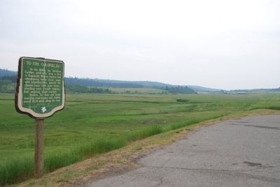
By Dawn Bowen, July 3, 2008
To the Goldfields! Marker
GEOGRAPHIC SORT Title Sort Marker Number Sort Marker Number Sort for Trails Publication Order Sort Publication Order Sort A Erected Year Sort Most Viewed Sort Most Recent-Interest Sort Most Recently Changed Sort SEE FAQ #33 FOR DESCRIPTIONS
On Provincial Highway 97 23.3 kilometers south of 150 Mile House, on the right when traveling south.
Near Barkerville Highway (Provincial Highway 26).
On Barkerville Highway (Provincial Highway 26) 1 kilometer south of Reduction Road, on the left when traveling south.
Near Barkerville Highway (Highway 26).
On Barkerville Highway (Provincial Highway 26).
On Kwah Road West 0.3 kilometers west of Stewart Lake Highway (British Columbia Highway 27), on the right when traveling west.
On Chilcotin-Bella Coola Highway (Provincial Highway 20) 8.2 kilometers east of Hanceville Cut Off Road, on the right when traveling east. Reported missing.
On Cariboo Highway (Provincial Highway 97) 1.1 kilometers south of Spur Road, on the right when traveling south.
On Front Street (Provincial Highway 97) at Carson Street, on the left when traveling north on Front Street.
Near Cariboo Highway (Provincial Highway 97) 2.2 kilometers south of Unity Road, on the left when traveling south. Reported missing.
On Nelson Nelway Highway (Provincial Highway 3A) 0.2 kilometers east of South Slocan Village Road, on the right when traveling east. Reported missing.
On Brilliant Road 0.5 kilometers east of Gorkoff Road, on the right when traveling east.
On British Columbia 6 0.2 kilometers south of Crescent Valley Road, on the right when traveling south.
On Highway 3A 0.3 kilometers south of View Road, on the right when traveling south.
Paid Advertisement
On Broadway Street West at 3 Avenue NW, on the left when traveling west on Broadway Street West.
On Broadway Street West at 4 Avenue NW, on the right when traveling west on Broadway Street West.
On Broadway Street West at 5th Avenue NW, on the right when traveling west on Broadway Street West.
On 5 Avenue Northwest at 1 Street NW, on the left when traveling north on 5 Avenue Northwest.
On Nelson Nelway Highway (Provincial Highway 3A) 0.2 kilometers west of Government Road, on the right when traveling west.
On Vernon Street at Ward Street, on the right when traveling east on Vernon Street.
On Eastman Avenue at Davis Street, on the left when traveling north on Eastman Avenue.
On Crowsnest Highway (Provincial Highway 3) 3 kilometers south of Salmo Ski Hill Road, on the left when traveling south.
On Slocan Star Street 0.3 kilometers east of Sandon Road, on the left when traveling east.
On Benvoulin Road 0.1 kilometers north of Casorso Road, on the right when traveling north. Reported missing.
On Okanagan Highway (Provincial Highway 97) 0.2 kilometers south of Hardy Street, on the left when traveling south.
Near Trans-Canada Highway (Provincial Highway 1) 0.8 kilometers north of Lybarger Road, on the right when traveling north.
Near Trans-Canada Highway (Provincial Highway 1) 0.8 kilometers north of Lybarger Road, on the right when traveling north.
Near Trans Canada Highway (Route 1) west of Whispering Wood Lane.
On Transcanada Highway (National Route 1), on the right when traveling west.
Paid Advertisement
Near Trans-Canada Highway (Provincial Highway 1) at Field Access Road.
Near Trans-Canada Highway (Provincial Highway 1) at Field Access Road.
Near Trans-Canada Highway (Provincial Highway 1) at Field Access Road.
On 1st Avenue at East First Street, on the left when traveling south on 1st Avenue.
Near 8 Avenue South north of 7 Street South.
Near 11 Avenue South at 14 Street South, on the right when traveling north.
Near Golden View Road 0.2 kilometers south of Lafontaine Road, on the right when traveling south.
Near 10th Avenue South (Provincial Highway 95) at 11 Avenue South, on the right when traveling north.
Near 11 Avenue South at 14 Street South, on the right when traveling north.
Near 11 Avenue South at 14 Street South, on the right when traveling north.
Near Trans-Canada Highway (Provincial Highway 1) 11.5 kilometers east of Provincial Highway 95, on the left when traveling east.
Near 11 Avenue South at 14 Street South, on the right when traveling north.
Near 11 Avenue South at 14 Street South, on the right when traveling north.
On 10th Avenue South (Provincial Highway 95) at Park Drive, on the right when traveling north on 10th Avenue South.
On 10th Avenue South (Provincial Highway 95) at 9 Street South, on the right when traveling south on 10th Avenue South.
Near 8 Avenue North south of 6 Street South.
Paid Advertisement
On 10th Avenue North (Provincial Highway 95) at Park Drive, on the right when traveling south on 10th Avenue North.
On 1 Street West at Boyle Avenue, on the right when traveling east on 1 Street West.
Near Big Bend Highway (Provincial Highway 23) 2.6 kilometers north of Pearkes Drive, on the left when traveling north.
On 2 Street West west of Garden Avenue, on the left when traveling west.
Near Trans-Canada Highway (Provincial Highway 1) 85 kilometers west of Provincial Highway 95.
On Trans-Canada Highway (Provincial Highway 1), on the right when traveling east.
On Kootenay Highway (Provincial Highway 93/95) 1.3 kilometers north of Burns Avenue, on the left when traveling north.
On Van Horne Street South (Provincial Highway 3) south of 5th Avenue South, on the right when traveling south.
On Wardner Fort Steele Road, on the right when traveling east.
On Provincial Highway 93/95 close to St. Mary's Street.
On Wardner Fort Steele Road, on the right when traveling east.
On Kootenay Highway (Provincial Highway 3) 0.8 kilometers east of Ha Ha Creek Road, on the left when traveling south.
On Crowsnest Highway (Provincial Highway 3/95) 0.4 kilometers south of Half Moon Avenue, on the right when traveling south.
On Crowsnest Highway (Provincial Highway 3/95) 0.3 kilometers south of Half Moon Avenue, on the right when traveling south.
On Kootenay Highway (Provincial Highway 93) 2.2 kilometers south of Stanley Street, on the right when traveling south.
Paid Advertisement
On Crowsnest Highway (Provincial Highway 3) just north of British Columbia-Alberta boundary line, on the left when traveling west.
On Crowsnest Highway (Provincial Highway 3) 3.3 kilometers south of Douglas Fir Road, on the right when traveling south.
On Crowsnest Highway (Provincial Highway 3) 0.4 kilometers west of Elk Valley Coal Road, on the right when traveling west.
On Kootenay Highway (Provincial Highway 93) 0.7 kilometers south of Simpson River Trailhead, on the right when traveling north.
On Banff-Windermere Highway (Provincial Highway 93), on the right when traveling north.
On Banff-Windermere Highway (Provincial Highway 93), on the right when traveling north.
On Banff-Windermere Highway (Provincial Highway 93), on the right when traveling north.
On Laurier Street 0.2 kilometers south of Daly Street, on the left when traveling south.
On Main Street, on the left when traveling east.
On Southern Yellowhead Highway (Provincial Highway 5) 2.4 kilometers south of Bear Road, on the left when traveling south.
Near Yellowhead Highway (Provincial Highway 16) at British Columbia-Alberta boundary line, on the right when traveling west.
On Yellowhead Highway (Provincial Highway 16) 24.8 kilometers west of Icefields Parkway (Provincial Highway 93), on the right when traveling west.
On Yellowhead Highway (Provincial Highway 16) 24.8 kilometers west of Icefields Parkway (Provincial Highway 93), on the right when traveling west.
On Yellowhead Highway (Provincial Highway 16) 24.8 kilometers west of Icefields Parkway (Provincial Highway 93), on the right when traveling west.
On Yellowhead Highway (Provincial Highway 16) 24.8 kilometers west of Icefields Parkway (Provincial Highway 93), on the right when traveling west.
On Yellowhead Highway (Provincial Highway 16) 24.8 kilometers west of Icefields Parkway (Provincial Highway 93), on the right when traveling west.
Paid Advertisement
On Yellowhead Highway (Provincial Highway 16) 24.8 kilometers west of Icefields Parkway (Provincial Highway 93), on the right when traveling west.
On Yellowhead Highway (Provincial Highway 16) 24.8 kilometers west of Icefields Parkway (Provincial Highway 93), on the right when traveling west.
On Yellowhead Highway (Provincial Highway 16) 24.8 kilometers west of Icefields Parkway (Provincial Highway 93), on the right when traveling west.
Near Viewpoint Road 0.2 kilometers east of Kinney Lake Road, on the left when traveling east.
On Caine Drive, on the right when traveling north.
On Crowsnest Highway (Provincial Highway 3) at Boundary Smelter Road, on the right when traveling east on Crowsnest Highway.
On British Columbia 395 0.1 kilometers east of Crowsnest Highway (Provincial Highway 3), on the left when traveling east.
On Crowsnest Highway (Provincial Highway 3) 2 kilometers west of Wilgas Lake Rest Area, on the left when traveling west.
On Crowsnest Highway (Provincial Highway 3) 3.4 kilometers west of Stewart Creek Road, on the left when traveling west.
On Smelter Viewpoint at Butte Avenue, on the right when traveling south on Smelter Viewpoint.
On Smelter Viewpoint at Butte Avenue, on the left when traveling north on Smelter Viewpoint.
On Crowsnest Highway (Provincial Highway 3) just west of Beamish Street, on the right when traveling west. Reported permanently removed.
On 5th Avenue at Florence Street, on the right when traveling east on 5th Avenue.
On BC-3B (Provincial Highway 3B) at Paterson-Trail Highway (Provincial Highway 22), on the right when traveling west on BC-3B.
Near Paterson-Trail Highway (Provincial Highway 22) 1.1 kilometers north of King George Park Road, on the right when traveling west.
On Okanagan Highway (Provincial Highway 97) 0.3 kilometers east of St. Annies Road, on the left when traveling south.
Paid Advertisement
On Vernon-Sicamous Highway (Provincial Highway 97A) just west of Creamery Road, on the left when traveling west.
On Kalamalka Lakeview Drive 0.3 kilometers south of Okanagan Highway (Provincial Highway 97), on the left when traveling south.
On Okanagan Highway east of The Hook, on the right when traveling east.
On Crowsnest Highway (Provincial Highway 3) 1.9 kilometers north of Barcello Road, on the left when traveling north.
On Daly Avenue north of Haynes Street, on the left when traveling north.
︽
115 entries matched your criteria. The first 100 are listed above.
The final 15 ⊳