146 entries match your criteria. The first 100 are listed. ⊳
Historical Markers and War Memorials
in the Drift Prairie Region
By Cosmos Mariner, September 1, 2023
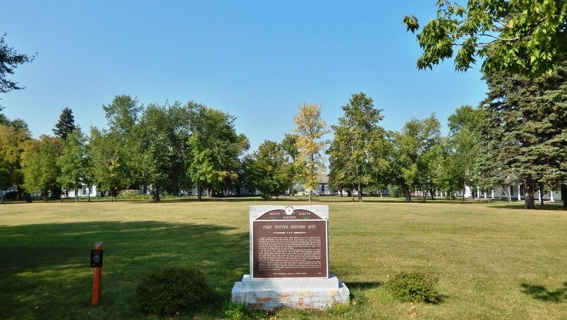
Fort Totten Historic Site Marker
1 ► North Dakota, Benson County, Fort Totten — Fort Totten Historic Site — North Dakota History —  |
| Near Calvary Circle just north of Calvary Road (1st Avenue). | |||
| 2 ► North Dakota, Bottineau County, Bottineau — Pierre Bottineau — Voyageur - Trapper - Guide — 1/1/1817 - 7/27/1895 — |
| On 5th Street West just west of Ohmer Street, on the right when traveling west. | |||
| 3 ► North Dakota, Bottineau County, Bottineau — Pioneer Monument — |
| On 5th Street West west of Ohmer Street, on the right when traveling west. | |||
| 4 ► North Dakota, Dickey County, Ellendale — Dickey County Veterans — |
| On 2nd Street North at 3rd Avenue North, on the right when traveling west on 2nd Street North. | |||
| 5 ► North Dakota, Dickey County, Fullerton — Carroll House — |
| Near North Monroe Street at Minneapolis Avenue, on the right when traveling south. | |||
| 6 ► North Dakota, Dickey County, LaMoure, Wright Township — St. Ansgar Lutheran Church — The Chan SanSan Scenic Backway — James River Valley Scenic Backway — |
| On 78th Street Southeast at County Road 60, on the left when traveling west on 78th Street Southeast. | |||
| 7 ► North Dakota, Dickey County, Oakes — 1891 Church - Oakes Historical Park — |
| Near 2nd Street South south of Maple Ave. | |||
| 8 ► North Dakota, Dickey County, Oakes — Hudson Townsite — |
| On 108th Avenue Southeast at 91st St SE, on the right when traveling north on 108th Avenue Southeast. | |||
| 9 ► North Dakota, Dickey County, Oakes — Stagecoach Relay Station — |
| Near 85th Street Southeast 0.3 miles west of 110th Ave SE, on the left when traveling west. | |||
| 10 ► North Dakota, Emmons County, Grassna — Langeliers Bay Recreation Area — |
| On 100th Street SouthWest near State Highway 1804. | |||
| 11 ► North Dakota, Emmons County, Hazelton — 1st Hazelton Post Office 1903 — History of Hazelton, N.D. Post Office — |
| On Main Street just east of Cook Avenue, on the right when traveling east. | |||
| 12 ► North Dakota, Emmons County, Linton — Emmons County Record — |
| On Broadway Street North at East Maple Avenue, on the right when traveling north on Broadway Street North. | |||
| 13 ► North Dakota, Foster County, Carrington — Thomas Nichols Putnam House — |
| On Main Street just west of 5th Avenue North, on the right when traveling west. | |||
| 14 ► North Dakota, Kidder County, Dawson — Dawson Congregational Church Bell — |
| On Lake Avenue at Thompson Street South East, on the right when traveling north on Lake Avenue. | |||
| 15 ► North Dakota, Kidder County, Dawson — Dawson Veterans Memorial Park — |
| On Lake Avenue at Thompson Street, on the right when traveling north on Lake Avenue. | |||
| 16 ► North Dakota, Kidder County, Steele — The World's Largest Sandhill Crane — |
| On 5th Street North East 0.1 miles east of Mitchell Avenue North. | |||
| 17 ► North Dakota, Kidder County, Tappen — Dr. J.S. Weiser — |
| Near 27th Street SE 1 mile east of 40th Avenue SE. | |||
| 18 ► North Dakota, Kidder County, Tappen — Sibley Trail — |
| Near 30th Street Southeast near 39th Avenue Southeast. | |||
| 19 ► North Dakota, Lamoure County, Edgeley — Ray Schlosser — Aug 29, 1911 - April 22, 1995 — |
| Near U.S. 281 0.3 miles north of 65th St. SE. | |||
| 20 ► North Dakota, LaMoure County, Grand Rapids, Grand Rapids Township — Grand Rapids, North Dakota — The Chan SanSan Scenic Backway — James River Valley Scenic Backway — |
| On 7th Street North at Taylor Aveenue, on the right when traveling west on 7th Street North. | |||
| 21 ► North Dakota, LaMoure County, Grand Rapids, Grand Rapids Township — Lamoure County Museum — |
| On 66th Street Southeast. | |||
| 22 ► North Dakota, Lamoure County, Kulm — In Memory of the Sioux Indians — |
| Near 86th Street Southeast near 73rd Avenue Southeast. | |||
| 23 ► North Dakota, Lamoure County, Kulm — In Memory of the Soldiers — |
| Near 73rd Avenue Southeast near 86th Avenue Southeast. | |||
| 24 ► North Dakota, Lamoure County, Kulm — Whitestone Hill Battlefield State Historic Site — |
| Near 73rd Avenue Southeast near 86th Avenue Southeast. | |||
| 25 ► North Dakota, LaMoure County, LaMoure — Civilian Conservation Corps Project — |
| On State Highway 13 0.6 miles west of Main St, on the right when traveling east. | |||
| 26 ► North Dakota, LaMoure County, LaMoure — Honorable Milton R. Young — |
| On 3rd Avenue Southwest (State Highway 13) 0.2 miles west of Main St, on the left when traveling east. | |||
| 27 ► North Dakota, LaMoure County, LaMoure — LaMoure County Courthouse — |
| On 4th Avenue Northeast at 2nd St. NE, on the right when traveling west on 4th Avenue Northeast. | |||
| 28 ► North Dakota, LaMoure County, LaMoure — Steamboats on the River — |
| On State Highway 13 0.2 miles west of Main St, on the left when traveling east. | |||
| 29 ► North Dakota, LaMoure County, LaMoure — Symbol of Freedom — |
| On 3rd Avenue Southwest (State Highway 13) 0.2 miles west of Main St, on the left when traveling east. | |||
| 30 ► North Dakota, LaMoure County, LaMoure, Ryan Township — Early Settlers of the Valley — The Chan SanSan Scenic Backway — James River Valley Scenic Backway — |
| On County Road 60 0.3 miles south of 76 1/2 Street Southeast, on the left when traveling south. | |||
| 31 ► North Dakota, LaMoure County, Verona — 1916 Block — |
| On 4th Street north of 2nd Avenue, on the left when traveling north. | |||
| 32 ► North Dakota, Logan County, Napoleon — Oley T. Thompson — Historical Marker — |
| On North Dakota Route 3 at 65th Street SE on North Dakota Route 3. | |||
| 33 ► North Dakota, McHenry County, Granville — Gilbert Peterson Cabin — Built 1890 — |
| On McHenry Avenue north of 3rd Street, on the left when traveling north. | |||
| 34 ► North Dakota, McHenry County, Velva — Peterson Homestead Cabin — |
| Near 2nd Avenue West just west of 5th Street West, on the right when traveling west. | |||
| 35 ► North Dakota, McIntosh County, Ashley — Ashley Jewish Homesteaders Cemetery — |
| On 48th Ave. | |||
| 36 ► North Dakota, McIntosh County, Ashley — Ashley Jewish Homesteaders Cemetery — |
| On 48th Ave. | |||
| 37 ► North Dakota, McIntosh County, Ashley — Hoskins Settlement — 1884 - 1888 — |
| On County Highway 11 0.7 miles west of 45th Avenue SE. | |||
| 38 ► North Dakota, McIntosh County, Wishek — Wishek, North Dakota Veterans Memorial — |
| On 4th Avenue South at South 9th Street on 4th Avenue South. | |||
| 39 ► North Dakota, McLean County, Coleharbor — Garrison Dam Overlook — Lewis and Clark in North Dakota — |
| On State Highway 200 near West Missouri Drive, on the right when traveling west. | |||
| 40 ► North Dakota, McLean County, Garrison — A Blank Canvas — Lewis and Clark in North Dakota — |
| Near 41st Avenue NW near Scooter Drive. | |||
| 41 ► North Dakota, McLean County, Garrison — Buffalo — |
| Near 41st Avenue NW (County Highway 15) near Scooter Drive. | |||
| 42 ► North Dakota, McLean County, Garrison — Contemporary Towns — Indian Hill — |
| Near 73rd Avenue NorthWest near 14th Street NorthWest. | |||
| 43 ► North Dakota, McLean County, Garrison — Custer Coal Mine — |
| On 16th Street NW (North Dakota Route 37) 0.3 miles west of U.S. 83, on the left when traveling west. | |||
| 44 ► North Dakota, McLean County, Garrison — De Trobriand — |
| Near 41st Avenue Northwest (County Road 15) near Scooter Drive, on the right when traveling south. | |||
| 45 ► North Dakota, McLean County, Garrison — Encampments — Indian Hills — |
| Near 73rd Avenue NorthWest @ 14th Street NorthWest. | |||
| 46 ► North Dakota, McLean County, Garrison — Fort Stevenson State Park — Lewis and Clark in North Dakota — |
| Near 41st Avenue NW near Scooter Drive. | |||
| 47 ► North Dakota, McLean County, Garrison — Four Bears Bridge — Indian Hills — |
| Near 73rd Avenue NorthWest at 14th Street NorthWest. | |||
| 48 ► North Dakota, McLean County, Garrison — Garrison Dam — Lewis and Clark in North Dakota — |
| Near 41st Avenue NW near Scooter Drive. | |||
| 49 ► North Dakota, McLean County, Garrison — Geology — Indian Hills — |
| Near 73rd Avenue NorthWest at 14th Street NorthWest. | |||
| 50 ► North Dakota, McLean County, Garrison — Lake Sakakawea — Lewis and Clark in North Dakota — |
| On 41st Avenue NW near Scooter Drive. | |||
| 51 ► North Dakota, McLean County, Garrison — Lake Sakakawea — Indian Hills — |
| Near 73rd Avenue NorthWest at 14th Street NorthWest. | |||
| 52 ► North Dakota, McLean County, Garrison — Land of Strange Disappearances — |
| On North Dakota Route 37 near U.S. 83, on the left when traveling west. | |||
| 53 ► North Dakota, McLean County, Garrison — Lewis & Clark — Indian Hills — |
| Near 73rd Avenue NorthWest at 14th Street NorthWest. | |||
| 54 ► North Dakota, McLean County, Garrison — Nightwalker's Butte — Indian Hills — |
| Near 73rd Avenue NorthWest at 14th Street NorthWest. | |||
| 55 ► North Dakota, McLean County, Garrison — Nightwalker's Butte — Indian Hills — |
| Near 73rd Avenue NorthWest at 14th Street NorthWest. | |||
| 56 ► North Dakota, McLean County, Garrison — Sakakawea — Indian Hills — |
| Near 73rd Avenue NW at 14th Street NW. | |||
| 57 ► North Dakota, McLean County, Garrison — Wildlife Area Evolves From Coal Mine — |
| On State Highway 37 near Federal Highway 83, on the left when traveling west. | |||
| 58 ► North Dakota, McLean County, Max — The First Fire & Curfew Bell — |
| On 2nd Avenue at Main Street, on the left when traveling north on 2nd Avenue. | |||
| 59 ► North Dakota, McLean County, Riverdale — Displaced Communities — |
| On State Highway 200 near West Missouri Drive, on the right when traveling north. | |||
| 60 ► North Dakota, McLean County, Riverdale — Growing out of the wheat fields and many have since returned. — |
| On State Highway 200 near West Missouri Drive, on the right when traveling east. | |||
| 61 ► North Dakota, McLean County, Riverdale — Riverdale — |
| On State Highway 200 near West Missouri Drive, on the right. | |||
| 62 ► North Dakota, McLean County, Riverdale — Taming the mighty Missouri by building the world's largest rolled earth dam of its time. — |
| On State Highway 200 near West Missouri Drive. | |||
| 63 ► North Dakota, McLean County, Riverdale — The Mandan, Hidatsa, and Arikara — |
| On State Highway 200 near West Missouri Drive, on the right when traveling west. | |||
| 64 ► North Dakota, McLean County, Riverdale — The Spillway Bridge is often believed to be "the dam", — |
| On State Highway 200 near West Missouri Drive, on the right when traveling west. | |||
| 65 ► North Dakota, McLean County, Washburn — A Natural — |
| Near 28th Avenue Southwest near 8th Street Southwest. | |||
| 66 ► North Dakota, McLean County, Washburn — A Respectable Fleet — |
| On 28th Avenue Southwest near 8th Street Southwest. | |||
| 67 ► North Dakota, McLean County, Washburn — Below the Freezing Point — |
| Near 8th Street Southwest (County Road 17) near 28th Avenue Southwest (State Road 23), on the right when traveling west. | |||
| 68 ► North Dakota, McLean County, Washburn — Bicentennial Wagon Train Pilgrimage to Pennsylvania — |
| Near 8th Street Southwest (County Highway 17) near 28th Avenue Southwest, on the right when traveling west. | |||
| 69 ► North Dakota, McLean County, Washburn — Cargo of Discovery — |
| On 28th Avenue Southwest near 8th Street Southwest. | |||
| 70 ► North Dakota, McLean County, Washburn — Cottonwood Canopy — |
| Near 28th Avenue Southwest near 8th Street Southwest. | |||
| 71 ► North Dakota, McLean County, Washburn — Current of Change — |
| Near 28th Avenue Southwest near 8th Street Southwest. | |||
| 72 ► North Dakota, McLean County, Washburn — Early Boats on the Missouri — Washburn Discovery Trail/Lewis & Clark Legacy Trail — |
| Near 8th Street Southwest just west of State Highway 200, on the left when traveling west. | |||
| 73 ► North Dakota, McLean County, Washburn — Ferry Boats on the Missouri — Washburn Discovery Trail/Lewis & Clark Legacy Trail — |
| On Boat Ramp Road just west of 1st Avenue, on the left when traveling west. | |||
| 74 ► North Dakota, McLean County, Washburn — First Farmers — |
| Near 28th Avenue Southwest near 8th Street Southwest. | |||
| 75 ► North Dakota, McLean County, Washburn — Fort Mandan — Lewis & Clark in North Dakota — McLean County — |
| Near 8th Street Southwest (County Road 17) near 29th Avenue Southwest (County Highway 23), on the left when traveling west. | |||
| 76 ► North Dakota, McLean County, Washburn — Fort Mandan — |
| Near 8th Street Southwest (County Road 17) near 28th Avenue Southwest (County Road 23), on the right when traveling west. | |||
| 77 ► North Dakota, McLean County, Washburn — Fort Mandan Historic Site — Fort Mandan — |
| On 37th Avenue Sourthwest near 7m Street Southwest, on the right. | |||
| 78 ► North Dakota, McLean County, Washburn — Lewis and Clark Expedition — |
| On 37th Avenue Southwest near 7m Street Southwest. | |||
| 79 ► North Dakota, McLean County, Washburn — Mandan Winter / Harmony Park — |
| On 8th Street Southwest near State Highway 200, on the left when traveling north. | |||
| 80 ► North Dakota, McLean County, Washburn — Men of Worth — |
| Near 8th Street Southwest (County Highway 17) near 28th Avenue Southwest (County Highway 23), on the left when traveling north. | |||
| 81 ► North Dakota, McLean County, Washburn — Nettle Creek Country School — Washburn Discovery Trail/Lewis & Clark Legacy Trail — |
| Near Boat Ramp Road just south of Lewis and Clark Trail (1st Street), on the right when traveling south. | |||
| 82 ► North Dakota, McLean County, Washburn — Pleasures and Pastimes — |
| On 28th Avenue Southwest near 8th Street Southwest, on the right when traveling south. | |||
| 83 ► North Dakota, McLean County, Washburn — River Boats on the Missouri — Washburn Discovery Trail/Lewis & Clark Legacy Trail — |
| Near 8th Street at 1st Avenue when traveling south. | |||
| 84 ► North Dakota, McLean County, Washburn — Seaman — |
| Near 28th Av SW. | |||
| 85 ► North Dakota, McLean County, Washburn — Sioux — |
| On Boat Ramp Road just west of 1st Avenue, on the left when traveling west. | |||
| 86 ► North Dakota, McLean County, Washburn — Soo Line Railroad & Depot — Washburn Discovery Trail / Lewis & Clark Legacy Trail — |
| Near 8th Street at 1st Avenue when traveling south. | |||
| 87 ► North Dakota, McLean County, Washburn — Taylor Cabin — Built in 1869 — |
| On Main Avenue just south of 10th Street, on the right when traveling south. | |||
| 88 ► North Dakota, McLean County, Washburn — The Sioux Ferry Boat — Washburn Discovery Trail / Lewis & Clark Legacy Trail — |
| On Boat Ramp Road just west of 1st Avenue, on the left when traveling west. | |||
| 89 ► North Dakota, McLean County, Washburn — The Washburn Plant — Washburn Discovery Trail/Lewis & Clark Legacy Trail — |
| Near State Highway 200 0.5 miles south of 8th Street Southwest (Border Lane), on the right when traveling south. | |||
| 90 ► North Dakota, McLean County, Washburn — Walter R. Hjelle Bridge — Washburn Discovery Trail / Lewis & Clark Legacy Trail — |
| Near Boat Ramp Road just south of 1st Street. | |||
| 91 ► North Dakota, McLean County, Wilton — Wilton Memorial Hall — Proudly Dedicated to Our War Veterans — |
| On Dakota Avenue just west of 1st Street South, on the left when traveling west. | |||
| 92 ► North Dakota, Pierce County, Rugby — Geographical Center of North America — |
| On U.S. 2, on the right when traveling east. | |||
| 93 ► North Dakota, Pierce County, Rugby — Great Northern Depot — Built 1907 — |
| Near West Dewey Street at 2nd Avenue Southwest, on the right when traveling west. | |||
| 94 ► North Dakota, Rolette County, Rolla — Finnish Pioneer Monument — |
| On 5th Avenue Northeast just east of 6th Street Northeast, on the left when traveling east. | |||
| 95 ► North Dakota, Sheridan County, McClusky — Quarter Century Vault — |
| Near 2nd Street East north of Avenue C E, on the right when traveling north. | |||
| 96 ► North Dakota, Stutsman County, Crystal Springs — Chase Lake NWR and the American White Pelican — |
| On Interstate 94 at milepost 223 near 47th Avenue Southeast, on the right when traveling west. | |||
| 97 ► North Dakota, Stutsman County, Crystal Springs — Chase Lake Prairie Project — |
| Near Interstate 94 at milepost 223 near 47th Avenue Southeast, on the right when traveling west. | |||
| 98 ► North Dakota, Stutsman County, Crystal Springs — The Missouri Coteau - North America's Duck Factory. — |
| Near Interstate 94 at milepost 223 near 47th Avenue Southeast, on the right when traveling west. | |||
| 99 ► North Dakota, Stutsman County, Crystal Springs — The National Wildlife Refuge System in North Dakota — |
| Near U.S. 94 at milepost 223 near 47th Avenue Southeast, on the right when traveling west. | |||
| 100 ► North Dakota, Stutsman County, Crystal Springs — Welcome to Crystal Springs WPA — |
| On Interstate 94 at milepost 223 near 47th Avenue Southeast, on the right when traveling west. | |||
146 entries matched your criteria. The first 100 are listed above. The final 46 ⊳