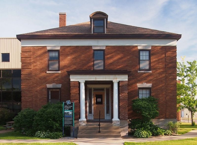
The original courthouse built on this site in 1887 included a jail and sheriff's residence. It served a population of about 2,000 people. As a logging town, Aitkin became a railhead and an important stopping point for boats on the Mississippi . . . — — Map (db m127867) HM
This is the site of the Civilian Conservation Corps (CCC) Biological Survey Camp 3. Serving as the home of Company 2705 from 1939 to 1941, as many as 23 buildings were once located here to house and support 200 men.
[Captions:] Crew . . . — — Map (db m210895) HM
The Civilian Conservation Corps (CCC), what began as a Depression era work program, became an important building block to the U.S. Fish and Wildlife Service's National Wildlife Refuge System. In 1939, seven thousand Corps participants worked at 35 . . . — — Map (db m210281) HM
Settlement
In the late 1800s, the first white settlers came to the area that is now the refuge. They were loggers, ranchers and market hunters. Loggers cut the pine trees from the land and floated them down the Rice River to the Mississippi . . . — — Map (db m210313) HM
In late 1850, some 400 Ojibwe Indians perished because of the government’s attempt to relocate them from their homes in Wisconsin and Upper Michigan to Minnesota west of the Mississippi River. The tragedy unfolded at Sandy Lake where thousands of . . . — — Map (db m206878) HM
Early water transportation on the Upper Mississippi River from St. Paul to St. Louis was hindered by fluctuating water levels. In 1878, the Corp of Engineers studied the impact of a reservoir system on the river. The study resulted in the building . . . — — Map (db m207887) HM
Of the American Fur Company was established near here about 1830, after an earlier location further south at the Northwest Company’s station had been abandoned.
William A. Aitkin for many years was a leading trader in this region. Indian . . . — — Map (db m207745) HM
This map shows the locations of some of the villages of the 19 Ojibwe Bands whose treaty annuities were paid at Sandy Lake in 1850. Today, these 19 Bands are succeeded by the 12 federally-recognized Bands whose present-day reservations also are . . . — — Map (db m207530) HM
To the native Anishinabe (Ojibwe) and to the white fur traders who bartered with them in the late 1700s and early 1800s, no Minnesota lake had a more strategic location than Big Sandy Lake, which stands at the intersection of two major trade . . . — — Map (db m210859) HM
(side 1)
Glacial Lake Aitkin
Two million years ago the first of four glaciers covered the surface of Minnesota. They were named for the limit of their southward expansion. The first was the Nebraskan, followed by the Kansan and the . . . — — Map (db m43932) HM
Beltrami County was established by an act of the state legislature on Feb. 28, 1866. The new county extended from a line drawn west from Lake Itasca to a north/south line between Cass Lake and Lake Winnibigoshish. The northern border went through . . . — — Map (db m290685) HM
Beltrami County was established by an act of the state legislature on February 28, 1866.
The first post office in the county was established in Red Lake in 1875.
The first homesteader in the county was Joachim Cyr at Little Turtle Lake in . . . — — Map (db m131652) HM
June 1911 Bemidji Commercial Club entertains Louis Hill, Governor Eberhart, and others at Markham Hotel for dinner and tours them around the Bemidji area hoping Hill will commission a new Great Northern Depot in Bemidji. April 24, 1912 . . . — — Map (db m235292) HM
In commemoration of the first Reserve Unit in the United States to be called into active service in World War I. Forty eight men, composing the Fifth Division of the Minnesota Naval Militia, were mustered in for service directly to the southwest of . . . — — Map (db m235294) HM
Beltrami Camp was built in 1942 by the Works Progress Administration. It was a popular gathering place for family reunions and civic groups. The only remaining building from the Beltrami Camp is the Dining Hall. Today it is still used by the Girl . . . — — Map (db m136149) HM
I wish you would listen in pity to my words for only a few moments. You see that I am now nothing but a corpse, but I will try to speak my mind to you. Regarding… our removal, what shall we do when we get there? How shall we manage to get ahead . . . — — Map (db m290901) HM
The statues of Paul Bunyan and Babe were both built in 1937 in connection with a January Winter Carnival. The 18-foot Paul weighs two-and-one-half tons and stands above five tons of concrete footings. Babe was originally built to be mobile, covered . . . — — Map (db m131670) HM
The utmost good faith shall always be observed towards the Indians, their lands and property shall never be taken from them without their consent… —Northwest Ordinance July 13, 1787 Shaynowishkung's life in this region spanned a time of . . . — — Map (db m290889) HM
Shaynowishkung was born about 1834 near Inger, Minnesota. He Who Rattles is the English translation of his Ojibwemowin name. As a young man, he hunted and harvested throughout this area, which had been a village site, gathering place and . . . — — Map (db m290883) HM
Here now, it is winter, and not a dollar of their annuities, which by solemn treaty stipulations… ought to have been paid months ago, have any of these destitute tribes received. —Minnesota Pioneer, November 21, 1850 As a result of many . . . — — Map (db m290899) HM
Near this spot, archaeologists found evidence for a Native American fishing camp. Pottery from the camp indicates that people lived here at various times between 3,000 and 600 years ago during what is known as the Woodland Period.
Harvested . . . — — Map (db m135890) HM
Pieces of pottery and other artifacts tell archaeologists that Native Americans have lived along the shores of the Turtle River and Three Island Lake for thousands of years. Because the ways in which Native Americans decorated and made their . . . — — Map (db m135881) HM
In recognition of the remarkable foresight of Dr. Haukebo in creating an unparalleled language and cultural immersion experience for young people, the Welcome Center of Concordia Language Villages at the entrance to the Turtle River Lake sites . . . — — Map (db m307392) HM
Norway Pine planted in memory of Harry Davidson 1894 — 1983
Harry and Vera Davidson operated Sunset Lodge on this site from 1938–1970. It included a café & bar, 9 cabins, and boat rentals. — — Map (db m199596) HM
Waskish was named by the Chippewa Indians who hunted, fished, and gathered wild rice along the Tamarack River. The Ojibway word for deer is Wawaskishi, which was shortened to Waskish by the early pioneers. The old town site was located at the . . . — — Map (db m181008) HM
Can you imagine the waves on a lake this size?
If you visited this region 10,000 years ago, the sight of Glacial Lake Agassiz would have astounded you! Covering 200,000 square miles, spanning numerous present-day states and . . . — — Map (db m307646) HM
Several years of dry weather set the stage for the devastating fire of 1931
Prelude to Disaster
The bog's early settlers often set fires to burn trash or to clear land for planting. During dry spells, these fires created . . . — — Map (db m308930) HM
As far back as 1927, walleye eggs were harvested at the mouth of the Tamarac River. Eggs collected here were sent to the State Hatchery at Redby for hatching until 1941 when the Waskish Hatchery was built as a Works Progress Administration . . . — — Map (db m272963) HM
River Routes
Our local rivers were used for transportation for centuries, first by Indians, later by white fur traders, explorers, trappers and hunters. From Red Lake, early travelers could canoe either to Lake Winnepeg via the . . . — — Map (db m272830) HM
In 1891, government surveyors platted this area as "meadows." Travel was difficult until drainage ditch spoil piles provided a rough bed for the first road, present-day Highway 72. A road linking Baudette and Kelliher was completed in 1914. . . . — — Map (db m191359) HM
Tradition holds that Red Lake was named after its beautiful red sunsets. The name first appeared on a 1755 map as "Lac Rouge," (French, translation–Red Lake.)
The great glaciers that covered Minnesota melted, first in the . . . — — Map (db m272683) HM
The Big Bog was the last refuge for the lower 48 states' woodland caribou, which vanished in the 1940s. Although caribou survived in Minnesota for a century after they disappeared in Wisconsin and Michigan, multiple threats took their toll here. . . . — — Map (db m190013) HM
An early 20th century attempt to drain the bog failed, but the old ditches still mark the invincible, yet fragile landscape.
Taking on the Bog
In 1889, the federal government appropriated almost three million acres of the Red Lake Indian . . . — — Map (db m191353) HM
Constructed by dragline in the 1960s, this ditch was used by fishermen as a marina and safe harbor. Shallow water, strong winds and big waves made mooring fishing boats difficult. Docking boats by the campground along the Tamarac River could also . . . — — Map (db m191558) HM
The Big Bog is part of the Patterned Peatland of Minnesota, whose rare landforms and plant and animal communities provide a vital resource for for scientific research, education, and recreation. A place of wonder and renewal for many, the Big Bog . . . — — Map (db m191556) HM
The Red Lakes have a long history of walleye production that supported a successful commercial fishery, a constant subsistence fishery, a popular sport fishery, as well as provided a source of walleye eggs for introducing or enhancing walleye . . . — — Map (db m272744) HM
You are standing at the site of an old forestry station, established decades ago to fight one of the biggest foes of forests—fire!
While pickaxes and pulaskis were common fire-fighting tools, a forester's biggest weapon may have been a tower. . . . — — Map (db m207228) HM
What is a burial mound?
Today, tombstones in cemeteries mark the burials of people from nearby towns and villages. They may tell us about the lifespan, disease, or other aspects of a person's life. The Gull Lake Mounds mark the burials of . . . — — Map (db m190007) HM
Grave Goods
Many cultures bury valued possessions, items of everyday life, or special burial items with a person. Archaeologists call these grave goods. At Gull Lake, archaeologists found a pottery cooking vessel, the bones and teeth of a . . . — — Map (db m190006) HM
Pottery Tells Us About Who Lived Here
The decorative patterns on pottery and vessel shapes change through time. By comparing the pottery found at Gull Lake to a regional sequence of pottery types based on pottery from other archaeological . . . — — Map (db m237142) HM
Lucette is the creative masterpiece of Doad Schroeder, an old-time resident and store owner in Hackensack. After a long period of mulling over the notion that the little village of Hackensack needed a gimmick of some kind, Schroeder put . . . — — Map (db m235099) HM
The arrival of a train in a small town was an important event, bringing new settlers, visitors, mail, news, and goods faster and more often than in the days before the railroads. Pine River wasn't the only place in Minnesota that changed once the . . . — — Map (db m189381) HM
People have lived in the Leech Lake Area for over 10,000 years and artifacts have survived that tell us the story of their lives. Our Early Man is holding a tool made of siltstone, discovered by the Leech Lake Heritage Sites Program of the Leech . . . — — Map (db m237143) HM
Descendants of the early man in the Leech Lake Area consisted of contemporaries of the woolly mammoth. Artifacts of the huge ivory tusks have been found in their burial grounds around Leech Lake. A civilization of the native Americans known as the . . . — — Map (db m237144) HM
The first excursion train pulled into Walker on August 8, 1896 and the town was ready for the invasion of fishermen from all over the country. Pat McGarry had opened up his White Tent City, consisting of twelve white tents, which became the next . . . — — Map (db m235797) HM
Throughout our American History, Walker and the Leech Lake Area have provided men and women to serve in the military in every conflict our great country has endured. Since Walker was founded in 1896, many of its original citizens were veterans of . . . — — Map (db m235795) HM
Missionaries were among the first to arrive in the Leech Lake Area and their work had a lasting impact on those who had settled there. Although their primary purpose was to spread the good news of salvation in Jesus Christ, they also served as . . . — — Map (db m235755) HM
In the early 1900s before the automobile, tourists could book round-trip railroad passage from Minneapolis to Walker for just fifty cents! At its peak in the 1970s, there were over 200 Ma & Pa establishments serving the lake — mostly simply fish . . . — — Map (db m235794) HM
Everybody remembers their own teachers, but names like Cerkvenik, Olness, Olstlund and Wallin were special to our WHS Class of 1949 and their teachings have been preserved in our hearts and minds throughout our lives. In 1896 our predecessors . . . — — Map (db m235791) HM
Many physicians have served the medical needs of the Leech Lake Area, beginning with Maji Gabowi, a documented medicine man of the Ojibwe Tribe. When Henry Schoolcraft led his first expedition in search of the source of the Mississippi, Dr. Houghton . . . — — Map (db m235793) HM
The name Leech Lake Village was changed to Walker, Minnesota when a lumber baron from Ohio by the name of Thomas B. Walker came to the area in 1862 and began buying up all the timberland around the area. The Village of Walker was named after him and . . . — — Map (db m235798) HM
The fur-trade industry began in our country in the 1600s and lasted into the 1800s. Fur hats and accessories became a symbol of success in Europe and created the demand which drove the fur trade. The original fur traders in the Leech Lake Area were . . . — — Map (db m235799) HM
In 1862, President Abraham Lincoln signed the Homestead Act, which gave an applicant free title to 160 acres of undeveloped federal land west of the Mississippi River. Twelve years later, on August 6, 1874, both Henry Stovall & George LeBorneau . . . — — Map (db m235756) HM
Today, the economy of Walker and The Leech Lake Area is dependent upon the visitations of the entire family. The small fish camps have given way to the large resorts that cater to a full schedule of events for all ages. Our little town has become . . . — — Map (db m235796) HM
This statue is of an Ojibwe Hoop Dancer. It is an Ojibwe tradition that the four hoops represent the four stages of life of the four colors of man, enjoying the four seasons, from the four winds, all living together within the four colors of . . . — — Map (db m290064) HM
On Leech Lake, Bugonaygeshig is celebrated as a symbol of resistance by both the Indian and white communities. He lived a long life, steadfast in his Indian ways and Bugonaygeshig School in Bena, MN is named in his honor. On September 15, 1898, he . . . — — Map (db m235754) HM
The Leech Lake Band of Ojibwe (Gaa-zagaskwaajimekaag) is a sovereign nation and part of the Ojibwe-Anishinabe, the second largest indigenous group in North America after the Navajo Nation. Within the Tribe, traditional Ojibwe culture is retained . . . — — Map (db m266795) HM
When a federal marshal with about 100 troops of the 3rd Infantry tried to arrest the Chippewa Chief Bugonaygeshig at Sugar Point opposite here on the northeast shore of the lake, a sharp fight occurred October 5, 1898. The whites lost 7 killed and . . . — — Map (db m124726) HM
Story adopted from "On This Day In History: The Battle of Sugar Point" by Kayla Duoos, Leech Lake News, Oct. 5, 2020 On the early Wednesday morning of October 5th, 1898, a handful of young Pillager Ojibwe men held off . . . — — Map (db m266796) HM
The diversified scenery of Minnesota- of which the Itasca park area is one phase- is due to the location of the state in the approximate center of the continent, situated midway between the Atlantic and Pacific oceans, Hudson Bay and the Gulf of . . . — — Map (db m232172)
Discovered by Henry R. Schoolcraft from the summit of this hill July 13, 1832 This tablet is placed by the Society of Colonial Dames of America in the State of Minnesota 1924 — — Map (db m155676) HM
The name "Itasca" was coined specifically from the Latin words "Veritas caput" -- literally meaning "true head" -- by Henry Rowe Schoolcraft in 1832. Led by Ozawindib, an Ojibwe guide who knew the upper reaches of the Mississippi River and its . . . — — Map (db m71470) HM
Herein, under the Ordinance of 1787, began the westward expansion of this nation • The American Bill of Rights first nationally recognized • Human slavery prohibited • Primogeniture abolished • And the great new principle of colonies becoming equal . . . — — Map (db m155672) HM
Acquiring a Homestead David S. Patterson came to Itasca in 1889. Patterson made claim to 152 acres, which included the Headwaters of the Mississippi. He purchased the land in 1891 for $191. Patterson's cabin was north of McMullen's cabin near . . . — — Map (db m155671) HM
The romantic 19th century quest for the source of the Mississippi river brought many explorers — among them Zebulon Pike, Lewis Cass, and Giacomo Beltrami — to northern Minnesota. The search ended when Ojibwe chief Ozawindib guided Henry . . . — — Map (db m155665) HM
Built their pioneer home at this place in 1893, one building being used as a store and post office. An act of the Minnesota Legislature in 1945 authorized acquisition of the homestead as an addition to Itasca State Park. Dedicated in grateful . . . — — Map (db m155673) HM
This replica of the original Wegmann Store was built in 1977 as part of an ongoing summer crafts program to demonstrate log cabin construction. The replica was built by craftsperson Christopher Alpine from Lengby, Minnesota. While the original . . . — — Map (db m155674) HM
This "fence section" you see before you is actually a bridge railing from the Laurel Street Bridge that sat at that Mississippi River location from 1898 to 1978. All the railings were salvaged before the old bridge was demolished. How they got . . . — — Map (db m279457) HM
Although never a city entity, this park was located on the east side of Sixth Street just south of the Northern Pacific Railroad tracks, also called NP Park as it was on Northern Pacific RR land. The first NP Depot was just to the north, . . . — — Map (db m213559) HM
Toward the close of the Wisconsin stage of glaciation about 12,000 years ago, the waning lobe of the ice sheet in the Brainerd area retreated westward, leaving in its wake many stagnant ice blocks which had become separated from the main ice field. . . . — — Map (db m155678) HM
At this location, on July 23, 1872, a tragedy occurred and two American Indian brothers lost their lives to a vigilante group. These members of the White Earth Nation had been accused in the disappearance of a 22 year-old woman from Crow Wing . . . — — Map (db m213585) HM
Founder Stewart C. Mills, Sr. December 6, 1891 – April 8, 1978 Lively Auto Company — 1922 Crow Wing Oil Company — 1924 Mills Motor, Inc. — 1931 Mills Fleet Farm — 1955 Mills Properties, Inc. — 1959 — — Map (db m238261) HM
The tall smokestack of the Croft Mine Historical Park symbolizes the days when men worked with picks and shovels, sometimes more than six hundred feet below the surface, to meet daily production quotas of iron ore. In 1914, the Merrimac Mining . . . — — Map (db m278114) HM
In memory and honor of all veterans of all branches of service from all conflicts who defended our freedom.
Special recognition to the 6th Division Minnesota Naval Militia and the Cuyuna Range National Guard Unit 21th CA,AA and all Vietnam . . . — — Map (db m278602) WM
Around the 1900's this mail cart was used at the Deerwood Northern Pacific Railroad Depot to haul the mail from the depot to the Deerwood's US postoffice.
Funded in memory of the 1959 C-1 graduate Douglas Ray
Refurbished by the . . . — — Map (db m278412) HM
Fitger of Duluth used this location on the railroadsiding east of the Soo Line Depot as a storage place for its beer, which came in by freight train. The building was an icebox to keep the beer cold. The manager lived in the upper story. — — Map (db m278414) HM
The Portsmouth was one of many iron and manganese mines that operated along the Cuyuna Range during the period 1911-1978. As much as 60 meters of glacial sediment cover the iron-bearing bedrock in this area; there are few natural rock exposures. . . . — — Map (db m277208) HM
The Portsmouth Mine was in operation from 1912 to 1960 and produced 12,370,260 tons of iron ore. The mine is located in Sections 1, 2, 11, T-46N, R-29W in the city of Crosby, MN.
On August 19, 1957 a balloon was launched from the mine which . . . — — Map (db m277793) HM
The Portsmouth Mine, operated by Coates and Tweed, first shipped ore in 1920. It originally was composed of one 30 acre site and one mine. Over the life of the mine however, other adjacent mines were incorporated under the Portmouth name. These . . . — — Map (db m277087) HM
The Cuyuna Range iron mining era began in 1907 when the Roger Brown Ore Company developed the Kennedy Mine north of Crosby. The mine began stockpiling in August 1908, but the lack of convenient and economical transportation slowed Cuyuna Range . . . — — Map (db m278545) HM
The city of Brainerd was built, like many others, on a dream. Despite skeptics, railroad entrepreneurs envisioning a transcontinental railroad, running from New York to Puget Sound, Washington, formed the Northern Pacific Railroad Company. . . . — — Map (db m277211) HM
"Going to the lake" is a facet of Minnesota life that's so familiar that it seems like a natural part of the state's culture. However, it is at least partly a result of public policy in the 19th century.
By the 1870s, heavy commercial . . . — — Map (db m277462) HM
Lakes constitute the hallmark resources of Minnesota. Minnesotans use lakes for recreational activities such as camping, fishing, boating and enjoying scenic beauty and solitude. Lakes provide prime habitat for fish and wildlife and form the . . . — — Map (db m277527) HM
Having three major ecological zones, or biomes, in a non-mountainous state such as Minnesota is unusual. Because each biome has unique features, the meeting of three leads to a rich diversity of plant and animal life.
Minnesota's biomes . . . — — Map (db m277820) HM
289 entries matched your criteria. The first 100 are listed above. Next 100 ⊳