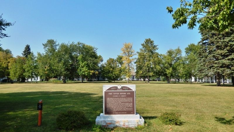
Named in honor of Brevet Major General Joseph Gilbert Totten, Fort Totten protected overland transportation and communication routes from Minnesota to the Missouri River and Montana. In addition, the treaty of February 19, 1867, provided for a . . . — — Map (db m231947) HM
Pierre Bottineau, son of Charles Joseph Bottineau, a French-Huggenot and Marguerite Adhik Songab (Clear Sky Woman) a Lake of the Woods Chippewa, was born near the mouth of the Turtle River (twelve miles north of Grand Forks, North Dakota). . . . — — Map (db m231815) HM
Erected in 1954 by the Bottineau County Old Settler’s Association and friends, as a memorial to our pioneer settlers who met the toil, trials, hazards and wants of life; who broke the sod with oxen or horses; built their homes of sod or logs as a . . . — — Map (db m231821) HM
Map insetThe pristine 35 miles of the Charles SanSan Trail / James River Valley Scenic Byway offers visitors splendid views of unspoiled, rich North Dakota landscapes. Along the route are many scenic and historic places to . . . — — Map (db m279335) HM
Built in 1891 by Oakes Methodists, this building was a block south of Main on Highway 1. When a larger church was needed in 1908, the Methodists built the present structure at 6th and Juniper and sold the original church to the Norwegian & . . . — — Map (db m112569) HM
Established in the spring of 1883 by a colony from New York state and named for the Hudson River. A railroad right-of-way was planned to serve the town from the east. Three years later the Northern Pacific and Northwestern railways met on the . . . — — Map (db m175276) HM
1/5 mile to the south is the site of the Stagecoach Relay Station. Benjamine and Mellinger operated the stage line, beginning in 1880, between Columbia, SD and Jamestown, ND. Service took two days each way and passengers could be fed and lodged . . . — — Map (db m112568) HM
Sunday, October 14, 1804
...journeying about 12 miles...
...bank opposite an...
...of an early Indian wall...
...75 lashes for insubordination,,,
...by a court martial...
..[Eagle] Feather, who was traveling with . . . — — Map (db m285609) HM
The Hazelton Post Office was established July 6, 1903. It was located at this site in the home of Elise Longpre Perras. In December of 1903 the nearby Williamsport Post Office (Williamsport, N.D. about 3 ½ miles N.E. of Hazelton) closed and its . . . — — Map (db m231462) HM
Darwin Reed Streeter, left, founded the Emmons County Record on June 10, 1884, at Williamsport, Dakota Territory, and the Emmons County Republican/Braddock News in 1899. His son, Frank, right, was the first editor in Braddock and, in 1912, . . . — — Map (db m231458) HM
This bell was purchased with funds raised by local people and with a large donation coming from Mr. & Mrs. Marble.
For several years in the early 1880's, Mr. & Mrs. Marble along with their guests, came to Dawson in their private railroad . . . — — Map (db m169175) HM
The Coteau Rangeland is an area of glacial potholes located in the central flyway, which makes this a favorite spot for migratory nesting wildlife including the Sandhill Crane. The crane is the oldest living species of birds and has existed . . . — — Map (db m169176) HM
The two oak trees flanking the sidewalk are dedicated to the memory of Ray Schlosser. Ray was the caretaker of this rest area from 1969 to 1995. He was a farmer before he became caretaker, and his dedication made this rest area an "Oasis on the . . . — — Map (db m118681) HM
Map insetThe pristine 35 miles of the Charles SanSan Trail / James River Valley Scenic Byway offers visitors splendid views of unspoiled, rich North Dakota landscapes. Along the route are many scenic and historic places to visit and . . . — — Map (db m283190) HM
The LaMoure County Museum building located in the LaMoure County Memorial Park was
erected in 1883 and was used as the LaMoure County Courthouse until the famous "county seat
fight" between the people of Grand Rapids and LaMoure. Having lost its . . . — — Map (db m296612) HM
In memory of soldiers of the 6th Iowa and 2nd Nebraska Cavalry killed on this ground in battle with Sioux Indians, Sept 3rd and 5th, 1863 — — Map (db m176198) HM WM
On September 3 and 5, 1863, United States cavalry here engaged Yanktonai
and Hunkpatina Sioux in the bloodiest battle fought on North Dakota soil
during the Indian wars.
The battle at Whitestone Hill resulted from the 1862 rebellion of . . . — — Map (db m274985) HM
This commemorative plaque is placed near the site where CCC Camp #2760 of the CCC was located in the City of LaMoure, North Dakota--when this Dam was constructed by the CCC in 1934.
CCC Co #2760 built the Dam across the James River just . . . — — Map (db m112158) HM
This community is the home of the Honorable Milton R. Young who as a farmer was selected by his peers to speak their voice in the halls of democracy in North Dakota and this nation. He has served his people well. This community is proud of the . . . — — Map (db m112562) HM
The brick walls of the LaMoaure County Courthouse have withstood the elements since 1910, and the building has become a cornerstone of the community's vitality. However, 15 years before the first brick was laid, two communities fought over its . . . — — Map (db m112561) HM
As printed in the LaMoure County Chronicle Aug. 30, 1912:
"Undoubtedly the most enjoyable trip was the one after supper Sunday evening, when fully half a hundred excursionists found plenty of room on the boat. With the wind reduced to a . . . — — Map (db m112189) HM
This deactivated missile is part of the Weapon System 133 Minuteman with the type and model being LCM 30. It was placed, along with many others, along the northern border of North Dakota to protect against war with Russia during the Cold War in . . . — — Map (db m112567) HM WM
Map insetThe pristine 35 miles of the Charles SanSan Trail / James River Valley Scenic Byway offers visitors splendid views of unspoiled, rich North Dakota landscapes. Along the route are many scenic and historic places to . . . — — Map (db m279333) HM
This block dated 1916 is from one of the original buildings located on this site. It was called the Farmers and Merchants State Bank of Verona. The bank was most notably known for a murder and robbery which occurred there in 1927. H.C. Bjone, . . . — — Map (db m279299) HM
Born in Norway 1851
Homesteaded and buried one mile west
Froze to death February 6, 1887 in Logan County
He was the first white man married.
Father of first white child born
And the first white man buried. — — Map (db m168907) HM
This original log cabin was built in 1885 as the town’s first dwelling. In 1907, August Peterson, an emigrant from Sweden, donated the cabin and park grounds to the City of Velva. — — Map (db m299494) HM
On November 17, 2015, the United States Department of the Interior officially named this site to the National Register of Historic Places. From the 1880s through the 1930s, 1200 Jewish farmers lived on over 250 homesteads in North Dakota - the . . . — — Map (db m103862) HM
Unlike most of their Jewish brethren who remained on or near the East Coast in big cities, these first-time farmers boarded trains to "The Great Northwest," staking their claims 20 years after McInstosh County was opened for homesteading. They . . . — — Map (db m103863) HM
- First settlement in McIntosh County
- First County seat of McIntosh County
- Named after Colonel C.A. Lounsberry wife's maiden name.
- Monument constructed in 1935 by H.A. Larimer, stonesman.
- Primary project donors: Ashley . . . — — Map (db m168899) HM
Wednesday, August 13, 1806
With "the assistance of the wind, the current and our oars," the expedition covered 86 miles of its homeward journey on the cool and blustery day. At the mouth of the Little Missouri, the party stopped to . . . — — Map (db m283568) HM
Thomas Jefferson imagined the land explored by the Corps of Discovery as a blank canvas which would take many generations to fill. When Fort Stevenson was established in 1867 less than three generations had passed and Jefferson's blank canvas was . . . — — Map (db m283551) HM
When Fort Stevenson was being built in 1867, 30 million or more buffalo roamed the Great Plains. By the time the fort was decommissioned sixteen years later, it is estimated that only 2,000 were left.
The Native American Indians used . . . — — Map (db m283116) HM
Evidence of Euro-American occupation began to appear near the "big bend" of the Missouri River not long after the Corps of Discovery passed through. Competing trading posts to serve the Mandan, Hidatsa, and Arikara, as well as other tribal groups . . . — — Map (db m284826) HM
Custer Mine, owned and operated by the Truax Traer Coal Company, was a
working surface mine from 1947-1964. The surface or strip mining method of coal
mining is used when the coal seam is near the surface of the ground. The
lignite coal was mined . . . — — Map (db m164410) HM
In August of 1867 General Philippe Regis Denis de Keredern de Trobriand took command of Fort Stevenson, headquarters for the Middle District of Dakota Territory. He served at the fort through April of 1869 and is the best known commander of Fort . . . — — Map (db m286143) HM
The Mandan, Hidatsa, and Arikara used various kinds of dwelling before and after coming together as a single group in the Nineteenth Century. Earthlodges were the largest of the dwellings. These were round structures based upon four large posts 12 . . . — — Map (db m284820) HM
Wednesday, August 13, 1806
With "the assistance of the wind, the current and our oars," the expedition covered 86 miles of its homeward journey on the cool and blustery day. At the mouth of the Little Missouri, the party stopped to . . . — — Map (db m283566) HM
In 1928 the Fort Berthold Reservation Civic Organization (FBRCO) was organized to promote the building of a Missouri River bridge at Elbowoods. The river split the reservation into two parts that could only be crossed by ferry boats. Work began in . . . — — Map (db m284818) HM
Dam Type ... Belled Earth
Height ... 202 feet
Length ... 11,3000 feet
Width At Top Of Dam ,,, 60 feet
Width At Bottom of Dam ... 3,400 feet
Volume of Earth Fill ... 66,500,000 cubic yard
Volume Of Concrete ... 1,500,000 cubic . . . — — Map (db m283554) HM
The Missouri River winds through the fertile and alluvial floodplains within the river trench.
Overlooking the valley is the drift prairie, covered by glacial till, which is equally fertile. Within the river are found bars of sand , silt, and . . . — — Map (db m284979) HM
In March 1805, Lewis and Clark hired a French-Canadian fur trader living with the Hidastsa Indians. This man, Toussaint Charbonneau, along with his wife, a teenage Indian girl named Sakakawea, would serve as interpreters.
Sakakawea proved her . . . — — Map (db m283555) HM
With the flooding of the reservoir, the Three Affiliated Tribes of Fort Berthold sought to have a Native American honored in naming the lake, particularly after having given up much of their prime agricultural land to the reservoir. Finally, on July . . . — — Map (db m284838) HM
People have lived in the area now called North Dakota for over 12,000 years. The people of prehistoric
times were nomadic hunters and gatherers. More recent Native American tribes of this area include the Mandan, Arikara and Hidatsa. These . . . — — Map (db m164407) HM
The Corps of Discovery, led by Meriwether Lewis and William Clark, passed through the part of the Missouri River Valley, now encompassed by Lake Sakakawea, in April 1805. The camp for the latter day being approximately at the south end of the Lewis . . . — — Map (db m284833) HM
Uncovering the Past
Nightwalker's Village was extensively excavated by archaeologists from the Smithsonian Institute in the 1950s, as part of the Missouri River Basin Surveys. Low circular mounds and depressions in the grass hinted at . . . — — Map (db m284977) HM
On the flat-topped butte across the valley, once stood and Hidatsa village of 28 small earthlodges, enclosed within a high, defensive fence, or palisade of posts that followed the bluff edge. The village was named after Nightwalker, a Hidatsa leader . . . — — Map (db m284978) HM
Sakakawea was probably born among the Shoshone Indians around 1787 in the Three-Forks-Shoshone Cove region of what is now southwestern Montana. She was captured at about age eleven by Hidatsa raiders from the Knife River villages in present-day . . . — — Map (db m283108) HM
The transition from a working coal mine to today's
Custer Mine Wildlife Management Area took place over
many years. While the coal mine was still in operation,
local residents started planting trees on the mine spoil
banks. The trees were . . . — — Map (db m164412) HM
Mandan, Hidatsa, and Arikara Territory
The Mandan, Hidatsa, and Arikara (MHA) tribal lands historically encompassed much of the west and central North Dakota, Before 1851, the US government did not delimit MHA territory, but this changed . . . — — Map (db m283984) HM
Riverdale, Pick City, Dakota City, American City, Sitka, Silver City, and Big Bend are towns a dam built.
Boom towns and the Government town of Riverdale sprang up rapidly between the years of 1945 and 1946 as the Garrison Dam . . . — — Map (db m284059) HM
The Garrison Dam Project required a significant workforce, and they lived in local company towns built and managed by the government. Blending permanent dam administration buildings with temporary homes for the surge of workers, towns like . . . — — Map (db m284084) HM
Two Engineers, General Lewis Pick and William Sloan, were tasked to develop a plan to stop flooding and drought cycles plaguing the region between 1935 and 1944. The Garrison Dam being part of their plan was authorized by congress in the Flood . . . — — Map (db m284057) HM
MHA Nation
The Mandan, Hidatsa, and Arikara, today allied as the HMA Natio, haven deep historical and cultural connections to the Missouri River. The Mandan and Hidatsa, both Siouan speaking peoples. have oral histories that tie their . . . — — Map (db m283980) HM
But it's only a small part, used to manage water levels above and below the dam.
(photo upper left:) The Emergency Spillway, as it was once called, is believed to only be used in the event of and emergency, but this is not the case. The . . . — — Map (db m284062) HM
"the root wen pounded in either green or dryed state makes an excellent poltice for swelling or soar throat..." Meriwether Lewis, Winter 1804
Captain Meriwether Lewis, a fervent student of plants since childhood and the naturalist of . . . — — Map (db m253187) HM
"... all our provisions goods and equipage on Board of a Boat of 22 oars, a large Perogue of 7 oars and a second Perogue of 6 oars, complete with sails" -Captain William Clark, May 13, 1804
The Corps of Discovery traveled nearly eight . . . — — Map (db m253141) HM
In December of 1804 the temperature dipped and snow began to fall. Despite waking to an unrelenting cold the Corps of Discovery continued to work on the finishing touches of Fort Mandan, went hunting and preformed the never-ending job of gathering . . . — — Map (db m162597) HM
From this site, North Dakota Wagon Train, that took our message to Valley Forge, left on September 26, 1975.
Outriders presented scrolls from their various bicentennial communities to Wagon Master Jerry Nelson and Governor Arthur Link. These . . . — — Map (db m162594) HM
"We are situated in a point of the Missouri North side in a Cotton wood Timbery this Timber is tall and heavy" William Clark, November 9, 1804
Cottonwood trees played a vital role in the success of the Lewis & Clark Expedition. Like . . . — — Map (db m253184) HM
"This River is a turbilant + muddy stream..." -William Clark, undated, winter 1804-05
The Missouri River was part of the Lewis & Clark Expedition from Camp Debois to near the crest of the Rocky Mountains. Even though the men contended . . . — — Map (db m253173) HM
One of the earliest forms of Missouri River transportation was the bull boat. Used primarily by the Mandan, Hidatsa, and Arikara tribes, bull boats served as the main watercraft for natives living along the river banks. These boats were both built . . . — — Map (db m235041) HM
To attract shoppers to Washburn from west of the Missouri River, the Washburn Road installed a cable ferry in May 1902, known unofficially as the General Washburn. Cable ferries were small, unpowered boats attached to steel cables stretched between . . . — — Map (db m235089) HM
"We had several presents from the women of corn boiled homney. soft corn &c.&c." -William Clark, October 28, 1805
Long before the migration of settlers and establishment of farms in present day North Dakota, Mandan and Hidatsa women . . . — — Map (db m253144) HM
Winter 1804-1805
Named for the nearby Indians, Fort Mandan was winter quarters for the Lewis and Clark Expedition. Sited by Captain Clark on November 2, 1804, the fort was built in a triangular shape from cottonwood logs cut in . . . — — Map (db m162536) HM
Fort Mandan, 1804-05 Winter Quarters of the Lewis and Clark Expedition, also was the birthplace of the son born to Sakakawea and her French husband Charbonneau, interpreter for the explorers. The "Bird Woman" helped guide Lewis and Clark to their . . . — — Map (db m162595) HM
Approximately two miles south of this point, on low ground, on the east bank of the Missouri River the Lewis and Clark Expedition built Fort Mandan. This fort, the first military post in the State, was a substantial log structure which served as . . . — — Map (db m252802) HM
camped in this vicinity from October 27 1804 to April 7 1805. Captain Meriwether Lewis, a member of St. Louis Lodge No. 111 A.F.&A.M., was possibly the first mason to tread upon what is now North Dakota soil. Captain William Clark was made a mason . . . — — Map (db m252808) HM
The Mandan Winter
"If we eat you Shall eat, if we Starve, you must Starve also."
Mandan Chief Sheheka-shote, to Captains Lewis and Clark, November 1, 1804
With those words, Chief Sheheke-shote (White Coyote), . . . — — Map (db m162953) HM
Privates John Shields, William Bratton and Alexander Willard manned the blacksmith shop at Fort Mandan. These men provided repair work to native tools, such as sharpening iron hoes and knives and fixing trade kettles.
The Mandan and Hidatsa who . . . — — Map (db m162950) HM
Nettle Creek School was the first school in McLean County, opening on November 6, 1883. Originally located seven miles east of Washburn, the one-room country school was first constructed as a log cabin, with clapboard siding added to it later. In . . . — — Map (db m235060) HM
"At half past 2 another gun was fired, as a notice to assemble at the dance, which was continued in a jovial manner until 8 at night…" Patrick Gass, Dec. 25, 1804
The Corps of Discovery found many ways to . . . — — Map (db m253183) HM
The first steamboat to reach the upper Missouri was the American Fur Company's Yellow Stone, which arrived at Fort Union in 1832. Nearly 30 years later, steamers began reaching Fort Benton, Montana, the head of navigation on the Missouri. From then . . . — — Map (db m235097) HM
While preparing for the expedition to the Pacific, Meriwether Lewis visited Philadelphia for instructions in natural sciences, astronomical navigation and field medicine. It is believed that it was during this period that Lewis purchased Seaman, . . . — — Map (db m36352) HM
The last stern wheel ferry on the Missouri. Built by Oscar Anderson in 1951 and operated by him on the Missouri River at Washburn from 1952 to 1962. Restored by the Washburn Bi-centennial Committee in 1976. American Revolution Bicentennial . . . — — Map (db m235096) HM
In 1898, William Drew Washburn, a wealthy Minneapolis flour miller, railroad man, and U.S. Senator from Minnesota, purchased 115,000 acres of land along the line between McLean and Burleigh counties. He formed the Bismarck, Washburn & Great Falls . . . — — Map (db m235098) HM
Pioneer home of Joseph Henry Taylor, soldier, trapper, hunter, author and printer by trade. Born in 1843 of Quaker parents in Chester County, PA., he drifted west, locating in the Painted Woods area, twelve miles south of here in 1869, where he led . . . — — Map (db m235199) HM
In 1950 Oscar Anderson, a native of Washburn who had traveled the world since 1917 as an officer in the merchant marine, returned home to spend his retirement years. He found a community that missed its ferryboat connection with the west bank of . . . — — Map (db m235095) HM
In the early 1920s, most North Dakota towns were served by small local power plants producing direct current (DC) electric power. In 1926, Otter Tail Power Company of Fergus Falls, Minnesota, was one of several companies building a series of power . . . — — Map (db m235057) HM
The bridging of the Missouri River at Washburn had been a longtime goal for residents of the community. As early as 1908, a party of local residents traveled to Washington, D.C., unsuccessfully, in the interests of such a project. During the 1920s . . . — — Map (db m235047) HM
In January 1931, a U.S. Geological Survey determined the center of North America in Pierce County. The center is marked with a monument or cairn that is pyramid form in shape. It is 21 feet high, 6 feet wide at its base, and setting on a . . . — — Map (db m138195) HM
[English] Founders We dedicate this monument to the memory of the Finnish pioneers who came here in 1896 and after. They tilled this soil with oxen and horses and lived in houses of earth sod. Through their early . . . — — Map (db m231967) HM
Herein are momentoes from the people of the year A.D. 1976 to the people of the year A.D. 2001. Sealed at the dedication of this Bicentennial structure June 25, 1976. — — Map (db m162769) HM
Chase Lake National Wildlife Refuge (NWR) was established by President Theodore Roosevelt on August 28, 1908, as one of the first national wildlife refuges in the country.
Since then, the pelican population has grown steadily. Today, Chase Lake . . . — — Map (db m162974) HM
The North American Waterfowl Management Plan (NAWMP) is an international plan developed to conserve waterfowl and migratory birds in North America. The Plan was established in 1986 and is supported by Canada, Mexico, and the United States. As part . . . — — Map (db m163091) HM
You are standing in the Missouri Coteau, a band of sharply rolling hills marked by potholes and grasslands. Coteau is the French word for "little hill." This unique landscape lies within the Prairie Pothole Region, and ranges from 10 to 50 miles . . . — — Map (db m163092) HM
The National Wildlife Refuge System is a network of lands that are specifically managed to protect and sustain wildlife. This System is a living heritage of our natural environment, conserving wildlife and habitat for today's visitors and . . . — — Map (db m163209) HM
The Crystal Springs Waterfowl Production Area (WPA_ is part of an extensive network of protected wetlands and uplands that are home to a rich diversity of wildlife. Acquired in the 1960s, this area is one of thousands of WPAs that were purchased . . . — — Map (db m163093) HM
146 entries matched your criteria. The first 100 are listed above. The final 46 ⊳