475 entries match your criteria. The first 100 are listed. Next 100 ⊳
Canada, Historic Sites and Monuments Board Historical Markers
Mandated to advise the Government of Canada, through the Minister of the Environment, on the commemoration of nationally significant aspects of Canada's history, the Board authorizes Parks Canada to install plaques inscribed with a bilingual text describing the historic significance of the subject. They are sometimes also written in a third language, particularly when the commemorated subject is linked to the history of Aboriginal peoples or ethnocultural communities.
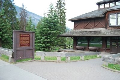
On Banff Avenue, on the right when traveling south.
Opened in 1895, the Banff Park Museum was moved into this building in 1903. Its cross-log motif exemplifies an architectural style common in the town at the time. Norman Bethune Sanson, the museum’s curator from 1896 to 1932, . . . — — Map (db m8836) HM
On Spray Avenue, 0.3 kilometers south of Rundle Avenue, on the right.
This hotel is among the largest and most renowned of the fashionable resort hotels established along railway and steamship routes in Canada during the late 19th and early 20th centuries. Constructed by the Canadian Pacific Railway Company in stages . . . — — Map (db m100084) HM
Born in Ceylon and educated in Scotland and Germany, Gibbon studied painting before turning to journalism. As publicity agent for the Canadian Pacific Railway from 1913 to 1945 he combined advertising with the promotion of a Canadian identity, . . . — — Map (db m108632) HM
Located at the top of Sulfur Mountain, the cosmic ray station was completed by the National Research Council in 1956, in preparation for International Geophysical Year (1957–1958) an undertaking involving 66 countries and a dozen scientific . . . — — Map (db m109422) HM
Near Cave Avenue, 1.4 kilometers west of Banff Avenue.
The Cave and Basin Springs were brought to public attention after being located by CPR construction workers in 1883. These and the Upper Hot Springs soon drew private entrepreneurs and tourists. Growing support for public ownership prompted the . . . — — Map (db m108877) HM
On 11 Street Southwest at 8 Avenue Southwest, on the right when traveling south on 11 Street Southwest.
[English] The scale and bold design of the Mewata Armoury exemplify the wave of national pride that greeted Canada's strong performance in the South African War. In western Canada this military enthusiasm led to a dramatic . . . — — Map (db m196993) HM
On 13 Avenue Southwest just west of 2 Street Southwest, on the right when traveling west.
[English] Born at Hopewell Hill, New Brunswick, Bennett moved to Calgary in 1897. A member of the legislature of the North West Territories (1898-1905) and of the Alberta Legislative Assembly (1909-11), he was elected to the Commons . . . — — Map (db m202450) HM
On Macleod Trail Southeast just south of 7 Avenue Southeast, on the right when traveling north.
[English] Completed in 1911, this building reflected the city's urban aspirations during its pre-1914 development boom. Designed by Regina architect William M. Dodd in the Romanesque Revival style often favoured for large municipal . . . — — Map (db m202627) HM
On 8 Avenue Southwest (Stephen Avenue) west of Centre Street South, on the right when traveling west.
[English] Stephen Avenue is a superb illustration of the central role that retail streets have played and continue to play in the Canadian urban experience. As a well-preserved commercial street the avenue bears eloquent witness to . . . — — Map (db m220699) HM
On 8 Avenue Southwest west of 1st Street Southwest, on the left when traveling west.
[English] Boasting an elegant facade and luxurious interior, this Neoclassical building is one of the last surviving examples of the “palace” style of cinema in western Canada. Owned by the Allen chain, a pioneer of film . . . — — Map (db m220807) HM
On 2 Street Northeast just west of 2 Avenue Northeast, on the right when traveling west.
[English] Built in 1912-1914, this church is a fine example of the Gothic Revival style, long favoured for ecclesiastical design in Canada. Gothic Revival churches were inspired by those of medieval Europe in plan, composition, and . . . — — Map (db m206552) HM
On Legislature Building Road Northwest just west of 107 Street Northwest, on the right when traveling west.
[English] The Province of Alberta, formerly part of the North-West Territories, was created on 1 September, 1905, and inaugurated at Edmonton on that same day by Governor General Earl Grey and Prime Minister Sir Wilfred Laurier. . . . — — Map (db m206184) HM
Near Fortway Drive Northwest just east of Legislature Building Road Northwest, on the left when traveling east.
[English] Partner in the North West Company, Chief Factor of the Hudson's Bay Company, Rowand of Fort Edmonton was reputed to be "the most influential white man among the wild tribes of the plains". Admired for his courage and . . . — — Map (db m220698) HM
On Main Street (Provincial Highway 22) at Valley Trail (Provincial Highway 546), on the right when traveling north on Main Street.
This plant, which was critical to the development of the Turner Valley oil field, is the earliest gas processing facility built in Canada and the only survivor of its type. The present complex was begun in 1921 after a fire destroyed the original . . . — — Map (db m8825) HM
On Main Street Northwest (Provincial Highway 22) at Valley Trail (Route 546), on the right when traveling north on Main Street Northwest.
Turner Valley is Alberta’s first great oilfield. Initially the field, which began production in 1914, yielded mainly natural gas. Local plants, which provided the only extensive gas-processing system in the province, extracted the marketable . . . — — Map (db m9204) HM
On Yellowhead Highway (Provincial Highway 16) 1 kilometer north of Hazel Avenue (Provincial Highway 93A), on the right when traveling north.
[English] Built by William Henry of the North West Company in 1811 to support David Thompson's exploration of the Athabasca Pass, Henry House stood at the head of navigation on the Athabasca River. When the pass became the principal . . . — — Map (db m202599) HM
On Connaught Drive (Provincial Highway 16A) just north of Miette Avenue, on the right when traveling south.
[English] This building is one of the finest and most influential examples of rustic architecture in Canada’s national parks. Designed by A.M. Calderon and completed in 1914, it introduced a building tradition based on the use of local . . . — — Map (db m197059) HM
On Yellowhead Highway (Provincial Highway 16) 4.2 kilometers north of Maligne Lake Road, on the right when traveling north.
[English] In 1862, the Overlanders, numbering about 250, left their homes in Canada for the Cariboo gold fields. They journeyed via Fort Garry and Edmonton, and thence, guided by Indians to the mountains and westward by the . . . — — Map (db m203692) HM
On Yellowhead Highway (Provincial Highway 16) 8 kilometers south of Miette Road (Range Road 275A), on the right when traveling south.
[English] In 1813, the North West Company built Rocky Mountain House on Brûlé Lake as a provision depot for brigades crossing the Athabasca Pass to the Pacific. When Jasper Hawes took command of the post in 1817 it became known as . . . — — Map (db m203680) HM
Near Icefields Parkway (Provincial Highway 93) 50 kilometers north of David Thompson Highway (Provincial Highway 11).
A preeminent topographical surveyor, Wheeler represented British Columbia on the commission which located and marked the boundary with Alberta between 1913 and 1925. His party surveyed and mapped the 1000 km-long mountain section, using photographs . . . — — Map (db m108876) HM
On Icefields Parkway (Provincial Highway 93) 24 kilometers south of Yellowhead Highway (Provincial Highway 16), on the right when traveling south.
[English] Born in London, Thompson served both the Hudson's Bay Company (1784-1797) and the North West Company (1797-1815) as trader, explorer and surveyor. One of the world’s great geographers, he accurately mapped the main travel . . . — — Map (db m203686) HM
The development of this field in 1947 marked a turning point in the history of the Alberta petroleum industry. After the drilling of Leduc No. 1, the geographical focus of the industry shifted from Turner Valley northward to the central plains area, . . . — — Map (db m8856) HM
On the Crowsnest Highway off-ramp to 1st Avenue South, 0.9 kilometers from Crowsnest Highway (Provincial Highway 3), on the right.
[English] This Canadian Pacific Railway viaduct, built between 1907 and 1909 across the Oldman River Valley, was an engineering triumph. More than 1,600 metres long and 95 metres high, this steel structure is the longest and . . . — — Map (db m196963) HM
Near 3 Avenue South at 6 Street South, on the right when traveling west.
[English] On August 7, 1919, Captain E.C. Hoy made the first crossing of the Canadian Rockies by air from Vancouver following a route over Vernon, Grand Forks, Cranbrook, and through Crawford Pass. His Canadian-built Curtiss JN-4 . . . — — Map (db m201700) HM
Near 3 Avenue South at 6 Street South, on the right when traveling west.
[English] In 1872, on the western bank of the Oldman River at the present site of the Federal Mine, Nicholas Sheran opened the first coal mine in Alberta. He broke his own trails, found his own markets, and hauled coal by ox-team . . . — — Map (db m220697) HM
Near Range Road 142, 0.4 kilometers south of Township Road 183A Road, on the right when traveling south.
[English] The CPR built this reinforced concrete aqueduct between 1912 and 1914. It was part of a large irrigation scheme using water diverted from the Bow River to transform 55,000 hectares east of Brooks from semi-arid rangeland to farmland . . . — — Map (db m196937) HM
Near Century Drive West, 0.2 kilometers west of Provincial Highway 10, on the left when traveling west.
[English] Atlas No. 3 (1936-1956) played a central role in the coal industry of the Drumheller Valley, a leading area in the production of Canadian coal. The mine employed skilled miners and used mechanized equipment to produce . . . — — Map (db m196996) HM
On 50th Avenue at 47th Street, on the right when traveling east on 50th Avenue.
[English] Rapid settlement of western Canada after 1900 created an urgent need for new judicial facilities. The Wetaskiwin Court House was one of the initial group of public buildings constructed in Alberta after the shift from territorial to . . . — — Map (db m197022) HM
On Crowsnest Highway (Provincial Highway 3) 0.1 kilometers east of 2 Avenue, on the right when traveling east.
[English] Between 1888 and 1905 the Government of Canada built a dozen court houses to serve the new settlements on the prairies. Most of these buildings were phased out of service and eventually demolished following the implementation of the . . . — — Map (db m196983) HM
On Morimoto Drive at Hardin Street, on the right when traveling south on Morimoto Drive.
The earliest trade route between eastward and northward flowing waters followed the Clearwater River and the Methye Portage.
Discovered by Peter Pond in 1778 and used continuously for more than a century by fur-traders and explorers, including . . . — — Map (db m8814) HM
Harvesting of the forest has long been an important aspect of life on the Pacific Coast. The native people were the first to utilize this valuable resource in the construction of dwellings, canoes, and implements. In the nineteenth century, spars . . . — — Map (db m9192) HM
Jennie Butchart began to shape this magnificent landscape in 1904. She established, in the style of the grand estates of the period, several distinct gardens to evoke a range of aesthetic experiences. An abandoned limestone quarry was . . . — — Map (db m74419) HM
In 1858, nearly 800 free Blacks left the oppressive racial conditions of San Francisco for a new life on Vancouver Island. Governor James Douglas had invited them here as promising settlers. Though still faced with intense discrimination, these . . . — — Map (db m72868) HM
The first permanent lighthouse on the Pacific coast of Canada, Fisgard was erected in 1859-60 by the British and Colonial Governments to guide mariners into Esquimalt Harbour. Brought from England with the first lightkeeper, the lantern became . . . — — Map (db m70876) HM
This superb example of an Edwardian park was laid out for James and Laura Dunsmuir in the early 20th century. At its centre stands a Tudor Revival mansion, whose picturesque design is enhanced by a rich array of decoration and fine craftsmanship. . . . — — Map (db m72870) HM
From 1878 to 1956 coast artillery installations protected the city of Victoria and the naval base at Esquimalt. Temporary batteries were constructed in response to the Anglo-Russian crisis of 1878, and in the 1890s Canada negotiated with Great . . . — — Map (db m72872) HM
The long naval presence here has produced a unique legacy among defence sites in Canada. From its establishment in 1865 until Britain's Royal Navy withdrew in 1906, Esquimalt served as headquarters of the vast Pacific Station. In the Dockyard, the . . . — — Map (db m72867) HM
Canadian Women's Army Corps (CWAC) Women's service in the military during the Second World War challenged the tradition of all-male armed forces. Between 1941 and 1946, close to 22,000 volunteers enlisted in the CWAC and were posted to bases at home . . . — — Map (db m72873) HM
On Crescent Road at Penzance Road, on the left when traveling south on Crescent Road.
This place, chosen by the Chinese Consolidated Benevolent Association in 1903 for its harmonized elements of Nature expressing the principles of "feng shui", is a significant legacy of the first Canadians of Chinese origin. Traditionally it was a . . . — — Map (db m72874) HM
Near Denison Road, 0.6 kilometers south of Beach Drive.
Competition for sovereignty and trade drew Europeans to the Pacific Northwest coast in the 1780s. Although long known to First Nations people, the strait received its present name in 1787 when Charles Barkley identified it as the legendary . . . — — Map (db m80552) HM
[English] Amor De Cosmos (Lover of the Universe) was the name adopted by William Smith of Windor, Nova Scotia, while in the California goldfields. In 1858 he arrived in Victoria and founded the opposition journal, the Colonist. For over two decades . . . — — Map (db m49079) HM
On Blanshard Street at Pandora Avenue, on the right when traveling north on Blanshard Street.
The Congregation Emanu-El Synagogue was built in 1863, just five years after the arrival if the first members of Victoria's Jewish community during the Fraser River gold rush period. Its opening was widely celebrated in Victoria for, despite their . . . — — Map (db m72875) HM
[English] This hotel was built between 1904 and 1908, and has since been enlarged twice. The architect, Francis M. Rattenbury, followed the practice of the Canadian Pacific Railway in employing the Chateau style, identifiable by the steep slate . . . — — Map (db m49238) HM
[English] Opened in 1889, the Victoria Law Courts was the first major public building constructed by the provincial government after union with Canada. Previously, court sessions had been held in one of the colonial administration buildings located . . . — — Map (db m49098) HM
On Wharf Street at Fort Street, on the left when traveling north on Wharf Street.
The mooring rings on the rocks below are the only surviving fragment of Fort Victoria built by the Hudson’s Bay Company in 1843. From 1846, when the Oregon boundary was drawn at the 49th parallel, this post served as grand depot and headquarters of . . . — — Map (db m9195) HM
On Government Street at Broughton Street on Government Street.
Founded by the Hudson’s Bay Company in 1843, Fort Victoria became, after 1846, the head-quarters of the Company’s trade in British territory west of the Rocky Mountains. When the Colony of Vancouver Island was formed in 1849 Victoria was the . . . — — Map (db m48542) HM
On Wharf Street at Broughton Street on Wharf Street.
(English) Completed in 1875 in the Second Empire style, Victoria’s original Custom House is a distinguished example of the buildings erected by the new Federal Government after Confederation. It regulated the trade of the West Coast’s busiest port . . . — — Map (db m49077) HM
[English] Begbie practised [sic] law in England for fourteen years before his appointment in 1858 as the first judge of the mainland Colony of British Columbia. During the gold rush, he won the respect of lawless miners of the Fraser River and . . . — — Map (db m49082) HM
On Blanshard Street, on the right when traveling south.
Soaring skywards with its bold array of coloured brick, stone and slate, St. Andrew's Roman Catholic Cathedral displays the confident spirituality that characterizes the best religious architecture of the High Victorian Gothic style. Designed in . . . — — Map (db m70881) HM
On Blanshard Street at Humboldt Street, on the right when traveling south on Blanshard Street.
This picturesque building is one of the finest expressions in wood of the Gothic Revival style in Canada. It was constructed in 1875 for the Reformed Episcopal church in Victoria by the Reverend Edward Cridge. Architect John Teague enhanced the . . . — — Map (db m72884) HM
Near Douglas Street / Trans-Canada Highway (National Highway 1), on the right when traveling south.
Victoria’s first city hall was designed in 1875. The building was begun three years later and completed in 1890. The designer was John Teague, an Englishman long resident in Victoria, who was responsible for planning many of the city’s . . . — — Map (db m49126) HM
On Fisgard Street at Fan Tan Alley on Fisgard Street.
[English] This district, first settled in 1858, is the oldest and most intact Chinatown in Canada, representing an important chapter in the long history and heritage of Chinese Canadians. As the major immigrant port of entry on the west coast in . . . — — Map (db m52980) HM
Born near Levis, Demers was trained at the Seminary of Quebec, ordained in 1836 and sent in 1838 as a missionary to the Columbia. His ministry extended from the interior of British Columbia to Oregon. First pastor of St. John's Church of Oregon . . . — — Map (db m72879) HM
On Broughton Street at Blanshard Street, on the right when traveling east on Broughton Street.
Constructed in 1912-1913 during the Victoria building boom, this structure originally opened as the Royal Victoria Theatre, owned by a group of local entrepreneurs. Theatres of this type, presenting live dramatic, musical and vaudeville . . . — — Map (db m72881) HM
For over a century, St. Ann's played an important role in the educational life of Western Canada. It served as the regional motherhouse for the Sisters of St. Ann, the major female Roman Catholic teaching and nursing order in British Columbia, which . . . — — Map (db m72883) HM
[English]
The province of British Columbia was created on July 20, 1871. Formerly a crown colony established by the union in 1866 of Vancouver Island with the mainland colony of British Columbia, the addition of the Pacific coast province made . . . — — Map (db m49038) HM
On Government Street at Simcoe Street on Government Street.
[English] Artist and author Emily Carr was born here and lived most of her life in this neighbourhood of Victoria where she died. Her compelling canvases of British Columbia landscape offer a unique vision of the forest an shore, while her . . . — — Map (db m49241) HM
On Douglas Street at Belleville Street on Douglas Street.
[English]
Justifiably described as “the father of British Columbia”, Douglas was born in Demerara. He joined the North West Company in 1819, serving at Fort William and Ile a la Crosse where he was taken into the Hudson’s Bay Company. . . . — — Map (db m48769) HM
Built for coal magnate Robert Dunsmuir, Craigdarroch symbolized the desire of late 19th-century industrialists to assert their social position through conspicuous displays of wealth. Completed in 1890, the eclectic mansion features . . . — — Map (db m72876) HM
This magnificent estate, residence of the Crown's representatives in British Columbia, is a cultural landscape that boasts a long and remarkable association with this high office. In 1865 the government of the colony purchased Cary Castle, a house . . . — — Map (db m72878) HM
Born into a family of Ayrshire coalmasters, Robert Dunsmuir achieved renown as a leading Canadian businessman. He developed the Wellington Mine near Nanaimo, which soon made him one of the richest men in Canada and, through his labour practices, one . . . — — Map (db m72880) HM
A career Imperial civil servant, Anthony Musgrave served as governor of Newfoundland (1864 - 69) and British Columbia (1869 - 71). Both terms of office were marked by a strong personal effort to encourage the two colonies to unite with the new . . . — — Map (db m72882) HM
This imposing brick roundhouse is a particularly fine example of an industrial structure associated with the steam railway era in Canada. Built in 1913, the ten-stall roundhouse with attached machine, boiler and blacksmith's shops is part of a . . . — — Map (db m72877) HM
On Brilliant Road, 0.5 kilometers east of Gorkoff Road, on the right when traveling east.
[English] This historic Bridge commemorates an achievement of the Doukhobors of Canada in establishing communal settlements in the Kootenay Boundary region of British Columbia during the early 20th century. Built in 1913 by community labour, . . . — — Map (db m197114) HM
Near Trans-Canada Highway (Provincial Highway 1) 0.8 kilometers north of Lybarger Road, on the right when traveling north.
[English] While exploring these mountains in the summer of 1865, Walter Moberly, assistant surveyor-general of British Columbia, noted the flight of eagles through a break in the Gold Range (Monashees), thereby discovering Eagle Pass. After . . . — — Map (db m198549) HM
On Kootenay Highway (Provincial Highway 93) 0.7 kilometers south of Simpson River Trailhead, on the right when traveling north.
[English] Born in the Scottish Highlands, Simpson joined the Hudson's Bay Company in 1820. In 1821 he became governor of the Northern Department, and in 1826 governor-in-chief in Rupert's Land. An energetic administrator with a . . . — — Map (db m201674) HM
On Yellowhead Highway (Provincial Highway 16) 24.8 kilometers west of Icefields Parkway (Provincial Highway 93), on the right when traveling west.
[English] This pass was used for brief periods from the mid-1820s to the early 1850s by the Hudson's Bay Company, principally to transport leather, especially moosehides, from the Saskatchewan District to its posts in New Caledonia. . . . — — Map (db m202600) HM
On Granville Street, on the right when traveling north.
Bright lights, glamorous decor, and streamlined forms are features which make the Vogue a magnificent example of the Art Deco style. Built by the Odeon chain in 1941, the theatre was unusual in its ability to accommodate both movies and . . . — — Map (db m236740) HM
Near Beacon Lane, 1.1 kilometers south of Marine Drive when traveling south.
[English] This lighthouse replaced an 1875 building of which the foundations of the keeper's dwelling survive. Built in 1912 by contractor W.H. Rourke, the hexagonal reinforced concrete tower, 18.3 metres high, is an early example of this . . . — — Map (db m198577) HM
On 9th Street just north of Victoria Avenue (Provincial Highway 1A), on the left when traveling north.
[English] Born near London, Upper Canada, Sifton as lawyer, politician, businessman and principal owner of the influential Manitoba Free Press, had great impact on Canadian development. As a member of the Manitoba Cabinet, he . . . — — Map (db m200468) HM
On Second Avenue south of Lady of the Lake Drive, on the left when traveling south.
New Iceland represents a distinctive episode in the early settlement of the Canadian West. In 1875 and 1876, more than a thousand Icelandic immigrants settled a large tract of land reserved for them by the federal government along the western shore . . . — — Map (db m8453) HM
Near Camp Hughes Road (Road 91 W) 1.6 kilometers south of Provincial Road 351.
[English] Named after Sir Sam Hughes, Minister of Militia and Defence (1911–1916), this site contains the most intact First World War battlefield terrain created for training purposes in Canada. One of a dwindling number worldwide, . . . — — Map (db m218700) HM
On Main Street just north of Third Avenue, on the right when traveling north.
[English] An internationally renowned writer, artist, and social reformer, Seton was passionately interested in nature and the relationship of Native peoples to their environment. His realistic animal stories were best-sellers that . . . — — Map (db m201689) HM
On Southshore Road (Provincial Highway 11), on the left when traveling south.
Pres de cet endroit s'élevait le Fort Maurepas, un des
postes de commerce de la Verendrye. La compagnie de la
Baie d'Hudson et la Compagnie
du Nord Ouest s'établirent
ici en 1792. Le Fort Alexander,
construit par la compagnie de
la . . . — — Map (db m204282) HM
On River Road (Provincial Highway 238) at St. Andrew's Road (Provincial Highway 410), on the left when traveling north on River Road.
Erected between 1852 and 1854, this large limestone dwelling housed the rector of nearby St. Andrew’s church and complemented the massive construction of that building. The rectory, built for the Reverend William Cockran was one of the first stone . . . — — Map (db m8449) HM
On River Road (Provincial Highway 238) at St. Andrews Road (Provincial Highway 410), on the left when traveling north on River Road.
Beginning in 1828 the Rev. W. Cockran held religious services in the homes of settlers in this area. In 1829 he established a permanent residence at Grand Rapids on the Red River and by 1831 had built a small wooden church. His growing congregation . . . — — Map (db m8445) HM
On River Road (Provincial Highway 238), on the right when traveling north.
Built in the mid-1850s, this house was the residence for a private girls’ school run by Matilda Davis until 1873. The school was supported by families of the Red River Settlement and by officers of the Hudson’s Bay Company from across western Canada . . . — — Map (db m8450) HM
On Railway Avenue, on the left when traveling south.
This impressive grouping of five standard-plan wooden grain elevators is a rare survivor of the long rows that once dominated Prairie towns. The row was built between 1922 and 1941, Manitoba's golden age of elevators, by a cross-section . . . — — Map (db m8491) HM
On River Road (Provincial Highway 238), on the right when traveling north.
This is the only Caméré curtain bridge-dam built in North America, and by far the largest ever constructed. H.E .Vautelet, the Canadian engineer responsible for its design, adapted a French technological advancement to deal with the . . . — — Map (db m9205) HM
On Transcanada Highway (National Route 1) 2.4 kilometers east of Manitoba Highway 26, on the right when traveling west.
The first marker of the Dominion Lands Survey was placed 10 July, 1871, on the Principal Meridian, about half a mile south of this site. The system, then inaugurated by Lieutenant Colonel J.S. Dennis, Surveyor-General, extends across the prairies . . . — — Map (db m8489) HM
Near Manitoba Route 209 near Manitoba Highway 209.
Constructed in 1899, this church is a fine early example of Ukrainian ecclesiastical architecture in Canada. Its distinctive massing, plan and bulbous cupolas reflect the Byzantine-influenced architectural heritage of the homeland of the settlers in . . . — — Map (db m8421) HM
Near Main Street (Trans-Canada Highway) (Provincial Highway 1) just south of Broadway, on the right when traveling south.
[English] This road was formerly part of a cart trail, also known as the Carlton, Saskatchewan or Fort Ellice Trail, which extended 1,400 kilometres between Fort Garry and Fort Edmonton. It was the principal overland trade route in . . . — — Map (db m220204) HM
Near Assiniboine Avenue just west of Main Street (Trans-Canada Highway) (Provincial Highway 1), on the left when traveling west.
[English] A native of Trois-Rivières, soldier, trader and explorer, La Vérendrye founded the first white settlements on the Canadian Prairies. Between 1731 and 1743 he and his sons established several posts beyond Lake Superior . . . — — Map (db m220128) HM
Near Broadway (Trans-Canada Highway) (Provincial Highway 1) just east of Garry Street, on the right when traveling east.
[English] Built between 1911 and 1913 according to plans drawn by architects George A. Ross and David H. MacFarlane, this hotel was one of a series constructed by Canadian railways in what is known as the Château style. The Fort . . . — — Map (db m220398) HM
Near Main Street (Trans-Canada Highway) (Provincial Highway 1) just south of Broadway, on the right when traveling south.
[English] Near this side stood the following Forts: Fort Rouge, under La Vérendrye, 1738; Fort Gibraltar, of the North West Company, 1810, became Fort Garry of the Hudson’s Bay Company, 1822; replaced by Upper Fort Garry, of stone, . . . — — Map (db m220450) HM
Near Tache Avenue just north of Rue Despins, on the right when traveling north.
[Français] Erigée à la fin des années 1840, cette maison a servi de premier couvent aux Sœurs Grises qui y firent de l’enseignement et dispensèrent des soins aux malades, aux orphelins et aux vieillards. Première institution de . . . — — Map (db m219200) HM
On King Street (Manitoba Route 42) just north of William Avenue, on the right when traveling north.
[English] This labour leader and politician fought for the interests of workers and advocated on behalf of the Jewish community. One of the more moderate leaders of the Winnipeg General Strike of 1919, Heaps pushed . . . — — Map (db m214599) HM
On Balmoral Street just north of Portage Avenue, on the left when traveling north.
[English] Born in Ontario, Bryce moved, in 1871, to Winnipeg where he had a distinguished career as clergyman, educator, and author. He founded Manitoba College and helped organize the University of Manitoba and the Manitoba . . . — — Map (db m200595) HM
On Memorial Boulevard (Provincial Highway 62) just south of Portage Avenue (Provincial Highway 85), on the right when traveling south.
[English] After establishing colonies of the dispossessed peasantry of Ireland and his native Scotland in Prince Edward Island and Upper Canada, Lord Selkirk secured from the Hudson's Bay Company a grant of land in southern Rupert's . . . — — Map (db m220400) HM
On Carlton Street (Manitoba Route 57) just south of Ellice Avenue, on the right when traveling south.
[English] A path-breaking advocate of women's rights in Manitoba, Cora Hind also gained international reputation as an agricultural journalist. Writing for the Manitoba Free Press from 1901 to 1942, she became legendary for the . . . — — Map (db m203900) HM
On Graham Avenue just east of Edmonton Street, on the right when traveling east.
[English] Founded in 1939 by Gweneth Lloyd and Betty Farrally, the Royal Winnipeg Ballet (RWB) was one of the earliest ballet companies in Canada and the first to achieve professional status. It successfully adapted classical ballet . . . — — Map (db m219000) HM
On Main Street (Manitoba Route 52) just south of Bannatyne Avenue, on the right when traveling south.
[English] The skyscraper was a by-product of technological advances and increased urbanization of the late 19th century. Steel-frame construction, the elevator and rising land values made multi-storeyed buildings . . . — — Map (db m214900) HM
On Main Street (Manitoba Route 52) just south of Market Avenue, on the right when traveling north.
[English] This ten story steel-framed office block is representative of early high-rise building construction technology in Winnipeg. Designed in the Chicago style of architecture by J. Wilson Gray of Toronto, it was . . . — — Map (db m214896) HM
On King Street (Manitoba Route 42) just south of William Avenue, on the right when traveling north.
[English] This remarkable group of commercial buildings vividly illustrates Winnipeg’s transformation between 1878 and 1913 from a modest pioneer settlement to Western Canada’s largest metropolitan centre. The . . . — — Map (db m215273) HM
On Market Avenue at Lily Street, on the right when traveling east on Market Avenue.
[English] In 1970, this structure was built to house the Manitoba Theatre Centre, a group founded in 1958 that has made a significant and lasting contribution to the development of regional theatre. Inside, the . . . — — Map (db m214600) HM
On Main Street (Manitoba Route 52) just south of William Avenue, on the right when traveling south.
[English] Constructed in 1903-1904, this building is Western Canada's oldest skyscraper. It combines the technology of steel framing, a rich exterior and an elegant interior to project a sense of modernity and . . . — — Map (db m215158) HM
Near Assiniboine Avenue, 0.2 kilometers east of Osborne Street North (Provincial Highway 62), on the right when traveling east.
[English] Born at St. Andrew's in the Red River settlement, Norquay was elected to the first provincial assembly in 1870. He held several cabinet portfolios from 1871 to 1878 when he became Premier. His government, based on communal . . . — — Map (db m220514) HM
Near Assiniboine Avenue, 0.2 kilometers east of Osborne Street North (Provincial Highway 62), on the right when traveling east.
[English] Born at L'Assomption, Lower Canada, Father Ritchot arrived at St. Norbert as a missionary in 1862, serving there until his death. He took part in the Red River Settlement's resistance when Canada annexed the Northwest . . . — — Map (db m220564) HM
On Kennedy Street at Broadway (Trans-Canada Highway) (Provincial Highway 1), on the right when traveling south on Kennedy Street.
[English] The construction of this monumental court house between 1912 and 1916 marked the peak of a period of dramatic growth for Winnipeg. Its classically-inspired design complemented the nearby Legislative Building and provided . . . — — Map (db m220569) HM
On Donald Street just north of Graham Avenue, on the left when traveling south.
[English] Erected in 1883-1884 to the designs of Winnipeg architect Charles H. Wheeler, this picturesque limestone structure is a fine example of the High Victorian Gothic style. It displays a creative interpretation . . . — — Map (db m214576) HM
475 entries matched your criteria. The first 100 are listed above. Next 100 ⊳