475 entries match your criteria. Entries 101 through 200 are listed.⊲ Previous 100 — Next 100 ⊳
Canada, Historic Sites and Monuments Board Historical Markers
Mandated to advise the Government of Canada, through the Minister of the Environment, on the commemoration of nationally significant aspects of Canada's history, the Board authorizes Parks Canada to install plaques inscribed with a bilingual text describing the historic significance of the subject. They are sometimes also written in a third language, particularly when the commemorated subject is linked to the history of Aboriginal peoples or ethnocultural communities.
By Kevin Craft, July 9, 2017
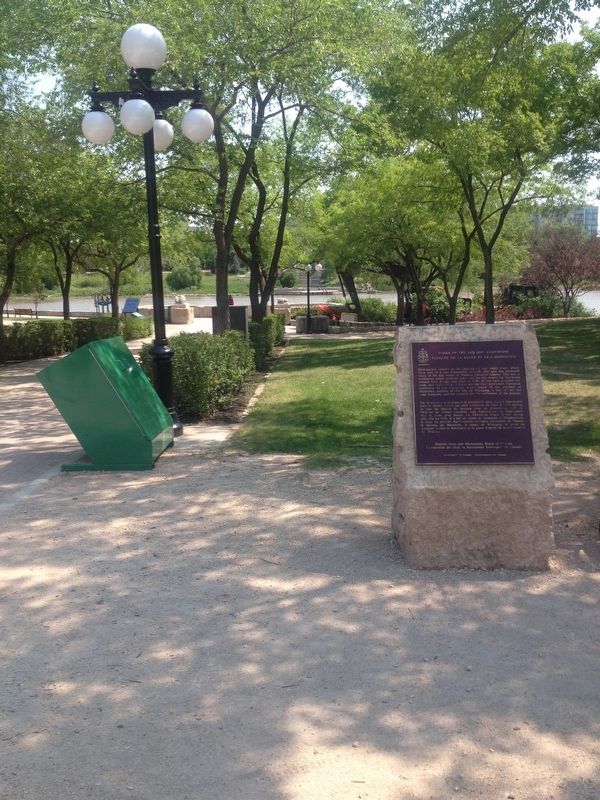
Wideview of Forks of the Red and Assiniboine Marker
Strategically located at the junction of two major rivers which form part of a vast continental network, this spot has witnessed many of the key events of Western Canadian history. This was a traditional native stopping place and for this reason La . . . — — Map (db m106447) HM
Near Forks Market Road, 0.3 kilometers east of Fort Gibraltar Trail.
[English] Between 1731 and 1743 La Vérendrye, a native of Trois-Rivières, supervised the construction of a series of fur trade posts west of Lake Superior. To secure the trade of the resident Cree, Ojibwa and Assiniboine, he and his . . . — — Map (db m220485) HM
Angered that they had not been consulted about the transfer of the Hudson's Bay Company territories to Canada, the inhabitants of the Red River Settlement, led by Louis Riel, in 1869 proclaimed a Provisional Government which took control of the . . . — — Map (db m106489) HM
On Main Street (New Brunswick Route 114) just south of Legion Street, on the left when traveling south.
Near this town on 3rd September 1755, a detachment of Major Frye's troops, sent from Fort Cumberland to destroy Acadian settlements on the river and compel the people to surrender for deportation, was defeated by a French force under Charles . . . — — Map (db m106630) HM
On Main Street (New Brunswick Route 114) at Hopewell Cross Road, on the right when traveling south on Main Street.
Viscount of Mickelham, Calgary and Hopewell
[Burgundy marker on monument]
Rt. Hon. Richard Bedford Bennett
1870-1947
Born at Hopewell Hill, New Brunswick, Bennett moved to Calgary in 1897. A member of the legislature of the North . . . — — Map (db m106707) HM
On Connell Street (New Brunswick Route 550), on the left when traveling south.
Lumber merchant and politician, Charles Connell had this house
constructed circa 1840. Its pedimented front and freestanding columns
make it a fine example of the Greek Revival style. Such houses inspired
by classical temples are rare . . . — — Map (db m139149) HM
On Montague Street at Edward Street, on the right when traveling west on Montague Street.
English: This elegant church marks the growth of Presbyterianism and the Kirk of Scotland in New Brunswick. Built in 1821-1824, the structure successfully combines the American meeting house form with the British Palladian style. The . . . — — Map (db m137515) HM
On Joes Point Road close to Harriet Street, on the right when traveling east.
This marker consists of two side-by-side plaques, one in English and the other in French. English:
The West Point Blockhouse and a battery were erected by the townspeople of St. Andrews at the outbreak of the War of 1812-14 in anticipation . . . — — Map (db m77240) HM
On Water Street close to King Street, on the right when traveling east.
English
Founded by Loyalists in 1783, St. Andrews is a fine and rare surviving example of a Canadian town whose plan and character clearly reflect its 18th-century origins. The town retains the four key elements of a British colonial . . . — — Map (db m77398) HM
On Milltown Boulevard (New Brunswick Route 170) close to King Street, on the right when traveling east.
English
Built in 1885-1887, this building was constructed to house the post office, customs and internal revenue. Designed under federal chief architect Thomas Fuller, the structure is one of a series of building erected to establish a . . . — — Map (db m77238) HM
On West St. Peter Boulevard (New Brunswick Route 11) near Sainte Ann Street North, on the left when traveling east.
English:
Because of the vicissitudes of war, the Acadians, pioneers of this country, were dispersed in 1755. The arrival of Alexis Landry at Ste. Anne de Bocage, soon after 1755, symbolizes the return of the Acadians to their beloved . . . — — Map (db m80579) HM
On Rue Principale (Main Street) (New Brunswick Route 134) at Chemin Desherbiers (Desherbiers Road), on the right when traveling south on Rue Principale (Main Street).
Français:
Né à Saint-Louis-de-Kent et ordonné prêtre en 1870, Mgr Richard fut l'une des figures de proue de la renaissance acadienne. Il stimula la colonisation afin de centrer l'exode yeti les États-Unis, fonda des écoles, des . . . — — Map (db m139702) HM
On Rue Victoria south of Station Street, on the right when traveling south.
English: From a start in his family's small sawmill in the 1880s, Archibald came a prominent pioneer of the New Brunswick pulp industry. As the lumber trade fell into decline, he sought new ways to exploit the province's vast forest . . . — — Map (db m137447) HM
On Chipman Hill just south of Union Street, on the left when traveling north.
English:
Remarkable for the range of trompe l'œil effects and skillful execution, the wall and ceiling paintings inside this residence, part of a row of similar town houses, reflect the taste of the High Victorian era, . . . — — Map (db m140107) HM
Construction of this tower was begun by the British Army during the War of 1812 as one of the projected series of fortifications intended to block the western land approach to Saint John. Subsequent to its completion in 1815 the tower was largely . . . — — Map (db m120628) HM
On Peters Wharf at Water Street, on the right when traveling east on Peters Wharf.
English
The first vessel in the world propelled by a compound steam engine was the REINDEER launched for service on the Saint John, in 1845. Both the vessel and engine were designed by Benjamin Tibbets, a native of Queen’s County, New . . . — — Map (db m77428) HM
On Peters Wharf at Water Street, on the right when traveling east on Peters Wharf.
English
In 1854, Robert Foulis of St. John, N.B., first advocated the use of a steam horn or whistle to give warning to vessels in foggy weather. An apparatus devised by him was installed on Partridge Island in 1859. This was the first . . . — — Map (db m77430) HM
Three markers are mounted on this monument Fort Howe
English Late in 1777 Major Gilfred Studholme hurriedly fortified this ridge overlooking the mouth of the Saint John River. Throughout the remainder of the American . . . — — Map (db m77537) HM
Near Fort Latour Drive at Navy Way, on the right when traveling east.
English:
In 1631, Charles de Sainte-Étienne de La Tour built a fort here on ground traditionally used by First Nations people, for some 4000 years. The fort became one of the earliest centres of the French fur trade with the . . . — — Map (db m139998) HM
On Sydney Street close to Kings Square North, on the left when traveling north.
English
The increase of population consequent upon the large influx of Loyalists in 1783 and 1784 convinced the British government of the desirability of creating the Province of New Brunswick. This was done on 16 August 1784. Brigadier . . . — — Map (db m77519) HM
On Kings Square South close to Sydney Street, on the right when traveling west.
English
Constructed in 1912-1913 to the designs of Philadelphia architect A.E. Westover, this structure was built by the Keith-Albee chain of New York City and its Canadian subsidiary, the Saint John Amusements Company. Dramatic, musical . . . — — Map (db m77506) HM
On Union Street just west of Germain Street (Wellington Row), on the right when traveling east.
English:
This gracious building is a well-preserved example of the homes built by prosperous United Empire Loyalists and their descendants. Constructed before 1820 by the merchant David Merritt, this house was maintained with . . . — — Map (db m139999) HM
On Sydney Street close to Kings Square South, on the right when traveling west.
English
The cry “Fire!” so terrified Canadians in the early 19th century that communities began to construct permanent fire stations. Erected in 1840, this elegant Neoclassical building is a pioneer example of a firehall . . . — — Map (db m77508) HM
On Prince William Street at Princess Street, on the left when traveling north on Prince William Street.
English: This historic streetscape is distinguished by its rare concentration of homogeneous, primarily late 19th century architecture. Traditionally referred to as “Wall Street,” the area contains major public buildings, banks, . . . — — Map (db m137519) HM
On Charlotte Street at Market Street on Charlotte Street.
English
Built between 1874 ad 1876, the Saint John City market narrowly escaped the fire that swept through the town in 1877 and stands today as a rare and distinguished example of a 19th century market building. Designed in the Second . . . — — Map (db m77535) HM
On Carleton Street at Wellington Row, on the right when traveling west on Carleton Street.
English:
Constructed in 1824-1825, St. John’s is one of the earliest Gothic Revival churches in Canada. Its name, the Stone Church, reflects the high quality of its regularly coursed masonry. The skillful treatment of its Gothic . . . — — Map (db m140105) HM
On Market Square near Chipman Hill, on the left when traveling east.
English
A three-masted full-rigged ship with a modified clipper hull, the Marco Polo earned a reputation as the “fastest ship in the world” and drew international attention to New Brunswick shipyards. Built in 1851 by . . . — — Map (db m77456) HM
Near Market Square at Water Street, on the right when traveling east.
English
On 10 May 1783 the Spring Fleet, carrying over 2,000 Loyalists, arrived at the Saint John River mouth. The exiles, mostly civilians from the Middle Colonies, established themselves in the newly-surveyed townsites of Parr and . . . — — Map (db m77432) HM
On Main Street, 0.2 kilometers south of Big Salmon River Road, on the right when traveling north.
English: From its origins in the late 18th century, the shipbuilding industry profoundly influenced New Brunswick history. Craftsmen in the colony built over 6,000 vessels during the 19th century, a third of the total tonnage produced in . . . — — Map (db m137643) HM
On Main Street (New Brunswick Route 106) just south of Cape Road (Woodlawn Road) (County Route 935), on the left when traveling south.
English: This Classical Revival house was built for Edward Barron Chandler (1800-1880) about 1831. A hipped slate roof tops the ashlar structure. Rustication on the first storey wall contrasts with the smooth face above. Triglyphs . . . — — Map (db m193181) HM
Near Woodlawn Road just east of Main Street (New Brunswick Route 106), on the left when traveling east.
English: Born at Shediac, educated locally, and called to the bar in 1847, Smith represented Westmorland in the New Brunswick Legislature from 1851 to 1867. Minister without portfolio in the first Liberal government of the province . . . — — Map (db m193194) HM
On Main Street near Inglis Street, on the left when traveling east.
English:
Born in or near Shediac, Pascal Poirier (1852-1933), historian and first Acadian senator; Placide Gaudet (1850-1930), historian and genealogist; John Clarence Webster (1863-1950), historian, Professor, and eminent surgeon, all . . . — — Map (db m80578) HM
Near Union Street (New Brunswick Route 105) at Station Road, on the right when traveling south.
English:
Lumber and railway baron and generous benefactor, Gibson was a pivotal figure in the economy of the Maritimes at a time of transformation and integration within the national economy. A leading entrepreneur in mid-to-late . . . — — Map (db m139997) HM
Near St. John Street south of Queen Street (New Brunswick Route 102), on the left when traveling south.
English:
Born in Fredericton, Fisher practised law before entering politics. Excepting the period 1850-1854 he represented York as a member of the Legislature continuously from 1837 until his retirement in 1868. Entering the . . . — — Map (db m139900) HM
On Church Street north of Brunswick Street (New Brunswick Route 102), on the right when traveling north.
English:
Christ Church Cathedral, begun in 1845, is one of the best and earliest examples of the Gothic Revival in Canada. Its stone walls, crossing tower and picturesque massing, echoing the internal parts of the church, were . . . — — Map (db m139987) HM
Near St. John Street south of Queen Street (New Brunswick Route 102), on the left when traveling south.
English:
The Legislature of New Brunswick, recognizing the growing importance of health as a matter of public concern, established, in 1918, a department of government with specific and exclusive responsibilities in that field. . . . — — Map (db m139899) HM
On York Street just north of Queen Street (New Brunswick Route 102), on the left when traveling north.
English:
Built in 1875-1876 to the design of architects McKean and Fairweather, this is the oldest municipal hall in Atlantic Canada still used for civic administration. Its imposing exterior and the many functions it has . . . — — Map (db m139800) HM
On Rue Carleton Street north of Queen Street (New Brunswick Route 102), on the left when traveling north.
English:
This building is one of four remaining structures of the British establishment which housed the garrison at Fredericton from 1784 until the withdrawal of Imperial troops in 1869. Occupying the area between York and Regent . . . — — Map (db m139996) HM
Near St. John Street south of Queen Street (New Brunswick Route 102), on the left when traveling south.
English:
Born in Sunbury County, educated at King’s College, and called to the bar in 1832, Wilmot entered politics as a reformer and represented York County in the Legislature (1835-51). A member of the Executive Council . . . — — Map (db m139897) HM
Near St. John Street south of Queen Street (New Brunswick Route 102), on the left when traveling south.
English:
Born in England, Douglas was Lieutenant-Governor and Commander in Chief of New Brunswick (1823-1831). He encouraged agriculture and fostered pioneer work in steam navigation and lighthouse construction. In 1828 he founded . . . — — Map (db m139898) HM
On George Street just east of York Street, on the left when traveling west.
English:
Built in 1886, St. Paul's is a fine example of High Victorian Gothic Revival architecture, fashionable in Canada during the second half of the 19th century. The style is marked by a bold and vigorous approach to design, . . . — — Map (db m139980) HM
On Queen Street (New Brunswick Route 102) just west of Rue Carleton Street, on the right when traveling west.
English:
Six companies of this Fredericton-based regiment made a 700-mile, 52-day march to Quebec and Kingston between February and April 1813. The feat was accomplished in the face of hunger, cold and heavy snows, with remarkably . . . — — Map (db m139995) HM
On Queen Street (New Brunswick Route 102) 0.1 kilometers west of St. John Street, on the right when traveling west.
English:
Opened about 1858, this building is the earliest surviving New Brunswick court house constructed of brick. It represents the beginning of the trend toward the widespread use of brick and stone in public buildings in the . . . — — Map (db m139799) HM
English
Cape Spear, Newfoundland’s oldest surviving lighthouse, has served as the chief approach light for St. John’s harbour since 1836. Constructed by local builders Nicholas Croke and William Parker, it consists of a stone towner . . . — — Map (db m79112) HM
Near Newfoundland and Labrador Route 10, on the right when traveling north.
Two plaques are mounted on this monument. English:
Near this site stood the “Mansion House” built between 1621 and 1625 by Captain E. Wynne, resident governor of the Colony of Avalon, for the proprietor, Sir . . . — — Map (db m79466) HM
English
In 1693 the French began construction of Fort Royal to guard the harbour at Placentia. When it was completed in 1703, several batteries and outworks supported the main fortifications. The defences, however, were precariously . . . — — Map (db m78917) HM
English
This hill was the site of the decisive assault by British troops on the French lines, September 15, 1762, in the last phase of the battle in North America between the forces fo Great Britain and France. The victorious attack, led by . . . — — Map (db m78938) HM
On Duckworth Street close to Soloman's Lane, on the left when traveling north.
English
This Italianate style building recalls evolution of banking in Newfoundland, Designed by Halifax architect David Stirling for the Bank of British North America, it opened in 1850 at a time when British investors controlled banking . . . — — Map (db m79034) HM
On Water Street close to Job Street, on the left when traveling south.
English
This remarkable building served as the headquarters and terminus of the Newfoundland railway system. Begun in 1881, the railway played a significant role in the development of the island. Its benefits were evident by the eve of . . . — — Map (db m79109) HM
On Forest Road close to Taaffe's Lane, on the right when traveling west.
English
Educator, suffragist, and prominent nursing leader, Mary Southcott led the campaign to professionalize nursing in early 20th-century Newfoundland. Trained in London, England, she founded the St. John’s General Hospital School of . . . — — Map (db m79031) HM
On Church Hill close to Gower Street, on the right when traveling north.
English
Begun in 1847, under the direction of Bishop Feild, this cathedral was designed by the noted British architect George Gilbert Scott and is an internationally important monument of the Gothic Revival style. Its historical . . . — — Map (db m79058) HM
On Water Street close to McMurdo's Lane, on the left when traveling north.
English
The St. John’s Court House, built 1900-1094, is by far the most striking and elaborate courthouse in the province. Set into a steep hill it commands a dramatic view of the harbour. The Romanesque Revival building was designed by . . . — — Map (db m79032) HM
On Duckworth Street at Cathedral Street, on the left when traveling north on Duckworth Street.
English
Born in Scotland, Carson came to Newfoundland as a physician in 1808, and became an ardent advocate of social and political reform. He was leader in the campaign for an elected legislature, established in 1832, and helped bring . . . — — Map (db m79033) HM
Near Newfoundland and Labrador Route 436 close to Newfoundland and Labrador Route 430.
English:
Discovered in 1960, this is the first authenticated Norse site found in North America and could be Leif Ericsson's short-lived Vinland camp. Some time about AD 1000 Norse seafarers established a base here from which they . . . — — Map (db m79611) HM
On West Street close to Hospital Road, on the right when traveling east.
English:
Born in England and trained in medicine, Grenfell gave 50 years of service to the people of northern Newfoundland and Labrador, and became a legend in his own time. He and those he inspired brought medical, spiritual and . . . — — Map (db m79610) HM
English:
From 1763 to 1767 Captain Cook. R.N directed a survey embracing the greater part of the coast of Newfoundland. The charting of this coastline was the first scientific, large scale, hydrographic survey to use precise triangulation . . . — — Map (db m79672) HM
On L'Anse Amour Branch Road close to Trans-Labrador Highway (Newfoundland and Labrador Route 510), on the right when traveling south.
English:
This mound of rocks is the earliest known funeral monument in the new world and marks the burial place of an Indian child who died about 7500 years ago. The Maritime Archaic people, to whom the child belonged, occupied this area . . . — — Map (db m79551) HM
English:
In the 16th century, the Labrador side of the Strait of Belle Isle emerged as the world's largest producer of whale oil. At its peak, whaling on this coast attracted nearly 2000 Basques annually from Spain and France, and Red Bay . . . — — Map (db m79527) HM
On St. George Street close to St. James Street, on the left when traveling north.
English
From its strategic setting, Annapolis Royal has witnessed pivotal events in the history of European settlement in Canada. Located on a former Mi’kmaq meeting place, the townsite and its environs were known as Port-Royal by the . . . — — Map (db m78670) HM
Near St. George Street close to St. Anthony Street, on the left when traveling west.
Two markers are located on these monument. Charles Fort / Le fort Charles English
A group of about 70 Scottish settlers began a colony here in 1629, eight years after King James I granted ‘Nova Scotia’ to Sir William . . . — — Map (db m78486) HM
Near St. George Street close to St. Anthony Street, on the left when traveling west.
English
A French Huguenot in the British army, Mascarene served here from 1710 to 1750. He was a member of the Council of Nova Scotia (1720-50), lieutenant-colonel of Philipps’ Regiment (1742-50), and administrator and commander in chief . . . — — Map (db m78491) HM
Near St. George Street close to St. Anthony Street, on the left when traveling west.
English
Adjutant-General of the force under Colonel Francis Nicholson which captured Port Royal, Capital of Acadia, in 1710.
First Governor and Commander-in-Chief. A notable figure in colonial history. An able soldier and administrator. . . . — — Map (db m78482) HM
On St. George Street, on the right when traveling north.
English
The Sinclair Inn is an important document in the history of building in Atlantic Canada. In the 1780s, tavern-keeper Frederick Sinclair created this inn by combining two existing structures. Both were frame, and the walls of one . . . — — Map (db m78701) HM
Near St. George Street close to St. Anthony Street, on the left when traveling west.
Two plaques share a common stand.
William Wolseley
1756-1842
English
William Wolseley was born at Annapolis Royal, the son of an officier of the garrison. He entered the Royal Navy in 1769, and served with . . . — — Map (db m78607) HM
On McKeen Street north of William Street, on the right when traveling north.
English:
Having demonstrated the feasibility of transatlantic wireless communication in 1901, Guglielmo Marconi established a permanent station on Cape Breton Island in 1902. When the original Table Head site proved too . . . — — Map (db m139300) HM
On Timmerman Street north of Vivian Street, on the left when traveling east.
English:
In 1901 Signor Guglielmo Marconi received the first transatlantic radio message at Signal Hill in St. John’s. On 15 December, 1902, he sent the first West to East message from a new station at Table Head to Poldhu, . . . — — Map (db m139201) HM
Near Havenside Road, on the left when traveling east.
English:
On this site was erected by France, in 1731, the first Lighthouse Tower, constructed of fireproof materials, in North America.
Near here the British erected batteries to silence the defensive works erected by France. In 1745, . . . — — Map (db m79967) HM
English:
In 1713, France decided to found Louisbourg to defend her colonial and maritime interests in North America. As capital of the colony of Isle Royale and guardian the Gulf of Saint. Lawrence, it became the most important French . . . — — Map (db m79915) HM
Near Havenside Road, on the left when traveling east.
English:
This tablet commemorated the valour and endurance displayed against overwhelming odds, by the French forces, who, in 1745 and again in 1758, garrisoned the defensive batteries on the Island opposite the entrance to the harbour of . . . — — Map (db m79968) HM
English:
Captured in Africa at the age of 19 and transported to Ile Royale, where she was sold to a member of the colonial elite, Marie Marguerite Rose is seen to be a key figure of the initial phase of Black slavery in Canada. Gaining her . . . — — Map (db m79917) HM
English: Here, 8th June, 1758, the men of Brigadier General James Wolfe’s brigade, after having been repulsed with heavy loss by the French troops entrenched westward made their gallant and successful landing.
Thus began the operation . . . — — Map (db m79938) HM
On Long Beach Road, 1 kilometer north of Marconi Trail (Route 255), on the left when traveling north.
Français:
Deux mille pieds au sud-est de cet endroit se trouvent les vestiges de la première exploitation régulière d’une mine de charbon en Amérique, commencée par le Français en 1720. Cette industrie, modeste à son origine, est . . . — — Map (db m139292) HM
On Esplanade north of York Street, on the left when traveling north.
English:
A distinguished military engineer, of Huguenot descent, Desbarres served in the British Army in North America during the Seven Years’ War, and participated in the capture of Louisbourg in 1758 and of Quebec in 1759. From . . . — — Map (db m140081) HM
On Esplanade north of York Street, on the left when traveling north.
English:
A native of Sydney, Bourinot was a journalist and legislative reporter in Halifax before joining the parliamentary staff at Ottawa in 1868. From 1880 to 1902 he served as Clerk of the House and was a recognized authority . . . — — Map (db m140082) HM
On Victoria Road (Route 28) south of Church Street, on the right when traveling north.
English:
In the late 19th and early 20th centuries, thousands of immigrants came to Cape Breton from Europe, the West Indies, the United States, and elsewhere to work in iron and steel production. Many settled in Whitney Pier, . . . — — Map (db m139295) HM
Near New Waterford Highway (Nova Scotia Route 28) 0.6 kilometers east of Cooks Lane, on the left when traveling east.
English:
During the Second World War the Royal Canadian Navy and the Royal Canadian Air Force protected shipping on vital North Atlantic routes which were the lifeline of the Allies. Army units shared in the defence of the . . . — — Map (db m140130) HM
On Glooscap Trail (National Route 2) 0.5 kilometers west of Belmont Road/Fort Belcher Road, on the right when traveling west.
English: This was the chief route of the French and Indians from Cobequid to Isle St. Jean and Louisbourg and later of the British from Halifax to Charlottetown.
Français: C’était la route principale des Français . . . — — Map (db m139192) HM
On Main Street (Nova Scotia Route 6) at Church Street, on the left when traveling west on Main Street.
In this harbour Capt. David Donahew of New England with three armed vessels surprised Lieut. Paul Marin's allied force en route from Annapolis Royal to Louisbourg. He drove them ashore, disheartened the Canadian Indians and prevented the French . . . — — Map (db m108133) HM
On Prince Street at Lorne Street, on the left when traveling east on Prince Street.
This building, opened in 1884, was erected to house the Post Office, Customs and Internal Revenue. Designed under the supervision of federal Chief Architect Thomas Fuller, the Truro Post Office was part of a nation-wide programme to house federal . . . — — Map (db m108244) HM
On Victoria Street East (Nova Scotia Route 6) just south of Havelock Street (Nova Scotia Route 2), on the right when traveling west.
Born in Amherst, Chandler was called to the New Brunswick bar in 1823. He represented Westmorland in the legislature (1827-36), was a Legislative Councillor (1836-78) and a member of the Executive Council almost continuously between 1844 and 1858. . . . — — Map (db m107018) HM
On Victoria Street East (Nova Scotia Route 6) just south of Havelock Street (Nova Scotia Route 2), on the right when traveling south.
Born in Cumberland County, N. S., McCully practised law in Amherst and was appointed to the Legislative Council of Nova Scotia in 1848 serving as Solicitor General and Government leader in the Council (1860-62). As editor of the Halifax Morning . . . — — Map (db m108034) HM
On Victoria Street East (Nova Scotia Route 6) just south of Havelock Street (Nova Scotia Route 2), on the right when traveling west.
Born in Amherst, educated at Windsor Academy, and called to the bar in 1834, Dickey practiced law in Amherst and sat in the Legislative Council of Nova Scotia (1858-67). A Father of Confederation, he attended both the Charlottetown and Quebec . . . — — Map (db m107017) HM
On Victoria Street East (Nova Scotia Route 6) just south of Havelock Street (Nova Scotia Route 2), on the right when traveling south.
Born at Amherst and educated in medicine, Tupper was elected in 1855 to the Nova Scotia Assembly, becoming Premier in 1864. In alliance with John A. Macdonald, he skilfully manoeuvered unwilling Nova Scotians into Confederation. Having held . . . — — Map (db m108038) HM
On Sunrise Trail (Nova Scotia Route 6) just east of Kerrs Mill Road, on the right when traveling east.
Born at Wallace Bridge, Newcomb moved to the United States in 1853. Graduating from Harvard he became Professor of Mathematics in the U.S. Navy and was assigned to the Naval Observatory. He was soon recognized as an authority on mathematical . . . — — Map (db m108085) HM
Near Water Street at King Street, on the left when traveling north.
English:
In 1957, at the height of the Cold War, the first Pugwash Conference on Science and World Affairs took place in this serene setting. Hosted by philanthropist Cyrus Eaton, top-level scientists from both sides of the Iron . . . — — Map (db m140759) HM
On School Street, on the right when traveling east.
Important as a centre for the North Atlantic fisheries from
the 16th century, the islands in Canso Harbour offered a
safe haven for fishermen. First frequented by the French
and Basques, the area became the site of an extensive . . . — — Map (db m138598) HM
On Pleasant Street (Nova Scotia Route 16), on the right when traveling north.
Born at Port Shoreham, N.S., educated at Guysborough Academy and at McGill, Tory served as professor at McGill (1893-1905), Principal of McGill College, Vancouver (1906-7), first President of the University of Alberta (1908-28), and . . . — — Map (db m138221) HM
On Marine Drive (Nova Scotia Route 316) at Port Felix Loop, on the left when traveling west on Marine Drive.
Every summer for more than 40 years,
beginning in 1565, this Basque fisherman
from Saint-Jean-de-Euz sailed to Eskikewa'kik,
a district of Mi’kma’ki within the traditional
territory of the Mi'kmaq. Here, his crew
caught codfish, which . . . — — Map (db m138605) HM
English
Built about 1819 by John Black, successful merchant and Executive Councillor (1813-23), this house is a notable example of the finest Halifax residences of its day - the first important era of stone construction in the town. James . . . — — Map (db m77657) HM
Near Union Street close to Kenny Street, on the left when traveling north.
English
Before the voyages that brought him world fame as Captain Cook, this British Royal Navy officier complied navigational charts for the coasts of Quebec and Nova Scotia. While based in Halifax from 1758 to 1762, he learned . . . — — Map (db m77953) HM
Near Granville Street north of Duke Street, in the median.
English:
This building, erected in 1860, provides a rare and early example of a full cast iron facade in Canada. Used in construction since the 1770s, cast iron had become a popular decorative material by the mid-19th century . . . — — Map (db m139596) HM
Near Upper Water Street just north of Duke Street, on the right when traveling north.
English:
An ambitious seaman from Liverpool, N.S., and sometime privateer, Enos Collins was reputed to be the richest man in British North America when he died. His fortune, amassed through shrewd investments in mercantile, . . . — — Map (db m139664) HM
Near Granville Street north of Duke Street, in the median.
English:
Born in Halifax, Newton had his first art lessons in Boston from his uncle Gilbert Stuart, painter of the George Washington portraits. Leaving for Europe in 1815 he settled in London and entered the Royal Academy Schools . . . — — Map (db m139597) HM
Near University Avenue west of Lemarchant Street when traveling west.
English:
In September, 1814, a British military and naval expedition from Halifax, under Lieutenant General Sir John Coape Sherbrooke and Rear Admiral Edward Griffith, occupied the portion of Maine between the Penobscot and St. . . . — — Map (db m140379) HM
On Sackville Street close to Brunswick Street, on the left when traveling north.
English
Built to defend against a land-based attack, the Halifax Citadel was the fourth in a series of forts to occupy this hill, The star-shaped fortress, completed in 1856, was the centerpiece of the extensive system of fortifications . . . — — Map (db m78258) HM
Near Argyle Street just south of Duke Street, on the left when traveling south.
English:
The Halifax City Hall, erected between 1887 and 1890, is the
largest and one of the oldest municipal buildings in Nova Scotia.
Designed by a local architect, Edward Elliot, its elegant facade
features an attractive and . . . — — Map (db m139509) HM
Near Upper Water Street close to Duke Street, on the left when traveling south.
English From the founding of Halifax in 1749 until the early twentieth century, this portion of the waterfront was associated with men and events in the civic and commercial life of the city. These seven typical warehouses and offices, . . . — — Map (db m77826) HM
On Beaufort Avenue at Belmont on the Arm, on the right when traveling east on Beaufort Avenue.
English:
A gifted lawyer, legislator, and judge, this Father of Confederation helped pave the way for Nova Scotia's reluctant entry into the new Dominion. He was a member of this colony's legislature and served as solicitor . . . — — Map (db m140961) HM
Near Barrington Street close to Spring Garden Road.
English
The Old Burying Ground, which contains more than 1,200 head and footstones, constitutes a unique concentration of gravestone art. A rich variety of styles, poignant images and carving skill is reflected in these old stones. The . . . — — Map (db m77784) HM
There are three plaques on this monument.
Pier 21 / Le Quai 21 English
This site witnessed the arrival of approximately one million immigrants, who have enriched the cultural mosaic of Canada. Opened in 1928, Pier 21 served . . . — — Map (db m77718) HM
475 entries matched your criteria. Entries 101 through 200 are listed above. ⊲ Previous 100 — Next 100 ⊳