By Mark Hilton, August 26, 2017
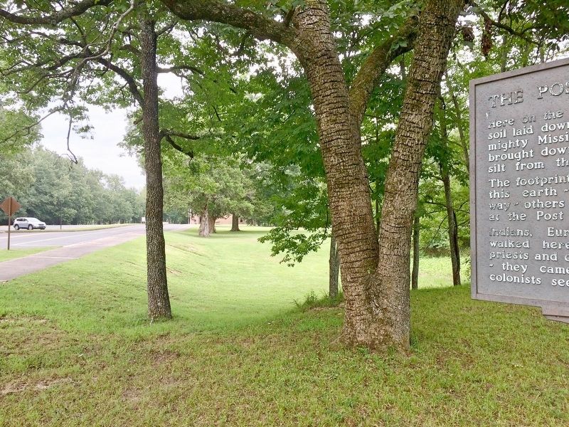
View from marker towards National Park Service Visitors Center.
| On Old Post Road at State Route 169, on the right when traveling south on Old Post Road. |
| Near Old Post Road, 0.5 miles south of State Route 169. |
| On Old Post Road, 0.5 miles south of State Route 169, on the left when traveling south. |
| Near Old Post Road, 0.8 miles south of State Route 169. |
| Near Old Post Road, 0.8 miles south of State Route 169. |
| Near Old Post Road, 0.8 miles south of State Route 169. |
| Near Old Post Road, 0.8 miles south of State Route 169. |
| Near Old Post Road, 0.5 miles south of State Route 169. |
| On Arkansas Route 153, 1 mile north of Arkansas Route 1, on the left when traveling north. |
| On Arkansas Route 153 north of Starks Lane, on the right when traveling north. Reported permanently removed. |
| On U.S. 165 at State Route 169, on the right when traveling north on U.S. 165. |
| On Belnap Avenue at NCC Camp Road, on the right when traveling east on Belnap Avenue. |
| On Broadway Avenue at Main Street, on the right when traveling east on Broadway Avenue. |
| On West Broadway Avenue at Arkansas Street, in the median on West Broadway Avenue. |
| Near Arkansas Route 5 at Wolf Street. |
| On Fair Avenue east of Arkansas Highway 59, on the right when traveling east. |
| On State Highway 7, 0.3 miles north of Doe Run Lane West, on the right when traveling north. |
| On North Walnut Street at East Rush Avenue, on the right when traveling north on North Walnut Street. |
| On Golden Gate (Arkansas Route 187) at Parkway Street South, on the right when traveling south on Golden Gate. |
| On Spring Street at Hillside Avenue, on the right when traveling west on Spring Street. |
| On Spring Street, 0.2 miles east of Polk Street, on the right when traveling east. |
| On Spring Street at Howell Avenue, on the right when traveling south on Spring Street. |
| On Flint Street at Steele Street, on the left when traveling south on Flint Street. |
| On Magnetic Drive, 0.2 miles east of North Main Street (Arkansas Route 23), on the left when traveling east. |
| On Main Street (State Highway 23) at Flint Street, on the right when traveling north on Main Street. |
| On Spring Street east of Pine Street, on the left when traveling east. |
| On Spring Street at Pine Street, on the left when traveling east on Spring Street. |
| On Main Street at Spring Street (State Highway 23), on the right when traveling north on Main Street. |
| On Spring Street, on the left when traveling north. |
| On North Main Street (Arkansas Route 23) at Magnetic Drive, on the right when traveling south on North Main Street. |
| On Grand Lake Loop (Arkansas Route 8) at Cariola Road when traveling south on Grand Lake Loop. |
| On East Lee Street, 0.5 miles south of South Main Street, on the right when traveling south. |
| On North Lakeshore Drive, 0.8 miles south of Club Drive, on the right when traveling south. |
| On Highway 257 near Bluebird Lane, on the right when traveling south. |
| Near State Highway 142, 0.9 miles east of Robert Mazzanti Road (Parish Road 505). |
| On U.S. 82 at Pugh Circle, on the right when traveling west on U.S. 82. |
| On U.S. 82, 0.1 miles west of Pugh Circle, on the right when traveling west. |
| On Clay Street at Court Street, on the right when traveling east on Clay Street. |
| On Old Camden Road, 0.4 miles south of Marks Cemetery Road, on the right when traveling south. |
| On Arkansas Route 97 at Arkansas Route 8, on the left when traveling north on State Route 97. |
| On East Railroad Avenue west of South Moose Street, on the right when traveling west. |
| On Union Street south of West Washington Avenue, on the left when traveling south. |
| On Main Street (Arkansas Route 59) 0.1 miles west of North 11th Street, on the right when traveling west. |
| On Fayetteville Road (State Highway 59) south of Hynes Street, on the right when traveling south. |
| Near North 3rd Street, 0.1 miles south of Knox Street, on the right when traveling south. |
| On Main Street at South 3rd Street, on the right when traveling east on Main Street. |
| Near North 3rd Street, 0.1 miles south of Knox Street, on the left when traveling south. |
| Near Arkansas Route 77 north of East Military Road, on the right when traveling south. |
| Near Arkansas Route 77 north of Military Road, on the right when traveling south. |
| On East Military Road at Sycamore Street, on the right when traveling north on East Military Road. |
| On County Road 409, 1.6 miles south of Cunningham Street, on the left when traveling south. |
| On Pickens Street (U.S. 165) east of Jack Dante Drive, on the right when traveling east. |
| On Arkansas Route 1, 0.1 miles south of Arkansas Route 138. |
| On Kelso Road, 0.3 miles east of State Route 1, on the right when traveling east. |
| On Arkansas Route 1 at Front Street, on the right when traveling east on State Route 1. |
| Near State Highway 319, 1.6 miles west of Old Morrilton Highway (U.S. 64). |
| Near State Highway 319, 0.1 miles west of Cadron Settlement Lane. |
| On East River Street east of South 1st Street, on the right when traveling east. |
| Near U.S. 63 at Main Street (State Route 9), on the right when traveling north. |
| Near U.S. 63 at Main Street (State Route 9), on the right when traveling north. |
| Near U.S. 63 at Main Street (State Route 9), on the right when traveling north. |
| Near U.S. 63 at Main Street (State Route 9), on the right when traveling north. |
| Near U.S. 63 at Main Street (State Route 9), on the right when traveling north. |
| On Reserve Street near Central Avenue. |
| On Fountain Street, 1.2 miles north of Central Avenue (State Highway 7), on the left when traveling west. |
| Near Central Avenue (Arkansas Route 7) at Canyon Court, on the right when traveling south. |
| Near Central Avenue (Arkansas Route 7) south of Whittington Avenue, on the right when traveling south. |
| On Central Avenue (Arkansas Route 7) at Canyon Court, on the right when traveling south on Central Avenue. |
| Near Country Club Road west of Malvern Avenue (Business U.S. 270), on the left when traveling west. |
| On Central Avenue (Arkansas Route 7) 0.2 miles north of Reserve Street, on the right when traveling north. |
| On Grand Promenade, 0.2 miles south of Fountain Street, on the left when traveling south. |
| On Highway 46, 2 miles south of Highway 291, on the right when traveling south. |
| Near State Highway 46, 1.9 miles south of State Highway 291, on the right when traveling south. |
| Near U.S. 270 west of Salburnit Road (State Route 291), on the right when traveling west. |
| On Pavilion Road east of Martin Luther King Boulevard (Business U.S. 270), on the left when traveling east. |
| On Chaney Drive, on the right when traveling east. |
| On Avenue Street, 0.1 miles west of Adams Street, on the right when traveling west. |
| Near Avenue Street west of Dillard Street, on the right when traveling west. |
| On Avenue Street, 0.1 miles west of Adams, on the left when traveling north. |
| On Avenue Street west of Adams, on the right when traveling west. |
| On North Main Street (U.S. 63/79) south of Myrtle Street, on the left when traveling west. |
| On West Main Street (U.S. 64) at South Fulton Street, on the right when traveling east on West Main Street. |
| On West Main Street (U.S. 64) at South Fulton Street, on the right when traveling east on West Main Street. |
| Near Arkansas Route 25 at 3rd Street, on the left when traveling south. |
| On State Road 25, 0.1 miles 3rd. Street, on the right when traveling east. |
| On South Drew Street at West Bradley Street, on the right when traveling south on South Drew Street. |
| On Arkansas Route 234 at County Road 133, on the right when traveling south on State Route 234. |
| On U.S. 412 at North Berry Street, on the right when traveling east on U.S. 412. |
| On County Road 201 south of State Highway 160, on the left when traveling south. |
| On State Highway 160, 0.4 miles east of County Road 4, on the right when traveling east. |
| On State Highway 198, on the left when traveling west. |
| On State Highway 198 when traveling east. |
| Near State Highway 362, 1.8 miles east of U.S. 49. |
| Near State Highway 362, 1.8 miles east of U.S. 49. |
| Near State Highway 362, 1.8 miles east of U.S. 49. |
158 entries matched your criteria. The first 100 are listed above.
The final 58 ⊳