After filtering for Minnesota, 199 entries match your criteria. The first 100 are listed. ⊳
Parks & Recreational Areas Topic
By McGhiever, September 29, 2022
CCC Camp 2705 Marker
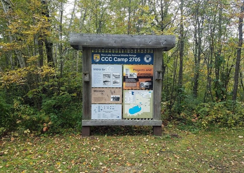
| 1 ► Minnesota, Aitkin County, East Lake — CCC Camp 2705 — Rice Lake National Wildlife Refuge — |
| Near 363rd Lane, on the left when traveling west. | |||
| 2 ► Minnesota, Aitkin County, East Lake — From Railroad Tracks to Refuge Road — |
| On 363rd Lane at Minnesota Route 65, on the right when traveling west on 363rd Lane. | |||
| 3 ► Minnesota, Aitkin County, East Lake — Mandy Lake — Rice Lake National Wildlife Refuge — |
| On Mandy Lake Access at 363rd Lane, on the left when traveling west on Mandy Lake Access. | |||
| 4 ► Minnesota, Anoka County, Anoka — Robert W. Akin — Akin Riverside Historic Promenade — |
| On Bridge Square. | |||
| 5 ► Minnesota, Anoka County, Anoka — The Stone House — Akin Riverside Historic Promenade — |
| Near 1st Avenue south of East Main Street, on the right when traveling south. | |||
| 6 ► Minnesota, Beltrami County, Bemidji — Historic Beltrami Camp — |
| On State Park Road Northeast, on the left when traveling north. | |||
| 7 ► Minnesota, Beltrami County, Waskish — The Marina — |
| Near State Highway 72, on the left when traveling north. | |||
| 8 ► Minnesota, Beltrami County, Waskish — The Old Waskish Town Site — |
| Near Waskish Road NE (County Road 40) west of State Route 72. | |||
| 9 ► Minnesota, Beltrami County, Waskish — The Patterned Peatland: Rare and Valuable — |
| Near State Highway 72, on the left when traveling north. | |||
| 10 ► Minnesota, Blue Earth County, Mankato — Amos Owen Garden of American Indian Horticulture — |
| On Warren Street north of Stadium Road, on the left when traveling east. | |||
| 11 ► Minnesota, Blue Earth County, Mankato — Lincoln Park — |
| On South Broad Street north of Lincoln Street, on the right when traveling north. | |||
| 12 ► Minnesota, Blue Earth County, Mankato — Minnesota State Parks — Windows on Minnesota’s Landscapes — Explore Minnesota's Prairie as Minneopa State Park — |
| Near Gadwall Road west of 547th Avenue. | |||
| 13 ► Minnesota, Blue Earth County, Mankato — Ray Erlandson Park — |
| 14 ► Minnesota, Blue Earth County, Mankato — Sibley Park — |
| Near Mound Avenue west of Spence Street. | |||
| 15 ► Minnesota, Blue Earth County, Mankato, South Bend Township — Former Homestead of Robert & Frieda Ulmen — 1950 - 1995 — |
| On Minneopa State Park south entrance road south of Gadwall Road (County Route 69), on the right when traveling east. | |||
| 16 ► Minnesota, Blue Earth County, Mankato, South Bend Township — George M. Palmer — 1853 – 1939 — |
| Near Gadwall Road (County Route 69), on the left when traveling west. | |||
| 17 ► Minnesota, Brown County, Hanska — Lake Hanska Pioneer / Lake Hanska County Park — A Tribute to Ole Synsteby 1856 – 1942 — |
| Near County Road 11, 1.1 miles north of County Road 6, on the left when traveling north. | |||
| 18 ► Minnesota, Brown County, New Ulm — John Lind Home — |
| On North State Street at Center Street on North State Street. | |||
| 19 ► Minnesota, Carlton County, Carlton — Henry C. Hornby — |
| Near State Highway 210, 3.9 miles east of State Highway 45, on the right when traveling east. | |||
| 20 ► Minnesota, Carver County, Victoria — Clearing the Land, Making a Home — Grimm Farm Historic Site — |
| Near Grimm Road west of Victoria Drive (County Route 11), on the right when traveling west. | |||
| 21 ► Minnesota, Cass County, Backus — City of Backus Time Capsule — |
| On Washburn Avenue (State Highway 87) at Front Street North (State Highway 87), on the right when traveling east on Washburn Avenue. | |||
| 22 ► Minnesota, Cass County, Walker — "Big Enough to Keep" — Circle of Time — |
| On Minnesota Avenue West (State Highway 200/371) at 3rd Street, on the right when traveling east on Minnesota Avenue West. | |||
| 23 ► Minnesota, Cass County, Walker — "More Than Just A Fish Camp!" — Circle of Time — |
| On Minnesota Avenue West (State Highway 200/371) at 3rd Street, on the right when traveling east on Minnesota Avenue West. | |||
| 24 ► Minnesota, Chisago County, Almelund — Almelund and the Immanual Lutheran Church — |
| On Park Trail (County Route 12) at Maple Lane, on the right when traveling north on Park Trail. | |||
| 25 ► Minnesota, Chisago County, Almelund, Wild River State Park — A Conservation Legacy — |
| 26 ► Minnesota, Chisago County, Almelund, Wild River State Park — Bringing Back the Prairie — |
| Near the main park road north of the road to the boat landing, on the left when traveling north. | |||
| 27 ► Minnesota, Chisago County, Almelund, Wild River State Park — Restored Prairies — |
| 28 ► Minnesota, Chisago County, Almelund, Wild River State Park — What Happened — To the Northern Pine Forests of the St. Croix River Valley? — |
| Near Equestrian campground Road north of Main park road. | |||
| 29 ► Minnesota, Chisago County, Almelund, Wild River State Park — Wild River State Park — Minnesota State Parks — Windows on Minnesota's Landscapes — |
| 30 ► Minnesota, Chisago County, Sunrise, Sunrise Township — Arrow Line Railway — Looking for a Better Life — |
| 31 ► Minnesota, Chisago County, Taylors Falls — A Place that Welcomes Many… — |
| Near Traprock Street south of South Street. | |||
| 32 ► Minnesota, Clearwater County, Park Rapids — From a Day When Trees Were Trees — |
| Near Douglas Lodge Drive. | |||
| 33 ► Minnesota, Clearwater County, Shevlin — Itasca Lake — Source of the Mississippi River — |
| Near Park Drive, 0.5 miles County Highway 48. | |||
| 34 ► Minnesota, Clearwater County, Shevlin — Patterson's Homestead — |
| Near County Road 117, 0.3 miles south of County Road 122. | |||
| 35 ► Minnesota, Clearwater County, Shevlin — Theodore and Johanna Wegmann — |
| Near Park Drive (County Road 38) just north of Itasca Township Road 4, on the left when traveling north. | |||
| 36 ► Minnesota, Clearwater County, Shevlin — Wegmann Store Replica — |
| Near Park Drive (County Road 38) just north of Itasca Township Road 4, on the left when traveling north. | |||
| 37 ► Minnesota, Cook County, Colvill, Hovland — Judge C.R. Magney State Park — "Our state parks are everyman's country estate" - CR Magney — |
| Near Superior Hiking Trail north of Highway 61, on the right when traveling north. | |||
| 38 ► Minnesota, Cook County, Grand Marais — Cascade River Overlook — |
| On North Shore Scenic Drive (State Highway 61) 0.8 miles east of Cascade Beach Road (County Road 97), on the right when traveling east. | |||
| 39 ► Minnesota, Cook County, Grand Marais — Eagle Mountain — Geology of Minnesota — |
| 40 ► Minnesota, Cook County, Grand Marais, Maple Hill — Welcome to the Wildflower Sanctuary — Site History — |
| On County Route 60 at Gunflint Trail (County Route 12), on the left when traveling east on County Route 60. | |||
| 41 ► Minnesota, Cook County, Grand Portage — A Warehouse for Furs, Trade Goods, and Now—Canoes — |
| Near Mill Creek Road, 0.2 miles south of Store Road. | |||
| 42 ► Minnesota, Cook County, Grand Portage — Guard the Gate — |
| Near Mill Creek Road, 0.1 miles south of Store Road. | |||
| 43 ► Minnesota, Cook County, Grand Portage — Naming This Place — |
| Near Mill Creek Road, 0.6 miles north of Marina Road. | |||
| 44 ► Minnesota, Cook County, Grand Portage — Voyageurs at Grand Portage — |
| Near Mill Creek Road, 0.2 miles south of Store Road. | |||
| 45 ► Minnesota, Cook County, West Cook — Portage Canoe Rest — |
| Near Moose Pond Drive (County Route 81). | |||
| 46 ► Minnesota, Cook County, West Cook — The American Plan Cabin — |
| Near Moose Pond Drive (Highway 81). | |||
| 47 ► Minnesota, Cottonwood County, Comfrey — Florence Cook Roefer Prairie Trail — |
| On 510th Avenue (County Road 2). | |||
| 48 ► Minnesota, Cottonwood County, Comfrey — Glaciers Marked the Rock — |
| On 510th Avenue (County Road 2). | |||
| 49 ► Minnesota, Cottonwood County, Comfrey — How did this Prairie get here? — |
| Near 510th Avenue (County Road 2). | |||
| 50 ► Minnesota, Cottonwood County, Comfrey — Prairie Preservation — |
| On 510th Avenue (County Road 2). | |||
| 51 ► Minnesota, Cottonwood County, Comfrey — Survival Through Fire — |
| On 510th Avenue (County Road 2). | |||
| 52 ► Minnesota, Cottonwood County, Comfrey — Why did people come to this region? — |
| On 510th Avenue (County Road 2). | |||
| 53 ► Minnesota, Crow Wing County, Brainerd — Depot Park — |
| On Front Street at South 6th Street (Voyageur Highway) (Business State Highway 371), on the right when traveling west on Front Street. | |||
| 54 ► Minnesota, Crow Wing County, Pequot Lakes — Art Savage, Fire Tower Ranger — |
| Near County Road 11, 0.3 miles east of State Highway 371, on the left when traveling east. | |||
| 55 ► Minnesota, Crow Wing County, Pequot Lakes — Close to Home... Area Historic Wildfires — |
| Near County Road 11, 0.3 miles east of State Highway 371, on the left when traveling east. | |||
| 56 ► Minnesota, Crow Wing County, Pequot Lakes — Fire and Healthy Forests — |
| Near County Road 11, 0.3 miles east of State Highway 371, on the left when traveling east. | |||
| 57 ► Minnesota, Crow Wing County, Pequot Lakes — Firefighting Heritage — |
| Near County Road 11, 0.3 miles east of State Highway 371, on the left when traveling east. | |||
| 58 ► Minnesota, Crow Wing County, Pequot Lakes — Fires and Firefighting — Protecting our Homes and Landscape — |
| Near County Road 11, 0.3 miles east of State Highway 371, on the left when traveling east. | |||
| 59 ► Minnesota, Crow Wing County, Pequot Lakes — Minnesota's Most Devastating Wild Fires — |
| Near County Road 11, 0.3 miles east of State Highway 371, on the left when traveling east. | |||
| 60 ► Minnesota, Crow Wing County, Pequot Lakes — Paul M. Thiede Fire Tower Park — |
| Near County Road 11, 0.3 miles east of State Highway 371, on the left when traveling east. | |||
| 61 ► Minnesota, Crow Wing County, Pequot Lakes — Prescribed Fire — |
| Near County Road 11, 0.3 miles east of State Highway 371, on the left when traveling east. | |||
| 62 ► Minnesota, Crow Wing County, Pequot Lakes — The Growing Forest — Young Aspen Stand — |
| Near County Road 11, 0.3 miles east of State Highway 371, on the left when traveling east. | |||
| 63 ► Minnesota, Crow Wing County, Pequot Lakes — The Pequot Fire Lookout Tower — |
| Near County Road 11, 0.3 miles east of State Highway 371, on the left when traveling east. | |||
| 64 ► Minnesota, Crow Wing County, Pequot Lakes — The Spotter's Cabin — |
| Near County Road 11, 0.3 miles east of State Highway 371, on the left when traveling east. | |||
| 65 ► Minnesota, Crow Wing County, Pequot Lakes — The Warehouse & Office — |
| Near County Road 11, 0.3 miles east of State Highway 371, on the left when traveling east. | |||
| 66 ► Minnesota, Dakota County, Mendota Heights — Local Stone, National Story — |
| On Sibley Memorial Highway west of Minnesota Route 13, on the left when traveling north. | |||
| 67 ► Minnesota, Freeborn County, Albert Lea — Everyone's Country Estate — |
| On Interstate 90 W at milepost 171. | |||
| 68 ► Minnesota, Goodhue County, Red Wing — Kiwanis Stairway — |
| Near East 5th Street. | |||
| 69 ► Minnesota, Goodhue County, Zumbrota — Zumbrota Covered Bridge 1970-1997 — |
| On West Avenue, 0.1 miles north of West 2nd Street, on the right when traveling north. | |||
| 70 ► Minnesota, Hennepin County, Edina, Country Club — Dwight Williams Park — |
| Near West 50th Street east of Browndale Avenue, on the left when traveling east. | |||
| 71 ► Minnesota, Hennepin County, Edina, Golf Terrace Heights — A Creek, a Cause and Some Cows: Add Together, What Do You Get? — |
| Near W. 50th Street east of Browndale Avenue, on the right when traveling east. | |||
| 72 ► Minnesota, Hennepin County, Fort Snelling — Coldwater Springhouse & Reservoir |
| Near South Minnehaha Park Drive, 0.5 miles south of East 54th Street. Reported missing. | |||
| 73 ► Minnesota, Hennepin County, Fort Snelling — Welcome to Fort Snelling State Park — |
| On Minnehaha Park Drive at E. 54th Street, on the left when traveling south on Minnehaha Park Drive. | |||
| 74 ► Minnesota, Hennepin County, Fort Snelling — Welcome to Fort Snelling State Park / A Moving Obstacle — |
| On Snelling Lake Road, on the right when traveling north. | |||
| 75 ► Minnesota, Hennepin County, Minneapolis, Beltrami — Maple Hill Cemetery — |
| On Broadway Street NE east of Polk Street NE, on the right when traveling east. | |||
| 76 ► Minnesota, Hennepin County, Minneapolis, Calhoun Isles — The Chain of Lakes — Linking the Lakes — Minneapolis Park & Recreation Board 125th Anniversary — |
| Near Bde Maka Ska Drive at The Mall, on the left when traveling north. | |||
| 77 ► Minnesota, Hennepin County, Minneapolis, Calhoun Isles — 2 — The Railroad and the City — Midtown Corridor — CM & St P Grade Separation Historic District — |
| On the Midtown Greenway at Humboldt Avenue, on the left when traveling east on the Midtown Greenway. | |||
| 78 ► Minnesota, Hennepin County, Minneapolis, Calhoun Isles — You Are Here… Lake Calhoun — |
| On West Lake Street (County Road 3) at East Bde Maka Ska Parkway, on the right when traveling east on West Lake Street. | |||
| 79 ► Minnesota, Hennepin County, Minneapolis, Camden — Webber Pool — Shingle Creek: swimming hole to pool — |
| On Webber Parkway (County Route 152) at N. Colfax Avenue, on the right when traveling west on Webber Parkway. | |||
| 80 ► Minnesota, Hennepin County, Minneapolis, Cedar-Riverside — Murphy Square — Our First Park — |
| On 23rd Avenue S. north of Butler Place S., on the left when traveling north. | |||
| 81 ► Minnesota, Hennepin County, Minneapolis, Cooper — Mississippi River — Horace Cleveland's Vision — The 125th Historical Marker Project — |
| On West River Parkway north of East 29th Street, on the right when traveling north. | |||
| 82 ► Minnesota, Hennepin County, Minneapolis, Downtown East — A Changing Landscape — Mill Ruins Park — |
| On W. River Parkway east of Portland Avenue, on the left when traveling east. | |||
| 83 ► Minnesota, Hennepin County, Minneapolis, Downtown East — A Milling District Timeline — Mill Ruins Park — |
| On West River Parkway, on the right when traveling west. | |||
| 84 ► Minnesota, Hennepin County, Minneapolis, Downtown East — Mills and Millraces — |
| Near West River Parkway at Portland Avenue, on the right when traveling west. | |||
| 85 ► Minnesota, Hennepin County, Minneapolis, Downtown West — Stevens House — Our Most Moved House — |
| On W. River Parkway. | |||
| 86 ► Minnesota, Hennepin County, Minneapolis, Hiawatha — Stevens House — Our Most Moved House — |
| On Minnehaha Avenue, on the right when traveling north. | |||
| 87 ► Minnesota, Hennepin County, Minneapolis, Hiawatha — The Winchell Trail — Trekking the Gorge — |
| Near West River Parkway north of East 44th Street. | |||
| 88 ► Minnesota, Hennepin County, Minneapolis, Logan Park — Logan Field House — First in Neighborhood Recreation — |
| On 13th Avenue NE at Madison Street NE, on the right when traveling east on 13th Avenue NE. | |||
| 89 ► Minnesota, Hennepin County, Minneapolis, Longfellow — 12 — Wonderland Amusement Park — The Museum in the Streets: Minneapolis, Minnesota — 27th and Lake: Industry and Transportation Infrastructure — |
| On E. Lake Street near 31st Avenue S., on the right when traveling west. | |||
| 90 ► Minnesota, Hennepin County, Minneapolis, Loring Park — Loring Park: Basilica and Churches — |
| On Grant Street west of Nicollet Mall, on the right when traveling west. | |||
| 91 ► Minnesota, Hennepin County, Minneapolis, Marshall Terrace — Building a Community in Northtown — |
| On St. Anthony Parkway at California Street NE, on the right when traveling east on St. Anthony Parkway. | |||
| 92 ► Minnesota, Hennepin County, Minneapolis, Marshall Terrace — Columbia Park and Golf Course — |
| On St. Anthony Parkway at California Street NE, on the right when traveling east on St. Anthony Parkway. | |||
| 93 ► Minnesota, Hennepin County, Minneapolis, Marshall Terrace — MLB ★ Minnesota Twins Rod Carew All★Star Field — Dedicated July 2014 — |
| On Marshall Street NE at St. Anthony Parkway, on the right when traveling north on Marshall Street NE. | |||
| 94 ► Minnesota, Hennepin County, Minneapolis, Marshall Terrace — Park Planning and the Grand Rounds — |
| On St. Anthony Parkway at California Street NE, on the right when traveling east on St. Anthony Parkway. | |||
| 95 ► Minnesota, Hennepin County, Minneapolis, Minnehaha — Restoration — The Changing Landscape — Longfellow Gardens of Yesteryear — |
| Near Minnehaha Avenue at Minnehaha Parkway. | |||
| 96 ► Minnesota, Hennepin County, Minneapolis, Nokomis — Playgrounds — The Innovation of Play — |
| Near East Minnehaha Parkway. | |||
| 97 ► Minnesota, Hennepin County, Minneapolis, Northrop — Bicycle Paths — Pedaling the Parkways — |
| On Minnehaha Parkway East at 14th Avenue South, on the right when traveling east on Minnehaha Parkway East. | |||
| 98 ► Minnesota, Hennepin County, Minneapolis, Phillips — Martin Olav Sabo Bridge — |
| On the Midtown Greenway west of Hiawatha Avenue (Minnesota Highway 55). | |||
| 99 ► Minnesota, Hennepin County, Minneapolis, Powderhorn — Fair Oaks — A Mansion for a Park — |
| On Stevens Avenue at East 22nd Street, on the right when traveling north on Stevens Avenue. | |||
| 100 ► Minnesota, Hennepin County, Minneapolis, Powderhorn Park — Powderhorn Oval — Olympic Proportions — |
| Near 10th Avenue South north of East 33rd Street when traveling north. | |||
199 entries matched your criteria. The first 100 are listed above. Next 100 ⊳