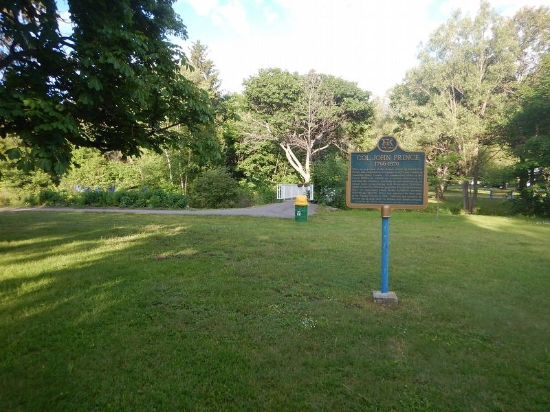
Here, on a portion of his former estate, is buried Col. Prince who emigrated from England in 1833 and settled at Sandwich, Upper Canada. As commanding officer of the Essex Militia, he stirred up a violent controversy by ordering the summary . . . — — Map (db m105739) HM
This house, built between 1814 and 1823 by Charles Ermatinger of the North West Company, is the oldest surviving house in northwestern Ontario. Constructed when Sault Ste. Marie was still a small fur trading post on the Upper Lakes, this fine house . . . — — Map (db m105955) HM
A Maine-born promoter, Clergue transformed Sault Ste. Marie into a major industrial centre. He purchased an unfinished hydroelectric station and canal at the Sault in 1894; then, lacking markets for his electric power, he created his own . . . — — Map (db m106374) HM
Explorer, interpreter, fur trader and diplomat, French-born Perrot played an important role in the establishment and protection of New France's western frontier during the last four decades of the 17th century. In 1671 he was with Saint-Lusson at . . . — — Map (db m105957) HM
The French explorers who first reached this favoured Ojibway hunting and fishing ground were soon followed by fur traders and missionaries who built a post and mission. By 1762 the region had come under British control and the trade eventually fell . . . — — Map (db m106412) HM
Travellers on the canoe route to the West had to make a portage around the St. Mary's rapids. The North West Company established a fur-trading post south of the river by 1791. After the British abandoned their occupation of the American midwest, . . . — — Map (db m106373) HM
In recognition And In Tribute To The Men and Women Of The Mining Industry Who Developed The Gold Mines, And Our Community To What It Is Today. — — Map (db m218198) HM
Wawa's first town historian was Mrs. Agnes Turcott. Born Agnes Lindgren in Goren, Missouri in 1909, she spent her youth on the family homestead at Biggar, Saskatchewan. At the age of 18 she was a pioneer teacher earning $400 a year. Her marriage . . . — — Map (db m218197) HM
Born in Sault Ste. Marie, Ontario in August, 1907, Joseph Ernest Aime Breton was raised in a large family whose parents were involved in the hotel industry. Aime loved the wilderness and people. He could run a hotel just as easily as he could trap, . . . — — Map (db m218502) HM
Born in Cape Breton, Nova Scotia, Alex Ross was attracted to the Michipicoten area with hundreds of other fortune seekers after the cry of gold echoed through the hills in 1897. Alex first worked as a cook at the Minto Mine in 1898. Never one to . . . — — Map (db m218193) HM
Born in 1907, Al Turcott came to Wawa in 1939 with the idea that he would be employed for 6 months assisting with the construction of the crushing plant at the New Helen Mine. Deeply attracted to the area, Al soon sent for his wife Agnes and two . . . — — Map (db m218196) HM
Francis Hector Clergue was the visionary who recognized that Wawa's resource rich wilderness was the fuel to feed an industrial empire in Sault Ste. Marie. Born in Brewer, Maine in 1856, Clergue was a dynamic man with boundless energy, . . . — — Map (db m218375) HM
During the winter months mail was handled by dog sled. The "Hudson's Bay Trail" from Sault Ste. Marie to Michipicoten followed a well-worn path to Batchawana, skirted the shore at Mamainse Harbour, travelled overland to Agawa, then headed north in . . . — — Map (db m218602) HM
Joe Ball is one of Wawa's more colourful pioneers. Born in Michigan in 1864, Joe was one of many prospectors who found himself attracted to the lure of gold in the rugged hills around Wawa at the end of the 19th century. Joe worked as a caretaker . . . — — Map (db m218192) HM
Born in Saginaw, Michigan in 1920, Keith earned his private pilot’s license at the age of 20. He joined the U.S. Navy during World War II and was first stationed in Alaska. He flew OS2U Kingfishers and learned the hard way what the brutal Northern . . . — — Map (db m218191) HM
Louise Towab and her husband William Teddy are memorialized in Wawa's history books as discovering gold on Wawa Lake and forever changing the rugged landscape of this corner of Lake Superior country. Born in 1857, Louise represents the virtually . . . — — Map (db m218194) HM
Mountains of Minerals The town of Wawa is surrounded by some of the world's oldest rock. These ancient Precambrian mountains were formed some 2.7 billion years ago. Within these mountains is a melting pot of minerals that have . . . — — Map (db m218199) HM
I think you would agree that the Wawa town site is situated in the perfect spot — a level plain on the shores of a picturesque lake of crystal green water surrounded by rolling mountains of natural abundance. Wawa's Ojibway ancestors, early . . . — — Map (db m218362) HM
Born in Chalut, France in 1813, Père Dominic Chardon du Ranquet became an ordained Deacon in 1838. He joined the Jesuit priesthood like his three older brothers before him. Instead of following them on their missionary work to India, he volunteered . . . — — Map (db m218601) HM
Sir James Dunn was a major Canadian business icon who was instrumental in the rebirth and growth of Wawa and Sault Ste. Marie in the first half of the 20th century. James Hamet Dunn was born in Bathhurst, New Brunswick in 1874. He was an articulate . . . — — Map (db m218195) HM
For Wawa residents, the name Surluga instantly conjures images of an overgrown gravel road, abandoned headframes rusted mining equipment and forgotten ghost towns. Tom Surluga was born in Krizisce, Croatia in 1907. As a teenager he found himself . . . — — Map (db m218397) HM
Wawa is just one of those place names that stands out. It is one of those names you will never forget. Where did this town get such a unique name and what does it mean? Ojibway Country When the first Europeans traveled to the Wawa . . . — — Map (db m218200) HM
Gold and Iron! What more could a mining town possibly want? The cry of "GOLD" in 1897 transformed the quiet fur trading country of Michipicoten into a bustling miniature Klondike. The Michipicoten Ojibway couple of Louise Towab and William Teddy . . . — — Map (db m218400) HM
Wawa's economy is based on our abundance of natural resources. Fur, fish, iron, gold, water and trees. The jumble of logs found at the base of Scenic High Falls are the remnants of Wawa's important logging history. Wood was first harvested along . . . — — Map (db m218600) HM
William Teddy was an Ojibway/Cree native Canadian born in 1855 in the Missinabie/Moose River region of Northern Ontario. Records show that William worked as a native guide for tourists, recreational fishermen and prospectors travelling thru the . . . — — Map (db m218189) HM
The weekly arrival of Captain Batten and the S.S. Caribou at Government Dock Beach at the mouth of the Michipicoten River was the highlight of early residents during the shipping season. Launched from her home port of Owen Sound in July 1904, the . . . — — Map (db m218556) HM
The life and legacy of Louisa MacKenzie represents the important role of women in Canada's early frontier and the evolution of the fur trade industry. Louisa was the daughter of Honourable Roderick Mackenzie and a Chipewyan woman. Louisa was born . . . — — Map (db m218188) HM
Once the main cemetery used by residents of Michipicoten River Village. It includes families of both Ojibway and European descent. The earliest headstone dates back to 1901. — — Map (db m218482) HM
From this high bluff, on a clear northern day, you can see the vast expanse of Lake Superior and the dramatic coastline of Michipicoten Bay. This is one of the only accessible lookouts with a fantastic view of pristine Lake Superior, mysterious . . . — — Map (db m218668) HM
Reverend James Evans was a Methodist missionary credited with translating the Cree language and creating the first Ojibway-Cree alphabet. Reverend Evans spent the winter of 1838-1839 at Michipicoten Post. Born in England in 1801, Evans emigrated . . . — — Map (db m218646) HM
This house was built in 1831 by Hiram Capron, a
native of Vermont who, in 1822, had emigrated to Norfolk
County where he helped to establish one of Upper Canada's
earliest iron foundries. He settled here at the Forks of the Grand in 1829, . . . — — Map (db m223280) HM
This house and the adjoining structure were built by Asa
Wolverton, a native of Cayuga County, New York, who had
immigrated to Upper Canada in 1826. About 1832 he settled
in Paris, where he erected sawmills and became a prosperous lumber . . . — — Map (db m223265) HM
English: Allies of the British during the American War of Independence, the Six Nations Iroquois received extensive lands along the Grand River in 1784. Mohawks, led by Joseph Brant, established a village of some 400 individuals here by . . . — — Map (db m83697) HM
This house, "Echo Villa", was built by the Reverend Peter
Jones (Kahkewaquonaby) who lived here from 1851 until
his death. Son of the noted surveyor, Augustus Jones, and
Tuhbenahneequay, a Missisauga chief's daughter, Peter was
born at . . . — — Map (db m237708) HM
In the 1820's significant improvements to the Hamilton and London road attracted settlers to the Indian lands at Brant's Ford where this thoroughfare crossed the Grand River. A thriving village soon developed and in 1830 the Six Nations surrendered . . . — — Map (db m199047) HM
A Brief History...
• 11,000 Years Ago - Nomadic hunter/ gatherer culture in tundra-like environment of the Grand River Valley.
• 9000 Years Ago - Hunter/gatherer culture begins to implement seasonal migratory camps.
The environment has . . . — — Map (db m240764) HM
In 1852, shortly after this region was opened for settlement, the government reserved land for a town here on the Elora and Saugeen Road, at the confluence of the Teeswater and Saugeen Rivers. Already settled on the site were Simon Orchard and . . . — — Map (db m198319) HM
County of Carleton
Agricultural Society
1844 - 1944
Presented by
Ontario Department of Agriculture
in recognition of
One Hundred Years Service
September 8th 1944 . . . — — Map (db m109968) HM
In August, 1818, some thirty disbanded veterans of the 99th Regiment, led by Captain G.T. Burke, arrived in newly surveyed Goulbourn Township. These formed the advance party of a military settlement planned and supported by the . . . — — Map (db m109965) HM
St. Andrew's was the first Presbyterian congregation in Carleton County and was served primarily by itinerant preachers until the 1840's. A wooden church was constructed on this site in 1847 and replaced by the present brick church and spire in . . . — — Map (db m109970) HM
Upon sighting American war ships at the mouth of the Thames River on October 1, 1813, the British Army boarded scows and bateaux near this site. One by one, the boats and their cargo were pulled across the river to their next encampment site at . . . — — Map (db m184677) HM
On this site a blockhouse was constructed in 1794 by order of Lieutenant-Governor John Graves Simcoe. He planned to establish here a small naval arsenal which would form a link in the defences of Upper Canada's western frontier and also draw the . . . — — Map (db m71313) HM
Thomas McCrae was an early settler, innkeeper, and political figure in Raleigh Township along the Thames River. He served as a captain and company commander in the Kent Militia and was present at the capture of Fort Detroit. Family tradition relates . . . — — Map (db m71308) HM
The Forks of the Thames are formed by the joining of the Thames River and McGregor Creek creating a peninsula that is present day Tecumseh Park in Chatham, Ontario. The strategic importance of the site was recognized by Lieutenant Governor John . . . — — Map (db m71331) HM
This house belonged to James Harris and his family, who are believed to be descendants of Weldon Harris, an African American who came to Canada and in 1825 purchased 50 acres on Lot 3, Concession 3 in Camden Township. Weldon Harris made . . . — — Map (db m78404) HM
After escaping to Upper Canada from slavery in Kentucky, the Reverend Josiah Henson became a conductor of the Underground Railroad and a force in the abolition movement. The founder of the Black settlement of Dawn, he was also an . . . — — Map (db m78377) HM
In the 1830s, the Reverend Josiah Henson and other abolitionists sought ways to provide refugees from slavery with the education and skills they needed to become self-sufficient in Upper Canada. They purchased 200 acres of land here in . . . — — Map (db m78376) HM
In 1846 Daniel van Allen, a Chatham merchant, laid out a town plot on land purchased from Jared Lindsley, the first settler (1825) on the site of Dresden. By 1849 the erection of a steam sawmill, and the operation a grist-mill in the neighbouring . . . — — Map (db m78416) HM
The Moravians or "Bohemian Brethren" were a protestant sect that originated in the 1400s in Moravia and Bohemia, the present day Czech Republic. They faced persecution in their homeland and in 1722 many moved to Saxony (now part of Germany) where . . . — — Map (db m72448) HM
(Front of monument)
Fairfield on the Thames / Fairfield sur la Thames
Here stood the village of Fairfield, destroyed by invading American forces following the Battle of the Thames. , 5th October, 1813.
Its inhabitants, Delaware . . . — — Map (db m116758) HM
Jacques (James) Baby 1763-1833: A member of the Legislative and Executive Council for Upper Canada, judge for the Western District, and in command of the 1st Kent Militia, Baby was captured by the Americans at the Battle of the Thames.
Billy . . . — — Map (db m71415) HM
James Johnson 1774-1826: The brother of Richard Johnson, James was elected as a Kentucky State senator in 1808. He served as a lieutenant colonel in Johnson's Mounted Infantry and led the charge on the British lines at the Battle of the Thames along . . . — — Map (db m72385) HM
Robert McAfee, a soldier in Colonel Johnson's Mounted Regiment, kept a journal of his experiences, and wrote on October 7, 1813:
Spent the day in collecting in plunder ... Colonel Owings Regiment of Regulars came up and took charge of the . . . — — Map (db m72414) HM
[English] For centuries the site of Cochrane was used by indigenous peoples as a summer camping ground. Later it became a stopping place for fur traders en route to Moose Factory. In 1907 the Temiskaming and Northern Ontario Railway . . . — — Map (db m217898) HM
Erected by the citizens of Iroquois Falls and the directors of the company to the memory of Frank Harris Anson 1859-1923 founder and first president of Abitibi Power and Paper Company Limited. — — Map (db m245618) HM
Was and continues to be recognized country wide. It was clear from the onset this town was to reflect strong and fresh designs complete withGarden Town Themes Our town is claimed as being the first planned community in Canada. Research . . . — — Map (db m245498) HM
[English] This region's first inhabitants were aboriginal peoples who were attracted by its abundant natural resources and extensive water routes. Europeans arrived in the late 1600s to acquire furs and establish trade with the . . . — — Map (db m217890) HM
On July 29, 1916, fires which had been burning for some weeks around settlers' clearings along the Timiskaming & Northern Ontario Railway were united by strong winds into one huge conflagration. Burning easterly along a 40-mile front, it largely or . . . — — Map (db m217800) HM
This village had been named originally after an Indian trapper by the name of MacDougall who was descended from an early Hudson’s Bay Factor. With the arrival of the Temiskaming and Northern Ontario Railway in 1906, the village was renamed Matheson . . . — — Map (db m244994) HM
The chute was a narrow, fast water part of the Black River located approximately 1.0 km above the highway 101 bridge. It was here that the MacDougall family and their friends set up an encampment during their journeys through the area. The chute . . . — — Map (db m244991) HM
[English] From the 1880s onwards, as railways opened up northern Ontario, prospecting activity in this region intensified. The Porcupine gold rush began in 1909 following three significant discoveries. Thousands of prospectors and . . . — — Map (db m217899) HM
[English] There is no shortage of stories about the prospectors who came north during the Porcupine Gold Rush of 1909. Life was not easy; they carried 75-pound packs through muskeg and uneven ground. Of course nothing was certain . . . — — Map (db m199240) HM
Official opening: January 16, 1939 Reeve: Victor H. Evans Council: George Helmer, Melvin Cavanagh, Emil Heino, William Fairhurst Last council at amalgamation: December 31, 1972 Reeve: Ernie R. White Council: Dennis Pope, Maurice Londry, Luigi . . . — — Map (db m244988) HM
[English] Timmins is one of the richest gold producing areas in the world; the Porcupine Gold Rush led to the extraction of well over 65 million ounces of gold to date and by comparison, the Klondike Gold Rush coaxed out just over 5 . . . — — Map (db m244434) HM
[English] "Great Rush of men to the Porcupine!" "On to the Porcupine is now the Cry!" Prospectors and speculators came from across the continent to take part in the Porcupine Gold Rush that began in earnest in 1909 with the . . . — — Map (db m244343) HM
The parish of St. George’s Anglican Church was founded at Duffins Creek (now known as Pickering Village) in 1832. The first incumbent of the parish, the Reverend Adam Elliot, originally met with his parishioners at their homes in an area that . . . — — Map (db m243739) HM
Between 1801 and 1807 a settlement developed here in Pickering Township where the Danforth Road crossed Duffin's Creek. Among the early settlers was Timothy Rogers, a prominent Quaker and colonizer who built a saw and grist-mill in 1809. A . . . — — Map (db m208413) HM
Originally known as Darlington Mills, Bowmanville was founded in 1794 when an American family of Loyalists settled near the site of Vanstone's Mill. The first businesses were established in the river valley south of the mill but are now gone. . . . — — Map (db m245101) HM
The first European settlers in Clarke Township were the Lovekins and the Bates arriving within weeks, possibly days, of one another.
Richard Lovekin Sr. arrived from County Cork, Ireland, via the United States and Niagara-on-the-Lake early in . . . — — Map (db m244742) HM
Perhaps the most fervent of the Methodist sects, the Bible Christian Church was formed in southwestern England in 1815 and established in Upper Canada during the 1830s.
Served by itinerant preachers, its small but loyal memberShip . . . — — Map (db m245216) HM
This mural, by local students of O’Neill C.V.I. and Msgr. Paul Dwyer C.H.S., depicts the first stage coach line that operated on Kingston Road (Hwy 2) between Fort Frontenac (Kingston) and Fort York (Toronto), 1817 to 1855. The last stop before . . . — — Map (db m227890) HM
"A very busy and thriving neighbourhood the harbour must have been in the middle decades of the last century when the Lake was the principal highway, when a great part of what was brought in came to the wharf, as well as most of what was sent . . . — — Map (db m245234) HM
"The house looked much the same as it does now. The buffalo house was behind Henry House and was used for a storage shed after the buffalo were taken away. "
- Betty MacInally
The land where Henry House stands was purchased by the Henry . . . — — Map (db m245223) HM
"It was more of a mystery to the kids of the area. For some reason on the main level of the house there was a pile of leather cuttings.
The kids used to dare one another to get pieces of leather to prove their entry into the house. You were . . . — — Map (db m245228) HM
This Blue Spruce tree has been planted to commemorate the 200th anniversary of the arrival of Captain Benjamin Wilson and family from Vermont in 1790. The Wilsons settled just east of the current harbour location (Lot 4). Together with other early . . . — — Map (db m245256) HM
On July 10, 1847 at Scripture's Inn on this site, a public meeting
was called to change the name of Windsor to Whitby because
of confusion in mail and shipping, with Windsor near Detroit. Whitby village was first called Windsor in 1819 by John . . . — — Map (db m245277) HM
Connection to Town
Fort Malden (originally called Fort Amherstburg) was the anchor of the town, which grew to the south. In this view, you are looking past the parade grounds of the fort (now a park) down Dalhousie Street . . . — — Map (db m71192) HM
Fort Malden Points of Interest • Fort Malden Points d'intérêt
(1) Visitor Centre
1939
Centre d'accueil
1939
(2) Military Pensioner's Cottage
circa 1851 (Restoration) . . . — — Map (db m71278) HM
Pensioner's Cottage
This cottage was built in the early 1850s for a retired soldier and his family. About 85 of these homes were constructed just east of the Fort, and leased at a modest rate to veteran soldiers in return for light . . . — — Map (db m71167) HM
Front - In English
Windsor is the oldest known site of continuous settlement in Ontario. The government of New France, anxious to increase its presence on the Detroit River, offered land agricultural settlement on the south shore in 1749. . . . — — Map (db m37343) HM
Massachusetts born, Hiram Walker had by the 1850s become a successful general merchant, distiller and grain dealer in Detroit. After Michigan adopted prohibition in 1855 he acquired land across the river in Canada where he established a distillery . . . — — Map (db m37377) HM
In 1728 a mission to the Huron Indians was established near Fort Pontchartrain (Detroit) by Father Armand de la Richardie, S.J. The mission was moved to Bois Blane Island and the adjacent mainland in 1742. In 1747 it was destroyed by disaffected . . . — — Map (db m37386) HM
In 1811 Matthew W. Smith located the site for a flour
and saw mill here on the Dunnville Road, south of
the village of Canborough. The mill was constructed
later that year by Major Robinson and operated first
by horses and then by water . . . — — Map (db m235440) HM
Haldimand County
Heritage Landmark
circa 1835
Nicholas
Log Cabin
A fine example of one of the
few remaining early pioneer
hand hewn timber constructed
log cabins in Haldimand County.
It was built by Thomas Nicholas
beside the Old . . . — — Map (db m235457) HM
Following the American Revolution Sir Frederick Haldimand,
Governor-in-Chief of Canada, granted to the Six Nations of
the Iroquois a tract of land extending for six miles on both sides of the Grand River from its source to Lake Erie. This grant . . . — — Map (db m234947) HM
This was the site of a flour and grist mill that served the village of York and district for almost a century. The original mill built in the 1820's or 1830's had a
water-wheel operated by water from the Grand River Navigation Co. dam at York. . . . — — Map (db m234917) HM
After receiving lands on the Grand River in 1784, the Six
Nations Indians invited Captain Hendrick Nelles, a Loyalist from the Mohawk Valley, to settle there with five of his sons. He and Robert, the eldest, established farms in what is new . . . — — Map (db m234914) HM
The Youngs
United Empire Loyalists
This land beside the Grand River was part of the Young
Tract granted to Adam Young and his family for their
loyalty to the Crown during the American Revolution. This
was in recompense for the loss of . . . — — Map (db m234931) HM
Ireland House on Oakridge Farm was built in 1837 by Joseph Ireland, an immigrant from Yorkshire, England.
Constructed of local fieldstone, this house was the home of four generations of the Ireland family. Designated under the Ontario Heritage Act . . . — — Map (db m243813) HM
St Luke's Church was built in 1834 on land originally patented by Chief Joseph Brant. Consecrated in 1838 by the Right Reverend C. J. Mountain, Anglican Bishop of Quebec, the church was a simple two-storey, frame building, with tower plain Gothic . . . — — Map (db m233233) HM
The original house on this site was built about 1800 by the famous Mohawk chief Joseph Brant (Thayendanegea). Two years previously Captain Brant had been granted some 3500 acres of land in this area for his military services to the Crown during . . . — — Map (db m233215) HM
In 1798 Joseph Brant, the celebrated Mohawk War Chief, was given a Crown grant of 3,450 acres in this area. James Gage purchased land from the Brant Tract in 1810, and laid out a town site at the northern end of Burlington Beach from Brant Street . . . — — Map (db m221366) HM
The intersection of Plains Road, Waterdown Road and Lasalle Park Road has always been a hub of activity and enterprise. The area surrounding these corners is rich in history and fabled for its market gardens. The settlement of Burlington Plains was . . . — — Map (db m243820) HM
Trafalgar Township settlers lived in isolation during the early years. Travel was difficult, and there was no newspaper or postal service. But transportation and communication links were not long in coming.
The first stage-coach service began . . . — — Map (db m242234) HM
The oldest commercial buildings date mostly from the 1846-57 period, when Oakville grew from a village of 500 to a newly-incorporated town of 2,000.
Development of Old Oakville's commercial district started at Sixteen Mile Creek and grew east . . . — — Map (db m238571) HM
Oakvilles churches, schools and taverns knit the community together and created a social support network.
Taverns and inns were usually the first public buildings in Upper Canadian towns. They doubled as town halls, churches and courthouses. . . . — — Map (db m238672) HM
The founder of Oakville was born in Nova Scotia of
Loyalist parents who moved to Burlington Bay in 1793.
William served with distinction in the militia during the
War of 1812. He settled in Nelson Township in 1816 and
became a successful . . . — — Map (db m237075) HM
Oakville Heritage Trails
Old Oakville Loop
Early Leaders
In addition to the founder William Chisholm, strong
leadership from other citizens was important in developing
Oakville into a town by 1857. One such person was Merrick . . . — — Map (db m237951) HM
457 entries matched your criteria. The first 100 are listed above. Next 100 ⊳