100 entries match your criteria.
Ohio and Erie Canal Historical Markers
Completed in 1833 and linking Lake Erie with the Ohio River, it spurred economic development along its route until the late 1800s.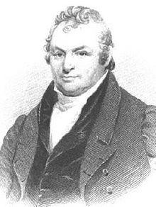
via Wikipedia, unknown
James Geddes
1 ► New York, Onondaga County, Syracuse, Eastside — James Geddes —  |
| Near Comstock Avenue. | |||
| 2 ► Ohio, Butler County, Middletown — Ohio Canals — Port Middletown Plaza — |
| On Central Avenue (Ohio Route 122) at N. Verity Parkway ( Route 73), on the right when traveling west on Central Avenue. | |||
| 3 ► Ohio, Columbiana County, Williamsport — Lock 36 — Sandy & Beaver Canal — |
| On Echo Dell Road (County Road 929) south of Leslie Road, on the right when traveling south. | |||
| 4 ► Ohio, Coshocton County, Roscoe — James LeRetilley Building - 1847 — |
| On Whitewoman Street, on the left when traveling north. | |||
| 5 ► Ohio, Cuyahoga County, Brecksville — Ohio & Erie Canalway — 110 Miles, Endless Possibilities — |
| Near Valley Parkway east of Riverview Road, on the left when traveling east. | |||
| 6 ► Ohio, Cuyahoga County, Brecksville, Sagamore Hills Township — Restoring The River — Removing Barriers — |
| Near Ohio & Erie Canal Towpath Trail south of West Aurora Road ( Route 82), on the right when traveling west. | |||
| 7 ► Ohio, Cuyahoga County, Cleveland, Downtown — Ohio & Erie Canalway — 110 Miles, Endless Possibilities — |
| On West Street west of Columbus Road, on the right when traveling west. | |||
| 8 ► Ohio, Cuyahoga County, Cleveland, Downtown — The Canal — |
| On West Street west of Columbus Road, on the right when traveling west. | |||
| 9 ► Ohio, Cuyahoga County, Independence — Alexander / Wilson Mill — Adapting with the Times — |
| On Ohio & Erie Canal Towpath Trail, on the left when traveling south. | |||
| 10 ► Ohio, Cuyahoga County, Independence — Floods and Repairs — Regulating Water Level — |
| On Ohio & Erie Canal Towpath Trail, on the right when traveling south. | |||
| 11 ► Ohio, Cuyahoga County, Independence — Lock 37 — Family Business — |
| On Ohio & Erie Canal Towpath Trail, on the left when traveling south. | |||
| 12 ► Ohio, Cuyahoga County, Independence — Mule Power — Towing Canal Boats — |
| Near Hillside Road at Canal Road, on the left when traveling west. | |||
| 13 ► Ohio, Cuyahoga County, Moreland Hills — 15-18 — Birthplace of James A. Garfield — |
| On S.O.M. Center Road. | |||
| 14 ► Ohio, Cuyahoga County, Northfield — Frazee Family — Impact of the Canal — |
| On Ohio & Erie Canal Towpath Trail, on the left when traveling south. | |||
| 15 ► Ohio, Cuyahoga County, Northfield — Pinery Narrows — Bridging the Valley — |
| Near Valley Parkway, on the left when traveling east. | |||
| 16 ► Ohio, Cuyahoga County, Northfield — Ride the Rails — |
| Near Station Road, on the left when traveling east. | |||
| 17 ► Ohio, Cuyahoga County, Northfield — Symbol of Success — |
| On Canal Road, on the right when traveling north. | |||
| 18 ► Ohio, Cuyahoga County, Valley View — Lock 38 — Boat Elevator — |
| Near Ohio & Erie Canal Towpath Trail at Hillside Road. | |||
| 19 ► Ohio, Cuyahoga County, Valley View — Tavern and Store — Canal Rest Stop — |
| On Ohio & Erie Canal Towpath Trail south of Hillside Road, on the right when traveling south. | |||
| 20 ► Ohio, Erie County, Milan — 20-22 — Edison Recalls Milan / Birthplace of Thomas A. Edison — / (1847 - 1931) — |
| On East Edison Drive north of Front Street, on the right when traveling south. | |||
| 21 ► Ohio, Fairfield County, Baltimore — Bope Warehouse Park — On The Ohio And Erie Canal — |
| On North Main Street at West Water Street, on the right when traveling south on North Main Street. | |||
| 22 ► Ohio, Fairfield County, Baltimore — 4-23 — The Ohio & Erie Canal and the "Twin Cities" / The Ohio & Erie Canal and the Dry Dock Lock — |
| On West Market Street (Ohio Route 256) at West Water Street, on the right when traveling east on West Market Street. | |||
| 23 ► Ohio, Fairfield County, Carroll — 7-23 — Junction of the Ohio Erie and Lancaster Lateral Canals — |
| On Center Street just north of Canal Street, on the left when traveling east. | |||
| 24 ► Ohio, Fairfield County, Lockville — Life in Lockville — |
| On Pickerington Road (County Route 20) 0.1 miles south of Broad Street South West, on the right when traveling south. | |||
| 25 ► Ohio, Fairfield County, Lockville — Welcome to Lockville Canal Park — 5895 Pickerington Rd; Carroll — (8+ acres in Bloom/Violet Townships) — |
| On Pickerington Road at Broad Street South West, on the right when traveling south on Pickerington Road. | |||
| 26 ► Ohio, Fairfield County, Millersport — Ohio-Erie Canal Lock Stones — |
| Near Chautauqua Boulevard at 6th Avenue, on the right when traveling east. | |||
| 27 ► Ohio, Franklin County, Canal Winchester, South Columbus — 26-25 — Canal Winchester and the Ohio and Erie Canal — |
| On South High Street, on the right when traveling north. | |||
| 28 ► Ohio, Franklin County, Groveport — Groveport - 1847 — Historic Canal Town — |
| On Main Street at Front Street, on the left when traveling west on Main Street. | |||
| 29 ► Ohio, Franklin County, Groveport — Ohio Canal in the Heart of Town — Historical Views of Groveport — |
| On Main Street at Front Street, on the right when traveling west on Main Street. | |||
| 30 ► Ohio, Franklin County, Groveport, South Columbus — 11-25 — Groveport Log House — |
| On Wilt Road 0.1 miles west of Walnut Street, on the right when traveling east. | |||
| 31 ► Ohio, Franklin County, Groveport, South Columbus — Life With The Ohio Canal — Historical Views of Groveport — |
| On Groveport Road at Richardson Road, on the right when traveling west on Groveport Road. | |||
| 32 ► Ohio, Franklin County, Groveport, South Columbus — 40-25 — Ohio and Erie Canal in Groveport / Scioto Valley Interurban — |
| On Blacklick Street 0.2 miles Front Street, on the right when traveling east. | |||
| 33 ► Ohio, Franklin County, Groveport, South Columbus — 96-25 — Ohio and Erie Canal Lock 22 — |
| Near Groveport Road, on the right when traveling west. | |||
| 34 ► Ohio, Franklin County, Groveport, South Columbus — Sharp's Landing — Ohio and Erie Canal Building — |
| On Wirt Road at Walnut Street, on the right when traveling west on Wirt Road. | |||
| 35 ► Ohio, Franklin County, Groveport, South Columbus — The Ohio And Erie Canal — Historical Views of Groveport — |
| On Blacklick Street at Cooper Alley, on the right when traveling east on Blacklick Street. | |||
| 36 ► Ohio, Franklin County, Lockbourne, South Columbus — 30-25 — Ohio-Erie Canal and Locks / The Columbus Feeder Canal — |
| On Commerce Street at Denny Street, on the right when traveling west on Commerce Street. | |||
| 37 ► Ohio, Licking County, Buckeye Lake — 13-45 — Buckeye Lake — |
| On Walnut Road (Ohio Route 79) at Cottage Street, on the right when traveling east on Walnut Road. | |||
| 38 ► Ohio, Licking County, Heath — 2-45 — Ohio Canal Ground-Breaking — |
| On Hebron Road (Ohio Route 79) near Coffman Boulevard, on the right when traveling north. | |||
| 39 ► Ohio, Licking County, Hebron — Hebron — The Historic National Road in Ohio — Transportation Crossroad — |
| Near West Main Street National Road (U.S. 40). | |||
| 40 ► Ohio, Licking County, Hebron — 1-45 — Hebron — |
| On Main Street (U.S. 40) at Basin Street, on the right when traveling west on Main Street. | |||
| 41 ► Ohio, Licking County, Hebron — Hebron Mill — The Historic National Road in Ohio — |
| On East Main Street National Road (U.S. 40) at Basin Street, on the right when traveling west on East Main Street National Road. | |||
| 42 ► Ohio, Licking County, Hebron — Hebron Milling Company — Historic Site — |
| On Main Street (U.S. 40) at Basin Street, on the right when traveling west on Main Street. | |||
| 43 ► Ohio, Licking County, Newark — Blackhand Gorge State Nature Preserve — |
| On East Canal street just east of South 3rd Street, on the right when traveling east. | |||
| 44 ► Ohio, Licking County, Newark — Ohio & Erie Canal — |
| On South 2nd Street at East Market Street, on the right when traveling north on South 2nd Street. | |||
| 45 ► Ohio, Licking County, Newark — Ohio and Erie Canal — |
| On East Canal Street. | |||
| 46 ► Ohio, Licking County, Newark — Railroads — |
| On South 2nd Street at East Market Street, on the right when traveling north on South 2nd Street. | |||
| 47 ► Ohio, Licking County, Newark — The Ohio & Erie Canal Park — |
| On South 1st Street north of East Canal Street, on the right when traveling north. | |||
| 48 ► Ohio, Licking County, Newark — Welcome to the Streetscape & History Walk — |
| On South 2nd Street at East Market Street, on the left when traveling south on South 2nd Street. | |||
| 49 ► Ohio, Pickaway County, Westfall, Wayne Township — Canal Park — Historic Ohio-Erie Canal Remnants — Pickaway County Park District — |
| On Canal Road (County Route 100), on the right when traveling north. | |||
| 50 ► Ohio, Pickaway County, Westfall, Wayne Township — Ohio-Erie Canal — Canal Park — Pickaway County Park District — |
| On Canal Road (County Route 100), on the right when traveling north. | |||
| 51 ► Ohio, Pickaway County, Westfall, Wayne Township — State Feeder Dam — Canal Park — Pickaway County Park District — |
| On Canal Road (County Route 100), on the right when traveling north. | |||
| 52 ► Ohio, Pickaway County, Westfall, Wayne Township — The Towpath Trail — Canal Park — Pickaway County Park District — |
| On Canal Road (County Route 100), on the right when traveling north. | |||
| 53 ► Ohio, Scioto County, McDermott, Rush Township — Ohio & Erie Canal — |
| On Ohio Route 104 0.1 miles north of Simpson Road, on the right when traveling south. | |||
| 54 ► Ohio, Scioto County, Portsmouth — Scioto County, Experience Our Heritage |
| On Front Street west of Court Street, on the right when traveling west. Reported permanently removed. | |||
| 55 ► Ohio, Scioto County, Portsmouth — 4 — Stagecoach / Hanging Rock Region / Ohio and Erie Canal / Early Industries — Floodwall Murals, 2000 Feet of History/2000 Feet of Art — |
| On Front Street just west of Court Street, on the right when traveling west. | |||
| 56 ► Ohio, Stark County, Canal Fulton — Babst Tavern — Canal Fulton Ohio — |
| On Tuscarawas Street Northwest at Cherry Street West, on the right when traveling south on Tuscarawas Street Northwest. | |||
| 57 ► Ohio, Stark County, Canal Fulton — Easly House — Canal Fulton Ohio — |
| On Market Street West south of Tuscararwas Street Northwest, on the right when traveling east. | |||
| 58 ► Ohio, Stark County, Canal Fulton — Great Western — Canal Fulton Ohio — |
| On Canal Street North at Cherry Street West, on the left when traveling north on Canal Street North. | |||
| 59 ► Ohio, Stark County, Canal Fulton, Lawrence Township — 1-76 — Ohio and Erie Canal — |
| Near Congressman Ralph Regula Towpath Trail 1.3 miles east of Cherry Street West ( Route 93), on the right when traveling east. | |||
| 60 ► Ohio, Stark County, Canal Fulton, Lawrence Township — Past, Present, Future — |
| Near Erie Avenue Northwest at Millfield Road Northwest, on the right when traveling east. | |||
| 61 ► Ohio, Summit County, Akron, Cascade Valley — How Can Water Going Down Make A Boat Go Up? — |
| On West North Street just west of North Howard Street. | |||
| 62 ► Ohio, Summit County, Akron, Cascade Valley — Jack E. Gieck — |
| On West North Street at Hickory Street, on the right when traveling west on West North Street. | |||
| 63 ► Ohio, Summit County, Akron, Cascade Valley — Lynn Rodeman Metzger — |
| On West North Street at Hancock Street, on the right when traveling west on West North Street. | |||
| 64 ► Ohio, Summit County, Akron, Cascade Valley — Made in Ohio, Produced for America — |
| On West North Street west of North Howard Street. | |||
| 65 ► Ohio, Summit County, Akron, Cascade Valley — Preserving "The Jewel of the Canal" — |
| On West North Street at Hickory Street, on the right when traveling west on West North Street. | |||
| 66 ► Ohio, Summit County, Akron, Cascade Valley — Robert Bruce Norton — |
| On West North Street at Hickory Street, on the right when traveling west on West North Street. | |||
| 67 ► Ohio, Summit County, Akron, Cascade Valley — The Canal Basin — |
| On West North Street west of North Howard Street. | |||
| 68 ► Ohio, Summit County, Boston — A River, Canal, and Railroad Town — |
| Near Boston Mills Road, on the right when traveling east. | |||
| 69 ► Ohio, Summit County, Boston — Building a Canal Boat — |
| On Boston Mills Road at Ohio & Erie Canal Towpath Trail, on the left when traveling east on Boston Mills Road. | |||
| 70 ► Ohio, Summit County, Boston — Bustling Boat-Building Village — |
| On Boston Mills Road at Ohio & Erie Canal Towpath Trail, on the left when traveling east on Boston Mills Road. | |||
| 71 ► Ohio, Summit County, Boston — Early 1900s Boston — Bag Industry Town — |
| On Boston Mills Road at Ohio & Erie Canal Towpath Trail, on the right when traveling east on Boston Mills Road. | |||
| 72 ► Ohio, Summit County, Boston — Fortunes Rise and Fall — |
| On Boston Mills Road at Ohio & Erie Canal Towpath Trail, on the right when traveling west on Boston Mills Road. | |||
| 73 ► Ohio, Summit County, Boston — Ohio & Erie Canalway — 110 Miles, Endless Possibilities — |
| Near Boston Mills Road at Ohio & Erie Canal Towpath Trail, on the right when traveling east. | |||
| 74 ► Ohio, Summit County, Boston — Welcome to the Cuyahoga Valley National Park — |
| Near Boston Mills Road at Ohio & Erie Canal Towpath, on the right when traveling east. | |||
| 75 ► Ohio, Summit County, Botzum — Lock 24 — Lost Village — |
| On Riverview Road, on the left when traveling north. | |||
| 76 ► Ohio, Summit County, Botzum — Lock 25 — Botzum Businesses — |
| On Riverview Road, on the left when traveling north. | |||
| 77 ► Ohio, Summit County, Brecksville, Sagamore Hills Township — Lock 36 — "Feeding" the Canal — |
| Near Ohio & Erie Canal Towpath Trail just north of West Aurora Road ( Route 82), on the right when traveling north. | |||
| 78 ► Ohio, Summit County, Brecksville, Sagamore Hills Township — Mudcatcher — Filtering the Flow — |
| On Ohio & Erie Canal Towpath Trail 0.1 miles north of West Aurora Road ( Route 82), on the right when traveling north. | |||
| 79 ► Ohio, Summit County, Clinton — Canal Boom Town — Clinton — |
| On North Street 0.1 miles north of Donnenwirth Street, on the right when traveling west. | |||
| 80 ► Ohio, Summit County, Clinton — Guard Lock — |
| On North Street 0.2 miles north of Donnenwirth Street, on the right when traveling west. | |||
| 81 ► Ohio, Summit County, Cuyahoga Falls — Cuyahoga River — |
| Near Riverview Road at Ira Road. | |||
| 82 ► Ohio, Summit County, Everett — Everett Covered Bridge — Cuyahoga Valley National Park — National Park Service, U.S. Department of the Interior — |
| On Everett Road 0.2 miles south of Oak Hill Road, on the right when traveling east. | |||
| 83 ► Ohio, Summit County, Peninsula — A Tight Fit — |
| Near Mill Street West north of North Locust Street, on the left when traveling north. | |||
| 84 ► Ohio, Summit County, Peninsula — Akron’s Building Blocks — Centennial Tour — Celebrating Cultural Heritage — |
| Near Riverview Road (County Road 9) south of Major Road, on the right when traveling north. | |||
| 85 ► Ohio, Summit County, Peninsula — Canal Builders — Engineers, Craftsmen, Laborers — |
| Near Mill Street West near North Locust Street, on the left when traveling north. | |||
| 86 ► Ohio, Summit County, Peninsula — Life on a Crooked River — |
| On Mill Street West west of North Locust St (Route et), on the left when traveling west. | |||
| 87 ► Ohio, Summit County, Peninsula — Lock 26 — Life in Cheesedom — |
| On Ohio & Erie Canal Towpath Trail, on the left when traveling north. | |||
| 88 ► Ohio, Summit County, Peninsula — Lock 29 — Crossing above the River — |
| Near Mill Street West north of North Locust Street, on the left when traveling north. | |||
| 89 ► Ohio, Summit County, Peninsula — Ohio & Erie Canalway — 110 Miles, Endless Possibilities — |
| On Bolanz Road east of Riverview Road (County Route 9), on the right when traveling east. | |||
| 90 ► Ohio, Summit County, Peninsula — Village and River Linked — |
| On Mill Street West north of North Locust Street, on the left when traveling north. | |||
| 91 ► Ohio, Summit County, Peninsula — Welcome to Cuyahoga Valley National Park — |
| On Valley Trail east of Everett Road, on the right when traveling west. | |||
| 92 ► Ohio, Summit County, Peninsula, Boston Township — Gristmill — Reaching Distant Markets — |
| Near Ohio & Erie Canal Towpath Trail, on the right when traveling north. | |||
| 93 ► Ohio, Summit County, Peninsula, Boston Township — Industry Shapes the Valley — |
| On Riverview Road near Boston Mills Road, on the right when traveling north. | |||
| 94 ► Ohio, Summit County, Peninsula, Boston Township — Peninsula — Flourishing Canal Town — |
| Near Ohio & Erie Canal Towpath Trail, on the right when traveling north. | |||
| 95 ► Ohio, Summit County, Peninsula, Boston Township — Welcome to Peninsula — |
| Near Mill Street West north of North Locust Street, on the left when traveling north. | |||
| 96 ► Ohio, Tuscarawas County, Bolivar — Canal — Fort Laurens |
| On Fort Laurens Road Northwest (County Route 102), on the right when traveling north. Reported permanently removed. | |||
| 97 ► Ohio, Tuscarawas County, Dover — 6-79 — The Ohio and Erie Canal / Canal Dover Toll House — 1825 - 1913 — |
| On Front Street, on the left when traveling west. | |||
| 98 ► Ohio, Tuscarawas County, New Philadelphia — 5-79 — The Ohio-Erie Canal In Tuscarawas County / The Ohio-Erie Canal 1825-1913 — |
| On Commercial Avenue SE (Ohio Route 416) at Canal Avenue SE, on the left when traveling south on Commercial Avenue SE. | |||
| 99 ► Ohio, Tuscarawas County, Tuscarawas — 12-79 — The Ohio & Erie Canal in Warwick Township — |
| On South Main Street (Ohio Route 416) south of Cherry Street, on the right when traveling south. | |||
| 100 ► Pennsylvania, Erie County, Erie — Erie Extension Canal — |
| On West 6th Street (Alternate Pennsylvania Route 5) west of Myrtle Street, on the right when traveling west. | |||