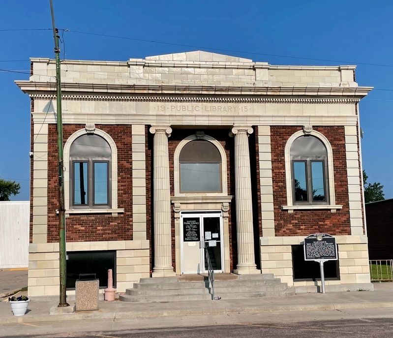
Harvard’s first library in 1885 was a traveling one established in Church’s Drugstore, and moved to other buildings until Mayor George H. Thomas appointed a committee in 1914 to contact the Carnegie Foundation. Citizens pledged $3,175.25 and . . . — — Map (db m251252) HM
As eight B-17F “Flying Fortresses” returned to Harvard AAF after training exercises on August 28, 1943, three collided. One crash-landed and two were demolished. Fourteen airmen died, including co-pilot Carl Hansen, whose parachute failed. . . . — — Map (db m251244) HM
The congregation organized in May 1881, building a church that fall on Oak Street east of the Harvard Courier building. The first service was in March 1882, with consecration by Bishop Robert Clarkson, Missionary District of the Platte. Five . . . — — Map (db m251260) HM
This stone remains from the pillar at the entrance of the Woodmen Hall building. The pillar and steps of Woodmen Hall were hauled on a flat wagon that was pulled by mules from Kansas.
Woodmen Hall was built by George Herzog in 1893. Erected . . . — — Map (db m287730) HM
The first permanent settler in the town of Sutton was Luther French, who arrived in 1870. He and his seven children lived near here in a dugout on the bank of School Creek. This dugout had a tunnel to the creek bank and the inside entrance could be . . . — — Map (db m78007) HM
Twenty-two German families from the Russian villages of Worms and Rohrbach arrived in Sutton in September 1873, the first of many German Russians to settle in Nebraska. The immigrants were descendants of ethnic Germans who began colonizing the Volga . . . — — Map (db m251263) HM
On March 27, 1879, George G. Meade Post 19, Grand Army of the Republic, Department of Nebraska, was founded in Sutton by twenty former Union soldiers. The G.A.R. was a national fraternal organization created to provide for the welfare of Union . . . — — Map (db m78006) HM WM
By the early 1600s, the ancestors of the Pawnee Nation began consolidating into a few large communities. Each was home to hundreds, if not thousands, of people. Some of these were built along nearby Shell Creek. These Shell Creek cities may have . . . — — Map (db m179394) HM
Bancroft was the home of John G. Neihardt between
1900 and 1920. Here he wrote all of his short stories
and lyric poetry including A Bundle of Myrrh, The
Splendid Wayfaring, and the Quest and began his epic
poem A Cycle of . . . — — Map (db m159850) HM
John Gneisenau Neihardt (1881-1973), teacher, philosopher, and Nebraska Poet Laureate, moved to Bancroft in 1900. Here he first became acquainted with Indians, married, and began his major work, A Cycle of the West, a five-part epic poem . . . — — Map (db m161558) HM
The building was erected on this site in
the 1890s for August Hartman and used as a
residence by various owners until 1964. Poet
John G. Neihardt rented the building from
1911 through 1920 for a study. Here he wrote
his lyrics, prose, and part . . . — — Map (db m161556) HM
Transported on a 107 foot tractor-trailer
to present location on Sept. 12. 1996 from
the Army National Guard base at Mead, NE.
Dedicated Nov. 11. 1996
In memory of all who served — — Map (db m161559) HM WM
Here stands the first Lutheran church building constructed in Nebraska. It has occupied this site since 1860. The congregation was first served by Reverend Henry W. Kuhns, a missionary sent by the Allegheny Synod to Nebraska Territory. Kuhns . . . — — Map (db m206698) HM
A Trial On August 18, 1804 Captains Meriwether Lewis and William Clark held a trial for Private Moses Reed. He was found guilty of desertion and sentenced to run the gauntlet four times, but visiting Otoe and Missouri Chiefs petitioned for his . . . — — Map (db m315703) HM
The frame schoolhouse in the background is part of Nebraska’s pioneer heritage-the oldest in Nebraska.
Originally erected in the spring of 1857 at Omadi, four miles south of Dakota City, the school shared the townsite’s peril when the Missouri . . . — — Map (db m154877) HM
It was near this location, a few miles south of present day South Sioux City, Nebraska, (as you look north east) that the Corps of Discovery, between August 13 and 19, 1804 fished daily, caught over 1,100 fish and enjoyed many feasts of fresh fish. . . . — — Map (db m315494) HM
An important Omaha Indian village called Tonwantonga (Large Village) by the Omaha stood on Omaha Creek in this area. Ruled by the great chief Blackbird, an estimated 1,100 people lived in this earthlodge town about 1795 and it played an important . . . — — Map (db m206966) HM
Pronounced “um ma ha” it means “against the current” and is the official name of the Omaha Tribe of Nebraska. The first historic record of the Omaha dates to the early 1500s when Spanish explorers, mapping the region, identified several large . . . — — Map (db m315708) HM
When the Lewis and Clark Expedition to the Pacific Ocean went through this area their mood was undoubtedly gloomy. On the previous day they had buried their comrade, Sergeant Charles Floyd, who died of a ruptured appendix. Although he was the . . . — — Map (db m206919) HM
About 1½ miles north of this spot is the abandoned site of "Old St. John's," one of the first towns established in Dakota County. The townsite was settled on June 2, 1856, by the Father Trecy Colony — sixty people, with eighteen ox-drawn covered . . . — — Map (db m158996) HM
Born December 29, 1984 in Sioux City, Iowa
Graduate of South Sioux City Senior High,
Class of 2003.
Enlisted in the United States Navy in 2003.
Awards: The Purple Heart, the Defense Meritorious Service Medal, the Bronze Star with "V" . . . — — Map (db m178817) WM
Designer: J.A.L. Waddell
Built By: Phoenix Bridge Company - Fabricator and Erector
Sooysmith & Company - Foundations & Piers
The stone of this monument came from piers of the previous bridge erected at this spot. The Pacific Short Line . . . — — Map (db m178597) HM
This short trail leads to two overlooks that offer views of a natural, free-flowing segment of the Missouri River. Here, the river still meanders through the countryside much as it did in Lewis and Clark's day. At the first overlook, exhibits . . . — — Map (db m15114) HM
The Missouri, the continent's longest river, figures prominently in the unfolding of America's saga. Flowing nearby in its 2,341-mile course from the Rocky Mountains to the Mississippi, the Big Muddy is not only loaded with sediment but steeped in . . . — — Map (db m15113) HM
The American Indians who life here on the bottomlands 1,000 to 600 years ago were unlike their 19th-century descendants in several ways.
Instead of roaming the Great Plains and living in portable hide-covered tepees, they settled in villages . . . — — Map (db m315596) HM
The Missouri flows free for 59 miles below Gavins Point Dam and fro 39 miles below Fort Randall Dam. These sections of the Missouri National Recreational River provide glimpses of the once undammed, unchannelized river that played a major role in . . . — — Map (db m315598)
On August, 24, 1804, the Lewis and Clark Expedition, traveling up the Missouri River, passed a bluff about 180 to 190 feet high. Clark wrote that it appeared to have been on fire and was still very hot. He also detected signs of coal and what looked . . . — — Map (db m155542) HM
Bur oak, basswood, boxelder, green ash - these are some of the trees in the ribbon of woods along the Missouri River bluffs. This assemblage, known as the eastern deciduous forest is uncommon on Nebraska's Great Plains because of the plant's . . . — — Map (db m315563) HM
On August 22, 1804, across the river near present-day Elk Point, South Dakota, the members of the expedition voted to have Patrick Gass serve as their new sergeant. Displaying their consensus-building skills, Lewis and Clark honored the men's wishes . . . — — Map (db m315574) HM
Ponca, one of northeast Nebraska’s earliest communities, was platted in 1856 by Frank West and laid out by Dr. Solomon B. Stough. The town was named for the Ponca Indian tribe that inhabited the area when the first white settlers arrived. The . . . — — Map (db m206794) HM
This region was first inhabited by prehistoric Indians. When French traders and trappers explored the river in the early 1700's, the Ioway Indians occupied this area. Later explorers, such as Lewis and Clark, also traveled the Missouri. White . . . — — Map (db m170764) HM
The Missouri, the continent’s longest river figures prominently in the unfolding of America's saga. Flowing nearby in its 2,341-mile course from the Rocky Mountains to the Mississippi, the Big Muddy is not only loaded with sediment but steeped in . . . — — Map (db m315581) HM
In 1804-1806, Captains Meriwether Lewis and William Clark led the Corps of Discovery on an epic journey. Charged by President Thomas Jefferson to find a water route to the Pacific Ocean through the newly acquired Louisiana territory, they mapped the . . . — — Map (db m315594) HM
Present-day Ponca, Nebraska, is near the first village built by the Ponca in the early 1600s after they separated from the Omaha and became their own tribe. Like the Omaha, they lived in semi-permanent earth lodge villages, planted corn, and hunted . . . — — Map (db m315559) HM
During the summer of 1804, the river below looked very different. Unlike today's course controlled by dams and dikes, the Missouri River that Lewis and Clark knew flowed wild and erratic . Strong currents floated branches embedded logs, submerged . . . — — Map (db m315568) HM
Fremont was laid out in August 1856. The town site was named for John C. Frémont, the new Republican Party's nominee for president in 1856, although Democrat James Buchanan was elected. Between 1842 and 1844 Frémont, then a U.S. Army topographical . . . — — Map (db m223447) HM
In 1917, the stately, six-story Hotel Pathfinder was built on the Southeast corner of 6th & Broad streets in Fremont. The hotel had 115 rooms and guest capacity of 360. The Pathfinder also included a barbershop, restaurant, and ballroom. The hotel . . . — — Map (db m251170) HM
The Mormon Pioneer Trail from Nauvoo, Illinois to the Rocky Mountains passed here April 17, 1847. In this vicinity a military-type organization was formed with Brigham Young, Lieutenant General; Stephen Markham, Colonel; John Pack and Shadrach . . . — — Map (db m58566) HM
Overland Trail 1813 to 1867
Mormon Trail 1847 to 1864
Military Road to New Fort Kearny 1856
Site of Albion, Lincoln P.O. and Timberville P.O. from 1856 to 1868 — — Map (db m251179) HM
Before the Pawnee Indians were placed on a reservation, they located their last earthlodge villages on these nearby bluffs. Pa-hŭk’ hill, one of the five sacred places of the Pawnee, was also near here. The villages were occupied from . . . — — Map (db m287986) HM
The north bank of the Platte River, from the 1830's through the 1860's, served as a major overland route to the West. It was used by fur traders, soldiers, gold seekers and other emigrants. The expedition of Major Stephen H. Long passed through . . . — — Map (db m251176) HM
The Union Pacific reached Fremont in 1866. The new Union Depot was erected at a cost of $50,000 and gave the approach to the city a dignified and completed appearance, with its winding gravel walks, grass and flower plots and wide frontage.
As a . . . — — Map (db m58553) HM
In 1872 Dodge County purchased 160 acres at this site to provide relief for the needy. In 1884 a residence was added for those receiving aid; by 1888 the farm comprised 245 acres. Paid stewards oversaw its operation. After 1935, federal and state . . . — — Map (db m288000) HM
Before this was the Datel Block, it was the Doubrava corner. A general store was opened on this site in 1869. Fredrick F. Doubrava took over the store in 1881 and A.F. Doubrava operated the store until 1911. The building had a few owners over the . . . — — Map (db m251834) HM
On one of the coldest days of 2009, smoldering insulation around a light caught fire around 1:30 p.m. The blaze grew to take out the south of the alley, the Pour House bar and apartment above, the North Bend Eagle, A Little Off the Top salon and a . . . — — Map (db m251900) HM
In late 1871, T.B. Purcell built a frame building here at Seventh and Main and ran a grocery store under the name Dowling and Purcell. The grocery store moved elsewhere and Milton May rented the building for a hardware store. North Bend's . . . — — Map (db m251820) HM
On this site once stood a 2-story brick building. C.W. Hyatt in 1883 to house
the newspaper he started the year before, the North Bend Flail. He moved the
paper to Fremont in 1888 and soon after
the building was bought by Charles S.J. Lee for a . . . — — Map (db m251839) HM
Victor W. Jansen came to North Bend in 1897 and joined C.L. Kelly Hardware as a sheet metal worker, a trade he learned as a teenager in Denmark. Jansen Hardware was established in 1907, adding plumbing and hardware to his sheet metal work. In 1916 . . . — — Map (db m251891) HM
This park is dedicated to all those who served in the Armed Forces of the United States of America. The founders of this memorial ask that you never forget
the sacrifices of these men and women especially those who died for the freedoms we enjoy . . . — — Map (db m251912) WM
First settlement of area by
George Young and Robert Millar
July 4, 1856 30 rods south-west
where Seth Young, the first son of
Dodge County settlers, was born
Nov. 30, 1856. — — Map (db m251917) HM
P.F. Carey bought the Farnham Building in 1919 for his furniture and undertaking business, but he soon built a new building across the street and moved there. In 1923 carey tore down the Farnham Building and transformed it into a filling station . . . — — Map (db m251822) HM
The establishment of the Webster community was centered around this intersection. Beginning in 1871 the village of Webster grew to include a post office, blacksmith shop, telephone company, store, school, and Webster Hall. Webster Hall hosted . . . — — Map (db m223448) HM
Dedicated to Boys Town's
sons & daughters who
have served their country in the
Armed Forces
July 1991
Honoring
Boys Town Alumni
who gave the
Ultimate Sacrifice
Ask not what your country can do for you
ask what you can do for . . . — — Map (db m58573) WM
Boys Town was founded as a home and school for homeless, abandoned, neglected or otherwise underprivileged boys, regardless of color or creed, by Father Edward J. Flanagan (1886-1948) on December 10, 1917. The first Father Flanagan's Boy's Home at . . . — — Map (db m53109) HM
Founder of Boys Town
Omaha, Nebraska, U.S.A.
"The work will continue, you see,
whether I am there or not,
because it is God's work, not mine."
Msgr. Edward J. Flanagan
Mol an oige
agus tiocfaidh si
Ni neart go cur le cheile . . . — — Map (db m58482) HM
In memory of
Rt. Rev. Monsignor
Edward J. Flanagan
Founder of Boys Town and
Recipient of Variety Clubs
First Humanitarian Award
His dictum:
"There is no such thing as a bad boy" — — Map (db m58481) HM
Just to the southwest is the Platte River, whose valley was one of the great roadways to the west, used by fur traders, emigrants, military expeditions, gold seekers, and Mormons. Mormon migration to the Salt Lake Valley began at Winter Quarters, . . . — — Map (db m290932) HM
Because he was a slave, one member of the expedition had no a first name -- York.
Stories about York's role in the Lewis and Clark Expedition sometimes paint him as either larger-than-life or as unimportant to the venture's success. Some . . . — — Map (db m286312) HM
When camped near here, the Lewis and Clark Expedition met with Oto and Missouri Indians. It was the Expedition's first official meeting with Indians west of the Mississippi River.
The Expedition's leaders had sent scouts to find Oto, Missouri, . . . — — Map (db m287490) HM
This 160-acre farm, most of which is now a lake and recreational area, was once home to three generations of Boettgers: William A. and Mina Stuhr Boettger, Otto M. and Irene Grau Boettger, Robert D. and Nadeen Preston Boettger. Homesteaded by Isaac . . . — — Map (db m287958) HM
When Meriwether Lewis invited William Clark to join him in the "fatigues and dangers" of the excursion up the Missouri River, Clark responded, "I will cheerfully join you." During months of preparing for the journey, the two leaders took great care . . . — — Map (db m287410) HM
The Lewis and Clark Expedition's first meeting with Indians west of the Mississippi River happened ten miles north of here, in 1804. The Indians they met were members of the Oto and Missouri tribes.
Oto and Missouri tribal stories tell that . . . — — Map (db m286325) HM
A few miles north is Ft. Atkinson (1819-27), the first U.S. military post west of the Missouri River. The fort’s location at the “Council Bluff” was recommended by Lewis and Clark in 1804. It was established to assert U.S. influence over the . . . — — Map (db m287989) HM
Built near this site in 1807 by Manuel Lisa, trader and Indian commissioner, through whose influence the Omaha, Pawnee, Ponca, Otoe and Sioux tribes remained loyal to the United States during the War of 1812. — — Map (db m7892) HM
Before setting out on the Expedition. Lewis and Clark studied the maps and journals of French and Spanish traders and explorers. They also interviewed fur traders who had spent time in Indian villages along the river. The trappers told Lewis and . . . — — Map (db m287409) HM
On their journey to the Pacific Ocean, the Expedition camped across the river from Dodge Park on July 28, 1804. George Drouillard, the principal hunter, retuned to camp that day with a Missouri Indian from a nearby Otoe camp, The next day, Lewis and . . . — — Map (db m287422) HM
At the camp established very near here Captain Clark wrote about the "butifull Breeze from the N W. this evening which would have been verry agreeable, had the Misquiters been tolerably Pacifick, but thy were rageing all night." Clark may have . . . — — Map (db m7886) HM
For many years before Lewis and Clark undertook their famous journey, Indians and Europeans already had been involved in brisk trade with one another. The Europeans brought firearms, hunting knives and cooking utensils. They exchanged these for . . . — — Map (db m286311) HM
The Shipley Cemetery, named for William Shipley, is located one-half mile north of this marker. In 1893 Shipley deeded part of his homestead for public use as a cemetery. The oldest known burial, dated 1861, is Shipley’s grandson, James. In . . . — — Map (db m287973) HM
Among the people living in this area that Lewis and Clark hoped to meet were the Omaha Indians ("Umonhon" in native spelling). But the villages were empty when the Expedition searched for them. It was August and the Omaha were away on the annual . . . — — Map (db m286323) HM
"Several gentlemen's sons have applied to accompany us, but as they are not accustomed to labor, I am cautious in giving them any encouragement," Clark wrote to Lewis in 1803.
But this journey had no place for "gentlemen's sons," Instead, . . . — — Map (db m287405) HM
When President Thomas Jefferson commissioned Meriwether Lewis and William Clark to journey up the Missouri River, he gave them a long list of questions. Many of the questions had to do with learning about the Indian tribes.
Jefferson said . . . — — Map (db m286327) HM
World War II
Biddle, Melvin E. · PFC · 24 Dec 44 · Belgium · 517th Airborne
Cole, Robert G. · LTC · 11 Jun 44 · France · 101st Airborne
Deglopper, Charles N. · PFC · 9 Jun 44 · France · 82nd Airborne
Eubanks, Ray E. · SGT · 23 Jul 44 · New . . . — — Map (db m261964) WM
Erected by the people of Douglas County to honor the men and women of this county who gave their lives in World War II
In Memorium
Abel, Charles E. · Adams, Robert S., Jr. · Abrahamson, Philip · Adler, Emil L. · Aguilera, Harold C. · . . . — — Map (db m266551) WM
Dundee, Omaha's first suburb, was connected to downtown by the streetcar. Dundee was literally the end-of-the-line. The streetcars reversed their course just west of this site. In 1891, a steam driven "trolley" and then a horse-drawn car brought . . . — — Map (db m58356) HM
This monument is dedicated to the men and women who served their country with great pride and honor and had the misfortune to be prisoners of war.
These members of the armed forces were subject to death marches, exposure to harsh elements, . . . — — Map (db m261895) WM
To Those Who Served
Korean Conflict 1950-1953
Vietnam War 1961-1973
America's fighting men and women have bravely and well in this nation's armed conflicts. Never was their dedication more evident than in the struggles against . . . — — Map (db m270001) WM
Honoring the bravery and heroism of those who went above and beyond their duty.
Iowa
Medal of Honor Recipients
World War I
Pike, Emory Jenison—Army
World War II
Beyer, Arthur O.—Army . . . — — Map (db m262054) WM
Omaha's Memorial Park honors men and women who served in the US military. The 65-acre park was constructed to symbolize the community's gratitude to Douglas County veterans and those killed while fighting for freedom in World War II. The purpose of . . . — — Map (db m270009) HM
Located at the highest point in Memorial Park, the World War II Memorial Shrine recognizes the men and women of Douglas County, Nebraska, who lost their lives while serving in the war.
The shrine is a semi-circular colonnade of seven arches. . . . — — Map (db m270015) HM
This garden is a living tribute to all of America's veterans and their families. In silence and respect, this is a place to remember why millions of Americans have fought and died for our liberty and our freedom. Here we renew our promise to . . . — — Map (db m261674) WM
This marker commemorates the men and women who achieved American independence. These Patriots, believing in the noble cause of liberty, fought valiantly to found a new nation.
1775 - 1783
Presented by Nebraska Society Daughters of . . . — — Map (db m261809) WM
Air Assault
Parachutists
Glider Men
Airborne Rangers
Lest we forget
Those who are serving
Those who have served
Those who will serve
This statue portrays a fully laden WWII paratrooper jumping from a C-47 aircraft and into . . . — — Map (db m262259) WM
The story of the Dodge Street Pedestrian Overpass began with parents' concern about the safety of their children walking to school. Responding to post-World War II growth in student population and requests from parents, the City of Omaha began . . . — — Map (db m265937) HM
This memorial is dedicated with great recognition and appreciation for all who have served & sacrificed past, present & future for years of loyal and dedicated service to the Corps and to the country
Semper Fidelis
Major . . . — — Map (db m261737) WM
This memorial honors those Americans who left the security of their country and loved ones to protect the freedoms and human rights of all people.
It honors the risks taken and sacrifices made by those who whether home or abroad knew what . . . — — Map (db m261641) WM
American servicemen have displayed exemplary courage in all our nation's wars. They have sacrificed their time, their energy, given their blood and thousands their lives, to help keep America free.
This flag is a special tribute to the Medal of . . . — — Map (db m35168) WM
Between 1804 and 1806, the Corps of Discovery traveled from St. Louis, Missouri, to the Pacific coast and back. President Jefferson instructed Meriwether Lewis to collect information on "the soil & face of the country, [its] growth & vegetable . . . — — Map (db m72050) HM
In August 1804, members of the Expedition visited villages like this one, homes to the Otoe and Missouria who lived in what is today Omaha. Planning to invite these tribes to a council, or meeting, the explorers found the villages deserted. The . . . — — Map (db m72049) HM
The tallgrass prairies of Nebraska stood in stark contrast to the forested homelands of the explorers. Dense grasses, some taller than a man, covered the land. Lewis and Clark noted beauty in the vast reaches of waist-high grarsses, a beauty . . . — — Map (db m72048) HM
Near here, the Corps of Discovery held its first council, making speeches and presenting gifts to the Otoe and Missouria. Communicating through an interpreter, members of the Expedition believed their messages were clear. But were they?
This . . . — — Map (db m72057) HM
867 entries matched your criteria. Entries 101 through 200 are listed above. ⊲ Previous 100 — Next 100 ⊳