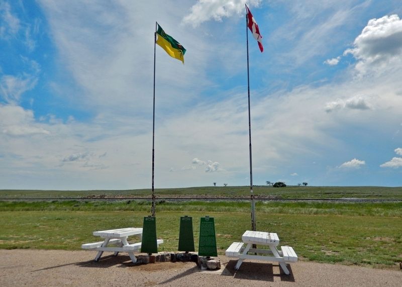
On Trans-Canada Highway (Provincial Highway 1) 4.6 kilometers east of Provincial Road 614, on the right when traveling east.
During the 1870’s, as the vast buffalo herds disappeared, ranchers came to this area to fill the empty prairie with cattle and horses. The arrival of the North-West Mounted Police, who established posts at nearby centres like Fort Walsh, helped . . . — — Map (db m201581) HM
On 3rd Street North at 1st Avenue, on the right when traveling east on 3rd Street North.
In memory of Rockglen and district veterans who served and those who gave their lives
1914 - 1918
1939 - 1945
Greater love hath no man than this
World War I 1914 – 1918
Gabriel Fagnet ·
Walter Gay
Auguste . . . — — Map (db m308134) WM
On 4th Street North east of 1st Avenue North, on the right when traveling east.
The Rockglen Beautification Committee
English:
In celebration of Canada's 150th anniversary, Tree Canada has planted ceremonial trees in this community with the support of the Government of Canada.
This tree . . . — — Map (db m312429) HM WM
On Central Avenue just north of 11th Street East, on the right when traveling north.
[English] This building is one of the few 19th century town halls still standing on the Prairies. It was built in 1892-1893, two years after the first railway arrived in town and over ten years before Prince Albert was incorporated as a city. . . . — — Map (db m196893) HM
On River Street at Central Avenue, on the right when traveling west on River Street.
On March 21st, 1887, Council passed a bylaw to establish a fire department for the Town of Prince Albert, Northwest Territories. There were two fire halls originally built, one on the east flat and the other on Central Avenue where City Hall now . . . — — Map (db m196896) HM
On Central Avenue north of 11th Street East, on the right when traveling north.
In 1892 the council of the burgeoning town of Prince Albert commissioned the architectural firm of F. J. Rostrick and Son of Hamilton to design a town hall/opera house. Built by A. and W. B. Goodfellow of locally produced brick, the building was a . . . — — Map (db m196894) HM
Near Central Avenue just north of 11 Street East, on the right when traveling north.
[English] A charismatic orator, John Diefenbaker served as Canada’s 13th prime minister from 1957 to 1963. Born in Ontario and raised in Saskatchewan, he was an accomplished defence lawyer and Member of Parliament for some forty . . . — — Map (db m203717) HM
On 19 Street West just east of 3 Avenue West, on the right when traveling west.
[English] This was John Diefenbaker’s home as he rose through the ranks to become leader of the federal Progressive Conservative Party and Prime Minister of Canada. In 1947, he bought this Tudor Revival home with his wife, Edna . . . — — Map (db m203702) HM
On Lincoln Street at Railway Street, on the left when traveling south on Lincoln Street.
In December of 1909 the Town Council gave its Public Works Committee the authority to order a fire bell, using the proceeds of a concert as part payment for the bell. This bell was mounted on the Town Hall in 1910 and was to be rung daily at the . . . — — Map (db m211794) HM
On 7 Street at Maple Avenue, on the left when traveling west on 7 Street.
Dedicated to the memory of the pioneers, teachers and pupils of Cando and district. Cando School was officially founded in 1914. It was located on the site of the present Roman Catholic Church. In 1952 a new three room school was . . . — — Map (db m211872) HM
On Main Street at 2 Street, on the right when traveling north on Main Street.
In commemoration of the first settlers who arrived in the Hague district on May 3, 1895 Village of Hague incorporated on August 25, 1903 with Klaas Dyck the first elected overseer — — Map (db m203736) HM
On 6 Street at 2 Avenue, on the right when traveling east on 6 Street.
Five times World Wheat Champion of the Rosthern District He received his Doctors’ degree for his extension work with The Queens University on cereal grains — — Map (db m203735) HM
On 2 Avenue at 6 Street, on the left when traveling north on 2 Avenue.
Pioneer Rosthern businessman He built the first residence and store in Rosthern in 1892 Justice of the Peace and M.L.A. from 1905-1911 — — Map (db m203747) HM
On Provincial Highway 312 at Provincial Highway 683, on the right when traveling west on Provincial Highway 312.
Mennonite settlers who arrived in this area in 1892 held church services in private homes until 1896, when the first church of the conference of Mennonites in the North-West Territories was built on this site. The Mennonite community had organized . . . — — Map (db m8531) HM
On Main Street (Provincial Highway 718) at Short Road, on the right when traveling north on Main Street.
Built in 1920, the Ambroz Blacksmith Shop is the oldest, fully furnished blacksmith shop in Saskatchewan still on its original site. Frank Ambroz, a local blacksmith, purchased the business in 1928 and operated it for the next sixty years. Like . . . — — Map (db m204884) HM
On Main Street (Provincial Highway 718) at Short Road, on the right when traveling north on Main Street.
Dedicated to the memory of Frank Ambroz and to his wife Mary. Frank learned the blacksmith trade in Poland; he came to Canada in 1926 and served the community as a blacksmith for 60 years. He died in 1986.
Always a faithful supporter of the . . . — — Map (db m205022) HM
On Snowbird Highway (National Highway 2) at Miles Selby Rd, on the left when traveling west on Snowbird Highway.
This cairn is dedicated in memory of those who served at No.2 Bombing and Gunnery School, Mossbank, during World War II. Between October 28, 1940 and December 15, 1944 the school trained 2, 539 air bomber and 3,702 air gunner students of whom . . . — — Map (db m204860) HM WM
On Snow Bird Highway (National Highway 2) at un-named, un-numbered, on the right when traveling south on Snow Bird Highway.
Mossbank Pioneer Post Office
NW ¼ 12-11-30 W2M
Beginning in September 1909, this site was the location of the Mossbank Post Office. The Post Office was housed in the pioneer home of Robert & Louise Jolly. “Bob” Jolly served as Post Master, . . . — — Map (db m204874) HM
On Louis Riel Trail (Provincial Highway 11) at Norfolk Avenue, on the right when traveling north on Louis Riel Trail.
In 1872 the Canadian Federal Parliament passed the Dominion Lands Act as a precursor to land settlement in the West. Eastern interests viewed settlement of the vast North West as a great economic opportunity. Essentially, the American system of the . . . — — Map (db m211670) HM
Near Provincial Highway 4 7 kilometers north of Provincial Highway 738, on the left when traveling north.
Saskatchewan Landing has been the main north-south crossing of the South Saskatchewan for generations. Indians regularly forded the river here, and Métis buffalo-hunters turned their Red River carts into boats and paddled across. In 1883 a . . . — — Map (db m201051) HM
On Main Street just north of 1 Avenue, on the right when traveling north.
The call of the West lured settlers to this virgin plains before the turn of the century. This district provided many opportunities, so pioneers with spirits of adventure came from Eastern Canada, U. S. A. and Europe. On June 9, 1906 the Village . . . — — Map (db m203873) HM
On CanAm Highway (Provincial Highway 39) just south of Souris Street, on the right when traveling south.
The most vital factor in the settlement of our area was the railroad. This line was opened to rail traffic in September 1893. The station building here was constructed in 1904. — — Map (db m207165) HM
On Dewdney Avenue just west of Scarth Street, on the right when traveling west.
This building was constructed in 1911 for harness maker B. F. Ackerman. He occupied the premises until 1925. Subsequent occupants were Hudson’s Bay Company, Great West Saddlery, cartage and storage firms such as Sneed’s Security Storage, MacCosham . . . — — Map (db m314600) HM
On Robinson Street at 8th Avenue, on the right when traveling north on Robinson Street.
Albert Branch Library was built in 1927 on the site of one of Regina's first branch libraries. The architect Joseph Warburton used a Gothic theme in the entranceway with Tyndal stone details highlighting the windows and roofline.
This plaque was . . . — — Map (db m196918) HM
On Memorial Way just south of Legislative Drive, on the right when traveling south.
Law Degree — Dalhousie Law School Rhodes Scholarship — Queen’s College, Oxford Elected M.L.A., 1960 Appointed Minister of Public Health, 1962 Elected Leader of the NDP, 1970 Leader of the Opposition, 1982, 1987 Queen’s Privy Council for . . . — — Map (db m314512) HM
On 13th Avenue at Elphinstone Street, on the right when traveling east on 13th Avenue.
Connaught Branch Library was built in 1930 to provide a public library service in this area. The architect Joseph Warburton highlighted this public building with classical Tyndal stone details details surrounding the entranceway.
The building is . . . — — Map (db m196919) HM
Near Hewitt Place just south of Dewdney Avenue, on the left when traveling south.
[English] Residence of the Lieutenant Governors of the North-West Territories (1891-1905) and Saskatchewan (1905-1945), Government House is one of the few surviving territorial buildings and was for many years the hub of official social life . . . — — Map (db m196906) HM
On Walter Scott Way just south of Legislative Drive, on the right when traveling west.
2014, being the Centennial of the creation of the United Empire Loyalists’ Association of Canada, meant a re-examination of the Association’s purpose and principles. The result was renewed interest and pride by those Canadians who trace their . . . — — Map (db m314378) HM
On Victoria Avenue at Cornwall Street, on the right when traveling east on Victoria Avenue.
Saskatchewan's first provincial land titles building was designed by Darling and Pearson and constructed in 1907-09. This building housed the Regina district records from 1910 until 1977. The distinctive architectural style is highlighted by the . . . — — Map (db m314399) HM
On Memorial Way just south of Legislative Drive, on the right when traveling south.
[English] Thousands of Canadian nurses have provided skilled and compassionate care to the sick and wounded in battle since 1885. In 1904, professional nurses entered the Canadian Army Medical Corps as Nursing . . . — — Map (db m201376) HM WM
On Legislative Drive just east of Albert Street (CanAm Highway) (Saskatchewan Highway 6), on the left when traveling east.
[English] Queen Elizabeth II Gardens dedicated by Her Majesty The Queen 18 May 2005 on the occasion of the Centennial of the Province of Saskatchewan 1905 — 2005 [Français] Les jardins . . . — — Map (db m313949) HM
On Legislative Drive just east of Albert Street (CanAm Highway) (Provincial Highway 6), on the left when traveling east.
[English] This statue of Queen Elizabeth II and her favourite horse Burmese commemorates the Golden Jubilee of the Accession of Her Majesty to the Throne as Queen of Canada on February 6, 1952. Burmese was born and . . . — — Map (db m314003) HM
On Victoria Avenue just east of Lorne Street, on the right when traveling east.
Constructed between 1907 and 1910, the Regina Land Titles Building was the first public building commissioned by the newly-established Province of Saskatchewan. Designed by the prominent Toronto architectural firm of Darling and Pearson, the . . . — — Map (db m196921) HM
Originally, settlers in and around Regina thought of Wascana Creek in practical terms. The creek was first dammed in 1883, creating the reservoir now known as Wascana Lake. The reservoir provided the settlement with the only substantial body of . . . — — Map (db m196903) HM
In 1903 the Province of Saskatchewan was created from the North-West Territories. Three years later the government Premier Walter Scott chose the form of Edward and W.S. Maxwell of Montreal to design a new legislative building for the Province. . . . — — Map (db m289887) HM
On Smith Street at 12th Avenue, on the left when traveling south on Smith Street.
This building, designed by Regina architects Storey and Van Egmond, was constructed in 1914 as the head office of the Saskatchewan Co-operative Elevator Company. Established in 1911, the company was one of the first major farmer co-operatives and . . . — — Map (db m196920) HM
On Walter Scott Way just south of Legislative Drive, on the right when traveling west.
The American Revolution split the population of the Thirteen Colonies into two main groups — the Patriots and the Loyalists. The Treaty of Separation of 1783 ended the eight years of civil war. A third of the colonists were granted no rights in the . . . — — Map (db m314397) HM
Near Walter Scott Way just north of Legislative Drive when traveling north.
In 1883 the CPR and its business partner, the Canada North-West Land Company, spent more than $14,000 in the new Regina town site digging a well, grading five streets, and building a dam. That dam was the first control structure on Pile of Bones . . . — — Map (db m196905) HM
Near Legislative Drive just east of Albert Street (CanAm Highway) (Provincial Highway 6), on the left when traveling east.
[English] In October, Princess Elizabeth spent one day in Saskatchewan with her husband Prince Philip, Duke of Edinburgh, as part of their first cross-Canada tour a year prior to her accession to the throne. She made . . . — — Map (db m314049) HM
Near Legislative Drive just east of Albert Street (CanAm Highway) (Provincial Highway 6), on the left when traveling east.
[English] In July, Queen Elizabeth II and Prince Philip, Duke of Edinburgh spent two days in Saskatchewan during the longest royal tour in Canadian history. They visited Moose Jaw, Regina and Saskatoon with train . . . — — Map (db m314071) HM
Near Legislative Drive just east of Albert Street (CanAm Highway) (Provincial Highway 6), on the left when traveling east.
[English] In July, Queen Elizabeth II and Prince Philip, Duke of Edinburgh visited Regina for two days to commemorate the centennial of the Royal Canadian Mounted Police (RCMP). During her address at RCMP “Depot” . . . — — Map (db m314084) HM
Near Legislative Drive just east of Albert Street (CanAm Highway) (Provincial Highway 6), on the left when traveling east.
[English] In July, Queen Elizabeth II and Prince Philip, Duke of Edinburgh, visited Saskatchewan for three days with their youngest son, Prince Edward, who was 14 at the time. While in Saskatchewan, they visited . . . — — Map (db m314093) HM
Near Legislative Drive just east of Albert Street (CanAm Highway) (Provincial Highway 6), on the left when traveling east.
[English] In October, Queen Elizabeth II and Prince Philip, Duke of Edinburgh, spent five days in Saskatchewan — her longest visit to the province. She came to celebrate the 75th anniversary of the opening of the . . . — — Map (db m314095) HM
Near Legislative Drive just east of Albert Street (CanAm Highway) (Provincial Highway 6), on the left when traveling east.
[English] In May, Queen Elizabeth II and Prince Philip, Duke of Edinburgh spent four days celebrating Saskatchewan's centennial in Regina, Lumsden and Saskatoon. In Regina she visited the First Nations University of . . . — — Map (db m314096) HM
On Memorial Way just south of Legislative Drive, on the right when traveling south.
This plaque is dedicated to honour the war brides of W.W.I and W.W.II who married Canadian servicemen in a theatre of war and were brought to Canada by the Canadian government. Between 1945 and 1947 approximately 48,000 brides and 22,000 children . . . — — Map (db m314353) HM
On Walter Scott Way just south of Legislative Drive, on the right when traveling west.
This cairn is built of fieldstone gathered from Saskatchewan homesteads and yards of descendants of United Empire Loyalists who settled here prior to and shortly after 1905. Included is one stone from Eastern Ontario where many of the Loyalists . . . — — Map (db m314398) HM
Near Legislative Drive just east of Albert Street (CanAm Highway) (Provincial Highway 6), on the left when traveling east.
[English] Premier of Saskatchewan (1905-1916) Walter Scott was born on a farm near Strathroy, Ontario in 1867. He came to the North-West Territories in 1886 and was elected to federal politics in 1900 . . . — — Map (db m314331) HM
On Memorial Way just south of Legislative Drive, on the right when traveling south.
To the Glorious Memory of the Officers, Non-Commissioned Officers and Men of the 28th (North West) Battalion, Canadian Expeditionary Force who fell in the Great European War 1914-1918. Perpetuated by 1st Battalion The Regina Rifle Regiment. To . . . — — Map (db m314356) WM
On Albert Street (Provincial Highway 6) just north of College Avenue, on the right when traveling south.
Telephones were introduced into Saskatchewan in the early 1880’s, but it was not until 1908 that a government agency was created to manage them. Constructed in 1924, this structure was the first official head office for Saskatchewan Government . . . — — Map (db m289100) HM
On Albert Street (Provincial Highway 6) at 19 Avenue, on the right when traveling north on Albert Street.
This bridge was built as an unemployment relief project during the Great Depression and was formally opened on November 10, 1930, by Premier J.T.M Anderson. It was dedicated as a memorial to the Saskatchewan soldiers who fell in the First World . . . — — Map (db m291198) HM
On Dewdney Avenue just west of Cornwall Street, on the right when traveling west.
This 1914 five-story building was constructed for the wholesale grocers Campbell, Wilson & Strathdee Company, shortly after the 1912 cyclone leveled many buildings in the area. The next occupant was the Saskatchewan Liquor Board (1925 to 1960), . . . — — Map (db m314779) HM
On Victoria Avenue at McIntyre Street, on the right when traveling west on Victoria Avenue.
Chief Payepot was a proud leader known for his wisdom, spirituality and fearlessness. As the leader of the Young Dog Society, he led buffalo hunting parties across the Western Plains. Herds of buffalo in the millions roamed the prairies and were . . . — — Map (db m289145) HM
Near Victoria Avenue at Cornwall Street, on the right when traveling west.
[English] The province of Saskatchewan, formerly of the North West Territories, was created on 1 September, 1905, and inaugurated on this site by Governor General Earl Grey and Prime Minister Sir Wilfred Laurier on 4 September, . . . — — Map (db m201271) HM
On Scarth Street just north of 12 Avenue, on the right when traveling north.
Honouring one of Regina's most distinguished citizens, the City Regina on December 14, 1998 officially renamed the Scarth Street Mall, THE FREDERICK W. HILL MALL. Prime Minister Jean Chretien formally dedicated the mall on June 8, 1998 saying, “It . . . — — Map (db m314400) HM
On Scarth Street at 12 Avenue, on the left when traveling north on Scarth Street.
A glockenspiel is the German word for musical chimes. In the European Middle Ages all important towns had their own bells that regulated the life of the town. They called the people to work and sent them to bed. Just as a bell tower stood in the . . . — — Map (db m314598) HM
Near Victoria Avenue at Cornwall Street, on the right when traveling west.
Walter Scott, a prominent journalist and politician, was raised in rural Ontario. In 1885 he moved west and, as a member of Parliament (1900-1905), played a leading role in achieving provincial status for Saskatchewan. Appointed its first Premier . . . — — Map (db m215979) HM
On Victoria Avenue just east of Cornwall Street, on the right when traveling east.
Hotel Saskatchewan opened in 1927 as the fourteenth hotel in the Canadian Pacific Railway’s nationwide hotel chain. The hotel ranked as the largest hotel in the province at that time and dominated the Regina skyline for many years. From 1945 to . . . — — Map (db m314445) HM
On 1861 McIntyre Street at 12 Avenue, on the left when traveling north on 1861 McIntyre Street.
This 1894 parish church was built for the Anglican Diocese of
Qu'Appelle to replace the original church built in 1883, and
dedicated on Thursday January 24, 1895, the Eve of the Feast of
the Conversion of Saint Paul. It was never intended to be . . . — — Map (db m289895) HM
On Saskatchewan Drive just west of Broad Street, on the right when traveling west.
Steam Locomotive #5093 was built in 1918 by the Montreal Locomotive Works Ltd. It is a Pacific-type locomotive, 75 feet long and weighs 287,500 pounds, or slightly more than 143 tons. While operative, it hauled passenger trains to various parts of . . . — — Map (db m314596) HM
On Victoria Avenue at Albert Street (CanAm Highway) (Provincial Highway 6), on the right when traveling east on Victoria Avenue.
This building was constructed in 1913 as a department store for the C. W. Sherwood Company. The store ceased operations in 1916. The ground floor was then occupied by the Regina Trading Company, followed by a military supply depot, and after that, . . . — — Map (db m314591) HM
On Lorne Street just north of Victoria Avenue, on the left when traveling north.
The Metropolitan Methodist Church was constructed in 1906 and partially destroyed by the Regina tornado of 1912. The present building, designed by architects Francis Portnall and J.H. Puntin, represents a traditional blend of Norman and Gothic . . . — — Map (db m291195) HM
On Scarth Street just south of 11th Avenue, on the left when traveling south.
In 1906 the Winnipeg-based Northern Bank commissioned its architects, Blair and Northwood, to design its new Regina Branch building. The result was this structure, with its classical revival facade. It is Regina’s oldest downtown commercial . . . — — Map (db m291197) HM
On Victoria Avenue just west of Scarth Street, on the right when traveling west.
The trial of Louis Riel, Metis Leader of the Northwest Resistance, was held in the town of Regina July 28 and 29, 1885 in a court house located 60 metres from this spot. Riel was found guilty of treason and executed by hanging November 16, 1885. . . . — — Map (db m314593) HM
On Lorne Street at 12 Avenue, on the right when traveling north on Lorne Street.
In September 1882 on the second Sabbath after Lt.-Gov. Edgar Dewdney had proclaimed Regina capital of the Northwest Territories, a Presbyterian worship service was conducted in a livery stable tent by the Rev. J.W. Mitchell. The Knox Presbyterian . . . — — Map (db m314594) HM
On Saskatchewan Drive just west of Broad Street, on the right when traveling west.
Constructed by the Canadian Pacific Railway in 1911 to 1912, Union Station was designed for use by both the CPR and the Canadian Northern Railway, which later became Canadian National Railway. An expansion in 1931 added a new south facade of . . . — — Map (db m314599) HM
On 11th Avenue just west of Hamilton Street, on the right when traveling west.
Parsons Construction and Engineering Company of Regina erected the building in 1911-12 for the Western Trust Company. It is located on the site of Regina’s first fire hall (1888), which shared property with the City’s original Town Hall (1886). It . . . — — Map (db m314429) HM
On Albert Street Promenade north of Walter Scott Way.
Between 1857 and 1860 a British funded expedition led by Captain John Palliser sought to increase scientific knowledge of the Canadian west. When the group reached what is now the Regina area their September 1857 journal entry talked about . . . — — Map (db m291280) HM
On Dewdney Avenue near Montague Street, on the right when traveling west.
Seat of Territorial Government
On March 27, 1883, Regina was named capital of the North-West Territories, and on August 20 Lieutenant Governor Edgar Lewdney first met with his council in the Council Chamber constructed on this . . . — — Map (db m288974) HM
On Trans - Canada Highway (National Highway 1), on the left when traveling east.
You are standing on the second meridian, which is one of the main control lines for surveys in this Province. The second meridian is a true north line established from the Canada - United States boundary to Saskatchewan's North-East corner. From . . . — — Map (db m288795) HM
On Broadway Avenue North at Burrows Avenue West, on the right when traveling south on Broadway Avenue North.
This water tower was purchased from the Prince Albert Penitentiary in 1927 & moved here the following year. The light on top of the tower was put into service in April 1929. Sometime later the frost-free casing was built. The tower was in use until . . . — — Map (db m196891) HM
On Redcoat Trail (National Highway 2) at Surdia Rd, on the right when traveling south on Redcoat Trail.
The Saskatchewan Air Ambulance service, born under the reign of T.C. (Tommy) Douglas, Premier of Saskatchewan made its' first flight February 3, 1946. The crews faced the extremes of Saskatchewan weather, often flying in near impossible . . . — — Map (db m205049) HM
On dirt farm lane, on the right when traveling south.
This cairn marks the site of the village of Ettington and where for 20 years McGuire’s Store was the heart of the community. Formed in 1913 with the arrival of the C.N. rail line, Ettington at one time had a population of 130 people. The community . . . — — Map (db m205018) HM
On Lorne Street West at 2nd Avenue NW, on the right when traveling west on Lorne Street West.
The Court House is one of the best historical landmarks in Swift Current. Designed by Raymond Philbrick, its construction began in 1913 and was completed in 1916. It was the first provincial building constructed outside of Regina dedicated to serve . . . — — Map (db m196930) HM
On 3 Avenue Northeast just north of Chaplin Street East, on the right when traveling north.
Dedicated in 1913, this church’s architecture reveals a gothic influence. The structure began as the home of the Knox Presbyterian Church. After the Metropolitan Methodist Church burned down in 1946, the Knox Presbyterians and the Metropolitan . . . — — Map (db m202461) HM
On Snowbird Highway (National Highway 2), on the left when traveling south.
An Indian legend from the 1800s reveals how Old Wives Lake, to the west, was named. One winter a Cree party went beyond their traditional area in search of buffalo. They ventured into territory claimed by both the Cree and Blackfoot.
The Cree were . . . — — Map (db m204855) HM
On Railway Avenue 0.1 kilometers north of 1 Street South, on the right when traveling north.
In memory of all those of Canada’s Armed Forces who gave their lives in the conflicts of W.W. I 1914-1918 W.W. II 1939-1945 Korea — — Map (db m211883) WM
On Provincial Highway 26 0.1 kilometers north of Railway Avenue East, on the right when traveling north.
This windmill was erected by the people of Edam and District to celebrate the 75th anniversary of the Province of Saskatchewan and to honour the original Dutch settlers, some from Edam, Holland who homesteaded in this area during the period 1904 – . . . — — Map (db m211875) HM
Near Trans-Canada Highway (Provincial Highway 1) 10 kilometers west of Allowance Road West (Provincial Road 632), on the left when traveling west.
Named for the herds of Pronghorn Antelope that roamed the prairies. 1900-1906 it was situated north of the C.P.R. track and listed as a siding 538 miles west of Winnipeg in the Northwest Territories. A town site almost directly south of here was . . . — — Map (db m201114) HM
Near Trans-Canada Highway (Provincial Highway 1) 10 kilometers west of Allowance Road West (Provincial Road 632), on the left when traveling west.
The school district was formed June 17, 1918. The school was built in 1919 on Sec. 1-14-18 W3 just to the south of the Hamlet of Antelope. Opening January 26, 1920 and in operation continuously until June 30, 1963. At one time 42 students, grades . . . — — Map (db m201115) HM
Near Trans-Canada Highway (National Highway 1) 6 kilometers east of Provincial Highway 37, on the right when traveling east.
This trail approximated the route of the C.P.R., and after 1883 was an important patrol route of the N.W.M.P. linking Divisional Headquarters at Maple Creek and the Swift Current Detachment. Used by pioneer ranchers and homesteaders well into the . . . — — Map (db m201262) HM
On Bosworth Street at Atlantic Avenue, on the right when traveling west on Bosworth Street.
This Municipal Heritage Building was a prefabricated wood-frame structure assembled for the Bank of Commerce in 1910. It exhibits the Georgian Classical style typical of smaller banks of the period and was one of the first businesses established in . . . — — Map (db m196901) HM
On Manitoba Avenue at Lanigan Street, on the right when traveling south on Manitoba Avenue.
This Municipal Heritage Building of brick and Manitoba Tyndall Stone, designed by provincial architect, Maurice Sharon, was completed in 1920.
Kerrobert was the seat of the judicial circuit from 1913 to 1996. The courthouse held offices of . . . — — Map (db m196900) HM
On Prairie Avenue at 3rd Street Northeast, on the right when traveling west on Prairie Avenue.
Weyburn Court House was designed by Provincial Architect Maurice Sharon in a distinctive Colonial style. Constructed in 1928, this elegant building expressed the confident aspirations of Saskatchewan towns in the last good harvest year before the . . . — — Map (db m203784) HM
On Second Avenue just east of Dean Street, on the right when traveling east.
The Mortlach Fire Hall and the bell played an important part in the early days of Mortlach's settlement and development. The Fire Hall was built in 1911.
The lower hall housed the horse drawn water tank and hose, which along with volunteers was . . . — — Map (db m196922) HM
On Trans-Canada Highway (Provincial Highway 1) 4.5 kilometers east of Highway 626, on the right when traveling west.
This marker at the Third Meridian, which is a major control survey line upon which the survey of Saskatchewan’s lands to the west depends, honors the work of pioneer surveyors who overcame great difficulties in establishing a vast survey system on . . . — — Map (db m202460) HM
On un-named, un-numbered dirt road, on the right when traveling south.
(top plaque)
Gondney School District 3781 br>
Established in June 1916. This school district was named from Goudney, Manitoba. The 'u' being mistaken for 'n'. The school, contracted by Waterman-Waterbury, was built in 1917 one mile . . . — — Map (db m205154) HM
On Edouard Beaupre Street at Avenue B (Provincial Highway 36), on the right when traveling east on Edouard Beaupre Street.
Born on January 9, 1881 at Willow Bunch (Talles Des Saules). Edouard was the eldest son of Gaspard Beaupre and Florentine Piche, Willow Bunch pioneers.
He died of lung hemorrhage, caused by tuberculosis while working for Ringling Brothers at . . . — — Map (db m205162) HM
On Edouard Beaupre Street at D Avenue, on the right when traveling east on Edouard Beaupre Street.
Trader and pioneer settler of Willow Bunch, where he opened a post in 1880, Jean-Louis Légaré, a native of Québec, had entered the fur trader at Wood Mountain in 1870. He became the trusted friend and unofficial spokesman for the . . . — — Map (db m205198) HM
On Lalonde Street at 1st Avenue, on the right when traveling south on Lalonde Street.
This park dedicated by the Town of Whitewood to Mayor Fred J. Hack, founder, in appreciation of his outstanding contributions to the community. July 15, 1973. — — Map (db m209039) HM
On Main Street at Service Street, on the right when traveling south on Main Street.
You can imagine the flurry of activity that occurred upon the arrival of the Barr Colonists. The few pioneers that were here finally had lots of neighbors, green though they were to this life on the prairies. The Mission Hall (1903) was moved in . . . — — Map (db m212376) HM
On Main Street at Service Street, on the right when traveling south on Main Street.
March 31, 1903: two thousand British Immigrants departed Liverpool, England; caught up with Reverend Isaac Barr's vision of founding a British Colony in Canada's North West Territories, with a prize of 160 acres of land for $10.00 and homestead . . . — — Map (db m212375) HM
On Main Street at Service Street, on the right when traveling south on Main Street.
In 1907, the Canadian Northern Railway Station plus a coal dock and water tank were followed by implement dealerships, a butcher shop, restaurants, bakery and a drug store. The Lashburn Public School opened. A second doctor and an undertaker came . . . — — Map (db m212377) HM
On Saskatchewan 4 (Saskatchewan Route 4), on the right when traveling north.
In the mid 19th century the trail, which passed near here, was the major route linking the Cypress Hills and Fort Qu'Appelle. Fur traders used it to transport the provisions, which they had acquired through trade or hunting, back to Fort Qu'Appelle. . . . — — Map (db m288971) HM
On Varennes Street just west of Richmond Street, on the right when traveling west.
In early twentieth century Saskatchewan, optimism was a chief driving force for many communities. Reflecting the view that growth was inevitable, many towns and cities built elaborate Town Hall-Opera House structures. Wolseley commissioned Manitoba . . . — — Map (db m200632) HM
195 entries matched your criteria. Entries 101 through 195 are listed above. ⊲ Previous 100