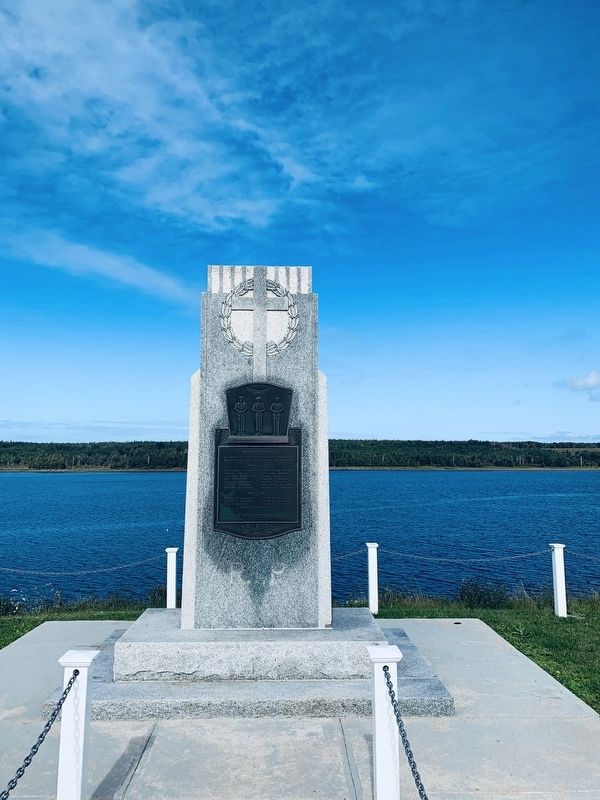
En mémoire des paroissiens de Chéticamp
morts dans les deux guerres mondiales
In memory of the parishioners of Chéticamp who died in the two World Wars
1914 - 1918
Hypolite H. AuCoin
Hubert AuCoin
William W. . . . — — Map (db m139821) WM
The life story of Jeanne Dugas illustrates
the experiences of Acadíans in the second
half of the 18th century. She and her
family fled Ile Royale (Cape Breton Island)
to escape the deportation of 1758, but
were later captured by the . . . — — Map (db m139618) HM
1790-1990 On September 27, 1790, His Excellency William MacCormick, Governor of the Province of Cape Breton, graciously and generously granted
7 000 acres of land at Chéticamp to our «Quatorze Vieux». By this
historical act, our . . . — — Map (db m140169) HM
Français:
Dés l'année suivante, en 1927, M. J. Macfarland engage M. A. Boudreau à temps plein comme directeur-adjoint des opérations à Chéticamp. M. Boudreau s'occupe particulièrement de la comptabilité de la compagnie, . . . — — Map (db m139698) HM
Français:
Cette bouée ancrée dans le havre de Chéticamp permettait aux grands transatlantiques de tourner sur eux-mêmes. Elle avait été entièrement attachée avec des rivets chauds. Elle servit de 1928 à 1946.
. . . — — Map (db m139797) HM
Français:
La guerre met cependant fin aux opérations quand l'Angleterre réquisitionne les bateaux pour le ravitaillement des troupes. La dernière cargaison pour l'Angleterre fut déchargée en mer pour permettre au bateau de se . . . — — Map (db m139734) HM
Français:
Après plusieurs vaines tentatives de ressusciter l'entreprise, ce n'est qu'en 1926 que l'Atlantic Gypsum Company de Boston achète toutes les installations et engage M. Joseph MacFarland pour relancer l'exploitation de la . . . — — Map (db m139697) HM
Built in 1893, St-Pierre's Church majestically watches over
the Acadian community of Chéticamp. An imposing 212
feet long, 74 feet wide and with a steeple rising to 167 feet,
St-Pierre's lavish Baroque interior and original . . . — — Map (db m139872) HM
Father Pierre Fiset, Chéticamp parish priest, is generally recognized as being responsible
for starting the gypsum mine in Chéticamp in 1907. When news broke that a prospector named Grandin had found gypsum in Chéticamp, Father Fiset . . . — — Map (db m139335) HM
Français:
On creuse un tunnel de l'entrepôt jusqu'à la mer, passant sous le chemin ; on construit un long quai recouvert dans lequel on achemine le gypse par convoyeur. Tous les travaux sont terminés en 1929, et au mois de juin de . . . — — Map (db m139696) HM
Français: Les affaires vont bien, on décide d'agrandir. Après le décès du Père Fiset, on emprunte 100,000$ pour construire une voie ferrée entre la carrière et le quai des Fiset. On achète une locomotive à vapeur avec dix wagons de . . . — — Map (db m139695) HM
English: Margaree is the proud birthplace of Dr. Moses Coady (1882-1959) and his double first cousin and mentor, Father Jimmy Tompkins (1870-1853), two men who devoted themselves to improving the minds and lives of the poor and uneducated. . . . — — Map (db m80070) HM
English:
A Canadian Heritage River, the Margaree has carved its way through Cape Breton since ancient times, creating the beautiful landscape and diversity of wildlife that has made this island famous. Essential for fishing, hunting and . . . — — Map (db m80069) HM
English:
The Margaree-Lake Ainslie River System, the largest on Cape Breton Island, includes the Margaree River, the Northeast and Southwest Margaree Rivers, and Lake Ainslie. From its origins in the Cape Breton Highlands, it . . . — — Map (db m80068) HM
They will never know the beauty of this
place see the seasons change, enjoy
nature's chorus, all we enjoy we owe to
them, men and women who lie buried in the earth of foreign lands and in the Seven Seas dedicated to the memory of Canadians who . . . — — Map (db m139476) WM
From the lone shieling of the misty island, mountains divide us, and the waste of seas – yet still the blood is strong, the heart is Highland, and we in dreams behold the Hebrides.
This shieling was erected in accordance with the terms of . . . — — Map (db m139857) HM
Making a Living in the Strait of Canso Area since 1784.
Transportation and Communication Early Years: Stage Coach Lines, Ferries, Mail Service Link, Telegraph Offices, American Consular Offices, Railroads, Boston Boats and Coastal . . . — — Map (db m139296) HM
English:
Work began on a causeway and canal complex between Cape Breton Island and mainland Nova Scotia in 1953 under a tri-party agreement between the federal Department of Transport, the Nova Scotia Department of Highways and . . . — — Map (db m139301) HM
English:
The Strait of Canso separates Cape Breton Island from the mainland of Nova Scotia. The Mi'kmaq were the original settlers in the area until the 1780's, when other settlements were established on both shores. Historically, . . . — — Map (db m139299) HM
English:
A canal is a manmade waterway connecting two bodies of water. When one body of water is higher than the other, the canal uses a lock, in this case, a tidal lock consisting of two sets of gates, to compensate for the . . . — — Map (db m139302) HM
English:
The foundation of this massive stone structure rests 66 metres below the Strait of Canso, creating the world’s deepest causeway. More than 9 million tonnes of rock fill were dumped into the strait between 1952 and 1955 . . . — — Map (db m139303) HM
English:
This monumentErected in memory of the 93 families who founded the parish of Saint Joseph du Moine. Was blessed by Reverend Charles Omer Cormier, and unveiled by Mr. and Mrs. Pat J. AuCoin on July 28, 1979 during the . . . — — Map (db m140308) HM
En memoire des défunts combattants
des dux guerres mondiales
In memory of the fallen soldiers of the two World Wars 1914 - 1918
Arsene F. Cormier
Daniel S. Leblanc
Jean D. Doucet
Elie P. Poirier
Jean S. . . . — — Map (db m139818) WM
This cairn marks the site of the
Acacia Villa School for Boys.
Founded in 1852 by
Joseph R. Hea,
he was principal until 1860.
Arthur McNutt Patterson
was principal from 1860 to 1907.
His son, Arthur H. Patterson
was principal from 1907 to . . . — — Map (db m139030) HM
This plaque commemorates
the 235th year of
the Grand Pre Marsh Body
1760-1995
in honour of the dykeland farmers,
past and present, for their 235 years
of dedication and sacrifice, and their
continuing struggle to protect and
maintain these . . . — — Map (db m138789) HM
English
The villages of Grand-Pré and Hortonville, and the fertile farmlands which surround them, comprise one of the oldest settlement and land use patterns of European origin in Canada. Acadians began settling near Grand-Pré in the 1680s, . . . — — Map (db m78721) HM
In 1759, the British authorities subdivided Nova Scotia into counties. The County of
Kings was divided into three townships: Cornwallis; Falmouth and Horton.
The Horton Town Plot (or plan), sited on the hills above Horton Landing and . . . — — Map (db m139033) HM
L'église-souvenir
Un témoignage durable
L'église-souvenir représente l'attachement profond
du peuple acadien au lieu historique national du
Canada de Grand-Pré.
Construite en 1922 grâce à des fonds recueillis . . . — — Map (db m140428) HM
Fondue avant l'avènement de l'education publique en
Nouvelle-Écosse, cette école a offert une éducation classique
et morale aux fils de familles aisées des Maritimes. L'école
accueillait quelques externes, mais la plupart des élèves
étaient . . . — — Map (db m138917) HM
English
This statue of Evangeline, heroine of Longfellow’s epic poem, Evangeline: A Tale of Acadie, is a powerful emotive symbol of the Deportation. It connects the story of Evangeline to the history of Grand Prê.
Two famous . . . — — Map (db m78723) HM
On February 11, 1747 Grand
Pré was the scene of a surprise
attack on Col. Arthur Noble's
detachment of British troops from
Massachusetts who were billeted
in the houses of the inhabitants.
A French and Indian force under
Coulon de . . . — — Map (db m140191) HM
English
The expulsion of the Acadians began in 1755, on the eve of the Seven Years’ War. Frustrated with the neutrality of the Acadians who refused to swear an unconditional oath of allegiance to the Crown, British forces began the . . . — — Map (db m78722) HM
How the Battle Unfolded
During the first half of the 18th century, France and Great Britain were at war for imperial domination of North America. Most Acadians, including those at Grand Pré, wanted to stay out of the conflict and be . . . — — Map (db m140430) HM
To entice the Planters to settle in Nova Scotia, the British colonial administration introduced an elected legislature in 1758, a form of representative government they had long known in New England. In the decades after their settlement . . . — — Map (db m140209) HM
In 1759, New England farmers and fishermen sent agents to Halifax to discuss with Governor Lawrence the settlement of the undeveloped areas of the province. Substantial immigration began in 1760 and, by late 1763, several thousand . . . — — Map (db m140207) HM
In the 1760’s, this spot was one of many to witness an influx of settlers from New England. The Planters called this region Horton Landing, a name it retains to this day. Within the Minas area, the newcomers established four agricultural . . . — — Map (db m140222) HM
In 1755, the worldwide struggle for empire between Great Britain and France had tragic consequences for the Acadians of Les Mines and elsewhere in Nova Scotia/Acadie
Lt-Col. John Winslow was the Massachusetts officer in charge of the . . . — — Map (db m140393) HM
Le lit desséché du crique que l’on aperçoit dans le pré à quelques pas d’ici est l’endroit ou furent embarques sur les chaloupes les victimes du Grand Dérangement de 1755 pour être transbordes sur les transports ancres dans le Bassin des Mines. . . . — — Map (db m138777) HM
English text only shown
The communities of Peggys Cove and Blandford were central to the recovery operation following the crash of Swissair Flight 111. The Whalesback and Bayswater Beach sites were chosen for their proximity to those . . . — — Map (db m47255) HM
Bridging the LaHave
It is only fitting that a place named "Bridgewater" should have such a rich history of bridges. Between 1825 and 1983, five bridges have spanned the LaHave River, connecting east and west Bridgewater. Prior to . . . — — Map (db m112428) HM
Up in Flames
In the cold, early hours of January 12, 1899, a fire began in the basement store of E. B. Simonson, located in the Music Hall at the corner of Dominion Street, and Commercial (now King) Street, where you are . . . — — Map (db m112426) HM
English
Seafaring of all kinds, and fishing especially, is one of most dangerous occupations. Lunenburgers have lived with the dangers associated with making a living from the sea. Fishermen in dories would get lost in the fog, unable to . . . — — Map (db m78204) HM
Here, in the year 1753, before any church was built, open-air Divine Services were held and Holy Communion administered in English, French, and German, to the first settlers and Garrison of the Town of Lunenburg by the Reverend Jean Baptiste . . . — — Map (db m112431) HM
English
When the British settlement at Lunenburg was established in 1753, the Town plot was enclosed by pickets surrounding the east, north and west ends of the Town. The west end was fortified by four blockhouses placed at strategic . . . — — Map (db m78328) HM
English
The earliest inhabitants of these lands were the Mi’kmaq. Their nation included most of the territory that later became Acadia and possibly parts of Newfoundland. This area was called Mi’kma’ki. It consisted of seven regions, each . . . — — Map (db m78297) HM
English
In 1750, British authorities, mistrustful of the colony’s large Acadian population, began encouraging immigration by settlers of more obvious loyalties. These settlers became known as the “Foreign Protestants.” They . . . — — Map (db m78296) HM
English
On June 8, 1753, a small flotilla of ships carried 1453 settlers protected by 150 troops and militia, arrived at the harbour which the Mi’kmaq called Merligueche after the whitecaps that topped the waves in the harbour. This group . . . — — Map (db m78318) HM
Solomon House c.1775
One of Lunenburg's Most Historic Homes
Built by Heinrich Koch
Heinrich Koch was nineteen when he arrived
at Lunenburg with the first settlers in 1753.
The next year, with his father Anton, he set
up the town's . . . — — Map (db m112430) HM
English
On March 26, 1921, Smith & Rhuland’s launched hull number 121, the fishing schooner Bluenose. Built from a design by William J. Roué, Bluenose at 258 tons, was the largest schooner ever launched at Lunenburg. Although . . . — — Map (db m78158) HM
English
By 1870, Lunenburg schooners abandoned the Labrador fishery and concentrated on the fishing banks off of Nova Scotia and Newfoundland. Instead of handlining from the schooner’s deck, fishermen set out in dories - double-ended, flat . . . — — Map (db m78207) HM
English
Although efforts were made to use large vessels known as otter trawls in the offshore fishery in the 1920’s, they were not used extensively until after the Second World War. Unlike the long line which used baited hooks to attract . . . — — Map (db m78206) HM
English
Lunenburg’s early settlers, the “Foreign Protestants,” came from a rich agricultural area in Europe and it was planned that they should establish farms which could supply both their own needs and those of the colony’s . . . — — Map (db m78259) HM
English
Lunenburg’s success in the fishery stimulated the construction of many fishing vessels. Almost all of the schooners fishing out of Lunenburg during the Town’s first 200 years were built in the Town or in other Lunenburg County . . . — — Map (db m78154) HM
English
This site known as the Old French Cemetery, is one of the few links to the Town’s Mi’kmaq and Acadian past. Known by the Mi’kmaq as Merligueche meaning whitecaps which topped the waves in the harbour, the name continued to be used . . . — — Map (db m78260) HM
English
A remarkable historical community is found in the streets, public spaces, buildings and daily life of Old Town Lunenburg. Set on a hill overlooking the harbour, Lunenburg was founded in 1753. Its gridiron layout, with a parade . . . — — Map (db m78209) HM
English
From 1920 until 1933, the sale of alcohol was prohibited due to the strong “Temperance Movement” in the United States. This prompted a demand for smuggled liquor which proved to be a lucrative business for organized crime . . . — — Map (db m78303) HM
Prominently sited on the parade square, this church was an important symbol of British authority and Anglican dominance for Lunenburg's early settlers, who were mainly German-speaking Protestants. From construction in 1754 through many alterations . . . — — Map (db m112453) HM
The first Anglican services in Lunenburg were held outdoors on this site and were conducted by a missionary from England. A two-storey structure in the New England Meeting House style was built between 1754 and 1763. The oak frames were . . . — — Map (db m112486) HM
English
More than a century before the founding of Lunenburg, these lands were inhabited by French-speaking settlers, known as Acadians. Their settlements, including one at Lunenburg, then known by its Mi’kimaq name, Merligueche, began in . . . — — Map (db m78294) HM
Beginning in the early hours of November 1, 2001, fire ravaged this historic church, substantially destroying the building. Undaunted by the destruction, the parishioners decided to restore the church. With financial help from friends around the . . . — — Map (db m112454) HM
This bell hung in the tower of St. John's since 1814 and served as the tolling bell for over 185 years. It was cast at the Whitechapel Foundry in London, England. On November 1, 2001, fire ravished through the Church, destroying the tower and . . . — — Map (db m112432) HM
The Labrador whaler Anderson Bros. is the type of boat that was used extensively in the Labrador fishery of the 19th century. Lunenburg County had a large fleet of 40 to 60 ton schooners known as “Labradormen” that went to the . . . — — Map (db m78205) HM
English
During the American Revolution many coastal settlements were harassed by enemy privateers. On the morning of 1 July 1782 approximately 100 raiders surprised and overpowered Lunenburg’s small defence force, captured the blockhouses . . . — — Map (db m78317) HM
Lunenburg is home to the oldest worshiping Lutheran congregation in Canada. The first Lutherans, mostly Germans from farming districts of the Upper Rhine, settled in the Town in 1753. Initially they worshiped outdoors and later were allowed to . . . — — Map (db m112480) HM
This stone of remembrance
is erected in loving memory
of our brave men
who laid down their lives
in the Great War
1914 - 1918
for
Truth Justice Liberty
In honour
of all who served
and in grateful appreciation
of the valiant . . . — — Map (db m112530) WM
Born in Pictou, here he was raised and lived his adult years.
Educated in the New Glasgow Schools, Sackville (Mount Allison) Academy, Glasgow University Scotland.
Public Servant, Politician, Pharmacist, Sportsman, Farmer, Horse Breeder. . . . — — Map (db m144796) HM
Into the East River at New Glasgow between 1821 and 1918 were launched some two hundred and ten sailing ships of 100 to 1400 tons burthen, built by native workmen from native materials.
The locally owned, commanded and manned vessels moved . . . — — Map (db m144793) HM
This area of Downtown New Glasgow was known as Bell's Corner for well over a century. Basil Bell (chemist, teacher and entrepreneur) constructed this architecturally sound stone home and store (to your left) in the mid 1840's. He and his wife would . . . — — Map (db m144797) HM
”One of New Glasgow’s most interesting and notable persons is George Rogers McKenzie. During his lifetime he was a builder of ships, deep water captain, a master mariner and a politician.” —Stories from Pictou County’s . . . — — Map (db m144795) HM
The land upon which this park is situated was given to the Town of New Glasgow by James William Carmichael, Esq. on the Twenty-fourth day of November Eighteen Hundred and Ninety — — Map (db m144802) HM
English:
Born and educated in New Glasgow, Cameron, having graduated from the Boston Law School, practiced law in the United States before joining Queen’s University in 1882. The following year he became editor of the Kingston . . . — — Map (db m139298) HM
This parcel of land in New Glasgow, Nova Scotia deeded to the City of Glasgow, Scotland, Aug. 6, 1975, during the visit of the Honourable Peter T. McCann, Lord Provost of the City of Glasgow, to officiate at the Festival of Tartans on the occasion . . . — — Map (db m144804) HM
You are standing beside the Mae MacGillivray Building, which was renovated in 2014 by MacGillivray Properties Limited. The loft apartments have an industrial theme rooted in the County's history of coal, steel and shipbuilding. A 1916 book Pictou . . . — — Map (db m144806) HM
This memorial and activity trail recognizes the inspiration of Johnny C. Miles (1905 to 2003). Johnny grew up in Sydney Mines, Nova Scotia and became an internationally known sports figure following his 1926 and 1929 wins of the Boston Marathon. He . . . — — Map (db m144803) HM
Originally dedicated in 1898 in honour of F.D. Laurie, former Mayor of New Glasgow, this park was rededicated in 1992 as Laurie Park, a Peace Park, by Her Worship Mayor Ann MacLean, on behalf of the residents of the Town of New Glasgow and the . . . — — Map (db m144883) HM
The community that was to become New Glasgow was settled in 1784 by Deacon Thomas Fraser. By 1809 the Town was named after Old Glasgow in Scotland and incorporated in 1875. A strong entrepreneurial spirit was evident even in 1809 when the first . . . — — Map (db m144794) HM
New Glasgow is a scenic riverside town of 9,455 residents, which serves as the commercial-service centre for northern Nova Scotia with a rich multi-cultural mosaic. Founded by Scottish settlers in 1784, the town was named after Glasgow, Scotland and . . . — — Map (db m144801) HM
This bell, belonging to the Town of New Glasgow, was refurbished and a bell tower was constructed as part of the New Glasgow Downtown Revitalization Project - Recreating the Experience, in 2009.
The bell was originally manufactured and supplied . . . — — Map (db m144799) HM
Donated to the citizens of the Town of New Glasgow in memory of our fallen comrades Normandy Br 34 The Royal Canadian Legion October 5 • 1980 — — Map (db m144880) WM
In grateful memory of The Rev James Drummond MacGregor, D.D. Born at Comrie, Perthshire, Scotland, 1759. Died at East River, Pictou, 1830. Pioneer Minister of the Gospel in Eastern Nova Scotia, where he labored with Apostolic zeal for 43 years. . . . — — Map (db m144800) HM
This likeness of a lion was sculpted by John A. Wilson in 1891 at the age of 15. Two others of its kind are known to exist, one here at the Carmichael Stewart House Museum and the other at the Lionstone Inn, Pictou.
This particular statue was . . . — — Map (db m144805) HM
This likeness of a lion was sculpted by John A. Wilson in 1902 at the age 26. Two others of its kind are known to exist, one here at the Carmichael Stewart House Museum and the other at the Lionstone Inn, Pictou.
Wilson, a New Glasgow native, was . . . — — Map (db m144807) HM
was in August 1784 with the arrival from Kirkhill, Inverness-shire, Scotland, of Thomas Fraser (Deacon) 1749 — 1813 who took possession of this land and created from the forest a farm home, the first in that part of the East River Lower . . . — — Map (db m139297) HM
The First Church in East Pictou was built on this site in 1787. Made of logs, it served the Lower Settlement East River Presbyterian Congregation for 16 years until 1803. From this beginning other Congregations developed in the East Pictou rural and . . . — — Map (db m144791) HM
Mrs. Viola Irene (Davis) Desmond was born on July 6, 1914 in Halifax, Nova Scotia, to James and Gwendolyn Davis. Viola was one of 15 siblings who grew up in and around the city area. After graduating from Bloomfield High School with excellent marks, . . . — — Map (db m144798) HM
Noted strongman of River John who amazed and astounded residents of River John, Pictou County and beyond with incredible feats of strength. Buried in Forest Hill Cemetery Denmark, N.S. — — Map (db m150300) HM
”The Town of Stellarton always meant a lot to me” —Frank H. Sobey Stellarton Town Square was the site of the Jubilee Theatre and the first Sobeys Food Store, built in 1912 by John William Sobey to expand his meat delivery . . . — — Map (db m151321) HM
Best known as the entrepreneur who grew his father’s small meat delivery business into a regional grocery powerhouse that has since expanded to serve millions of Canadians country-wide, Frank H. Sobey was, first and foremost, a proud Nova Scotian . . . — — Map (db m151320) HM
English:
This British firm established coal mining as a major industry in Nova Scotia. Granted a monopoly of provincial mineral rights in 1826, the GMA developed coal operations here at Albion Mines and at Sydney Mines, and . . . — — Map (db m140077) HM
"It was his friendliness, his knowing everybody in the community. It didn't matter whether you were a miner or a farmer or anyone else. He would stop and talk, ask your opinion about things, exchange notes about fishing." —Alfred . . . — — Map (db m151322) HM
From humble beginnings, two enterprising Pictou County blacksmiths, Graham Fraser and Forrest MacKay would set up a business to manufacture products for the railway and shipping industry. In the year 1878 they would move their growing company to . . . — — Map (db m150404) HM
This interpretive panel erected on July 11, 2019 to commemorate the designation by Trenton Town Council of this area as a Trenton Heritage Site, where the first successful commercial pouring of Steel in Canada occurred in 1883, within the Steel . . . — — Map (db m150403) HM
On September first, 1953, seventy years after the production in the open hearth plant of the Nova Scotia Steel Company Limited at Trenton, Pictou County, Nova Scotia, of the first steel ever made in Canada, this ingot, cast in 1883, erected by the . . . — — Map (db m150496) HM
Trenton Works axle hammer had a distinct sound when operating. People would refer to it as the "heartbeat of Pictou County", as the sound meant the plant received an order which was good news for the local economy. Trenton Works employees were noted . . . — — Map (db m150402) HM
In memory of the crew of the
Beam Trawler Jutland
foundered at sea March 11, 1920
These crossed anchors recovered from
fishing banks on Jutland's previous trip
are placed as a symbol of our hope that
their souls are resting in . . . — — Map (db m112407) HM
Designed by Halifax architect Herbert E. Gates, this dignitied town hall was constructed in 1901-1902. Such buildings were central to civic life across the country, providing accommodation for the growing number of services administered by local . . . — — Map (db m112404) HM
499 entries matched your criteria. Entries 301 through 400 are listed above. ⊲ Previous 100 — Next 100 ⊳