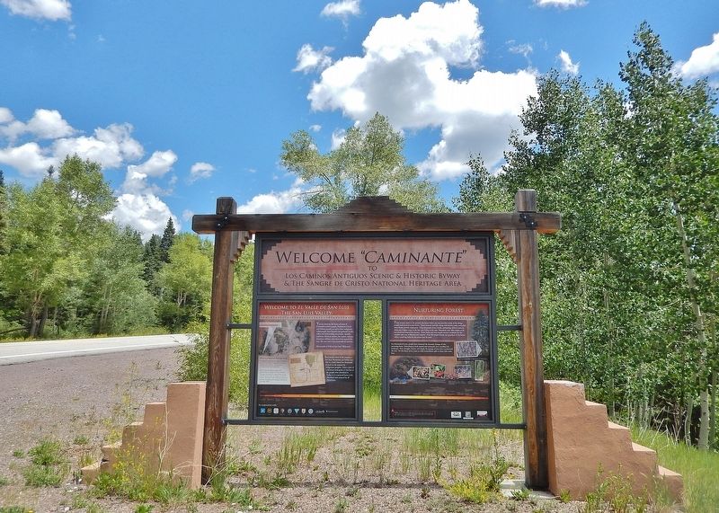
From ancient times to the present, the forest before you has provided many of the things people need to survive and thrive. Game animals and fish, along with berries, roots, and other plant foods, provide sustenance. Clear mountain rivers, creeks, . . . — — Map (db m295502) HM
Imagine that a group from a foreign country claimed your home as their own. Their culture is very different and they don't speak your language. You learn that you can defend your ownership, but only in the other's language and by rules you don't . . . — — Map (db m295554) HM
What is a National Heritage Area? A national heritage area is a region recognized by the United States Congress for its unique qualities and resources — natural, scenic, cultural, historic, and recreational. Rich in history, religion, . . . — — Map (db m295490) HM
Long before anyone claimed this land as their own, it was used for hunting, gathering, and spiritual pursuits by various groups of indigenous people. Navajos, Utes, Apaches, Pueblos, and other tribal groups migrated to and through the area. . . . — — Map (db m295553) HM
A major encounter between the U.S. Army and a large group of Utes and Jicarilla Apaches occurred here in July 1848. Old Bill Williams, the famous scout and guide, was badly wounded while fighting the Utes, who had once adopted him as a tribesman. — — Map (db m280188) HM
[left to right]
This Payan corrugated jar was found here at the Pit House site and was used for storage of corn, beans and wild seeds.
Mancos [and] Payan Corrugated
This style of pottery was often used for cooking. The corrugations helped . . . — — Map (db m160560) HM
The Northern San Juan Surface Pit House that was constructed here is composed of one large room used as a dwelling area and 3 rectangular room blocks used for storage.
[Left illustration caption reads]
Typical cross-section of surface pit . . . — — Map (db m160562) HM
Kivas or Ceremonial Houses were not only used for religious ceremonies but may have been used for governmental and social events as well. Kivas varied in size and had flat or cribbed roofs.
The cribbed roofs of kivas were constructed of logs . . . — — Map (db m160561) HM
Rising from a 90-million-year-old seabed. Chimney Rock's twin towers stand 300 feet above the surrounding mesa. The Europeans who first saw them probably approached from due east, obscuring their view of the westernmost spire. As a result, Spanish . . . — — Map (db m293894) HM
This building, constructed in the late 1890s, houses Pagosa Springs' oldest business. David Lowenstein, the original proprietor, arrived in the San Juans in 1876. He and his wife, Fanny, reached Pagosa Springs on the first train in October of 1900. . . . — — Map (db m281892) HM
Commencing in 1905, George, James, and Elmer Hatcher operated a hardware store at this location. The store advertised sporting goods and funeral services. The existing building was constructed following the fire of 1943. The second geothermal well . . . — — Map (db m293891) HM
The Star Theatre occupied this site until 1919 and had been originally constructed as a part of the Archuleta Mercantile. After two fires, the Mercantile was reconstructed as the Metropolitan Hotel and the Star Theatre was resurrected as the . . . — — Map (db m293804) HM
A 1919 fire destroyed the original Archuleta Mercantile building at this site. From 1919 to 1920, Alexander Sullenberger, founder of the Pagosa Lumber Company, built the “strictly modern” Metropolitan Hotel and Star (Liberty) Theatre. The Hotel . . . — — Map (db m293888) HM
Pagosa Springs has a rich history, beginning with the Anasazi Indians. Later the Utes, Navajos and Apaches inhabited this beautiful corner of the Southwest. They also visited the great “Pagosah” hot springs which they believed had curative . . . — — Map (db m27527) HM
Geothermal Energy Early settlers in Pagosa Springs took full advantage of the comforts afforded by the mineral waters. Many built special bathing rooms attached to their homes, the better to soak in privacy; others (beginning in the 1900s) . . . — — Map (db m293893) HM
Questions Unanswered
A thousand years ago, a civilization flourished here. What pulled people here — and why did they leave after 200 years?
Why did they build so high above the fields in the valley, the water, and other resources? . . . — — Map (db m153328) HM
The Old Spanish Trail was neither entirely Spanish nor Particularly old. But the name seemed to fit this rugged road, which passed about thirty miles south of here as it stretched from Santa Fe to California. Franciscan pathfinders Dominguez and . . . — — Map (db m293895) HM
Learning About Our Past, Preserving Our Legacy
The extraordinary archaeological resources at Chimney Rock have helped illuminate the history of the ancestral Puebloans who lived here over a thousand years ago. They built structures from the . . . — — Map (db m153331) HM
DSP&P Historical Timeline: 1872: Governor John Evans, the 2nd territorial governor of Colorado, forms the Denver, South Park & Pacific Railway. 1873: Governor Evans forms a new company, the Denver, South Park & Pacific Railroad (DSP&P, . . . — — Map (db m293299) HM
Native peoples traveled through the Upper Arkansas Valley for centuries before European and American explorers.
Ute, Comanche and other tribes traveled on foot until the arrival of the Spanish and the introduction of the horse in the 1600’s. . . . — — Map (db m107827) HM
St. Rose of Lima Catholic Church was located at West Main and Gunnison streets, across from The Princeton Hotel, which was built in 1893. The hotel survived two fires and was rebuilt each time. The third fire, which was in 1936-37, destroyed the . . . — — Map (db m293249) HM
The Ute People made this land home. Next came Spanish military expeditions and French fur trappers. The fledgling U.S. sent its own explorers west into the Rocky Mountains in the early 1800s. In 1806 the Zebulan Pike expedition explored the Buena . . . — — Map (db m293270) HM
The beauty and majesty of the landscape intrigued locals and visitors from Buena Vista's earliest days. Early newspapers touted everything from the scenery to the local hot springs, encouraging outdoor recreation and tourism via stagecoach, rail, . . . — — Map (db m293277) HM
Farms and ranches dotted the upper Arkansas River valley as early as 1864. The Mahon, Loan, and Bard families established some of the first ranches, portions of which are now part of Buena Vista. The area's first farmer, Dr. Frank Mayol, raised . . . — — Map (db m293274) HM
With the discovery of gold in California Gulch in 1860, getting to Oro City (now Leadville) meant an opportunity for fame and fortune.
It would, however, be twenty years before railroad service traversed the Upper Arkansas . . . — — Map (db m107833) HM
In the late 1800’s, transportation of goods and people could be an arduous undertaking.
Gold and silver fever led many to endure travel up the Arkansas River from Canon City to Leadville.
Although arguably the largest and most notorious, . . . — — Map (db m107835) HM
Constructed in 1883 as the Bank of Buena Vista, the bank was transferred to the First National Bank of Buena Vista in 1884. The property was placed on the Colorado State Registry of Historic Properties by the Colorado Historical Society August 9, . . . — — Map (db m293199) HM
In Memoriam William Joseph Walsh ————— 41 Replacement Unit No. 41 Medical Corps who died September 29, 1918, serving his country during The World’s War 1914 1918 — — Map (db m293296) HM WM
Dominating the view to the west, the peaks of the Sawatch Range define the Continental Divide. Fifteen of the peaks in the Upper Arkansas River Valley are "fourteeners," boasting summits exceeding 14,000 feet.
Between the peaks, creeks flow . . . — — Map (db m158531) HM
Agriculture in the Upper Arkansas Valley was initially developed to meet the demand of area mining camps. The flood of fortune-seekers created a market for meat, flour, vegetables, and other foods.
French immigrant Frank Mayol, credited . . . — — Map (db m158536) HM
As trappers, miners, and settlers migrated west they encountered an arid environment. Early explorers referred to the West as the Great American Desert and many believed it could not be settled. Unlike the wetter eastern United States, . . . — — Map (db m158541) HM
"It is a town of only eight days' growth, but full of life.... There are now about 300 inhabitants, with fifty houses, tents, etc., and quite a number of buildings in process of construction, comprising one hotel, one boarding house, two . . . — — Map (db m281103) HM
Intersection of the centuries You're standing on more than the junction of US Highways 50 and 285. This place where the Sawatch and Sangre de Cristo mountain ranges meet has seen many travelers over the centuries. The Utes and . . . — — Map (db m281224) HM
With its rich farmland, natural hot springs, and proximity to busy mining districts, Poncha Springs seemed poised for prosperity. By 1880 the town of 3,000 was receiving eight daily stagecoach arrivals, the Denver & Rio Grande Western tracks were . . . — — Map (db m281068) HM
Not everyone who came to this junction of mountains and waterways kept moving. Prospectors and homesteaders put down roots here in about 1860. The first cabin, built by Nat Rich and Bob Hendricks, still stands in the town of Poncha Springs. In . . . — — Map (db m281265) HM
As settlements grew and the quest for gold and silver brought prospectors and miners, transportation for people and goods became critical. Entrepreneur Joseph Lamb started a ten burro pack train to carry goods from Cañon City to the Upper . . . — — Map (db m281236) HM
The Top of the Rockies Scenic and Historic Byway travels through spectacular scenery and is surrounded by some of the state’s highest peaks. In the nineteenth century, these mountains yielded some of Colorado’s biggest mining fortunes. On the . . . — — Map (db m281215) HM
The Jackson Hotel was built in 1878 by Henry A. Jackson who left his home in Kentucky looking for a place where his family could escape the turmoil of post-Civil War reconstruction. A former Memphis steamboat captain, Jackson found himself high . . . — — Map (db m309473) HM
“The Colorado Rockies were once a great barrier to Western travel; then they became a great goal of Western travel.” — William M. Butler, Roof of the Rockies Of the 68 "fourteeners" — 14,000-foot-high mountains — in the continental . . . — — Map (db m281203) HM
Before the 1860s the Upper Arkansas Valley was crisscrossed by native peoples moving from summer to winter camps and by European and American explorers. The discovery of gold and other minerals in the Colorado Territory brought rapid change. . . . — — Map (db m293398) HM
Smokestack Construction Facts: Construction started: June 21, 1917 Construction completed: Nov 14, 1917 Last used: March 1920 Material: 264 standard gauge carloads of pressed, glazed brick and mortar. Chimney: Octagonal . . . — — Map (db m293380) HM
Chaffee County Courthouse built by Ray Lines Post 64 American Legion Architect De Morduant Approximate cost $120,000 Completed 1932 — — Map (db m293500) HM
[Roll of Honored Dead]
Frank J. Coscarelli • Jack Rundell • Joe A. Barnhill
Frank Holman • Roy J. Barnhill • John T. Fowler
Raymond Thorpe • John N. Maestas • Cyril J. Coster
Theodore D. Benjovsky • Laverne F. Knipp • Philip F. Scholl . . . — — Map (db m158549) WM
Frustrated in their attempt to climb Pike’s Peak on November 27, 1806, Zebulon Pike and his party of 15 trudged on through South Park looking for the Red River, southern boundary of the Louisiana Purchase. After crossing Trout Creek Pass, the . . . — — Map (db m127876) HM
Salida hosts the nation's oldest whitewater paddling festival the third weekend of every June. This four-day festival blends a world-class whitewater competition with raft racing and light-hearted events. FIBArk began in 1949 as a bet between two . . . — — Map (db m293297) HM
Following ancient paths The history of Chaffee County as part of the United States began in 1803, with the purchase of the Louisiana Territory from France. But human history was established here centuries earlier. Many of the hiking trails . . . — — Map (db m116085) HM
Salida sprouted within weeks of the arrival of the railroad. Homes and businesses couldn't be built fast enough, and many families spent time camped along the Arkansas River. In its first edition The Mountain Mail newspaper reported that . . . — — Map (db m293397) HM
Life changed rapidly in the Upper Arkansas River Valley with the arrival of European explorers and the United States settlers. Spanish presence in the area and their interaction with local Utes was recorded as early as 1626, but official . . . — — Map (db m293431) HM
Up, up, up the Pass! This popular walking and bike path follows a portion of the Monarch Spur, the railroad branch that crossed the Arkansas at the Salida railyards and stretched west to the mining camp of Maysville and up to the quarry below . . . — — Map (db m293396) HM
With the acquisition of the Louisiana Purchase in 1803, the United States had extensive new lands to explore. In search of a new border While Lewis and Clark engaged in their famous “Voyage of Discovery” along the Missouri River (1803-1806), . . . — — Map (db m293486) HM
As early as 1880, when gold, silver, copper, and iron mines began producing ore in Chaffee County, a local smelter was needed. Several small concentrating plants and smelters were built close to ore sources, but most were inadequate. The arrival . . . — — Map (db m293381) HM
A legacy of hard work and dedicated workers When operating, the smelter ran 24 hours a day. Work was physically demanding and often tedious, but the men were proud of their accomplishments. Many smelter workers and their families lived near . . . — — Map (db m293384) HM
Electricity was introduced in Salida in 1887 when a group of local townsfolk created The Electric Illuminating Company. In 1892 the then-named Salida Light and Power Company built a 1000-kilowatt steam generating plant at this location on the banks . . . — — Map (db m52403) HM
Salida Equal Suffrage League
formed by Carrie Chapman
Catt here at former Baptist
church in support of 1893
women's suffrage referendum. — — Map (db m250652) HM
The Arkansas River in the time of the Ute Indians fluctuated dramatically. In spring, snowmelt swelled the river, causing flooding and bank erosion. By mid-summer, the river shrank to a shallow stream. In the 1850s, silver and gold miners began . . . — — Map (db m293298) HM
The Griffith Lode (2,500 ft. N.E.), later a silver producer, was discovered June 17, 1859, by George W. Griffith, for whom Georgetown was named. Town site claimed June 29, 1860. The Belmont Lode (5.7 miles S.W.), first important silver discovery in . . . — — Map (db m173244) HM
Thomas Cornish built this elaborate home that combines a French Mansard roof with
Italianate and Gothic Revival detailing. It is one of the last homes in Georgetown to display such exuberance in Victorian architectural styles.
Cornish came to . . . — — Map (db m152842) HM
This former bank building was the first of a row of buildings that William H. Cushman built along this block of Alpine Street. In 1871, he bought out the majority interest of another bank and reorganized it as the First National Bank of . . . — — Map (db m282668) HM
In the fall of 1872, William Cushman was busily erecting two fine brick buildings, one on either side of his bank building. This one, on the west, had its roof completed as workers laid the foundation for the other one. Undoubtedly Cushman leased . . . — — Map (db m173241) HM
William H. Cushman built this imposing brick Italianate commercial building in two phases. He completed the western part as a two-story structure in 1872. Three years later, Cushman built an adjoining three-story edifice on the corner lot; he . . . — — Map (db m173242) HM
Charles R. Fish, a local banker, built this fine structure for his Bank of Clear Creek County. Today the Fish Block is one of the more prominent and substantial brick commercial buildings in town. It is similar in design, though less elaborate in . . . — — Map (db m173243) HM
The construction history of this building is uncertain. A.R. Forbes was an early owner
and used the space for his drug store until around 1880, at which time he moved his
business to the northwest corner of Alpine (now 6th) and Taos streets. He . . . — — Map (db m152848) HM
Restoration of the historic railway was done as a construction training exercise by military engineering units of the U.S. Navy and U.S. Army. Work was accomplished under the vision and direction of Captain Robert L. Ferriter, Civil Engineer . . . — — Map (db m282687) HM
Electric generating plants, through their high-voltage lines, provide critical power to the isolated mines in this region. Georgetown, completed in 1900, was unusual in employing both steam and water power. Its owner, United Light and Power . . . — — Map (db m285252) HM
Georgetown-Silver Plume
National Historic Landmark District
Hamill House
1867/1879
The Hamill House represents the height of prosperity achieved during Georgetown's mining era. The centerpiece of Historic Georgetown's properties, this . . . — — Map (db m69625) HM
A Norman inn built in a great silver mining camp by a mysterious Frenchman called Louis Dupuy, opened in 1875, richly furnished from New York ad abroad, it became nationally noted for continental delicacies and the literary bent of its proprietor, a . . . — — Map (db m173300) HM
Frenchman Louis Dupuy came to Georgetown in 1870 to seek his fortune in silver mining. A mine accident ended those dreams, and he soon opened the first phase of his extraordinary Hotel de Paris. The hotel, completed in 1890, featured steam heat, hot . . . — — Map (db m173301) HM
This plant is one of Colorado's oldest alternating-current hydroelectric facilities that is still generating electricity. When it began operating, the ability to provide inexpensive electric power with alternating current over long distances . . . — — Map (db m282673) HM
John Tomay came to Georgetown in 1873 to oversee the properties of the Baltimore Tunnel Company. He became an insurance, real estate, and loan agent and remained in Georgetown until his death in 1922. This “large, jovial man” was also . . . — — Map (db m173302) HM
Henry Kneisel built the western unit of this three-bay structure in 1892, and he moved his grocery business into it the following year. Kneisel had all the shelves and bins, which are still in use, built to his personal specifications. From his old . . . — — Map (db m173422) HM
Georgetown Lodge No. 12 AF & AM is one of the oldest continuously active fraternal orders in Colorado. The builder, Master Mason Charles Fish, incorporated Masonic symbols into the beautiful stained-glass windows. In 1912 this pioneer lodge combined . . . — — Map (db m173424) HM
In 1868 Erskine McClellan erected on this site a place of public gathering, McClellan Hall, which he later enlarged, calling it the McClellan Opera House. During the years 1869-1892, The great and the near-great of the theatrical worlds performed . . . — — Map (db m173425) HM
Attorney John McMurdy built this fine structure for offices; it is one of Georgetown's
earliest commercial buildings. Typical of the times, a false front extends above the gable roof, topped by a well-proportioned Italianate cornice.
Jacob . . . — — Map (db m152895) HM
This structure is one of the town’s oldest surviving wooden commercial buildings. Originally, it was a two-story structure that was about half the width of the present building. By 1874, the owners had doubled the size of the structure, creating a . . . — — Map (db m173427) HM
Now known as the Georgetown Community Center, this is one of the few two-story wooden commercial buildings remaining from the 1860s in Georgetown. Initially, builders John Fillius and J.G. Mahany had their Ohio Grocery and Bakery on the first floor, . . . — — Map (db m173428) HM
The town of Georgetown built this small stone jail in the summer of 1883, using steel cells donated by the county. Built at a cost of $700, the stone jail was known for awhile as the "Hotel de Barr," after town Marshall Barr and for the "vertical . . . — — Map (db m39338) HM
In 1873, The Colorado Miner reported that Theo Simmons had constructed "a handsome brick building on Rose Street," one of Georgetown's first commercial brick structures, to house his business. In 1877, he sold to William Hamill, who soon acquired . . . — — Map (db m282676) HM
This firehouse, which features Italianate detailing, originally stored the equipment of the Star Hook and Ladder Company, which had formed in 1874. The “Star Hooks” had acquired a new long fire truck with ladders, hook stakes, and . . . — — Map (db m173299) HM
The firm of Teal, Foster, and Co. built this fine brick office building. Brothers George and James Teal and their partner, Ernest Le Neve Foster, were "general mining agents and consulting engineers.” Their ads indicate that they managed . . . — — Map (db m152849) HM
The festivities that greeted the 1877 arrival of the railroad in Georgetown were short-lived. Word of massive silver discoveries in Leadville, forty-five miles to the southwest, sparked a rush to the new ore fields.
The Union Pacific Railroad, . . . — — Map (db m282681) HM
Situated in the heart of Colorado's Front Range, the Georgetown Loop Mining and Railroad Park recreates a significant part of Colorado's historic Clear Creek Valley. Some of the most important events of the Colorado gold and silver booms took place . . . — — Map (db m282686) HM
Colorado's scenic wonders lured settlers and tourists alike. Geography and weather placed strict limits on travel routes and seasons. Politicians, engineers, and citizens often disagreed about how to cross the Continental Divide. Between 1941 and . . . — — Map (db m152814) HM
Brothers James F. and Alfred C. Tucker conducted their grocery and provisions business out of this building during the 1870s. They advertised “Wines, Liquors, Tobacco, Queens-ware, Clothing, Boots and Shoes.” Here a customer in 1879 . . . — — Map (db m173240) HM
Arrastras like this one were used by the earliest hard-rock miners in this area to grind gold ore. People skilled in stone cutting made them for the miners from local rock.
This arrastra was chiseled by hand from blocks of hard granite. . . . — — Map (db m144184) HM
In Memoriam DREXEL LACEY 1892-1930 Resident Engineer State Highway Department Completed the survey of this highway August 13, 1926 — — Map (db m76801) HM
Mrs. Coddington owned a two-story brick double on the corner lot. It was occupied by W.K. Townsend (grocer) and Paul Lanius (hardware). Townsend imported glassware and crockery and was said to have the best selection of cigars in town. "Lets all . . . — — Map (db m76856) HM
J.J. Elliott had his assay office in the building which was built in 1879. Often during the boom days of the 1880's dozens of ore wagons were parked on Miner Street in front of the "Exchange". Elliott promoted himself in the city directories of the . . . — — Map (db m76854) HM
Charlie Tayler used this waterwheel to power a stamp mill at his gold mining operations on Ute Creek. Tayler, who attributed his good health to the fact that he never kissed woman or took baths, built the waterwheel in 1893. It was moved to its . . . — — Map (db m74371) HM
Built in 1881, this building housed M. C. Livingstone’s jewelry and sewing machine store during the early ‘80’s. Since Livingstone had some of the first commercial sewing machines in the district, he made a brisk living repairing the canvas awnings . . . — — Map (db m144187) HM
Mt. Evans, Colorado Elevation 14,125 ft.
“The World’s Highest Operational Observatory”
Building Dedication August 19, 1996
“...for educational purposes in astrophysics and astronomy...” — — Map (db m3364) HM
Argentine Central Shay Locomotive No. 1 in Silver Plume, 1905. The Argentine Central Railway, incorporated in 1905 and built to service the Argentine Mining District in the Waldorf area, reached the summit of Mt. McClellan in 1906. The railroad . . . — — Map (db m13629) HM
She looks tired, worn out after being up most of the night, tending to a sick patient. She's walking home in deep snow on a very cold windy night with her medical bag and railroad lantern. In her younger years she joked about carrying a six gun, . . . — — Map (db m288395) HM
Soldier weather. Bone-jarring exposure to heat, rain, wind, dust, numbing cold, sleet, and snow. Day after day of mind-bending boredom, interspersed with moments of stark terror. These elements chipped away at an infantry soldier on foot or in the . . . — — Map (db m288399) HM
As the lead organization for the Eisenhower sculpture, the Fraser Valley Lions Club and sculptor Howard Neville are proud to tell you the story of the Western White House. Known as Ike, Dwight Eisenhower is one of America’s best-loved . . . — — Map (db m295385) HM
The Indian and Eagle are highly regarded symbols of Americana. Prized by the Indian, eagle feathers guided arrows to their targets, and feathers served in civil, military, and religious displays. To capture these noble rulers of the heavens, . . . — — Map (db m288498) HM
Jeremiah Johnson was a Mountain Man. Indians gave him the name “Dapiek Absaroka”, meaning Crow Killer. He carried on a one-man war with the Crow Indian Nation in retaliation for the death and scalping of his Flathead Indian wife, The Swan, and . . . — — Map (db m288398) HM
238 entries matched your criteria. The first 100 are listed above. Next 100 ⊳