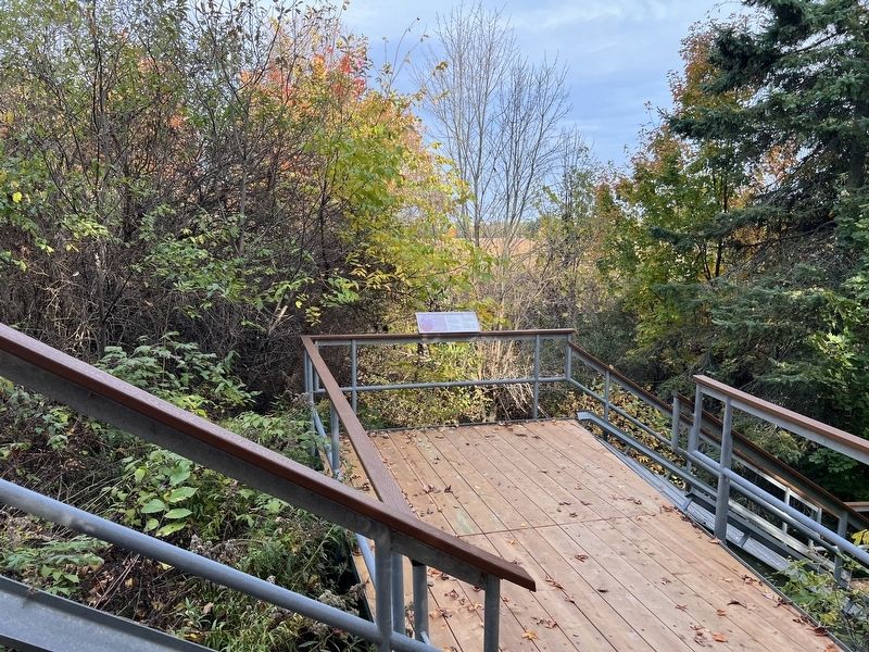
Strong words from the Poorhouse Physician, Dr. Abraham Groves of Fergus, who visited the House once a week to supervise the care of the ill and dying. In his annual reports, he described the conditions of their health and the particulars of some . . . — — Map (db m286932) HM
Consumption (tuberculosis) was known as "the poor man's disease" and caused great suffering for many of the dying inmates.
Harsh living conditions and poor diet contributed to chronic lung and heart disease, the two main causes of illness for . . . — — Map (db m286879) HM
During the first 50 years of burials, wooden crosses marked the gravesites on which the deceased's name, birth and death years were painted.
In the 1920s, metal markers attached to stakes replaced the crosses that had rotted with age. The . . . — — Map (db m286811) HM
The House was intended as a refuge for the aged who had no one to care for them. In fact, many mothers with children also sought aid at the House.
The loss of the main breadwinner - through death, illness, or abandonment - was a crisis from . . . — — Map (db m286934) HM
Near Wellington Road 18 1 kilometer Beatty Line, on the right when traveling west.
Erected in 1877 by the County of Wellington, the House of Industry and Refuge, later the Wellington County Home, provided shelter for many county residents until 1971. A barn was also built in 1877 so that farming could be carried on in conjunction . . . — — Map (db m286569) HM
An overwhelming number of men (196) are buried in the Poorhouse cemetery, compared to 75 females.
The oldest of the burials was Ann Sadler, a widow from Harriston who died in 1898 at age 106.
The youngest burial was Annie Thompson's . . . — — Map (db m286812) HM
Nine rural Houses of Industry and Refuge (Poorhouses) were built in Southern Ontario between 1869 and 1890 to provide shelter and food for the "respectable poor."
Township and village councils decided who was deserving of charity: the elderly, . . . — — Map (db m286949) HM
Within weeks of the first admissions to the Poorhouse in late 1877, an inmate died - James Burke, age 65, (Dec 21) and a County by-law designated a burial ground for "the pauper inmates whose friends do not claim their bodies." The cemetery was laid . . . — — Map (db m286880) HM
Jane Lewis, a member of the Brooks Bush Gang that terrorized Toronto residents in the 1860s, fled to Guelph when one gang member was hanged for the murder of MPP John Hogan.
Cutting a well-known figure in the rougher districts of town, Jane was . . . — — Map (db m286877) HM
Between 1877 and 1947, over 1500 destitute men, women and children sought refuge at the Wellington County House of Industry and Refuge, or the
'Poorhouse' as everyone called it.
Built as an Industrial Farm, the site included a sixty-bed . . . — — Map (db m286994) HM
During its seventy years as a House of Industry and Refuge (1877-
1947), about 600 died at the House of old age or from disease.
Over half of these were immediately claimed by family or friends and buried in local cemeteries throughout the . . . — — Map (db m286935) HM
On Church Street at Geddes Street, on the right when traveling east on Church Street.
A leader in the radical reform movement in 19th-century Ontario, Clarke was born in Lincoln, England. In his youth he developed a keen interest in politics and, after emigrating to Upper Canada and settling in Elora in 1848, he joined . . . — — Map (db m289250) HM
On Metcalfe Street at Carlton Place, on the left when traveling north on Metcalfe Street.
Arthur A. Badley
Arthur A. Badley (1895-1972) served in WW1 and later worked at J. C. Mundell Furniture. Manufacturers located in the industrial buildings south and west of the Victoria Street bridge. Throughout his lifetime he was an active . . . — — Map (db m289124) HM
On Geddes Street at Henderson Street, on the right when traveling south on Geddes Street.
Born in Scotland, Boyle came to Canada in 1856 and settled in this area. As a local school teacher, he began an extensive collection of native artifacts and became an archaeological authority. Boyle moved to Toronto in 1883 and three years later was . . . — — Map (db m312201) HM
Although it is one of the main tourist attractions in our area, human impact on this section of the gorge has not always been a story we are proud to tell. To early pioneers, trees were an obvious impediment to farming and a nuisance obstructing . . . — — Map (db m289363) HM
On Metcalfe Street 0.1 kilometers north of Water Street East, on the right when traveling north.
Elora Drill Shed
This handsome stone structure, built in 1865, is a rare surviving example of early drill hall architecture in Canada.
During the 1860s, the American Civil War and the Fenian raids raised fears for the defence of . . . — — Map (db m286564) HM
Near Mill Street West, on the left when traveling south.
The former Victoria Street bridge was built in
1842 and was the primary crossing over the Grand
River for over 100 years. It was reconstructed
several times and in 1871 the stone piers were built.
It was rebuilt again in 1899 as a four span . . . — — Map (db m289241) HM
On Metcalfe Street at James Street, on the right when traveling south on Metcalfe Street.
James J. Kirby, an Irish immigrant and grocery clerk, constructed this building in 1877-1876 and opened a wholesale and retail liquor: store here, the first in Elora. Before this, liquor had been sold as a sideline in grocery stores. Later, Kirby . . . — — Map (db m289358) HM
On Geddes Street at Church Street, on the right when traveling north on Geddes Street.
For most of the 19th century, lower Geddes Street was primarily a residential neighbourhood.
Its most prominent family lived in a large brick dwelling with expansive gardens on the southeast corner of Geddes and Church Streets. The head of the . . . — — Map (db m289272) HM
On Mill Street West at Metcalfe Street, on the right when traveling east on Mill Street West.
Shops along Mill Street began to compete with Elora's older business district, across the Grand River on Victoria Street, in the late 1850s. New buildings near Victoria Bridge here, mainly constructed of limestone from the riverbank, first appeared . . . — — Map (db m289211) HM
On Geddes Street at Colborne Street, on the right when traveling south on Geddes Street.
Captain William Gilkison (1777-1833) was born in Ayrshire, Scotland, and emigrated to North America in
1796. He served with the British forces in the War of 1812 as an assistant quartermaster-general, and in 1832 purchased some 14,000 acres of land . . . — — Map (db m289333) HM
On Geddes Street at Colborne Street, on the right when traveling north on Geddes Street.
This drinking fountain was erected in
1954 A.D. and donated to the Village
of Elora by Norman Stafford in memory
of the founders of our village, those God
fearing men and women who have left
us a great heritage and of the Stafford
family, who . . . — — Map (db m289409) HM
On Geddes Street at Henderson Street, on the right on Geddes Street.
When this part of Geddes Street was developed, its shops were built exclusively on the east side. During the 19th century, the west side of the street, from the Town Hall to the intersection of
Henderson Street, consisted of cattle pens and open . . . — — Map (db m289364) HM
On Metcalfe Street at James Street, on the right when traveling south on Metcalfe Street.
This section of Elora's main thoroughfare features three grand old hotel buildings.
Perched at the top of the hill, the eloquent Dalby House Hotel overlooks the village centre. This distinctive, two-tone brick flat iron building was erected by . . . — — Map (db m289390) HM
On James Crescent at Victoria Crescent, on the right when traveling south on James Crescent.
Welcome to Victoria Park.
This park provides some
of the best vantage
points from which you may
enjoy the natural beauty of the Elora Gorge.
Perched adjacent to the Gorge the park
offers you spectacular views of 25m (80ft)
limestone cliffs, . . . — — Map (db m289359) HM
On Mill Street West 0.1 kilometers west of Metcalfe Street, on the right when traveling east.
The original bridge at this site was constructed in 1842. The cut-stone piers that remain supported the third and fourth bridges built here in 1871 and 1899 respectively. With the completion of the Metcalfe Street bridge in 1954, the Victoria Street . . . — — Map (db m289238) HM
On Saint Andrew Street West at Menzies Lane, on the right when traveling east on Saint Andrew Street West.
Built in 1872, this building was home
to John Thomson and Son Furniture
and Funeral Business. John Thomson
was a local carpenter and cabinet
maker by trade, and entered the funeral
business when he was asked to make
coffins as well.
The . . . — — Map (db m286706) HM
On Bridge Street at Queen Street East, on the right when traveling north on Bridge Street.
Given to the Town of Fergus
by W.G. Beatty and M.J. Beatty
who built and operated the
pool from 1930-1961 for the
betterment of young and old. — — Map (db m286670) HM
On Anderson Street South at Lamont Street, on the right when traveling south on Anderson Street South.
Born in Bundu, now in Senegal, Richard Pierpoint was captured, forcibly transported to the Thirteen Colonies, and sold into slavery around 1760. He fought as a free man with Butler's Rangers, a loyalist unit, during the American Revolution . . . — — Map (db m312320) HM
On Anderson Street South at Lamond Street, on the right when traveling south on Anderson Street South.
Early Life and Military Service
This land was once part of a parcel owned by Richard Pierpoint, a prominent Black Loyalist, soldier, griot, early settler, farmer and National Historic Person of Canada.
Born in the Bundu region (present-day . . . — — Map (db m312362) HM
On Saint David Street South 0.1 kilometers south of St. Andrew’s Street East, on the left when traveling south.
The first St. David Street bridge was built
of wood in the 1850s. It was replaced with
various wood bridges, a steel through truss
in 1895, a concrete bowstring arch in 1926
as shown above, and a cantilevered concrete
bridge in 1968. With . . . — — Map (db m286668) HM
On Saint Andrew Street West at Menzies Lane, on the right when traveling east on Saint Andrew Street West.
Tucked quietly in the heart of downtown Fergus and perched on the edge of the
gorge, you will find Templin Gardens. Templin Gardens was commissioned
in the late 1920s by J.C.Templin who was the editor of the Fergus News
Record. The loving gesture . . . — — Map (db m286708) HM
On Tower Street North at St. George Street West, on the right when traveling south on Tower Street North.
This large granite stone or stane was uncovered in the 1830s when
the forest below St. Andrew's Presbyterian Church was first
cleared. The area was named James
Square in honour of James Webster
who, along with Adam Fergusson,
founded the new . . . — — Map (db m286712) HM
On Provost Lane 0.1 kilometers south of St. Patrick Street West when traveling north.
In 1904, the Grand Trunk Railway (later the CNR) built a Spur Line along St Patrick Street in Fergus. The Weigh Scale Building was constructed at this location during that same year. The building was designed and built by local craftsmen for a . . . — — Map (db m286667) HM
On Allen Street West at Elora Street South, on the right when traveling east on Allen Street West.
In 1878, Donald McEachern, Merchant, purchased the building. His store was known as the Clifford Emporium. Other owners: 1898 Henry Eckenswiller, Merchant,
1918 Edward Eckenswiller, Dry Goods, then Avery and Mossberg, . . . — — Map (db m278432) HM
On Allan Street West 0.1 kilometers west of Elora Street North, on the right when traveling west.
[south side]
Erected by the
citizens of Clifford and vicinity
in memory of
the heroes who fell in the Great War
1914 — 1918
Pte Crawford Newton
Killed in Action at Passchendaele Oct. 23 1917
Pte William A. Hood
Killed in . . . — — Map (db m279108) WM
On Elora Street South at Allan Street East, on the right when traveling north on Elora Street South.
George A. McDonald opened the first general store in the village in 1858, then a Grist Mill in 1867 followed by the American Hotel in 1872. The hotel was destroyed in the great fire of 1876 and rebuilt the same year calling it the Mansion House. The . . . — — Map (db m278339) HM
On Elora Street South at Allan Street East, on the right when traveling north on Elora Street South.
Clifford's founding father was English-born Francis Brown (1823-1880) who immigrated to Canada in 1845 and settled in Barrie. Brown then proceeded to secure lots 59 and 60 concession C of Minto Township at the land sale in Elora in 1854. Charles . . . — — Map (db m278406) HM
On Geddes Street at Metcalfe Street, on the right when traveling south on Geddes Street.
[east side]
In Memoriam
The Glorious Dead
1939 - 1945
E. Grant Aitchison ·
Russell B. Beirnnes ·
Gordon C. Bricker ·
William Brown ·
Billie C. Duncan ·
William J. Kay ·
Thomson H. Rennie ·
John R. Runnells ·
John C. . . . — — Map (db m289531) WM
On Metcalfe Street at Church Street West, on the right when traveling south on Metcalfe Street.
Enterprising businessmen began to locate on Metcalfe Street in the early 1860s. The lower section extended from the Mill Street intersection up the hill as far as Church Street. For more than a century, the street ended at the river (see photo) . . . — — Map (db m289407) HM
On Metcalfe Street (County Road 18) at Geddes Street, on the right when traveling south on Metcalfe Street.
This convergence of streets has, at various times, been called, “Business Corners”, “The Crescent” and “Market Square”. For most of the 19th century, the west side of Geddes Street was known as the Fair Grounds, home to the Monthly Cattle Fair and . . . — — Map (db m196210) HM
On Main Street at Union Street, on the right when traveling south on Main Street.
[east side]
In memory of our boys
who died in World War II
1939-1945
E.A. Anderson ·
J.D. Barbour ·
E. Bessey ·
R.P. Brady ·
I.T. Guthrie ·
A.G. McFee ·
G.A. Molozzi ·
A.E. Perryman ·
H.L. Young ·
W. Maxwell ·
D.P. . . . — — Map (db m281963) WM
On Main Street (County Road 124) just south of East Church Street, on the right when traveling south.
Meet Future Past 2412 Future Past 2412 combines the influence of the Victorian Era with the 21st Century in the style of Steampunk. By definition, Steampunk refers to a subgenre of science fiction and sometimes fantasy — also in . . . — — Map (db m243506) HM
On Main Street (County Road 124) just south of East Church Street, on the left when traveling south.
Welcome to the Village of Erin. As you can observe from the maps, the village is nestled in the valley of the West Credit River. Beginning in the 1820s, European settlers began to harness the power of the river to drive early mills. Erin prospered . . . — — Map (db m243400) HM
On Main Street (County Road 124) at Overland Drive, on the right when traveling south on Main Street.
Stanley Park started out on its history of being a premier tourist destination in the southern Ontario area, beginning with the purchase of 50 acres of land at the northwest corner of the Village of Erin in 1888 by James Long. During its heyday the . . . — — Map (db m243398) HM
On Main Street (County Road 124) at Overland Drive, on the right when traveling south on Main Street.
The process of officially designating the Stanley Park Gates & Arch under the Ontario Heritage Act was completed in September of 2017. The Gates and Arch are deemed to be of cultural heritage value, and interest. The designation recognizes their . . . — — Map (db m243399) HM
On Main Street 0.1 kilometers north of Water Street, on the right when traveling north.
A small community developed here following the erection of
mills on the Credit River about 1828-29. These were later
rebuilt by Daniel McMillan. In 1839 a post-office, Erin, was
established at McMillan's Mills and within a year village
lots had . . . — — Map (db m280948) HM
On Trafalgar Road (County Road 24) at 32 Side Road, on the right when traveling south on Trafalgar Road (County Road 24).
Erin Township was formed from land purchased by the Crown
from the Missisauga Indians in 1818. It was surveyed in
1818 and in 1820-21. A few grantees, including three named
Roszel, settled near the site of Ballinafad by 1820. Other
settlers came . . . — — Map (db m280974) HM
On Trafalgar Road (County Road 24) at 32 Side Road, on the right when traveling south on Trafalgar Road (County Road 24).
This historic site at Ballinafad Lot 1, Con 7,
Erin Township, Wellington County is where
Nathaniel Roszel made the first settlement
in the township in 1820. His child Benjamin was
the first white child born in the township.
Mr. Roszel donated . . . — — Map (db m280976) HM
On Saint George Street West at Tower Street North, on the right when traveling west on Saint George Street West.
Prominently sited on a hill-top overlooking Fergus, St. Andrew's was the dominant visual landmark as well as the religious focus of this Scottish community during the second half of the 19th century. It was erected in 1862 to serve a congregation . . . — — Map (db m286665) HM
On Saint George Street West 0.1 kilometers west of St. David’s Street North, on the right when traveling east.
The oldest continuously operating curling club in Ontario, the Fergus Curling Club was formed in 1834 by Scottish immigrants. At the organization's first formal meeting two years later Adam Fergusson, a founder of Fergus, was chosen . . . — — Map (db m286666) HM
Near Menzies Lane 0.1 kilometers west of St. David’s Road South.
Adam Fergusson (1782-1862) first visited Canada in 1831
to investigate emigration for the Highland Society of Scotland.
In 1833, in partnership with a fellow Scot, James Webster
(1808-69), he purchased over 7,000 acres of uncleared land
in . . . — — Map (db m218385) HM
On Douglas Street 0.1 kilometers east of Wyndham Street, on the right when traveling east.
Built in 1878 of local dressed limestone, this building
with its Italianate style and intact rear wall is an
outstanding example of late 19th century commercial
development in downtown Guelph. It was initially
built by the Mitchell family for . . . — — Map (db m284246) HM
On Douglas Street at Wyndham Steet North, on the right when traveling north on Douglas Street.
Built c. 1870 as a shop for carpenter William
Brownlow. Bought by Harry Gummer in 1912, it housed
the Gummer Press which published the Guelph Herald.
Severely damaged by fire in 2007. The restored
facade is an excellent surviving example of . . . — — Map (db m284162) HM
On Douglas Street 0.1 kilometers east of Wyndham Street North, on the right when traveling east.
This cairn
was erected in 1954 as part of
the Centennial Celebration of
the County of Wellington
and commemorates the pioneers of
this county and district, being
the District of Wellington, 1842-49
the County of Waterloo, 1850-51
the . . . — — Map (db m284248) HM
Near Reynolds Walk 0.1 kilometers west of Trent Lane.
Assistant Superintendent of Experiments, Ontario Agricultural College, 1888-1904
Head, Department of Field Husbandry, Ontario Agricultural College, 1904-1927
Charles Zavitz was born in Coldstream, Ontario, in 1863. He graduated from the . . . — — Map (db m285639) HM
Designed by W.A. Mahoney and built by G.A.
Scroggie in 1911. Utilized stone from 1839-
octagonal jail built by William Day and
designed by Toronto architect Thomas Young.
Segment of original stone wall of exercise
yard survives in south west . . . — — Map (db m284254) HM
On Douglas Street 0.1 kilometers east of Wyndham Street North, on the right when traveling north.
Erected by the County of Wellington in 1885.
Housed the Office of the Crown Attorney
1885-1967. Guelph Township offices were
located on the second floor 1886-1943.
Architect: John Hall
Restored by the County 1980
Designated as a . . . — — Map (db m284158) HM
On Quebec Street just east of Norfolk Street, on the right when traveling east.
The south eastern unit built 1853 by John Catchpole, tinsmith. Probably the first stone structure on Norfolk Street. John Howard added the larger corner section in 1864. Imposing mid 19th century styled masonry. Designated as a Building of . . . — — Map (db m208699) HM
Governor's Residence designed by
W. A. Mahoney, architect.
Constructed in 1911. It was the jailer's
residence until 1971 and was renovated
as county offices in 1988
The support of the Government of Ontario
through the Ontario Ministry . . . — — Map (db m284252) HM
On Gordon Street at McGilvray Street, on the left when traveling north on Gordon Street.
This eminent veterinarian contributed to
the improvement of animal and human
health. Internationally known for his
many discoveries in the field of animal
disease, he conducted research on sweet
clover poisoning in cattle leading to . . . — — Map (db m283422) HM
Premier of Ontario, 1943-1948
Chancellor, University of Guelph, 1965-1971
George Drew was born in Guelph in 1894. A graduate of the University of Toronto, he served with distinction in the First World War as an officer in the Canadian Field . . . — — Map (db m283735) HM
President, Ontario Agricultural College and Experimental Farm, 1904-1920
George Creelman was born in Collingwood, Ontario. He entered the Ontario Agricultural College (OAC) in 1885 and graduated with one of the first degrees bestowed by the . . . — — Map (db m283764) HM
George E. Raithby 1901-1981
Department of Animal Husbandry, 1922-1965
George Raithby was born on a farm near Auburn, Ontario, in 1901. He graduated from the Ontario Agricultural College (OAC) with a Bachelor of Science in Agriculture . . . — — Map (db m283676) HM
The Wellington District Gaol was constructed in 1839-40, and was one of the first public buildings in the City of Guelph. The accompanying Governor’s Residence was designed by architect W.A. Mahoney and constructed by G.A., Scroggie in 1911. The . . . — — Map (db m284251) HM
On Carden Street just west of Wyndham Street North, on the left when traveling west.
[English] Many Canadian cities erected well-designed municipal buildings during the mid-19th century railway boom. Guelph City Hall, one of the best of this group, symbolized the city’s confidence in its future. Designed by Toronto . . . — — Map (db m208693) HM
On Carden Street at Wyndham Street North, on the right when traveling east on Carden Street.
This fine example of classical architecture was begun in 1856 following the incorporation of Guelph as a town. It was designed by William Thomas, architect of St. Lawrence Hall, Toronto, and other important buildings throughout the province, and was . . . — — Map (db m196191) HM
On Paisley Street at Norfolk Street, on the left when traveling east on Paisley Street.
[English] One of the first municipally supported libraries formed in Ontario following passage of the Free Libraries Act of 1882, the Guelph Public Library was established on February 10, 1883. It replaced the limited library . . . — — Map (db m199845) HM
On Carden Street just west of Wyndham Street North, on the left when traveling west.
This photo shows the original Town Hall and Market House designed by architect William Thomas. The building opened in 1857. The tower bell was rung daily at 7 a.m., 12 noon and 6 p.m., and during fires, funerals and special events. The central . . . — — Map (db m208695) HM
Near Woolwich Street 0.1 kilometers west of Thorp Street, on the right when traveling west.
This graceful, arched bridge of reinforced concrete was built in 1914, replacing the original 1881 steel bridge, to plans by E.E. Clawson, City Engineer. A unique feature of the riverscape and important pedestrian link to the city's commercial core. . . . — — Map (db m196190) HM
On Woolwich Street 0.1 kilometers south of Eramosa Road, on the left when traveling south.
One of the most prolific architects in 19th-century Ontario, Langley was born in Toronto. In 1862, following his apprenticeship as an architect, he formed a partnership with Thomas Gundry. Langley undertook commissions for residential, commercial . . . — — Map (db m284136) HM
Principal, Ontario School of Agriculture, 1879-1880
President, Ontario Agricultural College and Experimental Farm, 1880-1904
James Mills was born near Bond Head, Ontario. He finished his primary education after the loss of his right arm in a . . . — — Map (db m283789) HM
President, Ontario Agricultural College, 1950-1962
President, Federated Colleges, 1962-1964
President, University of Guelph, 1964-1967
John Douglas MacLachlan was born in 1906 on a dairy farm near Burritt's Rapids, Ontario. After . . . — — Map (db m283477) HM
On Carden Street just west of Wyndham Street North, on the left when traveling west.
History maker, novelist, poet and superintendent of the Canada Company, he founded Guelph on April 23, 1827. The opening of the Huron Tract in Upper Canada has been described as the most important single attempt at settlement in Canadian history. . . . — — Map (db m208694) HM
On Carden Street just west of Wyndham Street North, on the left when traveling west.
John Galt's 1827 plan for the Town of Guelph shows a central gathering place inside the large, triangular Market Grounds. Galt’s plan was based on planned towns he had seen in his travels including Buffalo, New York and Detroit, Michigan which used . . . — — Map (db m208696) HM
OAC, Physics, English Instructor, 1893-1906
Head, English, 1906-1915
President, Manitoba Agricultural College, 1915-1920
President, OAC, 1920-1928
Joseph Reynolds was born on a farm near Bowmanville, Ontario, the youngest of 15 children. . . . — — Map (db m283474) HM
On College Avenue East at MacDonald Street, on the right when traveling west on College Avenue East.
Macdonald Hall was built in 1904 to house women attending the Macdonald Institute, which opened a year earlier. The residence was funded by Sir William Macdonald (1831-1917), the Montreal tobacco magnate and philanthropist, who also funded the . . . — — Map (db m283812) HM
On Macdonald Street 0.1 kilometers north of College Avenue East, on the right when traveling north.
Sir William Macdonald (1831-1917), born in Glenaladale, Prince Edward Island, was a Montréal tobacco magnate who was knighted in 1898 for his educational philanthropy. His major interest was funding educational initiatives to support the . . . — — Map (db m283833) HM
Malcolm Hugh Murdoch "Murdo" MacKinnon, 1917-2012
Professor of English 1964-1982
Founding Dean, Wellington College of Arts and Science 1964-1970
Dean, College of Arts 1970-1975
The MacKinnon Building honours Murdo MacKinnon, who in 1964 . . . — — Map (db m283489) HM
Earl Bruce MacNaughton, 1919-2015
Professor of Physics 1948-1984
Head of the Department of Physics 1956-1961
Head of the Department of Physics and Mathematics 1961-1967
Associate Dean, Wellington College of Arts and Science 1966-1970 . . . — — Map (db m285644) HM
The seeds for Massey Hall were sown at a chance meeting on a Toronto streetcar between OAC President James Mills and Walter Massey (1864-1901), president of the farm implement company Massey Harris. Mills used the opportunity to seek funds for a . . . — — Map (db m283480) HM
Completed in 1903 as a library. A gift from
the trustees of the Hart A. Massey estate.
Displays a unique combination of architectural styles in a substantial brick building. Architect G.M. Miller of Toronto.
Designated as a building of . . . — — Map (db m283483) HM
This portico was the entrance of the Frederick W. Stone farm-house, the building in which the first classes of the Ontario School of Agriculture were held on May 1, 1874. Renamed the Ontario Agricultural College in 1880, this institution, the first . . . — — Map (db m284287) HM
On College Avenue West at Gordon Street, on the left when traveling west on College Avenue West.
This college, known until 1869 as the Upper Canada Veterinary School, was the first in Canada to offer courses in veterinary medicine. It was established in Toronto in 1862 by the Board of Agriculture, and although partially sponsored by this . . . — — Map (db m284281) HM
On Gordon Street at College Avenue West, on the right when traveling south on Gordon Street.
The Ontario Veterinary College (OVC) is a world leader in veterinary education, research and health care, integrating the health of animals, people and the environment.
Founded in 1862, OVC initially focused on the health of horses that played . . . — — Map (db m285656) HM
On Carden Street just east of Wilson Street, on the right when traveling east.
In 1899, based on the city's reputation for promoting advanced agriculture, Guelph's Market Square was selected to host the annual Provincial Winter Fair. The square was also used regularly for livestock competitions, cattle and horse auctions, . . . — — Map (db m208700) HM
The members of the No. 4 Wireless School Association
dedicated this plaque June 25th, 1988
to commemorate the British Commonwealth Air Training School
that was located on this campus (1941-1945)
and to honour the memory of their comrades
who . . . — — Map (db m284293) HM WM
This cairn is erected on the site of the
gymnasium and Convocation Hall of
the Ontario Agricultural College,
built in 1892
Although primarily a gymnasium "by a
bit of interior decoration”, it could be
transformed into ‘Convocation . . . — — Map (db m283740) HM
On Douglas Street at Wyndham Street North when traveling east on Douglas Street.
Constructed c. 1856-1858, the Stewart Building façade was reduced from five to two bays in 1968 with the building of the current Canadian Imperial Bank of Commerce. The remaining structure is an excellent example of mid 19th century commercial . . . — — Map (db m307587) HM
On Macdonell Street 0.1 kilometers west of Woolwich Street, on the right when traveling west.
Presented to the city by J.B. Armstrong,
local manufacturer, as a symbol of
industry. Cast in zinc, mounted on a cast-
iron pedestal and red granite base. First
operated on Queen Victoria's birthday 1885.
Moved from St. George's Square 1922. . . . — — Map (db m307030) HM
On Trent Lane 0.3 kilometers south of College Avenue East, on the left when traveling south.
For many years following the founding of the Ontario Agricultural College (OAC) in 1874, this campus was essentially an isolated, semi-rural community outside the Guelph city limits. The college was responsible for its own fire suppression but was . . . — — Map (db m285638) HM
On Woolwich Street 0.1 kilometers north of MacDonell Street, on the right when traveling north.
John Galt, the celebrated Scottish novelist and first superintendent of the Canada Company, founded Guelph on April 23, 1827, naming it “in compliment to the Royal Family". Established and heavily promoted by Galt as the headquarters for the . . . — — Map (db m284294) HM
On Douglas Street at Wyndham Street North, on the right when traveling east on Douglas Street.
On the 23rd of February 1920, al this site, then known as Stewart's Drug Store" Rotary began its commitment of service to the Guelph community. — — Map (db m307588) HM
On October 1, 1873, the Ontario government purchased 550 acres of land near Guelph to establish a school of agriculture. The move followed several of debate over suitable sites for an agricultural school and the role it would play in advancing the . . . — — Map (db m283755) HM
193 entries matched your criteria. The first 100 are listed above. The final 93 ⊳