155 entries match your criteria. The first 100 are listed. ⊳
Historical Markers and War Memorials in Prince Edward Island
By Cosmos Mariner, July 16, 2019
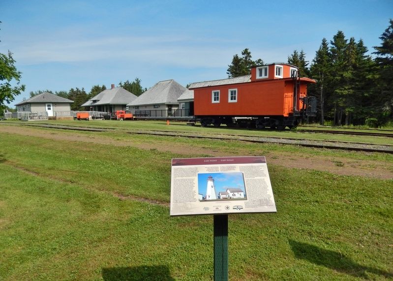
East Point Marker • wide view
(Elmira Railway Museum in left background)
(Elmira Railway Museum in left background)
| 1 ► Prince Edward Island, Kings County, Elmira — East Point — |
| Near Elmira Road, 1.6 kilometers south of Northside Road (Prince Edward Island Route 16), on the right when traveling south. | |||
| 2 ► Prince Edward Island, Kings County, Elmira — Elmira — The End of the Line / La Fin de la Ligne Ferroviaire — |
| Near Elmira Road, 1.6 kilometers south of Northside Road (Prince Edward Island Route 16), on the right when traveling south. | |||
| 3 ► Prince Edward Island, Kings County, Elmira — Elmira Railway Museum / Musée ferroviaire d’Elmira — |
| Near Elmira Road, 1.6 kilometers south of Northside Road (Prince Edward Island Route 16), on the right when traveling south. | |||
| 4 ► Prince Edward Island, Kings County, Elmira — The Original Fog Alarm Building — Le « Fog Alarm Building » — |
| Near Lighthouse Road, 2 kilometers east of East Point Road (Prince Edward Island Route 16), on the right when traveling east. | |||
| 5 ► Prince Edward Island, Kings County, Georgetown — Georgetown War Memorial — |
| Near Georgetown Road near Grafton Street, on the left. | |||
| 6 ► Prince Edward Island, Kings County, Georgetown — Georgetown’s New Railway Station — Nouvelle gare ferroviaire de Georgetown — |
| On Richmond Street close to West Street, on the left when traveling west. | |||
| 7 ► Prince Edward Island, Kings County, Georgetown — The Honorable Andrew Archibald (A.A.) Macdonald — |
| Near Georgetown Road close to Grafton Street, on the left when traveling south. | |||
| 8 ► Prince Edward Island, Kings County, Georgetown — Three Rivers — Les trois rivières — Samkook — |
| On Richmond Street close to West Street, on the right when traveling west. | |||
| 9 ► Prince Edward Island, Kings County, Greenwich — Havre Saint Pierre — |
| Near Prince Edward Island Route 313. | |||
| 10 ► Prince Edward Island, Kings County, Greenwich — Mussel Power/Les moules plus d'une utilité — |
| Near Prince Edward Island Route 313. | |||
| 11 ► Prince Edward Island, Kings County, Greenwich — St. Peters — |
| Near Prince Edward Island Route 313. | |||
| 12 ► Prince Edward Island, Kings County, Greenwich — The Sanderson Farm/La ferme Sanderson — |
| Near Prince Edward Island Route 313. | |||
| 13 ► Prince Edward Island, Kings County, Murray Harbour — Cape Bear — |
| Near Black Brook Road, 0.3 kilometers north of Cape Bear Road (Prince Edward Island Route 18), on the right when traveling north. | |||
| 14 ► Prince Edward Island, Kings County, Murray Harbour — Cape Bear Lighthouse / Phare de Cape Bear — |
| On Station Lane just south of Cape Bear Road (Main Street) (Prince Edward Island Route 18), on the right when traveling south. | |||
| 15 ► Prince Edward Island, Kings County, Murray Harbour — Getting the Train to the Track / L’Arrivée du Train sur la Voie Ferrée — |
| On Station Lane just south of Cape Bear Road (Main Street) (Provincial Route 18), on the right when traveling south. | |||
| 16 ► Prince Edward Island, Kings County, Murray Harbour — Murray Harbour War Memorial — |
| On Main Street (Prince Edward Island Route 18) just north of Cape Bear Road (Prince Edward Island Route 18A), on the right when traveling south. | |||
| 17 ► Prince Edward Island, Kings County, Murray Harbour — The “Harbour” / Le « Harbour » — |
| On Main Street (Prince Edward Island Route 18) just north of Westview Drive, on the right when traveling west. | |||
| 18 ► Prince Edward Island, Kings County, Murray Harbour — The Fishery at Murray Harbour / La Pêche À Murray Harbour — |
| On Station Lane just south of Cape Bear Road (Main Street) (Prince Edward Island Route 18), on the right when traveling south. | |||
| 19 ► Prince Edward Island, Kings County, Murray River — The Murray Harbour Branch / L’Embranchement Menant À Murray Harbour — |
| On School Street just west of Main Street (Prince Edward Island Route 4), on the left when traveling west. | |||
| 20 ► Prince Edward Island, Prince County, Bedeque — James Colledge Pope — 1826-1885 — |
| On Woodside Shore Road north of Prince Edward Island Route 112, on the left when traveling north. | |||
| 21 ► Prince Edward Island, Prince County, Kensington — A Stop Along the PEI Railway Route — Un Arrêt le long de la Voie de PEI Railway — Kensington PEI Rail Depot — |
| Near Commercial Street just west of Broadway Street North (Prince Edward Island Route 20), on the right when traveling west. | |||
| 22 ► Prince Edward Island, Prince County, Kensington — A Woman's Work is Never Done — Le travail d’une femme n’est jamais achevé — |
| Near Imperial Street just north of Commercial Street, on the left when traveling north. | |||
| 23 ► Prince Edward Island, Prince County, Kensington — A World Leader in Silver Foxes — Un chef de file mondial dans l'élevage du renard argenté — |
| Near Imperial Street just north of Commercial Street, on the left when traveling north. | |||
| 24 ► Prince Edward Island, Prince County, Kensington — Built in 1960 by Montreal Locomotive Works — Construite en 1960 par Montreal Locomotive Works — Kensington PEI Rail Depot — |
| Near Imperial Street just north of Commercial Street, on the left when traveling north. | |||
| 25 ► Prince Edward Island, Prince County, Kensington — Business and Agriculture — Commerce et agriculture — |
| Near Imperial Street just north of Commercial Street, on the left when traveling north. | |||
| 26 ► Prince Edward Island, Prince County, Kensington — Challenges in Store for the PEI Railway — Défis Attendaient la PEI Railway — Kensington PEI Rail Depot — |
| Near Commercial Street east of Imperial Street, on the left when traveling east. | |||
| 27 ► Prince Edward Island, Prince County, Kensington — Engine 1762 relocated to Kensington — Locomotive 1762 déplacée à Kensington — Kensington PEI Rail Depot — |
| Near Imperial Street just north of Commercial Street, on the left when traveling north. | |||
| 28 ► Prince Edward Island, Prince County, Kensington — Farming Groups in Kensington — Cercles agricoles à Kensington — |
| Near Imperial Street just north of Commercial Street, on the left when traveling north. | |||
| 29 ► Prince Edward Island, Prince County, Kensington — Joining the Confederation — Entrer dans la Confédération — Kensington PEI Rail Depot — |
| Near Commercial Street east of Imperial Street, on the left when traveling east. | |||
| 30 ► Prince Edward Island, Prince County, Kensington — Kensington Station / Gare de Kensington — |
| On Broadway Street North (Prince Edward Island Route 20) just north of Commercial Street, on the left when traveling north. | |||
| 31 ► Prince Edward Island, Prince County, Kensington — Original Meaning of Horsepower — Le sens original de cheval-vapeur — |
| Near Imperial Street just north of Commercial Street, on the left when traveling north. | |||
| 32 ► Prince Edward Island, Prince County, Kensington — Potato Farming Between the Tree Stumps — L'exploitation de pommes de terre entre les souches d'arbre — |
| Near Imperial Street just north of Commercial Street, on the left when traveling north. | |||
| 33 ► Prince Edward Island, Prince County, Kensington — Preserving Locomotive 1762 — Préserver la locomotive 1762 — Kensington PEI Rail Depot — |
| Near Imperial Street just north of Commercial Street, on the left when traveling north. | |||
| 34 ► Prince Edward Island, Prince County, Kensington — The Age of Steam Becomes the Age of Diesel — L’âge de la vapeur devient l’âge du diesel — Kensington PEI Rail Depot — |
| Near Commercial Street just east of Imperial Street, on the left when traveling east. | |||
| 35 ► Prince Edward Island, Prince County, Kensington — The Early Days of Farm Equipment — Les premiers balbutiements due matériel agricole — |
| Near Imperial Street just north of Commercial Street, on the left when traveling north. | |||
| 36 ► Prince Edward Island, Prince County, Kensington — The Efficiency of Mixed Farming — L’efficacité de l’agriculture mixte — |
| Near Imperial Street just north of Commercial Street, on the left when traveling north. | |||
| 37 ► Prince Edward Island, Prince County, Kensington — The PEI Railway Began Operation on 25 May, 1875 — La PEI Railway est Entrée en Opération le 25 mai 1875 — Kensington PEI Rail Depot — |
| Near Commercial Street east of Imperial Street, on the left when traveling east. | |||
| 38 ► Prince Edward Island, Prince County, Kensington — The Seven Year Rotation — La rotation de sept ans — |
| Near Imperial Street just north of Commercial Street, on the left when traveling north. | |||
| 39 ► Prince Edward Island, Prince County, Kensington — Unique Architecture and Cultural Significance — Architecture unique et signification culturelle — Kensington PEI Rail Depot — |
| Near Commercial Street east of Imperial Street, on the left when traveling east. | |||
| 40 ► Prince Edward Island, Prince County, Kinkora — Agriculture in Kinkora / L’agriculture à Kinkora — |
| Near Anderson Road (Prince Edward Island Route 225) just east of Somerset Street (Prince Edward Island Route 109), on the right when traveling east. | |||
| 41 ► Prince Edward Island, Prince County, Kinkora — Granite Mill Stone — |
| Near Anderson Road (Prince Edward Island Route 225) just east of Somerset Street (Prince Edward Island Route 109), on the right when traveling east. | |||
| 42 ► Prince Edward Island, Prince County, Kinkora — Kinkora — |
| Near Anderson Road (Prince Edward Island Route 225) just east of Somerset Street (Prince Edward Island Route 109), on the right when traveling east. | |||
| 43 ► Prince Edward Island, Prince County, Kinkora — This Granite Rock — |
| Near Anderson Road (Prince Edward Island Route 225) just east of Somerset Street (Prince Edward Island Route 109), on the right when traveling east. | |||
| 44 ► Prince Edward Island, Prince County, Miscouche — La Convention nationale des Acadiens de 1884 — The National Acadian Convention of 1884 — |
| Near Lady Slipper Drive North (Prince Edward Island Route 12) 0.1 kilometers north of Main Drive East (Veteran's Memorial Highway) (Prince Edward Island Route 2), on the right when traveling north. | |||
| 45 ► Prince Edward Island, Prince County, Miscouche — La Fanfare de Miscouche — The Miscouche Band — |
| On Main Drive East (Veteran's Memorial Highway) (Prince Edward Island Route 2) just east of Lady Slipper Drive North (Prince Edward Island Route 12), on the left when traveling east. | |||
| 46 ► Prince Edward Island, Prince County, Miscouche — La fondation de Miscouche — The Founding of Miscouche — |
| Near Main Drive East (Veteran's Memorial Highway) (Prince Edward Island Route 2) 0.2 kilometers east of Lady Slipper Drive North (Prince Edward Island Route 12), on the left when traveling east. | |||
| 47 ► Prince Edward Island, Prince County, Miscouche — Le Couvent Saint-Joseph et les religieuses de la Congrégation de Notre-Dame — Saint Joseph's Convent and the Sisters of the Congregation of Notre Dame — |
| Near Lady Slipper Drive North (Prince Edward Island Route 12) 0.1 kilometers north of Main Drive East (Veteran's Memorial Highway) (Prince Edward Island Route 2), on the right when traveling north. | |||
| 48 ► Prince Edward Island, Prince County, Miscouche — L'économie — The Economy — |
| On Lady Slipper Drive North (Prince Edward Island Route 12) just north of Main Drive East (Veteran's Memorial Highway) (Prince Edward Island Route 2), on the right when traveling north. | |||
| 49 ► Prince Edward Island, Prince County, Miscouche — L'Église Saint-Jean-Baptiste — Saint John the Baptist Church — |
| On Lady Slipper Drive North (Prince Edward Island Route 12) just north of Main Drive East (Veteran's Memorial Highway) (Prince Edward Island Route 2), on the right when traveling north. | |||
| 50 ► Prince Edward Island, Prince County, Miscouche — Les Acadiens de la baie de Malpèque — The Acadians of Malpeque Bay — |
| Near Main Drive East (Veteran's Memorial Highway) (Prince Edward Island Route 2) 0.2 kilometers east of Lady Slipper Drive North (Prince Edward Island Route 12), on the left when traveling east. | |||
| 51 ► Prince Edward Island, Prince County, Miscouche — Les Dix Conventions Nationales Acadiennes — The Ten Acadian National Conventions — |
| On Main Drive East (Veteran's Memorial Highway) (Prince Edward Island Route 2) 0.2 kilometers east of Lady Slipper Drive North (Prince Edward Island Route 12), on the left when traveling east. | |||
| 52 ► Prince Edward Island, Prince County, Miscouche — L'évolution du village de Miscouche — The Evolution of the Village of Miscouche — |
| On Main Drive East (Veteran's Memorial Highway) (Prince Edward Island Route 2) just east of Lady Slipper Drive North (Prince Edward Island Route 12), on the left when traveling east. | |||
| 53 ► Prince Edward Island, Prince County, Portage — Derelict Railway Stations / Gares Désaffectées — |
| Near Veteran's Memorial Highway (Prince Edward Island Route 2) at Rafferty Road (Prince Edward Island Route 12), on the right when traveling west. | |||
| 54 ► Prince Edward Island, Prince County, Portage — Portege Wildlife Management Area / Aire de Gestion de la Faune de Portege — |
| Near Veteran's Memorial Highway (Prince Edward Island Route 2) at Rafferty Road (Prince Edward Island Route 12), on the right when traveling west. | |||
| 55 ► Prince Edward Island, Prince County, Richmond — Wellington Station / Gare de Wellington — |
| On Western Road, 0.1 kilometers north of Macisaac Road (Prince Edward Island Route 127), on the right when traveling north. | |||
| 56 ► Prince Edward Island, Prince County, Summerside — Former Summerside Post Office / L'Ancien Bureau de Poste de Summerside — |
| On Summer Street just north of Fitzroy Street, on the left when traveling south. | |||
| 57 ► Prince Edward Island, Prince County, Summerside — Georgina Fane Pope — 1862-1938 — |
| On Summer Street just south of Fitzroy Street, on the left when traveling south. | |||
| 58 ► Prince Edward Island, Prince County, Summerside — Salute to the Prince Edward Island Railway — |
| On Water Street (Prince Edward Island Route 11) at Granville Street, on the right when traveling east on Water Street. | |||
| 59 ► Prince Edward Island, Prince County, Summerside — The Railway Station — |
| On Granville Street just south of Water Street (Prince Edward Island Route 11), on the left when traveling south. | |||
| 60 ► Prince Edward Island, Prince County, Summerside — The Summerside Armoury — |
| On Summer Street south of Fitzroy Street, on the left when traveling south. | |||
| 61 ► Prince Edward Island, Queens County, Belfast — A Lighthouse is Born / La Naissance du Phare — |
| Near Point Prim Road (Prince Edward Island Route 209) 11 kilometers west of Trans-Canada Highway (National Route 1). | |||
| 62 ► Prince Edward Island, Queens County, Belfast — Point Prim Lighthouse / Le Phare de Point Prim — A Lighthouse to Call Our Own / Un Phare Bien à Nous — |
| Near Point Prim Road (Prince Edward Island Route 209) 11 kilometers west of Trans-Canada Highway (National Route 1). | |||
| 63 ► Prince Edward Island, Queens County, Belfast — Reliable Communication / Des Communications Fiables — Samuel Cunard, Mail Delivery / Samuel Cunard, la Livraison de la Poste — Prince Edward Island Steam Navigation Company — |
| Near Point Prim Road (Prince Edward Island Route 209) 11 kilometers west of Trans-Canada Highway (National Route 1). | |||
| 64 ► Prince Edward Island, Queens County, Belfast — The 1864 Charlottetown Conference / La Conférence de Charlottetown de 1864 — Lighting the Way / Un Feu qui Nous Guide — |
| Near Point Prim Road (Prince Edward Island Route 209) 11 kilometers west of Trans-Canada Highway (National Route 1). | |||
| 65 ► Prince Edward Island, Queens County, Belfast — The Early Years / Les Premières Années — |
| Near Point Prim Road (Prince Edward Island Route 209) 11 kilometers west of Trans-Canada Highway (National Route 1). | |||
| 66 ► Prince Edward Island, Queens County, Canoe Cove — Canoe Cove School — |
| On Canoe Cove Road (Prince Edward Island Route 19A) just north of Prince Edward Island Route 19, on the left when traveling north. | |||
| 67 ► Prince Edward Island, Queens County, Cavendish — Cavendish Dunelands Trail/Cavendish Sentier Dunelands — History of the Cavendish Area/Histoire de la région de Cavendish. — |
| Near Gulf Shore Parkway West. | |||
| 68 ► Prince Edward Island, Queens County, Cavendish — Cavendish Dunelands Trail/Cavendish Sentier Dunelands — Wreck of the Marco Polo/L'épave du Marco Polo — |
| Near Gulf Shore Parkway West. | |||
| 69 ► Prince Edward Island, Queens County, Cavendish — Cavendish Dunelands Trail/Cavendish Sentier Dunelands — Sea Stories/Légendes de la mer — |
| Near Gulf View Parkway West. | |||
| 70 ► Prince Edward Island, Queens County, Cavendish — Cavendish Dunelands Trail/Cavendish Sentier Dunelands — Cavendish and Tourism/Cavendish et le tourisme — |
| 71 ► Prince Edward Island, Queens County, Cavendish — Lucy Maud Montgomery — (1874 - 1942) — |
| Near Cavendish Road (Prince Edward Island Route 6) close to Prince Edward Island Route 13, on the right when traveling east. | |||
| 72 ► Prince Edward Island, Queens County, Charlottetown — A BIG Year / Une année CRUCIALE — |
| Near Grafton Street at Great George Street, on the right when traveling north. | |||
| 73 ► Prince Edward Island, Queens County, Charlottetown — A Centre for the Arts — Un centre des arts — |
| On Water Street (Prince Edward Island Route 1) at Grafton Street, on the left when traveling north on Water Street. | |||
| 74 ► Prince Edward Island, Queens County, Charlottetown — A Dutiful Citizen / Un citoyen consciencieux — |
| On Queen Street at Grafton Street, on the left when traveling south on Queen Street. | |||
| 75 ► Prince Edward Island, Queens County, Charlottetown — A Neoclassical Design / Un style néoclassique — |
| On Grafton Street at Great George Street, on the right when traveling east on Grafton Street. | |||
| 76 ► Prince Edward Island, Queens County, Charlottetown — A River of Importance — Une rivière d’importance — |
| On Grafton Street at Water Street (Prince Edward Island Route 1), on the right when traveling east on Grafton Street. | |||
| 77 ► Prince Edward Island, Queens County, Charlottetown — A Wet Warehouse in a Dry City / La sobriété avant tout — |
| On Water Street east of Queen Street, on the right when traveling east. | |||
| 78 ► Prince Edward Island, Queens County, Charlottetown — All Souls’ Chapel — |
| On Rochford Street close to All Souls' Lane, on the right when traveling north. | |||
| 79 ► Prince Edward Island, Queens County, Charlottetown — Andrew Archibald Macdonald — 1829 - 1912 — |
| Near Richmond Street near Great George Street. | |||
| 80 ► Prince Edward Island, Queens County, Charlottetown — Andrew's Millpond — |
| On Veterans Memorial Highway (St. Peters Road) (Prince Edward Island Route 2) just south of Oakland Drive, on the left when traveling south. | |||
| 81 ► Prince Edward Island, Queens County, Charlottetown — Angus Bernard MacEachern (1759- 1835) — |
| On Great George Street at Dorchester Street, on the right when traveling south on Great George Street. | |||
| 82 ► Prince Edward Island, Queens County, Charlottetown — Apothecaries Hall — |
| On Queen Street at Grafton Street, on the right when traveling south on Queen Street. | |||
| 83 ► Prince Edward Island, Queens County, Charlottetown — Beaconsfield Historic House / Maison historique Beaconsfield — |
| On Kent Street south of West Street, on the left when traveling south. | |||
| 84 ► Prince Edward Island, Queens County, Charlottetown — Beginnings of a Settlement — Les débuts de la colonization — |
| On Grafton Street at Water Street (Prince Edward Island Route 1), on the right when traveling east on Grafton Street. | |||
| 85 ► Prince Edward Island, Queens County, Charlottetown — Big Donald — |
| On Kent Street just south of Queen Street, on the left when traveling north. | |||
| 86 ► Prince Edward Island, Queens County, Charlottetown — Birthplace of Confederation — Le Berceau de la Confédération — |
| On Water Street (Prince Edward Island Route 1) at Grafton Street, on the left when traveling north on Water Street. | |||
| 87 ► Prince Edward Island, Queens County, Charlottetown — Canadian National Hotels — Rodd Hotels & Resorts — |
| On Kent Street close to Pownal Street, on the left when traveling east. | |||
| 88 ► Prince Edward Island, Queens County, Charlottetown — Carvell Building — |
| On Queen Street close to Water Street, on the right when traveling north. | |||
| 89 ► Prince Edward Island, Queens County, Charlottetown — Charlottetown — Prince Edward Island — |
| On Kent Street near Queen Street, on the left when traveling east. | |||
| 90 ► Prince Edward Island, Queens County, Charlottetown — Charlottetown and Quebec Confederation of 1864 — Charlottetown Site — One of Two Identical Markers — |
| On Richmond Street at Great George Street, on the right when traveling west on Richmond Street. | |||
| 91 ► Prince Edward Island, Queens County, Charlottetown — Charlottetown City Hall — Hotel de ville de Charlottetown — |
| On Queen Street near Kent Street, on the right when traveling south. | |||
| 92 ► Prince Edward Island, Queens County, Charlottetown — Charlottetown Railway Station — |
| On Weymouth Street at Water St, on the right when traveling north on Weymouth Street. | |||
| 93 ► Prince Edward Island, Queens County, Charlottetown — Choices For Higher Education — Les choix d’éducation supérieur — |
| On Grafton Street at Water Street (Prince Edward Island Route 1), on the right when traveling east on Grafton Street. | |||
| 94 ► Prince Edward Island, Queens County, Charlottetown — Colonel John Hamilton Gray — 1811 - 1887 — |
| On Richmond Street close to Great George Street. | |||
| 95 ► Prince Edward Island, Queens County, Charlottetown — Confederation Centre of the Arts — Centre de Arts de la Confédération — |
| On Grafton Street at Queen Street, on the right when traveling east on Grafton Street. | |||
| 96 ► Prince Edward Island, Queens County, Charlottetown — Dundas Terrace — |
| On Water Street at Haviland Street on Water Street. | |||
| 97 ► Prince Edward Island, Queens County, Charlottetown — Edward Palmer — 1809 - 1889 — |
| Near Richmond Street close to Great George Street. | |||
| 98 ► Prince Edward Island, Queens County, Charlottetown — Edward Whelan — 1824 - 1867 — |
| Near Richmond Street close to Great George Street. | |||
| 99 ► Prince Edward Island, Queens County, Charlottetown — George Coles — 1810 - 1875 — |
| Near Richmond Street near Great George Street. | |||
| 100 ► Prince Edward Island, Queens County, Charlottetown — Great George Street Historic District — L’arrondissement Historique de la rue Great George — |
| On Great George Street, in the median. | |||
155 entries matched your criteria. The first 100 are listed above. The final 55 ⊳