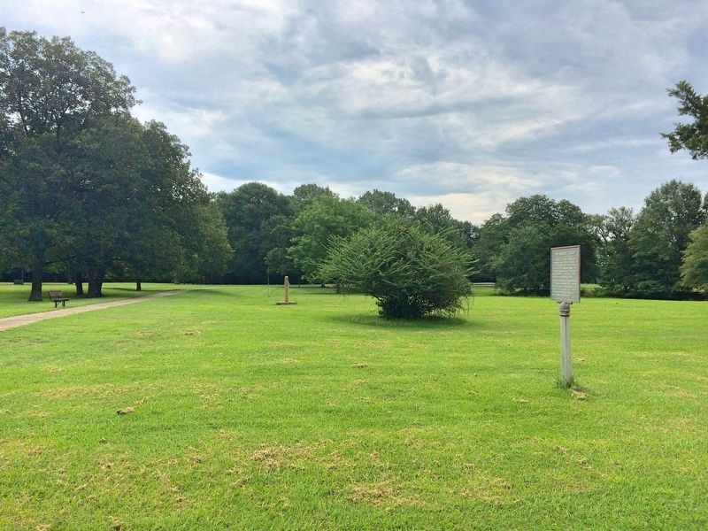
Near Old Post Road, 0.7 miles south of State Route 169.
The Regent of France authorized a settlement at the Post of Arkansas in 1722. These early settlers were on good terms with the Quapaw Indians who "exhibited a great spirit of friendliness and hospitality toward the French". Cotton was introduced . . . — — Map (db m108648) HM
On Old Post Road at State Route 169, on the right when traveling south on Old Post Road.
Here on the Grand Prairie you tread on
soil laid down over the centuries as the
mighty Mississippi and Arkansas Rivers
brought down their precious cargoes of
silt from the northern uplands.
The footprints of many were pressed into
this . . . — — Map (db m108486) HM
Near Old Post Road, 0.7 miles south of State Route 169.
In 1763 the Post of Arkansas became
Spanish territory when, by the Treaty of
Paris, the French King ceded Louisiana
to Spain. For several years after the
transfer, French officers and soldiers
remained at Arkansas Post.
In 1771 the . . . — — Map (db m108551) HM
Near Old Post Road, 0.8 miles south of State Route 169.
Spanish Explorer Hernan de Soto passed this way in 1542. Nearly
130 years later Father Marquette, the French missionary and explorer,
reached the nearby mouth of the Arkansas. In 1682 Robert Cavelier,
Sieur de la Salle, claimed this territory for . . . — — Map (db m108407) HM
On Hudson Road (U.S. 62) south of Rose Street, on the right when traveling north.
800 AD • Trace of the Rock People
1808 • Osage Boundary
1815 • Lawrence County
1827-28 • Lovely County
1838 • Trail of Tears
1840 • Trott's Stand
1858 • Old Wire Road
1858-61 • Butterfield Stage Route
1861 • Troop Trails
1862 • . . . — — Map (db m62485) HM
The Lewis & Clark Expedition was accomplished by Captain Meriwether Lewis, Captain William Clark, and their fellow explorers, and was the visionary journey of President Thomas Jefferson. The journey was to become one of America’s greatest . . . — — Map (db m91477) HM
On North Main Street at East Central Avenue (State Highway 72), on the right when traveling north on North Main Street.
The Osage Nation first used the area now known as Bentonville for their hunting grounds. The Osage would leave their settlements to hunt in present day Benton County for months at a time before returning to their families. Settlers first . . . — — Map (db m237837) HM
"Long time we travel on way to new land.... Womens cry... Children cry and men cry...but they say nothing and just put heads down and keep on go towards West. Many days pass and people die very much." -Recollection of a survivor of the Trail of . . . — — Map (db m35436) HM
On Military Park Road (County Road 65), on the left when traveling north.
Imagine 7,000 Confederate troops crowded in close order along Ford Road, the lane you see on the right edge of this field. As they trudged east toward Elkhorn Tavern, a small Union force of Iowa cavalrymen - only 600 men - unexpectedly appeared . . . — — Map (db m37755) HM
On State Highway 43 near State Highway 72, on the right when traveling south.
Occurred on Oct. 22, 1862. While Gen. James G. Blunt was encamped on the old Pea Ridge battlefield, word came that Gen. Douglas H. Cooper and Col. Stand Watie's Indian regiment were at old Fort Wayne across the line from Maysville. On Oct. 20 he . . . — — Map (db m52281) HM
On South Old Wire Road (County Road 83) 0.2 miles north of Dogwood Drive/Cross Hollows Road (County Road 1189), on the left when traveling north.
This site was donated to the Benton County Historical Society by Scarlett Biggs Wilson and Lara Wilson Rosenblum in honor of their parents/grandparents, Guy and Nell Biggs, early pioneers of the Cross Hollows area. Cross Hollows is recognized for . . . — — Map (db m68789) HM
On North Main Street at West Rush Avenue, on the right when traveling south on North Main Street.
In memory of 140 men, women and children N.W. Arkansas emigrants to California. In 1857 under leadership of Alexander Fancher (Piney Alex) left from Caravan Spring 4 miles south of here around May 1st - Camped at Mountain Meadows, Utah in early . . . — — Map (db m143889) HM
On Spring Street at Hillside Avenue, on the right when traveling west on Spring Street.
Crescent Spring was revered for its healing waters almost as much as the basin, the legendary Indian Healing Spring. Situated beside the Wagon Road on a hillside with a rocky outcropping described as "crescent" shaped, the spring was soon given . . . — — Map (db m80135) HM
On U.S. 371 at East Columbia Road (County Road 60), on the right when traveling north on U.S. 371.
One of the oldest settlements in Columbia County. Here Colonel John Dockery had his plantation and home. Here T.P. Dockery, who became a general in the War Between the States, was born and reared. The Caddo Indian Trail from Camden on the Ouachita . . . — — Map (db m121136) HM
On East Railroad Avenue west of South Moose Street, on the right when traveling west.
Lewisburg A trading post and steamboat landing was founded near here in 1825 by Major William Lewis, his son Stephen D. Lewis and Dr. Nimrod Manifee. The location gave them land and river access. A town grew up around the trading post and . . . — — Map (db m237068) HM
Stout's Point provides a dramatic overlook of the Arkansas River, the water route
of the Congressionally-designated Trail of Tears National Historic Trail.
What is the Trail of Tears?
After passage of the Indian Removal Act of 1830, . . . — — Map (db m233662) HM
The prehistoric rock art in Rock House Cave is part of our heritage that can never be replaced. Once it is gone, it is gone forever. It is up to us to preserve these images for as long as possible until the endless forces of wind and water turn . . . — — Map (db m233671) HM
As you explore these unique structures around Petit Jean State Park,
you will find that nature and history are strongly connected here.
Rock House Cave - Explore this sandstone
bluff shelter and look for ancient Native
American . . . — — Map (db m233679) HM
Near North 3rd Street, 0.1 miles south of Knox Street, on the right when traveling south.
From the front of his home, John Drennen could overlook the bustling port town of Van Buren, including the wharf originally known as Phillips Landing.
Until after the Civil War, the Arkansas River and the steamboats that plied its . . . — — Map (db m120427) HM
The Cherokee came from East Tennessee and North Carolina area. General Sam Houston was Governor of Tennessee until he resigned and joined the Cherokees in the Indian Territory, now Oklahoma. His wife Talahina, was the daughter of the Cherokee chief . . . — — Map (db m234420) HM
The next two (2) miles is a part of Military Road used in transporting Indians to Oklahoma Territory between 1832 and 1841. From a group of 16,000 Cherokees, 4,000 died enroute. Other tribes to move West were Chickasaw and Choctaw. The great war . . . — — Map (db m234419) HM
In 1673, another European expedition arrived in Arkansas. Canoeing down the Mississippi River from the Illinois country (the upper Mississippi River Valley), Father Jacques Marquette, Jesuit missionary, and Louis Joliet, a coureur de bois . . . — — Map (db m234417) HM
On June 18, 1541, Hernando de Soto's Spanish expeditionary force crossed the Mississippi River and became the first Europeans to enter Arkansas. For the next two years, the Spaniards explored through Arkansas with a large number of captive Indians. . . . — — Map (db m234415) HM
Near Arkansas Route 77 north of East Military Road, on the right when traveling south.
First Highway constructed in Arkansas, Hopefield
to Little Rock, extended to Fort Smith and into Indian Territory, (Oklahoma). Built by the United States under supervision of the Quartermasters Department of the United States Army. Survey was . . . — — Map (db m116549) HM
In 1831, a group of Native Americans collectively referred to as the Five Civilized Tribes: the Cherokee, Chickasaw, Choctaw, Muscogee, and Seminole, were living as autonomous nations in what would be later called the American Deep South. The . . . — — Map (db m234416) HM
On Dacus Road, 0.1 miles east of County Route 27, on the right when traveling east.
In North America, the Indians
were building mounds such as
these from before the time
of Christ until after DeSoto
explored this area. These are
believed to be villages of
the Aquixo or Pacaha, 1541. — — Map (db m221347) HM
On Arkansas Route 184, 0.4 miles north of U.S. 64, on the left when traveling north.
The legacy of the Mississippian culture lives forever through the Three Sisters Garden, like the one you see planted here.
The American Indians who lived here over 500 years ago were expert farmers whose most important crops were corn, beans, . . . — — Map (db m116605) HM
On State Highway 184 at U.S. 64 on State Highway 184.
Welcome to Northeast Arkansas Pick up your Discovery our guide in the part visitor for center.
From pre-history to today, people have come here for a variety of reasons. Settlers found a state rich in wildlife and wilderness. Ancient . . . — — Map (db m232112) HM
On State Highway 184, 0.2 miles north of U.S.64, on the left when traveling north.
Ongoing warfare with other
Native American groups
led villagers to construct a
defensive ditch around their
town. The depression before
you was a formidable obstacle
to anyone trying to attack. You
will cross this ditch several
more times . . . — — Map (db m231813) HM
On Ark. State Hwy 184, 0.1 miles Us Hwy 64, on the left.
In 1541 Chief Casqui
greeted Hernando
de Soto not far from.
where you are standing.
This trail highlights the unique
history of the archeological site.
The fully accessible 1/4 mile trail
will take you approximately 30
minutes to walk. . . . — — Map (db m233181) HM
Down the trail from where you are standing is the most well-preserved remaining section of the historic Trail of Tears in Arkansas.
Tradition and heritage run deep jn the collective souls of the Five Southeastern Tribes (Choctaw, Chickasaw, . . . — — Map (db m142034) HM
On Pickens Street (U.S. 165) east of Jack Dante Drive, on the right when traveling east.
The Arkansas Indians (the down stream people), a branch of the Quapaw tribe, lived in Desha County. Their presence was first recorded by Marquette and Joliet, French explorers, in 1673. They were known as les Beaux Hommes. La Salle while . . . — — Map (db m107809) HM
Near State Highway 319, 0.1 miles west of Cadron Settlement Lane.
After Congress passed the Indian Removal Act, May 28, 1830, the Government forceably relocated about 60,000 Indians from the southeastern U.S. to what is now Oklahoma. This included the five (5) civilized tribes Cherokee, Chickasaw, Creek, Choctaw, . . . — — Map (db m97912) HM
Near State Highway 319, 1.7 miles west of 6200 Highway 319 West (U.S. 64).
The blockhouse is a replica of a structure that was built on this site in the late 18th century. The building was a multiple use structure, but constructed originally for defense purposes. It was used as a trading post, as a residence, and as a . . . — — Map (db m96645) HM
Near State Highway 319, 1.7 miles west of Old Morrilton Highway (U.S. 64).
Following is a partial list of persons who died and were buried at Cadron. They perished from cholera while being relocated by the Army in 1834. Graves were marked with native stones with no inscriptions. Some of the Indians had adopted . . . — — Map (db m96643) HM
Near State Highway 319, 0.1 miles west of Cadron Settlement Lane.
Joseph W. Harris of New Hampshire, received appointment to the Military Academy at West Point at the age of 17 and graduated in 1825. He was assigned to accompany a group of 750 Cherokees aboard the steamboat Yeatman. They were forced to land at . . . — — Map (db m97914) HM
On East River Street east of South 1st Street, on the right when traveling east.
[Stone monument]
Trail of Tears
1832-1840
Arkansas River valley
routes
Choctaw – Chickasaw
Muscogee Creek
Seminole – Cherokee
[Panel]
Trail of Tears Routes through Franklin County
1. Northern Route through . . . — — Map (db m236869) HM
The Caddo, Quapaw, and Choctaw tribes lived in or visited the area during the 1700s and 1800s. This edifice pays homage to their lasting influence. The owners named the bathhouse for the Quapaw Indians, and incorporated an Indian head design over . . . — — Map (db m61795) HM
On North Mountain Drive, 0.5 miles north of Fountain Street, on the right when traveling north.
Native Americans have occupied the land we now call Hot Springs National Park for well over 10,000 years. This land was part of their hunting grounds, but also offered prime quarrying sites for stone to make sharp-edged, durable tools and weapons. . . . — — Map (db m234367) HM
On West Barraque Street at North Pine Street, on the right when traveling west on West Barraque Street.
This street was named for Antoine Barraque (1773-1858), native of France, soldier of Napoleon, and one of this area's earliest settlers. Founder of New Gascony in this county, he was a man of property and Indian sub-agent. Trusted and liked by the . . . — — Map (db m30577) HM
On South Drew Street at West Bradley Street, on the right when traveling south on South Drew Street.
Star City was laid off in 1871 as the County Seat of the newly created Lincoln County which was named in honor of President Abraham Lincoln. It was the center of many Indian trails and early roads which ran from Mississippi River landings back into . . . — — Map (db m229496) HM
On Ray Sowell Road at State Route 38, on the right when traveling west on Ray Sowell Road.
In 1807, citizens of Crystal Hill built a road to connect Cadron and Arkansas Post. From Cadron the road was built almost due east and continued until they reached the Wattensaw. At the Wattensaw swamps they found an Indian path that led south to . . . — — Map (db m116694) HM
On Toltec Mounds Rd, 1 mile south of Ar. Rd 165 (State Road 165), on the right.
This site was the year-round home to tribal leaders and their families, and it was the capital city of a large population living throughout the surrounding area. Daily routines here were interrupted when the site was transformed into a busy capital . . . — — Map (db m213788) HM
On Toltec Mounds Road, 1 mile Ar. Rd 165 (State Road 165), on the right when traveling south.
Just as pottery, stone tool, mounds are critical for understanding the Plum Bayou culture, so too are plants.
Through specialized techniques archeologist recover and analyze plant remains from archeological sites like Toltec Mounds. One . . . — — Map (db m213797) HM
On Toltec Mounds Road at Hwy 165, on the right on Toltec Mounds Road.
Long before domesticated maize and beans were introduced into the Southeast, Indians of Arkansas had begun tending and caring for native plants.
The archeological record of Arkansas demonstrates that by 3000 years ago, people's use of some . . . — — Map (db m213828) HM
On Toltec Mounds Road, 1 mile south of Local Highway 165, on the right when traveling south.
Plants of the past rooted early people to this land. European farmers were not the first to cultivate plants
here on these lands. People were here long before who
survived, told stories about, and even celebrated these
humble resources around . . . — — Map (db m215880) HM
On County Road 6035, 0.3 miles east of County Road 637, on the left when traveling east.
Rush—and other Buffalo River valleys—
is a story of the progression human
occupation. In the hills and hollows around
you is buried evidence of centuries of use.
Ancient Indians once walked these banks
and hills, leaving . . . — — Map (db m161940) HM
On East Main (County Road 9) just west of Snell Street, on the right when traveling west.
1541 - When Desoto brought his Spanish conquistadores to this area in 1541, he found an industrious Caddo Indian tribe who inhabited and enjoyed the area that was later to become Miller County, Arkansas. Along the Red River the Caddo farmed, . . . — — Map (db m173500) HM
On Indian Valley Road at Vaught Street, on the right when traveling east on Indian Valley Road.
In this area in 1541 a Spanish expedition from Florida commanded by Hernando De Soto encountered fierce resistance from the Indians, whom they described as the best fighting men they had met. De Soto then turned to the southeast and descended the . . . — — Map (db m201572) HM
On Indian Valley Road at Vaught Street, on the right when traveling east on Indian Valley Road.
This region was once the home of the Caddo Indians, whose settlement and town were scattered over what is now southwestern Arkansas, northeastern Texas and northwestern Louisiana. The Caddo River, which flows near this point, and Caddo Gap itself . . . — — Map (db m201016) HM
On East Main Street south of Polk Creek Road, on the left when traveling north.
• Caddo Indian burials were exposed accidentally during construction at this site in October, 1988. Subsequent archeological excavations by Ann Early identified 2 burials, a small cluster of residential features, and artifacts dating from the . . . — — Map (db m202077) HM
"The steamer Warren brought news... of the loss of the steamboat Monmouth, and the death of at least one-half of her infamously crowded passengers. This fatal, and most appalling, accident arose from a collision between these two boats; but from the . . . — — Map (db m52028) HM
1541-1931
June 18, 1541
Hernando De Soto
Crossed the Mississippi River
near Friar's Point to Aquixo
an Indian Village
south of
Helena, Arkansas — — Map (db m51917) HM
"I have no more land, I am driven away from home, driven up the red waters, let us all go, let us all die together and somewhere upon the banks we will be there."
—Sin-e-cha's Song, heard on several removal boats along the Trail of . . . — — Map (db m229331) HM
The Delta represents a “melting pot” of diverse cultures. And most of them got here by canoe.
Canoeing is the oldest form of water transportation on the Mississippi River-at least 2,000 years old! In the Quapaw tribal history, they arrived from . . . — — Map (db m229322) HM
Near Lock and Dam Road (Highway 7) just west of Sheppard Drive.
'The Arkansea' was a land of mystery, wonder and riches...
Back east rumors grew of the Arkansea, a land of vast swamps, gators, buffalo, elk, beaver, and more bear than could be imagined. There were huge flocks of green and yellow . . . — — Map (db m142029) HM
Near Lock and Dam Road (Highway 7) west of Sheppard Drive.
This stone is a marker from the old Military Road which extended from Little Rock to Ft. Smith. The marker was found west of Dardanelle in 1940 by Mr. Henry Sellers, District Highway Engineer, while supervising the construction of Arkansas Highway . . . — — Map (db m142032) HM
Indian Agent Lovely and his wife, Persis, established a home in this immediate vicinity following his designation as agent for the Western Cherokees in 1813. He served as agent until his death in 1817. Lovely was born in Ireland, but came to the . . . — — Map (db m208620) HM
"The route which the Choctaws and Chickasaws will
travel, in emigrating to their new homes, is not yet, we
believe, fully determined on; but it is quite probable
that a large proportion of them will cross the Mississippi
at Helena, and White . . . — — Map (db m116572) HM
"Long time we travel on way to new land.... Womens
cry.... Children cry and men cry...but they say nothing
and just put heads down and keep on go towards
West. Many days pass and people die very much."
-Recollection of a . . . — — Map (db m116602) HM
The first definite account of the site we call the "little rock" is from Benard de la Harpe, a French officer sent in 1722 to explore the Arkansas River. He identified "some rocky country" and a league further upriver to the right, a rock which he . . . — — Map (db m117089) HM
In 1818, the U.S. policy on Indian Removal
restricted the Quapaw to a reservation in Arkansas.
The western boundary, or Quapaw Line, began at
"the Little Rock." This was perhaps the first official
use of the name Little Rock. In 1824, a new . . . — — Map (db m116565) HM
While the Quapaw Indians could be said to "own" the land which
is the Riverfront Park, their villages were actually along the
Arkansas River between the "point of rocks" and the Mississippi
River. However, the Imbeau, Bartholomew, and Coussatt . . . — — Map (db m117431) HM
On East 9th Street at Commerce Street, on the right when traveling east on East 9th Street. Reported missing.
This stone marks the Quapaw Line, west boundary of lands in Territorial Arkansas, ceded the Quapaw Indians by the United States according to the Treaty of 1818 — — Map (db m241513) HM
The Arkansas River was one of the main routes
used to move Indians from the southeastern
United States to the Indian Territory (modern-day
Oklahoma) during the forced removals of the late
1830s. Hundreds of men, women and children
would have . . . — — Map (db m208846) HM
On Toltec Mounds Road, on the right when traveling south.
Plants affect every aspect of our lives. Without them, life would not be possible.
Crews working for the University of Arkansas Museum recovered this bag in the 1930s from a bluff shelter in Benton County, Arkansas.
Filled to the . . . — — Map (db m213906) HM
On U.S. 62/67 north of South Bettis Street, on the right when traveling north.
People have hunted and fished in the rich Black River Basin at least since the Paleo Indian Period (beginning around 10,000 B.C.). More recently, Native American built villages and mounds across the Mississippi River valley (3000 B.C.-A.D.1650). . . . — — Map (db m170367) HM
On U.S. 62/67 north of South Bettis Street, on the right when traveling north.
"This … region [is] annually covered by water and at all seasons by a heavy growth of timber [and] thick can-brakes."
U.S. Rep. A. H. Sevier of Arkansas
Feb. 21. 1838
The Black River flows through . . . — — Map (db m170376) HM
On N. Main Street at W. South Street, on the right when traveling south on N. Main Street.
The Indian parties followed an ancient trail that became known as the Southwest Trail. The primitive trail took the tribal groups by where you are standing. William S. Lockhart was the first permanent settler in the area, arriving in 1815, at a . . . — — Map (db m96596) HM
"American Indians inhabited these Ozark hills for thousands of years until the turmoil of European exploration and long periods of drought caused their movement out of the highlands at the same time that European trappers, hunters, and explorers . . . — — Map (db m143763) HM
If you had stood here in 1825, on your right would have been Arkansas Territory, and on your left, a vast domain traded to the Choctaw Nation for their ancestral lands in the east. Fort Smith’s location here at the edge of Indian country was a . . . — — Map (db m156900) HM
On July 27, 1864 Confederates led by Gen. Richard M. Gano surprised an outpost of the Sixth Kansas Cavalry at nearby Caldwell's Place. The Federal force was routed with a loss of 25 killed and wounded, 127 prisoners and much equipment. The . . . — — Map (db m52566) HM
In 1817, the first Fort Smith was built at Belle Point at the junction of the Poteau and Arkansas Rivers by Major William Bradford, for the mutual protection of the pioneers and Indians. He was in command until 1822. It was named in honor of . . . — — Map (db m77874) HM
"The Cherokees have been kept on a small spot, surrounded by a strong guard… obliged to live very much like brute animals… exposed to wind and rain, and herd[ed] together… like droves of hogs…” —Reverend Butrick, June 1838 The U.S. Army . . . — — Map (db m156907) HM
The removal of the Chickasaw from their southeast homelands began in the early 1800s. Government traders who forced tribal members into debt would demand tribal lands as payment. By 1818, the Chickasaw had unwillingly yielded property in Alabama, . . . — — Map (db m156906) HM
"No part of the land granted them shall ever be embraced in any… State; but the U.S. shall forever secure said Choctaw Nation, from and against all laws except such as… may be enacted in their own National . . . — — Map (db m156905) HM
Fort Smith was fired on only once during the Civil War. On July 31, 1864, Confederates staged a diversionary attack from across the Poteau River, hoping to capture the city of Fort Smith. Their strategy was to pull Union troops away from other city . . . — — Map (db m156983) HM
"Ascend the Arkansas River to the point where the Osage boundary line strikes that river… and therein erect as expeditiously as circumstances will permit a Stockade…" —Orders to Major William Bradford from Brigadier General Thomas Smith . . . — — Map (db m156993) HM
The Fort Smith Council was held in this building in September 1865. To establish relations following the Civil War, delegates of twelve Indian nations met with President Andrew Johnson’s representatives. Bitterly divided, Indians had fought for both . . . — — Map (db m59025) HM
The Muscogee (Creek) people are descendants of a remarkable culture that, before A.D. 1500, spanned the entire region now known as the southeastern United States. The Muscogee were not one tribe, but rather a union of several that evolved into a . . . — — Map (db m156904) HM
Two hundred and fifty years ago the river you see here flowed through the homeland of one of the most powerful Indian nations in the center of the continent. They called themselves "Wah-Zha-Zhe." Early French explorers spelled their name . . . — — Map (db m156908) HM
In the spring of 1821, Osage leader Bad-Tempered-Buffalo appeared across the Arkansas River with 400 warriors in war paint. He and seven warriors crossed the river requesting gunpowder and permission to hunt on Cherokee land. Acting fort commander, . . . — — Map (db m156998) HM
The Seminole people originated in Florida from the mixing of many indigenous groups throughout the southeast. Encroachment by white settlers and slave-hunters onto tribal territory started the Seminole wars in 1817. Sporadic warfare continued until . . . — — Map (db m156903) HM
On Garland Avenue at 6th Street (Arkansas Highway 255), on the left when traveling west on Garland Avenue.
This marks the last encampment of the Cherokee Indians on "The Trail of Tears," from their ancestral homes in the South to the land allotted them in the Indian Territory. — — Map (db m92345) HM
Regiment of Riflemen 1817-1822 After serving with distinction in the War of 1812, the elite Regiment of Riflemen established Fort Smith in 1817. Their mission was to promote peace between the Cherokee and Osage. The regiment merged with the 7th . . . — — Map (db m156986) HM
On State Highway 59 at State Highway 156, on the left when traveling north on State Highway 59.
The Indian Removal Act was signed by President Andrew Jackson on May 28, 1830. This act put in motion the systematic removal of the Choctaws, Muscogee Creeks, Chickasaws, Seminoles, and Cherokees from their ancestral homes in the east to Indian . . . — — Map (db m240074) HM
On Center Street at East Avenue, on the left when traveling west on Center Street.
The earliest known inhabitants of the hardwood forest of the Ozarks migrated to Arkansas over 12 thousand years ago through the Great Bering Strait. For the next two thousand years Bluff Dwellers hunted the mountain plateaus before the Quapaws, . . . — — Map (db m59882) HM
On North 5th Street (Business Highway 64) at Magnolia Street, on the right when traveling north on North 5th Street.
Much of the history of Augusta lies beneath these
grounds. It was the burial ground for the
Chickasaws before the first settlers. The earliest
extant gravestone is Penelopy Simmons, who
operated a hotel in Augusta and died in 1852.
First . . . — — Map (db m116627) HM
On South 1st Street at East Locust Street, on the right when traveling south on South 1st Street.
Chickasaws and Quapaws crossed the White River
here to visit, long before the first settlers. First
post office, named Chickasaw Crossing in Feb. 1848,
was soon changed to Augusta. Steamboats
docked here to deliver goods and left with . . . — — Map (db m116629) HM
Upon this spot, under the Council Oak, acting Governor Robert Crittenden and Chief Black Fox, tribe spokesman, met in council April, 1820 and made the treaty, which gave to Arkansas all the Cherokee land south of the Arkansas River. — — Map (db m233690) HM
On Sunrise Circle, on the left when traveling north.
In the River Valley Below
With dramatic views of the river valley, Mount Nebo State Park
is an ideal spot to view the Arkansas River where thousands of
Native Americans passed during the forced removal from their
native lands. Below, a . . . — — Map (db m233689) HM
On Union Street (Arkansas Route 27) at North Front Street, on the right when traveling west on Union Street.
Four blocks west of this point
stands the famous Council Oaks
under which Robert Crittenden, acting
governor of Arkansas Territory, and
Black Fox, chief of the Cherokee tribe,
met April, 1820, to fix the boundary
for the Cherokee lands. — — Map (db m170334) HM