After filtering for Arkansas, 95 entries match your criteria.
Native Americans Topic
By Mark Hilton, August 26, 2017
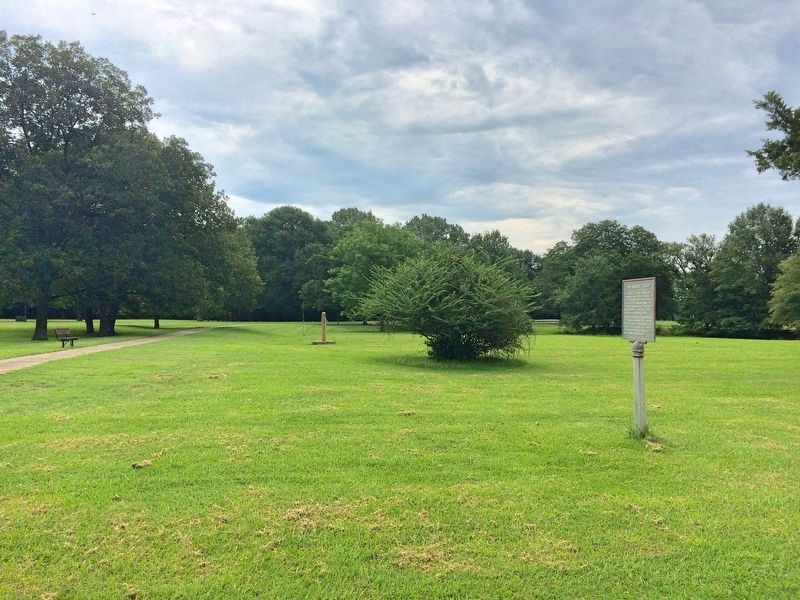
The French Period Marker in foreground looking east towards Old Post Road.
| 1 ► Arkansas, Arkansas County, Arkansas Post — The French Period — |
| Near Old Post Road, 0.7 miles south of State Route 169. | |||
| 2 ► Arkansas, Arkansas County, Arkansas Post — The Post of Arkansas — |
| On Old Post Road at State Route 169, on the right when traveling south on Old Post Road. | |||
| 3 ► Arkansas, Arkansas County, Arkansas Post — The Post under Spain — |
| Near Old Post Road, 0.7 miles south of State Route 169. | |||
| 4 ► Arkansas, Arkansas County, Arkansas Post National Memorial — First Post of Arkansas — 1686 — 1700 — The French Settlement of Henri de Tonti — |
| Near Old Post Road, 0.8 miles south of State Route 169. | |||
| 5 ► Arkansas, Benton County, Avoca — Sesquicentennial Trail of the Centuries — Benton County Arkansas Sesquicentennial Monument 1836 - 1986 — Arkansas Sesquicentennial 1836 - 1986 — |
| On Hudson Road (U.S. 62) south of Rose Street, on the right when traveling north. | |||
| 6 ► Arkansas, Benton County, Bella Vista — Lewis & Clark Expedition — |
| 7 ► Arkansas, Benton County, Bentonville, Downtown Bentonville — Bentonville's Early History — |
| On North Main Street at East Central Avenue (State Highway 72), on the right when traveling north on North Main Street. | |||
| 8 ► Arkansas, Benton County, Garfield — Pea Ridge and the Trail of Tears — Trail of Tears National Historic Trail — National Trails System — |
| On Military Park Road (County Road 65), on the left when traveling south. | |||
| 9 ► Arkansas, Benton County, Garfield — They Passed This Way — Trail of Tears National Historic Trail — National Trails System — |
| On Military Park Road (County Road 65). | |||
| 10 ► Arkansas, Benton County, Garfield — Two Armies Collide — Pea Ridge National Military Park — National Park Service, U.S. Department of the Interior — |
| On Military Park Road (County Road 65), on the left when traveling north. | |||
| 11 ► Arkansas, Benton County, Maysville — The Battle of Maysville — |
| On State Highway 43 near State Highway 72, on the right when traveling south. | |||
| 12 ► Arkansas, Benton County, Rogers — Cross Hollows — |
| On South Old Wire Road (County Road 83) 0.2 miles north of Dogwood Drive/Cross Hollows Road (County Road 1189), on the left when traveling north. | |||
| 13 ► Arkansas, Boone County, Harrison — The Mountain Meadows Massacre — |
| On North Main Street at West Rush Avenue, on the right when traveling south on North Main Street. | |||
| 14 ► Arkansas, Carroll County, Eureka Springs — Crescent Spring and Trail — |
| On Spring Street at Hillside Avenue, on the right when traveling west on Spring Street. | |||
| 15 ► Arkansas, Columbia County, Lamartine — C-27 — Columbia County Lamartine Pioneer Settlement — |
| On U.S. 371 at East Columbia Road (County Road 60), on the right when traveling north on U.S. 371. | |||
| 16 ► Arkansas, Conway County, Morrilton — Thousands Steamed By 1831-59, Two Cherokee Groups were Stranded Here — |
| On East Railroad Avenue west of South Moose Street, on the right when traveling west. | |||
| 17 ► Arkansas, Conway County, Russellville — Petit Jean Mountain and the Trail of Tears — |
| Near Stouts Point. | |||
| 18 ► Arkansas, Conway County, Winrock — Palisades Overlook: Your Gateway to the West — |
| On Petit Jean Mountain Road (State Highway 154) just west of State Highway 155, on the right when traveling west. | |||
| 19 ► Arkansas, Conway County, Winrock — Rock House Cave: Rock Art — |
| Near Red Bluff Drive. | |||
| 20 ► Arkansas, Conway County, Winrock — Special Places to See — |
| Near Petit Jean Mountain Road. | |||
| 21 ► Arkansas, Crawford County, Van Buren — Overlooking His Domain — |
| Near North 3rd Street, 0.1 miles south of Knox Street, on the right when traveling south. | |||
| 22 ► Arkansas, Crittenden County, Earle — Trail of Tears — |
| On Main Street, on the right when traveling east. | |||
| 23 ► Arkansas, Crittenden County, Earle — Tsa-La-Gi — Trail of Tears — |
| On Main Street, on the right when traveling east. | |||
| 24 ► Arkansas, Crittenden County, Marion — Father Jacques Marquette and Louis Joliet's French expedition arrived in Arkansas — |
| Near Cypress Drive. | |||
| 25 ► Arkansas, Crittenden County, Marion — Hernando De Soto's expeditionary force entering Arkansas — |
| Near East Military Road. | |||
| 26 ► Arkansas, Crittenden County, Marion — Military Road — |
| Near Arkansas Route 77 north of East Military Road, on the right when traveling south. | |||
| 27 ► Arkansas, Crittenden County, Marion — The Trail of Tears...A Sad Chapter in American History — Military Road through Marion is the Bell Route — |
| Near Cypress Drive. | |||
| 28 ► Arkansas, Crittenden County, West Memphis — Indian Mounds — |
| On Dacus Road, 0.1 miles east of County Route 27, on the right when traveling east. | |||
| 29 ► Arkansas, Cross County, Parkin — Mississippian Garden — Parkin Archaeological State Park — |
| On Arkansas Route 184, 0.4 miles north of U.S. 64, on the left when traveling north. | |||
| 30 ► Arkansas, Cross County, Parkin — Northeast Arkansas Discovery Tour — |
| On State Highway 184 at U.S. 64 on State Highway 184. | |||
| 31 ► Arkansas, Cross County, Parkin — Protecting Casqui's Capital — |
| On State Highway 184, 0.2 miles north of U.S.64, on the left when traveling north. | |||
| 32 ► Arkansas, Cross County, Parkin — Welcome to the Village Trail — |
| On Ark. State Hwy 184, 0.1 miles Us Hwy 64, on the left. | |||
| 33 ► Arkansas, Cross County, Wynne — The Trail of Tears along the Memphis to Little Rock Road — 1824-1840 — |
| Near County Highway 754. | |||
| 34 ► Arkansas, Desha County, Dumas — Arkansas Indians — |
| On Pickens Street (U.S. 165) east of Jack Dante Drive, on the right when traveling east. | |||
| 35 ► Arkansas, Faulkner County, Conway — "Trail of Tears" — |
| Near State Highway 319, 0.1 miles west of Cadron Settlement Lane. | |||
| 36 ► Arkansas, Faulkner County, Conway — Cadron Blockhouse — |
| Near State Highway 319, 1.7 miles west of 6200 Highway 319 West (U.S. 64). | |||
| 37 ► Arkansas, Faulkner County, Conway — Cherokee Memorial — |
| Near State Highway 319, 1.7 miles west of Old Morrilton Highway (U.S. 64). | |||
| 38 ► Arkansas, Faulkner County, Conway — Lt. Joseph W. Harris, U.S.A. — |
| Near State Highway 319, 0.1 miles west of Cadron Settlement Lane. | |||
| 39 ► Arkansas, Franklin County, Ozark — Trail of Tears Memorial — |
| On East River Street east of South 1st Street, on the right when traveling east. | |||
| 40 ► Arkansas, Garland County, Hot Springs — Indian Trail — |
| Near Country Club Road west of Malvern Avenue (Business U.S. 270), on the left when traveling west. | |||
| 41 ► Arkansas, Garland County, Hot Springs — Quapaw Bathhouse — Hot Springs National Park — |
| On Central Avenue. | |||
| 42 ► Arkansas, Garland County, Hot Springs, Hot Springs National Park — Native Americans and Quarries — Hot Springs National Park — |
| On North Mountain Drive, 0.5 miles north of Fountain Street, on the right when traveling north. | |||
| 43 ► Arkansas, Jefferson County, Pine Bluff — Barraque Street — |
| On West Barraque Street at North Pine Street, on the right when traveling west on West Barraque Street. | |||
| 44 ► Arkansas, Lincoln County, Star City — F-7 — Lincoln County — Star City — |
| On South Drew Street at West Bradley Street, on the right when traveling south on South Drew Street. | |||
| 45 ► Arkansas, Lonoke County, Austin — Oakland Grove (Old Austin) — Short Cut to Indian Territory 1832-1838 — Trail of Tears Through Arkansas — |
| On Ray Sowell Road at State Route 38, on the right when traveling west on Ray Sowell Road. | |||
| 46 ► Arkansas, Lonoke County, Scott — Home to Some; Capitol City to All — Toltec Mounds Archeological State Park — |
| On Toltec Mounds Rd, 1 mile south of Ar. Rd 165 (State Road 165), on the right. | |||
| 47 ► Arkansas, Lonoke County, Scott — Plants Tell a Human Story — |
| On Toltec Mounds Road, 1 mile Ar. Rd 165 (State Road 165), on the right when traveling south. | |||
| 48 ► Arkansas, Lonoke County, Scott — The Path to Domesticated Plants — The Relationship between people and plants is profoundly import — |
| On Toltec Mounds Road at Hwy 165, on the right on Toltec Mounds Road. | |||
| 49 ► Arkansas, Lonoke County, Scott — The Plum Bayou Garden — |
| On Toltec Mounds Road, 1 mile south of Local Highway 165, on the right when traveling south. | |||
| 50 ► Arkansas, Marion County, Rush — Rush Historic Mining District — From Ancient Indians to Zinc Miners — |
| On County Road 6035, 0.3 miles east of County Road 637, on the left when traveling east. | |||
| 51 ► Arkansas, Miller County, Fouke — Brief Moments in Fouke History — From the Native Americans… — |
| On East Main (County Road 9) just west of Snell Street, on the right when traveling west. | |||
| 52 ► Arkansas, Montgomery County, Caddo Gap — De Soto at Caddo Gap — |
| On Indian Valley Road at Vaught Street, on the right when traveling east on Indian Valley Road. | |||
| 53 ► Arkansas, Montgomery County, Caddo Gap — The Caddo People — |
| On Indian Valley Road at Vaught Street, on the right when traveling east on Indian Valley Road. | |||
| 54 ► Arkansas, Montgomery County, Norman — Archeological Analysis of Norman Caddo Indian Burial Ground — Site Map of Norman Indian Burial Ground — prepared by Mary Beth Trubitt Arkansas Archeological Survey Henderson Research Station — |
| On East Main Street south of Polk Creek Road, on the left when traveling north. | |||
| 55 ► Arkansas, Phillips County, Helena — Helena and The Trail of Tears — |
| On Missouri St.. | |||
| 56 ► Arkansas, Phillips County, Helena — Hernando De Soto — |
| On Cherry Street. | |||
| 57 ► Arkansas, Phillips County, Helena — They Passed This Way — The Trail of Tears - Water Route — |
| On Missouri St.. | |||
| 58 ► Arkansas, Phillips County, Helena — Those who have come before — |
| On Elm Street. | |||
| 59 ► Arkansas, Pope County, Russellville — Exploring the Arkansas — |
| Near Lock and Dam Road (Highway 7) just west of Sheppard Drive. | |||
| 60 ► Arkansas, Pope County, Russellville — Military Road Marker Stone — |
| Near Lock and Dam Road (Highway 7) west of Sheppard Drive. | |||
| 61 ► Arkansas, Pope County, Russellville — William L. Lovely — (1750 - 1817) — |
| On State Park Drive. | |||
| 62 ► Arkansas, Pulaski County, Jacksonville — The Trail of Tears through Jacksonville — Trail of Tears National Historic Trail — National Trails System — |
| Near East Trickey Lane at Military Road. | |||
| 63 ► Arkansas, Pulaski County, Jacksonville — They Passed This Way — Trail of Tears National Historic Trail — National Trails System — |
| Near East Trickey Lane at Military Road. | |||
| 64 ► Arkansas, Pulaski County, Little Rock — The Point of Rocks — |
| Near President Clinton Avenue. | |||
| 65 ► Arkansas, Pulaski County, Little Rock — Witness to Removal — La Petite Roche Historical Walk — |
| Near President Clinton Avenue. | |||
| 66 ► Arkansas, Pulaski County, Little Rock, Downtown — Settlements — |
| Near President Clinton Avenue. | |||
| 67 ► Arkansas, Pulaski County, Little Rock, MacArthur Park — The Quapaw Line |
| On East 9th Street at Commerce Street, on the right when traveling east on East 9th Street. Reported missing. | |||
| 68 ► Arkansas, Pulaski County, North Little Rock — Looking Down the Arkansas River to the West — Big Dam Bridge Arkansas — |
| Near Cook's Landing Road. | |||
| 69 ► Arkansas, Pulaski County, Scott — Not For Human Consumption — |
| On Toltec Mounds Road, on the right when traveling south. | |||
| 70 ► Arkansas, Randolph County, Pocahontas — Native American Culture — |
| On U.S. 62/67 north of South Bettis Street, on the right when traveling north. | |||
| 71 ► Arkansas, Randolph County, Pocahontas — The River Basin — |
| On U.S. 62/67 north of South Bettis Street, on the right when traveling north. | |||
| 72 ► Arkansas, Saline County, Benton — Quapaws, Choctaws, and Chickasaws Passed Here — 1825 - 1837 — |
| On N. Main Street at W. South Street, on the right when traveling south on N. Main Street. | |||
| 73 ► Arkansas, Searcy County, Marshall — South Mountain Scenic Overlook — Elevation 1386' — |
| On U.S. 65 north of County Road 415. | |||
| 74 ► Arkansas, Sebastian County, Fort Smith — At the Edge of Indian Country — Fort Smith National Historic Site — |
| Near Parker Avenue at South 3rd Street. | |||
| 75 ► Arkansas, Sebastian County, Fort Smith — Battle of Massard Prairie — |
| On Morgans Way, 0.1 miles west of Red Pine Drive. | |||
| 76 ► Arkansas, Sebastian County, Fort Smith — Belle Point — |
| 77 ► Arkansas, Sebastian County, Fort Smith — Cherokee Nation — |
| Near Parker Avenue at South 3rd Street. | |||
| 78 ► Arkansas, Sebastian County, Fort Smith — Chickasaw Nation — |
| Near Parker Avenue at South 3rd Street. | |||
| 79 ► Arkansas, Sebastian County, Fort Smith — Choctaw Nation — |
| Near Parker Avenue at South 3rd Street. | |||
| 80 ► Arkansas, Sebastian County, Fort Smith — Defending Fort Smith — Fort Smith National Historic Site — National Park Service, U.S. Department of the Interior — |
| Near Parker Avenue at South 3rd Street. | |||
| 81 ► Arkansas, Sebastian County, Fort Smith — Establishing Fort Smith — Fort Smith National Historic Site — National Park Service, U.S. Department of the Interior — |
| Near Parker Avenue at South 3rd Street. | |||
| 82 ► Arkansas, Sebastian County, Fort Smith — Meeting of Nations — Fort Smith National Historic Site — National Park Service, U.S. Department of the Interior — |
| On Park Avenue, on the left when traveling north. | |||
| 83 ► Arkansas, Sebastian County, Fort Smith — Muscogee (Creek) Nation — |
| Near Parker Avenue at South 3rd Street. | |||
| 84 ► Arkansas, Sebastian County, Fort Smith — Osage Nation — |
| Near Parker Avenue at South 3rd Street. | |||
| 85 ► Arkansas, Sebastian County, Fort Smith — Request Denied — Fort Smith National Historic Site — National Park Service, U.S. Department of the Interior — |
| Near Parker Avenue at South 3rd Street. | |||
| 86 ► Arkansas, Sebastian County, Fort Smith — Seminole Nation — |
| Near Parker Avenue at South 3rd Street. | |||
| 87 ► Arkansas, Sebastian County, Fort Smith — The Trail of Tears — |
| On Garland Avenue at 6th Street (Arkansas Highway 255), on the left when traveling west on Garland Avenue. | |||
| 88 ► Arkansas, Sebastian County, Fort Smith — Who Served Here? — Fort Smith National Historic Site — National Park Service, U.S. Department of the Interior — |
| Near Parker Avenue at South 3rd Street. | |||
| 89 ► Arkansas, Washington County, Evansville — Almost The End Of The Cherokee's Sad Journey Westward — |
| On State Highway 59 at State Highway 156, on the left when traveling north on State Highway 59. | |||
| 90 ► Arkansas, Washington County, Fayetteville — Evolution of Fayetteville — |
| On Center Street at East Avenue, on the left when traveling west on Center Street. | |||
| 91 ► Arkansas, Woodruff County, Augusta — Augusta Memorial Park — Established about 1850 — |
| On North 5th Street (Business Highway 64) at Magnolia Street, on the right when traveling north on North 5th Street. | |||
| 92 ► Arkansas, Woodruff County, Augusta — Chickasaw Crossing — River Mile 198 — |
| On South 1st Street at East Locust Street, on the right when traveling south on South 1st Street. | |||
| 93 ► Arkansas, Yell County, Dardanelle — Council Oak — |
| Near North Front Street. | |||
| 94 ► Arkansas, Yell County, Dardanelle — Mount Nebo and The Trail of Tears — In the River Valley Below — |
| On Sunrise Circle, on the left when traveling north. | |||
| 95 ► Arkansas, Yell County, Dardenelle — C-34 — Yell County Council Oaks — |
| On Union Street (Arkansas Route 27) at North Front Street, on the right when traveling west on Union Street. | |||