By Mark Hilton, August 22, 2018
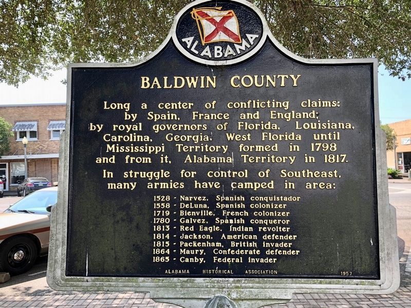
A County Older Than the State, Baldwin County Marker (reverse)
| On Courthouse Square (U.S. 31) at Hand Avenue, on the left when traveling east on Courthouse Square. |
| On Eastern Shore Trail south of Taylor Street, on the left when traveling north. |
| On Dixie Graves Parkway near Alabama Route 180 W. |
| On Spanish Fort Boulevard (U.S. 90/98) at Spanish Main, in the median on Spanish Fort Boulevard. |
| On Alabama Route 59 at milepost 56, on the right when traveling north. |
| On Alabama Route 225 just north of Lower Bryants Landing Road, on the left when traveling north. |
| On Sherling Lake Road (County Road 44) 1 mile west of Braggs Road (State Route 263), on the right when traveling west. |
| On South LaFayette Street (U.S. 431) at East Alabama Avenue, on the right when traveling north on South LaFayette Street. |
| On State Line Road (County Route 212) 0.1 miles south of North State Line Road, on the right when traveling north. |
| On Barlow Bend Road 0.2 miles north of Madison Road (Route 33), on the left when traveling north. |
| On Rockville Road (County Road 15) at Stimpson Sanctuary Road, on the right when traveling south on Rockville Road. |
| Near Interstate 20 (Interstate 20) west of Route 37, on the right when traveling west. |
| On County Road 1 at State Route 83, on the right when traveling south on County Road 1. |
| On Citizens Parkway (Alabama Route 22) 0.2 miles north of Singleton Drive, on the right when traveling north. Reported missing. |
| On Water Avenue at Lauderdale Street, on the left when traveling west on Water Avenue. |
| Near Interstate 59 1 mile north of County Road 140, on the right when traveling south. |
| Near Interstate 59 1 mile north of County Road 140, on the right when traveling south. |
| On West Fort Toulouse Road 0.1 miles west of U.S. 231, on the right when traveling west. |
| Near West Fort Toulouse Road 0.2 miles south of Jackson Park Road. |
| On Rainbow Drive (U.S. 411) east of Peteet Street, on the right when traveling east. |
| On Tuscaloosa Street (U.S. 11) east of Springfield Avenue, on the right when traveling east. |
| On Hartford Road (Alabama Route 10) 0.6 miles east of County Road 46, on the left when traveling east. |
| On County Road 42 0.2 miles east of County Road 442, on the left when traveling west. |
| On Bluff Road at Cloudland Drive, on the right when traveling east on Bluff Road. |
| On County Road 430 0.6 miles south of County Road 248, on the left when traveling south. |
| Near Lauderdale Street west of East Street (County Road 71), on the right when traveling west. |
| On Forest Road 949 0.2 miles north of State Route 186, on the left when traveling north. |
| On South Main Avenue at West Perry Street, on the right when traveling north on South Main Avenue. |
| On U.S. 43 0.2 miles north of Richie Road, on the right when traveling north. |
| On U.S. 43 at milepost 19, 0.1 miles south of Lofton Road, on the right when traveling north. |
| On Conti Street 0.1 miles west of South Royal Street, on the right when traveling west. |
| Near Government Street (U.S. 90) just east of South Hamilton Street, on the right when traveling east. |
| Near South Franklin Street south of Government Street (U.S. 90), on the left when traveling north. |
| On South Royal Street at Church Street, on the right when traveling south on South Royal Street. |
| Near Government Street (U.S. 90) just east of South Hamilton Street, on the right when traveling east. |
| On Government Street (U.S. 98) at South Jackson Street, on the right when traveling east on Government Street. |
| On North Royal Street at St Michael Street, on the right when traveling north on North Royal Street. |
| On Government Street (U.S. 90) at South Scott Street, on the right when traveling east on Government Street. |
| On Government Street (U.S. 90) east of South Hamilton Street, on the right when traveling east. |
| On St Francis Street at North Conception Street, on the right when traveling east on St Francis Street. |
| On Church Street west of South Royal Street, on the right when traveling west. |
| On South Royal Street at Theatre Street, on the right when traveling south on South Royal Street. |
| Near South Royal Street just south of Church Street, on the right when traveling south. |
| On South Royal Street at Church Street, on the left when traveling south on South Royal Street. |
| On U.S. 84 at Old Fort Claiborne Road, on the right when traveling west on U.S. 84. |
| On Federal Road 0.9 miles south of Cloverfield Road (County Road 24), on the left when traveling south. |
| On Water Street at Commerce Street, on the right when traveling east on Water Street. |
| Near Water Streer at Commerce Street, on the right when traveling west. |
| On Alabama Route 165 north of Creek Trail, on the right when traveling north. |
| Near Dillingham Street at Brickyard Road (Route 61). |
| On U.S. 280 just east of General Colin Powell Parkway, in the median. Reported missing. |
| Near Montevallo Road (Alabama Route 119) 0.3 miles south of Alex Mill Road, on the right when traveling south. |
| Near Montevallo Road (Alabama Route 119) 0.3 miles south of Alex Mill Road, on the right when traveling south. |
| Near Montevallo Road (Alabama Route 119) 0.3 miles south of Alex Mill Road, on the right when traveling south. |
| Near Montevallo Road (Alabama Route 119) 0.3 miles south of Alex Mill Road, on the right when traveling south. |
| Near Montevallo Road (Alabama Route 119) 0.3 miles south of Alex Mill Road, on the right when traveling south. |
| Near Montevallo Road (Alabama Route 119) 0.3 miles south of Alex Mill Road, on the right when traveling south. |
| Near Interstate 20, on the right when traveling east. |
| On 4th Avenue (U.S. 11) 0.6 miles north of Longshore Drive, on the right when traveling north. |
| On County Road 433 north of 1st Avenue, on the right when traveling north. |
| On U.S. Highway 280, on the right when traveling north. |
| On Lincoln Street when traveling east. |
| Near Mummy Cave Overlook Road 1.5 miles east of North Rim Highway (Indian Route 64). |
| On U.S. 93, on the right when traveling north. Reported missing. |
| On Signal Hill Road north of Golden Gate Road. |
| Near West Broadway Boulevard. |
| On East 2nd Street, on the right when traveling west. |
| Near North River Road 2.2 miles west of East Patagonia Highway (State Highway 82). |
| On Burruel Street, on the right when traveling north. |
| Near Prison Hill Road 0.5 miles north of Harold C. Giss Parkway. |
| Near Prison Hill Road 0.5 miles north of Harold C. Giss Parkway. |
| Near Prison Hill Road 0.5 miles north of Harold C. Giss Parkway. |
| Near Old Post Road south of State Route 169. |
| Near Old Post Road 0.7 miles south of State Route 169. |
| On U.S. 165 0.1 miles south of Gander Street Road, on the right when traveling north. |
| On Central Avenue (Arkansas Route 7) at Fountain Street, on the right when traveling north on Central Avenue. |
| On East Main (County Road 9) just west of Snell Street, on the right when traveling west. |
| Near State Highway 362 1.8 miles east of U.S. 49. |
| Near State Highway 362 1.8 miles east of U.S. 49. |
| On E. Carpenter Street (State Highway 35) at Military Road, on the right when traveling east on E. Carpenter Street. |
| On College Road, on the left when traveling north. |
| Near East 14th Street (State Highway 185) near Toler Avenue. |
| Near Bird Street at Huntoon Street. |
| On San Pablo Avenue near Cutting Boulevard, on the left when traveling north. |
| On Parker Avenue south of 4th Street, on the right when traveling north. |
| On Maricopa Highway (State Highway 166) 3.7 miles west of Interstate 5, on the right when traveling west. |
| Near Main Street south of First Street. Reported permanently removed. |
| On 162nd Street at Harvard Boulevard, on the right when traveling east on 162nd Street. |
| Near Donald Douglas Drive 0.1 miles west of Barbara London Drive, on the right when traveling south. |
| On Olvera Street south of Cesar E. Chavez Avenue, on the right when traveling north. |
| On Paseo de la Plaza at Olvera Street on Paseo de la Plaza. |
| Near Paseo de la Plaza at Olvera Street. |
| On North Main Street at Paseo Luis Olivares, on the left when traveling north on North Main Street. |
| Near Main Street north of U.S. 101, on the right when traveling north. |
13416 entries matched your criteria. The first 100 are listed above.
Next 100 ⊳
