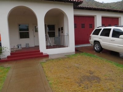
On North Broad Street, on the right when traveling south.
This property
has been placed on the
National Register
of Historic Places
By the United States
Department of the Interior
Circa 1919 — — Map (db m67462) HM
On Fire Control Road or "Control Road" (Route NF 64) 13.8 miles east of Arizona Route 260, on the left when traveling east.
On June 25, 1990 a lightning caused fire entrapped ten members of the Perryville fire crew in this canyon, resulting in six fatalities. Before the fire was contained it had burned more than 24,000 acres and destroyed over 70 structures.
This . . . — — Map (db m28210) HM
The deadliest natural disaster in Arizona history occurred over Labor Day weekend in 1970 when a tropical storm named Norma swept north into Arizona and turned deadly releasing a downpour of heavy rain. One weather station measured nearly 12 . . . — — Map (db m157859) HM
On Myrtle Point Trail 0 miles north of NF 431, on the left.
These Trees Planted in Memory of the Firefighters Who Died in the Dude Fire June 26, 1990
Sandra J. Bachman • Joseph Chacon • Alex S. Contreras • James L. Denny • James E. Ellis • Curtis E. Springfield — — Map (db m28211) HM
Side A
TSGT Jackie D. Glenn
56th SPS
SSGT Gerald A. Coyle
56th SPS
SSGT Faleagafulu Ilaoa
56th SPS, K-9
SGT Jimmy P. Black
56th SPS
SGT Bobby G. Collums
56th SPS
SGT Thomas D. Dwyer
56th SPS
SGT Bob W. . . . — — Map (db m292151) HM
On White Mountain Boulevard (Arizona Route 260) at Woodland Road, on the right when traveling west on White Mountain Boulevard.
The White Mountain communities dedicate this memorial to the
courageous men and women who voluntarily put themselves in harm's way to protect
from imminent destruction by the Rodeo-Chediski Fire.
By the Grace of God, and through the . . . — — Map (db m36745) HM
Lemmon Rock Lookout Tower was erected in 1928. It is the oldest lookout still in use on the Forest. This general locale has been used as a fire lookout since the Coronado Forest Reserve was established in 1902. The current lookout structure was . . . — — Map (db m55554) HM
On East Ski Run Road near East Cap Rock Trail, on the left when traveling west.
During spring and early summer—the main fire season here—a staffed fire lookout station keeps watch over the Santa Catalina Mountains. The trail in front of you leads to the U.S. Forest Service Lemmon Rock Station which has a panoramic view from . . . — — Map (db m304551) HM
On Arizona Route 79, on the left when traveling north.
Near this site on the evening of October 3, 1926, John "Button" Salmon, student body president and quarterback of the University of Arizona football team, was critically injured in a car accident while returning from a weekend in Phoenix with two . . . — — Map (db m26664) HM
Troop 301 and Venture Crew 301 cautions you to
Be Prepared
before you hike to the summit.
In memory of the 50th anniversary of the
Boy Scouts lost on
November 15, 1958
David Greenberg – 12 years old
Mike . . . — — Map (db m73898) HM
On South Cortez Street just north of West Goodwin Street, on the left when traveling north.
The Water Table By March of 1881, fire wells like this one were hand-dug on the four corners of the Courthouse Plaza. At the time, the water table was high enough to allow bucketing of water for fire emergencies. These wells were abandoned . . . — — Map (db m157663) HM
On S. Montezuma Street (Arizona Route 89) near W. Gurley St and S. Montezuma St., on the left when traveling south.
Prescott, Yavapai County Seat, founded 1864 on Granite Creek, source of Placer gold. Named for William Hickling Prescott, Historian, first Gov. JN. N. Goodwin, Appointee of Abraham Lincoln. Established first territorial capital of Arizona here. At . . . — — Map (db m18805) HM
On South Montezuma Street (Arizona Route 89) at West Goodwin Street, on the right when traveling south on South Montezuma Street.
A disastrous fire on the night of July 14, 1900 changed the face of downtown Prescott. Starting in a room in the Scopel Hotel on the southwest corner of Goodwin and Montezuma Streets, the fire quickly hopped across Goodwin Street and proceeded to . . . — — Map (db m20811) HM
Near Prison Hill Road 0.5 miles north of Harold C. Giss Parkway.
The Natural Setting The river supported pristine cottonwood / willow gallery forests, mesquite bosques, wetlands, inter-tidal salt flats, and lakes dependent on annual floods for existence. The area yielded a rich harvest of seasonal wild . . . — — Map (db m158377) HM
Near Prison Hill Road 0.5 miles north of Harold C. Giss Parkway.
The concrete slabs before you are all that remain of an early adobe structure. Originally, this building was where prisoners were processed, ate meals, and received medical attention. Later it housed offices, storerooms, barbershop and the two cells . . . — — Map (db m158297) HM
On State Highway 276 just east of Lumsden Road, on the left when traveling east.
Listed in the Arkansas Register of Historic Places in 2003, the Bayou Meto Schoolhouse is one of the last remaining historic school buildings in the area. The first Bayou Meto school was established in 1875, within the Pampas School District. It . . . — — Map (db m178030) HM
On West Broadway Avenue at Arkansas Street, in the median on West Broadway Avenue.
[Northeast face]
Officers and men killed on
the U.S.S. Mound City
{List of 124 dead}
[Northwest face]
Near this spot, on June 17, 1862,
a decisive engagement was
fought between the Conf-
ederates entrenched and
the . . . — — Map (db m108071) WM
On Jackson Place at McClure Avenue (Route 923), on the left when traveling north on Jackson Place.
Mar. 20, 1839 Trail of Tears Mar. 8, 1847 Robinson's Crossroads First Post Office Feb. 5, 1858 Name changed to Bloomington Sept. 18, 1858 Butterfield Stage Stop to 1861 Dec. 9, 1862 Civil War Skirmishes Aug. 24, 1864 "Camp Mudtown" Mar. 9, 1881 . . . — — Map (db m33712) HM
On State Highway 7 0.3 miles north of Doe Run Lane West, on the right when traveling north.
Near this spring, in September
1857, gathered a caravan of 150 men,
women and children, who here began
the ill-fated journey to California.
The entire party, with the exception
of seventeen small children, was
massacred at Mountain Meadows, . . . — — Map (db m225305) HM
On North Main Street (Business U.S. 65) at West Rush Avenue, on the right when traveling south on North Main Street.
In early September, 1857, the train arrived in a valley known as Mountain Meadows in southwestern Utah. Beginning early on the morning of September 7, the emigrants' camp was attacked by a group of Mormon militiamen and some Paiute Indians whom the . . . — — Map (db m225250) HM
On North Main Street (Business U.S. 65) at West Rush Avenue, on the right when traveling south on North Main Street.
Modern historical research has yielded information which was not readily available to those who designed the 1955 monument. Here is presented updated information and a modified more accurate map of the emigrants' route. Dedicated . . . — — Map (db m225248) HM
On North Main Street (Business U.S. 65) at West Rush Avenue, on the right when traveling south on North Main Street.
In memory of those who were killed in the Mountain Meadows Massacre, in September of 1857. Dedicated in 2020.
Modern historical research has yielded information which was not readily available to those who designed the 1955 monument. . . . — — Map (db m225251) HM
On North Walnut Street at East Rush Avenue, on the right when traveling north on North Walnut Street.
It is the former location of Hammerschmidt Lumber Co. and the First National Bank. It is now home of the Harrison flood of May 1961 mural (located inside) hand painted by Louis Fruend. This historic event commanded both national and international . . . — — Map (db m141869) HM
On County Road 912 0.1 miles north of U.S. 412, on the right when traveling north.
In early April 1857, a large wagon train known as the Fancher-Baker train left Caravan Spring (south of Harrison) and headed for California. They camped at this site en route to intercept the Cherokee trail at the Grand Saline in Indian territory. . . . — — Map (db m225245) HM
On State Highway 26 0.1 miles east of State Highway 53, on the right when traveling west.
As settlers began arriving in this area around 1812, the need for religious services became a top priority among the residents. Brush arbor meetings were held every summer. Soon a log structure was built along the creek that marked the beginning of . . . — — Map (db m184576) HM
On Court Street north of East Military Road, on the left when traveling north.
One of the city's biggest fires occurred
in the early 1900's when a series of
businesses in frame buildings on the
east side of Court Street were destroyed
by fire. Volunteer firefighters brought
water from Harvard yards by train to
help . . . — — Map (db m116545) HM
Near Arkansas Route 77 north of East Military Road, on the right when traveling south.
On April 27, 1865, the steamboat Sultana exploded on the Mississippi River. She was heading north, dangerously overloaded with some 2,200 passengers, most of them freed Union prisoners of war from the Andersonville and Cahaba camps. A . . . — — Map (db m116352) HM
Near Arkansas Route 77 north of Military Road, on the right when traveling south.
Early on April 27, 1865, the overcrowded steamboat Sultana exploded on the Mississippi River near Marion, Arkansas. The vast majority of the Sultana's passengers, believed to number over 2000, were Federal soldiers, recently released . . . — — Map (db m116356) HM
On East Military Road at Sycamore Street, on the right when traveling north on East Military Road.
News of the assassination of Abraham Lincoln on April 14, 1865 overshadowed the tragedy of the Sultana, which happened two weeks later.
The actual number of casualties from the SS Sultana is unknown, but some estimates are as high as 1,800. . . . — — Map (db m242015) HM
On Wilson Street at Lake Street, on the left when traveling south on Wilson Street.
The flood of 1912 was the greatest disaster ever suffered by Parkin. Breaks in the St. Francis and Mississippi levees covered the land and into our homes from 4 to 30 feet in depth in April and part remained until summer. Most of the people fled to . . . — — Map (db m234421) HM
On Capitol Street close to Kate Adams Avenue, on the left when traveling south.
The Flood of 1927 was the greatest disaster
ever suffered by the county. Breaks in the
Arkansas and Mississippi River levees, within
the county covered the land with water from
4 to 30 feet in depth in April and part
remained until summer. Most . . . — — Map (db m299003) HM
This important river port, county seat of Desha County from 1838 to 1874, was located 24 miles east at the junction of the Arkansas River with the Mississippi. The town was finally abandoned after most of it washed into the Mississippi River. — — Map (db m107758) HM
Local Ingenuity
Most communities along today's Delta Heritage Trail were once railway town-settlements created near rail routes where none existed before. One exception is Laconia Circle, an area close to Snow Lake with an
18-mile levee . . . — — Map (db m299923) HM
Era Ends, Era Begins
Large-scale farm and businesses were established here during the early 1800s, when people relied heavily on riverboats for transportation. As a formal community, Snow Lake was established with the arrival of the railroad . . . — — Map (db m299922) HM
Near State Highway 319 1.7 miles west of Old Morrilton Highway (U.S. 64).
Following is a partial list of persons who died and were buried at Cadron. They perished from cholera while being relocated by the Army in 1834. Graves were marked with native stones with no inscriptions. Some of the Indians had adopted . . . — — Map (db m96643) HM
Near Central Avenue (Arkansas Route 7) north of Bath, on the right when traveling south.
Major floods have occurred
periodically in downtown Hot
Springs. The Flood of 1923 was
the most severe. Torrents of water
swept huge sheets of asphalt off
Central Avenue. The water also
shattered storefronts and carried
automobiles as if they . . . — — Map (db m211179) HM
Near Central Avenue (Arkansas Route 7) south of Mountain Street, on the right when traveling south.
Major fires have raged through Hot Springs on three occasions. The fire of 1878 destroyed almost 100 buildings, including the major portion of the business district. The fire of 1905 destroyed 25 blocks of the city's southern section. The 1913 fire . . . — — Map (db m211170) HM
On Church Street just east of Pleasant Street, on the right when traveling east.
You are standing where, on September 5 at about 2:15 in the afternoon, the fire of 1913 began. A hot iron ignited a curtain and the flames soon consumed the Pine Bluff House. Driven by high winds, the fire quickly spread to nearby wooden buildings. . . . — — Map (db m264288) HM
On Grant 51 ( County Rd. 51) 2 miles east of State Road 35, on the right when traveling east.
On March 12, 1943 a B-17 Flying Fortress exploded mid-air while trying to
land in the field on the West side of this road. The B-17 replica marks the site
where the Flying Fortress came to rest. Over the years the gray monument
marking the crash . . . — — Map (db m227739) HM WM
On Drake Road 2.5 miles east of County Route 62, on the left when traveling east.
(side 1)
The first tracts of South Bend Plantation, originally known as the Jordan Place, were purchased in 1840 by Dr. John Augustus Jordan. In 1852, Jordan and Irene Johnson married and built a stately southern Georgian mansion on the . . . — — Map (db m285063) HM
On Route 140 east of Route 136, on the left when traveling east.
In loving memory of my brother
Joseph Allen Sisco
Technical Sergeant
AF1412 1721
Nov. 11, 1922 – Aug. 20, 1948
Son of Brownie and Daisy (Swift) Sisco
Brother to Earl, Clara, Lee, Sue, Anna and Mary Lou
Joe was born and raised in . . . — — Map (db m221255) WM
On U.S. 79 0.3 miles west of State Highway 86, on the right when traveling west.
Known as "Mouth of Cache" 1799-1837, Clarendon by 1828 had a post office and ferry and was the crossing for the Memphis to Little Rock Military Road. The town became Monroe County seat in 1857 and was incorporated two years later. Destroyed by Union . . . — — Map (db m155262) HM
On Ouachita Road 64 east of Highway 7, on the left when traveling east.
On January 20, 1944 near this spot, 8 brave airmen of the United States Army Air Forces lost their lives when their B-26 Medium Bomber crashed and burned about 1:37 PM.
397th Bomb Group 598th Bomb Sqdn.
In Memoriam
• 1st Lt. George . . . — — Map (db m212209) HM WM
Flooding, a long-feared natural phenomenon, is a very real concern throughout the region. Water has spilled from the banks of the Mississippi many times over the years, causing widespread fear and devastation. The Great Mississippi Flood of 1927, . . . — — Map (db m231575) HM
The Delta represents a “melting pot” of diverse cultures. And most of them got here by canoe.
Canoeing is the oldest form of water transportation on the Mississippi River-at least 2,000 years old! In the Quapaw tribal history, they arrived from . . . — — Map (db m229322) HM
On West Main Street (U.S. 64) at North Commerce Avenue, on the right when traveling west on West Main Street.
Late in the afternoon of January 17*, 1906, [see note below] a fire started in the Chronister Brothers grocery. Three hours later, twenty-two buildings, valued at two-hundred-fifty thousand dollars, were in ashes. Half of the central business . . . — — Map (db m225443) HM
On Garrison Avenue at 10th Street, on the right when traveling west on Garrison Avenue.
A cyclone, carrying death and destruction in its wake, visited Fort Smith at 11:15 p.m. on Tuesday, January 11, 1898. Out of the western skies on an unusually balmy night came first an epic show of lightning followed by heavy winds. Then with the . . . — — Map (db m92364) HM
On Garland Avenue at 6th Street ( Highway 255), on the left when traveling west on Garland Avenue.
This marks the last encampment of the Cherokee Indians on "The Trail of Tears," from their ancestral homes in the South to the land allotted them in the Indian Territory. — — Map (db m92345) HM
On Highway 65 South (U.S. 65 S) 0.1 miles north of Sulphur Road, on the left when traveling north.
Near this site on September 18-19, 1980, an accidental explosion destroyed Missile Complex 374-7, which housed an Air Force Titan II intercontinental ballistic missile (ICBM). At 103 feet tall and with a 9-megaton nuclear warhead, the Titan II was . . . — — Map (db m311547) HM
On Oxford Street south of Hearst Avenue, on the right when traveling south.
On the morning of September 17, 1923, a grass fire spread from Wildcat Canyon over the hills into Berkeley. Driven by hot, dry winds, the fire spread rapidly across the northeast residential districts of the city, burning as far south and west as . . . — — Map (db m54213) HM
On Tunnel Road east of Caldecott Lane, on the right when traveling east.
Panel One:
Fires and earthquakes are ever present dangers in the hills of the East Bay. This community exhibit provides a historical overview of major disasters in the area, and practical information on how local residents can prepare for . . . — — Map (db m222061) HM
On Mandela Parkway at 14th Street, on the right on Mandela Parkway.
15 Seconds
On October 17, 1989 at 5:04 pm the Loma
Prieta earthquake rocked the Bay Area.
Measuring 7.1 in magnitude, the earth
shook for 15 seconds. In those 15 seconds
a section of the Bay Bridge fell, a fire began
in the Marina and . . . — — Map (db m154538) HM
On Harrison Street at 4th Street, on the right when traveling north on Harrison Street.
Designer: R. Vane Woods
Construction Date: 1922, remodeled 1992
Architectural Style: Early 20th century utilitarian
The Saroni family were San Francisco candy makers and sugar wholesalers who lost their home and business in the . . . — — Map (db m228119) HM
Argonaut Mine, discovered 1850, and Kennedy Mine, discovered 1856, played dramatic roles in the economic development of California. They produced $105,268,760 in gold. Kennedy Mine has a vertical shaft of 5,912 feet, the deepest in the United . . . — — Map (db m100586) HM
On State Highway 49 (California Route 49), on the right when traveling south.
On the hill to your right stand the remains of the Argonaut Mine gallus (headframe), beneath which 47 miners were lost when a fire broke out deep in the main shaft on August 27, 1922. At that time the Argonaut was one of the deepest gold mines in . . . — — Map (db m94781) HM
Near Church Street 0.2 miles south of North Main Street.
In memory of Elmer Bacheller, James Clayton, Evan Ely, William Fessel, Charles Fitzgerald, Ernest Miller, Arthur and son Charles O'Berg, and Bert Seamans who died August 28, 1922 in the Argonaut Mine Fire — — Map (db m94757) HM
Near Church Street 0.1 miles south of North Main Street.
In memory of Peter Bagoye, Rafaelo Baldocchi, Domenico Boleri, Eugene Buscaglia, John Caminada, Peter Cavaglieri, Manuel Costa, Paul Delonga, A. Fazzini, V. Fideli, Simone Francisconi, Battista Gamboni, Timothy Garcia, Maurice Gianetti, Giuseppe . . . — — Map (db m94774) HM
On State Highway 49/88 (California Route 49), on the right when traveling south.
- The Kennedy Mine -
You are standing on property that once belonged to the Kennedy Mine. The Kennedy Mine is named for Andrew Kennedy, who reportedly discovered a quartz ledge in the late 1850s. The Kennedy Mining Company was formed in 1860 . . . — — Map (db m72070) HM
On Calaveritas Road at Costa Road, on the right when traveling east on Calaveritas Road.
Calaveritas, settled in 1849 by Mexicans, was a flourishing mining town complete with stores, saloons, gambling houses, and fandango halls. Joaquin Murieta is reported to have frequently visited its Fandango Halls and gambling houses. Destroyed by . . . — — Map (db m12992) HM
Here, at 10:08 p.m. on July 17, 1944 one of history's most powerful man-made, non-nuclear disasters obliterated two cargo ships, killed 320 men, and wounded hundreds. It was the worst stateside disaster of World War II. The cause of the explosion is . . . — — Map (db m136870) HM WM
July 17, 1944 was a typical day at Port Chicago Naval Magazine. Men of the Merchant Marine and the U.S. Navy Armed Guard prepared the empty, brand new SS Quinault Victory for loading on one side of the pier and prepared the nearly full SS . . . — — Map (db m136868) HM
Here, at 10:18 p.m. on July 17, 1944, one of history's most powerful manmade, non-nuclear explosions obliterated two ships, damaged structures in twelve nearby towns or cities, killed 320 men, and wounded 390. It was the worst stateside disaster of . . . — — Map (db m177667) HM
For more than a half-century, Port Chicago Naval Magazine has been a major port for the shipment of munitions to U.S. forces serving overseas. The Navy created the munitions-loading complex next to the town of Port Chicago as an annex to the Mare . . . — — Map (db m136861) HM WM
U.S. Naval Magazine and Naval Barracks
S2c James C. Akins • GM3c Clarence Allen, Jr. • Lt. (jg) Maxie L. Anderson • S2c Leslie K. Asare • S2c Isajah Ash. Jr. • S2c David Bacon, Sr. • S2c Henry W. Bailey • GM3c Leonard Baker • S2c Joseph . . . — — Map (db m136952) WM
In 1988, a massive oil spill from the nearby Shell Refinery
inundated the Carquinez Strait and downstream marshes
including McNabney Marsh. As a result of a settlement with
a number of agencies, Shell Oil paid over $12 million into a
Natural . . . — — Map (db m145095) HM
These young Welshmen died far from home in an 1876 mine accident. Despite hard times, these people of Nortonville pitched in to erect a white bronze monument on this site. This plaque keeps their memory alive. — — Map (db m199137) HM
During the evening of March 27, 1964 a massive earthquake shook Alaska’s Kenai Peninsula heavily damaging Anchorage, located more than 60 miles away, and sending a tsunami racing across the Pacific Ocean. About four hours later, on March 28, the . . . — — Map (db m114260) HM
On Front Street at Play Street, on the left when traveling south on Front Street.
The townspeople of Crescent City slumbered peacefully in the late-night hours
of March 28, 1964 - tragically unaware of a catastrophe at their doorstep.
Earlier whipped into fury by a devastating Alaskan earthquake, seismic waves
raced . . . — — Map (db m183645) HM
On K Street at 2nd Street, on the right when traveling south on K Street.
Thirty-seven tsunamis have been observed or recorded on the North Coast since
the first tide gauge was installed in Crescent City in 1933. All but five were tele-tsunamis (the source was far away). Crescent City, known as "Tsunami Central,” has . . . — — Map (db m183655) HM
On Klamath Boulevard 0.2 miles south of Ehlers Avenue, on the right when traveling north.
The heroic voyage of this crossbreed steer; floating downriver from Klamath Glen and up the coast into Crescent City Harbor, was an inspiration to the flood victims of Klamath. He embodied their courage, stamina, and indomitable spirit. A living . . . — — Map (db m91941) HM
Near Klamath Beach Road at Coastal Drive, on the right when traveling north.
During Christmas week in 1964, this area) was hit with the heaviest rain ever recorded in the region, Torrential storms dumped as much as 21 inches of warm rain over the mountains, melting the snow pack. Swollen creeks and rivers raged through . . . — — Map (db m285204) HM
On Coloma Road (California Route 49 at milepost 2) near Brewery Street, on the right when traveling north.
Built in 1850, the Sierra Nevada House was a two-story building with many windows and a broad balcony. Here guests could always expect superb food, excellent ballroom music, and comfortable beds. It was operated by Robert Chalmers from 1852 until . . . — — Map (db m215361) HM
The antique bricks that were used on the façade of this building were originally used to build the “Dougalss – Hines” Building.
The “Douglass – Hines” Building stood where the Fountain Plaza now stands at 312 . . . — — Map (db m13144) HM
On Los Gatos Creek Road 14 miles west of Derrick Avenue, on the right when traveling west.
On the morning of January 28, 1948, a plane went down
across the road from this memorial Killing 28 Bracero
workers, 3 crew members and an immigration officer.
The plane crash was observed by convicts from the
Fresno County Road . . . — — Map (db m310096) HM
On Coalinga Plaza (North 5th Street) near East Durian Avenue, on the right when traveling north.
In 1909 Dominique Bordagaray purchased six lots on 5th and “C” Streets and built row stores on them as Coalinga began to grow. The row stores included a French laundry, cigar shop, and liquor store, bicycle shop and confectionery shop.
The French . . . — — Map (db m63917) HM
On Coalinga Plaza (North 5th Street) at West Elm Street on Coalinga Plaza (North 5th Street).
On May 2nd, 1983 at 4:42 P.M. a major earthquake of 6.7 magnitude lasting 45 seconds destroyed 54 buildings in downtown Coalinga. Only 31 people were injured and miraculously there were no deaths.
The earthquake also destroyed over 300 homes and . . . — — Map (db m63914) HM
On Centerville Road 4.5 miles west of Ferndale, on the right when traveling east.
To the memory of the
38 pioneers who lost
their lives in the wreck
of the steamer "Northerner"
on January 6, 1860.
By Ferndale Parlor, NSGW, 1921.
Rebuilt because of
the earthquake of 1992.
Rededicated
February 11, 1995
by . . . — — Map (db m239831) HM
Near Ocean Avenue at Craig Street, on the right when traveling east.
This cross was erected on a bluff overlooking Centerville Beach on September 11, 1921, by the Native Sons
of the Golden West, Ferndale Parlor No. 93, to honor the 17 passengers and 21 crewmembers of the steamship
SS Northerner, who perished on . . . — — Map (db m247118) HM
On Avenue of the Giants (California Route 254) at Lum Street, on the right when traveling north on Avenue of the Giants.
A World class Forest Preserve
Containing over 53,000-acres, Humboldt Redwoods State Park includes some of the world's most impressive redwood forests, many miles of river frontage, and nearly 100 miles of hiking, riding and mountain bike . . . — — Map (db m176731) HM
On Avenue of the Giants (California Route 254) at Lum Street, on the right when traveling north on Avenue of the Giants.
Periodic winter flooding is not uncommon along California's Northcoast, and several floods have been catastrophic!
Try to imagine standing at this exact spot while 33 feet of river water rages overhead. Such was the scene in 1964, when a . . . — — Map (db m176729) HM
On U.S. 101 at Mattole Road / Lower Bull Creek Flat Road, on the left when traveling south on U.S. 101.
Better Beginnings
You are standing on the site of the historic town of Dyerville.
In the late 19th century, timber gave rise to a booming community
that served outposts and lumber camps up and down the Eel River.
Dyerville boasted several . . . — — Map (db m121336) HM
On Scotty’s Castle Road near Ubehebe Crater Road, on the left when traveling north.
Flash Flood Scours Grapevine Canyon
On the night of October 18, 2015, heavy rains pounded Grapevine Canyon. Floodwaters roared out of the canyon mouth — visible to the northeast — and down the valley behind the ranger station. After . . . — — Map (db m195573) HM
Near U.S. 395 1.4 miles south of Route 136, on the right when traveling south.
Named for the Diaz family who established a ranch
here when brothers Rafael and Eleuterio Diaz
emigrated from Chile in the 1860's. They owned and
operated a successful cattle ranch until the land
was sold to the City of Los Angeles Dept of . . . — — Map (db m221367) HM
Near U.S. 395 0.1 miles south of Pangborne Lane, on the right when traveling south.
On the date of March 26, 1872, an earthquake of major proportions shook Owens Valley and nearly destroyed the town of Lone Pine.
Twenty seven persons were killed.
In addition to single burials, 16 of the victims were interred in a . . . — — Map (db m34157) HM
On Main Sreet (U.S. 395) south of Busch Street, on the right when traveling south.
On March 26, 1872 at 2:30AM, one of the largest earthquakes ever recorded destroyed 52 out of the 59 buildings in Lone Pine.
Because of the scarcity of building materials the largely immigrant population of Lone Pine, (estimated 250-300), . . . — — Map (db m52102) HM
Near Chester Avenue just north of 36th Street, on the left when traveling north.
In the 1930’s, more than half of a million Americans fled the Southwestern part of the United States due to the prolonged drought called the “Dust Bowl.”
Traveling in old cars with just basic necessities, the migrants came primarily from . . . — — Map (db m167100) HM
Near Broome Road 0.5 miles north of Woodford-Tehachapi Road, on the left when traveling north.
In memory of conductor Everett S. Crown, brakeman Allan R. Riess, who lost their lives in a tragic train wreck in San Bernardino Calif, May 12, 1989. — — Map (db m255660)
On Green Street, on the right when traveling south.
The first bank in Tehachapi was incorporated on October 11, 1892, in a dry goods store on "G" Street (now Tehachapi Boulevard). The founder and first President of the Bank of Tehachapi was Isadore Asher, who operated the bank in the rear of this . . . — — Map (db m52966) HM
On this site, the first frame building in Tehachapi was built by Mary and Bernard Kessing. They replaced the original wooden building in 1905 with a beautiful brick building named the Kessing Building, which was destroyed in the 1952 earthquake. A . . . — — Map (db m53123) HM
On Pauley Street at Tehachapi Boulevard, on the right when traveling north on Pauley Street.
The Tehchapi Loop put Tehachapi on the map when it was completed in 1876. Before that time there was no rail access across the Tehachapi Mountains. The historic Loop is pictured here, circa 1952, with a trompe l'oeil effect showing damage to the . . . — — Map (db m53117) HM
On Woodford-Tehachapi Road, on the left when traveling east.
On September 30th torrential rains flooded Tehachapi Creek, undermining the tracks under Santa Fe Engine No. 3834 which was waiting out the storm about ½ mile east of Woodford Station. The engine disappeared into the raging water below. It remained . . . — — Map (db m202039) HM
On Green Street, on the right when traveling north.
At 4:52 a.m. on July 21, 1952 Tehachapi residents were awaken by an earthquake lasting 45 seconds and registering 7.7 on the Richter Scale (lowered in recent years to 7.5). The quake claimed 11 lives, injured others and left 70% of the buildings in . . . — — Map (db m135037) HM
League's Store, destroyed in the fire of 1924, housed the beginnings of both the Odd Fellows Hall and the Harriet Lee Hammond Library. The post office moved here when the library opened in 1916. The Griner Brothers eventually built and relocated . . . — — Map (db m61079) HM
Near Cornell Road 0.4 miles north of Mulholland Highway, on the left when traveling north.
You've seen Western Town in hundreds of movies, TV shows and commercials. It all started back in 1927 when Paramount Pictures purchased 2,700 acres of the old Rancho Las Virgenes for use as a "movie ranch."
"Cisco Kid," "Dr. Quinn, Medicine . . . — — Map (db m150029) HM
Near Escondido Canyon Road 0.5 miles east of Agua Dulce Canyon Road, on the right when traveling east.
Before you stands the beautiful "Devil's Punchbowl Wildlife" Civic Art mural, painted
by artist Aaron Morse in 2020 in collaboration with the L.A. County Arts Commission.
Originally created for Devil's Punchbowl Natural Area, a sister facility . . . — — Map (db m274903) HM
Near Mount Lowe Railway Trail south of Sam Merrill Trail.
This photograph was taken from the Castle Canyon trail
which is to your left leading into Castle Canyon.
The Casino building was in the area behind this sign
to your right.
The Casino was used for meetings, banquets, and dances. It
was not . . . — — Map (db m248853) HM
Near Little Tujunga Canyon Road 5 miles north of U.S. 210.
In dedication to the Firefighters who heroically defended Wildlife Waystation throughout the entire December 2017 Creek Fire. Our eternal gratitude for their selfless act of bravery - Cal Fire, Contra Costa County Fire, Los Angeles County Fire Dept, . . . — — Map (db m138093) HM
Near Mount Lowe Railway Trail south of Sam Merrill Trail.
The foundations for the 1895 Power
Plant are in the area right of this sign.
The foundations of the 1899 Power
Plant are to the left.
All of the foundations for the Motors
and Generators shown in the drawings
are visible along with the . . . — — Map (db m248808) HM
Near 183rd Street west of Bloomfield Avenue, on the right when traveling west.
On August 31, 1986 at 11:56 A.M., two planes collided above a Cerritos neighborhood in the vicinity of Carmenita Road and 183rd Street. The tragic accident claimed 82 lives, destroyed 11 homes and severely damaged seven others. The collision was . . . — — Map (db m73108) HM
Near Commerce Way south of Harbor Street, on the right when traveling south.
The Commerce City Council hereby dedicates this space in honor of our beloved Commerce residents and neighbors around the world lost to COVID-19.
City of Commerce - 2021 — — Map (db m266228) HM
4161 entries matched your criteria. Entries 101 through 200 are listed above. ⊲ Previous 100 — Next 100 ⊳