Like many of the early Wetaskiwin settlers, Clifton Compton and his wife arrived with few possessions, but they were full of confidence and hope. Mr. Compton came from Prince Edward Island in 1894 and worked at the John West Store until the great . . . — — Map (db m315496) HM
The building on this site was constructed in 1906. It originally housed George Owen's Second-Hand Store. George Owen lived above the store and kept race horses in a barn behind it. He also had an auction sale building there. Patrons to either of . . . — — Map (db m315796) HM
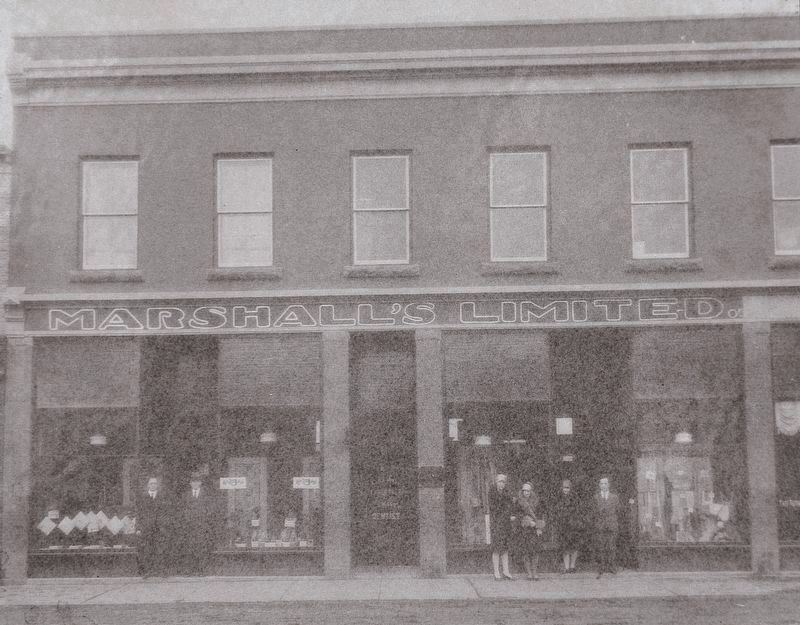
This two-story, brick building was constructed in 1906 with Lou Rix as the owner. In 1907, J.R. Staples opened his Men's Outfitter Store here, offering all the latest styles in men's clothing. Charlie McMurdo bought the store in 1913 and continued . . . — — Map (db m315797) HM
Hugh J. Montgomery came to Wetaskiwin in 1898 from Prince Edward Island. He went to work as a bookkeeper for his uncle, John West, in the Star Trading Company General Store until West's original store, stable, and home were destroyed by the . . . — — Map (db m315798) HM
In 1891 the Calgary and Edmonton railway line was completed and Siding 16 was created. Later, because of a suggestion by Father Lacombe, it was named Wetaskiwin, which in Cree means "the place where peace was made." The trains that travelled . . . — — Map (db m206513) HM
In 1911, the Royal Meat Market was established in this new, two-story brick building, constructed after a fire destroyed the previous building. The original proprietors were Thomas Ward and C.L. Thomas. Clad in long, white aprons, they cut cheese . . . — — Map (db m315799) HM
[English] Rapid settlement of western Canada after 1900 created an urgent need for new judicial facilities. The Wetaskiwin Court House was one of the initial group of public buildings constructed in Alberta after the shift from territorial to . . . — — Map (db m197022) HM
The red brick building that most people know as the Old Post Office was built by the Federal Government in 1911, but it wasn't Wetaskiwin first Post Office. Until the completion of the Calgary & Edmonton Railway line in 1891, mail was delivered by . . . — — Map (db m197029) HM
Driving towards Wetaskiwin from any direction, the 10-storey water tower is the first visible sign of the City. Like the prairie grain elevators, water towers have long been the signature landmarks of communities. Unfortunately, most of them have . . . — — Map (db m197030) HM
The original building at this location was destroyed by the disastrous fire of 1903, and the building that replaced it was a very small wooden structure. In 1907, it was occupied by two real estate firms, Smith and Gibbs, and Bradley and Nickerson. . . . — — Map (db m280600) HM
In 1882, part of the North West Territories was divided into the Districts of Alberta, Assiniboia, Athabasca and Saskatchewan. The old District of Alberta lies to the west of this cairn. In 1905, the provinces of Alberta and Saskatchewan were . . . — — Map (db m303393) HM
To the east of this cairn lies the old District of Assiniboia of the North West Territories. When, in 1905, Alberta and Saskatchewan became provinces in the growing Dominion of Canada, the District of Assiniboia was absorbed in the main by . . . — — Map (db m303200) HM
You have just entered the Eastern Irrigation District (EID), located within the Palliser Triangle (the semi-arid area of the western prairies). The Triangle, named after the Palliser Expedition of 1857-60, was thought to be of insignificant . . . — — Map (db m303398) HM
On 17 November 1879, Constable Marmaduke Graburn of the North-West Mounted Police (NWMP) was shot and killed approximately 55 kilometres southeast of here. A member of the Kainai Nation, Star Child, was arrested and tried for the murder in 1881. . . . — — Map (db m201753) HM
The A. P. Burns house and the Gas City Planing Mill originally stood where the courthouse extension and part of City Hall are now located.
Arthur P. Burns arrived in Medicine Hat in 1901. He is best remembered as a local entrepreneur, real . . . — — Map (db m206637) HM
Presented to the citizens of Medicine Hat by Canadian Pacific this sixth day of July, 1985 A.D.
The two Canadian Pacific locomotives (Units 1418 and 1424) are typical of the locomotives put in service by Canadian Pacific in the 1950’s. These . . . — — Map (db m205307) HM
On this site facing Sixth Avenue, now occupied by the City Hall, once stood three buildings.
A two-story brick and tile structure situated adjacent to the river was erected in 1914. The Medicine Hat News, which had previously operated from the . . . — — Map (db m205357) HM
Until 1892, when Medicine Hat became a separate judicial seat for the territorial District of Assiniboia, court officials travelled from the judicial headquarters in Fort Macleod to hear cases. The first local courthouse, a small and inexpensive . . . — — Map (db m206559) HM
Dutch Canadian Society of Medicine Hat and District
This monument was placed with everlasting gratitude to honor the men and women of the Canadian Forces who were involved in the liberation of the Netherlands during World War II on the occasion . . . — — Map (db m205303) WM
This distinctive 1½ storey Victorian style red brick home was originally constructed in 1887 by H. C. Yuill on behalf of John Ewart and his wife to be, Jessie Herald, daughter of prominent pioneer Rev. James Herald. Mr. Ewart was a local . . . — — Map (db m206564) HM
A downtown landmark, Fifth Avenue Methodist Church was designed in the Arts and Crafts style by Medicine Hat architect William T. Williams and built by Lussier Construction Company. Opened in 1913, it featured large stained glass windows, red . . . — — Map (db m206986) HM
Finlay Bridge is a vehicle and foot bridge that crosses the South Saskatchewan River, connecting the north (Riverside) and south sides (downtown) of Medicine Hat. It officially opened in May 14, 1908/
Finlay Bridge is named for William T. Finlay: . . . — — Map (db m196935) HM
The First Street South Municipal Historic Area is recognized as one of the oldest residential districts in Medicine Hat. The boundaries include the road right-of-way with views of the homes on both sides of First Street, from Fourth Avenue SE to . . . — — Map (db m206914) HM
The Hargrave Sissons Block is a two-storey brick structure designed in the Edwardian Commercial style. The Grocery Warehouse, a single-storey brick structure also in the same style, was added in 1910. The combined structure stands at a major . . . — — Map (db m206783) HM
The Indian people, living in close harmony with the land for thousands of years, referred to this beautiful river valley as "the place where the river comes closest to the mountains." The eagles that lived on the cliffs near Police Point provided . . . — — Map (db m206688) HM
The Hull Block is a three storey, load-bearing brick structure designed in the Edwardian Commercial style. It features engaged brick pilasters, symmetrically placed upper level windows and pressed metal entablature. The ground floor brickwork has . . . — — Map (db m206785) HM
On June 9, 1995 at 9:00 P.M., the south Saskatchewan River overflowed its banks and peaked at 9.8 meters (32 feet). Hundreds of people were affected by the "100 year" flood. Several families lost their homes. This wall is to commemorate that tragic . . . — — Map (db m205301) HM
This Sherman tank is presented by the South Alberta Light Horse to the City of Medicine Hat in Canada's Centennial Year and is a memorial to the Men of the South Alberta Regiment who used them during the 1939 - 1945 War. — — Map (db m205308) WM
Dedicated
To the Sons and Daughters
of Medicine Hat and
District Who Served With
Their Majesties Forces to
Preserve the Freedom
Which We and Others Enjoy
Originated by the Royal Canadian Legion Robertson Memorial Branch 12
Donated . . . — — Map (db m205310) WM
This monument is erected by their grateful fellow citizens, to the everlasting memory of those men and women of Medicine Hat and district who laid down their lives for their country on active service in the Great War
Lest We Forget
Middle . . . — — Map (db m205323) WM
The Merchants Bank of Canada is a two-storey brick structure with a cottage roof configuration and rectangular floor plan; hallmarks of the Georgian style. The façade features: a symmetrical storefront with large display windows and central . . . — — Map (db m206902) HM
An icon of Medicine Hat’s entertainment history, the Monarch Theatre is a two-storey Streamline Moderne-style building. Connected to buildings of similar scale and vintage, it is distinctive for its boxed massing, smooth stucco surfaces, and . . . — — Map (db m206913) HM
River Road was the brainchild of Allan Gunter City Engineer. Before his plan received approval, those in opposition to it dubbed it "Gunter's Folly," predicting that it would wash away and be a waste of taxpayers money. However, the plan was . . . — — Map (db m206575) HM
This is the original site of Medicine Hat’s first radio station “1270 CHAT AM.” CHAT AM signed on-air November 1, 1946 and continues to serve Medicine Hat and surrounding area. For the past fifty years CHAT AM has been broadcasting on a frequency . . . — — Map (db m206682) HM
St. John’s Presbyterian Church is a brick and sandstone structure executed in Gothic Revival style with a prominent corner square tower and octagonal pinnacle which frame the main façade with its gothic arch windows. The front façade is largely . . . — — Map (db m206995) HM
[English] Built in 1912-1914, this church is a fine example of the Gothic Revival style, long favoured for ecclesiastical design in Canada. Gothic Revival churches were inspired by those of medieval Europe in plan, composition, and . . . — — Map (db m206552) HM
Between 1912 and 1989 over a dozen different pottery companies operated in Medicine Hat and Redcliff. The availability of natural gas, suitable clay deposits nearby, and a location on the CPR mainline, were major factors in locating pottery . . . — — Map (db m205412) HM
Central School was built in June of 1887 to accommodate the nearly 100 children of Medicine Hat. Built over six lots on Toronto Street at cost of $3,000, the school opened in 1889, with only the bottom portion of the building occupied. The school . . . — — Map (db m206574) HM
1912 Coal miners working in the Star Mine crossed the Red Deer River in rowboats.
1919 An aerial cable car system was built, which transported both men & coal from the mine to tipple on this (south) side, The C.N.R. carried the coal . . . — — Map (db m196998) HM
[English] Atlas No. 3 (1936-1956) played a central role in the coal industry of the Drumheller Valley, a leading area in the production of Canadian coal. The mine employed skilled miners and used mechanized equipment to produce . . . — — Map (db m196996) HM
[English] The Province of Alberta, formerly part of the North-West Territories, was created on 1 September, 1905, and inaugurated at Edmonton on that same day by Governor General Earl Grey and Prime Minister Sir Wilfred Laurier. . . . — — Map (db m206184) HM
The 1909 Strathcona City Council had to make a decision. Where do they house the volunteer fire department? After much spirited debate they decided that the old fire hall was not worth repairing and a new one should be built. The citizens agreed. . . . — — Map (db m197048) HM
Originally known as Strathcona Fire Hall Number 1, this structure is the last remaining example of a pre First World War fire hall in Edmonton. Designed by Arthur G. Wilson and David E. Herrald, the hall was built by contractor James M. Eaton at a . . . — — Map (db m197047) HM
This was the first public library building in Edmonton. The Carnegie Foundation offered to build a library of a specified size and shape; this did not meet the requirements of the citizens of Strathcona, who refused the offer and instead financed . . . — — Map (db m197046) HM
[English] Construction of a bridge across the North Saskatchewan River was first proposed by the Canadian Pacific Railway in 1905. After extended negotiations with the government and the cities of Edmonton and Strathcona, . . . — — Map (db m197052) HM
[English] Partner in the North West Company, Chief Factor of the Hudson's Bay Company, Rowand of Fort Edmonton was reputed to be "the most influential white man among the wild tribes of the plains". Admired for his courage and . . . — — Map (db m220698) HM
Humberstone Coal Mine
Mine No. 43. North half. Sec 7-53-23-W4, west of river and part of River Lot 40. Entrance along northeast bank of North Saskatchewan (30th Street), north of 111th Avenue and south of 115th Avenue. Recorded production . . . — — Map (db m275458) HM
[English]
Amisk Wacîw Mêskanaw Trail - Beaver Hill Road Trail
Amisk Wacîw Mêskanaw is a 100-km pedestrian trail connecting six municipalities
through the North Saskatchewan River Valley: Parkland County, Devon, Edmonton, . . . — — Map (db m294328) HM
The edifice of St. Luke's Anglican Church is a distinctive example of modernist church architecture. Built in 1958, in the postwar period, new construction materials and techniques ushered in novel, bold, and expressive forms of church design. St. . . . — — Map (db m289171) HM
This plant, which was critical to the development of the Turner Valley oil field, is the earliest gas processing facility built in Canada and the only survivor of its type. The present complex was begun in 1921 after a fire destroyed the . . . — — Map (db m8825) HM
Turner Valley is Alberta’s first great oilfield. Initially the field, which began production in 1914, yielded mainly natural gas. Local plants, which provided the only extensive gas-processing system in the province, extracted the . . . — — Map (db m9204) HM
Fort Saskatchewan, constructed in 1875, was the first North West Mounted Police Post built in northern Alberta. As a center of law enforcement in the area it was, from 1885 until 1913, the headquarters of “G” Division. This cairn was erected in . . . — — Map (db m212479) HM
Constructed in 1974as an Alberta-R.C.M.P. Centennial project by the Knights of Columbus and the Catholic Women’s League of Fort Saskatchewan to commemorate the part that the North West Mounted Police, the native peoples, the first settlers and the . . . — — Map (db m212495) HM
The first missionaries to arrive in this area were the Oblate Fathers from St. Albert who began a mission at Lamoureux in 1875. This mission became a formal parish in 1891 and was later administered by the Franciscan Fathers who established a . . . — — Map (db m212497) HM
Arriving in the Fall of 1872, Joseph and François Lamoureux spent the winter sheltered on the north side of the river across from what is now the City of Fort Saskatchewan. This was the beginning of the first settlement in this area which was later . . . — — Map (db m212498) HM
Centuries ago the many Indian tribes using the North Saskatchewan waterway established a boatbuilding encampment at the mouth of the Sturgeon River. This encampment was commonly known as “Birch Hills” due to the availability of Birch trees for the . . . — — Map (db m212496) HM
This pivot point and two towers are part of the first two water drive pivot systems introduced to Canada by Donald and Wyman Campbell. They arrived in the Burdett area on May 11, 1962 from the Valley Manufacturing Co., Valley, Nebraska, USA. The . . . — — Map (db m201765) HM
‘Unknown’ Lands Imagine making your way through these mountains before there were trails, rails or roads. That is just what geologist Dr. James Hector of the Palliser Expedition did in 1859. He and three colleagues were on a . . . — — Map (db m312387) HM
A Lasting Legacy“My grandfather’s blood still runs here.” Emil Moberly Elder of the Upper Athabasca Valley Elders Council Long ago protecting nature by banishing human “intrusions” must have seemed like a simple solution. Now we . . . — — Map (db m312396) HM
A Piece of Jasper's History
This rustic shelter was built in 1933 by workers involved in a federal relief project during the Great Depression. Since that time, the building has served generations of visitors and residents . . . — — Map (db m294220) HM
First People Stone tools like these were found in the Athabasca Valley — the wide glacially-carved valley you are standing in. They are nearly 10,000 years old, suggesting that humans have been in these mountains since the last . . . — — Map (db m312395) HM
Strolling down the aisle, a conductor announces your destination. With steely squeals and a pish-sh-sh-sh of pent up steam, the locomotive glides to a halt. Descending the coach's stairs you step through the mist and arrive at Jasper Station. . . . — — Map (db m108634) HM
[English] Built by William Henry of the North West Company in 1811 to support David Thompson's exploration of the Athabasca Pass, Henry House stood at the head of navigation on the Athabasca River. When the pass became the principal . . . — — Map (db m202599) HM
1914 — 1918S. W. Edwards • Ed. Montgomery • F. McLeod • Alec. McQueen • T. Nevitt • John Symes 1939 — 1945Raymond G. Brasnett • Franklin N. Bryant • John Buckham • Karl Christensen • Alden P. Cottam • Robert F. Gourlay • Bruce Harrison • . . . — — Map (db m312496) WM
Those who made the ultimate sacrifice at the Canoe River Disaster enroute to the Korean War We celebrate the sacrifice of 17 members of the 2nd RCHA and 4 CNR crew. We will remember them Dedicated by the Jasper Korean Community Korea . . . — — Map (db m312497) HM WM
[English] This building is one of the finest and most influential examples of rustic architecture in Canada’s national parks. Designed by A.M. Calderon and completed in 1914, it introduced a building tradition based on the use of local . . . — — Map (db m197059) HM
[English] Jasper School District No. 3063 was established on November 22, 1913, when Jasper was a tent town. In 1914 the first class was taught in an abandoned railway construction shack, which was succeeded by a . . . — — Map (db m311997) HM
A Jasper Landmark For 94 years, a magnificent Haida totem pole stood proudly near Jasper's railway station. It was an important Jasper landmark and a colourful reminder of the community's early railway history. Born in the Mists of . . . — — Map (db m312367) HM
In memory of those who made the ultimate sacrifice for freedom, democracy and peace. Dedicated by the members of the Han and Gil family. — — Map (db m312495) WM
Memories of Home Most people today think of Jasper National Park as a nature preserve and tourist playground. But for some people, it holds memories of home. They have historical ties to Jasper House fur trade post, where traders met . . . — — Map (db m312397) HM
[English] Parks Canada wishes to acknowledge THE FRIENDS OF JASPER NATIONAL PARK ASSOCIATION for the restoration work on this recognized Federal Heritage Building. Built in 1949, it served until 1972 as Jasper . . . — — Map (db m312322) HM
Railway Ties Forty years after surveyors mapped a route west over Yellowhead Pass, ribbons of steel finally traversed this valley and a town was born. Since 1911, the railway has flavoured our community's spirit, lending a unique . . . — — Map (db m312398) HM
“We remember our grandfathers telling us, at the time that they were sent out they were told, ‘the next place where you settle you will not be bothered!’” Upper Athabasca Valley Elders Council The First Homesteaders When Jasper . . . — — Map (db m312399) HM
The first recorded patrol was made into this valley on the 3rd August 1893 by Insp. A. E. Snyder of the North West mounted police and was followed, in 1903 by Cst. M. Bailey who remained in the area for about one month. It was not until 1913 that a . . . — — Map (db m312357) HM
[English] In 1862, the Overlanders, numbering about 250, left their homes in Canada for the Cariboo gold fields. They journeyed via Fort Garry and Edmonton, and thence, guided by Indians to the mountains and westward by the . . . — — Map (db m203692) HM
Cedar Storytellers When Jasper's Raven Totem Pole was repatriated to Haida Gwaii, a new totem pole was commissioned by Parks Canada to take its place. The 12 metre tall, Two Brothers Totem Pole was carved in Haida Gwaii. It tells a . . . — — Map (db m312376) HM
[English] In 1813, the North West Company built Rocky Mountain House on Brûlé Lake as a provision depot for brigades crossing the Athabasca Pass to the Pacific. When Jasper Hawes took command of the post in 1817 it became known as . . . — — Map (db m203680) HM
A preeminent topographical surveyor, Wheeler represented British Columbia on the commission which located and marked the boundary with Alberta between 1913 and 1925. His party surveyed and mapped the 1000 km-long mountain section, using photographs . . . — — Map (db m108876) HM
[English] Athabasca Pass played an important role in the fur trade and the early development of Canada. It is one of a family of national historic sites across the country. The Government of Canada designates . . . — — Map (db m312586) HM
[English] Born in London, Thompson served both the Hudson's Bay Company (1784-1797) and the North West Company (1797-1815) as trader, explorer and surveyor. One of the world’s great geographers, he accurately mapped . . . — — Map (db m203686) HM
[English] From humble beginnings as a fur trade clerk, David Thompson became the greatest land geographer of all time. From 1792 to 1812, Thompson travelled over 90,000 km by canoe, dog sled, horse and snowshoe and . . . — — Map (db m312592) HM
[English] By 1810 the race was on between rival companies to establish a fur trading post at the mouth of the Columbia River on the Pacific coast. The North West Company sent their best man, David Thompson, to . . . — — Map (db m312602) HM
[English] During the early 19th century scientists, artists, missionaries, and even spies hitched a ride in the fur trade brigade canoes crossing the continent. These gentlemen passed through the valley in front of . . . — — Map (db m312692) HM
One of Blackfalds first general stores called "The Pioneer Store"was built by John McKay around 1901. Not only did Mr. McKay do business with the newly arrived homesteaders, he traded with the local natives, baling up many hides to ship every . . . — — Map (db m212446) HM
Ukrainian Settlement The first Ukrainian immigrants to Canada came to this part of Alberta in the early 1890s, fleeing poverty and oppression in their homeland. Taking out homesteads, they gradually cleared the forest to create . . . — — Map (db m204235) HM
The development of this field in 1947 marked a turning point in the history of the Alberta petroleum industry. After the drilling of Leduc No. 1, the geographical focus of the industry shifted from Turner Valley northward to the central plains area, . . . — — Map (db m8856) HM
George Ambrose Liggins was Leduc's first Canadian Pacific Railway stationmaster. In 1891 his family was the second to settle in Telford Place, now known as Leduc. He was instrumental in the development of Leduc's first school, served as a school . . . — — Map (db m213003) HM
On this site in December, 1902, the first bank in Leduc was opened by the Merchants Bank of Canada which later merged with the Bank of Montreal. This plaque commemorates that event and was installed by the Bank to . . . — — Map (db m213002) HM
Mennonites have been moving to Alberta for well over a century. Mennonite settlement stretches back to 1894 when Mennonites from Waterloo County, Ontario, established a settlement at Didsbury. Didsbury’s first building was a narrow log immigrant . . . — — Map (db m201774) HM
In May 1905, Lethbridge signed its largest incentive agreement to bring the CPR's divisional point from (Fort) Macleod to Lethbridge. The City offered the company a 20-year tax exemption on 120 acres (48.6 ha) of land and 200,000 gallons (909,000 L) . . . — — Map (db m196966) HM
Built in 1890 and manned by volunteer firefighters, the structure is the oldest brick fire hall in Alberta. The building was expanded and rebuilt on this site in 1908. Larger doors accommodated new equipment and additional space provided living . . . — — Map (db m196970) HM
The employees of the Alberta Railway & Coal Company founded the “Miners Library” and established the earliest library in Lethbridge. In 1918 the local YMCA provided the first home for the Lethbridge Public Library. As the city grew, the citizens . . . — — Map (db m196972) HM
Rising 307 feet from the valley floor, this bridge, over which runs the Canadian Pacific Railway through the Crows Nest Pass, spans the valley in one mile and forty seven feet. Completed in 1909, it is the longest, highest bridge of its type in the . . . — — Map (db m196961) HM
On October 10th, 1912 the Duke of Connaught, Governor General of Canada, officially opened this building as the “Manual Training School”, the first in the Province of Alberta. Designed by architects H.M. and W.A. Whiddington, they used a combination . . . — — Map (db m196976) HM