160 entries match your criteria. The first 100 are listed. ⊳
Historical Markers and War Memorials in Manitoba
By Rev. Ronald Irick, July 19, 2022
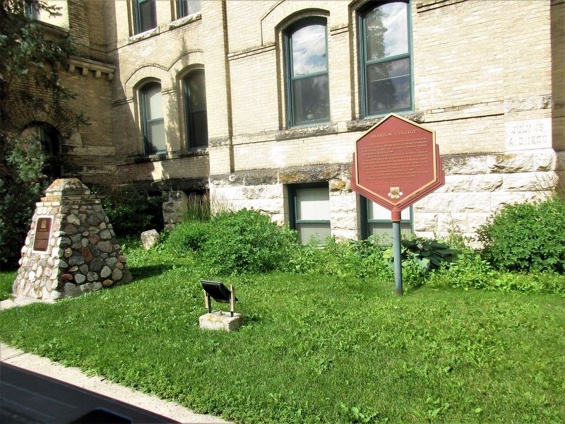
Brandon College Marker
1 ► Manitoba, Brandon — Brandon College —  |
| On 18th Street (National Highway 10) at Lorne Avenue, on the right when traveling south on 18th Street. | |||
| 2 ► Manitoba, Brandon — Brandon Courthouse and Gaol — Palais de Justice et Prison de Brandon — |
| On Victoria Avenue East, on the left when traveling east. | |||
| 3 ► Manitoba, Brandon — Burchill & Howey Block — 908 Rosser Avenue — |
| On Rosser Avenue just west of 9th Street, on the right when traveling east. | |||
| 4 ► Manitoba, Brandon — Central Fire Station #1 — 637 Princess Avenue — |
| On Princess Avenue just west of 6th Street, on the right when traveling west. | |||
| 5 ► Manitoba, Brandon — Coronation Park — |
| On Louise Avenue at Louise Ave., on the left when traveling south on Louise Avenue. | |||
| 6 ► Manitoba, Brandon — Daly House — 122 18th Street — |
| On 18th Street (Provincial Highway 10) just south of Rosser Avenue, on the right when traveling south. | |||
| 7 ► Manitoba, Brandon — Former Merchants Bank Building / Édifice de L'ancienne Merchants Bank — |
| On Rosser Avenue at 11 Street, on the left when traveling east on Rosser Avenue. | |||
| 8 ► Manitoba, Brandon — Paterson-Matheson House — |
| On Louise Avenue at 11 Street, on the right when traveling west on Louise Avenue. | |||
| 9 ► Manitoba, Brandon — Prairie College — 1880- 1883 — |
| On 18th Street (National Highway 10) at Lorne Avenue, on the left when traveling south on 18th Street. | |||
| 10 ► Manitoba, Brandon — Sir Clifford Sifton — 1861-1929 — |
| On 9th Street just north of Victoria Avenue (Provincial Highway 1A), on the left when traveling north. | |||
| 11 ► Manitoba, Brandon — Thomas Mayne Daly — |
| On 18th Street (National Highway 10), on the left when traveling north. | |||
| 12 ► Manitoba, Brokenhead — Holy Trinity Ukrainian Catholic Church — |
| On Parish Highway 84 at Parish Highway 43, on the left when traveling east on Parish Highway 84. | |||
| 13 ► Manitoba, Brokenhead Municipality, Beausejour — The Saints Peter & Paul Parish Community — |
| On Provincial Highway 12, on the right when traveling north. | |||
| 14 ► Manitoba, Brokenhead Municipality, Libau — Dencross Manitoba — 1938- 1970 — |
| On Provincial Trunk Hwy 12 at Provincial Road 317, on the right when traveling south on Provincial Trunk Hwy 12. | |||
| 15 ► Manitoba, Dauphin — Dauphin Railway Station / Gare de Dauphin — |
| On 1 Avenue Northwest, on the left when traveling west. | |||
| 16 ► Manitoba, Dauphin — Ukrainian Catholic Church of the Resurrection / L'Église Catholique Ukrainienne de la Résurrection — |
| On 1 Street Southwest at 11th Av SW when traveling north on 1 Street Southwest. | |||
| 17 ► Manitoba, Emerson – Franklin Municipality, Dominion City — First Railway in Western Canada / Le Premier Chemin de Fer de L'Ouest du Canada — |
| On Centennial Drive, on the left when traveling north. | |||
| 18 ► Manitoba, Emerson – Franklin Municipality, Dominion City — The Fish — |
| On Centennial Drive at Waddell Street, on the left when traveling north on Centennial Drive. | |||
| 19 ► Manitoba, Emerson – Franklin Municipality, Emerson — Emerson Court House and Town Hall — |
| On Church Street at Winnipeg Street, on the right when traveling east on Church Street. | |||
| 20 ► Manitoba, Emerson – Franklin Municipality, Emerson — Fort Dufferin — |
| On Manchester Avenue, on the left when traveling east. | |||
| 21 ► Manitoba, Emerson – Franklin Municipality, Emerson — Pembina - Emerson Area — |
| On Dallas Avenue, on the left when traveling east. | |||
| 22 ► Manitoba, Emerson – Franklin Municipality, Emerson — The March West / La Marche Vers L'ouest |
| On Manchester Avenue, on the right when traveling north. Reported permanently removed. | |||
| 23 ► Manitoba, Gimli — New Iceland — |
| On Second Avenue south of Lady of the Lake Drive, on the left when traveling south. | |||
| 24 ► Manitoba, Lac du Bonnet — Lac du Bonnet Cemetery War Memorial and Honour Rolls — |
| On Smith Road, on the right when traveling west. | |||
| 25 ► Manitoba, Lac du Bonnet, Lac Du Bonnet — Lac Du Bonnet Veterans Memorial — WW I and WWII Honor Rolls — |
| On Park Avenue at Lake Qve., on the left when traveling south on Park Avenue. | |||
| 26 ► Manitoba, Lac du Bonnet — St Mary’s Polish Catholic Church — |
| On McArthur Ave at Fifth Street, on the right when traveling south on McArthur Ave. | |||
| 27 ► Manitoba, Lac du Bonnet — Winnipeg River — Assiniboia Boundary - 1811 — Manitoba - The Postage Stamp Province - 1870 — |
| On Provincial Road 313 (Provincial Highway 313), on the left when traveling east. | |||
| 28 ► Manitoba, Lac du Bonnet Municipality, Allegra — St. Thomas the Apostle Roman Catholic Church (1936 - 1994) — |
| On Foxlane Road (Parish Highway 82) at Allegra Rd (Parish Highway 48E), on the right when traveling east on Foxlane Road. | |||
| 29 ► Manitoba, Lac du Bonnet Municipality, Lowland — St. John the Baptist Ukrainian Catholic Church — |
| On Lowland Road (Parish Highway 84) at Allegra Road (Parish Highway 43), on the left when traveling east on Lowland Road. | |||
| 30 ► Manitoba, Lac du Bonnet Municipality, Seven Sisters Falls — First Airmail / James Richardson / Bush Pilots — |
| On Park Avenue at Third St., on the left when traveling south on Park Avenue. | |||
| 31 ► Manitoba, Municipality of Russell – Binscarth Municipality, Binscarth — Binscarth Colony Farm — |
| On Russell Street at 4 Avenue, on the left when traveling north on Russell Street. | |||
| 32 ► Manitoba, Municipality of Russell – Binscarth Municipality, Binscarth — St Matthew's Anglican Church — |
| On Russell Street near 4th Avenue, on the left when traveling north. | |||
| 33 ► Manitoba, Municipality of Russell – Binscarth Municipality, Russell — History of the Town of Russell — |
| On Main Street North, on the right when traveling north. | |||
| 34 ► Manitoba, Municipality of WestLake – Gladstone Municipality, Gladstone — Postage Stamp Province — |
| On 5 Street at Queen Street, on the left when traveling west on 5 Street. | |||
| 35 ► Manitoba, Neepawa — Beautiful Plains County Court Building — Le Palais de Justice de Beautiful Plains — |
| On Hamilton Street, on the right when traveling east. | |||
| 36 ► Manitoba, Neepawa — The Beautiful Plains County Court Building — |
| On Hamilton Street, on the left when traveling west. | |||
| 37 ► Manitoba, North Cypress – Langford Municipality, Camp Hughes — Camp Hughes — |
| Near Camp Hughes Road (Road 91 W) 1.6 kilometers south of Provincial Road 351. | |||
| 38 ► Manitoba, North Cypress – Langford Municipality, Camp Hughes — Camp Hughes — Overview / Tour d'horizon du Camp Hughes — |
| On Camp Hughes Road (Road 91 W) 1 kilometer south of Provincial Road 351, on the right when traveling south. | |||
| 39 ► Manitoba, North Cypress – Langford Municipality, Camp Hughes — Camp Hughes / Le Camp Hughes — |
| Near Camp Hughes Road (Road 91 W) 1.6 kilometers south of Provincial Road 351. | |||
| 40 ► Manitoba, North Cypress – Langford Municipality, Camp Hughes — Camp Hughes National Historic Site of Canada / Le camp Hughes Lieu historique national du Canada — |
| Near Camp Hughes Road (Road 91 W) 1.6 kilometers south of Provincial Road 351. | |||
| 41 ► Manitoba, North Cypress – Langford Municipality, Camp Hughes — Camp Hughes Railway Station / Depot / Railhead Area — Gare / dépôt / terminal ferroviaire du Camp Hughes — |
| On Camp Hughes Road (Road 91 W) 1 kilometer south of Provincial Road 351, on the left when traveling south. | |||
| 42 ► Manitoba, North Cypress – Langford Municipality, Camp Hughes — Camp Life / La vie de camp — |
| Near Camp Hughes Road (Road 91 W) 1.6 kilometers south of Provincial Road 351. | |||
| 43 ► Manitoba, North Cypress – Langford Municipality, Camp Hughes — Headquarters, Administration and Logistics Area — Le quartier général et la zone administrative et logistique — |
| On Camp Hughes Road (Road 91 W) 1 kilometer south of Provincial Road 351, on the left when traveling south. | |||
| 44 ► Manitoba, North Cypress – Langford Municipality, Camp Hughes — The Hospital / L'hôpital — |
| On Camp Hughes Road (Road 91 W) 1.6 kilometers south of Provincial Road 351, on the left when traveling south. | |||
| 45 ► Manitoba, North Cypress – Langford Municipality, Camp Hughes — The Parade Ground / La terrain de parade — |
| On Camp Hughes Road (Road 91 W) 1 kilometer south of Provincial Road 351, on the right when traveling south. | |||
| 46 ► Manitoba, North Cypress – Langford Municipality, Camp Hughes — The Soldier's Recreation / Les moments de loisir des soldats — |
| On Camp Hughes Road (Road 91 W) 1 kilometer south of Provincial Road 351, on the right when traveling south. | |||
| 47 ► Manitoba, North Cypress – Langford Municipality, Camp Hughes — Training For War / L'entraînement de guerre — |
| Near Camp Hughes Road (Road 91 W) 1.6 kilometers south of Provincial Road 351. | |||
| 48 ► Manitoba, North Cypress – Langford Municipality, Camp Hughes — Trench Warfare / La guerre de tranchées — |
| Near Camp Hughes Road (Road 91 W) 1.6 kilometers south of Provincial Road 351. | |||
| 49 ► Manitoba, North Cypress – Langford Municipality, Carberry — Ernest Thompson Seton — (1860-1946) — |
| On Main Street just north of Third Avenue, on the right when traveling north. | |||
| 50 ► Manitoba, Piney — Postage Stamp Province / La Province Timbre-Poste — |
| On Manitoba 89, on the right when traveling north. | |||
| 51 ► Manitoba, Portage la Prairie — Portage la Prairie Public Building / Édifice public de Portage la Prairie — |
| On East Saskatchewan Avenue (National Highway 1A) just west of Royal Road South, on the right when traveling east. | |||
| 52 ► Manitoba, Riding Mountain West Municipality, Inglis — Elevator Five - The Paterson Elevator — Lélévateur numéro cinq - L'élévateur Paterson — |
| On Railway Avenue at Anzac Avenue, on the right when traveling north on Railway Avenue. | |||
| 53 ► Manitoba, Riding Mountain West Municipality, Inglis — Inglis Grain Elevators — |
| On Railway Avenue, on the left when traveling south. | |||
| 54 ► Manitoba, Riding Mountain West Municipality, Inglis — Inglis Grain Elevators — Les Silos-Élévateurs d'Inglis — |
| On Anzac Avenue, on the right when traveling north. | |||
| 55 ► Manitoba, Riding Mountain West Municipality, Inglis — The Reliance Grain Company - La Reliance Grain Company — The Murphy Foundation - La Murphy Foundation — |
| On Railway Avenue, on the right when traveling north. | |||
| 56 ► Manitoba, Sagkeeng First Nation Reservation, Fort Alexander — Fort Maurepas — Fort Alexander — |
| On Southshore Road (Provincial Highway 11), on the left when traveling south. | |||
| 57 ► Manitoba, Sagkeeng First Nation Reservation, Powerview-Pine Falls — Pine Falls Veterans Memorial — WW II Honor Roll — |
| On Pine Street (Provincial Highway 11) at Tamarack Street, in the median on Pine Street. | |||
| 58 ► Manitoba, Saint Andrews — St. Andrew’s Rectory — |
| On River Road (Provincial Highway 238) at St. Andrew's Road (Provincial Highway 410), on the left when traveling north on River Road. | |||
| 59 ► Manitoba, Saint Andrews — St. Andrews Anglican Church — |
| On River Road (Provincial Highway 238) at St. Andrews Road (Provincial Highway 410), on the left when traveling north on River Road. | |||
| 60 ► Manitoba, Saint Andrews — Twin Oaks — |
| On River Road (Provincial Highway 238), on the right when traveling north. | |||
| 61 ► Manitoba, Saint François Xavier — The Assiniboine River — |
| On Jones Drive, on the right when traveling south. | |||
| 62 ► Manitoba, Saint François Xavier — White Horse Plain — |
| On Jones Drive, on the right when traveling north. | |||
| 63 ► Manitoba, Sifton Municipality, Oak Lake — The RM of Sifton and Area — Our Home and Native Land — |
| On North Railway Street just west of 2nd Avenue West, on the left when traveling west. | |||
| 64 ► Manitoba, St. Andrews Municipality, Gimli — St. Andrews Caméré Curtain Dam — |
| On River Road (Provincial Highway 238), on the right when traveling north. | |||
| 65 ► Manitoba, St. Andrews Municipality, Lockport — Duncan McRae — 1813-1898 — |
| On Provincial Trunk Highway 9, on the right when traveling north. | |||
| 66 ► Manitoba, St. François Xavier Municipality, Saint Eustache — Dominion Lands Survey System — |
| On Transcanada Highway (National Route 1) 2.4 kilometers east of Manitoba Highway 26, on the right when traveling west. | |||
| 67 ► Manitoba, Stuartburn, Gardenton — St Michael's Ukrainian Orthodox Church — |
| On Road 32 East when traveling south. | |||
| 68 ► Manitoba, Stuartburn Municipality, Gardenton — St. Michael’s Ukrainian Orthodox Church — |
| Near Manitoba Route 209 near Highway 209. | |||
| 69 ► Manitoba, Virden — Municipal Building and Auditorium / Immeuble Municipal et Auditorium — |
| On Wellington Street West west of 7 Avenue S, on the right when traveling west. | |||
| 70 ► Manitoba, Virden — Past / Present — Verdin Welcomes You — |
| On 6 Avenue South just south of Nelson Street West, on the left when traveling south. | |||
| 71 ► Manitoba, Virden — The Fifty-Millionth Barrel of Crude Oil — Province of Manitoba — 1951-1964 — |
| On Wellington Street West just east of 8th Avenue South, on the right when traveling east. | |||
| 72 ► Manitoba, Virden — Virden's Oil Heritage — |
| On Lyons Street West just east of 8th Avenue South, on the right when traveling east. | |||
| 73 ► Manitoba, Wallace – Woodworth Municipality, Elkhorn — Elkhorn Veterans Memorial — 1914 - 1918 — |
| On Richhill Avenue (County Highway 66N) at Cavendish Street (County Highway 256), on the left when traveling west on Richhill Avenue. | |||
| 74 ► Manitoba, Wallace – Woodworth Municipality, Kirkella — A.C. Emmett and the Development of Manitoba's Highways — A.C. Emmett et le développement du réseau routier du Manitoba — |
| Near Trans-Canada Highway (National Highway 1) 0.6 kilometers east of Provincial Highway 542, on the right when traveling east. | |||
| 75 ► Manitoba, West Interlake Municipality, Oakview — Origin of the Name "Manitoba" — |
| On Skinny Dip Drive, on the left when traveling west. | |||
| 76 ► Manitoba, West Saint Paul, West St Paul, Middlechurch — St. Paul's Middlechurch — 1825 — |
| On Balderstone Road, on the left when traveling east. | |||
| 77 ► Manitoba, Whitehead Municipality, Kemnay — Kemnay Pioneer Memorial — |
| On Sandison Street at Provincial Highway 1A, on the right when traveling south on Sandison Street. | |||
| 78 ► Manitoba, Winnipeg — The Five Saint Boniface Cathedrals — |
| On Tache Avenue 0.1 kilometers south of Avenue de la Cathedrale, on the right when traveling north. | |||
| 79 ► Manitoba, Winnipeg, Assiniboine Park — Hartley T. Richardson — LVO, O.C., O.M., LL.D. — |
| On Pavilion Crescent. | |||
| 80 ► Manitoba, Winnipeg, Assiniboine Park — Order of Manitoba / Ordre du Manitoba — |
| On Locomotive Drive. | |||
| 81 ► Manitoba, Winnipeg, Broadway - Assiniboine — Ambroise-Didyme Lépine — 1840-1923 — |
| Near Main Street (Trans-Canada Highway) (Provincial Highway 1) just south of Broadway, on the right when traveling south. | |||
| 82 ► Manitoba, Winnipeg, Broadway - Assiniboine — Bonnycastle Park — |
| Near Assiniboine Avenue at Garry Street, on the right when traveling east. | |||
| 83 ► Manitoba, Winnipeg, Broadway - Assiniboine — Dr. Amelia Yeomans / Le Docteur Amelia Yeomans — 1842-1913 — |
| On Broadway (Trans-Canada Highway) (Provincial Highway 1) just west of Donald Street, on the left when traveling west. | |||
| 84 ► Manitoba, Winnipeg, Broadway - Assiniboine — Fort Garry — |
| Near Main Street (Trans-Canada Highway) (Provincial Highway 1) just south of Broadway, on the right when traveling south. | |||
| 85 ► Manitoba, Winnipeg, Broadway - Assiniboine — Fort Garry — Fort Edmonton Trail — La Piste de Fort Garry à Fort Edmonton — |
| Near Main Street (Trans-Canada Highway) (Provincial Highway 1) just south of Broadway, on the right when traveling south. | |||
| 86 ► Manitoba, Winnipeg, Broadway - Assiniboine — Government House — |
| On Kennedy Street 0.2 kilometers south of Broadway (Trans-Canada Highway) (Provincial Highway 1), on the right when traveling south. | |||
| 87 ► Manitoba, Winnipeg, Broadway - Assiniboine — Pierre Gaultier de La Vérendrye — 1685-1749 — |
| Near Assiniboine Avenue just west of Main Street (Trans-Canada Highway) (Provincial Highway 1), on the left when traveling west. | |||
| 88 ► Manitoba, Winnipeg, Broadway - Assiniboine — The Fort Garry — Historic Winnipeg — |
| Near Broadway (Trans-Canada Highway) (Provincial Highway 1) just east of Garry Street, on the right when traveling east. | |||
| 89 ► Manitoba, Winnipeg, Broadway - Assiniboine — The Fort Garry Hotel / L'hôtel Fort Garry — |
| Near Broadway (Trans-Canada Highway) (Provincial Highway 1) just east of Garry Street, on the right when traveling east. | |||
| 90 ► Manitoba, Winnipeg, Broadway - Assiniboine — Upper Fort Garry Gateway / Porte d'entrée d'Upper Fort Garry — |
| Near Main Street (Trans-Canada Highway) (Provincial Highway 1) just south of Broadway, on the right when traveling south. | |||
| 91 ► Manitoba, Winnipeg, Central Park — Knox Church — |
| On Qu'Appelle Avenue at Edmonton Street, on the left when traveling east on Qu'Appelle Avenue. | |||
| 92 ► Manitoba, Winnipeg, Central St. Boniface — Chief One Arrow — |
| On Avenue de la Cathedrale just east of Tache Avenue, on the right when traveling east. | |||
| 93 ► Manitoba, Winnipeg, Central St. Boniface — Jean Baptiste La Vérendrye and Jean-Pierre Aulneau — |
| Near Avenue de la Cathedrale just east of Tache Avenue, on the right when traveling east. | |||
| 94 ► Manitoba, Winnipeg, Central St. Boniface — Le Couvent des Soeurs Grises / Grey Nuns' Convent — |
| Near Tache Avenue just north of Rue Despins, on the right when traveling north. | |||
| 95 ► Manitoba, Winnipeg, Central St. Boniface — Les Soeurs Nolin / Nolin Sisters — Pionniers de l'éducation / Pioneers in Education — |
| Near Tache Avenue just north of Rue Despins, on the right when traveling north. | |||
| 96 ► Manitoba, Winnipeg, Central St. Boniface — Sister Marguerite d’Youville / Sœur Marguerite d’Youville — |
| Near Tache Avenue just north of Rue Despins, on the right when traveling north. | |||
| 97 ► Manitoba, Winnipeg, Civic Centre — Abraham Albert Heaps — (1885-1954) — |
| On King Street (Manitoba Route 42) just north of William Avenue, on the right when traveling north. | |||
| 98 ► Manitoba, Winnipeg, Civic Centre — First Salvation Army Meeting West of the Great Lakes — December 12th 1886 — |
| On King Street (Manitoba Route 42) just north of William Avenue, on the right when traveling north. | |||
| 99 ► Manitoba, Winnipeg, Civic Centre — Nicolaus Copernicus / Mikołaj Kopernik — 1473-1973 — |
| On Main Street (Manitoba Route 42/52) just north of James Avenue ( Route 42), on the right when traveling north. | |||
| 100 ► Manitoba, Winnipeg, Civic Centre — Old City Hall — 1883-1886 — Historic Winnipeg — |
| On King Street (Manitoba Route 42) just north of William Avenue, on the right when traveling north. | |||
160 entries matched your criteria. The first 100 are listed above. The final 60 ⊳