427 entries match your criteria. The first 100 are listed. ⊳
Covered Bridges Historical Markers
Wooden bridges were covered to protect the bridge flooring from the elements. It was more economical to re-roof a bridge than to replace the flooring. Concrete and Steel spans replaced covered bridges when they became cheaper to build.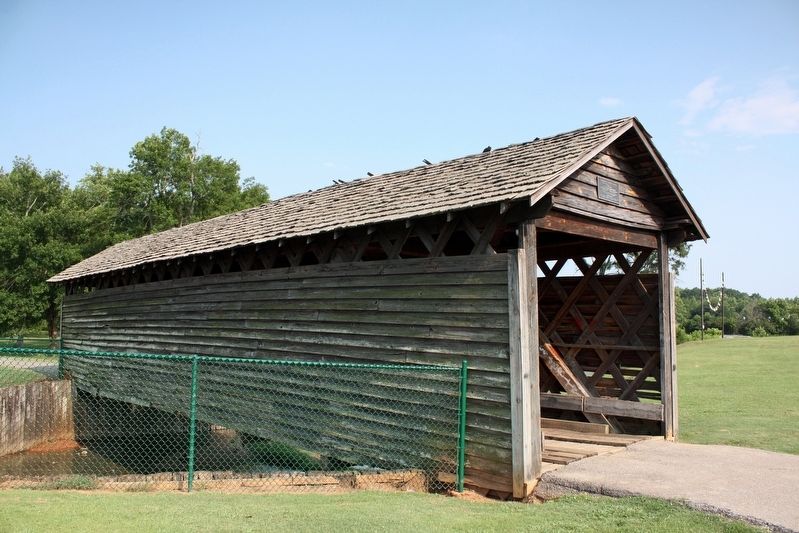
By cmh2315fl via Flickr (CC BY-NC 2.0), June 12, 2011
Coldwater Covered Bridge Marker
1 ► Alabama, Calhoun County, Oxford — Coldwater Covered Bridge —  |
| Near Recreation Drive east of Mc Cullars Lane, on the left when traveling east. | |||
| 2 ► Alabama, Cullman County, Cullman — Clarkson Covered Bridge — Sometimes Called Legg Bridge — |
| Near County Road 1043 west of County Road 1117, on the right when traveling north. | |||
| 3 ► Alabama, Lee County, Opelika — Salem Shotwell Covered Bridge — |
| On Park Road 0.1 miles west of Rocky Brook Road, on the right when traveling west. | |||
| 4 ► Alabama, Sumter County, Livingston — Sumter County's Covered Bridge — |
| On Student Union Drive 0.5 miles south of University Drive, on the right when traveling south. | |||
| 5 ► Alabama, Tallapoosa County, Daviston — Miller Covered Bridge — 1908~1963 — Horseshoe Bend National Military Park — |
| Near Horseshoe Bend Road (Alabama Route 49) 2.1 miles north of Freeman Road, on the left when traveling north. | |||
| 6 ► Alabama, Tuscaloosa County, Northport — Home Guard Defended Covered Bridge / Bridging The Black Warrior River — |
| On Bridge Avenue when traveling south. | |||
| 7 ► Arizona, Navajo County, Pinedale — The Mauretta B. Thomas Pinedale Memorial Bridge — |
| On Pinedale Road 0.5 miles south of Arizona Route 260, on the left when traveling south. | |||
| 8 ► California, Butte County, Chico — Honey Run Covered Bridge / Gold Dredge |
| On Honey Run Road at Centerville Road, on the right when traveling north on Honey Run Road. Reported permanently removed. | |||
| 9 ► California, Nevada County, Penn Valley — 390 — Bridgeport (Nyes Crossing) Covered Bridge — Bridgeport Historic District |
| Near Pleasant Valley Road. Reported permanently removed. | |||
| 10 ► California, Nevada County, Penn Valley — Bridgeport Bridge — |
| Near Pleasant Valley Road 7.5 miles north of California Route 20, on the left when traveling north. | |||
| 11 ► California, Nevada County, Penn Valley — Bridgeport Bridge — "Wood’s Crossing" — |
| Near Pleasant Valley Road 7.5 miles north of California Route 20, on the left when traveling north. | |||
| 12 ► California, Nevada County, Penn Valley — 390 — Bridgeport Historic District — |
| Near Pleasant Valley Road 7.5 miles north of California Route 20, on the left when traveling north. | |||
| 13 ► California, Santa Cruz County, Felton — 583 — Felton Covered Bridge — |
| Near Covered Bridge Road 0.5 miles south of Graham Hill Road. | |||
| 14 ► California, Santa Cruz County, Felton — Roaring Camp Covered Bridge — |
| Near North Big Trees Park Road. | |||
| 15 ► California, Stanislaus County, Knights Ferry — 347 — Knight's Ferry — ← 1 Mile — |
| On California Route 120 0.3 miles east of Sonora Road, on the right when traveling west. | |||
| 16 ► California, Stanislaus County, Knights Ferry — 347 — Knight's Ferry — ← 1 Mile — |
| On State Highway 120 at milepost 16.4 at Kennedy Road, on the left when traveling west on State Highway 120. | |||
| 17 ► California, Stanislaus County, Knights Ferry — Knight's Ferry Bridge — National Historic Landmark — |
| Near Covered Bridge Road east of Sonora Road (Main Street), on the right when traveling east. | |||
| 18 ► California, Stanislaus County, Knights Ferry — Knights Ferry Covered Bridge — |
| Near Knights Ferry Road. | |||
| 19 ► California, Stanislaus County, Roberts Ferry — Roberts Ferry History Walk — |
| On Roberts Ferry Road 0.2 miles south of Yosemite Boulevard ( Highway 132). | |||
| 20 ► California, Yuba County, Camptonville — Marysville to Virginia City in 32 Hours — 49 Miles Along Highway 49 — |
| On Alleghany Ridge Road at Highway 49, on the right when traveling north on Alleghany Ridge Road. | |||
| 21 ► California, Yuba County, Camptonville — Oregon Creek Covered Bridge — |
| On Alleghany Ridge Road. | |||
| 22 ► Connecticut, Lower Connecticut River Valley Region, Colchester — Comstock Covered Bridge / Comstock Covered Bridge and the Evolution of Timber-Truss Engineering — Built in 1873 by the Towns of Colchester and East Hampton — |
| On Colchester Avenue (Connecticut Route 16) at Browns Mill Road, on the right when traveling north on Colchester Avenue. | |||
| 23 ► Delaware, New Castle County, Hockessin, Mill Creek Hundred — Ashland Bridge — Red Clay Creek — Listed on National Register of Historic Places – 1973 — |
| On Barley Mill Road, on the right when traveling north. | |||
| 24 ► Delaware, New Castle County, Wilmington, Christiana Hundred — Smith's Bridge — Brandywine Creek — |
| On Smith's Bridge Road 0.1 miles west of Creek Road, on the right when traveling east. | |||
| 25 ► Delaware, New Castle County, Wilmington, Christiana Hundred — Smith's Bridge — Brandywine Creek — |
| On Smithbridge Road, on the right when traveling west. | |||
| 26 ► Delaware, New Castle County, Wilmington, Wooddale — Wooddale Bridge — Red Clay Creek — |
| On Foxhill Lane at West Rolling Mill Rd, on the right when traveling north on Foxhill Lane. | |||
| 27 ► Florida, Broward County, Coral Springs — F-517 — Coral Springs Covered Bridge — |
| On Northwest 95th Avenue south of Wiles Road, on the left when traveling south. | |||
| 28 ► Georgia, Athens-Clarke County, Athens — A View to History — Broad St. Where the University of Georgia & Athens Meet — |
| On East Broad Street east of First Street, on the right when traveling east. | |||
| 29 ► Georgia, Athens-Clarke County, Athens — River Overview — The Mill Bridge — |
| Near East Broad Street east of Wilkerson Street, on the right. | |||
| 30 ► Georgia, Banks County, Maysville — The Hurricane Shoals Covered Bridge — |
| On Hurricane Shoals Park Road 0.1 miles south of Wheeler Cemetery Road, on the right when traveling south. | |||
| 31 ► Georgia, Bartow County, Euharlee — 8-1 — Euharlee Creek Covered Bridge — |
| On Covered Bridge Road SW 0.1 miles west of Covered Bridge-Stilesboro Road SW, on the right when traveling west. | |||
| 32 ► Georgia, Clay County, Fort Gaines — The Old Lattice Bridge — |
| On Bluff Street south of Commerce Street, on the right when traveling south. | |||
| 33 ► Georgia, Cobb County, Smyrna — Concord Covered Bridge — |
| On Concord Road Southwest 0.2 miles east of East-West Connector, on the right when traveling west. | |||
| 34 ► Georgia, DeKalb County, Stone Mountain — Covered Bridge — |
| On Covered Bridge Lane. | |||
| 35 ► Georgia, Early County, Blakely — Covered Bridge 2 Mi. — <-----<<< — |
| On Columbia Highway (Georgia Route 62) at Old River Road, on the right when traveling west on Columbia Highway. | |||
| 36 ► Georgia, Early County, Hilton — 49-1 — Coheelee Creek Covered Bridge |
| On Old River Road at Fanny Askew Williams Park Entrance, on the left when traveling north on Old River Road. Reported damaged. | |||
| 37 ► Georgia, Early County, Hilton — Coheelee Creek Covered Bridge / Fannie Askew Williams Park — |
| Near Old River Road. | |||
| 38 ► Georgia, Forsyth County, Cumming — 58-1 — Poole's Mill Covered Bridge — |
| Near Old Poole's Mill Road 0.2 miles north of Heardsville Circle, on the right when traveling south. | |||
| 39 ► Georgia, Franklin County, Royston — 59-3 — Cromer's Mill Covered Bridge — |
| Near Baker Road south of Cromers Bridge Road when traveling south. | |||
| 40 ► Georgia, Fulton County, Roswell — The History of Vickery Creek and the Covered Bridge — Old Mill Park — |
| Near Mill Street 0.3 miles east of Atlanta Street, on the right when traveling south. | |||
| 41 ► Georgia, Meriwether County, Edman — 99-2 — Red Oak Creek Covered Bridge — |
| On Covered Bridge Road 0.2 miles east of Dan Stribling Road, on the right when traveling north. | |||
| 42 ► Georgia, Muscogee County, Columbus — Horace King — Master Builder — |
| On Chattahoochee Riverwalk, on the left when traveling south. | |||
| 43 ► Georgia, Oconee County, Watkinsville — 108-1 — Elder Mill Covered Bridge — |
| On Elder Mill Road 0.3 miles north of Saxon Road, on the right when traveling north. | |||
| 44 ► Georgia, Oglethorpe County, Comer — 109-8 — Watson Mill Bridge — |
| On Watson Mill Road at Whitsel Hollow Road, on the left when traveling west on Watson Mill Road. | |||
| 45 ► Georgia, Oglethorpe County, Smithonia — 109-2 — Howard's Covered Bridge — |
| Near Chandler Silver Road (County Route 311) at Smithonia Road. | |||
| 46 ► Georgia, Troup County, LaGrange — Horace King 1807-1885 — |
| On West Mulberry Street east of Douglas Street, on the left when traveling west. | |||
| 47 ► Georgia, Troup County, LaGrange — Horace King Bridge Builder — |
| On Greenville Street at Horace King Street, on the right when traveling east on Greenville Street. | |||
| 48 ► Georgia, Upson County, Thomaston — Auchumpkee Creek Bridge — |
| Near Allen Road 0.2 miles west of Wilmot Mill Road, on the left when traveling east. | |||
| 49 ► Georgia, White County, Sautee Nacoochee — 154-1 — Stovall Mill Covered Bridge — |
| On Georgia Route 255 3 miles Route 17, on the right when traveling north. | |||
| 50 ► Illinois, Cumberland County, Greenup — "The Road that Built the Nation" — |
| On Cumberland Road north of U.S. 40, on the right when traveling east. | |||
| 51 ► Illinois, Cumberland County, Greenup — Cumberland County Covered Bridge — |
| On Cumberland Road north of U.S. 40, on the right when traveling east. | |||
| 52 ► Illinois, Cumberland County, Greenup — Old to New: Bridges over the Embarras River — |
| On Cumberland Road north of U.S. 40, on the right when traveling east. | |||
| 53 ► Illinois, Cumberland County, Toledo — Construction of the Cumberland County Covered Bridge — |
| On Cumberland Road 0.9 miles west of Mill Road, on the right when traveling east. | |||
| 54 ► Illinois, Henderson County, Gladstone — Henderson County Covered Bridge — |
| On Illinois Route 104 north of Dnr Road, on the right when traveling north. | |||
| 55 ► Illinois, Randolph County, Chester — Mary's River Covered Bridge — |
| Near Illinois Route 150 0.2 miles south of Briarhill Road. | |||
| 56 ► Illinois, Shelby County, Cowden — Thompson Mill Bridge — |
| On 1790 East west of 1740 East, on the right when traveling south. | |||
| 57 ► Indiana, Carroll County, Cutler — Adams Mill — |
| On County Road S75E north of Road E500S, on the left when traveling north. | |||
| 58 ► Indiana, Carroll County, Delphi — Bicentennial Garden — Wabash and Erie Canal Park Trail — Wabash & Erie Canal Park Village — |
| Near West North Washington Street just east of Charles Street, on the right when traveling east. | |||
| 59 ► Indiana, Carroll County, Owasco — Lancaster Covered Bridge — |
| On South 500 West 0.5 miles north of West 600 South, on the right when traveling north. | |||
| 60 ► Indiana, Dearborn County, Guilford — Guilford Covered Bridge — |
| Near Main Street. | |||
| 61 ► Indiana, Decatur County, Westport — Westport Covered Bridge — |
| On W. Layton Drive north of County Road W1100S, on the right when traveling west. | |||
| 62 ► Indiana, DeKalb County, Spencerville — 17.1996.1 — Spencerville Covered Bridge — |
| On County Road 68 west of County Road 57, on the right when traveling west. | |||
| 63 ► Indiana, Fayette County, Connersville — The Longwood Covered Bridge — |
| Near Park Road (Indiana Route 1) just south of East 28th Street, on the right when traveling north. | |||
| 64 ► Indiana, Franklin County, Metamora — Metamora to Twin Locks: along the trail — Whitewater Canal Trail — |
| On Pennington Road at Whitewater Canal Trail, on the right when traveling east on Pennington Road. | |||
| 65 ► Indiana, Franklin County, Rockdale — 24.2005.1 — Snow Hill Covered Bridge — |
| On Snow Hill Road 0.1 miles west of Johnson Fork Road, on the right when traveling west. | |||
| 66 ► Indiana, Grant County, Matthews — Covered Bridge — |
| On 4th Street south of High Street, on the right when traveling east. | |||
| 67 ► Indiana, Grant County, Matthews — Cumberland Covered Bridge — |
| Near 3rd Street at Front Street, on the right when traveling north. | |||
| 68 ► Indiana, Grant County, Matthews — This Covered Bridge — |
| On North 3rd Street (County Road 1000E) at Front Street, on the left when traveling north on North 3rd Street. | |||
| 69 ► Indiana, Greene County, Bloomfield — 28.1998.1 — Richland-Plummer Creek Covered Bridge — |
| On S. Baseline Road (County Road 25 E) 1.2 miles north of County Road 300 S, on the left when traveling north. | |||
| 70 ► Indiana, Hamilton County, Noblesville — 29.2007.1 — Potter's Covered Bridge — |
| On Allisonville Road, on the right when traveling west. | |||
| 71 ► Indiana, Hamilton County, Noblesville — White River Greenway — Potter's Bridge: Spanning Through Time — |
| On Allisonville Avenue at Covered Bridge Way, on the right when traveling west on Allisonville Avenue. | |||
| 72 ► Indiana, Howard County, Kokomo — Vermont Bridge — 1875 — |
| On Old Ben Drive at Country Club Drive, on the right when traveling west on Old Ben Drive. | |||
| 73 ► Indiana, Jackson County, Medora — Medora Covered Bridge — |
| Near State Road 235. | |||
| 74 ► Indiana, Jackson County, Seymour — Shieldstown Bridge — |
| On East County Road 200 North. | |||
| 75 ► Indiana, Marion County, Indianapolis, Downtown — Parke County — Organized in 1821 — Named for Benjamin Parke — |
| Near North Blackford Street north of Indianapolis Cultural Trail, on the right when traveling north. | |||
| 76 ► Indiana, Montgomery County, Darlington — 54.1993.1 — Darlington Covered Bridge — |
| On County Road E 500N at County Road N 575E, on the right when traveling east on County Road E 500N. | |||
| 77 ► Indiana, Owen County, Cloverdale — 60.2008.1 — Cataract Falls Covered Bridge — |
| Near N. Cataract Road at Owen Park Road, on the right when traveling west. | |||
| 78 ► Indiana, Owen County, Cloverdale — The Cataract Covered Bridge — |
| Near N. Cataract Road at Owen Park Road. | |||
| 79 ► Indiana, Parke County, Annapolis — Wilkins Mill Covered Bridge — 1906 — Indiana's Historic Pike County, The Covered Bridge Category — |
| On Cox Ford Road 0.2 miles U.S. 41, on the left when traveling east. | |||
| 80 ► Indiana, Parke County, Howard — Mill Creek Covered Bridge — 1907 — Indiana's Historic Parke County, The Covered Bridge Capital — |
| On Tow Path Road 0.1 miles north of Brook Road (County Road 248), on the right when traveling north. | |||
| 81 ► Indiana, Parke County, Nyesville — State Sanatorium Covered Bridge — |
| On County Road 100 N east of Adams Road (County Road 349), on the right when traveling east. | |||
| 82 ► Indiana, Parke County, Rockville — 1883 Railroad Depot — |
| On East Ohio Street (U.S. 36) at Constitution Street on East Ohio Street. | |||
| 83 ► Indiana, Parke County, Roseville — 61.1966.3 — Roseville — |
| On County Road S325W north of County Road S550W, on the right when traveling north. | |||
| 84 ► Indiana, Parke County, Waveland — 61.1998.1 — Portland Mills Covered Bridge — |
| On County Road E 650N at Saddle Club Road, on the right when traveling east on County Road E 650N. | |||
| 85 ► Indiana, Putnam County, Bainbridge — Hillis Bridge — |
| On East County Road 650 North. | |||
| 86 ► Indiana, Spencer County, Fulda — Huffman Mill Bridge 1864-65/Pioneer George Huffman — |
| On Huffman Mill Road. | |||
| 87 ► Indiana, Vermillion County, Eugene — 83.1995.2 — Eugene Covered Bridge — |
| Near North Main Street. | |||
| 88 ► Indiana, Vermillion County, Newport — 83.1995.1 — Newport Covered Bridge — |
| On County Road 50 (AKA: Hopkins Street) 0.6 miles State Road 63, on the right when traveling west. | |||
| 89 ► Indiana, Wabash County, Roann — Roann Covered Bridge — 1877 — |
| On North Chippewa Street just south of Roann Lukens Lake Road (Local Road N700W), on the left when traveling south. | |||
| 90 ► Iowa, Madison County, Winterset — Cedar Covered Bridge — |
| On Cedar Bridge Road 1.8 miles north of Iowa Highway 92, on the left when traveling north. | |||
| 91 ► Iowa, Madison County, Winterset — Cutler-Donahoe Covered Bridge - 1870 — |
| On South 9th Street, on the right when traveling south. | |||
| 92 ► Iowa, Madison County, Winterset — Hogback Covered Bridge — |
| On Hogback Bridge Road, on the left when traveling north. | |||
| 93 ► Iowa, Madison County, Winterset — Middle River Water Trail — Holliwell Covered Bridge (eventually to Bevington) — |
| On Holliwell Bridge Road, on the right when traveling east. | |||
| 94 ► Iowa, Madison County, Winterset — Middle River Water Trail — Roseman Covered Bridge to Pammel Park — |
| On Elderberry Avenue south of Roseman Bridge Road, on the right when traveling south. | |||
| 95 ► Iowa, Madison County, Winterset — Roseman Covered Bridge — |
| On Elderberry Avenue south of Roseman Bridge Road, on the right when traveling south. | |||
| 96 ► Iowa, Polk County, Des Moines, Bloomfield/Allen — Owen's Covered Bridge — |
| Near Easter Lake Drive at Southeast 28th Street. | |||
| 97 ► Kentucky, Bourbon County, Paris — 1566 — Colville Covered Bridge / Covered Bridges — |
| On Colville Road (Kentucky Route 3118) north of Endicott Lane, on the right when traveling north. | |||
| 98 ► Kentucky, Bracken County, Brooksville, Woolcott — 1565 — Walcott Covered Bridge / Covered Bridges — |
| On Woolcott Road 0.1 miles east of Wellsburg Walcott Road ( Route 1159) when traveling east. | |||
| 99 ► Kentucky, Fleming County, Grange City — 1569 — Grange City Covered Bridge — |
| On Kentucky Route 111 at City Road, on the left when traveling north on Kentucky Route 111. | |||
| 100 ► Kentucky, Fleming County, Hillsboro — 1568 — Ringos Mill Covered Bridge — |
| On Ringos Mills Road (Kentucky Route 158) at Rawlings Road, on the left when traveling east on Ringos Mills Road. | |||
427 entries matched your criteria. The first 100 are listed above. Next 100 ⊳