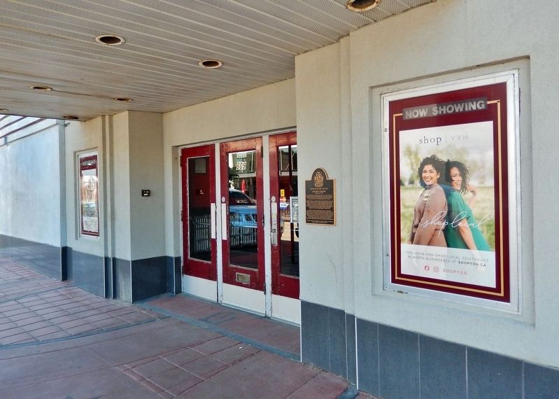
An icon of Medicine Hat’s entertainment history, the Monarch Theatre is a two-storey Streamline Moderne-style building. Connected to buildings of similar scale and vintage, it is distinctive for its boxed massing, smooth stucco surfaces, and . . . — — Map (db m206913) HM
River Road was the brainchild of Allan Gunter City Engineer. Before his plan received approval, those in opposition to it dubbed it "Gunter's Folly," predicting that it would wash away and be a waste of taxpayers money. However, the plan was . . . — — Map (db m206575) HM
This is the original site of Medicine Hat’s first radio station “1270 CHAT AM.” CHAT AM signed on-air November 1, 1946 and continues to serve Medicine Hat and surrounding area. For the past fifty years CHAT AM has been broadcasting on a frequency . . . — — Map (db m206682) HM
St. John’s Presbyterian Church is a brick and sandstone structure executed in Gothic Revival style with a prominent corner square tower and octagonal pinnacle which frame the main façade with its gothic arch windows. The front façade is largely . . . — — Map (db m206995) HM
[English] Built in 1912-1914, this church is a fine example of the Gothic Revival style, long favoured for ecclesiastical design in Canada. Gothic Revival churches were inspired by those of medieval Europe in plan, composition, and . . . — — Map (db m206552) HM
Between 1912 and 1989 over a dozen different pottery companies operated in Medicine Hat and Redcliff. The availability of natural gas, suitable clay deposits nearby, and a location on the CPR mainline, were major factors in locating pottery . . . — — Map (db m205412) HM
Central School was built in June of 1887 to accommodate the nearly 100 children of Medicine Hat. Built over six lots on Toronto Street at cost of $3,000, the school opened in 1889, with only the bottom portion of the building occupied. The school . . . — — Map (db m206574) HM
[English] The Province of Alberta, formerly part of the North-West Territories, was created on 1 September, 1905, and inaugurated at Edmonton on that same day by Governor General Earl Grey and Prime Minister Sir Wilfred Laurier. . . . — — Map (db m206184) HM
The 1909 Strathcona City Council had to make a decision. Where do they house the volunteer fire department? After much spirited debate they decided that the old fire hall was not worth repairing and a new one should be built. The citizens agreed. . . . — — Map (db m197048) HM
Originally known as Strathcona Fire Hall Number 1, this structure is the last remaining example of a pre First World War fire hall in Edmonton. Designed by Arthur G. Wilson and David E. Herrald, the hall was built by contractor James M. Eaton at a . . . — — Map (db m197047) HM
This was the first public library building in Edmonton. The Carnegie Foundation offered to build a library of a specified size and shape; this did not meet the requirements of the citizens of Strathcona, who refused the offer and instead financed . . . — — Map (db m197046) HM
[English] Construction of a bridge across the North Saskatchewan River was first proposed by the Canadian Pacific Railway in 1905. After extended negotiations with the government and the cities of Edmonton and Strathcona, . . . — — Map (db m197052) HM
[English] Partner in the North West Company, Chief Factor of the Hudson's Bay Company, Rowand of Fort Edmonton was reputed to be "the most influential white man among the wild tribes of the plains". Admired for his courage and . . . — — Map (db m220698) HM
This plant, which was critical to the development of the Turner Valley oil field, is the earliest gas processing facility built in Canada and the only survivor of its type. The present complex was begun in 1921 after a fire destroyed the original . . . — — Map (db m8825) HM
Turner Valley is Alberta’s first great oilfield. Initially the field, which began production in 1914, yielded mainly natural gas. Local plants, which provided the only extensive gas-processing system in the province, extracted the marketable . . . — — Map (db m9204) HM
Fort Saskatchewan, constructed in 1875, was the first North West Mounted Police Post built in northern Alberta. As a center of law enforcement in the area it was, from 1885 until 1913, the headquarters of “G” Division. This cairn was erected in . . . — — Map (db m212479) HM
Constructed in 1974as an Alberta-R.C.M.P. Centennial project by the Knights of Columbus and the Catholic Women’s League of Fort Saskatchewan to commemorate the part that the North West Mounted Police, the native peoples, the first settlers and the . . . — — Map (db m212495) HM
The first missionaries to arrive in this area were the Oblate Fathers from St. Albert who began a mission at Lamoureux in 1875. This mission became a formal parish in 1891 and was later administered by the Franciscan Fathers who established a . . . — — Map (db m212497) HM
Arriving in the Fall of 1872, Joseph and François Lamoureux spent the winter sheltered on the north side of the river across from what is now the City of Fort Saskatchewan. This was the beginning of the first settlement in this area which was later . . . — — Map (db m212498) HM
Centuries ago the many Indian tribes using the North Saskatchewan waterway established a boatbuilding encampment at the mouth of the Sturgeon River. This encampment was commonly known as “Birch Hills” due to the availability of Birch trees for the . . . — — Map (db m212496) HM
This pivot point and two towers are part of the first two water drive pivot systems introduced to Canada by Donald and Wyman Campbell. They arrived in the Burdett area on May 11, 1962 from the Valley Manufacturing Co., Valley, Nebraska, USA. The . . . — — Map (db m201765) HM
Strolling down the aisle, a conductor announces your destination. With steely squeals and a pish-sh-sh-sh of pent up steam, the locomotive glides to a halt. Descending the coach's stairs you step through the mist and arrive at Jasper Station. . . . — — Map (db m108634) HM
[English] Built by William Henry of the North West Company in 1811 to support David Thompson's exploration of the Athabasca Pass, Henry House stood at the head of navigation on the Athabasca River. When the pass became the principal . . . — — Map (db m202599) HM
[English] This building is one of the finest and most influential examples of rustic architecture in Canada’s national parks. Designed by A.M. Calderon and completed in 1914, it introduced a building tradition based on the use of local . . . — — Map (db m197059) HM
[English] In 1862, the Overlanders, numbering about 250, left their homes in Canada for the Cariboo gold fields. They journeyed via Fort Garry and Edmonton, and thence, guided by Indians to the mountains and westward by the . . . — — Map (db m203692) HM
[English] In 1813, the North West Company built Rocky Mountain House on Brûlé Lake as a provision depot for brigades crossing the Athabasca Pass to the Pacific. When Jasper Hawes took command of the post in 1817 it became known as . . . — — Map (db m203680) HM
A preeminent topographical surveyor, Wheeler represented British Columbia on the commission which located and marked the boundary with Alberta between 1913 and 1925. His party surveyed and mapped the 1000 km-long mountain section, using photographs . . . — — Map (db m108876) HM
[English] Born in London, Thompson served both the Hudson's Bay Company (1784-1797) and the North West Company (1797-1815) as trader, explorer and surveyor. One of the world’s great geographers, he accurately mapped the main travel . . . — — Map (db m203686) HM
One of Blackfalds first general stores called "The Pioneer Store"was built by John McKay around 1901. Not only did Mr. McKay do business with the newly arrived homesteaders, he traded with the local natives, baling up many hides to ship every . . . — — Map (db m212446) HM
Ukrainian Settlement The first Ukrainian immigrants to Canada came to this part of Alberta in the early 1890s, fleeing poverty and oppression in their homeland. Taking out homesteads, they gradually cleared the forest to create . . . — — Map (db m204235) HM
The development of this field in 1947 marked a turning point in the history of the Alberta petroleum industry. After the drilling of Leduc No. 1, the geographical focus of the industry shifted from Turner Valley northward to the central plains area, . . . — — Map (db m8856) HM
George Ambrose Liggins was Leduc's first Canadian Pacific Railway stationmaster. In 1891 his family was the second to settle in Telford Place, now known as Leduc. He was instrumental in the development of Leduc's first school, served as a school . . . — — Map (db m213003) HM
On this site in December, 1902, the first bank in Leduc was opened by the Merchants Bank of Canada which later merged with the Bank of Montreal. This plaque commemorates that event and was installed by the Bank to . . . — — Map (db m213002) HM
Mennonites have been moving to Alberta for well over a century. Mennonite settlement stretches back to 1894 when Mennonites from Waterloo County, Ontario, established a settlement at Didsbury. Didsbury’s first building was a narrow log immigrant . . . — — Map (db m201774) HM
In May 1905, Lethbridge signed its largest incentive agreement to bring the CPR's divisional point from (Fort) Macleod to Lethbridge. The City offered the company a 20-year tax exemption on 120 acres (48.6 ha) of land and 200,000 gallons (909,000 L) . . . — — Map (db m196966) HM
Built in 1890 and manned by volunteer firefighters, the structure is the oldest brick fire hall in Alberta. The building was expanded and rebuilt on this site in 1908. Larger doors accommodated new equipment and additional space provided living . . . — — Map (db m196970) HM
The employees of the Alberta Railway & Coal Company founded the “Miners Library” and established the earliest library in Lethbridge. In 1918 the local YMCA provided the first home for the Lethbridge Public Library. As the city grew, the citizens . . . — — Map (db m196972) HM
Rising 307 feet from the valley floor, this bridge, over which runs the Canadian Pacific Railway through the Crows Nest Pass, spans the valley in one mile and forty seven feet. Completed in 1909, it is the longest, highest bridge of its type in the . . . — — Map (db m196961) HM
On October 10th, 1912 the Duke of Connaught, Governor General of Canada, officially opened this building as the “Manual Training School”, the first in the Province of Alberta. Designed by architects H.M. and W.A. Whiddington, they used a combination . . . — — Map (db m196976) HM
[English] This Canadian Pacific Railway viaduct, built between 1907 and 1909 across the Oldman River Valley, was an engineering triumph. More than 1,600 metres long and 95 metres high, this steel structure is the longest and . . . — — Map (db m196963) HM
[English] On August 7, 1919, Captain E.C. Hoy made the first crossing of the Canadian Rockies by air from Vancouver following a route over Vernon, Grand Forks, Cranbrook, and through Crawford Pass. His Canadian-built Curtiss JN-4 . . . — — Map (db m201700) HM
[English] In 1872, on the western bank of the Oldman River at the present site of the Federal Mine, Nicholas Sheran opened the first coal mine in Alberta. He broke his own trails, found his own markets, and hauled coal by ox-team . . . — — Map (db m220697) HM
Lloydminster City Hall is located on the site of the former Meridian School, which was built in 1925. The eastern entrance replicates the original design of the school, re-using the original brick and tyndall stone from the building. R.L. Wilkin . . . — — Map (db m212401) HM
In 1967, Canada’s centennial year, a caravan of motor vehicles travelled from Winnipeg to Vancouver to celebrate the final stages of construction of a new highway through the Rocky Mountains… the Yellowhead. These people were members of the . . . — — Map (db m212400) HM
Old Mannville was a cluster of commercial and residential buildings constructed on land originally homesteaded by Dan McLean. In anticipation of the arrival of the Canadian Northern Railway, J.B. Burch built a store here in 1904, along the . . . — — Map (db m206503) HM
In 1884 Canmore was just a whistle-stop on the newly built Canadian Pacific Railway when two prospectors unearthed black coal on the west side of the Bow River. Two years later, Queen Victoria granted a Charter to mine coal in the Canmore area and . . . — — Map (db m197082) HM
This is a story about the history of this place from the Îyârhe [ee-YAH-hhay]. Îyârhe means “mountain people.” We are a branch of the Sioux/Dakota/Lakota/Nakoda people, who are now called the Stoney Nakoda Nation. When our grandfathers were . . . — — Map (db m203570) HM
As a gateway to a major pass through the Rocky Mountains, the Bow Valley has been a transportation corridor since the time of the early Aboriginal groups, explorers, and fur traders. The arrival of the Canadian Pacific Railway in 1883 and the . . . — — Map (db m203491) HM
In 1875 the Morleyville church was constructed entirely by hand from logs from surrounding timber. John McDougall, his father, his son and schoolmaster Andrew Sibbald labored to construct the church measuring 47' X 26' 7" wide and 21' 8" high. . . . — — Map (db m214299) HM
Chief Crowchild of the Tsuu T'ina people donated this cabin to be used by a caretaker for the church. The cabin was originally an Indian Agent's cabin on the Tsuu T'ina (Sarcee) Reserve west of Calgary. Workers dismantled it to be transported . . . — — Map (db m214301) HM
Robert Rundle introduced the Stoney people to Christian worship during his visit in 1842. Rundle promised to send missionaries to stay with the Stoney people. In 1873, Rev. George McDougall and his wife Elizabeth, along with sons John and . . . — — Map (db m214298) HM
[north tablet]To the Glory of God and in memory of Rev. George Millward McDougall and Rev. John Chantler McDougall, D.D. father and son and their devoted wives. Combined ministry 77 years. Pioneer missionaries of the . . . — — Map (db m214297) HM
The historic church at the end of this pathway was constructed in 1875. At that time native people were still hunting bison on the prairies. The young nation of Canada was only eight years old; the Canadian Pacific Railway still nine years in . . . — — Map (db m214300) HM
After it closed in 1921, the church was neglected until the early 1950s when a group of volunteers began restoration. A group of men from the United Church formed the Morley Church Restoration Society and began fund-raising to restore the . . . — — Map (db m214296) HM
Sacred to the memory of Rev. George MacDougall aged 54 years ——————————— The deceased was for 16 years Chairman of the Wesleyan Missions in the North-West. He lost his way on the prairie about 40 miles east of this place on January 24th . . . — — Map (db m214291) HM
Rev. George McDougall dedicated his life to frontier mission work. As a young man, George became interested in religion and while attending one of his first revival meetings he met a young Quaker girl, Elizabeth Chantler. They were married in . . . — — Map (db m214278) HM
The name "Stoney" is an English translation of their Assiniboine name which means "the people who cook with stones." The Stoney people are a branch of the Siouan Confederacy. They were comparative latecomers to the area and many of the local place . . . — — Map (db m214276) HM
In A History of Grande Cache, renowned Canadian artist Robert Guest described a typical fur cache. "The cache was made from sturdy logs to withstand the severe winter conditions and the predators such as wolverines and bears, which might try . . . — — Map (db m205223) HM
Water flowed through the Brooks Aqueduct every year from 1915 until it was replaced in 1979. The engineers who built the Aqueduct planned a delivery rate of about 900 cubic feet (25 cu. m) of water per second. The Aqueduct never managed it. From the . . . — — Map (db m196947) HM
Getting the water in and out of the Aqueduct wasn't the only challenge. As it marched across the valley it would run smack into the CPR tracks. The Aqueduct as planned was not high enough for trains to go under it. And the construction required to . . . — — Map (db m196952) HM
Many settlers in the Eastern Irrigation Section had a hard time in the 1920s and 1930s. Low grain prices, deteriorating soils from alkali seepage into fields, and inexperience with irrigation farming techniques were some of the problems. Even though . . . — — Map (db m196954) HM
1916 “On April 6 … a camp … was located at the aqueduct for the purpose of tightening and repacking the metal bands at six expansion joints, and also of putting on additional bands … Total cost $160.00.”
1917 “Work was started on . . . — — Map (db m196955) HM
[English] The CPR built this reinforced concrete aqueduct between 1912 and 1914. It was part of a large irrigation scheme using water diverted from the Bow River to transform 55,000 hectares east of Brooks from semi-arid rangeland to farmland . . . — — Map (db m196937) HM
“So he grabbed hold of a pick, he just kind of lifted it up a bit and then drove it right through, right through the bowl. Well, as the pick went through the bowl his hair stood straight up on end, I can assure . . . — — Map (db m196950) HM
In the early 1900s the Canadian Pacific Railroad began construction of a huge irrigation project in Alberta comprising over a million hectares (3 million acres). Part of this original block land grant to the railway is now known as the Eastern . . . — — Map (db m196941) HM
The coming of the railway to Wabamun initiated many changes. Old Wabamun was moved across the lake to its present location. The rails ran through Wabamun in 1909 and a railway station was built. It consisted of office, waiting room, freight and . . . — — Map (db m212500) HM
Who was Maskipeton? He was a Cree, born around 1807. He became chief and led a Cree band that hunted south of today's Edmonton, but that also ranged into Saskatchewan and Montana. He traded into the Missouri River area. He was a warrior, respected . . . — — Map (db m206506) HM
As you look at this structure, covered by a facade of glass and stucco, it's hard to imagine this is Red Deer's oldest building still located on its original site. Known as the Brumpton Store, it is reminiscent of a very different Red Deer — one . . . — — Map (db m206611) HM
At the end of World War II, life was getting back to normal. Soldiers returned home from the battlefields, families were reunited and the strain of wartime was replaced by a tangible feeling of prosperity. Businesses in Red Deer flourished, and the . . . — — Map (db m206759) HM
In the winter of 1890, the arrival of the Calgary and Edmonton Railway brought significant changes to the hamlet of Red Deer. Its strategic location midway between the larger centres positioned Red Deer as a focal point for the distribution of . . . — — Map (db m206609) HM
The smell of food wafting onto the street is as enticing now as it was when George Moon opened his first café in 1916. Had you been a patron of Moon's restaurant in the early years, you would have found that good food, plenty of company and a . . . — — Map (db m206694) HM
Hugh Farthing built this Prairie Vernacular style building in 1939. The main floor was used as his photography studio. The second floor had a six-roomed suite used as his residence. The signage was simply “Farthing’s.” Today the signage font and . . . — — Map (db m206763) HM
Red Deer's population grew rapidly during the Second World War due to the construction of military training camps and the onset of Alberta's energy boom. In response to the city's growth, the Federal Building, which housed the post office, was . . . — — Map (db m197005) HM
Is there a Roman influence in Red Deer? The Greene Block in front of you could make such a claim, as its origins can be traced to a Romanesque revival style of architecture that was pieced together with sandstone blocks from a local quarry. The . . . — — Map (db m206712) HM
In 1935, Mrs. Sadie Collins made the local newspaper when she offered cash to purchase this property on Ross Street. It was unusual for a woman to start a new business venture in the middle of the Great Depression, so Collins made the news several . . . — — Map (db m206778) HM
The October 26, 1955, edition of the Red Deer Advocate stated there would be big changes in downtown Red Deer — the old Horsley Pharmacy building located at this corner would be torn down and a new Horsley Block would take its place. Richard Earl . . . — — Map (db m206841) HM
Mable Lee Fong and Herschell N. Bryant constructed this building in 1947 to house the Paris Cafe. This solid, simply detailed masonry building symbolized post war Red Deer. It replaced a 40 year old structure that had also served as the Paris Cafe. . . . — — Map (db m206876) HM
The austere brick walls and Tyndall limestone columns of the Old Court House convey a sense of awe. This was intentional, as the building's Classical Revival style was meant to give the impression of power and civilization – attributes designed to . . . — — Map (db m197003) HM
Built in 1914 in the Gothic Revival style, the Armoury was constructed as the headquarters of the 35th Central Alberta Horse Regiment. The Armoury served as a recruitment office and training centre for the Department of Militia and Defence for more . . . — — Map (db m197012) HM
[First plaque]
In proud and grateful
remembrance of those
who made the supreme
sacrifice in the wars
1914 – 1918
1939 – 1945
1950 – 1953
[Second plaque]
If ye break faith
with us who die
we shall not sleep . . . — — Map (db m197000) WM
Rev. Dr. Leonard Gaetz, founder of Red Deer, gazes down main street. A Methodist minister from Nova Scotia, Rev. Gaetz came to the Red Deer Valley in 1884. He quickly distinguished himself as a farmer, and became an outstanding and eloquent . . . — — Map (db m206970) HM
Standing at this spot in 1893, you would have heard whinnying horses and seen bustling activity at the North West Mounted Police stable. That year the police detachment moved from Fort Normandeau to the new community of Red Deer, and they built . . . — — Map (db m206882) HM
Looking toward Ross Street on your right, you see the beautiful sandstone structure of the Greene Block. In front of you, the historic brick building connects with the one beside it, stretching all the way down to the corner. These three buildings . . . — — Map (db m206972) HM
Briefly called the Bowness Bridge during its construction in 1910-11, this structure has been known for many years as the Shouldice Bridge. Since its construction, the bridge has provided an invaluable transportation link between Bowness and . . . — — Map (db m196995) HM
Originally Presbyterian, this church was built — and most likely designed — by Andrew and Robert Chapman in 1909 to replace the smaller, white clapboard structure of 1901. The 200-seat church was consecrated in February 1910. In 1925, the members . . . — — Map (db m202496) HM
[English] Atlas No. 3 (1936-1956) played a central role in the coal industry of the Drumheller Valley, a leading area in the production of Canadian coal. The mine employed skilled miners and used mechanized equipment to produce . . . — — Map (db m196996) HM
1912 Coal miners working in the Star Mine crossed the Red Deer River in rowboats.
1919 An aerial cable car system was built, which transported both men & coal from the mine to tipple on this (south) side, The C.N.R. carried the coal . . . — — Map (db m196998) HM
CNR Water Tank History
Heinsburg became a terminal and turn around point for the Canadian National Railway (CNR) Coronado sub-division in the 1920's after the proposed Heinsburg-Frenchman Butte link was cancelled. A water tank was needed at . . . — — Map (db m197045) HM
The turntable was one means of turning steam locomotives and an essential component of the roundhouse complex. It consisted of a revolving bridge, balanced on a centre bearing, in a circular pit. After dumping their fires at the ash pit, locomotives . . . — — Map (db m197013) HM
Every divisional point had an engine house or “shop” as it was commonly referred to. It was in these structures that after each run, steam locomotives were checked, cleaned, and miscellaneous light repairs performed. The “roundhouse,” known as such . . . — — Map (db m197014) HM
The Alberta Company of the Daughters of the Utah Pioneers dedicate this site in the memory of the early Mormon Pioneers who came to Canada in 1903 and settled here. They had the foresight to see that this barren stretch of prairie land, with a lone . . . — — Map (db m202487) HM
In 1897 a rancher drove the first herd of cattle into the Vermilion area, to a site about two miles east of the present day town, but it was only after the region was surveyed in 1902 that significant numbers of settlers from Eastern Canada, . . . — — Map (db m212197) HM
Like many other communities in Alberta, Wainwright is where it is today because of a railway. The Grand Trunk Pacific Railway (GTPR) surveyed the townsite in 1908, forcing the moving of buildings from Denwood 2.5 miles to the new town. Following its . . . — — Map (db m197033) HM
West of Wainwright the railway met a deep challenge, a glorious valley that was home to the Battle River. In 1907, the concrete footings of the bridge that would span the valley were poured. Farmers and other contractors hauled supplies to the site . . . — — Map (db m197037) HM
[World War I plaque]
These went and came not again
In memory of those from
this community who gave
their lives in the Great War.
H.C. Barss • J. Berry • P.A. Conneau • J. Coutts • J. Crompton • A. Dalton • J. Edmonds • J. Elliott • . . . — — Map (db m197042) WM
Old Town Hall is a neo classical two storey brick building built in 1929. Prominent features of this style include the building's symmetrical facade, decorated cornice with dentil detailing and decorate lintels above the window and door openings. . . . — — Map (db m197041) HM
ENGLISH INSCRIPTION
Western Canada’s first producing oil was drilled in this valley at the turn of the 20th century. This success spurred further activity in this area, attracting more drilling and workers. A.P. Patrick, an investor . . . — — Map (db m82965) HM
4545 entries matched your criteria. Entries 101 through 200 are listed above. ⊲ Previous 100 — Next 100 ⊳