By Rev. Ronald Irick, July 19, 2022
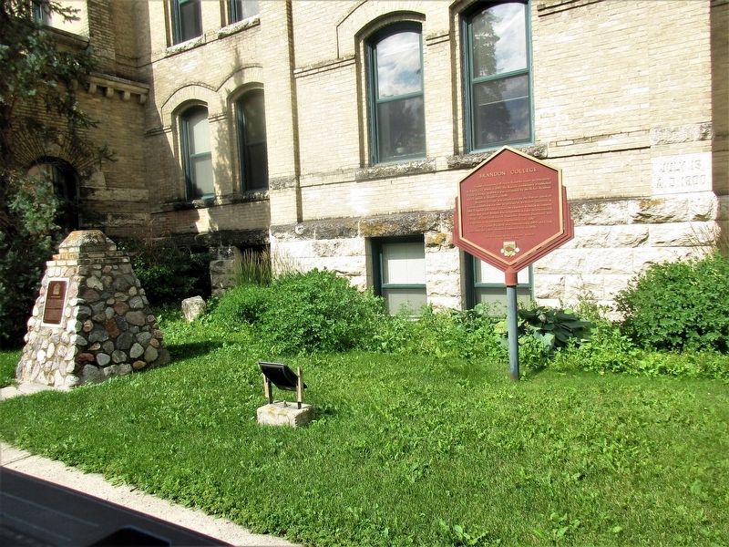
Brandon College Marker
| On 18th Street (National Highway 10) at Lorne Avenue, on the right when traveling south on 18th Street. |
| On Princess Avenue just west of 6th Street, on the right when traveling west. |
| On 18th Street (Provincial Highway 10) just south of Rosser Avenue, on the right when traveling south. |
| On 18th Street (National Highway 10) at Lorne Avenue, on the left when traveling south on 18th Street. |
| On 9th Street just north of Victoria Avenue (Provincial Highway 1A), on the left when traveling north. |
| On 18th Street (National Highway 10), on the left when traveling north. |
| On Parish Highway 84 at Parish Highway 43, on the left when traveling east on Parish Highway 84. |
| On Provincial Highway 317 at Provincial Highway 12, on the right when traveling east on Provincial Highway 317. |
| On Provincial Highway 12, on the right when traveling north. |
| On Louise Avenue at Louise Ave., on the left when traveling south on Louise Avenue. |
| On 1 Street Southwest at 11th Av SW when traveling north on 1 Street Southwest. |
| On Second Avenue south of Lady of the Lake Drive, on the left when traveling south. |
| On Smith Road, on the right when traveling west. |
| On Park Avenue at Lake Qve., on the left when traveling south on Park Avenue. |
| On McArthur Ave at Fifth Street, on the right when traveling south on McArthur Ave. |
| On Provincial Road 313 (Provincial Highway 313), on the left when traveling east. |
| On Foxlane Road (Parish Highway 82) at Allegra Rd (Parish Highway 48E), on the right when traveling east on Foxlane Road. |
| On Park Avenue at Third St., on the left when traveling south on Park Avenue. |
| Near Camp Hughes Road (Road 91 W) 1.6 kilometers south of Provincial Road 351. |
| On Camp Hughes Road (Road 91 W) 1 kilometer south of Provincial Road 351, on the right when traveling south. |
| Near Camp Hughes Road (Road 91 W) 1.6 kilometers south of Provincial Road 351. |
| Near Camp Hughes Road (Road 91 W) 1.6 kilometers south of Provincial Road 351. |
| On Camp Hughes Road (Road 91 W) 1 kilometer south of Provincial Road 351, on the left when traveling south. |
| Near Camp Hughes Road (Road 91 W) 1.6 kilometers south of Provincial Road 351. |
| On Camp Hughes Road (Road 91 W) 1 kilometer south of Provincial Road 351, on the left when traveling south. |
| On Camp Hughes Road (Road 91 W) 1.6 kilometers south of Provincial Road 351, on the left when traveling south. |
| On Camp Hughes Road (Road 91 W) 1 kilometer south of Provincial Road 351, on the right when traveling south. |
| On Camp Hughes Road (Road 91 W) 1 kilometer south of Provincial Road 351, on the right when traveling south. |
| Near Camp Hughes Road (Road 91 W) 1.6 kilometers south of Provincial Road 351. |
| Near Camp Hughes Road (Road 91 W) 1.6 kilometers south of Provincial Road 351. |
| On Main Street just north of Third Avenue, on the right when traveling north. |
| On East Saskatchewan Avenue (National Highway 1A) just west of Royal Road South, on the right when traveling east. |
| On Lowland Road (Parish Highway 84) at Allegra Road (Parish Highway 43), on the left when traveling east on Lowland Road. |
| On Southshore Road (Provincial Highway 11), on the left when traveling south. |
| On Pine Street (Provincial Highway 11) at Tamarack Street, in the median on Pine Street. |
| On River Road (Provincial Highway 238) at St. Andrew's Road (Provincial Highway 410), on the left when traveling north on River Road. |
| On River Road (Provincial Highway 238) at St. Andrews Road (Provincial Highway 410), on the left when traveling north on River Road. |
| On River Road (Provincial Highway 238), on the right when traveling north. |
| On Railway Avenue, on the left when traveling south. |
| On North Railway Street just west of 2nd Avenue West, on the left when traveling west. |
| On River Road (Provincial Highway 238), on the right when traveling north. |
| On Transcanada Highway (National Route 1) 2.4 kilometers east of Manitoba Highway 26, on the right when traveling west. |
| Near Manitoba Route 209 near Manitoba Highway 209. |
| On Wellington Street West just east of 8th Avenue South, on the right when traveling east. |
| On Lyons Street West just east of 8th Avenue South, on the right when traveling east. |
| On Richhill Avenue (County Highway 66N) at Cavendish Street (County Highway 256), on the left when traveling west on Richhill Avenue. |
| Near Trans-Canada Highway (National Highway 1) 0.6 kilometers east of Provincial Highway 542, on the right when traveling east. |
| On Sandison Street at Provincial Highway 1A, on the right when traveling south on Sandison Street. |
| On Tache Avenue, 0.1 kilometers south of Avenue de la Cathedrale, on the right when traveling north. |
| Near Main Street (Trans-Canada Highway) (Provincial Highway 1) just south of Broadway, on the right when traveling south. |
| Near Assiniboine Avenue at Garry Street, on the right when traveling east. |
| On Broadway (Trans-Canada Highway) (Provincial Highway 1) just west of Donald Street, on the left when traveling west. |
| Near Main Street (Trans-Canada Highway) (Provincial Highway 1) just south of Broadway, on the right when traveling south. |
| On Kennedy Street, 0.2 kilometers south of Broadway (Trans-Canada Highway) (Provincial Highway 1), on the right when traveling south. |
| Near Assiniboine Avenue just west of Main Street (Trans-Canada Highway) (Provincial Highway 1), on the left when traveling west. |
| Near Broadway (Trans-Canada Highway) (Provincial Highway 1) just east of Garry Street, on the right when traveling east. |
| Near Broadway (Trans-Canada Highway) (Provincial Highway 1) just east of Garry Street, on the right when traveling east. |
| Near Main Street (Trans-Canada Highway) (Provincial Highway 1) just south of Broadway, on the right when traveling south. |
| On Qu'Appelle Avenue at Edmonton Street, on the left when traveling east on Qu'Appelle Avenue. |
| On Avenue de la Cathedrale just east of Tache Avenue, on the right when traveling east. |
| Near Avenue de la Cathedrale just east of Tache Avenue, on the right when traveling east. |
| Near Tache Avenue just north of Rue Despins, on the right when traveling north. |
| Near Tache Avenue just north of Rue Despins, on the right when traveling north. |
| Near Tache Avenue just north of Rue Despins, on the right when traveling north. |
| On King Street (Manitoba Route 42) just north of William Avenue, on the right when traveling north. |
| On King Street (Manitoba Route 42) just north of William Avenue, on the right when traveling north. |
| On Main Street (Manitoba Route 42/52) just north of James Avenue (Manitoba Route 42), on the right when traveling north. |
| On King Street (Manitoba Route 42) just north of William Avenue, on the right when traveling north. |
| On Balmoral Street just north of Portage Avenue, on the left when traveling north. |
| On Memorial Boulevard (Provincial Highway 62) just south of Portage Avenue (Provincial Highway 85), on the right when traveling south. |
| On Carlton Street (Manitoba Route 57) just south of Ellice Avenue, on the right when traveling south. |
| On Graham Avenue just east of Edmonton Street, on the right when traveling east. |
| On Main Street (Manitoba Route 52) at McDermot Avenue, on the right when traveling north on Main Street. |
| On Main Street (Manitoba Route 52) at Market Avenue, on the right when traveling north on Main Street. |
| On Market Avenue at Rorie Street, on the right when traveling east on Market Avenue. |
| On Main Street (Manitoba Route 52) just south of William Avenue, on the right when traveling south. |
| On Main Street (Manitoba Route 52) just south of Bannatyne Avenue, on the right when traveling south. |
| On Princess Street just south of Elgin Avenue, on the right when traveling south. |
| On Princess Street just south of Coulter Avenue, on the right when traveling south. |
| On William Avenue at Main Street (Provincial Route 52), on the right when traveling east on William Avenue. |
| On King Street (Manitoba Route 42) at Bannatyne Avenue, on the right when traveling north on King Street. |
| On Main Street (Manitoba Route 52) just north of Bannatyne Avenue, on the right when traveling north. |
| On Lombard Avenue just east of Main Street (Provincial Route 52), on the right when traveling west. |
| On Market Avenue just east of Main Street (Provincial Route 52), on the right when traveling east. |
| On John Hirsch Place at Rorie Street, on the left when traveling east on John Hirsch Place. |
| On Main Street (Manitoba Route 52) just south of McDermot Avenue, on the right when traveling south. |
| On Bannatyne Avenue just east of Main Street (Provincial Route 52), on the right when traveling west. |
| On Main Street (Manitoba Route 52) just south of Market Avenue, on the right when traveling north. |
| On King Street (Manitoba Route 42) just south of William Avenue, on the right when traveling north. |
| On Lombard Avenue just west of Rorie Street, on the right when traveling west. |
| On Market Avenue at Lily Street, on the right when traveling east on Market Avenue. |
| On King Street (Manitoba Route 42) just north of Bannatyne Avenue, on the left when traveling north. |
| On Main Street (Manitoba Route 52) just south of William Avenue, on the right when traveling south. |
| On Main Street (Manitoba Route 52) just south of William Avenue, on the right when traveling south. |
| On Main Street (Manitoba Route 52) at Lombard Avenue, on the right when traveling north on Main Street. |
| On Main Street (Manitoba Route 52) just south of William Avenue, on the right when traveling south. |
| On Arthur Street at McDermot Avenue, on the right when traveling south on Arthur Street. |
| Near Assiniboine Avenue, 0.2 kilometers east of Osborne Street North (Provincial Highway 62), on the right when traveling east. |
| On Broadway (Trans-Canada Highway) (Provincial Highway 1) just west of Memorial Boulevard, on the right when traveling west. |
| Near Assiniboine Avenue, 0.2 kilometers east of Osborne Street North (Provincial Highway 62), on the right when traveling east. |
122 entries matched your criteria. The first 100 are listed above.
The final 22 ⊳