Guided to Hiddenwood Cliff by Sioux and Arikara scouts, General George Armstrong Custer and the 7th Cavalry camped on this famed buffalo hunting spot on July 8, 1874. The Custer Expedition was on its way to the Black Hills in South Dakota and . . . — — Map (db m113252) HM
Yellowstone Trail
The Yellowstone Trail was the first transcontinental automobile highway through he United States northern tier. The highway was created from a grassroots movement of local volunteers and originated near this . . . — — Map (db m113251) HM
In 1882 and 1883, the American buffalo made their last stand here in the valley of Hiddenwood and within a 30-mile range of this area. Hiddenwood Cliff, directly opposite across Hiddenwood Creek, was an ancient landmark for buffalo hunting tribes . . . — — Map (db m113254) HM
Named in honor of Brevet Major General Joseph Gilbert Totten, Fort Totten protected overland transportation and communication routes from Minnesota to the Missouri River and Montana. In addition, the treaty of February 19, 1867, provided for a . . . — — Map (db m231947) HM
Three prominent leaders among the Lakota and Dakota Sioux who called this region home and resisted encroachment by white Americans were Tatanka Iyotake (Sitting Bull), Pizi (Gall), and Inkpaduta (Red Point). Sitting Bull, born in 1831, became an . . . — — Map (db m87775) HM
The Yellowstone Expedition of 1876, organized to suppress the hostile Sioux, marched from Fort Abraham Lincoln May 17, 1876.
The Expedition camped at the junction of Davis Creek and the Little Missouri River, four miles south of Medora on May . . . — — Map (db m154256) HM
The Little Missouri Badlands played a key strategic role in the conflict between American Indians and the expanding United States. General Alfred Sully in 1864 led the first military expedition to cross the badlands. The expedition of 2,200 men . . . — — Map (db m87805) HM
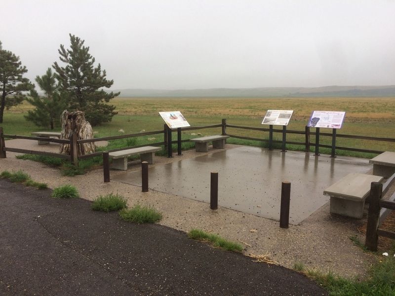
The vast prairies of America have been described by many people as "an ocean of grass." This region of the country is considered either shortgrass or midgrass prairie, depending on the soil moisture, precipitation, and relative humidify in a . . . — — Map (db m113241) HM
On this site in September 1864 an immigrant train, under the command of Capt. James L. Fisk, bound for the gold fields of Montana, was besieged by hostile Sioux Indians, despite the fact that an armed escort of 50 U. S. Cavalrymen had been provided . . . — — Map (db m33923) HM
The first scholarly archaeological study of a Mandan earthlodge village village site was made in 1905 by Harvard University students George Will and Herbert Spinden. They excavated portions of six midden mounds, two houses, six cache pits, and the . . . — — Map (db m154677) HM
Bullboats, round-bottomed watercrafts, were used by the Mandans, Hidatsas, and Arikaras to transport goods and people
along waterways. Bullboats were indispensable for river traffic and for hauling loads of driftwood for cooking and heating
fires. . . . — — Map (db m164368) HM
Fortification systems attest to the fierce warfare between villagers and surrounding nomadic tribes that is reported in early historic records. Ditch 2 that you seen in front of you at Double Ditch appears to have combined mounds and the ditch, with . . . — — Map (db m154250) HM
Ditch 3 is more recent than Ditch 4 and was constructed in the AD 1500s. Ditch 3, with only a few bastions, encompasses 15 acres and, like Ditch 4, is not visible on the surface. It reflects a fallback to a slightly smaller community and simpler . . . — — Map (db m154708) HM
Double Ditch Indian Village, overlooking the Missouri River, was a large earthlodge village inhabited by Mandan Indians between AD 1490 and 1785. The remains of earthlodges, midden mounds (trash heaps), and two fortification ditches are clearly . . . — — Map (db m154709) HM
Double Ditch Indian Village, overlooking the Missouri River, was a large earthlodge village inhabited by Mandan Indians between AD 1490 and 1785. The remains of earthlodges, midden mounds (trash heaps), and two fortification ditches are clearly . . . — — Map (db m154710) HM
In front of you is a segment of the inner fortification ditch. Mandan villages usually were surrounded
by a ditch and wood palisade to keep out enemies. These villages also used natural features, such as
steep terrain and riverbanks, for added . . . — — Map (db m164478) HM
Geophysics applies the methods of physics to remotely investigate and define objects or materials
in the earth's subsurface without direct contact. Geophysical investigations do not disturb the
soil and cultural features, as do traditional . . . — — Map (db m164367) HM
The Mandans, as well as the Hidatsa and the Arikaras, built dome-shaped houses of logs and earth, known as earthlodges. All that remains of the earthlodges on the surface are circular depressions. The men usually decided how large an earthlodge . . . — — Map (db m154544) HM
While the Mandans relied heavily on the cultivation of plants, they
were also skilled hunters. Bison hunting was as important as farming
and bison were vital to the Mandan diet. Before the arrival of horses,
bison were stalked individually, or . . . — — Map (db m164358) HM
Mandan origins and history have been passed on orally. These origin stories are memorized and passed from generation to generation, telling the history of a
people. These traditions provide information regarding the origins of sacred bundles and . . . — — Map (db m164357) HM
Life for these agriculturalists centered on the cultivation and trade of native corn, beans, squash, and sunflowers along with hunting. Women watched the skies
carefully for the arrival of flocks of geese and ducks, which signified the arrival of . . . — — Map (db m164355) HM
The raised areas you see around the village are midden mounds or earthen mounds ranging from one to ten feet high. There are more than 30 mounds surrounding the village. The Mandans at Double Ditch disposed of their trash in heaps such as the one in . . . — — Map (db m154930) HM
Missouri River The Missouri River valley provided water, food, and shelter for the Mandans. Abundant timber and game could be found in the wooded bottomlands, and bison flourished on the surrounding prairie grasslands. The terrace edge . . . — — Map (db m154068) HM
Pó is the root for fish in the Mandan language-pótande is the catfish. The Missouri River system, along with its larger
tributaries such as the Heart River, supported fisheries that the Mandans drew upon as part of their subsistence . . . — — Map (db m164371) HM
Sakakawea Sakakawea has become a recognized name as part of the Lewis and Clark expedition. Although her name is famous, few facts remain to document her life and contributions to the voyage. When Lewis and Clark met Sakakawea in 1804 she was . . . — — Map (db m43838) HM
Square Buttes is a prominent and imposing landmark along this stretch of the Missouri River. The buttes take their name from their corresponding physical characteristics and robust form that is visible on the horizon eight miles to the north. . . . — — Map (db m154069) HM
Geophysical surveys and follow-up excavations have revealed that the village had four ditch fortification systems constructed over a period of 300 years. The fourth, or outermost, ditch had several well-defined bastions and was probably the oldest. . . . — — Map (db m154920) HM
The fortification ditch and house depressions, as well as the site's location away from the Missouri River, immediately caught the attention of archeologists when the site was rediscovered in 1936. At that time, many people believed it was the . . . — — Map (db m154401) HM
This house was built in an oval-shaped pit about two feet deep and measured 16 by 23 feet in size. Before it was excavated in the late 1990s, remote sensing studies were conducted. Precise surface elevations were recorded and about 3,500 individual . . . — — Map (db m154406) HM
has been designated a
Registered National Historic Landmark
under the provisions of the Historic Sites Act of August 21, 1955. This site possesses exceptional value in commemorating and illustrating the history of the . . . — — Map (db m153165) HM
Menoken Village was a small community consisting of approximately 30 oval-shaped, earth-covered houses and a prominent fortification system. Once thought to have been a Mandan Village occupied at the time of early contact with Euroamericans, Menoken . . . — — Map (db m154254) HM
Menoken Village is a terminal Late Woodland (ca. AD 1200) settlement on Apple Creek, an eastern tributary of the Missouri River. Menoken is listed in the National Register of Historic Places. The site is also a registered National Historic Landmark . . . — — Map (db m154628) HM
Recovered stone, metal, and shell artifacts show that the people were involved in trade systems that spanned the continent. It is not clear how these systems worked. Residents at Menoken probably did not travel far beyond what is now central North . . . — — Map (db m154403) HM
August 16, 1863, General Sibley marched over this spot with 3400 soldiers on his return after driving the Indians across the Missouri River. — — Map (db m169803) HM
The Native American Medicine Garden The concept for this medicine wheel garden originated with the sacred medicine wheel representing various symbolisms and teachings. It honors seasonal cycles, represents rituals, and expresses . . . — — Map (db m240295) HM
Sodbuster: San Isidro Sodbuster: San Isidro combines the artistic traditions of the American Southwest with imagery that represents the hardworking farmers of the Red River Valley. The term "Sodbuster" is a colloquialism for farmers, . . . — — Map (db m240401) HM
Not much is known of the very early history of Cavalier County. The Sioux are believed to have been the earliest residents. The first known white men to have set foot in Cavalier County were those in the Verendrye expedition, which camped in the . . . — — Map (db m214095) HM
In 1989, inspection of the Lake Ilo dam found that critical maintenance was needed. A notch cut into the spillway lowered the water about 7 feet so the work could be completed. The exposed lake bed revealed remarkable discoveries and mysteries of . . . — — Map (db m153143) HM
The Yellowstone Expedition of 1876 organized to quell the hostile Sioux marched from Fort Abraham Lincoln May 17, 1876 and passed within three fourths of a mile to the south of this marker on June 3, 1876. Between Sentinel Butte and Beach . . . — — Map (db m202891) HM
Over this trail the Indians carried freight and mail for the U.S. Govt. from Fisher’s Landing to Fort Totten in the years 1879 to 1882. — — Map (db m155662) HM
Named for Captain Charles B. Atchison, assistant commissary and acting ordnance officer, on the staff of General H. H. Sibley. This camp was used as a base for Sibley's Operations to the Missouri River in pursuit of the Sioux Indians and was . . . — — Map (db m200660) WM
People have lived in the area now called North Dakota for over 12,000 years. The people of prehistoric
times were nomadic hunters and gatherers. More recent Native American tribes of this area include the Mandan, Arikara and Hidatsa. These . . . — — Map (db m164407) HM
One of the earliest forms of Missouri River transportation was the bull boat. Used primarily by the Mandan, Hidatsa, and Arikara tribes, bull boats served as the main watercraft for natives living along the river banks. These boats were both built . . . — — Map (db m235041) HM
The Mandan Winter
"If we eat you Shall eat, if we Starve, you must Starve also."
Mandan Chief Sheheka-shote, to Captains Lewis and Clark, November 1, 1804
With those words, Chief Sheheke-shote (White Coyote), . . . — — Map (db m162953) HM
On this site are the remains of a large earthlodge village originally settled by the Mandan Indians (ca.1822) and the trading forts Clark and Primeau. Previous to the establishment of Fort Clark, an unnamed post was built in the area by James Kipp . . . — — Map (db m33313) HM
The river that nurtured Awatixa Village is erasing evidence of its existence. In 1798, explorer-trader David Thompson estimated fifty-two earthlodges here. As of 1990, only thirty-one earthlodge depressions remained. Cutbank erosion and channel . . . — — Map (db m162270) HM
Circles in the Earth
You are at the edge of a large village of earthlodges. When the dwellings collapsed, they left circular mounds of earth around hardened saucer-like floors. From that pattern you can picture the extent of this village . . . — — Map (db m162212) HM
In front of you are situated what archaeologist believe may have been corrals constructed by the Arikaras. Because views of the fort painted by George Catlin and Karl Bodmer between 1832 and 1834 do not show the corrals, they were likely built after . . . — — Map (db m162381) HM
Anatomy of a Village
Viewed at prairie level, the village site shows few details of the Hidatsa people's lives. Most evidence lies below the surface. Here along the bank, repeated floods have exposed a slice of village life and given it . . . — — Map (db m162272) HM
The earthlodge was a type of home used by many tribes on the Great Plains. Around you are the remains of earthlodges found in the village of Mih-tutta-hang-kush. There were more than eighty of these homes found on this site. Today, circular . . . — — Map (db m162528) HM
From archeological evidence, we know how the Hidatsa fished. The villagers used bone fishhooks at first, but metal hooks began to appear after the 1790s - a result of trade with Europeans. From catfish spines and fish scales found in middens, we . . . — — Map (db m162273) HM
With simple tools, Hidatsa women grew corn, beans, squash, and sunflowers in the fertile soil along the Missouri and Knife Rivers.
Buffalo Bird Woman, known in Hidatsa as Maxidiwiac, was born born about 1839, in an earth lodge along the . . . — — Map (db m162210) HM
Fortified Ground
A thriving earthlodge village stood here. Though surface clues appear minimal, there is a pattern to the ground's subtle dips and wrinkles, a way to reconstruct the life and death of the village. Read the terrain like . . . — — Map (db m162274) HM
With 168 days and 1,600 miles behind them, the Lewis and Clark Expedition arrived near the Knife River Villages. Captain William Clark wrote:
October 27, 1804
"came too at the Village on the L.S. this village is situated on an eminance . . . — — Map (db m33610) HM
Mato-Tope (the Four Bears)
The second chief of the Mandans, Mato-Tope, was respected and revered for his leadership, honor, and bravery. George Catlin referred to his in an 1832 letter:
This extraordinary man, though second in . . . — — Map (db m162529) HM
To imagine these people's daily lives, consider their trash. Molehill-like mounds two to four feet high near the village edge are middens or garbage heaps packed with broken pottery, bone tools, and flaked stone. Shattered buffalo bones are the most . . . — — Map (db m162214) HM
You are approaching the site of a former Mandan Indian village called Mih-tutta-hang-kush. This name means "east village" or "first village." Mih-tutta-hanf-kush was established in 1822 and was occupied by the Mandans until 1837 when the smallpox . . . — — Map (db m162276) HM
You are now looking at a portion of the former palisade wall and the ditch that surrounded the Mandan village of Mih-tutta-hang-kush. A palisade is a row of closely spaced vertical posts set together to form a protective wall. Archaeologists belief . . . — — Map (db m162534) HM
This earthlodge was the home of Pierre Garreau. Garreau, the son of a French father and an Arikara mother, was employed by the American Fur Company as an interpreter. He was well known for his strength and bravery. Interpreters, such as Garreau, . . . — — Map (db m162391) HM
Built so close to the river, Awatixa Village and other nearby sites suggest a pattern - a vital link between Hidatsa culture and the riverine environment. The Missouri River and its tributaries provided fish, fertile soil for crops, and a green . . . — — Map (db m162271) HM
In the summer of 1837, the steamboat St. Peters arrived at the Mandan village and Fort Clark, carrying passengers, supplies, and trade goods. Tragically, some of the people on the St. Peters were also infected with smallpox. In a . . . — — Map (db m162532) HM
"Tobacco was cultivated in my tribe only by old men." - Buffalo Bird Woman's Garden
"Our young men did not smoke much; a few did, but most of them used little tobacco, or almost none. They were taught that smoking would injure their . . . — — Map (db m178101) HM
Winter villages of the Mandans and the neighboring Hidatsas were located in the forested river bottoms of the Missouri River and Knife River valleys. These temporary village locations were chosen based on availability, suitable protection form harsh . . . — — Map (db m162473) HM
Fort Rice was a United States military post established to provide protection for white settlers who had just commenced to penetrate the territory of Dakota and as a military base for operations against hostile Indian tribes.
The post was . . . — — Map (db m154080) HM WM
In 1866-1868, Indian councils were held at the post. The most important of these was the Great Council with the Sioux bands in July 1886. A key leader of the Lakota, Thathanka Iyotake (Sitting Bull), refused to participate. Father Pierre Jean De . . . — — Map (db m154294) HM WM
Archaeological excavations have occurred at Huff village in 1938-1939, 1959, 1960, and 1999. In all but the most recent work, focus has been on uncovering houses at Huff Village and understanding details of prehistoric architecture. The floors of l1 . . . — — Map (db m164393) HM
Only recently have we been able to accurately determine the age of Huff Village. Archeological deposits and the settlement layout suggests that the village was probably inhabited for only 20 years or so. Fourteen radiocarbon dates and several . . . — — Map (db m154336) HM
Huff Indian Village State Historic Site is a classic prehistoric Mandan settlement dating to about AD 1450, perhaps two hundred years before Euroamerican influence reached the Missouri Valley area. The village is a very large, well-planned community . . . — — Map (db m154135) HM
In front of you is part of the fortification system that once surrounded this village. The fortification system at Huff Village is a classic example of civil defense and community preparation for conflict. Inter-village conflict may have been . . . — — Map (db m154306) HM
This United States military post was established as Fort KcKeen, June 14, 2872 by companies "B" and "C" of the 6th Infantry under the command of Lieutenant-Colonel Daniel Huston Jr. It was named in commemoration of Colonel H. Boyd McKeen of the 81st . . . — — Map (db m153168) HM
The U.S. Army Quartermaster Department employed both Native Americans and European-Americans as scouts at Fort Abraham Lincoln. Many of these scouts were "Rees" or Arikara who fought the Lakota. Some of the best known scouts at Fort Abraham Lincoln . . . — — Map (db m227764) HM
Slant Village was occupied by the Mandan, an agricultural Indian tribe, and received its name because of the sloping ground upon which it was situated. The village embraced about seven or eight acres of ground and the most recent survey of the site, . . . — — Map (db m153125) HM
The Yellowstone Expedition of 1876, organized to quell the hostile Sioux, marched from Fort Abraham Lincoln May 17, 1876, and camped a short distance in a southerly direction of this marker on May 19, 1876. The trail extends to the banks of the . . . — — Map (db m234874) HM
Marie Bottineau Baldwin, born Pembina 1863. Ojibwa attorney, suffragist. Stated native women had “virtual suffrage since time immemorial.” — — Map (db m205232) HM
Devils Lake The question is often asked where did the name "Devils Lake" come from? Long before European settlers came to this area, local Native Americans fondly referred to the lake as "Mníwakháŋ," meaning water with energy, . . . — — Map (db m242839) HM
The Inyan Bosendata of the Dakota
Indians used this site as a place
for ceremonials and offerings.
In 1839 the explorers Nicollet and
Fremont noted this landmark on the
maps of that date. The state geographic board has designated this
place . . . — — Map (db m175432) HM
Historic Fort Ransom
Fort Ransom (1867-72) was one of several small military outposts established by General Alfred H. Terry to place troops in strategic locations along frontier transportation routes as a defensive measure against Indian . . . — — Map (db m176138) HM
Writing Rock
Just over the ridge to the west, a rock
bears some very unusual markings.
These script-like engravings are the topic
of much speculation and debate.
Geologists believe that running water
etched the stone, or that ancient . . . — — Map (db m177126) HM
This building is listed on early maps and drawings
of Fort Abercrombie as a barracks. Barracks were
the living quarters for the enlisted soldiers at Fort
Abercrombie. The front of the building had two
squad rooms where the soldiers slept. . . . — — Map (db m177197) HM
A member of the Hunkpapa band of the Teton Sioux Indians, Sitting Bull became a warrior of much renown and was eventually acknowledged as a leader of all the Teton Sioux. A noble and just leader but misunderstood by the white man.
He was . . . — — Map (db m82316) HM WM
The Yellowstone Expedition of 1876, organized to quell the hostile Sioux, marched from Fort Abraham Lincoln May 17, 1876, and camped about three miles south of Belfield on May 26, 1876. From this campsite Custer’s route extends south to the . . . — — Map (db m234870) HM
General Alfred Sully, Commander of a United States military expedition to Dakota Territory to punish hostile Sioux, established a base camp on this site on July 26, 1864. Sully left his surplus supplies and equipment and an immigrant train wish was . . . — — Map (db m156144) HM WM
The Yellowstone Expedition of 1876, organized to quell the hostile Sioux, marched from Fort Abraham Lincoln May 17, 1876, and camped near Young Mans Butte about two miles east of this marker on May 23, 1876. Between Young Mans Butte and . . . — — Map (db m234898) HM
The Yellowstone Expedition of 1876, organized to quell the hostile Sioux, marched from Fort Abraham Lincoln May 17, 1876, and camped about eight miles west of this marker on May 24, 1876. Custer’s Calvary route passes three miles south of Taylor, . . . — — Map (db m234897) HM
Old maps of the Northwest apply the name of Dakota to the James River. The junction of the
Can Sa Sa (James River) and the Pipestem, where Jamestown is now located, was a favorite place for getting together among the Indians before the . . . — — Map (db m112686) HM
Wahpeton, North Dakota 1917-1982 Company G, 2nd Battalion, 19th Infantry Regiment, 24th Infantry Division, U.S. Army On October 20, 1951, Master Sergeant Keeble, who was leading a support platoon in the attack on Hill 765, observed that attacking . . . — — Map (db m240693) HM
This building was constructed in 1871 as the post commanding officers' quarters. It served in that capacity until 1889, when a new commanding officers' quarters was built near the north side of the post. The single most important event that . . . — — Map (db m143159) HM
Visitors entering the Fort from the river side had to pass through outer and inner gates separated by an enclosed area with access to the Indian Trade Room. When the outer gate was closed, trading could be carried on through a wicket (or window) . . . — — Map (db m143221) HM
Early explorers reported that America’s western mountains were rich in furs. As a part of a plan to extend trading into the Upper Missouri country, John Jacob Astor’s American Fur Company built Fort Union here, near the junction of the Missouri and . . . — — Map (db m62068) HM
The Countrey in every direction is plains. -- William Clark
This area held large herds of bison, elk, and deer, which had grazed on grasses and shrubs for millennia. Chief among the native grasses were big bluestem, buffalo grass, and . . . — — Map (db m143204) HM