On Scenic Drive, on the right when traveling north.
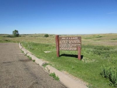
These small boulders are clues to a fascinating story. Geologists believe they were ripped from bedrock 400 miles north in Canada and carried to this point by a great glacier which covered nearly all North America north and east of here. . . . — — Map (db m88638) HM
Near 2nd Avenue Southwest at Main Street South (State Highway 23), on the left when traveling west.
Between 1874 and 1893, millions of head of cattle and horses went up the Great Western Trail from Texas through nine U.S. states into Canada. This famous trail lasted more years, carried more cattle, and was longer than any other cattle trail in . . . — — Map (db m202898) HM
On Scenic Drive, on the right when traveling north.
Abundant grass in North Dakota resulted in cattle being driven in the 1880’s along this trail to the Long X Ranch three miles north of this point. In North Dakota the trail passed through the place that is now the town of New England, then . . . — — Map (db m88651) HM
On Scenic Drive, on the left when traveling north.
Good grass and shelter attracted ranching interests to the badlands. Taking advantage of the void left by the killing of the bison, a Texas trail drive pushed 4,000 head of longhorn cattle into this region in the fall of 1884. Other trail drives . . . — — Map (db m88641) HM
On Scenic Drive, on the right when traveling north.
Throughout history livestock growing has depended upon abundant grasslands. An unused sea of grass in this region attracted cattlemen who brought large herds here in the early 1880’s. Damage from overstocking and overgrazing brought a quick . . . — — Map (db m88637) HM
The badlands you see here were so named because they were badlands to travel over before modern roads were built. A part of the Northern Great Plains the area has been carved by rain, wind and running water of the Little Missouri River. These layers . . . — — Map (db m96782)
In the spring of 1886 thieves stole Theodore Roosevelt’s boat from his Elkhorn Ranch, 25 miles south of here. Roosevelt pursued the thieves past this point and captured them at the mouth of Cherry Creek about 24 miles downstream. He then . . . — — Map (db m87201) HM
On Scenic Drive, on the right when traveling north.
These tilted mounds were once part of the higher cliffs beyond. Stream cutting against their base over-steepened the cliffs. During wet periods, blocks of earth slid downhill, retaining their original layered sequence. Can you match . . . — — Map (db m88649) HM
On Cedar Canyon Road, aka Scenic Drive near Theodore Roosevelt Expressway (U.S. 85), on the left when traveling west.
Before this land became a national park, this spot was recognized for its dramatic beauty. The area's future was uncertain-would it become a state park? A national park? A recreation area? No one knew yet, but they did known one thing: this view was . . . — — Map (db m162198) HM
On Theodore Roosevelt Expressway (U.S. 85), on the right when traveling north.
In memory of Walter H. Chaloner 1918 – 1933 Near this spot, this pioneer’s son failed in an attempt to jump a washout because of the tie-down on his horse. After five days of searching, he was found alive pinned under his horse. He did not . . . — — Map (db m85879) HM
On 16th Street NW (North Dakota Route 37) 0.3 miles west of U.S. 83, on the left when traveling west.
Custer Mine, owned and operated by the Truax Traer Coal Company, was a
working surface mine from 1947-1964. The surface or strip mining method of coal
mining is used when the coal seam is near the surface of the ground. The
lignite coal was mined . . . — — Map (db m164410) HM
On North Dakota Route 37 near U.S. 83, on the left when traveling west.
People have lived in the area now called North Dakota for over 12,000 years. The people of prehistoric
times were nomadic hunters and gatherers. More recent Native American tribes of this area include the Mandan, Arikara and Hidatsa. These . . . — — Map (db m164407) HM
On State Highway 37 near Federal Highway 83, on the left when traveling west.
The transition from a working coal mine to today's
Custer Mine Wildlife Management Area took place over
many years. While the coal mine was still in operation,
local residents started planting trees on the mine spoil
banks. The trees were . . . — — Map (db m164412) HM
Near 8th Street Southwest (County Road 17) near 28th Avenue Southwest (State Road 23), on the right when traveling west.
In December of 1804 the temperature dipped and snow began to fall. Despite waking to an unrelenting cold the Corps of Discovery continued to work on the finishing touches of Fort Mandan, went hunting and preformed the never-ending job of gathering . . . — — Map (db m162597) HM
Near 8th Street Southwest (County Highway 17) near 28th Avenue Southwest, on the right when traveling west.
From this site, North Dakota Wagon Train, that took our message to Valley Forge, left on September 26, 1975.
Outriders presented scrolls from their various bicentennial communities to Wagon Master Jerry Nelson and Governor Arthur Link. These . . . — — Map (db m162594) HM
Near 8th Street Southwest just west of State Highway 200, on the left when traveling west.
One of the earliest forms of Missouri River transportation was the bull boat. Used primarily by the Mandan, Hidatsa, and Arikara tribes, bull boats served as the main watercraft for natives living along the river banks. These boats were both built . . . — — Map (db m235041) HM
On Boat Ramp Road just west of 1st Avenue, on the left when traveling west.
To attract shoppers to Washburn from west of the Missouri River, the Washburn Road installed a cable ferry in May 1902, known unofficially as the General Washburn. Cable ferries were small, unpowered boats attached to steel cables stretched between . . . — — Map (db m235089) HM
Near 8th Street Southwest (County Road 17) near 29th Avenue Southwest (County Highway 23), on the left when traveling west.
Winter 1804-1805
Named for the nearby Indians, Fort Mandan was winter quarters for the Lewis and Clark Expedition. Sited by Captain Clark on November 2, 1804, the fort was built in a triangular shape from cottonwood logs cut in . . . — — Map (db m162536) HM
Near 8th Street Southwest (County Road 17) near 28th Avenue Southwest (County Road 23), on the right when traveling west.
Fort Mandan, 1804-05 Winter Quarters of the Lewis and Clark Expedition, also was the birthplace of the son born to Sakakawea and her French husband Charbonneau, interpreter for the explorers. The "Bird Woman" helped guide Lewis and Clark to their . . . — — Map (db m162595) HM
On 8th Street Southwest near State Highway 200, on the left when traveling north.
The Mandan Winter
"If we eat you Shall eat, if we Starve, you must Starve also."
Mandan Chief Sheheka-shote, to Captains Lewis and Clark, November 1, 1804
With those words, Chief Sheheke-shote (White Coyote), . . . — — Map (db m162953) HM
Near 8th Street Southwest (County Highway 17) near 28th Avenue Southwest (County Highway 23), on the left when traveling north.
Privates John Shields, William Bratton and Alexander Willard manned the blacksmith shop at Fort Mandan. These men provided repair work to native tools, such as sharpening iron hoes and knives and fixing trade kettles.
The Mandan and Hidatsa who . . . — — Map (db m162950) HM
Near Boat Ramp Road just south of Lewis and Clark Trail (1st Street), on the right when traveling south.
Nettle Creek School was the first school in McLean County, opening on November 6, 1883. Originally located seven miles east of Washburn, the one-room country school was first constructed as a log cabin, with clapboard siding added to it later. In . . . — — Map (db m235060) HM
Near 8th Street at 1st Avenue when traveling south.
The first steamboat to reach the upper Missouri was the American Fur Company's Yellow Stone, which arrived at Fort Union in 1832. Nearly 30 years later, steamers began reaching Fort Benton, Montana, the head of navigation on the Missouri. From then . . . — — Map (db m235097) HM
While preparing for the expedition to the Pacific, Meriwether Lewis visited Philadelphia for instructions in natural sciences, astronomical navigation and field medicine. It is believed that it was during this period that Lewis purchased Seaman, his . . . — — Map (db m36352) HM
On Boat Ramp Road just west of 1st Avenue, on the left when traveling west.
The last stern wheel ferry on the Missouri. Built by Oscar Anderson in 1951 and operated by him on the Missouri River at Washburn from 1952 to 1962. Restored by the Washburn Bi-centennial Committee in 1976. American Revolution Bicentennial . . . — — Map (db m235096) HM
Near 8th Street at 1st Avenue when traveling south.
In 1898, William Drew Washburn, a wealthy Minneapolis flour miller, railroad man, and U.S. Senator from Minnesota, purchased 115,000 acres of land along the line between McLean and Burleigh counties. He formed the Bismarck, Washburn & Great Falls . . . — — Map (db m235098) HM
On Main Avenue just south of 10th Street, on the right when traveling south.
Pioneer home of Joseph Henry Taylor, soldier, trapper, hunter, author and printer by trade. Born in 1843 of Quaker parents in Chester County, PA., he drifted west, locating in the Painted Woods area, twelve miles south of here in 1869, where he led . . . — — Map (db m235199) HM
On Boat Ramp Road just west of 1st Avenue, on the left when traveling west.
In 1950 Oscar Anderson, a native of Washburn who had traveled the world since 1917 as an officer in the merchant marine, returned home to spend his retirement years. He found a community that missed its ferryboat connection with the west bank of . . . — — Map (db m235095) HM
Near State Highway 200, 0.5 miles south of 8th Street Southwest (Border Lane), on the right when traveling south.
In the early 1920s, most North Dakota towns were served by small local power plants producing direct current (DC) electric power. In 1926, Otter Tail Power Company of Fergus Falls, Minnesota, was one of several companies building a series of power . . . — — Map (db m235057) HM
The bridging of the Missouri River at Washburn had been a longtime goal for residents of the community. As early as 1908, a party of local residents traveled to Washington, D.C., unsuccessfully, in the interests of such a project. During the 1920s . . . — — Map (db m235047) HM
On unnamed paved road, on the right when traveling north.
On this site are the remains of a large earthlodge village originally settled by the Mandan Indians (ca.1822) and the trading forts Clark and Primeau. Previous to the establishment of Fort Clark, an unnamed post was built in the area by James Kipp . . . — — Map (db m33313) HM
On North Dakota Route 200 east of Park Avenue, on the right when traveling east.
Construction of the dam began in 1947
and was completed in 1954 at a cost of
$300 million dollars. Garrison Dam is
one of the largest earthen dam structures
in the world with a volume of 66.5 million
cubic yards of rolled earth fill. The . . . — — Map (db m178019) HM
On State Highway 200 east of Park Avenue, on the left when traveling east.
Construction of the Intake
Structure took 5 years and
cost $21 million dollars
back in 1954. Enough
concrete to pave a road
115 miles long was used
in construction of the
structure. The Intake Structure is 249 feet
tall, 540 feet long and . . . — — Map (db m177992) HM
On North Dakota Route 200 east of Park Avenue, on the right when traveling east.
Hydroelectric power is produced
through generating units in the
Powerhouse. The generators
produce electricity at 13,800 volts
which is stepped up to 115,000 and
230,000 volts for transmission. The
rotors on units 1, 2, and 3 are 35 feet
in . . . — — Map (db m178018) HM
Near County Road 37 near 6th Street Southwest, on the right when traveling north.
The river that nurtured Awatixa Village is erasing evidence of its existence. In 1798, explorer-trader David Thompson estimated fifty-two earthlodges here. As of 1990, only thirty-one earthlodge depressions remained. Cutbank erosion and channel . . . — — Map (db m162270) HM
Near County Highway 37 near 6th Street Southwest, on the right when traveling north.
Circles in the Earth
You are at the edge of a large village of earthlodges. When the dwellings collapsed, they left circular mounds of earth around hardened saucer-like floors. From that pattern you can picture the extent of this village . . . — — Map (db m162212) HM
Near 37th Avenue Southwest near 12th Street Southwest (State Highway 200), on the right when traveling north.
In front of you are situated what archaeologist believe may have been corrals constructed by the Arikaras. Because views of the fort painted by George Catlin and Karl Bodmer between 1832 and 1834 do not show the corrals, they were likely built after . . . — — Map (db m162381) HM
Near State Road 37 near 6th Street Southwest, on the right when traveling north.
Anatomy of a Village
Viewed at prairie level, the village site shows few details of the Hidatsa people's lives. Most evidence lies below the surface. Here along the bank, repeated floods have exposed a slice of village life and given it . . . — — Map (db m162272) HM
Near 37th Avenue Southwest near 12th Street Southwest (State Highway 200), on the right when traveling north.
The earthlodge was a type of home used by many tribes on the Great Plains. Around you are the remains of earthlodges found in the village of Mih-tutta-hang-kush. There were more than eighty of these homes found on this site. Today, circular . . . — — Map (db m162528) HM
Near County Road 37 near 6th Street Southwest, on the right when traveling north.
From archeological evidence, we know how the Hidatsa fished. The villagers used bone fishhooks at first, but metal hooks began to appear after the 1790s - a result of trade with Europeans. From catfish spines and fish scales found in middens, we . . . — — Map (db m162273) HM
Near 37th Avenue Southwest near 12th Street Southwest (State Highway 200), on the right when traveling north.
This location contains the remains of Fort Clark, named in honor of former explorer William Clark, who was Superintendent of Indian Affairs at the time. It was built by James Kipp for trade with the Mitutanka Mandan Indians living in the earthlodge . . . — — Map (db m162387) HM
Near 37th Avenue Southwest near 12th Street Southwest (State Highway 200), on the right when traveling north.
Fort Clark was a small but important post in the American Fur Co. (AMF) empire but only a minute element within an immense international fur and hide trade. Its cycle of trade incorporated Native Americans of the northern plains, American traders . . . — — Map (db m162379) HM
Near 37th Avenue Southwest near 12th Street Southwest (State Highway 200), on the right when traveling north.
Eighteen years before the establishment of the Mandan Village of Mih-tutta-hang-kush, a settlement of a different kind was being built a few miles northwest of this point. In November 1804, the Lewis and Clark Expedition began construction of their . . . — — Map (db m162530) HM
Near 37th Avenue Southwest near 12th Street Southwest (State Highway 200), on the right when traveling north.
Geophysics is the application of the methods of physics to the study of object or materials beneath the surface of the earth. Archeo-geophysics applies geophysical principles to the study of near-surface archaeological deposits. The goal is to . . . — — Map (db m162461) HM
Near County Highway 37 near 6th Street Southwest, on the right when traveling north.
With simple tools, Hidatsa women grew corn, beans, squash, and sunflowers in the fertile soil along the Missouri and Knife Rivers.
Buffalo Bird Woman, known in Hidatsa as Maxidiwiac, was born born about 1839, in an earth lodge along the . . . — — Map (db m162210) HM
Near County Road 18 near County Road 37, on the left when traveling east.
Fortified Ground
A thriving earthlodge village stood here. Though surface clues appear minimal, there is a pattern to the ground's subtle dips and wrinkles, a way to reconstruct the life and death of the village. Read the terrain like . . . — — Map (db m162274) HM
On County Route 31, on the right when traveling north.
With 168 days and 1,600 miles behind them, the Lewis and Clark Expedition arrived near the Knife River Villages. Captain William Clark wrote:
October 27, 1804
"came too at the Village on the L.S. this village is situated on an eminance . . . — — Map (db m33610) HM
Near 37th Avenue Southwest near 12th Street Southwest (State Highway 200), on the right when traveling north.
Mato-Tope (the Four Bears)
The second chief of the Mandans, Mato-Tope, was respected and revered for his leadership, honor, and bravery. George Catlin referred to his in an 1832 letter:
This extraordinary man, though second in . . . — — Map (db m162529) HM
Near County Road 37 near 6th Street Southwest, on the right when traveling north.
To imagine these people's daily lives, consider their trash. Molehill-like mounds two to four feet high near the village edge are middens or garbage heaps packed with broken pottery, bone tools, and flaked stone. Shattered buffalo bones are the most . . . — — Map (db m162214) HM
On 37th Avenue Southwest near 12th Street Southwest (State Highway 200), on the right when traveling north.
You are approaching the site of a former Mandan Indian village called Mih-tutta-hang-kush. This name means "east village" or "first village." Mih-tutta-hanf-kush was established in 1822 and was occupied by the Mandans until 1837 when the smallpox . . . — — Map (db m162276) HM
Near 37th Avenue Southwest near 12th Street Southwest (State Highway 200), on the right when traveling north.
Fort Clark and its opposition post Primeau's Post, as well as that of the nearby Mandan and later Arikara village, were for defense and also served to tap the bountiful natural resources of this stretch of the Missouri River valley. Between 1832 and . . . — — Map (db m162383) HM
Near 37th Avenue Southwest near 12th Street Southwest (State Highway 200), on the right when traveling north.
You are now looking at a portion of the former palisade wall and the ditch that surrounded the Mandan village of Mih-tutta-hang-kush. A palisade is a row of closely spaced vertical posts set together to form a protective wall. Archaeologists belief . . . — — Map (db m162534) HM
Near 37th Avenue Southwest near 12th Street Southwest (State Highway 200), on the right when traveling north.
This earthlodge was the home of Pierre Garreau. Garreau, the son of a French father and an Arikara mother, was employed by the American Fur Company as an interpreter. He was well known for his strength and bravery. Interpreters, such as Garreau, . . . — — Map (db m162391) HM
Near County Road 37 near 6th Street Southwest, on the right when traveling north.
Built so close to the river, Awatixa Village and other nearby sites suggest a pattern - a vital link between Hidatsa culture and the riverine environment. The Missouri River and its tributaries provided fish, fertile soil for crops, and a green . . . — — Map (db m162271) HM
Near 37th Avenue Southwest near 12th Street Southwest (State Highway 200), on the right when traveling north.
In the summer of 1837, the steamboat St. Peters arrived at the Mandan village and Fort Clark, carrying passengers, supplies, and trade goods. Tragically, some of the people on the St. Peters were also infected with smallpox. In a . . . — — Map (db m162532) HM
Near 37th Avenue Southwest near 12th Street Southwest (State Highway 200), on the right when traveling north.
The stone shelter you are standing in was constructed in the 1930s as one of the many projects completed throughout the state by the Civilian Conservation Corps (CCC) and the Works Progress Administration (WPA). The CCC and the WPA were programs . . . — — Map (db m162476) HM
Near 37th Avenue Southwest near 12th Street Southwest (State Highway 200), on the right when traveling north.
Fort Clark's most prominent structural features, the enclosure or "palisade" and projecting blockhouses, were built to defend its occupants from attack and the Company's trade goods from theft. Curiously, historic documents and archaeological . . . — — Map (db m162471) HM
Near 37th Avenue Southwest near 12th Street Southwest (State Highway 200), on the right when traveling north.
Fort Clark's citizens were small in number but extremely diverse in cultural origin. This ethnic diversity is reflected in one Company trader's remarks that trading posts were a "Babylonian confusion of languages...Assiniboin, Crow, Herantsa, . . . — — Map (db m162389) HM
Near County Highway 37 near 6th Street Southwest, on the right when traveling north.
"Tobacco was cultivated in my tribe only by old men." - Buffalo Bird Woman's Garden
"Our young men did not smoke much; a few did, but most of them used little tobacco, or almost none. They were taught that smoking would injure their . . . — — Map (db m178101) HM
Near 37th Avenue Southwest near 12th Street Southwest (State Highway 200), on the right when traveling north.
Shortly after Fort Clark's construction (circa 1830), Prince Maximilian of Wied (Germany) described the post in his journal as "built on the same plan as the other trading posts of the Company. The front and back of the square are forty-four paces . . . — — Map (db m162459) HM
On 37th Avenue Southwest near 12th Street Southwest (State Highway 200).
James Kipp
In the twilight of his years, a "Canadian of German descent," James Kipp, (1788-1880_ was to be remembered for both his AMF fort-building experiences and his vast knowledge of the Upper Missouri country and its . . . — — Map (db m162456) HM
Near 37th Avenue Southwest near 12th Street Southwest (State Highway 200), on the right when traveling north.
Winter villages of the Mandans and the neighboring Hidatsas were located in the forested river bottoms of the Missouri River and Knife River valleys. These temporary village locations were chosen based on availability, suitable protection form harsh . . . — — Map (db m162473) HM
On North Dakota Route 21, 0.5 miles east of College Street, on the left when traveling east.
This 240 mile route from Bismarck to Deadwood was authorized by the Territorial Legislature in 1877 to provide a direct route from Bismarck to Deadwood Stage, a distance of 240 miles. It was originally routed by the Northwest Express & . . . — — Map (db m153101) HM
Near South Main Street (County Road 84) 0.1 miles south of 1st Avenue West, on the right when traveling south.
The first Northern Pacific Railway Co. Train reached this point in September of 1910. The railroad linked the communities of Mandan, Huff, Fort Rice, Cannonball, Solen, Brelen, and Flasher together with Southwestern North Dakota.
It was a means . . . — — Map (db m161850) HM
Fort Rice was a United States military post established to provide protection for white settlers who had just commenced to penetrate the territory of Dakota and as a military base for operations against hostile Indian tribes.
The post was . . . — — Map (db m154080) HM WM
In 1866-1868, Indian councils were held at the post. The most important of these was the Great Council with the Sioux bands in July 1886. A key leader of the Lakota, Thathanka Iyotake (Sitting Bull), refused to participate. Father Pierre Jean De . . . — — Map (db m154294) HM WM
Fort Rice was established on July 7, 1864, by General Alfred H. Sully as a field base during his 1864 expedition. The fort was named for Brigadier General James Clay Rice of Massachusetts who was killed in battle during the Civil War. Fort Rice was . . . — — Map (db m154247) HM
Near North Dakota Route 1806, 0.6 miles north of County Road 136, on the right when traveling north.
Archaeological excavations have occurred at Huff village in 1938-1939, 1959, 1960, and 1999. In all but the most recent work, focus has been on uncovering houses at Huff Village and understanding details of prehistoric architecture. The floors of l1 . . . — — Map (db m164393) HM
Only recently have we been able to accurately determine the age of Huff Village. Archeological deposits and the settlement layout suggests that the village was probably inhabited for only 20 years or so. Fourteen radiocarbon dates and several . . . — — Map (db m154336) HM
Huff Indian Village State Historic Site is a classic prehistoric Mandan settlement dating to about AD 1450, perhaps two hundred years before Euroamerican influence reached the Missouri Valley area. The village is a very large, well-planned community . . . — — Map (db m154135) HM
In front of you is part of the fortification system that once surrounded this village. The fortification system at Huff Village is a classic example of civil defense and community preparation for conflict. Inter-village conflict may have been . . . — — Map (db m154306) HM
The barracks served as quarters for the 123 men of the two companies of the 6th Infantry who built Fort McKeen. Soldiers prepared their meals and dined in the mess hall and kitchen located at the rear of the building. Bunks with bed-sacks filled . . . — — Map (db m153207) HM
Near Fort Lincoln Road, on the right when traveling south.
The Infantry Post was protected by blockhouses and, on the north and west sides, by cottonwood walls called palisades. The rugged terrain to the south and east helped discourage attacks.
The palisades were costly to maintain and were removed . . . — — Map (db m227861) HM
An important daily function at military posts was guard duty. Guards and pickets prevented intruders from entering the post or advancing near enough to shoot at soldiers, steal horses or set fire to buildings.
One such outpost was the . . . — — Map (db m227347) HM
On Fort Lincoln Road, on the left when traveling north.
Concretions are spheres of mineral matter once surrounded by rock of a different composition. They occur when a cementing material forms around a center of organic matter such as a leaf, twig, shell or tooth. As the softer surrounding material . . . — — Map (db m227464) HM
Near Fort Lincoln Road, on the right when traveling south.
"The Worker" commemorates the valuable contributions of the Civilian Conservation Corps (CCC) across this great country during the years 1933 to 1943. That depression-era decade was a critical period in American history. The CCC played a major role . . . — — Map (db m227237) HM
Near Fort Lincoln Road, on the right when traveling south.
Let this be a reminder to future generations of the invaluable service rendered by so many young men in preserving and maintaining parks and wildlife areas of this country.
The CCC assisted in the development of Fort Abraham Lincoln State . . . — — Map (db m227761) HM
The commanding officer’s quarters was one of seven frame residences (called Officers Row) built n 1873 to house cavalry officers stationed at Fort Abraham Lincoln. The first commanding officer and tenant was Lt. Colonel (Brevet Major General) George . . . — — Map (db m96771) HM
Near Fort Lincoln Road, 1.8 miles north of State Route 1806, on the right when traveling south.
This United States military post was established as Fort KcKeen, June 14, 2872 by companies "B" and "C" of the 6th Infantry under the command of Lieutenant-Colonel Daniel Huston Jr. It was named in commemoration of Colonel H. Boyd McKeen of the 81st . . . — — Map (db m153168) HM
On Fort Lincoln Road, on the left when traveling north.
This hand carved boundary marker was once located along the western edge of the Fort Abraham Lincoln Military Reservation.
President Ulysses S. Grant established the Fort Abraham Lincoln Military Reservation on February 11, 1873. The . . . — — Map (db m227236) HM
Soldiers of the 20th Infantry relax around a Gatling gun at the Fort Abraham Lincoln Infantry Post during the mid 1870s
The remains of these breastworks before you once supported a Gatling gun and a small group of infantry. . . . — — Map (db m227762) HM
Near Fort Lincoln Road, 1.7 miles north of 46th Street (State Highway 1806), on the left when traveling north.
The laundresses were some of the few females officially recognized by the Army. As such, they were afforded housing and rations in return for tending to the soldiers' laundry. The laundresses' quarters, also known as "Suds Row," was a large log . . . — — Map (db m153213) HM
On Interstate 94, 0.2 miles west of Sunset Drive Exit, on the right when traveling east.
Sunday, October 21, 1804 A driving northeast wind, cold temperatures, and freezing rain and snow led Lewis and Clark to seek shelter after only 7 miles. During the day, they passed the mouth of the Heart River learning from their Arikara . . . — — Map (db m44707) HM
Near Fort Lincoln Road, on the right when traveling south.
Of the 123 soldiers stationed at Fort McKeen in the late summer of 1872, seven were officers. They lived in four Officers' quarters located at the northwestern end of the parade ground. As with the other fort buildings, the officers; quarters were . . . — — Map (db m153201) HM
Charles Page, a civilian worker at Fort Abraham Lincoln who froze to death in the fall of 1873, was the first recorded burial in the cemetery. Freezing, gangrene, gunshot wounds, and other illnesses and injuries were typical causes of death. After . . . — — Map (db m227882) HM
Near Fort Lincoln Road, on the right when traveling south.
Completed on November 8, 1872, the hospital was of wood-frame construction and had two 12 bed wards. To save money, the army used paper board instead of plaster to finish the inside walls. Earth commodes adjoined each ward for use by patients too . . . — — Map (db m153959) HM
Near Fort Lincoln Road, on the right when traveling south.
Storage for ammunition and explosives at any military post was vital. At Fort Abraham Lincoln Infantry Post, three powder magazine stored ammunition for weapons of all types.
Powder and magazines had thick walls or were built into the ground. . . . — — Map (db m153956) HM
Near Fort Lincoln Road, on the left when traveling south.
The schoolhouse provided the basics of reading and writing for children living at the post. Even soldiers sought education within the walls that once stood on this spot. Many of the soldiers serving in the infantry post could not read or write. It . . . — — Map (db m153211) HM
The U.S. Army Quartermaster Department employed both Native Americans and European-Americans as scouts at Fort Abraham Lincoln. Many of these scouts were "Rees" or Arikara who fought the Lakota. Some of the best known scouts at Fort Abraham Lincoln . . . — — Map (db m227764) HM
Slant Village was occupied by the Mandan, an agricultural Indian tribe, and received its name because of the sloping ground upon which it was situated. The village embraced about seven or eight acres of ground and the most recent survey of the site, . . . — — Map (db m153125) HM
Near 8th Street North, 0.7 miles south of Interstate 94, on the right when traveling south.
The Yellowstone Expedition of 1876, organized to quell the hostile Sioux, marched from Fort Abraham Lincoln May 17, 1876, and camped a short distance in a southerly direction of this marker on May 19, 1876. The trail extends to the banks of the . . . — — Map (db m234874) HM
The World’s Largest Holstein Cow is 38 feet high, 50 feet long, and weighs 12,000 pounds.
Salem Sue was erected in 1974 at a cost of nearly $40,000.00 contributed by dairymen, farmers, businessmen, the dairy industry, and area residents. The . . . — — Map (db m161849) HM
On State Highway 8, 0.3 miles north of U.S. 2, on the right when traveling north.
This bronze statue is of a combat soldier on the Burma Trail, an almost forgotten part of WW II. It is to honor all Soldiers, Airmen, Marines, and Sailors. We thank them for their service and the contributions they and their families made to keep . . . — — Map (db m202893) HM WM
On 1st Street at Broadway, on the left when traveling east on 1st Street.
The worst rail disaster in North Dakota history happened Aug. 9, 1945 at 7:20 PM, one thousand feet west of here, on a one degree curve to the West. The first section of a Great Northern passenger train had to make an emergency stop, then the . . . — — Map (db m206392) HM
On 38th Avenue Southwest (Center Avenue) (State Highway 48) at Bridge Avenue, on the right when traveling south on 38th Avenue Southwest (Center Avenue).
[east side]In honor and memory of all Men and Women who served in the Armed Forces of the United States of America to preserve our freedom[west side]American Legion and Auxiliary Miller-Linn Post 90 Oliver County Center, N.D. In God . . . — — Map (db m231513) WM
Near Dakota Street West just east of Court House Drive, on the right when traveling east.
This property has been placed on the National Register of Historic Places by the United States Department of the Interior November 25, 1980 — — Map (db m209445) HM
On Division Avenue North (State Highway 5/18) just south of 96th Street Northeast, on the right when traveling north.
This missile is a full-scale model of a United States Army interceptor called a Spartan. Cavalier Air Force Station was originally part of a 6-part system known as SAFEGUARD designed to provide an anti-ballistic missile capability for defending . . . — — Map (db m209099) HM
598 entries matched your criteria. Entries 301 through 400 are listed above. ⊲ Previous 100 — Next 100 ⊳