598 entries match your criteria. Entries 301 through 400 are listed.⊲ Previous 100 — Next 100 ⊳
Historical Markers and War Memorials in North Dakota
By Bill Coughlin, July 21, 2015
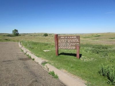
Edge of a Glacier Marker
| 301 ► North Dakota, McKenzie County, Watford City — Edge of a Glacier — |
| On Scenic Drive, on the right when traveling north. | |||
| 302 ► North Dakota, McKenzie County, Watford City — Great Western Trail — |
| Near 2nd Avenue Southwest at Main Street South (State Highway 23), on the left when traveling west. | |||
| 303 ► North Dakota, McKenzie County, Watford City — Long X Cattle Trail — |
| On Scenic Drive, on the right when traveling north. | |||
| 304 ► North Dakota, McKenzie County, Watford City — Longhorns — |
| On Scenic Drive, on the left when traveling north. | |||
| 305 ► North Dakota, McKenzie County, Watford City — Man and Grass — |
| On Scenic Drive, on the right when traveling north. | |||
| 306 ► North Dakota, McKenzie County, Watford City — North Dakota Badlands — |
| On Scenic Drive. | |||
| 307 ► North Dakota, McKenzie County, Watford City — Roosevelt and the Boat Thieves — |
| On Scenic Drive. | |||
| 308 ► North Dakota, McKenzie County, Watford City — Slump Formation — |
| On Scenic Drive, on the right when traveling north. | |||
| 309 ► North Dakota, McKenzie County, Watford City — The View that Launched a Park — Rebuilding a Nation - Building a Park — |
| On Cedar Canyon Road, aka Scenic Drive near Theodore Roosevelt Expressway (U.S. 85), on the left when traveling west. | |||
| 310 ► North Dakota, McKenzie County, Watford City — Walter H. Chaloner — |
| On Theodore Roosevelt Expressway (U.S. 85), on the right when traveling north. | |||
| 311 ► North Dakota, McLean County, Garrison — Custer Coal Mine — |
| On 16th Street NW (North Dakota Route 37) 0.3 miles west of U.S. 83, on the left when traveling west. | |||
| 312 ► North Dakota, McLean County, Garrison — Land of Strange Disappearances — |
| On North Dakota Route 37 near U.S. 83, on the left when traveling west. | |||
| 313 ► North Dakota, McLean County, Garrison — Wildlife Area Evolves From Coal Mine — |
| On State Highway 37 near Federal Highway 83, on the left when traveling west. | |||
| 314 ► North Dakota, McLean County, Washburn — Below the Freezing Point — |
| Near 8th Street Southwest (County Road 17) near 28th Avenue Southwest (State Road 23), on the right when traveling west. | |||
| 315 ► North Dakota, McLean County, Washburn — Bicentennial Wagon Train Pilgrimage to Pennsylvania — |
| Near 8th Street Southwest (County Highway 17) near 28th Avenue Southwest, on the right when traveling west. | |||
| 316 ► North Dakota, McLean County, Washburn — Early Boats on the Missouri — Washburn Discovery Trail/Lewis & Clark Legacy Trail — |
| Near 8th Street Southwest just west of State Highway 200, on the left when traveling west. | |||
| 317 ► North Dakota, McLean County, Washburn — Ferry Boats on the Missouri — Washburn Discovery Trail/Lewis & Clark Legacy Trail — |
| On Boat Ramp Road just west of 1st Avenue, on the left when traveling west. | |||
| 318 ► North Dakota, McLean County, Washburn — Fort Mandan — Lewis & Clark in North Dakota — McLean County — |
| Near 8th Street Southwest (County Road 17) near 29th Avenue Southwest (County Highway 23), on the left when traveling west. | |||
| 319 ► North Dakota, McLean County, Washburn — Fort Mandan — |
| Near 8th Street Southwest (County Road 17) near 28th Avenue Southwest (County Road 23), on the right when traveling west. | |||
| 320 ► North Dakota, McLean County, Washburn — Mandan Winter / Harmony Park — |
| On 8th Street Southwest near State Highway 200, on the left when traveling north. | |||
| 321 ► North Dakota, McLean County, Washburn — Men of Worth — |
| Near 8th Street Southwest (County Highway 17) near 28th Avenue Southwest (County Highway 23), on the left when traveling north. | |||
| 322 ► North Dakota, McLean County, Washburn — Nettle Creek Country School — Washburn Discovery Trail/Lewis & Clark Legacy Trail — |
| Near Boat Ramp Road just south of Lewis and Clark Trail (1st Street), on the right when traveling south. | |||
| 323 ► North Dakota, McLean County, Washburn — River Boats on the Missouri — Washburn Discovery Trail/Lewis & Clark Legacy Trail — |
| Near 8th Street at 1st Avenue when traveling south. | |||
| 324 ► North Dakota, McLean County, Washburn — Seaman — |
| 325 ► North Dakota, McLean County, Washburn — Sioux — |
| On Boat Ramp Road just west of 1st Avenue, on the left when traveling west. | |||
| 326 ► North Dakota, McLean County, Washburn — Soo Line Railroad & Depot — Washburn Discovery Trail/Lewis & Clark Legacy Trail — |
| Near 8th Street at 1st Avenue when traveling south. | |||
| 327 ► North Dakota, McLean County, Washburn — Taylor Cabin — Built in 1869 — |
| On Main Avenue just south of 10th Street, on the right when traveling south. | |||
| 328 ► North Dakota, McLean County, Washburn — The Sioux Ferry Boat — Washburn Discovery Trail/Lewis & Clark Legacy Trail — |
| On Boat Ramp Road just west of 1st Avenue, on the left when traveling west. | |||
| 329 ► North Dakota, McLean County, Washburn — The Washburn Plant — Washburn Discovery Trail/Lewis & Clark Legacy Trail — |
| Near State Highway 200, 0.5 miles south of 8th Street Southwest (Border Lane), on the right when traveling south. | |||
| 330 ► North Dakota, McLean County, Washburn — Walter R. Hjelle Bridge — Washburn Discovery Trail/Lewis & Clark Legacy Trail — |
| Near Boat Ramp Road just south of 1st Street. | |||
| 331 ► North Dakota, McLean County, Wilton — Wilton Memorial Hall — Proudly Dedicated to Our War Veterans — |
| On Dakota Avenue just west of 1st Street South, on the left when traveling west. | |||
| 332 ► North Dakota, Mercer County, Fort Clark — Fort Clark Historic Site — |
| On unnamed paved road, on the right when traveling north. | |||
| 333 ► North Dakota, Mercer County, Pick City — Garrison Dam — |
| On North Dakota Route 200 east of Park Avenue, on the right when traveling east. | |||
| 334 ► North Dakota, Mercer County, Pick City — Intake Structure — |
| On State Highway 200 east of Park Avenue, on the left when traveling east. | |||
| 335 ► North Dakota, Mercer County, Pick City — Powerhouse — |
| On North Dakota Route 200 east of Park Avenue, on the right when traveling east. | |||
| 336 ► North Dakota, Mercer County, Stanton — Awatixa Village — (Ah-wah-TEE-khah) (Eh) — |
| Near County Road 37 near 6th Street Southwest, on the right when traveling north. | |||
| 337 ► North Dakota, Mercer County, Stanton — Awatixa Xi'e Village — (Ah-wah-TEE-khah) (Eh) — |
| Near County Highway 37 near 6th Street Southwest, on the right when traveling north. | |||
| 338 ► North Dakota, Mercer County, Stanton — Corrals — Fort Clark State Historic Site — |
| Near 37th Avenue Southwest near 12th Street Southwest (State Highway 200), on the right when traveling north. | |||
| 339 ► North Dakota, Mercer County, Stanton — Cutbank Archeaology (sic) — |
| Near State Road 37 near 6th Street Southwest, on the right when traveling north. | |||
| 340 ► North Dakota, Mercer County, Stanton — Earthlodges — Fort Clark State Historic Site — |
| Near 37th Avenue Southwest near 12th Street Southwest (State Highway 200), on the right when traveling north. | |||
| 341 ► North Dakota, Mercer County, Stanton — Feeding the River — Hidatsa Fishing Techniques — |
| Near County Road 37 near 6th Street Southwest, on the right when traveling north. | |||
| 342 ► North Dakota, Mercer County, Stanton — Fort Clark (circa 1830-1860) — Fort Clark State Historic Site — |
| Near 37th Avenue Southwest near 12th Street Southwest (State Highway 200), on the right when traveling north. | |||
| 343 ► North Dakota, Mercer County, Stanton — Fort Clark in the International Fur Trade — Fort Clark State Historic Site — |
| Near 37th Avenue Southwest near 12th Street Southwest (State Highway 200), on the right when traveling north. | |||
| 344 ► North Dakota, Mercer County, Stanton — Fort Mandan Overlook — Fort Clark State Historic Site — |
| Near 37th Avenue Southwest near 12th Street Southwest (State Highway 200), on the right when traveling north. | |||
| 345 ► North Dakota, Mercer County, Stanton — Geophysics and Archaeology — Fort Clark State Historic Site — |
| Near 37th Avenue Southwest near 12th Street Southwest (State Highway 200), on the right when traveling north. | |||
| 346 ► North Dakota, Mercer County, Stanton — Hidatsa Garden — |
| Near County Highway 37 near 6th Street Southwest, on the right when traveling north. | |||
| 347 ► North Dakota, Mercer County, Stanton — Hidatsa Village — |
| Near County Road 18 near County Road 37, on the left when traveling east. | |||
| 348 ► North Dakota, Mercer County, Stanton — Lewis & Clark at the Knife River Indian Villages — Lewis & Clark in North Dakota — |
| On County Route 31, on the right when traveling north. | |||
| 349 ► North Dakota, Mercer County, Stanton — Mandans and Arikaras of the Village — Fort Clark State Historic Site — |
| Near 37th Avenue Southwest near 12th Street Southwest (State Highway 200), on the right when traveling north. | |||
| 350 ► North Dakota, Mercer County, Stanton — Middens — |
| Near County Road 37 near 6th Street Southwest, on the right when traveling north. | |||
| 351 ► North Dakota, Mercer County, Stanton — Mih-tutta-hang-kush (meaning East Village or First Village) — Fort Clark State Historic Site — |
| On 37th Avenue Southwest near 12th Street Southwest (State Highway 200), on the right when traveling north. | |||
| 352 ► North Dakota, Mercer County, Stanton — Missouri Valley Environs — Fort Clark State Historic Site — |
| Near 37th Avenue Southwest near 12th Street Southwest (State Highway 200), on the right when traveling north. | |||
| 353 ► North Dakota, Mercer County, Stanton — Palisade Wall — Fort Clark State Historic Site — |
| Near 37th Avenue Southwest near 12th Street Southwest (State Highway 200), on the right when traveling north. | |||
| 354 ► North Dakota, Mercer County, Stanton — Pierre Garreau's Lodge — Fort Clark State Historic Site — |
| Near 37th Avenue Southwest near 12th Street Southwest (State Highway 200), on the right when traveling north. | |||
| 355 ► North Dakota, Mercer County, Stanton — River-Centered — |
| Near County Road 37 near 6th Street Southwest, on the right when traveling north. | |||
| 356 ► North Dakota, Mercer County, Stanton — Smallpox and the Central Plaza — Fort Clark State Historic Site — |
| Near 37th Avenue Southwest near 12th Street Southwest (State Highway 200), on the right when traveling north. | |||
| 357 ► North Dakota, Mercer County, Stanton — Stone Shelter — Fort Clark State Historic Site — |
| Near 37th Avenue Southwest near 12th Street Southwest (State Highway 200), on the right when traveling north. | |||
| 358 ► North Dakota, Mercer County, Stanton — The Blockhouses — Fort Clark State Historic Site — |
| Near 37th Avenue Southwest near 12th Street Southwest (State Highway 200), on the right when traveling north. | |||
| 359 ► North Dakota, Mercer County, Stanton — The People — Fort Clark State Historic Site — |
| Near 37th Avenue Southwest near 12th Street Southwest (State Highway 200), on the right when traveling north. | |||
| 360 ► North Dakota, Mercer County, Stanton — Tobacco — |
| Near County Highway 37 near 6th Street Southwest, on the right when traveling north. | |||
| 361 ► North Dakota, Mercer County, Stanton — Trading Post Plan — Fort Clark State Historic Site — |
| Near 37th Avenue Southwest near 12th Street Southwest (State Highway 200), on the right when traveling north. | |||
| 362 ► North Dakota, Mercer County, Stanton — Two Bourgeois or Head Traders of the Fort — Fort Clark State Historic Site — |
| On 37th Avenue Southwest near 12th Street Southwest (State Highway 200). | |||
| 363 ► North Dakota, Mercer County, Stanton — Winter Villages and Lodges — Fort Clark State Historic Site — |
| Near 37th Avenue Southwest near 12th Street Southwest (State Highway 200), on the right when traveling north. | |||
| 364 ► North Dakota, Morton County, Flasher — Bismarck to Deadwood Stage Trail — |
| On North Dakota Route 21, 0.5 miles east of College Street, on the left when traveling east. | |||
| 365 ► North Dakota, Morton County, Flasher — Flasher Centennial Railroad Park — 1889 1989 — Dedicated July 15, 1989 — |
| Near South Main Street (County Road 84) 0.1 miles south of 1st Avenue West, on the right when traveling south. | |||
| 366 ► North Dakota, Morton County, Fort Rice — Fort Rice — |
| On North Dakota Route 1806. | |||
| 367 ► North Dakota, Morton County, Fort Rice — Fort Rice After General Sully's Expeditions — Fort Rice State Historic Site — |
| Near North Dakota Route 1806. | |||
| 368 ► North Dakota, Morton County, Fort Rice — The Founding of Fort Rice — Fort Rice State Historic Site — |
| Near North Dakota Route 1806. | |||
| 369 ► North Dakota, Morton County, Huff — Archaeological Excavations of Houses — Huff Indian Village State Historic Site — |
| Near North Dakota Route 1806, 0.6 miles north of County Road 136, on the right when traveling north. | |||
| 370 ► North Dakota, Morton County, Huff — Huff Indian Village Dates to AD 1443-1465 — Huff Indian Village State Historic Site — |
| Near North Dakota Route 1806. | |||
| 371 ► North Dakota, Morton County, Huff — Huff Indian Village State Historic Site — |
| Near North Dakota Route 1806. | |||
| 372 ► North Dakota, Morton County, Huff — Village Fortifications and Human Conflict — Huff Indian Village State Historic Site — |
| Near North Dakota Route 1806. | |||
| 373 ► North Dakota, Morton County, Mandan — Barracks — |
| Near Fort Lincoln Road. | |||
| 374 ► North Dakota, Morton County, Mandan — Blockhouses & Palisades — |
| Near Fort Lincoln Road, on the right when traveling south. | |||
| 375 ► North Dakota, Morton County, Mandan — Breastworks — |
| 376 ► North Dakota, Morton County, Mandan — Cannonball Concretions — |
| On Fort Lincoln Road, on the left when traveling north. | |||
| 377 ► North Dakota, Morton County, Mandan — Civilian Conservation Corps — |
| Near Fort Lincoln Road, on the right when traveling south. | |||
| 378 ► North Dakota, Morton County, Mandan — Civilian Conservation Corps Project — The Civilian Conservation Corps (CCC) Company 2775-V of Mandan, ND — |
| Near Fort Lincoln Road, on the right when traveling south. | |||
| 379 ► North Dakota, Morton County, Mandan — Commanding Officer’s Quarters — Fort Abraham Lincoln — |
| On Fort Lincoln Road. | |||
| 380 ► North Dakota, Morton County, Mandan — Fort Abraham Lincoln Infantry Post — |
| Near Fort Lincoln Road, 1.8 miles north of State Route 1806, on the right when traveling south. | |||
| 381 ► North Dakota, Morton County, Mandan — Fort Abraham Lincoln Military Reservation Boundary Marker — |
| On Fort Lincoln Road, on the left when traveling north. | |||
| 382 ► North Dakota, Morton County, Mandan — Gatling Gun Emplacement — |
| 383 ► North Dakota, Morton County, Mandan — Laundress' Quarter: "Suds Row" — |
| Near Fort Lincoln Road, 1.7 miles north of 46th Street (State Highway 1806), on the left when traveling north. | |||
| 384 ► North Dakota, Morton County, Mandan — Mandan Scenic Overlook — Lewis & Clark in North Dakota — |
| On Interstate 94, 0.2 miles west of Sunset Drive Exit, on the right when traveling east. | |||
| 385 ► North Dakota, Morton County, Mandan — Officers' Quarters — |
| Near Fort Lincoln Road, on the right when traveling south. | |||
| 386 ► North Dakota, Morton County, Mandan — Post Cemetery — |
| 387 ► North Dakota, Morton County, Mandan — Post Hospital — |
| Near Fort Lincoln Road, on the right when traveling south. | |||
| 388 ► North Dakota, Morton County, Mandan — Powder Magazines — |
| Near Fort Lincoln Road, on the right when traveling south. | |||
| 389 ► North Dakota, Morton County, Mandan — Schoolhouse — |
| Near Fort Lincoln Road, on the left when traveling south. | |||
| 390 ► North Dakota, Morton County, Mandan — Scouts — |
| Near Fort Lincoln Road. | |||
| 391 ► North Dakota, Morton County, Mandan — Slant Indian Village — |
| Near Fort Lincoln Road. | |||
| 392 ► North Dakota, Morton County, New Salem — Custer Trail — 1874-1876 — |
| Near 8th Street North, 0.7 miles south of Interstate 94, on the right when traveling south. | |||
| 393 ► North Dakota, Morton County, New Salem — Salem Sue — 1889 1989 — |
| Near North Eighth Street. | |||
| 394 ► North Dakota, Mountrail County, Stanley — War Mules — |
| On State Highway 8, 0.3 miles north of U.S. 2, on the right when traveling north. | |||
| 395 ► North Dakota, Nelson County, Lakota — The A.M. Tofthagen Library and Museum — National Register of Historic Places — |
| Near B Avenue West just east of 2nd Street West, on the right when traveling west. | |||
| 396 ► North Dakota, Nelson County, Michigan — Site of the 1945 Michigan Train Wreck — |
| On 1st Street at Broadway, on the left when traveling east on 1st Street. | |||
| 397 ► North Dakota, Oliver County, Center — In Memory of Hazel Miner — April 11, 1904 — March 16, 1920 — |
| Near 38th Avenue Southwest (Center Avenue) (State Highway 48) at Market Street, on the right when traveling south. | |||
| 398 ► North Dakota, Oliver County, Center — Veterans Memorial — |
| On 38th Avenue Southwest (Center Avenue) (State Highway 48) at Bridge Avenue, on the right when traveling south on 38th Avenue Southwest (Center Avenue). | |||
| 399 ► North Dakota, Pembina County, Cavalier — Pembina County Courthouse — Built 1912 — |
| Near Dakota Street West just east of Court House Drive, on the right when traveling east. | |||
| 400 ► North Dakota, Pembina County, Cavalier — Spartan Interceptor Missile — |
| On Division Avenue North (State Highway 5/18) just south of 96th Street Northeast, on the right when traveling north. | |||
598 entries matched your criteria. Entries 301 through 400 are listed above. ⊲ Previous 100 — Next 100 ⊳