By James Hulse, September 9, 2021
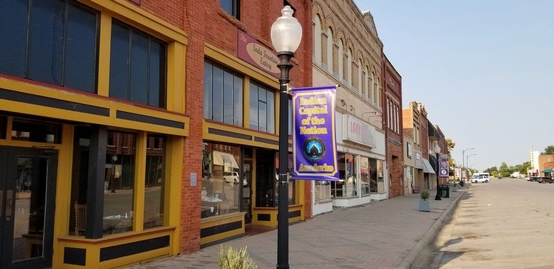
The Soda Fountain Eatery and Marker
| On West Broadway Street at South 1st Street (U.S. 281), on the left when traveling west on West Broadway Street. |
| On East Central Boulevard (State Highway 9) 0.3 miles east of Southeast 7th Street, on the right when traveling west. |
| On East Central Boulevard (U.S. 62) 0.3 miles east of Southeast 7th Street, on the right when traveling west. |
| On West Broadway Street, 0.1 miles Southwest 2nd Street, on the right when traveling west. |
| On East Central Boulevard (U.S. 62) 0.3 miles east of Southeast 7th Street, on the right when traveling west. |
| Near East Central Boulevard (State Highway 9) 0.3 miles east of Southeast 7th Street. |
| On North Main Street north of 4th Street, on the right when traveling north. |
| On Hazlett Street (State Highway 9) at Mopope Street, on the left when traveling south on Hazlett Street. |
| On U.S. 281, 0.5 miles south of Old U.S. 66, on the left when traveling south. |
| On State Highway 152, 1.5 miles east of U.S. 281, on the right when traveling east. |
| On Old U.S. 66 east of South Coleman Avenue, on the right when traveling east. |
| On State Highway 58, 0.3 miles south of 2nd Street, on the right when traveling north. |
| On Business Interstate 40 east of Old U.S. 66, on the right when traveling west. |
| On U.S. 81 at 164th Street Northwest, on the right when traveling south on U.S. 81. |
| On Sunset Drive at South Bickford Avenue, on the right when traveling west on Sunset Drive. |
| On South Rock Island Avenue at SE 22nd Street, on the right when traveling north on South Rock Island Avenue. |
| On South Evans Avenue south of West Watts Street, on the left when traveling north. |
| On North Czech Hall Road at Silver Maple Drive, on the right when traveling south on North Czech Hall Road. |
| On West Broadway Street at B Street NW, on the right when traveling west on West Broadway Street. |
| On Scenic State Highway 77 south of U.S. 70, on the right when traveling south. |
| On East Main Street at Mill Street NE, on the left when traveling east on East Main Street. |
| On West Main Street (Oklahoma Route 199) at B Street SW, on the left when traveling west on West Main Street. |
| On D Street NW north of 9th Avenue NW, on the right when traveling north. |
| On North Washington Street at Paradise Alley, on the left when traveling north on North Washington Street. |
| Near East Main Street at Mill Street NE, on the right when traveling west. |
| On West Main Street (Oklahoma Route 199) west of B Street SW, on the left when traveling west. |
| On West Main Street (Oklahoma Route 199) at North Washington Street, on the right when traveling west on West Main Street. |
| On West Main Street (Oklahoma Route 199) at B Street SW, on the left when traveling west on West Main Street. |
| On West Main Street (Oklahoma Route 199) west of B Street NW, on the right when traveling west. |
| On U.S. 177 at Daisy Lane, on the right when traveling east on U.S. 177. |
| On Armstrong Street at General Street, on the right when traveling north on Armstrong Street. |
| On East Main Street west of SE 5th Street, on the right when traveling west. |
| On East Main Street (State Highway 76) west of SE 5th Street, on the right when traveling west. |
| On South Muskogee Avenue (U.S. 62) 0.1 miles north of Crestwood Drive, on the right when traveling north. |
| On South Muskogee Avenue (U.S. 62) 0.1 miles north of Crestwood Drive, on the right when traveling north. |
| On South Muskogee Avenue (U.S. 62) 0.1 miles north of Crestwood Drive, on the right when traveling north. |
| Near South Keeler Drive, 0.3 miles south of East Willis Road (County Route D0790), on the left when traveling south. |
| On Cottonwood Street, 0.1 miles south of Muskogee Avenue (U.S. 62), on the left when traveling south. |
| On Cottonwood Street, 0.1 miles south of Muskogee Avenue (U.S. 62), on the left when traveling south. |
| On Cottonwood Street, 0.1 miles south of Muskogee Avenue (U.S. 62), on the left when traveling south. |
| On Cottonwood Street, 0.1 miles south of Muskogee Avenue (U.S. 62), on the left when traveling south. |
| Near Red Road, 1 mile north of U.S. 70, on the right when traveling north. |
| Near Red Road, 0.8 miles north of Tram Road, on the right when traveling north. |
| Near Red Road, 0.8 miles north of Tram Road when traveling north. |
| Near Red Road, 0.8 miles north of Tram Road, on the right when traveling north. |
| Near Red Road, 1.2 miles north of U.S. 70, on the right when traveling north. |
| On East 2060 Road, 0.2 miles west of North 4375 Road, on the right when traveling west. |
| On Red Road, 1 mile north of U.S. 70, on the right when traveling north. |
| Near Red Road, 1.5 miles U.S. 70. |
| On Red Road, 1 mile north of U.S. 70, on the right when traveling north. |
| On Red Road, 0.9 miles north of Tram Road, on the right when traveling north. |
| Near North 4375 Road, 0.7 miles north of U.S. 70, on the left when traveling north. |
| Near Red Road, 0.8 miles north of Tram Road, on the right when traveling north. |
| Near U.S. 70 west of State Route 209, on the right when traveling east. |
| On U.S. 70 east of State Route 209, on the right when traveling east. |
| On East 2060 Road, 0.2 miles west of North 4375 Road, on the right when traveling west. |
| On East 2060 Road, 0.2 miles west of North 4375 Road when traveling east. |
| Near Red Road, 0.8 miles north of Tram Road, on the right when traveling north. |
| Near North 4375 Road, 0.7 miles U.S. 70, on the left when traveling north. |
| On Red Road, 0.1 miles north of Tram Road, on the right when traveling north. |
| Near Red Road, 0.8 miles north of Wilson Street, on the right when traveling north. |
| Near Red Road, 1.5 miles north of U.S. 70. |
| Near North 4355 Road, 0.7 miles north of U.S. 70, on the left when traveling north. |
| Near Red Road, 0.1 miles Tram Road when traveling north. |
| Near Red Road, 0.8 miles north of Tram Road, on the right when traveling north. |
| Near Red Road, 0.8 miles Tram Road, on the right when traveling north. |
| Near Red Road, 0.8 miles Tram Road, on the right when traveling north. Reported unreadable. |
| Near Red Road north of U.S. 70, on the right when traveling north. |
| On Fort Towson Historic Site Road (County Road E2060) 0.5 miles west of County Road N4375. |
| Near Red Road, 0.8 miles north of Tram Road, on the right when traveling north. |
| On North 4th Street at East Jackson Street (Business U.S. 70), on the right when traveling south on North 4th Street. |
| On North 4200 Road west of Old Spring Road, on the left when traveling west. |
| On U.S. 70 east of N4310 Road (State Route 147), on the right when traveling west. |
| On Main Street (State Highway 325) at Cimarron Avenue (U.S. 385), on the right when traveling west on Main Street. |
| On U.S. 287, 3.1 miles north of E0130 Road, on the left when traveling north. |
| On Main Street (State Highway 325) at Cimarron Avenue (U.S. 385), on the left when traveling west on Main Street. |
| On U.S. 287, 3.1 miles north of E0130 Road, on the left when traveling north. |
| On 325 Highway, 3.5 miles north of E0190 Road, on the left when traveling north. |
| On State Highway 325, 3.6 miles north of E0190 Road, on the left when traveling north. |
| On 325, 3.6 miles north of E0190 Road, on the left when traveling north. |
| On U.S. 77 at North Main Street, on the right when traveling north on U.S. 77. |
| On 89er Park Street at U.S. 77, on the left when traveling east on 89er Park Street. |
| On U.S. 77 at '89er Park Street, on the right when traveling north on U.S. 77. |
| On East Eufaula Street at South Peters Avenue, on the left when traveling east on East Eufaula Street. |
| On 48th Avenue Southeast at East Imhoff Road, on the right when traveling north on 48th Avenue Southeast. |
| On J. Willis Stovall Drive, 0.1 miles east of Chautauqua Avenue, on the right when traveling east. |
| On East Comanche Street at South Peters Avanue, on the right when traveling east on East Comanche Street. |
| On South Main Street at West Clay Avenue, on the right when traveling north on South Main Street. |
1357 entries matched your criteria. Entries 101 through 200 are listed above.
⊲ Previous 100 —
Next 100 ⊳