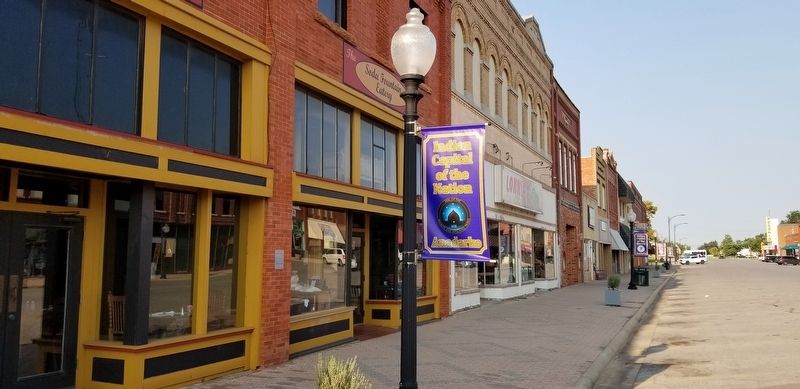
The building that houses the Soda Fountain Eatery was built in 1901. This building has only housed pharmacies until it was converted into a restaurant in 2012, and had only three owners over the past century or more.
The current establishment . . . — — Map (db m181814) HM
Noted as the "War Chief" of the Chickasaws, advisor and leader in the Treaty of Pontotoc (1832) and final removal of the tribe to the west. — — Map (db m182128) HM
"Old Man Wagon" Kiowa Principal Chief From 1833-1866
A courageous warrior, peacemaker, skilled diplomat and a member of Koitsenko "Real dogs", the elite Kiowa military society consisting of the 10 bravest men in the Kiowa tribe.
He . . . — — Map (db m182501) HM
This building has been the location of a number of businesses over the years. It was WN Lankford Grocery before 1935 when it became Hagemeier Grocery, then a year later it was Toma's Grocery.
Bill's Club was here in 1938, followed by Broadway . . . — — Map (db m181824) HM
(Warm Springs Apache-Band of Chil-ehn-deh) ca 1809 - 1879
Victorio was known for his skills in warfare tactics. He lived up to his name, "The Triumphant One". Despite the hardships and abuses imposed on his people, he tried to keep peace. He . . . — — Map (db m182469) HM
Honor Roll of All Cement Area Men Who Died While Our Country. 2nd LT. William A. Simms • 2nd LT. V. Leslie Dixon • Clyde Walker, S. SGT. • Samuel Lawrence Estes, PVT. • Sidney Ezzell, PVT. • Lester Logston, SA • Loftin McGinnis, CPL. • John David . . . — — Map (db m192435) WM
Established Oct. 1. 1859 by 1st Cavalry, U.S.A. under Major Wm. H. Emory. Post evacuated by Federal troops, May 1861, and occupied by Confederate garrison 1862. Hq. for Gen. W.B. Hazen, special Indian Agent, 1868. Gen. Phil H. Sheridan based here . . . — — Map (db m181533) HM
This bridge spans the South Canadian River, which at this point is the boundary between Canadian and Caddo Counties Oklahoma. It is 3,944.33 feet in length and was built jointly by the state and federal governments. Contract for its construction was . . . — — Map (db m171053) HM
Established in 1911 and known as Science Hill. The school house was located one half mile east of this memorial. Later the name was changed to Britton School in honor of the pioneer family. The church located at the same site served as a Grade . . . — — Map (db m142497) HM
This rural Rt. 66 filling station with an over the drive design was built by Carl Ditmore in 1929.
W.O. Waldrop bought the business/home in 1934 and renamed the place, the Provine Station. A small tourist court was added for overnight stays. . . . — — Map (db m174530) HM
An encomium of honor to
Senator Don Baldwin
Born Feb. 2, 1912 Anadarko
Caddo County Oklahoma
Member House of
Representatives 1944-1948
Majority Floor Leader
State Senate 1955
President Pro Tempore
State Senate . . . — — Map (db m171056) HM
This duplex, erected in 1876, served as the home of married officers and their families until Fort Reno was decommissioned in 1948. There were 3 bedrooms and a maid's room upstairs, and a parlor, front room, kitchen, and front porch on the ground . . . — — Map (db m171132) HM
This Adjutant Office you see before you today is not actually the originally which was built of wood and served as Post Headquarters & Officer Quarters for 51 years. This structure, constructed of low fired brick and faced with concrete. In 1939, . . . — — Map (db m171129) HM
During World War II, an eastern portion of the Fort Reno lands served as an internment work camp for German & Italian Prisoners of War. Mostly from Gen. Rommel's Afrikakorp, captured in North Africa, over 1,300 Germans were brought to Fort Reno by . . . — — Map (db m171128) HM
The Commander's Quarters was constructed in 1876. This building underwent major renovations during the WPA period in the late 1930's. Last remodeled in 2014, the building is home to BlueSTEM AgriLearning Center. This STEM (science, technology, . . . — — Map (db m171131) HM
U.S. troops encamped near Cheyenne Agency in Indian uprising 1874. Site s.w. of agency selected by Agt. J.D. Miles and Capt T. Wint, established as permanent post in July, 1875, and named for Gen. Jesse L. Reno who died in action in Battle of . . . — — Map (db m39808) HM
In 1868, after several years of chasing the Plains Indians in the summertime, with no success, General Sherman developed the idea of a winter campaign. Severe winter weather made all Tribes less mobile. Sherman selected General Sheridan and Col. . . . — — Map (db m171122) HM
The Fort Reno Commissary is a 234-foot-long, 16,300 square foot building. It was constructed in three parts. The center section was built in 1885. The north and south sections were added in 1886. Supply trains and freight wagons brought food and . . . — — Map (db m171125) HM
The Guard House, also known as a jail, was constructed in 1888 of native stone from a quarry located about 6 miles west of here. Many windows still have the bolts imbedded where iron bars were held in place. An annex was added to the west side of . . . — — Map (db m171127) HM
Originally built in the late 1930's to serve as officer's barracks, then turned into a hospital in the mid 1940's, this building now serves as the Administration Building for USDA ARS Grazinglands Research Laboratory (GRL). GRL develops and delivers . . . — — Map (db m171124) HM
Mennonites settled in this area soon after Oklahoma territory opened by run April 22, 1889. Their first mission activity was among Indians. This colony was southernmost for Mennonites along Chisholm Trail. Farmers of Swiss (from Berne, Ind.), . . . — — Map (db m186333) HM
El Reno namesake born in Wheeling, West Virginia. Reno was a 1846 graduate of West Point Military and thrice decorated hero of 1846 war with Mexico. He was promoted to Brigadier General at the start of the Civil War. Reno is credited with saving the . . . — — Map (db m56899) HM
School and Chapel 1885
Home of Ben & Moka Clark 1908-1914
Ben Clark, more than any other man in the history of Western Oklahoma, can be identified with the history of Fort Reno. He was one of the interpreters at the signing of the treaty . . . — — Map (db m171123) HM
The western branch of the Chisholm Trail passed less than one mile east of this location on its way to the Darlington Indian Agency located about a mile to the northeast. Fort Reno thus became an important resupply location for the drovers and herds . . . — — Map (db m171121) HM
The home was built in 1900-1901, by William and Magdalen Goff. Mr. Goff came to El Reno, in 1892, to work for Anheuser and Busch. He soon became an agent for the firm, later he started Goff Bottling Works and organized the Goff Cadet Band.
The . . . — — Map (db m171134) HM
This Victorian style house was built in 1891 and used as Officer Quarters. It has three stories plus a basement. The foundation is stone with load-bearing brick on the lower floor. The second and third floors are a wood frame constructed with . . . — — Map (db m171130) HM
Established in 1899 by early Czech settlers who were members of Sokol Karel Havliček Lodge and Western Fraternal Life Association Lodge Jan Žižka No. 67. Original structure replaced in 1925. Focal point of Czech, social and musical functions in . . . — — Map (db m56898) HM
This building, originally built in 1930 by
architect J.B. White, was called the
Gilbert Building. It was renamed the
Ardmoreite Building in 1966 when it
became the home of The Daily
Ardmoreite. Between 1930 and 1966
many businesses . . . — — Map (db m142416) HM
This park was created between 1933 and 1940 by members of Civilian Conservation Corps Companies 1813 and 849, two of many organized by the federal government during the Great Depression. To provide useful employment for thousands of young men . . . — — Map (db m212797) HM
Daubes’ Department Store was a long time landmark on Main Street of Ardmore.
The original Daube Store was opened in Bowie, Texas, in 1883, and was owned by Sam Daube.
In about 1888, when the Ardmore area was in Pickens County, Indian . . . — — Map (db m142482) HM
The construction of this courthouse was
financed in 1898 by two private
entrepreneurs, Joe F. Robinson and
A. V. Doak. The building was leased to the Federal
Government and the court was presided over by
Judge Hosea Townsend. This fourth . . . — — Map (db m142411) HM
A Methodist college once stood here. Begun by the City of Ardmore it was given to the Indian Mission Conference of the Methodist Church. Named in honor of Bishop Robt. K. Hargrove. In 1907 the school burned but was rebuilt north of the city. It . . . — — Map (db m141620) HM
The Hotel Wisnor, named in honor of Benjamin Wisnor Carter, prominent Chickasaw citizen, was built on this site in 1884 and was the first and finest establishment of its kind in Indian Territory. The three-story building of brick and stone had 50 . . . — — Map (db m142485) HM
In 1893, E.B. Luke came to Ardmore, Chickasaw Nation, from Detroit, Michigan. At the time, his brother, Jack Luke, operated a music and school book store in Oklahoma City, and urged E.B. to open this same type of store in Ardmore. So in 1895, E.B. . . . — — Map (db m142420) HM
On April 19, 1895 a fire broke out in Harper’s Caddo Street Livery Stable. It quickly spread and consumed six blocks of East Main Street from the Santa Fe Railroad tracks to Washington (then known as Springer Street). Eighty-six businesses were . . . — — Map (db m142489) HM
The Noble Brothers, Sam and Ed, arrived in Ardmore, Chickasaw Nation, in 1893, from Oakland Prairie, Pickens County, after a brief sojourn in Pottsboro, Texas, where they were partners in a general merchandise business and operated a ferry crossing . . . — — Map (db m142481) HM
Before 1899, J.W. Banks built, at this site, a mercantile establishment combined with lodging quarters. In 1903, W.F. (Dixie) Gilmer arrived from North Carolina and leased the hotel which was a three story structure with rooms on the second and . . . — — Map (db m142422) HM
Rosella Hightower
The world renowned ballerina was born 1/20/1920 on Wolf Creek 2 miles south and ½ mile east (C SW SE SE Sect. 34, 3E 4S). She became the prima ballerina of the Ballet Russe de Monte Carlo, the original Ballet Russe, . . . — — Map (db m147485) HM
March 14, 1943 Aeronca L-3C Grasshopper
Emil M. Horkavi Gary, Indiana • Frank M. Dimond Wilmington, California
November 4, 1943 B-17 Flying Fortress
Derald C. Holland, Santa Ana, California •
Lee R. Woodall Jr. El Dorado, Arkansas • . . . — — Map (db m209383) HM WM
Production of crude oil from the newly-discovered Healdton field surrounding this marker site flooded the marker with an oversupply of petroleum protesting that pipeline purchases were inadequate. Producers claimed they were being deprived of . . . — — Map (db m180600) HM
WW II CO Co K 152nd Inf 38th Inf Div
Wounded in Philippine Islands May 16, 1945
Korea CO Tank Co 179 Inf Reg 45 Inf Div wounded May 6, 1952
Distinguished Service Cross
Distinguished Service Cross by direction of the President under the . . . — — Map (db m180534) HM WM
Center of Cherokee culture was one mile east on Park Hill Creek; Home of Chief John Ross, Samuel Austin Worcester, Elias Boudinot, other pioneers and The Mission Press which printed millions of pages for the benefit of the Cherokee people nearly . . . — — Map (db m52751) HM
Established July, 1837, Rev. S.A. Worcester, Supt. Over 25 million pages were printed in Indian languages and in English by 1861. Printers and translators were John F. Wheeler, John W. Candy, Edwin Archer, Stephen Foreman. Near site are graves of . . . — — Map (db m52755) HM
First Annual Indian Mission Conference of the Methodist Church was held in Oklahoma at Riley's Chapel, Oct. 23, 1844, Bishop Thomas A. Morris presiding. Conference area was west to the Rocky Mts., east to Ark.-Mo. line. Rev. Thomas Bertholf, . . . — — Map (db m52757) HM
(front)
The United States Government, unable to conclude an agreement with the duly authorized leaders of the Cherokee Nation, signed a treaty with a minority faction willing to cede the last remaining portion of the original Cherokee . . . — — Map (db m77932) HM
(front)
A grateful Cherokee Nation dedicates
this memorial to all men and women,
both living and dead,
who have defended their families
their people and their homeland
(rear)
These names are carved in stone forever
so that . . . — — Map (db m108886) WM
"Doaksville is a small but pleasant looking village. There are a number of neat, if not tasteful dwelling houses, and two stores, which I found contained a little of almost everything from hoops to hunting shirts. It has a respectable looking . . . — — Map (db m237362) HM
This is one of three wells known in Doaksville; one is a short distance to the north while the other is in the vicinity of the hotel. At this location, archaeologists found that a stone pavement surrounded the well. Archaeological evidence . . . — — Map (db m238724) HM
The building that was once at this location is very different from other excavated at Doaksville. Here, a rock-walled cellar defines the footprint of a small building with a large fireplace. The cellar, which was excavated by archaeologists and . . . — — Map (db m238332) HM
Archaeologists found the partial remains of two different buildings when this site was excavated in 1995 and 1996. All that remained of one building was a section of stone foundation. The construction of this wall showed that it was the northwest . . . — — Map (db m238985) HM
Despite the importance of Doaksville prior to the Civil War, there is very little information about what the town looked like at that time. In order to have a better understanding of the town, archaeologists excavated the remains of a mercantile . . . — — Map (db m238238) HM
The Soldier's Home
In 1843 and later, four new barracks to house one hundred men each were constructed, two each on opposite sides of the parade ground. The lower story was a stone basement that contained a mess hall, kitchen, and pantry. . . . — — Map (db m239623) HM
Dedicated to veterans who served during World War I · World War II · Korean War · Vietnam War To honor men and women who bravely served their country during war and peace resting here in the Doaksville
Ft. Towson Cemetery Erected in the year of our . . . — — Map (db m236991) WM
This site is at the north end of Main Street, called "Commercial Row," in this town begun in 1831. Name of nearby post office, "Fort Towson," was changed to Doaksville on Nov. 11, 1847. — — Map (db m52564) HM
Established in the early 1800's, and in continuous use, its name was taken from the now vanished town of the same name, just East of these grounds.
Marble Tombstones, brought by steamboat from New Orleans, show the high regard frontier . . . — — Map (db m237045) HM
Doaksville is a small place, containing fifty or sixty people, consisting mostly of traders and mechanics. It has six stores, two saddler shops, one tailor, one blacksmith, one cabinet, and one shoemaker shop, also a drug store and a public . . . — — Map (db m239334) HM
Dorothy Jane Orton was the prime mover in urging the restoration of Old Fort Towson. Due to her untiring efforts her home community and the entire state became aware of the important of preserving Fort Towson as a part of Oklahoma's Historic . . . — — Map (db m239411) HM
Archaeologists spent the summers of 1995, 1996, and 1997 digging to unravel the mysteries of this area. All that was visible before they began was a small, low, earth mound with a few protruding rocks and brick fragments. The archaeologists . . . — — Map (db m238283) HM
Established May, 1824, under command of Col. Matthew Arbuckle to guard this region of Spanish border. Headquarters of Gen. S.B. Maxey, U.S. Army. Abandoned at end of Civil War. In the vicinity, Doaksville was important trading center and one time . . . — — Map (db m52576) HM
The Fort Towson Landing was south of here on the banks of the Red River. Also known as the Public Landing, from 1824 to 1854 it served as a receiving point for soldiers and supplies delivered by keelboats and steamboats. Traders from the Choctaw . . . — — Map (db m52578) HM
The post hospital consisted of the main structure and a kitchen. A large, central fireplace heated the log building. Inside was a waiting room, office, large wardroom, smaller wardroom for the seriously ill, and a "dead room" or mortuary. The . . . — — Map (db m239662) HM
Memorial
To three Native American patriots who died in the vicinity of Fort Towson. Col. George Colbert was buried in this cemetery with military honors. The other two were buried also with military honors, but their graves are unknown, . . . — — Map (db m241589) WM
Many whites had settled in what is today southeastern Oklahoma prior to the removal of the Choctaws to Indian Territory following the Treaty of Dancing Rabbit Creek in 1830. This unauthorized settlement was a problem during the initial . . . — — Map (db m238771) HM
The three houses of "Officers' Row" were the domain of Army officers and their families. The commanding officer lived in the larger, middle house flanked by quarters for other officers on either side. The houses were built of hewn logs covered . . . — — Map (db m239532) HM
My father and mother are both buried in the old cemetery at Doaksville. It is more than one hundred and twenty-five years old and many of our family are buried there. Clemmie G. Sacra, 1937
The Doaksville cemetery has served the . . . — — Map (db m239285) HM
"The famous old military road came in from Arkansas to Fort Towson near Doaksville, thence in a westerly direction to Armstrong Academy to Washita, Tishomingo, thence west to Fort Arbuckle." Matthew Walton James, 1937
[In 1879] . . . — — Map (db m237791) HM
Here at Doaksville, June 23, 1865, Brigadier General Stand Watie, Cherokee Indian, was the last Confederate General to surrender. — — Map (db m151958) HM
The post's sutler was a civilian storekeeper permitted by the Federal government to operate a trading house on or near a fort. His general merchandise business provided goods and services not regularly supplied by the military. It was also open to . . . — — Map (db m239504) HM
The public house is owned by Col. David Folsom one of the principal men in the Choctaw Nation. He keeps an excellent house on strictly temperance principles. He also owns the blacksmith shop. Rev. P.P. Brown, 1847
Hotels during the . . . — — Map (db m238382) HM
Economic and political changes to the region surrounding Doaksville caused this community to decline rapidly in late 1860s and 1870s. There is little archaeological evidence of sustained activity at this place after about 1870.
In 1854, Fort . . . — — Map (db m239198) HM
I remember the old stone jail at Doaksville, just a one-room affair with iron-barred slits for windows. I wondered when and by whom it was built. That old place was so interesting to me. Charles Washington Ervin, 1937
The Choctaw . . . — — Map (db m239185) HM
To commemorate the history of Doaksville, the first historical marker was placed in 1960. A second commemorative marker was placed in 1965 to acknowledge the 100th anniversary of General Stand Watie's surrender. At the end of the Civil War on June . . . — — Map (db m238464) HM
Prior to 1830, Mississippi was the Choctaw homeland. The Choctaw migration to a new western homeland began shortly after the Treaty of Dancing Rabbit Creek was signed in 1830. The Choctaw people relocated to Indian Territory, traveling overland . . . — — Map (db m238148) HM
During the early 1800's, present Southeastern Oklahoma was a major transportation crossroads. Roads connected Fort Towson in the Choctaw Nation to military installations to the North, South and West. On the Texas side of the Red River, Jonesboro was . . . — — Map (db m52580) HM
The mounds at Doaksville were once thought to have formed when masonry buildings or chimneys collapsed. Over time, it was thought the resulting pile of rubble became covered with soil. However, when archaeologists excavated this site and the jail, . . . — — Map (db m239134) HM
For those who died in that terrible war: we bestow our highest honor, respect, and appreciation for they gave the supreme sacrifice.
For those who are still missing: we hope and pray for their return home.
To those who still suffer, . . . — — Map (db m61963) WM
Begun 1848 by Rev. John Lathrop of American Bd. of Foreign Miss. Rev. O.P. Stark, Supt. (1850), built 1st church. Mrs. Stark opened 1st school here. Others in the service through 100 years include W.J.B. Lloyd, J.P. Gibbons, Bella M. Gibbons, Silas . . . — — Map (db m160362) HM
Noted school for boys, established by Choctaw Nation 1841; named for John C. Spencer, U.S. Sec. of War. Students who were later prominent leaders included Coleman E. Nelson, Allen Wright, Jackson McCurtain, Charles S. Vinson, B. F. Smallwood, . . . — — Map (db m147475) HM
Surveyed by J.C. Brown 1826-27
Heaviest traffic during California Gold Rush 1849
Abandoned on completion of A.T.&S.F. railroad in 1880 — — Map (db m106477) HM
From September 23 through 27, 1846, the Mormon Battalion crossed the northwestern portion of the Oklahoma panhandle. The little army's 500-plus volunteers, recruited for the Mexican War, were enlisted near Council Bluffs, Iowa, from among the first . . . — — Map (db m55260) HM
(Left Panel)
The Santa Fe Trail
A Bridge Between the United States and Mexico
Before you is a portion of the historic Santa Fe Trail. Established as a wagon route by William Becknell in 1822, the Santa Fe Trail became the . . . — — Map (db m106478) HM
Established in May 1865, by Kit Carson, hero of Valverde and Brig. Gen., New Mexico Volunteers, to guard Santa Fe Trail and furnish escorts for caravans engaged in Santa Fe trade. Santa Fe Trail crossed this highway here and was first traveled by . . . — — Map (db m39798) HM
(left panel) A Bridge Between the United States and Mexico
Before you is a portion of the historic Santa Fe Trail. Established as a wagon route by William Becknell in 1822, the Santa Fe Trail became the first major trade link between . . . — — Map (db m131308) HM
August 24, 1835
One mile northwest the Camp Holmes Treaty was signed to guarantee peace, friendship, good hunting, safe travel, as far as the western borders of the U.S.A. To negotiate their first treaty with our government and the Civilized . . . — — Map (db m144841) HM
Birthplace & Boyhood Home
Col. John L. Smith Dec. 26, 1914 - June 10, 1972
Col. John Lucien Smith U.S.M.C. In 54 days of aerial combat in the Solomon Islands he destroyed 19 Japanese planes to become the leading air ace of World War II at that . . . — — Map (db m144843) HM WM
Canadian River was south line of “Old Oklahoma” opened by Run at 12 o’clock noon, April 22, 1889. Riders started at river crossing near here. Many thousands entered the 2,000,000 a. tract north: homes were planted and tent cities . . . — — Map (db m144698) HM
Norman was designated as the seat of Cleveland County shortly after the Land Run of 1889. The first permanent courthouse was located in the Original Townsite of Norman at the corner of Gray Street and Ponca Avenue. This structure was destroyed by . . . — — Map (db m121720) HM
Located 1 mi. S of here on Chisholm Cattle Trail, also called Arbuckle Cattle Trail, Blue hired Cherokees and Creeks to kill wild buffalo in early 1870s and to deliver the hides to Atoka for shipment east. — — Map (db m141848) HM
In 1899 the Oklahoma Territorial Legislature created a natural history museum to preserve Oklahoma’s rich heritage. More than 100 years later, the Sam Noble Oklahoma Museum of Natural History was built to protect the museum’s priceless . . . — — Map (db m143652) HM
Although the Norman townsite was settled during the Land Run on April 22, 1889, Cleveland County did not exist for another year, and almost
wasn't named Cleveland County. In fact, if not for the efforts of Norman's early citizens and civic leaders, . . . — — Map (db m121630) HM
A bond issue totalling $454,323.56 was voted on by the taxpayers of Coal County to construct a new courthouse. The bond was issued on June 1, 1968 and was supported by a tax levy of 1/2 mil. the debt was paid for on June 1, 1990.
Architect . . . — — Map (db m181749) HM
1356 entries matched your criteria. Entries 101 through 200 are listed above. ⊲ Previous 100 — Next 100 ⊳