By Cosmos Mariner, June 26, 2022
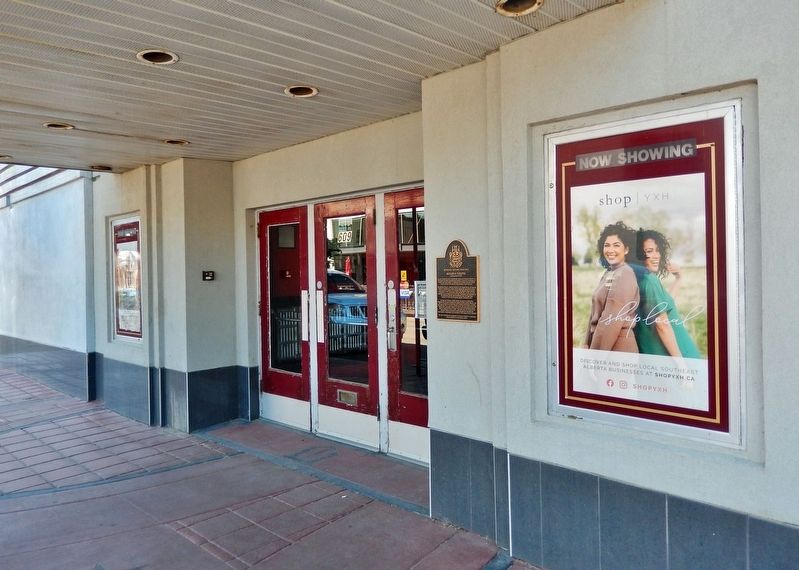
Monarch Theatre Marker
GEOGRAPHIC SORT Title Sort Marker Number Sort Marker Number Sort N Marker Number Sort T Publication Order Sort Publication Order Sort A Erected Year Sort Most Viewed Sort Most Recent-Interest Sort Most Recently Changed Sort SEE FAQ #33 FOR DESCRIPTIONS
On 2nd Street Southeast just east of 6th Avenue Southeast, on the left when traveling west.
On River Road Southeast, 0.3 kilometers east of 4 Avenue Southeast, on the left when traveling east.
On 1 Street Southeast (Provincial Highway 41A) 0.1 kilometers west of 6 Avenue Southeast, on the right when traveling west.
On 2 Street Southeast at 5 Avenue Southeast, on the right when traveling west on 2 Street Southeast.
On 2 Street Northeast just west of 2 Avenue Northeast, on the right when traveling west.
Near Southridge Drive Southeast just south of Trans-Canada Highway (Provincial Highway 1), on the right when traveling south.
On 3rd Street Southeast just east of 4th Avenue Southeast (Macleod Trail Southeast) (Provincial Highway 41A), on the left when traveling east.
On Legislature Building Road Northwest just west of 107 Street Northwest, on the right when traveling west.
On 83 Avenue Northwest just west of Gateway Boulevard, on the right when traveling west.
On Connors Road Northwest just north of 98 Avenue Northwest, on the right when traveling north.
On 83 Avenue Northwest just west of Gateway Boulevard, on the right when traveling west.
On 104 Street Northwest at 84 Ave Northwest, on the right when traveling north on 104 Street Northwest.
On 109 Street Northwest, 0.2 kilometers south of 97 Avenue Northwest, on the left when traveling south.
Near Fortway Drive Northwest just east of Legislature Building Road Northwest, on the left when traveling east.
On Main Street (Provincial Highway 22) at Valley Trail (Provincial Highway 546), on the right when traveling north on Main Street.
Paid Advertisement
On Main Street Northwest (Provincial Highway 22) at Valley Trail (Route 546), on the right when traveling north on Main Street Northwest.
Near 101 Street, 0.1 kilometers north of 100 Avenue, on the left when traveling north.
Near 101 Street at 100 Avenue, on the right when traveling south.
Near 101 Street at 100 Avenue, on the right when traveling south.
Near 101 Street at 100 Avenue, on the right when traveling south.
Near 101 Street at 100 Avenue, on the right when traveling south.
Near 101 Street at 100 Avenue, on the right when traveling south.
On Crowsnest Highway (Provincial Highway 3) at Main Street, on the right when traveling west on Crowsnest Highway.
On Connaught Drive (Alternate Provincial Highway 16A) 0.4 kilometers north of Hazel Avenue, on the right when traveling north.
On Yellowhead Highway (Provincial Highway 16) 1 kilometer north of Hazel Avenue (Provincial Highway 93A), on the right when traveling north.
On Connaught Drive (Provincial Highway 16A) just north of Miette Avenue, on the right when traveling south.
On Yellowhead Highway (Provincial Highway 16) 4.2 kilometers north of Maligne Lake Road, on the right when traveling north.
On Yellowhead Highway (Provincial Highway 16) 8 kilometers south of Miette Road (Range Road 275A), on the right when traveling south.
Near Icefields Parkway (Provincial Highway 93) 50 kilometers north of David Thompson Highway (Provincial Highway 11).
On Icefields Parkway (Provincial Highway 93) 24 kilometers south of Yellowhead Highway (Provincial Highway 16), on the right when traveling south.
On Broadway Avenue at Park Street, on the right when traveling north on Broadway Avenue.
Paid Advertisement
Near Yellowhead Highway (Provincial Highway 16) 6.3 kilometers east of Range Road 190 (Provincial Highway 834), on the right when traveling east.
Near Provincial Highway 60.
Near 47 Street just north of 47 Avenue, on the left when traveling north.
On 49 Avenue at 48 Street, on the right when traveling east on 49 Avenue.
On Crowsnest Highway (Provincial Highway 3) 0.8 kilometers west of Range Road 195, on the right when traveling west.
On 1 Avenue South at 8 Street South, on the right when traveling west on 1 Avenue South.
On 2 Avenue South at 4 Street South, on the right when traveling east on 2 Avenue South.
On 3 Avenue South at 6 Street S, on the right when traveling west on 3 Avenue South.
On the Crowsnest Highway off-ramp to 1st Avenue South, 0.8 kilometers from Crowsnest Highway (Provincial Highway 3), on the right.
On 5 Avenue South at Stafford Drive South, on the right when traveling west on 5 Avenue South.
On Mayor Magrath Drive, South.
On the Crowsnest Highway off-ramp to 1st Avenue South, 0.9 kilometers from Crowsnest Highway (Provincial Highway 3), on the right.
Near 3 Avenue South at 6 Street South, on the right when traveling west.
Near 3 Avenue South at 6 Street South, on the right when traveling west.
On Meridian Avenue (50 Avenue) (Provincial Highway 17) just north of Yellowhead Highway (Ray Nelson Drive) (Provincial Highway 16), on the left when traveling north.
On Meridian Avenue (50 Avenue) (Provincial Highway 17) at Yellowhead Highway (Ray Nelson Drive) (Provincial Highway 16), on the right when traveling south on Meridian Avenue (50 Avenue).
Paid Advertisement
On 47 Street (Provincial Highway 881) just north of 47 Avenue, on the right when traveling south.
On Spur Line Trail at Higashikawa Friendship Trail, on the right when traveling west on Spur Line Trail.
On 1 Avenue at 1st Street, on the right when traveling west on 1 Avenue.
On 1 Avenue at 1st Street, on the right when traveling west on 1 Avenue.
Near Bow Valley Trail (Provincial Highway 1A) 1.6 kilometers east of Morley Road (Provincial Highway 133X), on the right when traveling east.
Near Bow Valley Trail (Provincial Highway 1A) 1.6 kilometers east of Morley Road (Provincial Highway 133X), on the right when traveling east.
Near Bow Valley Trail (Provincial Highway 1A) 1.6 kilometers east of Morley Road (Provincial Highway 133X), on the right when traveling east.
On Bow Valley Trail (Provincial Highway 1A) 1.6 kilometers east of Morley Road (Provincial Highway 133X), on the right when traveling east.
On Bow Valley Trail (Provincial Highway 1A) 1.6 kilometers east of Morley Road (Provincial Highway 133X), on the right when traveling east.
Near Bow Valley Trail (Provincial Highway 1A) 1.6 kilometers east of Morley Road (Provincial Highway 133X), on the right when traveling east.
Near Bow Valley Trail (Provincial Highway 1A) 1.6 kilometers east of Morley Road (Provincial Highway 133X), on the right when traveling east.
Near Bow Valley Trail (Provincial Highway 1A) 1.6 kilometers east of Morley Road (Provincial Highway 133X), on the right when traveling east.
Near Bow Valley Trail (Provincial Highway 1A) 1.6 kilometers east of Morley Road (Provincial Highway 133X), on the right when traveling east.
On 100 Street (Provincial Highway 40) just east of 98 Avenue, on the right when traveling west.
On Range Road 142, 0.4 kilometers south of Township Road 183A Road, on the right when traveling south.
On Range Road 142, 0.4 kilometers south of Township Road 183A Road, on the right when traveling south.
Paid Advertisement
On Brooks Aqueduct trail, 1.4 kilometers west of Range Road 142.
On Brooks Aqueduct trail, 1.4 kilometers west of Range Road 142.
Near Range Road 142, 0.4 kilometers south of Township Road 183A Road, on the right when traveling south.
On Range Road 142, 0.4 kilometers south of Township Road 183A Road, on the right when traveling south.
Near Range Road 142, 0.4 kilometers Township Road 183A Road, on the right when traveling south.
On 51 Avenue just west of 51 Street, on the left when traveling west.
On Provincial Highway 2A, 0.5 kilometers south of Ermineskin Avenue, on the left when traveling south.
On 50 Street just west of Gaetz Avenue (50 Avenue), on the left when traveling west.
On Gaetz Avenue (50 Avenue) just north of 51 Street, on the right when traveling south.
On 51 Avenue (Provincial Highway 2A) at 50 Street, on the right when traveling south on 51 Avenue.
On 50 Street just west of Gaetz Avenue (50 Avenue), on the left when traveling west.
On 50 Street, 0.1 kilometers west of 49 Avenue (Provincial Highway 2A), on the right when traveling west.
On Provincial Highway 2A at 50 Street, on the right when traveling south on Provincial Highway 2A.
On Gaetz Avenue (50 Avenue) just south of 50 Street, on the right when traveling south.
On 50 Street just east of Gaetz Avenue (50 Avenue), on the right when traveling west.
On Gaetz Avenue (50 Avenue) just north of 50 Street, on the left when traveling south.
Paid Advertisement
On 50 Street just east of Gaetz Avenue (50 Avenue), on the right when traveling west.
On 50 Street at Provincial Highway 2A, on the right when traveling west on 50 Street.
On 48th Avenue at 49th Street, on the right when traveling south on 48th Avenue.
On 50 Street west of Provincial Highway 2A, on the right when traveling west.
On 50 Street at Gaetz Avenue (50 Avenue) on 50 Street.
On Gaetz Avenue (50 Avenue) just north of 50 Street, on the left when traveling south.
On Gaetz Avenue (50 Avenue) just south of 50 Street, on the right when traveling south.
On Bow River Pathway Bridge at Bowness, 0.2 kilometers north of 52 Street Northwest, in the median.
On 1 Street East, 0.1 kilometers east of Centre Avenue, on the left when traveling east.
Near Century Drive West, 0.2 kilometers west of Provincial Highway 10, on the left when traveling west.
On Mabbott Road east of Starmine Drive, on the left when traveling east.
On Township Road 553B at 1 Street East on Township Road 553B.
Near Railway Avenue South at 2nd Street, on the right when traveling north.
Near Railway Avenue South at 2nd Street, on the right when traveling north.
On 50 Street just north of Veterans Memorial Highway (Provincial Highway 3/36), on the left when traveling north.
On Buffalo Trail (Provincial Highway 41) just north of 46 Avenue, on the right when traveling north.
Paid Advertisement
On Viewpoint Road, 0.6 kilometers north of Township Road 452 when traveling west.
On Viewpoint Road, 0.6 kilometers north of Township Road 452 when traveling west.
On 10 Street at 2 Avenue, in the median on 10 Street.
On 2 Avenue just east of 10 Street, on the left when traveling east.
On Akamina Parkway (Local Road 14A) 8 kilometers west of Provincial Highway 5, on the right when traveling south.
214 entries matched your criteria. Entries 101 through 200 are listed above.
⊲ Previous 100 —
The final 14 ⊳