136 entries match your criteria. The first 100 are listed. ⊳
Historical Markers and War Memorials
in the Sault Ste. Marie and Algoma Area Region
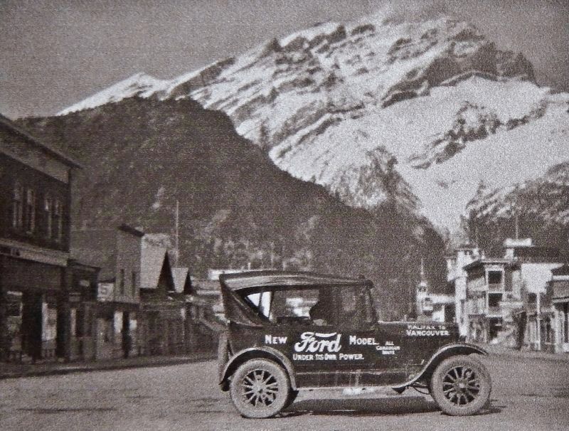
Courtesy CAA South Central Ontario
Marker detail: Banff National Park in 1925
1 ► Ontario, Algoma District, Batchawana Bay — Chippewa Falls / Chutes de Chippewa — Halfway Point on the Trans-Canada Highway / Au beau milieu de la Transcanadienne —  |
| On Trans-Canada Highway (Provincial Highway 17) 0.8 kilometers west of Whispering Pines Road, on the right when traveling west. | |||
| 2 ► Ontario, Algoma District, Batchawana Bay — The Trans-Canada Highway — |
| On Trans-Canada Highway (Provincial Highway 17) 0.8 kilometers west of Whispering Pines Road, on the right when traveling west. | |||
| 3 ► Ontario, Algoma District, Blind River — Blind River — Historic Site Historique — |
| On Provencher Lane just north of Causley Street (Trans-Canada Highway) (Ontario Route 17), on the left when traveling north. | |||
| 4 ► Ontario, Algoma District, Bruce Mines — Bruce Mines Museum / Musée de Bruce Mines — Brimming With Stories of a Mining Town / Un condensé d'histoire d'une localité minière — |
| On Trans-Canada Highway (Provincial Highway 17) at Robinson Drive, on the right when traveling east on Trans-Canada Highway. | |||
| 5 ► Ontario, Algoma District, Bruce Mines — The Bruce Mines — |
| On Trans-Canada Highway (Provincial Highway 17) at Taylor Street, on the right when traveling east on Trans-Canada Highway. | |||
| 6 ► Ontario, Algoma District, Desbarats — "Ripple Rock" — |
| On Trans-Canada Highway (Provincial Highway 17) 1.5 kilometers west of Kensington Road, on the right when traveling west. | |||
| 7 ► Ontario, Algoma District, Echo Bay — Echo Bay Celebrates Canada's Iconic “Loonie” / Célébre le « huard », pièce emblématique du Canada — |
| On Provincial Highway 17B 0.5 kilometers north of Church Street, on the left when traveling north. | |||
| 8 ► Ontario, Algoma District, Echo Bay — Welcome to Echo Bay — Home of the Loon Dollar Monument — |
| On Provincial Highway 17B 0.5 kilometers north of Church Street, on the left when traveling north. | |||
| 9 ► Ontario, Algoma District, Elliot Lake — Elliot Lake Mining Camp / Le camp minier d'Elliot Lake — |
| On Provincial Highway 108 at Hillside Drive South, on the left when traveling north on Provincial Highway 108. | |||
| 10 ► Ontario, Algoma District, Hilton Beach — Black Hole or Flogging/Le trou noir, ou le fouet? — Fort Saint Joseph National Historic Site — |
| Near Fort Road 4.8 kilometers west of A Line Road. | |||
| 11 ► Ontario, Algoma District, Hilton Beach — Build it Better/Une construction améliorée — Fort Saint Joseph National Historic Site — |
| Near Fort Road 4.8 kilometers west of A Line Road. | |||
| 12 ► Ontario, Algoma District, Hilton Beach — Carterton — |
| On 10th Side Road at P Line Road, on the right when traveling north on 10th Side Road. | |||
| 13 ► Ontario, Algoma District, Hilton Beach — Fort St. Joseph — Fort Saint Joseph National Historic Site — |
| Near Fort Road 4.8 kilometers west of A Line Road. | |||
| 14 ► Ontario, Algoma District, Hilton Beach — Fort St. Joseph / Le Fort Saint-Joseph — |
| Near Fort Road 3 kilometers west of A Line Road. | |||
| 15 ► Ontario, Algoma District, Hilton Beach — Inside the Walls/À l'intérieur des remparts — Fort Saint Joseph National Historic Site — |
| Near Fort Road 4.8 kilometers west of A Line Road. | |||
| 16 ► Ontario, Algoma District, Hilton Beach — Land of Little Comfort / Un Territoire offrant peu de confort — Fort Saint Joseph National Historic Site — |
| Near Fort Road 4.8 kilometers west of A Line Road. | |||
| 17 ► Ontario, Algoma District, Hilton Beach — Major Intersection/Une intersection importante — Fort Saint Joseph National Historic Site — |
| Near Fort Road 4.8 kilometers west of A Line Road. | |||
| 18 ► Ontario, Algoma District, Hilton Beach — Making Do/Se débrouiller avec les moyens du bord — Fort Saint Joseph National Historic Site — |
| Near Fort Road 4.8 kilometers west of A Line Road. | |||
| 19 ► Ontario, Algoma District, Hilton Beach — Tenby Bay — |
| On 5th Side Road 0.5 kilometers south of 2nd Concession Road, on the right when traveling south. | |||
| 20 ► Ontario, Algoma District, Hilton Beach — The Importance of Friends/L'importance des amis — Fort Saint Joseph National Historic Site — |
| Near Fort Road 4.8 kilometers west of A Line Road. | |||
| 21 ► Ontario, Algoma District, Hilton Beach — Want to be a Soldier?/Vous voulez être un soldat? — Fort Saint Joseph National Historic Site — |
| Near Fort Road 4.8 kilometers west of A Line Road. | |||
| 22 ► Ontario, Algoma District, Hilton Beach — What's the Story?/Histoire de la cheminée — Fort Saint Joseph National Historic Site — |
| Near Fort Road 4.8 kilometers west of A Line Road. | |||
| 23 ► Ontario, Algoma District, Richards Landing — Sailor's Encampment — |
| Near C Line Road (Provincial Highway 548) at Sailors Encampment Drive. | |||
| 24 ► Ontario, Algoma District, Richards Landing — Site of John Richards' Homestead — |
| On Richards Street just north of Russell Street (Ontario Route 548), on the left when traveling north. | |||
| 25 ► Ontario, Algoma District, Richards Landing — St. Joseph World War Memorial — |
| On Richards Street 0.2 kilometers north of Russell Street (Ontario Route 548), on the left when traveling north. | |||
| 26 ► Ontario, Algoma District, Sault Ste. Marie — 1622 — |
| Near Canal Drive 0.8 kilometers south of Huron Street. | |||
| 27 ► Ontario, Algoma District, Sault Ste. Marie — 1783 — |
| On Huron Street just south of Canal Drive, on the right when traveling south. | |||
| 28 ► Ontario, Algoma District, Sault Ste. Marie — 1821 — |
| On Huron Street just south of Canal Drive, on the right when traveling south. | |||
| 29 ► Ontario, Algoma District, Sault Ste. Marie — 1870 — |
| On Queen Street West at Huron Street, on the left when traveling west on Queen Street West. | |||
| 30 ► Ontario, Algoma District, Sault Ste. Marie — 70th Anniversary Dutch-Canadian Friendship Tulip Garden — Jardin de tulipes du 70ième anniversaire de l'amitié Hollandaise-Canadienne — |
| On Canal Drive 0.4 kilometers south of Huron Street, on the left when traveling south. | |||
| 31 ► Ontario, Algoma District, Sault Ste. Marie — A National Historic Site at the Sault / Un lieu historique national au Sault — |
| Near Canal Drive 0.7 kilometers south of Huron Street, on the left when traveling west. | |||
| 32 ► Ontario, Algoma District, Sault Ste. Marie — Algoma Central Corporation — 1899 — 1999 — |
| On Bay Street 0.2 kilometers south of Dennis Street, on the right when traveling south. | |||
| 33 ► Ontario, Algoma District, Sault Ste. Marie — An Accident at the Canal / Un accident dans le canal — |
| Near Canal Drive 0.7 kilometers south of Huron Street, on the left when traveling west. | |||
| 34 ► Ontario, Algoma District, Sault Ste. Marie — Anna Jameson — 1794-1860 — |
| On St Mary's River Drive 0.2 kilometers west of Foster Drive, on the right when traveling south. | |||
| 35 ► Ontario, Algoma District, Sault Ste. Marie — Baawaating — the Place of the Rapids / Baawaating — le lieu des rapides — |
| Near Canal Drive 0.7 kilometers south of Huron Street, on the left when traveling west. | |||
| 36 ► Ontario, Algoma District, Sault Ste. Marie — Blossoms and Berries — A Rose by Another Name — Ermatinger • Clergue National Historic Site — |
| Near Bay Street just west of Pim Street, on the left when traveling east. | |||
| 37 ► Ontario, Algoma District, Sault Ste. Marie — Canadian Veterans Memorial — |
| On Canal Drive 1 kilometer west of Huron Street, on the left when traveling west. | |||
| 38 ► Ontario, Algoma District, Sault Ste. Marie — Canal Under Construction, 1894 / Le canal en construction, 1894 — Views to the Past / Images du passé — |
| Near Canal Drive 0.7 kilometers south of Huron Street, on the left when traveling west. | |||
| 39 ► Ontario, Algoma District, Sault Ste. Marie — Celebrating Indigenous History and Heritage / Célébrons l'histoire et le patrimoine autochtones — |
| Near Canal Drive 0.7 kilometers south of Huron Street, on the left when traveling west. | |||
| 40 ► Ontario, Algoma District, Sault Ste. Marie — City of Sault Ste. Marie 100th Anniversary Flower Garden and Commemorative Plaque — |
| On Bay Street at Russ Ramsay Way, on the right when traveling south on Bay Street. | |||
| 41 ► Ontario, Algoma District, Sault Ste. Marie — Clergue Blockhouse — A Link to Sault Ste. Marie's Past — Ermatinger • Clergue National Historic Site — |
| Near Bay Street just west of Pim Street, on the left when traveling east. | |||
| 42 ► Ontario, Algoma District, Sault Ste. Marie — Col. John Prince — 1796-1870 — |
| Near Lake Street 0.6 kilometers south of Queen Street East. | |||
| 43 ► Ontario, Algoma District, Sault Ste. Marie — CPR Passenger Ships in the Lock / Paquebots de la CFCP dans l'écluse — Views to the Past / Images du passé — |
| Near Canal Drive 0.7 kilometers south of Huron Street, on the left when traveling west. | |||
| 44 ► Ontario, Algoma District, Sault Ste. Marie — D-Day/Jour J — 1944 — |
| Near Canal Drive 0.7 kilometers south of Huron Street, on the left when traveling west. | |||
| 45 ► Ontario, Algoma District, Sault Ste. Marie — Discovery of Steelton Wells — March 6th 1914 — |
| On Second Line West (Provincial Highway 550) just east of 1st Avenue, on the right when traveling east. | |||
| 46 ► Ontario, Algoma District, Sault Ste. Marie — Dr. Roberta Bondar — |
| On Foster Drive 0.4 kilometers east of St Mary's River Drive, on the right when traveling east. | |||
| 47 ► Ontario, Algoma District, Sault Ste. Marie — Edison Sault Electric Building — |
| Near Saint Mary's River Drive 0.3 kilometers west of Bay Street, on the left when traveling west. | |||
| 48 ► Ontario, Algoma District, Sault Ste. Marie — Elderberries and Roses — Ermatinger • Clergue National Historic Site — |
| Near Bay Street just west of Pim Street, on the left when traveling east. | |||
| 49 ► Ontario, Algoma District, Sault Ste. Marie — Emergency Swing Bridge Dam / Barrage tournant de secours — |
| On Canal Drive 1.2 kilometers west of Huron Street, on the left when traveling west. | |||
| 50 ► Ontario, Algoma District, Sault Ste. Marie — Equality and Multiculturalism / Égalité et multiculturalisme — Viola Desmond / Viola Desmond — |
| Near Canal Drive 0.7 kilometers south of Huron Street, on the left when traveling west. | |||
| 51 ► Ontario, Algoma District, Sault Ste. Marie — Ermatinger House — La Maison Ermatinger — |
| Near Bay Street at Pim Street. | |||
| 52 ► Ontario, Algoma District, Sault Ste. Marie — Ermatinger Old Stone House — Oldest Stone Building Northwest of Toronto — Ermatinger • Clergue National Historic Site — |
| Near Bay Street just west of Pim Street, on the left when traveling east. | |||
| 53 ► Ontario, Algoma District, Sault Ste. Marie — Francis Hector Clergue — (1856-1939) — |
| On Hub Trail at Canal Drive, on the right when traveling north on Hub Trail. | |||
| 54 ► Ontario, Algoma District, Sault Ste. Marie — Gathering Place — |
| Near Foster Drive at Spring Street. | |||
| 55 ► Ontario, Algoma District, Sault Ste. Marie — Herbs in the 19th Century — Ermatinger • Clergue National Historic Site — |
| Near Bay Street just west of Pim Street, on the left when traveling east. | |||
| 56 ► Ontario, Algoma District, Sault Ste. Marie — John Rowswell Park — John Rowswell Hub Trail — |
| Near Foster Drive 0.2 kilometers south of Bay Street. | |||
| 57 ► Ontario, Algoma District, Sault Ste. Marie — Keystone Lodge — 1885 - 1985 — |
| On Albert Street East at Elgin Street, on the right when traveling north on Albert Street East. | |||
| 58 ► Ontario, Algoma District, Sault Ste. Marie — Nicolas Perrot — ca. 1644-1717 — |
| Near Bay Street at East Street. | |||
| 59 ► Ontario, Algoma District, Sault Ste. Marie — Opening and Closing the Gates / Ouverture et fermeture des portes — |
| Near Canal Drive 0.7 kilometers south of Huron Street, on the left when traveling west. | |||
| 60 ► Ontario, Algoma District, Sault Ste. Marie — Our Bushplane Museum / Notre musée d'avions de brousse — Come Fly Away / Une visite de haut vol — |
| Near Pim Street at Bay Street. | |||
| 61 ► Ontario, Algoma District, Sault Ste. Marie — Passenger and Packet Freighters on the Upper Great Lakes — |
| On Foster Drive 0.4 kilometers east of St Mary's River Drive, on the right when traveling east. | |||
| 62 ► Ontario, Algoma District, Sault Ste. Marie — Paving Brick — |
| On Ron Francis Way (Bruce Street) at Queen Street East, on the right when traveling north on Ron Francis Way (Bruce Street). | |||
| 63 ► Ontario, Algoma District, Sault Ste. Marie — Post Office — 1902 — |
| On Queen Street East at East Street, on the right when traveling north on Queen Street East. | |||
| 64 ► Ontario, Algoma District, Sault Ste. Marie — Powerhouse, 1900 / La centrale électrique, 1900 — Views to the Past / Images du passé — |
| Near Canal Drive 0.5 kilometers south of Huron Street, on the left when traveling west. | |||
| 65 ► Ontario, Algoma District, Sault Ste. Marie — Precious Blood Cathedral — |
| On Queen Street East 0.2 kilometers west of Pim Street, on the right when traveling west. | |||
| 66 ► Ontario, Algoma District, Sault Ste. Marie — Roberta Bondar Park — |
| Near Foster Drive just south of St Mary's River Drive, on the right when traveling south. | |||
| 67 ► Ontario, Algoma District, Sault Ste. Marie — Sacred Mountain Ash Tree — Planted August 10, 2001 — |
| Near Bay Street just west of Pim Street, on the left when traveling east. | |||
| 68 ► Ontario, Algoma District, Sault Ste. Marie — Sault Ste. Marie Canal / Canal de Sault Ste. Marie — |
| Near Canal Drive 0.7 kilometers south of Huron Street, on the left when traveling west. | |||
| 69 ► Ontario, Algoma District, Sault Ste. Marie — Sault Ste. Marie Memorial Tower — |
| On Queen Street East just north of Ron Francis Way, on the left when traveling north. | |||
| 70 ► Ontario, Algoma District, Sault Ste. Marie — Sault Ste. Marie Ship Canal — Canal de Sault Ste. Marie — |
| Near Canal Drive 0.7 kilometers south of Huron Street, on the right when traveling east. | |||
| 71 ► Ontario, Algoma District, Sault Ste. Marie — Sault Ste. Marie World War II Memorial — Abitibi Power & Paper Company Limited — |
| On Huron Street just south of Canal Drive, on the right when traveling south. | |||
| 72 ► Ontario, Algoma District, Sault Ste. Marie — Shingwauk Hall — |
| On Queen Street East 0.2 kilometers west of Riverside Drive, on the right when traveling west. | |||
| 73 ► Ontario, Algoma District, Sault Ste. Marie — Spirits Rising — |
| On Saint Mary's River Drive 0.3 kilometers west of Bay Street, on the left when traveling west. | |||
| 74 ► Ontario, Algoma District, Sault Ste. Marie — The "Chicora" Incident — 1870 — |
| On Canal Drive 1 kilometer west of Huron Street, on the right when traveling west. | |||
| 75 ► Ontario, Algoma District, Sault Ste. Marie — The All Canadian Waterway (1895-1959) / La voie navigable entièrement canadienne (1895-1959) — |
| Near Canal Drive 0.7 kilometers south of Huron Street, on the left when traveling west. | |||
| 76 ► Ontario, Algoma District, Sault Ste. Marie — The Canal at war, 1914 / Le canal en guerre, 1914 — Views to the Past / Images du passé — |
| Near Canal Drive 0.7 kilometers south of Huron Street, on the left when traveling west. | |||
| 77 ► Ontario, Algoma District, Sault Ste. Marie — The Dam in Action! / Le barrage à l'œuvre! — |
| On Canal Drive 1.1 kilometers west of Huron Street, on the left when traveling west. | |||
| 78 ► Ontario, Algoma District, Sault Ste. Marie — The First Sault Ste. Marie Canal — Le Premier Canal de Sault Ste-Marie — |
| On Huron Street 0.1 kilometers south of Canal Drive, on the right when traveling south. | |||
| 79 ► Ontario, Algoma District, Sault Ste. Marie — The Last Emergency Swing Dam in the World! / Le dernier barrage tournant de secours au monde! — |
| On Canal Drive 1.1 kilometers west of Huron Street, on the left when traveling west. | |||
| 80 ► Ontario, Algoma District, Sault Ste. Marie — The Métis in Sault Ste. Marie / Les Métis de Sault Ste. Marie — |
| Near Canal Drive 0.7 kilometers south of Huron Street, on the left when traveling west. | |||
| 81 ► Ontario, Algoma District, Sault Ste. Marie — The North West Company Post — |
| Near Hub Trail 0.1 kilometers east of Canal Drive, on the right when traveling east. | |||
| 82 ► Ontario, Algoma District, Sault Ste. Marie — The Sault Canal / Le canal du Sault — |
| Near Canal Drive 0.7 kilometers south of Huron Street, on the left when traveling west. | |||
| 83 ► Ontario, Algoma District, Sault Ste. Marie — The Sault's Industrial Heritage / Le patrimoine industriel du Sault — |
| Near Canal Drive 0.7 kilometers south of Huron Street, on the left when traveling west. | |||
| 84 ► Ontario, Algoma District, Sault Ste. Marie — The St. Marys River / La rivière Sainte-Marie — The Canadian Heritage Rivers System / Le Réseau de rivières du patrimoine canadien — February / Février 2000 — |
| Near Foster Drive just north of Spring Street, on the left when traveling north. | |||
| 85 ► Ontario, Algoma District, Sault Ste. Marie — The Three Sisters Garden — Welcome to the Garden of the “Three Sisters” — Ermatinger • Clergue National Historic Site — |
| Near Bay Street just west of Pim Street, on the left when traveling east. | |||
| 86 ► Ontario, Algoma District, Sault Ste. Marie — To The Voyageurs — |
| On Huron Street just south of Queen Street West, on the right when traveling south. | |||
| 87 ► Ontario, Algoma District, Sault Ste. Marie — Waterfront / Les Rives — |
| Near Canal Drive 0.7 kilometers south of Huron Street, on the left when traveling west. | |||
| 88 ► Ontario, Algoma District, Sault Ste. Marie — What a Rush! / Urgence! — |
| On Canal Drive 1.1 kilometers west of Huron Street, on the left when traveling west. | |||
| 89 ► Ontario, Algoma District, Sault Ste. Marie — Why Preserve This Big Hunk of Steel? / Pourquoi préserver cette énorme structure d'acier? — |
| On Canal Drive 1.1 kilometers west of Huron Street, on the left when traveling west. | |||
| 90 ► Ontario, Algoma District, Sault Ste. Marie — William Henry “Bill” Orazietti — |
| On Saint Mary's River Drive 0.3 kilometers west of Bay Street, on the left when traveling west. | |||
| 91 ► Ontario, Algoma District, Thessalon — Capture of the "Tigress" and "Scorpion" — |
| On Lakeside Drive just north of Stanley Street, on the right when traveling north. | |||
| 92 ► Ontario, Algoma District, Wawa — 100 Years of Gold Mining in Michipicoten — 1897-1997 — |
| Near Mission Road (Provincial Highway 101) just east of Trans-Canada Highway (Provincial Highway 17), on the left when traveling north. | |||
| 93 ► Ontario, Algoma District, Wawa — Agnes Turcott (nee Lindgren) — |
| Near Mission Road (Provincial Highway 101) just east of Trans-Canada Highway (Provincial Highway 17), on the left when traveling north. | |||
| 94 ► Ontario, Algoma District, Wawa — Aime Breton — |
| On Broadway Avenue just north of Mackey Street, on the left when traveling north. | |||
| 95 ► Ontario, Algoma District, Wawa — Alex Ross — |
| Near Mission Road (Provincial Highway 101) just east of Trans-Canada Highway (Provincial Highway 17), on the left when traveling north. | |||
| 96 ► Ontario, Algoma District, Wawa — Artillo Berdusco — |
| On Broadway Avenue just north of Mackey Street, on the left when traveling north. | |||
| 97 ► Ontario, Algoma District, Wawa — Bernard Alphonse (Al) Turcott — |
| Near Mission Road (Provincial Highway 101) just east of Trans-Canada Highway (Provincial Highway 17), on the left when traveling north. | |||
| 98 ► Ontario, Algoma District, Wawa — Birth of a Legend — |
| On Mission Road (National Highway 101) 0.5 kilometers north of Trans-Canada Highway (National Highway 17), on the left when traveling north. | |||
| 99 ► Ontario, Algoma District, Wawa — Construction of the Trans-Canada Highway / La Construction de la Route Transcanadienne — |
| On Mission Road (National Highway 101) 0.5 kilometers north of Trans-Canada Highway (National Highway 17), on the right when traveling south. | |||
| 100 ► Ontario, Algoma District, Wawa — Francis Hector Clergue — |
| On Broadway Avenue just north of Mackey Street, on the left when traveling north. | |||
136 entries matched your criteria. The first 100 are listed above. The final 36 ⊳