This region’s first farmers. mainly of British descent, established themselves on lots of 200
acres after the Mississauga purchase of 1805. As they cleared their land, their first products for sale were timber and potash (from the burning of trees . . . — — Map (db m242254) HM
As Oakville’s population and
prosperity increased, stately homes were built near George's Square. These houses represent different architectural styles and designs from various periods in the town's development.
19th Century Heritage Homes . . . — — Map (db m238721) HM
In Oakville, as in most of the area villages, the first public building to be erected was the tavern. Necessary way-stations in a land of arduous travel, taverns also provided meeting places for the new settlers to conduct business and enjoy . . . — — Map (db m241808) HM
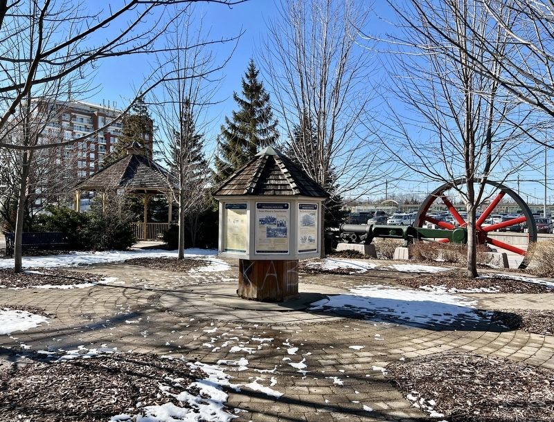
Tannery Park
Life "Over the Creek"
West Harbors history as a working class neighborhood began in the 1830s with William Chisholm's need to raise money for his ill-fated Oakville Hydraulic Company, which was to construct a dam on the . . . — — Map (db m237434) HM
The area that is present day Oakville was first settled by Europeans in 1806, after the land was purchased from the Mississauga tribe and Trafalgar Township was surveyed.
Twenty-one years later, in 1827, William Chisholm bought 960 acres at . . . — — Map (db m238670) HM
On this site in 1827 Oakville's meeting hall was built,
which also was used as a church on Sundays and a
school on weekdays. Oakville's first library was
established here when William Tassie, the town's first
schoolmaster, opened a reading room. . . . — — Map (db m237948) HM
The early settlers of Oakville, while full of optimism lacked formal training- there were few master builders or architects at the time. In fact, the shipbuilders who came to work for Chisholm in the shipyard also built many of the first houses . . . — — Map (db m238338) HM
Period Homes
For the greater part of the nineteenth century, the centre hall Georgian plan remained popular. In the early homes, this basic form was embellished with door and window surrounds and cornice treatments. The degree of decorative . . . — — Map (db m238341) HM
An Act to incorporate the Town of Oakville was assented to on May 27th, 1857. The first council members were:
Mayor G.K. Chisholm Farmer & Landowner
Ward 1 R.K. Chisholm Customs Agent & Postmaster
W.E. Hagaman General Merchant
Ward . . . — — Map (db m238339) HM
Under the Royal Proclamation of 1763, European settlement could not proceed without a formal treaty with the aboriginal proprietors of the land. In 1806 the Mississauga signed the treaty surrendering all the lands from Etobicoke River to Burlington . . . — — Map (db m241812) HM
The first town survey was completed in 1833, enclosing an area bounded on the west by Brock Street, on the north by Rebecca and Randall Streets, and on the east by Allan Street.
Road allowances were laid out in the standard grid pattern . . . — — Map (db m238336) HM
Oakville Heritage Trails
Tannery Park
Oakville founder William Chisholm's 1827 grant of land included about 300 acres of land west of Sixteen Mile Creek. By buying a parcel owned by James and Susannah Brock, he was able to extend the . . . — — Map (db m237941) HM
For nearly a century, commercial fishing was a way of life for the village of Bronte. In 1850, the mouth of Twelve Mile Creek resembled an Atlantic Coast outport. Fishing shanties lined the creek, nets hung on reels drying in the sun, and fish boats . . . — — Map (db m247113) HM
In Lasting Memory
of the
United Empire
Loyalists
Who preferred to remain loyal British
subjects and came to canada
in large numbers immediately
following the American Revolution
of 1776 and the . . . — — Map (db m66131) HM
European settlement began here
in 1792 with William Davis (1741-1834),
a United Empire Loyalist
who left North Carolina to fight
alongside the British in the
American Revolution. Davis was
granted 2300 acres in Barton and
Saltfleet . . . — — Map (db m228834) HM
This milling stone is all that remains of Albion Mills.
The first mill, built about 1795 by Wm. Davis, contributed
to the area's economic development. Settlers came and
the land was cleared. Many of their early homes are
within a short . . . — — Map (db m228965) HM
The Hermitage Estate encompassed a mansion, several
outbuildings, and a large farm. Throughout the mid-nineteenth century, the farm thrived under George Leith's management, producing hay, oats, barley, and wheat crops. He also grew carrots, . . . — — Map (db m226401) HM
In 1791 James Wilson in partnership with Richard Beasley built a sawmill and a grist-mill on the site of this community. The mills were sold to Jean Baptiste Rousseaux (known as St. John) in 1794 and developed into a thriving pioneer enterprise. . . . — — Map (db m220193) HM
The Hermitage had several owners before it was acquired by George Gordon Browne Leith (1812 -1887) in 1855. Mr. Leith, a wealthy Irish-born Scottish immigrant, settled his family on the land because of its proximity to the privileges of the . . . — — Map (db m226349) HM
Richard Hatt became one of the most influential men in this region. He emigrated from England in 1792 and worked in a store in Newark (Niagara). In 1795 he petitioned the government for land for himself, his siblings and father. They arrived in . . . — — Map (db m246663) HM
This cemetery was part of the Young farm purchased in 1806 by Daniel Young.
What is reputed to be "Hamilton's first murder
mystery" is connected with this farm property.
Daniel's son John and his grandson Christopher
were accused of . . . — — Map (db m246333) HM
Born at Queenston, George Hamilton was the son of a prosperous merchant, the Hon. Robert Hamilton. He followed his father's career as a merchant in the Niagara District until the War of 1812, in which he served as a Captain of Light Dragoons. . . . — — Map (db m218241) HM
William Terryberry
(1779-1847)
Since 1812, the name William Tenybeny has been associated with this section of Mohawk Road West. Having immigrated to the province of Upper Canada from the state of New Jersey, Terryberry purchased land along . . . — — Map (db m232325) HM
In 1794, William Cope and his family were the first settlers arriving in what is now the Copetown area. The first worship services were held in settlers' homes. In 1808, these settlers joined a large circuit of parishes with William Case as . . . — — Map (db m245858) HM
[North Side]
This monument is dedicated to the lasting memory of
The United Empire Loyalists
who, after the Declaration of Independence, came into British North America from the seceded American colonies and who, with faith and fortitude, . . . — — Map (db m229935) HM
By 1799 the Morden family had a sawmill near this site
on Spencer Creek north of Dundas Street. They sold this
property in 1800 to Edward Peer who built a grist-mill
about 300 yards south-east, close to Dundas Street, and
adopted the name . . . — — Map (db m220819) HM
Richard Hatt was an ambitious English businessman who came to Dundas in 1801. The large milling complex he built at the junction of Governor's Road and Spencer Creek, known as the Dundas Mills, transformed the quiet valley into an industrial centre . . . — — Map (db m246745) HM
The area now known as the Dundas Driving Park was
previously a large part of the estate of George Rolph,
lawyer, local politician and hero of the War of 1812. For
many years Rolph graciously allowed a large portion of his
estate to be used as . . . — — Map (db m234178) HM
THE FOUNDING OF DUNDAS
In 1793 Lieutenant-Governor Simcoe authorized a townplot in this vicinity at the then eastern terminus of Dundas Street. Its original name, "Coote's Paradise", was derived from that of the adjoining marsh, a haunt of . . . — — Map (db m219992) HM
From 1860 to the early 1940s, the boathouse community
known as "Shack Town" was located along the Desjardins
Canal and the east shore of Cootes Paradise. Homes ranged from tar-paper shacks to two-story dwellings. Many residents used boats to . . . — — Map (db m227154) HM
Dedicated to the Irish who settled in Hamilton.
Their hard work, dedication,
love of family and pride,
continues to contribute
to the growth
and prosperity of this
great city.
Erected in this
Sesquicentennial Year of 1996 . . . — — Map (db m235969) HM
The MacNab-Charles Heritage Conservation District is one of the finest concentrations of pre-Confederation architecture in Hamilton. It evokes a Hamilton in its founding stages, when Scottish Presbyterian settlers erected new churches and houses . . . — — Map (db m234787) HM
Early Black Community on Hamilton Mountain
Beginning in the 1840s, people of African descent purchased plots of land on the Hamilton Mountain brow along today's Concession Street between Upper Wellington and Upper Sherman Streets. William . . . — — Map (db m229634) HM
Organized worship was first held in the Flamboro school house opposite the present church in 1825. George Sheed, licentiate of the Church of Scotland, tutored the children of the Honourable James Crooks of Crooks' Hollow and conducted Sunday . . . — — Map (db m245861) HM
Robert Land settled near this site as early as 1784 as a refugee of the American Revolution. A Pennsylvania
magistrate and farmer, Land joined Joseph Brant's Volunteers as a courier, scout and Loyalist recruiter. Captured and sentenced to death . . . — — Map (db m220750) HM
This land was occupied by various indigenous groups, including the Chonnonton Nation, meaning people who tend deer'. They were known by their neighbours as the 'Attiuoindaron' and by the French as the Neutrals.
United Empire Loyalist Colonel . . . — — Map (db m220755) HM
Jacob Smith (1739-1821) came to Canada from New Jersey in August of 1788 with his wife, Elizabeth (nee Lewis), and 13 surviving children. As a member of the Jersey Volunteers, who fought with the British during the American Revolution, he is . . . — — Map (db m246376) HM
This plaque commemorates the historic homesite of
Richard Beasley
United Empire Loyalist Merchant Soldier Politician
Member of the Legislative Assembly of Upper Canada 1791
Appointed Justice of the Peace 1795, Magistrate 1796 . . . — — Map (db m231253) HM
In the 1790s, many of Hamilton's first United Empire Loyalist families settled around this site where the head of an extended inlet from Burlington Bay intersected a prehistoric trail from Niagara.
Smith's Tavern, the first public house in . . . — — Map (db m224070) HM
Jacob Hess (1766-1823) served as a Private in Captain Charles Depew's company of the 5th Regiment Lincoln Militia during the War of 1812. His brothers Samuel and Peter, and his son-in-law David Almas, Sr. also served in the same unit. Jacob's . . . — — Map (db m246635) HM WM
Augustus Jones (C. 1757-1836)
Augustus Jones was born of Welsh ancestry in the Hudson River valley circa 1757. He received survey training in New York City in 1786 and he moved to Niagara in 1787. From then until 1789, to meet the needs of . . . — — Map (db m232645) HM
The Mississaugas (Anishinaabe Peoples) have lived in the Niagara and Great Lakes region since the late 17th century. Known as Head-of-the-Lake on the North shore of Lake Ontario, this site was a strategic communication and trade junction. A . . . — — Map (db m246969) HM
John William Kerr emigrated from Ireland to Canada in the 1840s and settled a crown grant on the Hamilton Mountain in the 1850s. Kerr was made the first provincial fisheries overseer by royal warrant in 1864. From a telescope on the escarpment . . . — — Map (db m223692) HM
William Rymal (1759-1852), his wife Barbara and his younger brother along with their family members obtained, through crown grants and purchases, 800 acres of land on either side of Upper Paradise Road from the escarpment to Rymal Road. Arriving . . . — — Map (db m233115) HM
Originally located at the north-east corner of king Street East and Nash Road in the city of Hamilton, the house known as the Nash=Jackson House was built in 1818. The property on which the house stood, part of William Gage's original land grant, . . . — — Map (db m56859) HM
Erected in memory
the Pioneers of
Clinton
This marks the site
of the first church
erected A.D. 1835
and the burial grounds
of the pioneers of the
district
1928 — — Map (db m233557) HM
According to legend, the Honourable John Dryden, Ontario Minister of Agriculture, got off the train at Barclay Tank to stretch his legs on a trip to the west in 1893. He was impressed with the clover growing along the embankment, and as a result . . . — — Map (db m242999) HM
Alan Durance left behind a legacy of accomplishments the likes of which most people only dream. It all began in 1919 at age 17 when he arrived from England with his parents and siblings and settled on a homestead farm two miles north of Dryden. . . . — — Map (db m243095) HM
About 1885 gold was discovered at Goldrock on the northern tip of Upper Manitou Lake about 30 miles southeast of here. A townsite was laid out in 1898 which grew to a town of 500 by its peak in 1908. At that time there were 5 gold mines operating . . . — — Map (db m243000) HM
Built in 1897 by J. S. McFadyenMr. McFadyen built several of the town’s early buildings including the first jail & council chamber in 1904. — — Map (db m243242) HM
In 1894, The Honourable John Dryden, Minister of Agriculture, travelled to Northwestern Ontario to explore the commercial possibilities of the region. He found clover growing in abundance and, at that time, there was a demand for clover on the . . . — — Map (db m243054) HM
In the early 1900’s the best and strongest wrapping paper was made from Jack Pine using the Kraft process. The process used then required quantities of soap stone, and there are a number of soap stone mines in the Dryden area. The principal forest . . . — — Map (db m242993) HM
Construction of the Canadian Pacific Railway was completed through the Dryden area in 1882. The railroad was constructed through virgin wilderness in this area, mostly mature forest which was readily ignited by sparks from the wood burning . . . — — Map (db m242998) HM
Dedicated in memory of William Jennings (Bill) Silver A papermaker of forty-eight years and husband of Edna Lillian Silver (nee Neely), Bill was a gentle and upright man who loved and supported his family and his community. The Silver family was . . . — — Map (db m243293) HM
Reception of the Marquis of Lorne, August 5, 1881 at the Lake of the Woods, Rat Portage Most of the 500-plus inhabitants of Rat Portage, including older Indians and French-Canadian voyageurs, waited along the waterfront behind today's Library, . . . — — Map (db m245165) HM
This was early frontier Kenora/Keewatin, and was named by the Ojibway people for the many muskrats inhabiting these waters. Venturing into this area were a number of fur traders employed by the Northwest Company and the Hudson’s Bay Company. They . . . — — Map (db m244996) HM
On Old Fort Island a half mile north of here, the Hudson's Bay Company erected a stockaded fur trading post about 1836. This was the first known European structure within present Kenora. In 1861 the post was moved to the mainland, where it formed . . . — — Map (db m106495) HM
Born at St. Sulpice, Quebec, and ordained in 1849, Father Lacombe took up mission work at Fort Edmonton in 1852. The following year he founded Ste. Anne, first of several Oblate missions he established in what is now Alberta. He won the confidence . . . — — Map (db m106498) HM
In September, 1883 an event unique in Canadian political history occurred in Rat Portage. The origin of the story took place thirteen years earlier when both Ontario and Manitoba claimed Rat Portage as part of their territory. Manitoba claimed all . . . — — Map (db m244999) HM
In August, 1870, a force of British regulars and Canadian militia comprising some 1,200 men commanded by Colonel Garnet Wolseley, arrived in this area en route to the Red River to establish Canadian authority within the present province of . . . — — Map (db m106494) HM
Main Street, Rat Portage in 1870 was little more than a collection of buildings on the edge of the Lake. Frank Gardner's business establishment is clearly identified; a pioneer who was active for a further 65 years. Lower photo, taken in 1880 . . . — — Map (db m245198) HM
By Water Since Explorer Days By Rail Since 1882 By Road Since 1932 The Keenora: Built in Kenora in 1897, it was the largest steamer ever to operate on Lake of the Woods. It was 128 feet long with a beam of 28 feet. It’s 22 staterooms could . . . — — Map (db m244998) HM
We are standing on a section of Queen Street that has a long history of civilian uses for housing, in close proximity to important military facilities. An early town graveyard still exists up the street next to St. Paul's Church.
The site is on . . . — — Map (db m144972) HM
English:
In September 1783, Deputy Surveyor-General John Collins was despatched to Cataraqui by Governor Haldimand to lay out townships for loyalist settlers. The necessary land was purchased from Mississauga Indians, and on 27 . . . — — Map (db m140199) HM
One of the most influential and controversial figures in Canadian history, Frontenac was born at St-Germain-en-Laye, France. As a member of the noblesse d'epee he was able in 1672 to secure the appointment as Governor-General of New France. Devoted . . . — — Map (db m39978) HM
This Anglican Church burial ground is one of the oldest consecrated cemeteries in Ontario.
Loyalists, who wanted to continue living under British rule, came to Kingston after the American Revolution. A Loyalist soldier, Corporal Forbes of the . . . — — Map (db m141394) HM
English:
Emigrating from Eastern Europe in the late 1800s, Kingston's Jewish Community grew to 125 persons and three congregations by 1908. When Isaac Cohen committed to building a synagogue, they formed the Beth Israel . . . — — Map (db m144899) HM
This plaque was unveiled by
HER MAJESTY THE QUEEN
during the tercentenary celebrations
of the City of Kingston
to commemorate the granting of
Queen's University's Royal Charter
by Queen Victoria on 16 October 1841
27 June . . . — — Map (db m243753) HM
Formerly St. George’s Burial Ground, this cemetery is the oldest in the Kingston district. Among the distinguished persons buried here are Molly Brant, Reverend John Stuart, Lieutenant Hugh Earl (Provincial Marine), Colonel Sir Richard Bonnycastle, . . . — — Map (db m141397) HM
English:
Because of the Loyalist influx into the western part of Quebec after the American Revolution, the province was divided into Upper and Lower Canada (now Ontario and Quebec). The Constitutional Act of 1791 provided for . . . — — Map (db m140198) HM
The largest Loyalist Corps in the Northern Department during the American Revolution, the King's Royal Regiment of New York was raised on June 19, 1776 under the command of Sir John Johnson. Originally composed of one battalion with ten companies, . . . — — Map (db m39977) HM
Born in Pennsylvania, Stuart was ordained in 1770 and sent to Fort Hunter, N.Y., as missionary to the Mohawks. An ardent Loyalist, he came to Canada in 1781 where he was appointed chaplain to the 2nd Battalion King’s Royal Regiment of New York. In . . . — — Map (db m144202) HM
Following the discovery of oil at Oil Springs in 1857 prospectors extended their search to the entire township of Enniskillen. At the site of Petrolia, which contained two small settlements with post offices named Durance and Ennis, a well was . . . — — Map (db m78417) HM
The sawmill and grist-mill completed here on the Mississippi River in 1823 by Daniel Shipman provided the nucleus around which a community known as Shipman's Mills had developed by 1824. About 1850 two town plots were laid out here - "Victoria" by . . . — — Map (db m104000) HM
In 1857 James Rosamond built this mill on the Mississippi River, thereby firmly establishing the woollen industry in Almonte. An Irish-born entrepreneur, Rosamond was previously a resident of nearby Carleton Place where, in 1846, he had built one . . . — — Map (db m104009) HM
The families of Edmond Morphy and William Moore became in 1819 the first settlers on the site of Carleton Place. About 1822 Hugh Boulton built a mill here on the Mississippi River which provided the nucleus around which a community, known as . . . — — Map (db m103985) HM
The settlers who first received land grants within the present area of the Town of Carleton Place were four members of the family of Edmond Morphy and three members of the William Moore family. The Moore family's grant stretched from present-day . . . — — Map (db m234328) HM
The Town Hall Square forms the nucleus of the pioneer development along the Mississippi River and rapids. This environmentally important area, near the unique and significant stand of Hackberry Trees, has become the central part of the Town of . . . — — Map (db m234372) HM
The Ripple [Steamboat on Mississippi River] 1885
First Nations Harvesting of wild rice
Logging on the Mississippi
Men's War Canoe Team 1905
The Ballygiblin Riots 1824 — — Map (db m234374) HM
The first road through Beckwith Township was cleared
in 1819 from Richmond to Perth:
This work was done by British soldiers. The road was cut 60 feet wide
and was to connect the military settlements of Richmond and Perth.
It entered . . . — — Map (db m234011) HM
Perth merchants regularly used the Tay Canal between 1834 and 1850. Potash, timber and local produce were shipped to Montreal, and dry goods and manufactured articles were imported.
But the canal steadily fell into disrepair as soon . . . — — Map (db m208017) HM
In the wilderness of 19th century Upper Canada, transportation was the key to settlement, growth and prosperity. Waterways, modified with locks and canals, were seen as the solution to many transportation problems. A feverish era of . . . — — Map (db m208032) HM
The landscape in the Tay Basin has changed dramatically over the years. It has gone from an early settlers' campground to shipping docks and from residential housing to a market square.
Once called Perth Landing, its docks bustled with . . . — — Map (db m207886) HM
The British government established the first Military Settlement in Canada in March, 1816 at Perth upon Tay in response to continuing fears of an American invasion
following the War of 1812. A depot was established with a Superintendent's . . . — — Map (db m207948) HM
Perth was created in 1816 as part of a grand British defence strategy which included the Rideau Canal and Fort Henry at Kingston. By 1822 Perth had burst into a vibrant frontier town, the new County Seat for the District of Bathurst . . . — — Map (db m208000) HM
Enthusiasm for canals in 19th century Canada remained high despite the flurry of railway
construction after 1850. The government continued to maintain canals, including the Rideau Canal, to ensure their competitiveness. This kept alive . . . — — Map (db m208028) HM
The Tay has seen many tales over the years. Once covered by the salt water of
the Champlain Sea, the banks of the Tay hold the memory of a very different aquatic life from what you see today. The fossils in the bedrock tell the story of a . . . — — Map (db m207937) HM
[Photo captions, counterclockwise from top left, read]
• Spalding & Stewart
• Spalding & Stewart
• McLaren's Distillery
• THE TAY FROM HAGGARTS
• [Trail map and] Legend
The Tay River Trail is an historic pathway and portage . . . — — Map (db m233875) HM
The present townships of Bathhurst, Beckwith and Drummond were settled under the jurisdiction of the Quarter Master General's Department. Scottish emigrants, quartered in barracks at Brockville during the winter of 1815-16, and soldiers . . . — — Map (db m207754) HM
One of the most influential Presbyterian clergymen in Upper Canada, Bell was born in Airdrie, Scotland. In 1808, he entered a Congregational academy in London to train for the ministry and, after completing his studies in Scotland and . . . — — Map (db m233976) HM
Constructed 1826-32 by the British government for military purposes, but used principally for commerce, the Rideau waterway, together with the lower Ottawa River, was the first canalized route from Montreal to the Great Lakes. Although eastbound . . . — — Map (db m142082) HM
A tribute to the great
Canadians that came
from the British Isles to
Canada and lived off
the land. They worked
hard to clear the land,
built log homes and
raised their families.
All that is left to
remember them is the
little . . . — — Map (db m142020) HM
Farmersville was named by its founder, Joshua Bates to honour farmers as the foundation of the community. Bates was an entrepreneur, philanthropist, politician, and a progressive Reformer who believed that education, and hard work would . . . — — Map (db m141903) HM
This Mural was created by artist, Pierre Hardy on the north wall of the H & R Feed & Pet Supplies building in 1988. In this mural, the action takes place in the lumberyard of the Hartley Saw Mill. It is springtime, the time of year when Farmers . . . — — Map (db m142021) HM
A tribute to the little
immigrants ages 5 to 14 who
came from the Quarrier Homes
Scotland, and the Barnardo
Homes England, to the
Fairknowe Home in Brockville.
They were placed on hundred
acre farms and made to work
long hours at . . . — — Map (db m141961) HM
The Brockville Farmers' Market was first established here in 1833
The Legislative Assembly of Upper Canada, by an Act passed on December 18, 1832, authorized the establishment of a market in Brockville. The Act was signed into . . . — — Map (db m141676) HM
Brockville was named after the Provisional Civi Administrator of Upper Canada and the Commanding Officier of the British forces in Upper Canada during the War of 1812-1814.
The government of Upper Canada first named this community . . . — — Map (db m83527) HM
A prominent Canadian politician, Morris was born in Paisley, Scotland. His family immigrated to Canada in 1801 and later settled in Elizabethtown (Brockville). He joined his brothers, Alexander and William, in business there about 1820 and by 1836 . . . — — Map (db m87063) HM
Major James Morrow Walsh was a colourful figure who played an important role in opening the Canadian West. Born on May 22, 1840 in Prescott, Ontario, he became one of the first nine officers of the North West Mounted Police . . . — — Map (db m141663) HM
447 entries matched your criteria. Entries 101 through 200 are listed above. ⊲ Previous 100 — Next 100 ⊳