147 entries match your criteria. The first 100 are listed. The final 47 ⊳
Tennessee – Williamson County Historical Society Historical Markers
A bloody and pivotal Civil War battle. Native American settlements. Historic 200-year-old houses. These and other facets of Williamson County's rich history are chronicled by this series of markers erected by the local historical society.
On Owen Hill Road east of Do Drop In Lane, on the left when traveling east.
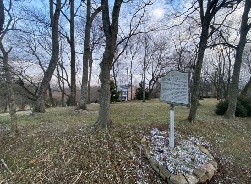
Once a thriving community, Owen Hill was home to Peter, Richard. and Greenberry Owen, pioneer tobacconists, who came to Williamson County in 1817. Confederate surgeon Dr. Urban G. Owen began practicing medicine here in 1859. In 1850 this site, upon . . . — — Map (db m164908) HM
The early settlement of “Petersburg” was granted a post office in 1858. At that time, the village’s name was changed to Arrington for the nearby creek. Among the early families were Buchanan, Couch, Crockett, Duff, King, Morris, . . . — — Map (db m112079) HM
On Murfreesboro Road (Tennessee Route 96) at Meadowbrook Boulevard, on the right when traveling west on Murfreesboro Road.
As early as 1804 Peter Cartwright, William McKendree, and Jacob Young were preaching the
Methodist doctrine in southeastern Williamson County. In 1815 Kings' Chapel was constructed as an outgrowth of their campground meetings. In 1849, the . . . — — Map (db m166376) HM
Kings’ Chapel Cemetery
This sacred burial ground of 48 poles by 100 poles was donated by Major William Edmondson to the trustees of Kings’ Chapel, as mentioned in a deed of 1843 between Robert and Thomas Edmondson to William King. Though the . . . — — Map (db m112080) HM
On Osburn Road at Osburn Hollow Road, on the right when traveling west on Osburn Road.
Robert Ozburn was born in 1755 in York County,
PA, where his family settled after emigrating
from Scotland. The family moved to Mecklenburg,
NC, where he enlisted in the NC Militia and
served in several companies during the Revolutionary War . . . — — Map (db m149869) HM
On Nolensville Road (U.S. 41) at Old Murphreesboro Road, on the right when traveling north on Nolensville Road.
This village dates from about 1800 and was first called Hardeman Cross Roads. After 1849 it took the name of the Methodist Church and became known as Triune. Prior to the Civil War, Triune was a flourshing center of commerce and agriculture. Known . . . — — Map (db m32798) HM
On Nolensville Road (U.S. 41), on the right when traveling north.
Buried here are the following 48 Confederate veterans who have been identified: J.S.C. Bain, T.M.Baker, I.J. Battle, Dr. T.J.Bennett, J.C. Bostick, M.H. Bostick, T.H.Caldwell, J.W. Carroll, Thomas Chambers, W.R. Cherry, Dr. J.G.Cook, W.W.Crockett, . . . — — Map (db m32813) HM
On Nolensville Road (U.S. 41), on the right when traveling north on Nolensville Road.
The Triune United Methodist Church's origin goes back to King's Chapel, organized ca. 1815 a mile west. A brick building was built here in 1849 on the then-new highway. The Church was named Triune and the village, previously known as Hardeman Cross . . . — — Map (db m202650) HM
On Nolensville Rd near TN Hwy 96, on the right when traveling north.
This church was organized on October 13, 1804 with forty-six members including fourteen African-Americans. Early families to worship here were Clayton, Davis, Fleming, Hill, Hyde, Jordon, McKnight, McFadden, and Pate. The site was donated by John D. . . . — — Map (db m112078) HM
On Hillsboro Road (U.S. 431) 0.1 miles north of Hillsboro Valley Road, on the right when traveling north.
Samuel McCutchen, Charles Brown, and Samuel Edmiston settled here before 1800. Thomas W. Stockett, who built a mill on Little Harpeth River, came by 1802. Near the intersection of Beech Creek Road and the Nashville-Hillsboro Turnpike were various . . . — — Map (db m149816) HM
On Old Smyrna Road 0.9 miles west of Edmondson Pike, on the right when traveling west.
Cottonport stands on the site of Mayfield Station, a fort constructed as protection from Indian raids. Built on the site of an Indian town, the station was attacked by Indians in 1788. John Frost, later a captain in the War of 1812, came here from . . . — — Map (db m151478) HM
On Wilson Pike (Tennessee Route 252) at Crocket Road, on the right when traveling north on Wilson Pike.
Forge Seat was built in 1808 by Samuel Crockett III, one of a large family of Crocketts who settled on extensive tracts of land in this area during the late 1700's. The house took its name from an iron forge on the property where Crockett and his . . . — — Map (db m54042) HM
On Green Hill Boulevard at Concord Road ( Route 253), on the right when traveling south on Green Hill Boulevard.
This Revolutionary War officer and Methodist leader
settled and built his home here in 1799. He was influential in establishing Methodism on the Tennessee frontier and founded the Liberty Methodist Church
one mile east. The Western Conference of . . . — — Map (db m149864) HM
On High Lea Road at Maryland Way, on the right when traveling south on High Lea Road.
Johnson Chapel was established about 1803 on part of Col. Thomas McCrory's property purchased by Maj. John Johnston in 1796. His son Matthew Johnston built the first church here. The land on which that log church stood was deeded to the
trustees of . . . — — Map (db m164727) HM
On Wikle Road East at Devens Drive, on the right when traveling west on Wikle Road East.
This house was built by Major Andrew Crockett, planter and gunsmith, who came here with his family in the late 1700's. He was the ancestor of several Crockett families who lived in the area. The house is built on a Revolutionary War Grant to Major . . . — — Map (db m166386) HM
On Concord Road (State Road 253) 0.1 miles east of Lipscomb Drive, on the right when traveling east.
The school was founded as a private academy in the 1860's by Professor William Lipscomb, brother of David Lipscomb, founder of David Lipscomb University. Students were attracted to the school from the local area as well as from other parts of the . . . — — Map (db m145738) HM
On Wyndchase Circle just west of Aspen Grove Drive, on the right when traveling west.
David and William McEwen were two of the first white settlers with families in this area. They set aside this family cemetery on land acquired by William in 1789 and David in 1800. William, born in Scotland 1744, emigrated with his family to Penn. . . . — — Map (db m166411) HM
On Franklin Road (U.S. 31) at Country Club Drive, on the right when traveling south on Franklin Road.
Midway, which takes its name from being half
way between Nashville and Franklin, was built
in 1846 to replace an earlier home destroyed
by fire. It was built by Lysander McGavock, who
married Elizabeth Crockett, daughter of the
original owner . . . — — Map (db m271987) HM
On Executive Center Drive 0.1 miles east of Franklin Road (U.S. 31), on the right when traveling west.
Mooreland is built on a land grant to Revolutionary War soldier, General Robert Irvin, upon which his daughter and husband, James Moore, settled in 1807. The original log house stood northeast of Mooreland, which was begun in 1838 by their son, . . . — — Map (db m164729) HM
On Franklin Road (U.S. 31) at Jackson Lane, on the right when traveling south on Franklin Road.
Owen Chapel Church of Christ, established July 24, 1857, continued to meet during the Civil War in a log cabin east of this site. The present building was completed in 1867 on land donated by James C. Owen. Early ministers included Elisha G. Sewell, . . . — — Map (db m159942) HM
On Old Smyrna Road 0.3 miles east of Jones Parkway, on the right when traveling east.
Sneed Acres was established as a plantation in 1798 by James Sneed (1764-1853) and wife, Bethenia Harden Perkins Sneed (1770-1812). They came to this area from Halifax County, Virginia. Three original buildings remain on this site with a portion . . . — — Map (db m151476) HM
On Franklin Road (U.S. 31) north of Elijahs Way, on the right when traveling north.
Tennessee Baptist Children's Home. On May 5, 1891 a committee assembled by Mrs. Georgia Eastman met to organize the “Tennessee Baptist Orphans' Home.” The home became a reality Oct. 13, 1891 when by laws were adopted, application made for . . . — — Map (db m271988) HM
On Concord Road (State Highway 253) 0.1 miles east of Lipscomb Drive, on the left when traveling east.
This station began operation October 5, 1932, the anniversary of WSM's founding in 1925 by the National Life and Accident Insurance Company of Nashville. WSM-AM operates on a clear channel frequency of 650 kilohertz with power of 50,000 watts. It . . . — — Map (db m145744) HM
On Carters Creek Pike (Tennessee Route 246) at Popes Chapel Road, on the left when traveling south on Carters Creek Pike. Reported damaged.
Originally named Williamsburg, later Shaw, the village's name was changed to Burwood, a title taken from Mrs. Humphrey Ward's novel, "Robert Elsmere." Rev. John Pope, a Revolutionary War veteran, built his home, Eastview, here in . . . — — Map (db m310334) HM
Arno Community
Arno was named by a U.S. Postal official after a river in Italy. The name has long outlasted the post office, which closed in 1908. Arno had a public school from 1893 until 1947. At the crossroads there was a country store . . . — — Map (db m164903) HM
On Horton Highway (Alternate U.S. 31) 0.1 miles north of Bellenfant Road, on the left when traveling south.
On March 31, 1860, Dr. Samuel Webb deeded
the land for College Grove Methodist Episcopal
Church South and a seminary for young ladies.
The present Victorian structure was erected in
1888 by T. G. Slate. Two pioneer circuit riders
who served . . . — — Map (db m163079) HM
On Horton Highway (Alternate U.S. 31) at Arno-College Grove Road, on the right when traveling south on Horton Highway.
Once called Harpeth, then Poplar Grove, this area was settled about 1800 by the Allison, Cannon, Ogilvie and Wilson families. Home to Congressman Meredith Gentry and William Demonbreun, son of pioneer Timothy Demonbreun, the town's name was changed . . . — — Map (db m149762) HM
On Pulltight Hill Road at Cross Keys Road, on the right when traveling west on Pulltight Hill Road.
Laban Hartley, Jr. built a stone house here ca. 1818 and operated a tavern for which this community was named. Mt. Pisgah, located 1/2 mile southwest, was used as a reference point when surveyors created the 1783 Military Reservation line, which . . . — — Map (db m149768) HM
On Flat Creek Road, on the left when traveling west.
This historic cemetery is the resting place for an impressive number of Revolutionary War soldiers. Thought to be buried here are the remains of these patriots who fought in our War of Independence: David Gillespie (1761-1835) of N.C., Thomas . . . — — Map (db m164781) HM
On Horton Highway (Alternate U.S. 31) 0.3 miles south of 3rd Street, on the right when traveling south.
This property was settled by William and Mary Harris Ogilvie, who came to this area via ox wagons from Granville County, N.C. during the late 1790s. Their nine children - Harris, Sarah, Smith, Kimbrough, John, William, Patty, Richard, and Nancy - . . . — — Map (db m149764) HM
On Flat Creek Road, on the right when traveling west.
The Reed family operated the store from 1862 until
1939. Jerome Reed and brothers, William Caleb and
Winfield Scott, started it in the home of William
Tucker, their grandfather. It later moved to a
building closer to the home and as commerce . . . — — Map (db m164779) HM
On Horton Highway (Alternate U.S. 31) at Flat Creek Road, on the right when traveling south on Horton Highway.
Located 110 yards west at crossing of Fishing Ford or Riggs Rd., oldest traveled thoroughfare in Middle Tennessee, and old Columbia or Flat Creek Rd. Old village compound consisted of a brick house, post office, blacksmith shop, and store on about . . . — — Map (db m151006) HM
On Owen Hill Road, on the right when traveling east.
The cemetery, which had its beginning in 1826, is
located one-half mile south. William Rucker, Sr.
(1760-1826), a Revolutionary War veteran, was the
first person buried in the cemetery. Also buried
there are his son, William Rucker, Jr. . . . — — Map (db m164906) HM
On Arno-Allisona Road at Pulltight Hill Road, on the left when traveling north on Arno-Allisona Road.
Shadowed on the southwest by Pull-Tight Hill and bisected by Arno Road, the Cove was home to the Biggers, Bizzell, Clendenin, Connell, Crafton, Creswell, Farrar, Graham, Ladd, Rickman, Simmons, Skinner, Watson, White, and Wilson families. On May . . . — — Map (db m149766) HM
On Caney Fork Road, on the right when traveling west.
This stone stack marks the eastern-most site of a significant state industry that ran along the Western Highland Rim where 33 iron furnaces were in blast by 1847. Tennessee produced over 50,000 tons of pig iron by 1856, and often led the south in . . . — — Map (db m202655) HM
On Bowie Lake Road, on the right when traveling west.
With her innovative ecology practices, Dr. Evangeline Bowie transformed this area from a
washed-out, barren wasteland into a rich woodland and passed it along to her neighbors
in Fairview. With the help of the financial acumen of her sister, Anna . . . — — Map (db m166399) HM
On City Center Boulevard at City Center Way, on the right when traveling south on City Center Boulevard.
Marion’s Rifles, CSA
In May 1861 over 50 men from the 1st District of Williamson County traveled to Franklin and enlisted in Company H of the 20th Tennessee Confederate Infantry Regiment. Company H was nicknamed Marion's Rifles. This . . . — — Map (db m162883) HM
On Founders Pointe Boulevard at New Highway 96 (State Route 96), on the right when traveling north on Founders Pointe Boulevard.
Abram Maury (1766-1825) came to this area from Virginia in 1797 to settle on 640 acres he purchased from Major Anthony Sharpe. In 1798, he reserved a square-shaped area of 109 acres for a town he intended to name Marthasville for his wife. Instead, . . . — — Map (db m50694) HM
This complex of ten depression-era buildings, with a total of 310,000 square feet, housed four different factories over its industrial lifetime. The buildings were built for the Allen Manufacturing Co. (stove manufacturers) in 1929. More than . . . — — Map (db m69023) HM
On Lewisburg Avenue (U.S. 431) at Thompson Alley, on the left when traveling south on Lewisburg Avenue.
(obverse)
Attack On The Union Left
Confederate Regiments from Brig. Gen. Thomas Scott's, Brig. Gen. John Adams', and Brig. Gen. Winfield Featherstons's Brigades of Maj. Gen. William Loring's Division advanced under artillery fire . . . — — Map (db m40107) HM
On Columbia Avenue (Business U.S. 31) at Everbright Avenue, on the left when traveling north on Columbia Avenue.
Front:
Founded in 1889 as Battle Ground Academy, the first campus was located on the foundation of the Carter Cotton Gin on Cleburne Street, the epicenter of the Battle of Franklin in 1864. BGA, founded on the principles of Character, . . . — — Map (db m146536) HM
On Ernest Rice Lane, on the left when traveling east.
Founded in 1889 as Battle Ground Academy, the school was named for its original location across from the Carter House where the Battle of Franklin occurred in 1864. BGA, dedicated in an address by U.S. Senator William B. Bate, was founded on the . . . — — Map (db m151498) HM
On Granbury Street at Columbia Avenue (Business U.S. 31), on the left when traveling west on Granbury Street.
Beasley Town
In 1899, W.J. Beasley and family came from Lick Creek to Franklin to establish a home and lumber mill. By 1920, Beasley was paying taxes on his home, sawmill and 24 rental houses valued at over $10,000 in total. Originally, the . . . — — Map (db m149782) HM
On Bending Chestnut Road at Greenbriar Road, on the right when traveling north on Bending Chestnut Road.
The Indian practice of bending a chestnut
sapling to the ground for marking trails gave this
community its name. Such a tree stood at the
crossroads which links Garrison to Greenbrier
and Flagpole to Smarden. Fox's Store, established
by . . . — — Map (db m164777) HM
Near South Berrys Chapel Road at Hillsboro Road (U.S. 431), on the left when traveling west.
In 1880, a group of Christians, including the Hamilton, Whitfield, and Dobson families, began to meet in the Perkins School (later called Parman School), a
one-room building located at the present day junction of Spencer Creek Road and Hillsboro . . . — — Map (db m158709) HM
On South Berrys Chapel Road at Hillsboro Road (U.S. 431), on the left when traveling south on South Berrys Chapel Road.
Berry's Chapel Stone Wall. In the early 20th century, miles of limestone fences lined both sides of Hillsboro, Franklin and Columbia Pikes. Our predecessors placed a high value on their stonewalls. The good ones were referred to as "hog deep . . . — — Map (db m158712) HM
On Boyd Mill Pike at Old Hillsboro Road ( Route 46), on the right when traveling east on Boyd Mill Pike.
Among the early landowners in this once-flourishing community on Old Hillsboro Road
were members of the Boyd, Carter, Haley, Hughes, Poynor, Reynolds, Rodgers, Short
and Stone families. Bingham boasted Boyd's Mill on the West Harpeth, a federally . . . — — Map (db m166004) HM
On Leipers Creek Road, on the right when traveling west.
In 1801, Revolutionary soldier William Sparkman
settled on 320 acres on the headwaters of
Leiper's Fork near the Duck River Ridge.
In time, the Beasley, Davis, Marlin, Robinson, Skelley, Sudberry and Walls families became his neighbors. . . . — — Map (db m164796) HM
On Boyd Mill Pike just south of Route 96, on the left when traveling south.
Boyd Mill Pike
John B. McEwen operated a stagecoach from the Franklin L&N depot
to Fernvale twice daily during the summer season. The 114-room
Fernvale Hotel burned in 1910 lessening the use of the road from Old
Hillsboro Road to Fernvale, . . . — — Map (db m193093) HM
On Boxley Valley Road 0.2 miles south of Boyd Mill Pike, on the right when traveling south.
Boyd's Mill was once the center of the costal and economic life of the Bingham community. Today, only the stone foundations give evidence to its position on the West Harpeth River. Originally built by Hendley Stone in 1809, sequent owners and . . . — — Map (db m150386) HM
On Carnton Lane south of Brandon Drive (Route 0.3), on the left when traveling south.
Carnton was built ca. 1815 by Randal McGavock (1768-1843), planter, political leader and mayor of Nashville. Named after the McGavock home in Northern Ireland, the house was greatly enlarged by Randal ca.1826. His son, John, later added the Greek . . . — — Map (db m62916) HM
On Carothers Parkway at Corporate Centre Drive, on the right when traveling north on Carothers Parkway.
Robert Carothers, Sr., a Revolutionary War soldier, and his family came to Tennessee from North Carolina in 1791 and were living in Williamson County in 1799. His son James, a War of 1812 veteran, became a prosperous landowner well-known for his . . . — — Map (db m149859) HM
On Cleburne Street, on the right when traveling west. Reported missing.
The Carter cotton gin house, the scene of some of the bloodiest fighting of the Battle of Franklin, was located about 80 yards east of Columbia Pike. General Adams, Cleburne and Granbury were killed near here. The gin house, a weatherboarded, frame . . . — — Map (db m146527) HM
Johnson Elementary School was dedicated on November 30, 1958, being named for Dr. Charles C. Johnson (1886-1966), a prominent local African American physician. Mr. James R. Watkins (1914-1996), Johnson’s first principal, led the school through the . . . — — Map (db m141186) HM
On 4th Avenue North just north of North Margin Street, on the right when traveling north.
The two-acre city cemetery was deeded by Joel Parrish in 1811 to the town commissioners for $100. Among the early settlers buried here are Ewan Cameron who built Franklin’s first house, and Thomas Stuart, who served as judge of the Fourth Circuit . . . — — Map (db m141592) HM
On Herbert Drive at Breezeway Lane, on the left when traveling east on Herbert Drive.
Clovercroft Road and Wilson Pike Area. On Dec. 23, 1837, the Tennessee General Assembly granted a charter to the Harpeth Turnpike Co. to build Harpeth Pike a.k.a. Wilson Pike, which was to run from the Little Harpeth River Bridge to Rigg's . . . — — Map (db m200316) HM
On Main Street (U.S. 31) at 3rd Avenue South, on the right when traveling east on Main Street.
Williamson County's first courthouses, one log, one brick, were in the center of the square. This the third, completed in 1858 under the supervision of John W. Miller, is one of seven antebellum courthouses in Tennessee. The four iron columns were . . . — — Map (db m61696) HM
On Cummins Street, on the left when traveling south.
Cummins Street Church of Christ
On December 2, 1877 James Harrison conveyed
Lot 31 of Belltown to the Christian Colored Church
of Franklin and the Colored Masonic Order of
Franklin. In 1944 Masonic trustee H. D. Ewing
deeded the . . . — — Map (db m193492) HM
On Glass Lane 0.1 miles Highway 96, on the right when traveling north.
Buried here is one of Franklin's first settlers, Metcalfe DeGraffenreid (1760-1803), a Lunenburg County, Virginia native. Three of his sons, Abram, Metcalfe, Jr., and Matthew Fontaine, were veterans of the War of 1812. One of them, Metcalfe, Jr. is . . . — — Map (db m149650) HM
On Kittrell Rd at Columbia Pike (Highway 31), on the right when traveling west on Kittrell Rd.
Edward Swanson laid the foundation for a cabin one mile west prior to March 1780. This was the earliest known attempted white settlement in Williamson County. Swanson was one of eight men who came to the French Lick with James Robertson early in . . . — — Map (db m126981) HM
On Arno Road 0.3 miles west of Old Arno Road, on the left when traveling west.
This church, dedicated in 1910, was formed by the union of two earlier churches, Thomas
Church (1853) and North’s Chapel (1866). Land for the new church was given by Jesse A. and Mittie Toon Pierce. The chancel rail from the old Thomas Church and . . . — — Map (db m165236) HM
On 2nd Avenue South south of East Main Street (U.S. 31), on the right when traveling south.
On this site in 1798 Ewen Cameron built the first house in the town of Franklin. Cameron was born Feb. 23, 1768 in Balgalkan, Ferintosh, Scotland. He emigrated to Virginia in 1785 and from there came to Tennessee. Cameron died Feb. 28, 1846, having . . . — — Map (db m61692) HM
On Murfreesboro Road (Tennessee Route 96) 0.5 miles west of Eddy Lane, on the right when traveling east.
Ewingville
The local newspaper reported in 1875 that Ewingville "is to Franklin what West End is to London; what Brooklyn is to New York; what Edgefield is to Nashville." Ewingville begins on the east bank of the Harpeth River and extends on . . . — — Map (db m149068) HM
On Legends Club Lane 0.1 miles east of Franklin Road (U.S. 31), on the right when traveling east.
First Presbyterian Church was organized on June 8, 1811 with 46 members, including four newly ordained elders. The founding pastor, the Rev. Gideon Blackburn, was a noted
preacher, teacher, founder of numerous churches and schools, and . . . — — Map (db m149857) HM
On Pinewood Road (Tennessee Route 46) at Green Chapel Road, on the right when traveling east on Pinewood Road.
Flagpole Campground
During the 1890s Williamson County experienced a religious awakening under the banner of the “Holiness Movement.” Advocates of the “second blessing" and “entire sanctification” met at . . . — — Map (db m166398) HM
On Carters Creek Pike (State Highway 246) 0.7 miles south of Bear Creek Road, on the right when traveling south.
This community was named for the plantation of Thomas F, Perkins, earlier owned by Nicholas Perkins Hardeman and originally a land grant to Hugh Leiper. The plantation plus a portion of Hardy Murfree's 5,000 acre tract, the Kinnard, Mayberry, and . . . — — Map (db m149644) HM
On Old Hillsboro Road (Tennessee Route 46) at Old Natchez Trace, on the right when traveling north on Old Hillsboro Road.
This community, which appeared on a early twentieth century map spelled "Forrest Home," is thought to have been named for Gen. Nathan B. Forrest, C.S.A., who found it a safe haven after his raid on Brentwood in March, 1863. Forest Home is near the . . . — — Map (db m149807) HM
On Captain Freeman Parkway east of Lewisburg Pike ( Route 106), on the left when traveling east.
On Friday, mid-afternoon, April 10, 1863, Brig. Gen.
Nathan Bedford Forrest, with a force of his skilled
cavalrymen, was in the vicinity of the Harpeth River
west of Hughes Ford, when he learned that his Chief
of Artillery, Capt. Samuel L. . . . — — Map (db m202640) HM
In the spring of 1863, Federal forces commanded by Maj. Gen. Gordon Granger occupied Franklin. Construction of major fortifications began under the direction of Capt. W. E. Merrill, U.S. Corps of Engineers, the largest of them being placed on . . . — — Map (db m165630) HM
On Jamison Station Lane at Old Liberty Pike, on the right when traveling north on Jamison Station Lane.
The Federal Garrison at Franklin centered on the earthworks fortification on Figuers' Bluff. Detached works included Gen Granger's headquarters at a smaller works some 700 yards east at Ralston Lane, gun emplacement on Liberty Pike east of Ralston . . . — — Map (db m135395) HM
On 4th Avenue North north of Main Street, on the left when traveling north.
In 1833, a congregation of seventeen Christians was organized in Franklin following preaching by Tolbert Fanning, Absalom Adams, and Alexander Campbell. Joel Anderson and Andrew Craig were other early leaders in this church, one of the oldest in the . . . — — Map (db m149649) HM
On 1st Avenue South 0.1 miles south of East Main Street (U.S. 31), on the left when traveling south.
Franklin Cotton Factory and Foundry. Dyer Pearl, Thomas Parkes and Joseph L. Campbell established a manufacturing operation for the production of cotton and woolen goods on this 3.5 acres site in 1825. The first steam powered loom in the . . . — — Map (db m193179) HM
The town of Franklin was developed in 1799 by Abram Maury, who acquired the land from Major Anthony Sharpe. The original town, consisting of 109 acres, was composed of sixteen blocks divided into 188 lots centered on a 2-acre public square. The . . . — — Map (db m140424) HM
Near Hughes Crossing just east of Levisa Lane, on the right when traveling west.
This state-of-the-art Public building was masterfully designed to embrace the architectural heritage of Franklin, constructed to look more like a traditional small town southern factory than a grocery store. The vintage steel windows were . . . — — Map (db m154314) HM
On Granbury Street 0.1 miles west of Columbia Avenue (Business U.S. 31), on the right when traveling west.
The Franklin Housing Authority (FHA) was chartered 1953 and from that point has been a leader in providing safe, affordable housing in the Franklin community. The FHA owns approximately 53 acres on six sites in the core of Franklin. These sites . . . — — Map (db m163816) HM
On Franklin Road (U.S. 31) at Legends Club Lane, on the right when traveling north on Franklin Road.
In 1902, eight Nashville businessmen (Frank Bond, James Fulcher, Frank Haskell, John H. McMillen, James L. Parks, Jr., Charles Ruth, W.H. Whittemore, and D.J. Wikle) formed the Nashville and Columbia Railroad. Completed in 1908, the Interurban was . . . — — Map (db m149730) HM
On Long Lane 0.1 miles north of Peytonsville Road, on the right when traveling north.
The Franklin Noon Rotary Club was chartered in 1948 by nineteen leading Williamson County businessmen, professionals, and farmers. The organization is best known for founding the Franklin Rodeo in 1950, an annual event which has grown into one of . . . — — Map (db m83285) HM
On South Margin Street just east of 2nd Avenue South, on the right when traveling north.
In 1853, John S, Claybrook, a Williamson County railroad visionary, led a group of about 30 local citizens to provide the initial $20,000 capital for building the Tennessee & Alabama Railroad. The City of Franklin followed with $20,000. Once the . . . — — Map (db m142176) HM
On West Main Street west of 6th Avenue North, on the left when traveling west.
On October 27, 1906, the Franklin School Board was created by the Board of Mayor and Aldermen. In April 1907, the Tennessee Legislature officially recognized District Nine, Franklin City School System. The original Franklin Elementary School was . . . — — Map (db m83180) HM
On Southall Road just east of McMillan Road, on the right when traveling east.
Franklin-Hillsboro Turnpike
The Franklin Hillsboro Turnpike Company was chartered March 15, 1880. The turnpike ran from the Wye at Southall and Carter's Creek Turnpike to the Cunningham Bridge on Garrison Creek. Original stockholders were . . . — — Map (db m149778) HM
On Natchez Street just north of West Fowlkes Street, on the right when traveling north.
This site is historically recognized for its former owner Ruth Gaylor (1902-1982) and her guest house participation in the famed Green Book. This book was first published in 1936 by Victor H. Green (1892-1960). The Green Book was the product of . . . — — Map (db m149709) HM
On Garrison Road, on the left when traveling west.
In 1801, a U. S. Military garrison, under the command of Capt. Robert Butler, was established here to enforce the 1785 Indian boundary along the Duck River Ridge section of the new Natchez Trace. The Anderson, Burns, Campbell, Cowan, Cunningham, . . . — — Map (db m164778) HM
This classic two-story Federal-style house was built c 1829 by Judge Thomas Stuart, Williamson County's first Circuit Judge. It features Flemish Bond brickwork on the front and American Bond on the sides and rear. The “glorified . . . — — Map (db m166391) HM
On Hillsboro Road (U.S. 431) at Boxwood Drive, on the right when traveling south on Hillsboro Road.
This site was part of a 1784 land grant to heirs of Wm. Leaton, Jr. The tract was settled in the late 1820s by W. Leaton III. By 1801 John Campbell, John Stuart, Ephriam Brown, Wm. Tarkington, and Joseph German were living in this area. Later . . . — — Map (db m149815) HM
On Greenbriar Hill Road, on the right when traveling south.
Revolutionary War soldiers John Beard, Henry W. Davis, John Mayberry, James Potts, and Thomas Prowell established homesteads and reared large families on Lick Creek. By 1811 Hugh Fox, Thomas and Sampson Prowell, and James Thompson had migrated . . . — — Map (db m164776) HM
On Old Charlotte Pike East 0.3 miles south of Hamilton Branch Lane, on the left when traveling south.
In 1791, Elijah Hamilton purchased 320 acres on the West Harpeth River. Around that time, he moved his family to this site, known as Hamilton Place (Williamson County Tax Book I shows he was here in 1800). The house, designed with a rigid symmetry . . . — — Map (db m200322) HM
On 11th Avenue North at Glass Street, on the right when traveling north on 11th Avenue North.
In 1873, W.S. McLemore subdivided 15 acres which he called “Hard Bargain” because of a difficult land deal struck in 1866. Hard Bargain became a stable community, largely African-American. The Harvey McLemore house on this lot, built in . . . — — Map (db m141263) HM
On 2nd Avenue North north of East Main Street ( Route 6), on the right when traveling north.
(obverse)
Harpeth Square
Since 1805, there have been eight bridges along First Avenue North. Because of the destruction of the Harpeth River Bridge in 1862, approximately 800 Union Army wagons were forced to wait all day on November . . . — — Map (db m154588) HM
On Hargrove Road 0.2 miles north of Hargrove Ridge Road, on the right when traveling south.
In 1846, David and Sarah Hawks King came from Warren County, N.C. to settle fifty acres on Backbone Ridge between Leiper's Fork and Smith's Spring. Their homestead in the vast forest gave Kingfield its name. The Kings reared a large family . . . — — Map (db m166015) HM
On Hillsboro Road (U.S. 431) 0.1 miles south of J B Hood Drive, on the right when traveling south.
In 1898 Thomas J. and Mattie Dudley Leigh purchased a 103-acre parcel of land on the west side of Hillsboro Pike in the area known as the Grassland community. Supporting the family as farm land and orchids, the property evolved into a business . . . — — Map (db m68996) HM
On Old Hillsboro Road (Tennessee Route 46) east of Joseph Street, on the right when traveling east.
The Union Meeting House was built on this site in 1821. With the Restoration movement and the preaching of Andrew Craig and Joel Anderson, Leiper's Fork became the first Church of Christ south of Nashville. In 1831, Seth and Rebecca Sparkman were . . . — — Map (db m149654) HM
On South Margin Street (Business U.S. 431) at Lewisburg Avenue (Business U.S. 431), on the left when traveling west on South Margin Street.
This Historic District, located along Lewisburg Ave. immediately south of what once was the town limit, consisted of 31 houses in 1993. The district's oldest residence is the Otey-Campbell House, built in 1840 on the corner of South Margin and . . . — — Map (db m149015) HM
On Church Street at 2nd Avenue South, on the right when traveling west on Church Street.
Lot 60 at the Corner of Cameron & Church Street
In 1867 Rev. Otis O. Knight of Nashville purchased Lot 60, selling the southern half to ex-slave A.N.C. Williams, and the northern half for the construction of Wiley Memorial Methodist Episcopal . . . — — Map (db m69010) HM
On 2nd Avenue South south of East Main Street, on the left when traveling south.
This Masonic Temple, home of Hiram Lodge No. 7, built in 1823, was the first three-story building in Tennessee, and was at that time, the tallest building west of the Allegheny Mountains. It has been occupied by Hiram Lodge No. 7 since its . . . — — Map (db m61690) HM WM
On Blazer Road 0.4 miles east of McMillan Road, on the left when traveling east.
Born 1811 in Virginia, he moved with his family to this farm. At the age of 15 he entered Harpeth Academy in Franklin, then under charge of Rev. James H. Otey with whom he maintained a life-long friendship. After spending his formative years in . . . — — Map (db m271991) HM
On West Main Street (Business U.S. 31) at 3rd Avenue North, on the left when traveling north on West Main Street.
This oldest building on the square was built 1815-1817 by Thomas T. Maury, cousin of Matthew Fontaine Maury, “Pathfinder of the Seas,” and nephew of Abram Maury, Franklin’s founder. It has housed Franklin’s first bank, “Doctors’ . . . — — Map (db m142099) HM
On Bear Creek Road 0.3 miles west of Carters Creek Pike ( Route 246), on the right when traveling west.
Henry George Washington Mayberry (1823-1897) carved a 1,608-acre farm out of the original 5,000 acre land grant of Col. Hardy Murfree in 1848. The fertile land along Murfree's Fork provided for a rich antebellum agrarian lifestyle, complete with . . . — — Map (db m169332) HM
Near Eastern Flank Circle 0.4 miles south of Lewisburg Pike ( Route 106), on the left when traveling west.
In the spring of 1866, Col. John McGavock, seeing the deteriorating condition of the Confederate graves on the Franklin battlefield, set aside 2 acres of Carnton Plantation as the nation's largest private Confederate cemetery. The dead were . . . — — Map (db m84205) HM
Near Eastern Flank Circle 0.4 miles south of Lewisburg Pike ( Route 106), on the left when traveling west.
Buried here, beginning ca. 1818, are the remains of numerous family members. Among them are Randal McGavock (1768-1843), planter and political leader who built Carnton; his son, Col. John McGavock (1815-1893), successful farmer and civic leader who . . . — — Map (db m84174) HM
On Del Rio Pike east of Two Rivers Lane, on the left when traveling east.
This house, named for its location at the confluence of the Big Harpeth and West Harpeth rivers, was built in the early 1800s by Thomas Harden Perkins (1757-1838), Revolutionary War officer, Tennessee pioneer, planter, and ironmaster. It is one of . . . — — Map (db m149798) HM
147 entries matched your criteria. The first 100 are listed above. The final 47 ⊳